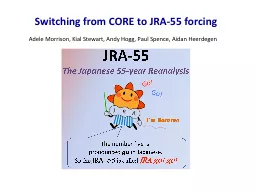
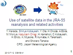
/
Use of satellite data in the JRA-55 reanalysis and Use of satellite data in the JRA-55 reanalysis and

Use of satellite data in the JRA-55 reanalysis and - PowerPoint Presentation

kittie-lecroy
kittie-lecroy . @kittie-lecroy
Follow
386 views
Uploaded On 2016-07-02

Use of satellite data in the JRA-55 reanalysis and - PPT Presentation

related activities YHarada Shinya Kobayashi YOta HOnoda AEbita MMoriya Kazutoshi Onogi HKamahori CKobayashi HEndo KMiyaoka RKumabe ID: 387575

data jra hpa satellite jra data satellite hpa reprocess reanalysis year reprocessed jma amvs era climate reanalyses quality monitoring

Share:

Link:

Embed:

Download Presentation from below link

Download Presentation The PPT/PDF document "Use of satellite data in the JRA-55 rean..." is the property of its rightful owner. Permission is granted to download and print the materials on this web site for personal, non-commercial use only, and to display it on your personal computer provided you do not modify the materials and that you retain all copyright notices contained in the materials. By downloading content from our website, you accept the terms of this agreement.


Presentation Transcript

Slide1

Use of satellite data in the JRA-55 reanalysis and related activities

Y.Harada, Shinya Kobayashi, Y.Ota, H.Onoda, A.Ebita, M.Moriya, Kazutoshi Onogi, H.Kamahori, C.Kobayashi, H.Endo, K.Miyaoka, R.Kumabe, K.Takahashi, and Shotaro TanakaCPD, Japan Meteorological Agency

1

2013/7/12 CGMS-41Slide2

Japanese Global Atmospheric Reanalysis1st JRA-25

By JMA and CRIEPI (1979~2004)(Central Research Institute for Electric Power Industry)2nd JRA-55 ( JRA Go! Go! )By JMA (1958~2012)JRA-55 is the first reanalysis which covers more than 50 years since 1958 with 4D-var data assimilation system.2Slide3

JRA-55 Reanalysis system

JRA-25 JRA-55

Reanalysis years1979-2004 (26 years)

1958-2012 (55 years)

Equivalent operational NWP system

As of Mar. 2004

As of Dec. 2009

Resolution

T106L40

(~110km)

(top layer at 0.4

hPa)TL319L60 (~55km)(top layer at 0.1 hPa)Time integrationEularianSemi-LagrangianAssimilation scheme3D-Var4D-Var(with T106 inner model)Bias correction(satellite radiance)Adaptive method(Sakamoto et al. 2009)Variational Bias Correction(Dee et al. 2009)GHG concentrationsConstant at 375 ppmv (CO2)Annual mean data are interpolated to daily data(CO2,CH4,N2O)

3Slide4

Observational Data available for JRA-55

GNSS: Global Navigation Satellite System4Slide5

Number of observations assimilated (Global)

ATOVS

Lower coverage in TOVS

FGGEMETEOSAT

METEOSAT(Indian Ocean)

5

logarithmic scale

3Slide6

Reprocess of geostationary satellite data for reanalysis6Slide7

Available Reprocessed AMV and CSR data7

CSRAMV

Thick line : reprocessed period

Expanding yellow part in the obs. data tableSlide8

8

Heightassignment ofOperational AMVs used in ERA-15(ERA-15Report 3,Uppala, 1997)

Always

at 850hPaAlways at 850hPaUsually at 200hPa but sometimes changedVery small amount of data

Replaced by reprocessed AMV

Replaced by reprocessed AMV

Still used in reanalyses

Impossible to reprocess

Still used in reanalyses

Impossible to reprocess

Still used in reanalyses

University

of Wisconsin has a plan

to reprocess GOES AMVs.Slide9

Reprocess of Japanese geostationary satellites data by MSC/JMAMSC of JMA reprocessed 2 times for the JRA reanalyses. 1

st Reprocessed AMVs for JRA-25GMS-3, 4, and 5.2nd Newly reprocessed AMVs and CSRs for JRA-55GMS-1(1979only), 3, 4, 5, GOES-9, and MTSAT-1RAs a pilot project of SCOPE-CMJRA-25 reanalysis was used as a reference.QI is allocated for each AMV.Expansion of derivation area (from 50S-50N to 60S-60N).Quality has been improved.9Slide10

2nd reprocess by MSC for JRA-55

MSC/JMA has been computing AMVs from the past satellites (GMS, GOES-9 and MTSAT-1R between 1979 and 2009) using the latest AMV derivation algorithms. The data set of AMVs is provided for JRA-55 and SCOPE-CM.

for

JRA-25

(Previous reprocess)

for

JRA-55

(New reprocess)

Main quality difference between the previous reprocess (for JRA-25) and the new reprocess (for JRA-55).

Expansion of derivation area

(from 50S-50N to 60S-60N).

Mitigation of slow wind speed bias in the winter hemisphere,

owing to the improvement of height assignment scheme and resizing target box size.

Wind speed bias (QI>0.85) of high-level IR-AMVs to JRA-25 analysis fields (Jan.1990, GMS-4)Information website: http://mscweb.kishou.go.jp/product/reprocess/index.htm Oyama(2010)Meteorological Satellite Center Technical Note, No. 54106Slide11

Performance of JRA-5511Slide12

Isentropic Potential Vorticity (at 360 K)1 June 1983 00UTC – 6 June 1983 00UTC

JRA-55(4D-var)

JRA-25

(3D-var)

12Slide13

Forecast [FT=48] Scores

RMSE of Z500 for N.H. and S.H. [gpm]N.H.S.H.

Operation

JRA-25JRA-55VTPRTOVS

ATOVS

Lower spatial coverage in TOVS

13

Year

YearSlide14

(hPa)

(hPa)

Time-Height Cross Sections of global mean Temperature [K] anomalies in JRA and ERA

reanalyses

(hPa)

(hPa)

(Year)

(Year)

(Year)

(Year)

Anomalies from the mean temperature at each pressure level for years 1980 to 2001 of each reanalysis, JRA-55, ERA-40, JRA-25 and ERA-Interim , respectively.

JRA-55

ERA-40

JRA-25ERA-Interim14Slide15

(hPa)

(hPa)

(

hPa

)

(Year)

(Year)

(Year)

(Year)

JRA-55

(hPa)

MERRA (NASA GMAO)

NCEP/NCAR R1

(hPa)CFSR (NCEP)Time-Height Cross Sections of global mean Temperature [K] anomalies in JRA-55, R1, MERRA and CFSR15Slide16

Summary and plan of JRA-55Observational Data for JRA-55

Improvement in both quality and quantity from JRA-25Many reprocessed Satellite DataNewly available dataValidation of JRA-55 JRA-55 has much better quality than JRA-25. Less unnatural gaps than other reanalysesAutumn 2013JRA-55 products will be released for research use.The data will be available from JMA, DIAS…Comprehensive reports are in preparation.

16

9.5Slide17

Use of satellite data in JMA’s operational Climate Monitoring Services(Related activities)

CPD of JMA operates climate monitoring services.JRA reanalysis data are basic climate data.Anomalies from JRA climate are evaluated.Satellite data contribute to improve reanalysis quality.Satellite data are directly used as well.Convection active area (OLR)Snow coverage (SSM/I, SSMIS)17Slide18

Analysis

AnomalySatellite data used in JMA’s climate monitoring

OLR(Outgoing Long-wave Radiation)

18Slide19

19

Satellite data used in JMA’s climate monitoringSnow covered days analyzed from SSM/I & SSMIS datahttp://www.data.jma.go.jp/gmd/cpd/db/diag/db_hist_mon.html12Slide20

Thank you for your attention

20