/
2015 gary richardson 2015 gary richardson

2015 gary richardson - PDF document

lindy-dunigan
lindy-dunigan . @lindy-dunigan
Follow
358 views
Uploaded On 2016-08-15

2015 gary richardson - PPT Presentation

x2014 Reproducx00740069on for distribux00740069on or re sale is strictly prohibited except under licence
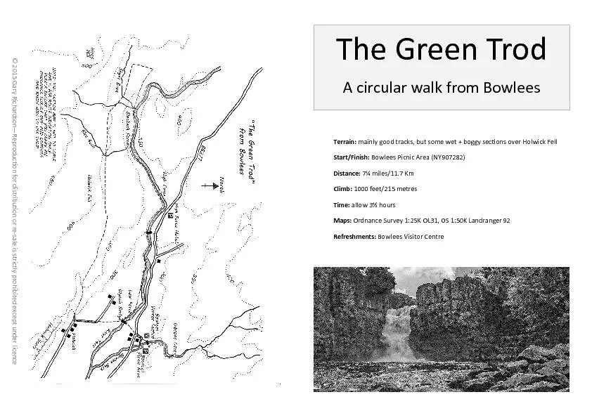
 The Green Trod A circular walk from Bowlees Terrain mainly good tracks but some w ID: 448624

— Reproduc�on for distribu�on re - sale

Share:

Link:

Embed:

Download Presentation from below link

Download Pdf The PPT/PDF document "2015 gary richardson" is the property of its rightful owner. Permission is granted to download and print the materials on this web site for personal, non-commercial use only, and to display it on your personal computer provided you do not modify the materials and that you retain all copyright notices contained in the materials. By downloading content from our website, you accept the terms of this agreement.


Presentation Transcript

© 2015 Gary Richardson — Reproduc�on for distribu�on or re - sale is strictly prohibited except under licence The Green Trod A circular walk from Bowlees Terrain: mainly good tracks, but some wet + boggy sec�ons over Holwick Fell Start/Finish: Bowlees Picnic Area (NY907282) Distance: 7¼ miles/11.7 Km Climb: 1000 feet/215 metres Time: allow 3½ hours Maps: Ordnance Survey 1:25K OL31, OS 1:50K Landranger 92 Refreshments: Bowlees Visitor Centre A walk through the rugged natural beauty of Upper Teesdale, the �rst half is over the heather moorland of Holwick Fell along the old drovers road of the Green Trod, which gives great panoramic views of Teesdale, the return follows the Pennine Way along the banks of the River Tees passing the stunning waterfalls of High and Low Force. From the car park, cross the footbridge over Bowlee Beck heading for the Visitors Centre, passing through the yard to join a lane. Con�nue straight on, following the lane through the hamlet of Bowlees to reach the B6277, cross the road and take the footpath signposted for Low Force, crossing two meadows . A gate/s�le give access to a wooded area, leading to the River Tees, the Wynch Bridge and Low Force. Cross the bridge and take the path, heading away from the river towards Holwick village. Follow this path uphill across three meadows, to reach a road beside ca�le grid. Turn le� and follow the road to reach Holwick village. At the T - junc�on, turn right and follow track uphill, passing a house on the le�. Take le� hand path where is splits just a�er house and con�nue uphill, passing through the impressive rocky outcrops of Holwick Scar to reach an ornate s�le, featuring sheep and grouse sculptures. Join rough vehicle track which is followed for about a mile across Holwick Fell un�l a �nger post on the le� indicates the path leaves the track and heads across the some�mes wet and boggy moorland. This sec�on of the walk over Whiteholme Bank to Skyer Beck the path can be sketchy in places, also two streams, Blea Beck and Skyer Beck have to be crossed, both have stepping stones, but a�er prolonged wet condi�ons, these crossing can some�mes be problema�c. A�er crossing Skyer Beck, the path starts to climb up towards Cronkley Fell. Keep a look out for gate/sheep fold in the wall on your right hand, take a faint path through heather, and go through the gate to reach the Pennine Way on top of Bracken Rigg. Turn right and follow the path down through the Juniper bushes, crossing two footbridges and then across a �at meadow passing the unsightly quarry works. The next footbridge is over Bleabeck, which you crossed earlier in walk via stepping stones, the short detour along the beck to view the wonderful Bleabeck Force is well worth it. Re - join Pennine Way and con�nue following the river downstream to reach the top of High Force. Best views of the falls are few hundred metres downstream , follow path through Juniper bushes, keep eye out for path heading o� on the le�. Care needed as steep drops into river below. Con�nue downstream again, following the River Tees about 2 miles back to Low Force. Ignore the green footbridge across the river and keep on the south bank. With the river on one side and meadows on the other to eventually reach Low Force and the Wynch Bridge again, re - trace outward route back to the car park. A visit to Gibsons Cave and Summerhill Force is highly recommended before leaving, its only about 10 minutes walk (each way) from car park along banks of Bowlee Beck. Designed and produced by Gary Richardson all images and content are ©2015 Gary Richardson. Email: gary@garyrichardson.me Tel: 01325 247767/07583 242904