/
AIR TRAFFIC ROUTES AIR TRAFFIC ROUTES

AIR TRAFFIC ROUTES - PowerPoint Presentation

lindy-dunigan
lindy-dunigan . @lindy-dunigan
Follow
434 views
Uploaded On 2015-11-25

AIR TRAFFIC ROUTES - PPT Presentation

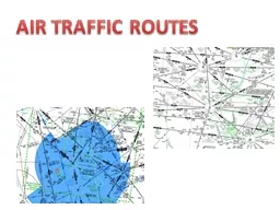
Air Traffic Service ATS routes R oute designed for the management of air traffic or for the provision of air traffic services An ATS route may be a lowmedium frequency LMF route eg colored airways ID: 205438

preferred routes route altitude routes preferred altitude route ifr airways airway listed time high traffic departure flight jet airport air ats vor

Share:

Link:

Embed:

Download Presentation from below link

Download Presentation The PPT/PDF document "AIR TRAFFIC ROUTES" is the property of its rightful owner. Permission is granted to download and print the materials on this web site for personal, non-commercial use only, and to display it on your personal computer provided you do not modify the materials and that you retain all copyright notices contained in the materials. By downloading content from our website, you accept the terms of this agreement.


Presentation Transcript

Slide1

AIR TRAFFIC ROUTESSlide2

Air Traffic Service (ATS) routesRoute designed for the management of air traffic or for the provision of air traffic servicesAn ATS route may be a

low/medium frequency (L/MF) route (e.g., colored airways)VOR (victor) airways (Vxxx)Jet routes (Jxxx)Area navigation (RNAV) routes“T" will prefix RNAV routes below FL 180

“Q" will prefix RNAV routes FL 180 and above

Routes are only established in controlled airspace

Numbering

Even numbers for ATS routes that are east and west oriented

Odd numbers for ATS routes that are north and south orientedSlide3

Low Altitude AirwaysVictor airways are low-altitude airways Low altitude airways are designated as Class E, airspaceExtend from 1,200 feet AGL up to, but not including, 18,000 feet MSL

Can be flown by pilots under either IFR or VFR Depicted as black lines on IFR Low-Altitude Enroute charts and as faded blue lines on VFR chartsDefined in straight-line segments, each of which based on a straight line between either two VOR stations, or a VOR and a VOR intersectionSlide4

Low Altitude AirwaysWidth of the airway depends on the distance from the navigational aidsWhen VORs are less than 102 nautical miles (NM) from each other, the victor airway extends 4 NM on either side of the centerline (8 NM total width)

When VORs are more than 102 NM from each other, the width of the airway in the middle increases. Up to 51 NM – 4nm on each side of the centerlineBeyond 51 NM from a navaid the airway is 4.5 degrees on either side of the centerline between the two navaids Slide5

Jet RoutesJet routes extend from FL 180 to FL 450, inclusive, and are designated to indicate frequently used routingsJet routes are normally based on “H" class NAVAIDs spaced no farther apart than 260 NM or non-VOR/DME area navigation system performance

Jet routes have no specified widthSlide6

Q RoutesUS and Canada use "Q" as a designator for RNAV routes (US 1-499/Canada 500-999)Additional routes in the same airspace, as the routes start and end at a defined point in space and waypoint spacing is 12 to 500NM

Greater efficiencyLess conflictions between routesRadar monitoring requiredGenerally flown with GPSExample of phraseology: ”Cleared via Q one forty five” “ Fly heading one-five-zero to join Q three”, “Cleared direct ELMAA, Q one, rest of route unchanged”Some are unidirectionalSlide7

Q RoutesA/FD ListingSlide8

IFR Preferred RoutesPreferred Routes are routes between busier airports to increase system efficiency and capacityPreferred IFR routes are correlated with SID (standard instrument departures) and STAR (standard terminal arrivals) and may be defined by airways, high-level airways, direct routes between NAVAIDs (navigational aids) or waypoints, radials, DME (distance-measuring equipment) fixes, or any combination of these

Preferred IFR routing should be used by aircraft when operating between the specified airportsIf a flight is planned to or from an area having such routes but the departure or arrival point is not listed in the Airport/Facility Directory, pilots may use that part of a Preferred IFR Route which is appropriate for the departure or arrival point that is listed.Weather, traffic density and other system delays may cause preferential routing to change or not be used from time to timeSlide9

IFR Preferred RoutesPreferred routes minimize routing changes and aid in the orderly management of air trafficLow and high altitude preferred routes are listed in the Airport/Facility Directory (A/FD)

The high altitude list is in two sectionsTerminal to terminal routes Single direction route segmentsAlso, on some high altitude routes, low altitude airways are included as transition routes.Slide10

IFR Preferred RoutesPreferred routes beginning/ending with an airway number indicate that the airway essentially overlies the airport and flight are normally cleared directly on the airway.Preferred IFR routes beginning/ending with a fix indicate that aircraft may be routed to/from these fixes via a Standard Instrument Departure (SID) route, radar vectors (RV), or a Standard Terminal Arrival Route (STAR)

Preferred IFR routes are listed alphabetically under the name of the departure airportWhere several airports are nearby they are listed under the principal airport as a metropolitan area;Preferred IFR routes used in one direction only for selected segments, irrespective of point of departure or destination, are listed numerically showing the segment fixes and the direction and times effective.

Where more than one route is listed the routes have equal priority for use.

Some routes have specific effective times – They are listed in UTC

Daylight saving time effective times will be one hour earlier than indicated

High Altitude Preferred IFR Routes are in effect during the following time periods unless otherwise noted.

Sun................................................................................................................................. 1300–2259 local time.

Mon thru Fri ..................................................................................................................... 0701–2259 local time.

Sat ................................................................................................................................. 0701–1459 local time.

For high altitude routes, the portion of the routes contained in brackets is suggested but optional. The portion of the route outside the brackets will likely be required by the facilities involved.Slide11

Low Altitude Preferred Route FormatsA/FDSlide12

High Altitude Preferred Route FormatsA/FDSlide13

Airway NotamsPart 1, Section 1 of Notices to Airmen will contain Airway changes and noticesMEA changeMOCA change

Fix changesNew / deleted airwaysRequired equipment changesSlide14

PTS StandardsExhibits adequate knowledge of the elements related to ATS routes, and related pilot/controller responsibilitiesUses the current and appropriate navigation publications for the proposed flight

Selects and uses the appropriate communication facilities; selects and identifies the navigation aids associated with the proposed flightIntercepts, in a timely manner, all courses, radials, and bearings appropriate to the procedure, route, or clearanceMaintains the applicable airspeed within ±10 knots; headings within ±10°; altitude within ±100 feet; and

tracks

a course, radial, or bearing

within ¾-scale deflection

of the CDISlide15

Questions

15Slide16

DisclaimerInstrument flight can be dangerous. Do not rely solely on this presentation – PROFESSIONAL INSTRUCTION IS REQUIRED

The foregoing material should not be relied upon for flightALTHOUGH THE ABOVE INFORMATION IS FROM SOURCES BELIEVED TO BE RELIABLE SUCH INFORMATION HAS NOT BEEN VERIFIED, AND NO EXPRESS REPRESENTATION IS MADE NOR IS ANY TO BE IMPLIED AS TO THE ACCURACY THEREOF, AND IT IS SUBMITTED SUBJECT TO ERRORS, OMISSIONS, CHANGE16