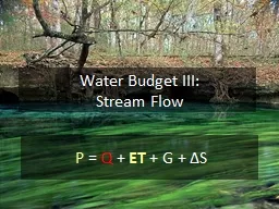
Stream Flow P Q ET G Δ S Why Measure Streamflow Water supply planning How much water can we take out without harming ecosystems we want to protect Flood protection ID: 286482
Download Presentation The PPT/PDF document "Water Budget III:" is the property of its rightful owner. Permission is granted to download and print the materials on this web site for personal, non-commercial use only, and to display it on your personal computer provided you do not modify the materials and that you retain all copyright notices contained in the materials. By downloading content from our website, you accept the terms of this agreement.
Slide1
Water Budget III:
Stream Flow
P
=
Q
+
ET
+ G +
Δ
SSlide2
Why Measure Streamflow
?Water supply planningHow much water can we take out (without harming ecosystems we want to protect)Flood protectionHow much water will come down the channel if X storm happens? Who’ll be flooded?
Water quality
What are the fluxes
(flow x concentration)
of contaminants to a lake or estuary?
What are the effects of land use change on water delivery to downstream systems? Slide3
Stream Flow Network
(http://water.usgs.gov) Slide4
Extreme Low Flows
Rainfall between Oct 1. 2010 and January 21, 2011 is
2.68 inchesSlide5
Hydrograph- graph of flow over timeSlide6
Flow Over Time – Santa Fe RiverSlide7
Seasonality of FlowSlide8
Watersheds as Filters
Rain fallsStorages “buffer” the rainfall signal, letting water out slowlyMore storage = more bufferingThe result is that the rainfall signal looks stochastic, the flow looks more “organized”Watershed properties AND size affect the filtering effectSlide9
Rainfall Filtering – Santa Fe RiverSlide10
Rainfall Filtering – Finer ViewSlide11
Consider the “Filter” Effects of:
Watersheds with steep vs. shallow slopesWatersheds with deep vs. shallow soilsWatersheds with intense vs. extended rainfallWatersheds with forests vs. parking lotsWatersheds with dams vs. notBig vs. little watershedsWatersheds with big shallow aquifersSlide12
Basin Filtering Creates Lags – Hatchet CreekSlide13
Where is Stream Flow From?
At any time, flow is a composite of water with different sources and residence timesSome water is stored in the watershed for a very long time, some very shortDuring low flow conditions, water is mostly oldDuring storms, the contribution of new water increasesHow does an aquifer affect this?Slide14
2%
8%
23%Slide15
Flow and Rainfall Intensity
If Rainfall Intensity > Infiltration Capacity then surface runoff occursStream flows are composites ofSurface runoffSubsurface flowsSlide16
Variable Source Area
(Stormflow Generation in Florida)Slide17
Variable Source Area Makes Antecedent Rainfall IMPORTANTSlide18
Land Use (Cover) Affects Runoff Generation
Impervious surfaces preclude infiltrationLess infiltration means more runoffRunoff also MOVES faster Less “filtering”Compare land uses…Slide19Slide20
More
stormflow, higher peak flow, sooner.Slide21
Forest
Ag
UrbanSlide22
Same total
flow (area under the curve),
lower peak flow.
The importance of
storage – the basis of filteringSlide23
Water Storage in the ForestSlide24Slide25
D
epressions and vegetation (swamps) slow
runoff.
Upper watershed
wetland storage delays runoff and reduces peak flows.
Wetland flood plain
has
a dominant influence on downstream peak
flow and solute transport.
Wetland Hydrological ServicesSlide26
200,000 m
3
of
Stormwater
Runoff;
Channel Peak Flow capacity of 1m
3
/s
All in one day
Peak Flow =2.3 m
3
/s
Spread over 3 days
Peak Flow = 0.8m
3
/s
Why Does Storage Matter?Slide27
How Big a Flood Can We Expect?
The size of the flood is inversely proportional to it’s frequencyBig event happen rarelyBig events shape the landscapeMedium events maintain the landscapeSmall events control the biologyHow would we predict the size of a flood that happens roughly once in 25 years?Think back to the rainfall lab…Slide28
Rainfall Recurrence SeriesSlide29
Flow (Santa Fe River Station 3)Slide30
Daily Flow Recurrence SeriesSlide31
The 100-yr Floodzone
MapSlide32
How Do We Measure Streamflow?
Funny you should ask…basis of Lab #4.Basis is to estimate:Cross-sectional area (A; through which water flows)Water flow velocity (V)Q = A * VSlide33
Measuring Surface FlowSlide34
Typical stream velocity profileSlide35
Float Velocity * 0.8 for natural channels
Float Velocity * 0.9 for concrete channels
Where to measure mean velocity?Slide36
Turn-cup
0.500 ft/s
Electromagnetic
0.050 ft/s
Sonic Doppler
0.005 ft/s
$2k
$4k
$7k
Velocity InstrumentsSlide37
Sect
Width (m)
Depth (m)
Vel@.6 m/s
Flow
(m
3
/s)
1
1
0.7
0.20
0.14
2
1
2.0
0.25
0.50
3
1
1.3
0.15
0.20
Total
0.84m
3
/sSlide38
Discharge is HARD to Measure
We want:Daily (or sub-daily) measurementsMultiple stations per riverReal time updating (detect changes in flow as they are happening)Slide39
Rating equations (stage vs. discharge) allow continuous flow monitoringSlide40
Stage-Discharge Relation
Water stage (elevation) is EASY to measureStage is related to dischage via a mathematical relationship
Applying that relationship to measured stage gives estimates of discharge
Q
H
H
Q
t
t
Stage Hydrograph
Stage-Discharge Curve
or Rating Curve
Discharge HydrographSlide41
Stage-Discharge Relation
Typical relationship: Q = a(H +b)cThe relationship between H & Q has to be calibrated locally for different stationsSlide42
Stage Discharge Relationship for the Ichetucknee River
At low stage, positive relationship between stage and dischargeAt high stage, negative relationshipWhy?
Stage
DiscahrgeSlide43
Staff gage
Float-pulley
Pressure
Ultrasonic
Stage MeasurementsSlide44
WeirsSlide45
FlumesSlide46
Type
The Good
The Bad
Weir
Low cost
Easy installation
Won’t work on low gradient streams
Upstream flooding
Clogs
Changes WQ
Wildlife barrier
Flume
Works ok in low gradient streams
Better for WQ and wildlife Self cleaning
High cost
Difficult to install
Weir
vs
FlumeSlide47
What if there’s no rating curve?
New watershed, new conditionsAreas where it’s hard to develop rating curves
For example, the EvergladesSlide48
Q= 1/n * A * r
2/3 * s1/2
Q =
estimated flow m
3
/s
n = Manning’s
roughness
number
(0.02 smooth to 0.15 rough or weedy, 0.5 dense vegetation)
A =
cross sectional area (m
2
)
r
=
Hydraulic Radius (wetted
perimeter = WD/(W + 2D)
W > 10D, R → D)
s
=
Hydraulic Gradient
Δ
H/L
Manning’s Equation -
Flow Estimation without a rating equationSlide49Slide50
Predicting Flow in the Everglades
Dense vegetation channel (n = 0.4)Shallow slope (s = 3 cm per km = 0.00003)Wide channel (100 m wide, 0.3 m deep, A = 30 m2, r = 30 m2 / 100.6 m = 0.3 m)
What is Q? What is flow velocity (u)?
Q = (1/n) * A * r
0.67
* s
0.5
V = Q / A
Q = (1/0.4) * 30 m
2
* 0.3 m
0.67
* 0.00003
0.5
= 0.183 m
3
/s
V = 0.183 m
3
/s / 30 m
2
= 0.006 m/s = 0.6 cm/sSlide51
Next Time…
Groundwater