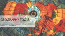
PROJECT 01 LESSON 01 WHAT ARE THE DIFFERENT TYPES OF TOOLS GEOGRAPHERS USE Geographers use all sorts of tools to help them investigate their questions They commonly use maps globes atlases aerial photographs satellite photographs information graphics and a computer program called GIS ID: 611107
Download Presentation The PPT/PDF document "GEOGRAPHY TOOLS" is the property of its rightful owner. Permission is granted to download and print the materials on this web site for personal, non-commercial use only, and to display it on your personal computer provided you do not modify the materials and that you retain all copyright notices contained in the materials. By downloading content from our website, you accept the terms of this agreement.
Slide1
GEOGRAPHY TOOLS
PROJECT 01 - LESSON 01Slide2
WHAT ARE THE DIFFERENT TYPES OF TOOLS GEOGRAPHERS USE?
Geographers use all sorts of tools to help them investigate their questions. They commonly use maps, globes, atlases, aerial photographs, satellite photographs, information graphics, and a computer program called GIS. Slide3
MAPS
A
map
is a flat representation of a part of
Earth.
Geographers
use many different types of maps
.
Maps can show lots of different information including the location of places on the world. Maps use projection to try and display a round object (Earth) on a flat surface (a map).Cartographers (map-makers) have long struggled with trying to find the most accurate projection to make maps with.
© Wikimedia Commons, File:1-12_Political_Color_Map_World.png, CC BY-SASlide4
ATLAS
An atlas is a book of maps
An atlas contains maps of the world or a region of the world
Some atlases also include more information about the places they include in the maps
Atlases can be very helpful for traveling. Instead of
bringing
many maps, you can bring one atlas
This image is in the public domain. Map by
Anselmo
Banduri
1675-1743Slide5
GLOBE
A globe is a model of the Earth, used to avoid distortions in spatial relations on the world.Maps of the world are distorted from trying to make a round object fit on a flat surface. The globe is round, so it remains accurate. The globe provides an accurate scale of how far apart locations are. You can also use a globe to get a comparison of the size of different locations
© Wikimedia Commons, File:GEO_Globe.jpg, CC BY-SASlide6
AERIAL
PHOTOGRAPHS
Aerial
photographs
are photographs taken from the sky and used to take measurements or create
maps.
Aerial
photographs can be taken from airplanes, balloons, or even kites.
The image on the left is an aerial photo of South Boston, MA. It was taken in 1978. You can download aerial photos at: http://earthexplorer.usgs.gov This image is in the public domain. Provided by the U.S. Geological SurveySlide7
NASA Earth Observatory image created by Jesse Allen, using EO-1 ALI data provided courtesy of the NASA EO-1 team and the United States Geological
Survey`
Satellite
photographs
are like aerial photographs, but they are taken from
space.
Satellite photographs can capture large areas of the Earth, but they can also zoom in pretty close
.
The image on the right is a satellite photo of Marion Island, South Africa. Marion Island is a protected land and is only inhabited by researchers studying the island.
SATELLITE PHOTOGRAPHSSlide8
INFORMATION GRAPHICS
Information Graphics or Infographics
are visual symbols of data. They are images that show information using pictures or symbols
.
Information graphics can be as simple as a
bar graph
or as complex as the image to the left.
The infographic on the left is a
display of land cover change in the Mid-Atlantic between 1996-2006
.
This
graphic shows that over 10 years, forests and
wetlands
have decreased, while other types of land cover, including
developments
have increased.
The
graphic does not represent actual locations of land cover, just numbers representing it.
This image is in the public domain. Provided by the National Oceanic and Atmospheric Administration (NOAA)Slide9
GIS
(Geographic Information System
)
GIS
is a computer based program used to store, manage, and analyze
data
A
GIS map is more than a map because it can pull up a lot of information. Geographers use GIS to help make decisions
.
Imagine
that you wanted to make sure schools were not near any factories that might pollute the air. With a GIS map, geographers can use the database (place that stores information) to show where all the schools are. They can then use the database to also show where all the factories are. The GIS helps geographers see all kinds of information and how it relates to locations. The image to the left is an example of how GIS layers information.
This image provided by the San Bernardino County Information Services Department