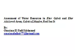
Khor Gabeit and Khor Adalaweb Areas Gabeit aLMaaden Red Sea St By Omaima El Fadil Mohamed omaimafadhel77hotmailcom Presentation contents Introduction Study area ID: 787489
Download The PPT/PDF document "Assessment of Water Resources in" is the property of its rightful owner. Permission is granted to download and print the materials on this web site for personal, non-commercial use only, and to display it on your personal computer provided you do not modify the materials and that you retain all copyright notices contained in the materials. By downloading content from our website, you accept the terms of this agreement.
Slide1
Assessment of Water Resources in
Khor
Gabeit
and
Khor
Adalaweb
Areas,
Gabeit
aLMaaden
, Red Sea St
By:
Omaima
El
Fadil
Mohamed
omaimafadhel-77@hotmail.com
Slide2Presentation contents
Introduction
Study area
Objectives
Methodology
Results
Conclusion
Slide3This study aimed at assessing water resources in
Khor
Gabet and Khor Adalaweb areas (Red Sea State) and providing a technical assistance for effective and efficient management of the Mining activities. Many of the wadi and khor drainages in the area contain seasonal rock pools during and after the short rainy seasons, and shallow, hand-dug wells that have accessed small aquifers developed within the wadi gravels. Such aquifers may comprise palaeo-water accumulations that have only partial replenishment during the rains and therefore, may not sustain prolonged usage. Many of the hand-dug wells are distributed in distinctive zones of the wadi/khor networks, whereby the flow of water has been held-up or retarded by geomorphological features. In particular, it has been noted that wells commonly occupy changes in the direction of the wadis/khors and where there are constrictions in the drainages. In this latter case, it is suggested that shallow bedrock or rock barriers have provided natural dams interrupting the flow of water through the wadi gravels
1. Introduction
Slide42. Study area
Drainage pattern of
Gabet aL Maadin areaDEM image displaying the general elevation of Gabet aL Maadin areaLocation of the Study area
Slide5Khor
Gabet and Khor Adalaweb represent the study area targeted for assessment of the available water resources. Khor Gabet groundwater basin is the main source of water supply for Gabet aL Maddin town and mining. The start of the basin lies at 75 km east of Dungunab Gulf and extends over 52 km upstream. The catchment area or the area drained; by Khor Gabet and Khor Adalaweb is about 537.6 km2 and 525.3 km2 respectively composed of basement rocks. Morphologically the area can be divided into three distinctive parts.
The upper mountainous part incised by narrow (about 5m wide) channel (s) forming the upstream (catchment) area of
Khor
Arbaat
and extending more than 30 km west of the high dam
;
The down/lower stream part, starting from the upper gorge (gate) beyond which the
Khor
Arbaat
opens out into an alluvium plain extending further down towards the Red Sea;
The delta of
khor
Arbaat
where agriculture was practiced by the local people
Slide6The overall objectives of the study are to identify the most potential zones for surface and groundwater occurrences. The identification process based mainly on detailed geological, hydrogeological, hydrological, and remotely sensed data and its manipulation as digital image processing, GIS spatial analysis and structural analysis of the extracted hydrogeological/ hydrological criteria. The study is done with hydro-geophysical and hydrological investigation, and ground truth checking
2. Objectives
Slide7Preparation of base maps
3. Methodology
Mapping of the whole catchment of Gabet areaMajor drainage channels and tributaries and the flood delta of Khor GabetMajor topographic features and general elevation of the area based on Digital elevation modeling (DEM) Study survey sites and infrastructure have been located using GPS and plotted in these base maps.Field visits
Slide8Methodology
Field work
Ground truthingGeologyHydrogeologyHydrology
Engineering
parameters
Data processing
Data analysis
Data interpretation
Data production
Inception report
Preliminary design of
proposed recharge dam
Final report
Final design
&
BOQs
Data collection
Geophysical
survey
Data Processing
Slide94. Results
GEOLOGICALLY:
the area surrounding the project area is occupied by intermediate-basic metavolcanics with two granitic types dominated by a young post tectonic batholic of medium-coarse-grained size pint granite of about 4 km in diameter. The pink granite is intruded into a huge biotitic granite and granodiotite intruded into the older metamorphic rocks. Two sets of acidic and basic dykes have intruded the pink granite mainly along NNE-SSW and NNW-SSE directions. Landsat image of the study areageological map of the study area
Slide10CLIMATICALLY:
the study area lies within the transmission climatic zone between the Red Sea coastal region and arid/semi-arid northern Sudan region, with a maximum temperature of about 40 C during the months June, July and August, while the minimum temperature is about 26 C during January and February. It normally receives two rainstorms in; summer and winter. The summer rains commence from July and end in October, while winter rains prevail during the period December to February. The probability of rain failure (not receiving rainfall) is high amounting about 50% and highly variable, with a coefficient of variability (Cv) amounting 80%. Variability of Rainfall in the study Area
Slide11Climatically
Thirty year climatic average (1956- 1987) indicates an average rainfall of 111mm per year, while last 30 years(1976 to 2007) indicates an average of 85mm/year, indicating a decrease in the trend of the rainfall in the area since mid-1990s. Also the period from 1976 to 1990 was characterized by low rain falls below the average, while the period between 1990 and 1997 witnessed higher rainfall; above the average.30- years average climatic parameters in the Study area, Red Sea State
Slide12HYDROGEOPHYSICAL INVESTIGATION:
40
(VES) measured in electrical profiling techniques. The area is known to be a crystalline basement terrains in which relatively thin weathered basement occur below the wadi fill deposits in the area. All the observed VES curves reveal relatively thin multi-layered earth. The range of resistivity for the area is generally very low to high. Location of VES points along khor Gabet and khor Adalaweb
Slide13HYDROGEOPHYSICAL INVESTIGATION:
The dominant types of curves are HA, HAA
KHA, and the dominant types are the HAA-type indicating 5 to 7 geo-electric layers reflecting thin and very low to high resistivity ground. The basement trends are revealed within the surveyed area within the range between (74-9000 Ωm) However, most of the curves tend to indicate relatively low resistivity range (10 -30 Ωm) at the maximum separation attained at 300-400m.Typical Measured VESs
Slide14HYDROGEOLOGICALLY:
T
he study area, associates with the alluvium sediments; underlain by fractured basement rocks, along the channel of Wadi basins. The aquifer covers an area of 21 km2 of a longitudinal strip of 35 km by 0.6 km. Deposit the aquifer heterogeneity and presence of appreciable percentage of fine-grained material of the whole saturated wadi-fill can be considered as one anisotopic aquifer body. The thickness of the area ranges from 4.0 m in the vicinity of the upper stream to 30.0 m at the Mangam area (Gabet Village). The saturated aquifer thickness depends on the depth to water level and its spatial variation.
Water level fluctuation in the study area
Slide15Generally depth to groundwater caries from 1-31 m depending on type of aquifer, the time of the year, location, intensity of the flood (recharge) and the relative elevation of ground surface. Results of the pumping test have revealed a
transmissivity
(T) value in the range of 0.84×10² – 0.86×10² m2/day.The quality of water varies between potable, brackish and intensely saline, reflecting the geological and geomorphological environment in the watershed and along the route of the drainages. Experience suggests that potable water is more often found in narrower wadi/khor systems where there is a high run-off factor, and a natural sub-surface damming of the drainage system.
Slide16Analysis of Rainfall Data:
The study area lies within the transmission climatic zone between the red sea coastal region (where the annual mean is 30 mm). Rainfall datasets was provided from three main sources: MoWRE, SMA and USGS satellite estimates, rainfall in the study area is characterized by scarcity and extreme variability of occurrence with high frequency of drought. Statistical analysis of rainfall maximum 24 hours series, the obtained 100 year storm equals 44.15 mm and following SCS storm (type II).HYDROLOGICALLY:
Slide17shows a comparison between the average monthly precipitation in
Portsudan
and Arbaat and it is noticed that only half of winter rain in Portsudan occurred at Arbaat which is 36.2 km northwest, this reveals significant reduction in rainfall west of the coastal region. Monthly Mean Rainfall (MoWRE 1975-1998) in Portsudan and Arbaat
Slide18Shows the
plot of the probability of
exceedence of monthly events of October and November, these charts indicated that monthly mean value have low reliability e.g. the reliability of mean November rainfall is about 28% in Arbaat and 34% in Portsudan. On the other hand, wide range of high rainfall (40mm to 100mm) might occur with shorter range of reliability.Rainfall Probability of Exceedence Comparison (October)Rainfall Probability of Exceedence
Comparison (November)
Slide19Physical basin characteristics:
The physical basins characteristics in the study are were determined from
Archydro/GeoHMS tools as described previously. HEC-HMS schematic of the interested locations can be seen in figure (29) below.Watershed Land Cover most of lands are covered by bare soil, only wadies patterns being covered by sandy and non cohesive materials with very open and scattered shrubs .Some locations on the upper watershed found widely bounded by tine sandy layers
Slide20Rainfall Hyetograph
Hydrologic analysis SCS method as defined in HEC-HMS suggests several storm types that describe possible hourly distribution of rainfall, based on local observation of seasonal rainfall behavior.
The maximum annual rainfall event most frequently occurred during a very short duration about (01:00 -01:30 hours). SCS Storm Type 2 found the best in representing the actual storm case in which more than 50 % of the rainfall occurred within 2 hours. Hence, the 100-year storm can be distributed accordingly as presented in this curve (Temporal distribution of design storm)
Slide21HEC-HMS hydrological model was configured to produce the design flood hydrograph at the interested locations based on selected rainfall frequency event. The resulted range of peak discharge values is 14 - 48 m3/s. The suggested type of spillway is broad-crested weir with a 30 m width and 1 m height found to be satisfactory in conveying the upper boundary of design discharge.
Sediment supply in the study area is governed by the scarcity of flood occurrence, USBR regression method was used to estimate the annual sediment yield, the obtained results given an average of 380 m3/ km2/yr.
Slide225. Conclusion
The proposed
Gabet Al Maaden proposed Dam is an aquifer recharge facility meant to replenish the groundwater aquifer of Khor Gabet and thus relieve water demand pressure on RedRock mining activities well field. There are no other cheap and reliable water supply options in the vicinity. Current water supply is reduced in the dry season. Khor Gabet aquifer has been identified as being vulnerable to drought in the event of rainfall failure. It is the only option for water supply to the Gabet Al Maaden population which has grown to 2,000 in 2013. During the dry season, 3 of the 8 hand pumps in Khor Gabet well field dried up while the remaining ones supply less of the wet season yield by about 50%. Water is also supplied by three motorized boreholes. Ground water table around
Gabet
has dropped in the last years.
Gabet
Al
Maaden
proposed dam is the top priority project since it will recharge
Khor
Gabet
aquifer, increase well yield, provide sustainable water supply source for surrounding communities and
RedRock
camps, and contribute to sustainable water supply to
Gabet
Al
Maaden
town.
Slide23The proposed artificial recharge facility and the surface water storage facility suggested in option 1 in
Khor
Gabet should be protected from the pollutants, waste disposal, and the harmful human activities. Development of groundwater for mining purposes can be achieved by drilling of boreholes tapping the weathered/fractured and alluvial aquifer (low yield) with the following specifications: Total depth of the well = 20-30mDiameter of the drilled hole = 311mmDiameter of the cased hole =140mmLength of casing = 10-20mDiameter of the screen (filters) =140mmLength of the screen = 9-12m
Designed yield = 1000
gph
(4.5 m
3
/h)
Slide24Thank you