/
Red River Flooding and Weather Briefing Red River Flooding and Weather Briefing

Red River Flooding and Weather Briefing - PowerPoint Presentation

mitsue-stanley
mitsue-stanley . @mitsue-stanley
Follow
443 views
Uploaded On 2015-11-16

Red River Flooding and Weather Briefing - PPT Presentation

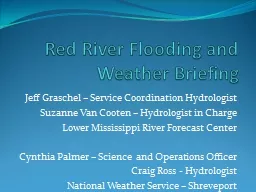
Jeff Graschel Service Coordination Hydrologist Suzanne Van Cooten Hydrologist in Charge Lower Mississippi River Forecast Center Cynthia Palmer Science and Operations Officer ID: 195670

crest june major river june crest river major red rise flood stage record feetrise minor moderate blw monday 11a day saturday 1945

Share:

Link:

Embed:

Download Presentation from below link

Download Presentation The PPT/PDF document "Red River Flooding and Weather Briefing" is the property of its rightful owner. Permission is granted to download and print the materials on this web site for personal, non-commercial use only, and to display it on your personal computer provided you do not modify the materials and that you retain all copyright notices contained in the materials. By downloading content from our website, you accept the terms of this agreement.


Presentation Transcript

Slide1

Red River Flooding and Weather Briefing

Jeff

Graschel

– Service Coordination Hydrologist

Suzanne Van

Cooten

– Hydrologist in Charge

Lower Mississippi River Forecast Center

Cynthia Palmer – Science and Operations Officer

Craig Ross - Hydrologist

National Weather Service – ShreveportSlide2

30 Day Percent of NormalSlide3

3 Day QFP Outlook:

Today – Monday Morning

The threat of showers and thunderstorm will continue through this weekend as a series over disturbances move across the area.

Heavy rain is likely with the thunderstorms.

Flash Flooding Watch in effect through 7 pm SaturdaySlide4

7 Day QFP Outlook:

Today –

Friday Morning

The threat of isolated to scattered showers and thunderstorm will continue through next week as an upper level low sets up over Louisiana.

Heavy rain may be possible with the thunderstorms.Slide5

30 day Rainfall Total Ending May 29, 2015Slide6

Upstream Conditions Slide7

Red River at Fulton, AR

* Stage 10A May 29: 24.44 FT (0.46

ft

blw

Action Stage)

* Rise above Minor F.S. Saturday May 30

* Rise above Moderate F.S. Monday June 1

* Crest: 33

ft

Thursday June 4

(Major F.S.= 32.5ft; Flood of record 37.4

ft

on 4/2/1945)

Red River at Index, AR

* Stage 11A May 29: 27.21 FT (0.79

ft

blw

Major F.S.) * Rise above Major F.S. early Saturday, May 30* Crest: 31

ft Tuesday June 2(Major F.S.= 28ft; Flood of record 34.4 ft

on 2/23/1938)

Red River at Shreveport, LA

* Stage 11A May 29: 28.69 FT (1.31

ft

blw

Minor F.S.)* Rise above Minor F.S. Sunday May 31* Rise above Moderate F.S. late Monday June 1* Rise above Major F.S. Wednesday June 3* Crest: 34 ft Saturday June 6 (Major F.S.= 33 ft; Flood of Record 45.90 ft on 8/10/1849 )

Red River at Coushatta, LA

* Stage 11A May 29: 31.54 FT (0.54 ft abv Minor F.S.)* Rise above Moderate F.S. of 33ft early Monday May 31* Crest: 36.5 ft Sunday June 7(Major F.S.= 37 ft; Flood of Record 39.90 ft on 04/07/1945)

F.S = Flood Stage

Red River at Grand

Ecore, LA* Stage 11A May 29: 35.95 FT (0.05 ft blw Moderate F.S.)* Rise above Major F.S. of 39ft Thursday June 4* Crest: 40.5 ft Monday June 8(Major F.S.= 39 ft; Flood of Record = 44.7 ft on 04/10/1945)

Red River at Alexandria, LA

* Stage 11A May 29: 31.52 FT (0.48 ft blw Minor F.S.)* Rise above Moderate F.S. of 36 ft Friday June 5* Crest: 38 ft Tuesday June 9(Major F.S.= 40 ft; Flood of Record = 45.23 ft on 4/17/1945)Slide8

Point

Current

Stage

Flood

Stage

Forecast / Crest

(*=Additional

Rises Possible)

Near De Kalb

(Pecan

Pt)

*MAJOR

34.84

ft

24 feet

Rise

and crest near 35.3

ft

on June 1

st

.

Index

(N of TXK)

*MINOR

26.87

ft

25 feetRise and crest near 31 ft byJune 1st.Fulton24.20 ft27 feetRise and crest

near 33 ft byJune 4th.

Shreveport28.58 ft30 feetRise and crest near 34 ft by June 6th.Coushatta*Moderate

31.46 ft

31 feetRise and crest near 36.5 ft

by June 7th.Grand Ecore*MODERATE35.93 ft33 feetRise to near 40.5 ft by June 8th.

Red River Forecast

Friday, May 29, 2015 – 7am Morning UpdateSlide9

Impacts to the Red River

Severe back water flooding of agriculture land along and adjacent to the river.

Cattle or farm equipment that hasn’t been moved to higher ground may be lost.

Some subdivisions may become cut off from flood waters, with some homes and businesses potentially flooded.

Recreational activities limited through the summer.

Secondary roads may become inundated and cutoff.Slide10

Questions?

Red River in north Bossier City on 05/18/2015

weather.gov/

shv

US National Weather Service Shreveport

@

NWSShreveport

NWSShreveport