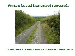
Didy Metcalf South Pennine Packhorse Trails Trust The countdown to 2026 Is the current system working Examples of success in other councils How a new approach might work in Bradford ID: 716326
Download Presentation The PPT/PDF document "Parish based historical research" is the property of its rightful owner. Permission is granted to download and print the materials on this web site for personal, non-commercial use only, and to display it on your personal computer provided you do not modify the materials and that you retain all copyright notices contained in the materials. By downloading content from our website, you accept the terms of this agreement.
Slide1
Parish based historical research
Didy
Metcalf -
South
Pennine Packhorse Trails Trust Slide2
The countdown to 2026…
Is the current system working?
Examples of success in other
councils
How a new approach might work in BradfordSlide3
Is the current system working?
Not really. It’s struggling to deal with many historical inaccuracies including:Paths deleted in 1965
Uncertainty
: Unclassified County
Roads
Confusion
over privately
repaired
roads
Objections
public bodies owned the landPaths ending at Parish boundaries
And, last but not least: areas for which no proper legal record was made in the old Borough of Bradford and part of Keighley.Slide4
Example:Additions and
deletions from 1965, following the draft map consultation Keighley Municipal Borough
Additions
Footpaths:
Belle Isle Road to Mill Hey.
Bank House to Dunkirk.
Off Cock Hill Road, Oxenhope.
Along Hill House Lane, Oxenhope.
Bridleway,
Off Hambleton Lane, Oxenhope.
DeletionsFootpaths: On Morton Moor.On Keighley Moor.On Oakworth Moor.At Harehill Edge.Near Dry Clough.Near Tewitt HallAt White Hill.South of Freedom Mills.
Oldfield Lane to Bent House.On Stanbury Moor.At Enfield Side.At Sand Delf Hill.North of Leeshaw Reservoir
.
On
Howarth Moor.
Off Hebden Bridge Road, OxenhopeBridleways, Off Cemetery Lane.Near Tewitt Hall.At West Morton.At Bracken Hill Edge.At Dean Fields.Near Upwood Oxenhope.Near Thorne Bank, Oxenhope.At Sand Delf Hill.Near Cold Knoll End.At Silver Hill Bank.Slide5
What are other councils doing about this?Slide6
Devon County
Council…
Identifying missing paths
Gathering user and historic evidence
Getting landowner agreement
Processing unopposed orders
“This method of dealing with DMMOs has meant that a large number of modification orders are added to the map each year. 45 parishes in Devon are currently under review”.
…..is carrying out parish-by-parish reviews.
They report success in:Slide7
Hampshire County Council…
50 volunteers researched 30 parishesStudied Tithe, Enclosure, Highways Handover, and OS Maps
HCAF applied for Heritage Lottery funding, supported by HCC
Heritage Lottery Fund awarded HCAF £46,600
Dedicated project manager appointed.
…have secured additional
funding
through a parish-by-parish approach “Discovering Hampshire’s Lost Ways” Slide8
How could it work in Bradford?Slide9
Step 1.
The public are invited to a parish meetingBradford MDC ARE YOU INTERESTED IN
FOOTPATHS, BRIDLEWAYS
& BYWAYS?
Bradford Metropolitan District Council is
carrying out a review of public rights of way in
Wilsden.
You are invited to:
A
presentation about the Definitive Map Review for
Wilsden parish, on Tuesday the 12th May 2015 at 8 p.m. (in the Parish Council’s Annual General Meeting at the Village Hall, Wilsden) A short talk will be given about the Definitive Map of public rights of way and how changes can be made followed by questions and discussion. For further information please contact thePublic Rights of Way Officer, Definitive Map Review, Bradford MDC; telephone: 01274 xxxxxx Slide10
Step 2.
Bradford MDC DEFINITIVE MAP REVIEW 2016/17 WILSDEN PARISH (WITH PARTS OF AWLISCOMBE AND LUPPITT PARISHES) CONSULTATION SCHEDULE
Proposal 1: Claimed addition of footpath
Application for claimed footpath between Combe Raleigh–Honiton road and Footpath 5 at Woodhayne Farm, points A–B
Grid ref: ST 16130138–15730165
Proposal 2: Claimed addition of footpath
Application for claimed footpath between Combe Raleigh–Honiton road and lane near Summerland Cottage, points A–C–D–E Grid ref: ST 16130138–15440218 Proposal 3: Claimed addition of footpath Application for claimed footpath between lane south-west of Combe Raleigh village and junction of Duck’s Path with Limer’s Cross–Tracey road (in Awliscombe parish), points F–G–D–H
Grid ref: ST 15760222–15100166
Proposal 4: Claimed addition of footpath
Application for claimed footpath between lane south–west of Combe Raleigh village and lane leading to Worfield House, points I–C
Grid ref: ST 15850226–1580189 Proposal 5: Claimed addition of footpath Application for claimed footpath between Dunkeswell–Honiton road and Combe Raleigh road, points J–K Grid ref: ST 16280267–16200254 Proposal 6: Claimed addition of footpath and claimed byway Applications for claimed footpath and byway, known as Hill Road, between end of lane near reservoir and Limer’s Cross–A373 road, points L–M–N Grid ref: ST 15170234–14290274 Proposal 6a: Claimed addition of footpath Application for claimed footpath between junction with Claim 3 and Junction with Claim 6, part of a network, points M–G Grid ref: ST 15440197–15070241 Compile a schedule of evidence-based claimsSlide11
Step 3.Provide an informal consultation mapSlide12
The benefits of this approach are….
It complements the Neighbourhood Plans that are already being compiled by parish councils The review of Rights of Way Improvement Plan is due in 2017
It is likely to increase the quantity and quality of our rights of way network and protect it for future generationsSlide13
Next steps
If your parish council feels they would like to take this further, please contact the LAF through our secretary at:BradfordLAF@bradford.gov.ukOr
contact me at
:
contact@rombalds-riding.org.co.uk