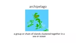
PPT-archipelago a group or chain of islands clustered together in a sea or ocean
Author : natalia-silvester | Published Date : 2018-11-07
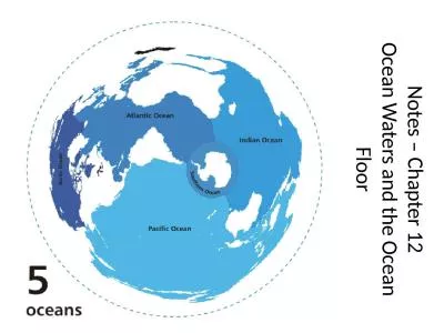
bodies of water Water in different sizes and shapes naturally found on the Earths surface Oceans seas bays lakes rivers and ponds are examples of bodies of water
Presentation Embed Code
Download Presentation
Download Presentation The PPT/PDF document "archipelago a group or chain of islands ..." is the property of its rightful owner. Permission is granted to download and print the materials on this website for personal, non-commercial use only, and to display it on your personal computer provided you do not modify the materials and that you retain all copyright notices contained in the materials. By downloading content from our website, you accept the terms of this agreement.
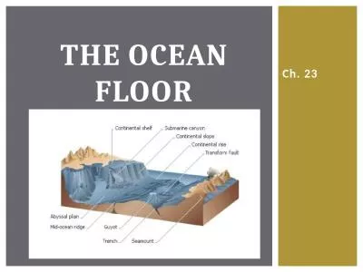
archipelago a group or chain of islands clustered together in a sea or ocean: Transcript
Download Rules Of Document
"archipelago a group or chain of islands clustered together in a sea or ocean"The content belongs to its owner. You may download and print it for personal use, without modification, and keep all copyright notices. By downloading, you agree to these terms.
Related Documents