/
Storytelling in Geoscience Research: An Analysis of K-8 Science Textbooks and their Treatment Storytelling in Geoscience Research: An Analysis of K-8 Science Textbooks and their Treatment

Storytelling in Geoscience Research: An Analysis of K-8 Science Textbooks and their Treatment - PowerPoint Presentation

norah
norah . @norah
Follow
66 views
Uploaded On 2023-05-29

Storytelling in Geoscience Research: An Analysis of K-8 Science Textbooks and their Treatment - PPT Presentation

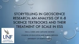
Kim A cheek and caroline George College of education and human services University of north florida Defining Scale Spatial temporal or numeric magnitude of an object or event measurable in standard or nonstandard units ID: 1000005

numeric temporal ambiguous spatial temporal numeric spatial ambiguous images sun relationshipnone amp magnitude scale misrepresentation materials grade textbooks science

Share:

Link:

Embed:

Download Presentation from below link

Download Presentation The PPT/PDF document "Storytelling in Geoscience Research: An ..." is the property of its rightful owner. Permission is granted to download and print the materials on this web site for personal, non-commercial use only, and to display it on your personal computer provided you do not modify the materials and that you retain all copyright notices contained in the materials. By downloading content from our website, you accept the terms of this agreement.


Presentation Transcript

1. Storytelling in Geoscience Research: An Analysis of K-8 Science Textbooks and their Treatment of Scale in ESSKim A. cheek and caroline GeorgeCollege of education and human servicesUniversity of north florida

2. Defining Scale*Spatial, temporal, or numeric magnitude of an object or event; measurable in standard or nonstandard units: km, AU, days, years, many, small, short, longSpatial, temporal, or numeric relationship between objects or events; includes formal proportional relationships and informal descriptors: 1:625,000, larger, smaller, shorter, longer*(from Cheek, LaDue, and Shipley, 2017)

3. Learners’ understanding of scaleCrosscutting Concept in NGSS (Fick, 2018; Osborne et al., 2018)Widespread difficulty estimating spatial (Delgado et al., 2017; Jones et al., 2008, Tretter et al., 2006) and temporal (Catley & Novick, 2009; Cheek, 2013; Delgado, 2013; Trend, 2000) magnitude at extremes of scaleRelative estimation better than absolute (Libarkin et al., 2007; Trend, 2000; Tretter et al., 2006)Number magnitude estimation improves with age (Siegler & Opfer, 2003) but remains challenging for adults at unfamiliar scales (Landy et al., 2016)

4. Textbooks in science instructionMajor driver of instructional content and delivery (Abd-El-Khalick et al., 2017)Figures (photographs, drawings, diagrams, maps, graphs, tables, timelines) are source of many of the examples of natural phenomena students see in classroom (Kelly, 2007)Relatively low self-efficacy of K-8 science teachers leads to overreliance on textbooks for instructional design and delivery

5. How do images in select K-8 science textbooks depict information about spatial, temporal, and numeric scale as magnitude and as relationship?

6. methodsMost recent editions of a sample of K-8 science textbooks for CA, FL, and Tx, (3 publishers = 70% of U.S. textbook market)content analysis: accuracy of scale information, type of image (photograph, drawing, map, table graph, timeline)Analyzed by grade bands (K-2, 3-5, 6-8)Only Images on instructional pages, coded once, time lapse images showing change over time (e.g., shadow length), coded singly

7. Grade BandAstronomyEarth Materials & ProcessesWeather & ClimateMean Images per PageImages Depicting ScaleMean Images per PageImages Depicting ScaleMean Images per PageImages Depicting ScaleK-21.118%1.610%1.518%3-51.327%1.619%1.618%6-81.429%1.416%1.421%Table 1. Mean Number of images and percentage depicting scale by grade band and topic area.

8. AccuracyGreater accuracy: K-2 images as a whole, temporal magnitude (astronomy and weather & climate), numeric magnitudeLess accuracy: gr. 3-5 and 6-8 as a whole, temporal magnitude (earth materials & processes), spatial relationship (astronomy), temporal relationship (earth materials & processes)

9. Figure 1. Image Type Frequency by Topic Area and Grade Band

10. conclusionsScale depicted infrequently; grade level and topic area differencesAccuracy varies with topic areaphotographs and drawings most commonMinimal or no supporting information when objects not to scale Numeric magnitudes encountered in gr. 3-8 not evidentlimitationsInsufficient time to develop ngss-aligned textbooksMeaning teachers & students make of imagesis conceptual understanding improved?Type of support teachers need to integrate SPQIs it fruitful?

11. QUESTIONS?Kim A. Cheekk.cheek@unf.eduThis research was supported by a University of NorthFlorida Academic Affairs scholarship grant.

12. Coding CategoryExample ImageAccurate Spatial RelationshipTopographic map with scaleConfusing/Ambiguous Spatial RelationshipPartial Sun and Earth; because Sun is partially visible relative sizes are ambiguousMisrepresentation Spatial Relationship4 Earths in orbit around Sun at solstices and equinoxes; All Earths are same diameter as Sun Accurate Spatial MagnitudeSand dunes with grain sizes labeled in mmConfusing/Ambiguous Spatial MagnitudeRelated images of sediments sorted by size but no indication if images are at the same level of magnificationMisrepresentation Spatial MagnitudeSaturn and Io; distance between them is too smallAccurate Temporal RelationshipSeafloor spreading showing older crust farther from mid-ocean ridgeConfusing/Ambiguous Temporal RelationshipDebris flow with caption that says materials can move “quickly”Misrepresentation Temporal RelationshipNone foundAccurate Temporal MagnitudeDevonian Sea with caption that says 380 MaConfusing/Ambiguous Temporal MagnitudeSteel and paper clips; caption says they last a “long time”Misrepresentation Temporal MagnitudeTimeline not to scaleAccurate Numeric RelationshipNone foundConfusing/Ambiguous Numeric RelationshipNone foundMisrepresentation Numeric RelationshipNone foundAccurate Numeric MagnitudeTable listing number of moons of JupiterConfusing/Ambiguous Numeric MagnitudeDevelopment of a rift valley; caption says “numerous” cracks developMisrepresentation Numeric MagnitudeNone foundCoding CategoryExample ImageAccurate Spatial RelationshipTopographic map with scaleConfusing/Ambiguous Spatial RelationshipPartial Sun and Earth; because Sun is partially visible relative sizes are ambiguousMisrepresentation Spatial Relationship4 Earths in orbit around Sun at solstices and equinoxes; All Earths are same diameter as Sun Accurate Spatial MagnitudeSand dunes with grain sizes labeled in mmConfusing/Ambiguous Spatial MagnitudeRelated images of sediments sorted by size but no indication if images are at the same level of magnificationMisrepresentation Spatial MagnitudeSaturn and Io; distance between them is too smallAccurate Temporal RelationshipSeafloor spreading showing older crust farther from mid-ocean ridgeConfusing/Ambiguous Temporal RelationshipDebris flow with caption that says materials can move “quickly”Misrepresentation Temporal RelationshipNone foundAccurate Temporal MagnitudeDevonian Sea with caption that says 380 MaConfusing/Ambiguous Temporal MagnitudeSteel and paper clips; caption says they last a “long time”Misrepresentation Temporal MagnitudeTimeline not to scaleAccurate Numeric RelationshipNone foundConfusing/Ambiguous Numeric RelationshipNone foundMisrepresentation Numeric RelationshipNone foundAccurate Numeric MagnitudeTable listing number of moons of JupiterConfusing/Ambiguous Numeric MagnitudeDevelopment of a rift valley; caption says “numerous” cracks developMisrepresentation Numeric MagnitudeNone foundTable A. Examples of Images Coded Accurate, Confusing/Ambiguous, or Misrepresentation