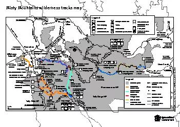
PDF-Cardwell Range trailheadCochable Creek Carter Creek Tully Gorge Henrie
Author : olivia-moreira | Published Date : 2015-09-07
3 Cockram Rd Tumoulin RoadTully Gorge National ParkTully Falls National ParkTo Mount GarnetTo Tully 40km MamuTropical To Silkwood Grant Falls lookout rfWooroonooran
Presentation Embed Code
Download Presentation
Download Presentation The PPT/PDF document "Cardwell Range trailheadCochable Creek C..." is the property of its rightful owner. Permission is granted to download and print the materials on this website for personal, non-commercial use only, and to display it on your personal computer provided you do not modify the materials and that you retain all copyright notices contained in the materials. By downloading content from our website, you accept the terms of this agreement.
Cardwell Range trailheadCochable Creek Carter Creek Tully Gorge Henrie: Transcript
Download Rules Of Document
"Cardwell Range trailheadCochable Creek Carter Creek Tully Gorge Henrie"The content belongs to its owner. You may download and print it for personal use, without modification, and keep all copyright notices. By downloading, you agree to these terms.
Related Documents