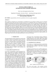
/
GENERALISATION SUPPORT SERVICESDepartment of Geography, University of GENERALISATION SUPPORT SERVICESDepartment of Geography, University of

GENERALISATION SUPPORT SERVICESDepartment of Geography, University of - PDF document

olivia-moreira
olivia-moreira . @olivia-moreira
Follow
389 views
Uploaded On 2015-07-27

GENERALISATION SUPPORT SERVICESDepartment of Geography, University of - PPT Presentation

ISPRS WG II3 II6 Workshop Multiple representation and interoperability of spatial data Hanover Germany February 2224 2006 ID: 94725

ISPRS II/3 II/6 Workshop

Share:

Link:

Embed:

Download Presentation from below link

Download Pdf The PPT/PDF document "GENERALISATION SUPPORT SERVICESDepartmen..." is the property of its rightful owner. Permission is granted to download and print the materials on this web site for personal, non-commercial use only, and to display it on your personal computer provided you do not modify the materials and that you retain all copyright notices contained in the materials. By downloading content from our website, you accept the terms of this agreement.


Presentation Transcript

GENERALISATION SUPPORT SERVICESDepartment of Geography, University of Zurich–{neun,burg,weibel}@geo.unizh.chJoint ISPRS Workshop on Multiple Representationand Interoperability ofSpatial Datamap generalisation, web services, generalisation web services, graphs, triangulationABSTRACT:While standards for automated access and presentation of cartographic data over the internet are defined, services for automategeneralisation and the transfer and storage of the data involved are not yet standardised. Web service technologies can be usedestablish an interoperable framework between different generalisation systems. The service architectures can be distinguished intomiddleware services, which are delivering original and/or pre-generalised data from a database through a WMS or WFS, andresearch platforms which provide only access to the generalisation ISPRS WG II/3, II/6 Workshop "Multiple representation and interoperability of spatial data", Hanover, Germany, February 22-24, 2006__________________________________________________________________________________________________________ Figure1: Middleware generalisation serviceThis service wouldrequire a fully automated, real-timeexecution of the generalisation process. Another possible use 6 6 are generalisation support services (see section 1.4) which pre-process cartographic data e.g. from aWFSso that they can thenbe used by more complex generalisation algorithms.The other service type is thean interactive Generalisation Service for GIS research and forGIS users in organisations such as national mapping agencies(NMA) and Universities. In this case the Generalisation Servicewould provide its functionality and its calculation power to theservice subscribers. It also fulfils the requirements of a commonresearch platform (Edwardeset al., 2005), where the researcherswant to have access to a common generalisation framework.This WebGen platform offers the ability to provide specialisedor novel algorithms to the research community without forcingthe participating researchers to adapt their systems to thespecific needs (Neun and Burghardt, 2005).In an open research model every researcher can present his/herown generalisation service (Fig. 2). Through the internet andthe use of platform independent technologies such services canreside on servers all over the world. For discovering theseservices some “Yellow Pages” are needed, indicating whichservices are available, where they are located and whatalgorithms they offer (Burghardt et al., 2005). This is the“Registry” for generalisation services. The registry offers asingle access-point where all furtherinformation is to be found.Whilst services can change or move they are always to be foundagain through the registry. This model for sharing anddiscovering generalisation services can be summarised by the“publish-find-bind” paradigm (UDDI, 2005) wherethe serviceis published, for instance, by the author in the registry and canthen be easily found and used by others. Figure2: Generalisation research platformFirst Generalisation Services have already been implemented(Neunand Burghardt, 2005). These are rather simple services(e.g. Douglas-Peucker line simplification, buildingsimplification) where spatial context is not considered. Theobjective was to show the feasibility of the service-basedapproach and to describe theminimum set of componentsneeded to run the Generalisation service algorithms are written in Java for the WebGenframework (Neun and Burghardt, 2005). This framework uses aweb-server with Java servlets, SOAP (2000) forthecommunication and JTSTopology Suite(2006) for thegeometry representation. JTS cSpecification for SQL, published by the Open GIS ConsortiumThe client for accessing the services is currently available fortheJUMPUnified Mapping Platform(2006). The client plug-inoffers the configuration and selection of the desired service. Thedata to be processed by the service together with the parametersfor the algorithm are encoded and sent to the service. The result,sent back from the service, is then decoded and presented in theclient. A client with similadeveloped for many of the co1.3Categories of Generalisation Servicesss involves both, rather simplegeneralisation operations which are applied only to individualmap objects (so-called independent generalisation), as well ashighly context-dependent operations which require control overthegeneralisation workflow (so-called contextualgeneralisation). Hence, Burghardt et al. (2005) argue that threecategories of generalisation services must be offered in order toenable comprehensive web-based generalisation. These threecategories are shown in context in Figure 3 and briefly Figure3: Categories of generalisation services1.3.1Generalisation Support Servicesare, for example,services for buffering or for creating a topological data struc-ture, a skeleton or a constrained Delaunay triangulation. Resultsof such a service can be seen as additional (enriching) carto-graphic information in support of the automated generalisationprocess. Support services take raw data with a simple structureas input and deliver either a simple structure but with additionalenriching information or a more complex data structure withobject relations as output. Thus a main goal of such services ison explicit, representing commonstructural properties such as alignments, neighbourhood orproximity relations, which can be usefully exploited by gener-alisation operations (Neun et al., 2004). Sometimes the estab-rmation is very expensive interms of time and memory so that optionally the persistent stor-age in a special multi-resolution database (MRDB) can be use-ful e.g. for real-time generalisation.1.3.2Generalisation Operator Servicesdeliver the func-tionality of standalone generalisation operators such as the onesdefined by McMaster and Shea (1992). Examples are servicesaggregation, amalgamation,merging, collapse, refinement, exaggeration, enhancement anddisplacement. These generalisation operator services can be fur-ther subdivided for point, line and area objects and specialiseddepending on object classes. It is obvious that rivers, politicalboundaries, or railway tracks have to be generalised in a differ-ent way, despite the fact that all of them are represented as lineobjects. The generalisation operators of this second servicecategory are offered in an interactive mode, with the user select-ing appropriate generalisation operators and algorithms as wellas setting the control parameters of the algorithms. 7 7 1.3.3Generalisation Process Servicesuse services from thelower categories for the control and orchestration of generalisa-tion operators. Examples are services for automated orchestra-tion, services for the evaluation of generalisation results, as wellas meso agents (Ruas 2000) as described for the advanced Gen-eralisation Service category. Automated control of the generali-sation process presently receives ample attention as a researchtopic. Besides agent-based modelling, combinatorial and con-tinuous optimisation approaches are also proposed in the litera-ture (Harrie and Weibel, 2006). Simulated annealing (Ware etal., 2003), as a combinatorial optimisation approach allows therations controlled by assigningcosts to each operation. Continuous optimisation approachesinclude the finite element method (Højholt, 2000), snakes ornd Meier, 1997; Bader, 2001;Galanda and Weibel, 2003) and l2.TAXONOMY OF GENERALISATION SUPPORTThe execution of generalisation operators or algorithms dependson the input they receive. Of importance are elements such asalgorithm parameters, the character of the map features togeneralise, and also mutual influences between map features,such as roads exerting a push on nearby houses in the mapfeature displacement.dge about the spatial contextin the algorithms is a very important factor (Mustière andMoulin, 2002). So, relations between the map features areexplicitly established or basic geometrical operators areexecuted. Examples range from the creation of a simple bufferto a topological data structure, a skeleton or a constrainedDelaunay triangulation.Often, when a researcher develops a new generalisationalgorithm he/she will have tocreateall these supportingfunctionalities and structures from scratchordevelopconverterstouseexistingones. In contrast, support services try to offer aframework of common supporting functionalities and datastructureswhich can then be (re-)used by more advancedgeneralisation operators. Offering these support services as webservices (Neun et al., 2005) makes the use of the supportingframework easier and platform independent. Therefore theoutput of the support services must be storable and transferableacross networks in a standardised way.Support services can beused for both, data pre-processing and real-time generalisation.The limiting factor is the calculation time of the specific supportservice not the interface.Figure4: Support service typesSupport services can be distinguished by the type of thesupporting data they offer, and thus by the output they deliverto the service consumer (Fig. 4). There are two main types.First, there are the support services which deliver features with attributes which help thegeneralisation operator (see section 2.1 for details andexamples). Second, there is the large family of graphs (section2.2). They range from (directed or undirected) networks, suchas transport graphs and triangulations, to hierarchies which canbe expressed by trees. All graphs and trees can also berepresented as a data structure by matrices or arrays.2.1Feature Support ServicesThe most obvious output of a support service are simplefeatures (OGC, 1999) with supporting attributes or geometries.Functionalities to read and write these supporting datastructures are included in most GIS software. These services arejust enriching features with additional attributes or are creating2.1.1Creating Geometries:Output of such a support ser-vice isjust geometries. They can easilybe expressed by simplefeatures. Thus, no extra data format is needed to getresults.An example of a simple support service is the creation of thebuffer polygon from an input geometry which could also beused for a selection service (Fig. 5). Taking, for instance, a roadand a set of houses as input a selection service returns thehouses contained in a certain buffer around the road. The outputof both services are just simple features. Figure5: Buffering / feature selectionSimilarly the edges of a road network could be used forpartitioning and thus for the selection of features. Thisfunctionality could be available through a topology supportservice (see 2.2.2)A further example of supporting geometries includes thecomputation of alignment lines, chaining together a group ofmap features such asbuildings (Christophe and Ruas, 2002).The creation of inflection points or localisation local extremesfor line generalisation (Plazanet, 1995) serves as a finalexample of supporting geometries. It delivers a series of criticalpoints which can then beused, among others, for linesegmentation (partitioning) or the creation of trend lines,approximating a line (Fig. 6). Figure6: Inflection point / trend-line generation2.1.2Generating Attributes:These services take map fea-turesas input and return the features with changed or new at- SupportServices Features Relations Hierarchical Non-Hierarchical Geometries Attributes 8 8 tributes. In essence, most of these services are performing ananalysis of the shape and structure of map features, also termedcartometric analysis (McMasteof such a function is the calculation of the sinuosity or densityof a line (Plazanet, 1995) which is stored as an attribute of theline feature. Plenty of other measures can be calculated, such asarea size, shortest distances to next neighbours, and many more.Often,these measures can be used in a comparative way to es-tablish priority orderings among map features (e.g. small poly-gons may be defined to be insignificant and therefore omitted).2.2Relation Support ServicesThe modelling of spatial relationships is criticalfor theunderstanding of the role of cartographic features and thus forautomated generalisation (Regnauld, 2005). Additionally,structural and semantical relationships are essential ingredientsfor many complex generalisation operators. Relationshipsbetween cartographic features can be modelled as graphs (Fig.7). Examples aretopological data structures (e.g. polygonalmaps), transportneighbourhood graphs, triangulations. As a more specific case, hierarchies can beexpressed bytrees. Hierarchies occur for semantical as well as Figure7: Examples of graphs: Weighted graph, triangulationThus, the following support services for expressing relationshave as common output a data structure which can be expressedby a graph. Graphs can be further differentiated into (general)networks and trees, with trees being a special form of a graphwith no cycles, rooted in a single node.2.2.1Hierarchical Relationscan exist between cartographicfeatures. Then, the hierarchy creating criterion is any propertyof the feature such as the position or an attribute such as a class.However, hierarchies can also consist only of attribute values orcounts, such as feature classes or the frequency of a certain fea-ture type. Hierarchical relations can usually be expressed bytrees.The following hierarchical data structures are supportinggeneralisation algorithms and are therefore potentially useful asComplex features (feature groups)Hierarchical similarity trees or dendrogramsLinks between levels of detail (LoDs) of MRDBsReactive data structuresHierarchical surface data structuresComplex features:Map features often form meaningful groups,that is, complex mapfeatures consisting of simple features.Examples include a cluster ofbuildings that forma smallsettlement(however, not being represented explicitly), a groupof buildings and surroundingstreets forming a city block, orseveral fields, ponds, trails, etc. forming a park. Complexfeatures arebuilding groups, thus they arethesimplest and alsomost general case of hierarchical (partonomic) relations. Suchcomplex features can either be user-defined or establishedautomatically by cartographic pattern recognition (e.g.,Similarity trees or dendrograms:For the aggregation ofgeometries or the translation of features from one featureschema to another, often a reclassification of the featurecategories is needed. A reclassification needs some sort of rulebase how to assign new categories to the input features. Thisrule base can be in many cases a strict hierarchy which assigns anew category to every inputcategory (e.g. 'deciduous forest' and'coniferous forest' are both reclassified to 'forest'). Thishierarchy can be defined by the user of the system or generatedautomatically, for instance by a statistical evaluation of theinput categories to establishtheir relevancy. A reclassificationservice would request asimilarity treefrom the support serviceand then classify the map features accordingly. Thus a similaritytree expresses the semantic similarity or adjacency of thefeature’s classes which can then be used for reclassifications oraggregations (van Smaalen, 2003). A special case isencountered if multiple output categories are possible for agiven input category. However, in such a case thesedependencies are no longer hierarchical and a weighteddecisiongraph (e.g. represented as a directed acyclic graph, DAG) can beused instead (see 2.2.2).For the generation of multi-resolution databases(MRDB)out of different datasetstheon the different levels of detail (LoD) is indispensable. Thebetween the features on the higher scale with the matchedfeatures on the lower scale are mostly of nature 1:0, 1:1 and 1:nas shown by Timpf (1998). 1:1 and 1:n relations can beexpressed by a simple tree. However, n:mrelations as theyexist, for instance, in typification operations (e.g. 5 buildingsare typified by 3 buildings) are more complex to model andrequire a DAG (directed acyclic graph)as they can’t bemodelled by a tree.A well known example for ahierarchy is theHorton-Strahlerordering of hydrologynetworks (Horton, 1945; Strahler, 1952). This is a veryobviousand intuitive example for a tree as a river from the embouchureto the source links has a natural tree-like structure. In manycases this tree structure must not be explicitly generated againby the support service but the ordering can just be assigned asweights to the branches of the river network. Hierarchicalnetworks of the main hydrological features, stream channels andridges, can also be modelled as interlocking networks (withchannels being the dual of ridges; Werner, 1988). Suchstructures were also used by Weibel (1992) to represent the 3-Dskeleton of a terrain surface and hence generalise digital terrainmodels.For the efficient storage and access ofline simplifications or polygon aggregations in MRDBs treestructures provide a useful hierarchy for the contained features.Ballard (1981) introduced thestrip treestrips for partitioning a line. On the highest level of the striptree the whole line is contained within one strip (i.e. co-axialminimum bounding rectangle, MBR). Proceeding down thebinary strip-tree the strips get smaller and deliver a betterapproximation of the line. Another hierarchical structure for 9 9 line approximation in a multi-resolution environment is theBLG-tree(van Oosterom, 1993). This reactive data structureuses the Douglas Peucker line simplification algorithm forsplitting up theline.Hierarchical surface data structures:Hierarchical structures forstoring surfaces include, for example, the multi-resolutiontopographic surface database (Ware and Jones, 1992) whichuses hierarchical surface triangulation as well as hierarchicalTINs (HTINs) which use also a hierarchical triangulation formulti-resolution surface description (De Floriani and Puppo,1995). Hierarchical surface data sturctures are mainly used inapplications that require real-time rendering of surfaces, such asterrain surfaces in flight simulation.Partitioning and distributed processing:map data sets is often helpful to assist the generalisationprocess. For instance, settlement generalisation is facilitated bypartioning the settlement into city blocks formed by the streetnetwork (Ruas 2000). Additonally, such partitions might also beusefully exploited to increase the speed of complexgeneralisation operations. Also, the distributed processing of apartitioned dataset on multiprocessor computer architectures oreven on clusters could be possible. Unfortunately, appropriatemethods for distributed processing do not exist.2.2.2Non-Hierarchical Relations: Common representationsof non-hierarchical data structures are graph-based networkstructures. These networks can contain cycles, are possiblytures in many ways.The following networks may support generalisation algorithmsand are therefore potentially useful as generalisation supportservices:Minimum spanning trees (MST)Topology graphsTriangulations and related structuresSurface networksRoads orrailway networks form in a way acan be used for example togeneralise a road network connecting a set of cities by selectingthe roads in the minimum spanning tree (Mackaness and Beard,1993; Thomson and Richardson, 1995). This way theconnectivity of the transport network is assured.Minimum spanning trees (MST):(MST) can also be used in automated road matching for multi-resolution databases. The MST is, for instance, used for theselection ofcandidate roads (Lüscher, 2005). Although being atree the MST does not express a hierarchical relationshipbetween features. For managing building relations in thebuilding displacement process Bader et al. (2005) use aductiletrussnning tree, forming cycles untilevery node is connected to two neighbours.A very direct and geometricrelationship is the neighbourhood of a feature. Anders (2004)neighbourhood graphsfor the interpretation of spatialdata, data analysis and data enrichment of disjoint objects (e.g.the buildings of Fig. 8). As support service for generalisation anearest neighbourhooda relative neighbourhoodgraphcan be used in many cases where one feature influencesFor expressing adjacencies between mapfeaturestopological data structuresare used. A topologicaldata structureis an extended planand faces to represent the topologiThereby the space is divided completely by the nodes and edgesof the map features. The use of such a topology graph in analgorithm ensures data integrity, shared boundaries andrules (embedding, planar enforcement, etc.) can be used toprevent holes which are created due to a geometry type changefrom a polygon to a line or point (Bobzien and Morgenstern,2002). A data format for storing and exchanging topologicaldata structures is available through GML 3 (OGC, 2004). Thus,support services for adding topology to a dataset are possibleand do not need any new data format. However, full topologicalstructuring is quite heavyweight and sometimes, such as forassuring connectivity, a much simpler graph could be used. Forinstance, Petzold et al. (2005) used a 'polygon connectivitygraph' to relate polygonal road segments in order to generate theroad skeleton.Triangulations and related structures:Delaunayof a point (vertex) set is a collection of trianglessatisfying the property that no other vertexes are within eachtriangle’s circumcircle (Fig. 8). The constrained and theconforming Delaunay triangulations are adaptations of theDelaunay triangulation which can be used to triangulate overpolygonal objects by incorporating the polygons edges aspredetermined or constrained triangle edges. Figure8: Delaunay triangulation (non-constrained) of polygonsand of polygon centroidsJones et al. (1995) use the constrained Delaunay triangulation intheir simplical data structure (SDS) for implementingexaggeration, collapse, amdisplacement algorithms. Ruas (1998) uses a Delaunaytriangulation of building centroids to represent proximityrelations for managing the building displacement process.is the geometric dual to the Delaunayas Thiessen polygons and definesthe border of the space which is closer to the contained object(e.g. a point) then to any other object. Thus, the result is acomplete tessellation of the space between the objects. Chitahambaram and Beard (1991) usethese properties forcreating the skeleton of a polygon.Surface networksuse a graph-theoretic approach originally suggested by Pfaltz 10 10 (1976). Surface topology is stored as a weighted graphconsisting of verticesrepresenting the surface-specific points(peaks, passes, and pits), and edges representing connectingridges and channels. Both point features (peaks, pits, ands and channels) are assigned aweight according to their degree of importance. Thus, relativelyunimportant parts of the network can be removed and theremaining network readjusts automatically.Strictly partonomic relations can be expressedby hierarchical trees (see smultiple associations, depending on an attribute or any otheresented in a tree because of thepossibility of cycles in the structure. Therefore aweighted(or a weighted adjacency matrix) can expresssuchrelationships. Such a graph can also be represented as adirected acyclic graph (DAG) which has, if needed, weightededges. An example is the reclassification step which precedesthe aggregation or amalgamation of cartographic features. Asshown in Fig. 9an alley could, depending on its size, becomepart of a city block or part of the road network. Figure9: Partonomy with multiple associations3.REPRESENTING GRAPHSIn the context of web services we distinguish the representationof a graph as a data structure in the computer’s main memoryand the representation as a pers3.1Data StructureThe in-core data structure has to facilitate the generation,modification and especially thequerying of a graph in thecomputer's main memory. This data structure is depending onthe platform and the programming environment. In general wecan distinguish list or matrix based as well as object orientedFor all types of graphs there are two common node based datastructures for graph representation. In theadjacency listallnodes are listed in an ordered fashion and every node has aunique identifier (number). Corresponding to every node thereis a list or array containing the identifiers of its neighbours,connected by incident edges. Theadjacency matrixuses a two-dimensional boolean array of size #nodes x #nodes to representnode adjacencies. In many cases the adjacency matrix (see Fig.10) is easier and faster to use. For graphs which have a highnumber of edges per node, not much space remains unused inthe matrix. However, if there are not many edges per node (i.e.if the node degree is low), such as in triangulations with largenumbers of nodes that are on average of degree5 to 6, a lot ofspace is wasted in adjacency matrices.Thususually matrices arenot applicable in real application because they require toomuchdata storagealready for normal size datasets.In adjacency lists,on the other hand, the size of a list is dynamically dependent on(actually, a triangle list) data structure is possible. In thiscase a list containing the nodes with uniqueidentifiersand a listcontaining the faces of the graph(i.e. triangles) each with thethree nodes of the triangle are built. This data structure is easierto query, e.g. for containment in a triangle. Figure 10: Simple graph (triangulation) and correspondingadjacency matrixObject-oriented (OO) conceptsallow a more flexible graphrepresentation. In this case the processing efficiency is moreimportant than the storage. Regnauld (2005) proposes a Javabased object-oriented data structure to represent proximitynheritance allows extending abasic graph representation with nodes and edges.In a simple basic OO graph representation (see Fig. 11) a graphconsists of a list of nodes and a list of edges. Each nodecontains only a list of the incident edges. The edges have twovariables which point to the two end-nodes of the edge. For the use as generalisation support such a basic graph can beeasily extended through class inheritance. In graphs whichrepresent cartographic features, that is, where the nodescorrespond to nodes or vertices of cartographic features, thenodes have coordinates and/or contain a link to thecorresponding cartographic feature. For planar graphs liketopology graphs or triangulations the basic graphmodel can beextended with faces or triangles. An example of such anextension is shown for Delaunay triangles by Regnauld (2005).For creating such an OO Delaunay triangulation usually thealgorithm to generate the triangulation receives a set of pointsas input. The algorithm builds the edges and triangles and storesthe nodes, edges and triangles in Java objects. In the sameenvironment the triangulation can now be queried and modifiedby other algorithms. After the completion of the program thetriangulation will be lost. As an additional problem, suchobjects are not easily exchangeable with other programmingenvironments or across networks. Therefore in the context ofsupport services, where the different services may reside ondistributed computers,a data format to persistently store andexchange the graph structures is needed. 11 11 The use of the same data format for storing the graph andrepresenting it in the main memory is possible, but notnecessary and often not even appropriate. It can be appropriateif both the in-core data structure and the transfer format arebased on adjacency lists or adjacency matrices (represented bylists or arrays). For object-oriented data formats, however, it ismore suitable to have two different data formats. That is,the in-core representation should be optimised for the querying andmodification of the graph while the transfer data format isoptimised for being efficiently saved, transferred over a networkand parsed at the receiver.3.2Storing or Exchanging Trees andGraphsTrees are directly implementable in the hierarchical XMLformat. Elements of an XML data structure can enclose otherelements. Thus they are creating a nested structure whichrepresents a strict hierarchy. The following example shows abuilding being part of a lot which is again part of a cityblock:cityblocklotcityblockSuch an XML representation can also be used in an object-oriented manner in the main memory of a computer. For doingso almost all XML parsers for object-oriented programminglanguages are offering a tree-like data structure for querying theData formats or languages for stexist. There are very simple text files containing node and facehuk, 1996) or the XML basedGraphGXL (Holt et al., 2000). GXL is verypowerful and tries to represent a maximum of different graphtypes. As XML is very flexible and has a hierarchical structurealso own XML formats for representing graphs can easily becreated.All these data formats are based on a list representation such asan adjacency list for simple graphs or a triangle list withassociated nodes and possibly their adjacent triangles. Theadvantage of these data formats is that they are compact, theydon’t contain much redundancy and they can easily be saved ina file or be sent over a network using standard protocols.However, using these data formats as in-core data structure forgraph representation is not very practical and efficient. Anquery, modify and extend.The WebGen research platform described by Neun andBurghardt (2005) uses the XML based SOAP protocol (2000)for the data exchange between the different services and theclient, making the use of an XMstraightforward. As there exists yet no standard for representingany graph in GIS a data format is desirable which can easily becreated and read in different programming environments or GISplatforms. Thus, parsers for the different generalisation supportdata structures are needed. In the case of an OO representationof the graph on the computer the data structure is converted toan XML structure sent overa network and parsed on thereceiving system into its own, internal data structure which mustnot be the same as the transfer format.During first tests with graphs in the WebGen framework (Neunand Burghardt 2005) we used a very simple XMLrepresentationwhich is in fact just using a redundancy freeadjacency list. The following example shows the sample XMLcode for a simple basic graph as shown in Figure 10:ixg:graph120.0,109.0208.0,567.0ixg:edge458.0,297.0edgeedge765.0,512.0edgeedge782.0,115.0edgeedgeedgeixg:graphThis data format must be read in the correct order like a list asthe “edge” elements do always link the preceding node with thenode whose ID is contained in the “idx” attribute of the edge.Thus, this format does not contain any redundancy. This dataformat can be parsed very fast and converted to an OO graphrepresentation. For direct querying, however, this transferformat is rather tedious.4.DISCUSSION4.1Standardisation of Spatial Structures and RelationsStandardised functionalities to compute and use spatial andstructural relationships are sparse in GIS. Furthermore,transfer formats do commonly notinclude the modelling and storage of the advanced relationshipsthat are discussed above.Many algorithms for enriching data or for creating spatialr different platforms and dataformats. Interoperability, however,is not ensured and thedifferent implementations of algorithms are not comparable.The development process of advanced generalisation operatorstakes more time because of the fact that algorithms orconverters for the support data structures have to be generatedLanguages exist (e.g. GXL) for expressing graph-like andmatrix-like structures and they can be used in many ways. Whatis still missing today, however, is an agreement in thegeneralisation community on how to exploit XML-basedlanguages toachieve a standardised data format for expressinges. Such a format could thenbe used in the development of new generalisation supportservices and possibly also converters for already existingsupport structures wouldbe developed. Following thecategories of generalisation services (see section 1.3) thegeneralisation support services can then be the foundation of themore advanced generalisation operator and generalisationprocess services. 12 12 4.2Persistency vs. RecalculationThe aim of this paper was to illustrate the possible use ofgeneralisation support services as web services. This promptedthe discussion about data models and formats for storing thesupport structures. Another point is the question why todaymost support structures are only generated at runtime and arenot saved persistently. Some are very expensive to calculate but could easily be savedpersistently for multiple use, for instance, by other4.3Usage of Generalisation Support Services on the one hand should deliverdata structures which are expensive to calculate. On the otherhand, and probably most importantly, a generalisation serviceshould deliver the result of complex supporting algorithms,such as complex measures, support geometries or map featurerelations, with an easy interface and a preferably simple output.The aim is to make support services available to developers ofservice-based generalisation architectures in such a way thatthey can use these in conjunction with generalisation operatorservices without having to know in detail how the support datais generated. One example is a Delaunay support service thatcan generate a Delaunay triangulation from a set of pointswhich can later be queried, for instance, for the shortest edge orupdated by removing the shortest edge.5.CONCLUSIONIn an earlier paper Burghardt et al. (2005) made a proposal forgeneralisationweb services. In that paper three typesofgeneralisation serviceswere distinguished, includinggeneralisation support services, generalisation operator services,and generalisation process services. In this paper, we dwellprimarily on the generalisation support services, which areintended to enrich the raw input data with additionalinformation such as shape or importance attributes and newgeometries as well as spatial and structural relationships, henceproviding direct support to the other two service categories. Asa first contribution,this paper delivers a comprehensivetaxonomy of generalisation support services in relation totors. Second, methods areproposed to represent, store and especially exchange the spatialrelations generated by support services.Many relations can beexpressed in a graph-like form. Thus, the proposed datastructures and formats are mainly graph based. Finally, anumber of important, yet still open issues are discussed,transfer formats, persistencyvs. recalculation, and different paths for generalisation serviceexploitation. The latter issue–service usage–will be ofparticular importance to the further development ofart from developing different'business models'of how generalisation services might best beused, open questions include the right granularity ofupport services (i.e. what areuseful functional building blocks that may serve to developservice-based generalisation systems), as well as problems ofpartitioning generalisation problems so that they may beamenable to distributed processing. Obviously, there are stillplenty of open problems remaining, as generalisation isrevisited given a different architecture (service-based ratherthan standalone) and at least partially given more stringentconstraints w.r.t. processing efficiency.We plan to address the above issues step by step in the future byfurther extending the WebGen platform (Neun and Burghardt,2005; Burghardt et al., 2005) which is intended to serve both asa demonstrator and a proof-of-concept. The generalisationsupport services discussed in this paper will be integrated into first attempts with supportservices providing a graphas output are evaluated. Thesesupport structures can then be used by other generalisationoperators over the web services interface. More specifically, weare experimenting with the use of triangulations (as a supportservice) in conjunction with building typification operatorservices.The research reported in this paper was partially funded by theSwiss NSF through grant no. 20-101798, project DEGEN.Thanks go to Alistair Edwardes and Matthias Bobzien forhelpful comments.Anders, K.-H.. 2004.Clustering-Verfahren zur Interpretation raumbezogener DatenDoctoral Thesis, Institut of Photogrammetry, University ofStuttgart, Germany.Energy Minimization Methods for FeatureDisplacement in Map Generalization. Doctoral Thesis,Department of Geography, University of Zurich, Switzerland.Bader M., M. Barrault and R. Weibel. 2005. Buildingdisplacement over a ductile truss. International Journal ofe. Vol. 19, No. 8–9, 915–936.Bobzien M. and D. Morgenstern. 2002. Geometry-Type Chancein Model Generalization-a Geometrical or a TopologicalProblem? Proceedings of the Joint ISPRS/ICA Workshop onMulti-Scale Representations of Spatial Data, 2002, Ottawa.Burghardt, D. and S. Meier. 1997. Cartographic DisplacementUsing the Snakes Concept. In: Förstner, W., and L. PlümerSemantic Modeling for the Acquisition of TopograficInformation from Images and Maps, Birkhäuser Verlag, 59-71.Burghardt, D.,M. Neun and R. Weibel. 2005. GeneralizationServices on the Web–A Classification and an Initial PrototypeImplementation.Cartography and Geographic Information, 32(4): 257-268.Chithambaram, R., M.K. Beard and R. Barrera. 1991.Skeletonizing Polygons for Map Generalization.Technical. Baltimore. Vol. 2, pp. 44-55.Christophe S., Ruas A., 2002, "Detecting Building structuresIn: D. Richardson & P. vanAdvances in Spatial Data Handling, Berlin ,Springer, 10th international Symposium on Spatial DataHandling, (SDH'02, Canada/Ottawa), p419-432.De Floriani L. and E. Puppo. for multiresolution surface description.Graphics, 14(4):363--411. 13 13 Edwardes, A., D. Burghardt, M. T. Reichenbacher, M. Sester and R. Weibel. 2003. MapGeneralisation Technology: Addressing the need for a common. Durban, South Africa. (CD-ROM)build an open generalisation system. In: W. Mackaness, A. Ruasand T. Sarjakoski (eds),Challenges in the Portrayal ofGeographic Information: Issues of Generalisation and MultiFitzke, J., K. Greve, M. Müller, A. Poth. 2004. Building SDIswith Free Software–the deegree project. In:Global Spatial Data Infrastructureel. 2003. Using anEnergyMinimization Technique for Polygon Generalization.Cartography and Geographic Information Science275.Harrie, L. 1999. The Constraint Method for Solving SpatialConflicts in Cartographic Generalization.Geographic Information Science, 26(1): 55-69.Harrie, L. and R. Weibel. 2006. Modelling the Overall Processof Generalisation. In: Mackaness,. Elsevier Science. Forthcoming.Højholt, P. 2000. Solving Space Conflicts in MapGeneralization: Using a Finite Element Method.Cartographyand Geographic Information Science, 27(1): 65-73.Holt R.C., A. Winter and A. Schürr. 2000. GXL: Toward aStandard Exchange Format. http://www.gupro.de/GXL/Horton, R.E. 1945. Erosional development of streams and theirdrainage basins: Hydrophysical approach to quantitativemorphology., 56, 275-370.ICA. 2004. Brain storming Sessions. ICA Workshop onGeneralisation and Multiple Representation (Leicester),available from http://ica.ign.fr/Illert, A. and S. Afflerbach. 2004. Global schema specification.GiMoDig-project, IST-2000-30090, Deliverable D5.3.1, PublicEC report, 35 pgs., http://gimodig.fgi.fi/deliverables.phpJones C.B., G.L. Bundy and J.M. Ware. 1995. MapCartographyand Geographic Information Systems22(4), pp 317-331.JTS. 2006. The JTS Topology Suite, Vividsolutions.http://www.jump-project.org/project.php?PID=JTS&SID=OVER(accessed 11/JUMP. 2006. The JUMP Unified Mapping Platform.http://www.jump-project.org/project.php?PID=JUMP&SID=OVERLehto, L., and T. Sarjakoski. 2004. An Open ServiceArchitecture For Mobile Cartographic Applications. In: G.Gartner (ed.), Location Based Services & TeleCartography,, Vienna University ofTechnology, January 28-29, 2004, Vienna, 141-145.Lüscher P. 2005. Matching von Straßendaten starkunterschiedlicher Maßstäbe und Aufbau einer MRDB.42.Sitzung der Arbeitsgruppe Automation in Kartographie,, Wien.Mackaness W.A. and M.K. Beard. 1993. Use of graph theory tosupport map generalization. Cartograohy and GeographicInfromation Systems, 20.McMaster, R., and S. Shea. 1992.Cartography. Washington D.C: Association of AmericanGeographers.Mustière S. and B. Moulin. 2002. What is Spatial Context inCartographic Generalisation?Conference Geospatial Theory,, IAPRS & SIS, vol. 34, No. 4Ottawa, Canada. Pages 274-278.Neun, M., R. Weibel and D. Burghardt. 2004. Data Enrichmentfor Adaptive Generalisation. In:Generalisation and Multiple Representation(Leicester),available from http://ica.ign.fr/Neun, M. and D. Burghardt. 2005. Web Services for an OpenGeneralisation Research Platform. In:Generalisation and Multiple Representationavailable from http://ica.ign.fr/OGC. 1999. OpenGIS® Simple Features ImplementationSpecification for SQL. http://www.opengeospatial.org/specs/OGC. 2002. The OpenGIS® Abstract Specification, Topic 12:OpenGIS Service Architecture, Version4.3,OGC02-112.http://www.opengeospatial.org/specs/(accessed 11/2005)OGC. 2004. The OpenGIS®Geography Markup LanguageVersion 3.1.1,OGC03-105r1.http://www.opengeospatial.org/specs/(accessed 11/2005)Petzold I., D. Burghardt and M. Bobzien. 2005. AutomatedDerivation of Town Plans from Large Scale Data in aCartographic Production System. In:Proc. XXII InternationalCartographic Conference (ICC2005),Plazanet C., J.-G. Affholder and E. Fritsch. 1995. Theimportance of geometric modeling in linear featuregeneralization.Cartography and Geographic InformationSystems, 22(4):291–305.Regnauld, N. 2005. Spatial Structures to Support AutomaticProc. XXII International CartographicConference (ICC2005),Ruas A. 1998. A Method for buiding displacement in automatedInternational Journal on GIS, vol12 no8p789-803.Ruas, A. 2000. The Roles of Meso Objects for Generalisation.In: Proceedings9th Symposium on Spatial Data HandlingSarjakoski, T., Sester, M., Sarjakoski, L.T., Harrie, L., Hampe,M., Lehto, L.and T. Koivula. 2005. Web generalisationservices in GiMoDig-towards a standardised service for real- 14 14 time generalisation. In: Toppen, F., and M. Painho, (eds.),Conference proceedings, AGILE 2005, 8th Conference onGeographic Information Science, Estoril, Portugal, May 26-28,2005, pp. 509-518.Sester, M. 2000. Generalization Based on Least-squaresAdjustment. In: InternationalArchives of Photogrammetry and, Vol. XXXIII, Part B4, Amsterdam, 931-938.Sester, M., L. T. Sarjakoski, L. Harrie,M. Hampe, T. Koivula,T. Sarjakoski, L. Lehto, B. Elias, A.-M. Nivala, and H. Stigmar.2004. Real-time Generalisation and Multiple Representation inthe GiMoDig Mobile Service. GiMoDig-project, IST-2000-30090, Deliverables D7.1.1*, D7.2.1* and D7.3.1, Public ECreport, 151 pgs. http://gimodig.fgi.fi/deliverables.php (accessed01/2005)Smaalen, J.W.N. van, 2003. Geographic Objects: A New Approach to the ConceptualWageningen University and Research Centre.SOAP. 2000. Simple Object Access Protocol (SOAP) 1.1.Strahler, A.N. 1952. Dynamic basis of geomorphology., 63, 923-938.Timpf, S., 1998, Hierarchical structures in map series. PhdThesis, Technical University of Vienna.Thomson R.C. and D.E. Richapproach to road network generalization. In:Proceedings of the, Barcelona, Spain.UDDI. 2005. Universal Description, Discovery, and Integration.Ware, J.M., C.B. Jones and N. Thomas. 2003. Automated MapGeneralization with Multiple Operators: A Simulated AnnealingInternational Journal of Geographical Information, 17(8): 743-769.Werner, C., 1988. Formal Analysis of Ridge and ChannelPatterns in Maturely Eroded Terrain.Annals of the Association, 78 (2): 253-270.Weibel, R., 1992. Models and Experiments for AdaptiveComputer-Assisted Te, 19 (3): 133-153.Woods J.D. and S. Rana. 2000. Constructing Weighted SurfaceNetworks for the Representation and Analysis. In:International Conference on GeoComputation, UK. 15 ISPRS WG II/3, II/6 Workshop "Multiple representation and interoperability of spatial data", Hanover, Germany, February 22-24, 2006__________________________________________________________________________________________________________ 15