PDF-Calibrating maps with MAPCMAPC Use FileLoad Map for Ca
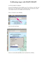
The map is first displayed to fit the available screen To se e it full size click Full and then use the L R U and D buttons to move around the map Left click m oves
Download Presentation
"Calibrating maps with MAPCMAPC Use FileLoad Map for Ca" is the property of its rightful owner. Permission is granted to download and print materials on this website for personal, non-commercial use only, provided you retain all copyright notices. By downloading content from our website, you accept the terms of this agreement.
Presentation Transcript
Transcript not available.