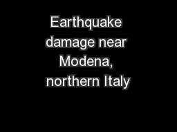
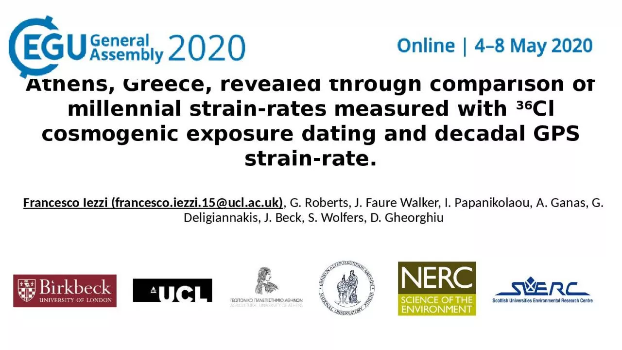
/
Temporal and spatial earthquake clustering near Athens, Greece, revealed through comparison Temporal and spatial earthquake clustering near Athens, Greece, revealed through comparison

Temporal and spatial earthquake clustering near Athens, Greece, revealed through comparison - PowerPoint Presentation

rodriguez
rodriguez . @rodriguez
Follow
66 views
Uploaded On 2023-11-04

Temporal and spatial earthquake clustering near Athens, Greece, revealed through comparison - PPT Presentation

36 Cl cosmogenic exposure dating and decadal GPS strainrate Francesco Iezzi francescoiezzi15uclacuk G Roberts J Faure Walker I Papanikolaou A Ganas G Deligiannakis J Beck S Wolfers D ID: 1028406

faults fault strain slip fault faults slip strain clusters gps rates 36cl earthquake active time strike dating rate measured

Share:

Link:

Embed:

Download Presentation from below link

Download Presentation The PPT/PDF document "Temporal and spatial earthquake clusteri..." is the property of its rightful owner. Permission is granted to download and print the materials on this web site for personal, non-commercial use only, and to display it on your personal computer provided you do not modify the materials and that you retain all copyright notices contained in the materials. By downloading content from our website, you accept the terms of this agreement.


Presentation Transcript

1. Temporal and spatial earthquake clustering near Athens, Greece, revealed through comparison of millennial strain-rates measured with 36Cl cosmogenic exposure dating and decadal GPS strain-rate.Francesco Iezzi (francesco.iezzi.15@ucl.ac.uk), G. Roberts, J. Faure Walker, I. Papanikolaou, A. Ganas, G. Deligiannakis, J. Beck, S. Wolfers, D. Gheorghiu

2. IntroductionClustered earthquake activity causes problems in the identification of the locations of active faults and associated strain-rates. Moreover, earthquake activity has been suggested to swap across strike onto neighboring faults to maintain regional strain-rates (e.g. Cowie et al., 2012). It becomes therefore important to gain observations able to resolve the precise locations of active structures over different time scales. GPS observations are commonly used to map regional strain-rates using decadal observations. However, debate is centered on whether GPS results (a) apply over multiple seismic cycles, that is, hundreds to thousands of years, and (b) can resolve the location of active faults if the region between GPS stations contains multiple active faults, but the seismic activity is clustered on specific faults within the GPS stations. To answer these questions, we performed 36Cl cosmogenic dating results on three parallel active faults arranged across strike in the direction of the principal extensional strain in the region of Athens, central Greece. The material shown in this presentation is currently under review in Iezzi et al., 2020, in Geology.

3. Crab nebula supernovae remnantCosmogenic dating of fault planesCosmic particles from supernovae are constantly bombarding the Earth’s surfaceMt. Vettore fault scarp, white free face is the coseismic surface rupture following 2016 Central Italy earthquakes (modified after Iezzi et al., 2018)

4. Crab nebula supernovae remnantNeutrons and muons fromsupernovaeCalcium atom36Cl atomsCosmogenic dating of fault planesThe impact of neutrons and muons with Calcium atoms causes production of 36Cl atoms 36Cl production on carbonate rocksImpactProduction

5. Neutrons and muons fromsupernovaeCalcium atom36Cl atomsParticle accelerator at SUERC, East Kilbride, ScotlandCosmogenic dating of fault planesThe concentrations of 36Cl can be measured with a particle accelerator36Cl productionImpactProduction36Cl production on carbonate rocks

6. Attica, central Greece Location of study areaExtension is accommodated by multiple parallel low slip-rate faults (0.2-0.5 mm/yr; Deligiannakis et al. 2018) with little or no evidence of historical surface-rupturing earthquakes, although historical and instrumental earthquakes of M  6 occurred in the area. The area presents a set of seven active faults arranged across-strike, crossed by the transect across GPS stations 007A-025A. We sampled three out of the seven faults across the GPS transect (other faults did not present sites suitable for cosmogenic dating).

7. Attica, central Greece Location of study areaThe three faults present low slip-rates, but they are all capable of releasing earthquakes with M  6.The faults are in the proximity of Athens (~4 million population), with the southernmost of them (Fili fault) having its SE tip probably underlying the city. The definition of the fault slip histories is fundamental for the evaluation of the seismic hazard of Athens.

8. Sampling of fault planesMilesi faultSamples are collected on a planar fault plane with no post- 15 ka erosion or sedimentation, with undisturbed upper and lower slopes, parallel hangingwall and footwall cutoffs.

9. Sampling fault planesMalakasa faultSamples are collected on a planar fault plane with no post- 15 ka erosion or sedimentation, with undisturbed upper and lower slopes, parallel hangingwall and footwall cutoffs.

10. Sampling fault planesFili faultSamples are collected on a planar fault plane with no post- 15 ka erosion or sedimentation, with undisturbed upper and lower slopes, parallel hangingwall and footwall cutoffs.

11. Modelling is performed using a Bayesian reversible-jump MCMC approach (Beck et al., 2018). It iterates the slip history many thousands of times, forward modelling expected 36Cl concentrations each time, to search for the best-fit to the measured 36Cl. The model has been allowed to explore slip histories for a large time interval to cope with possible early preservation of fault scarps. Milesi fault Modelling of cosmogenic 36Cl measured on fault planes Malakasa fault Fili fault

12. ResultsCombined slip histories of the three studied faults Episodic behaviour, with non-systematic alternance of periods of rapid slip accumulation and periods of quiescence. We interpret the slip pulses as periods during which the faults experienced repeated surface-rupturing earthquakes in a short time interval (i.e. earthquake clusters), alternating with periods of quiescence (i.e. earthquake anticlusters).

13. ResultsCombined slip histories of the three studied faults during the last 15 ka Earthquake clusters are alternating on the three parallel faults. Cluster on one fault corresponds to periods of quiescence on other faults. The clusters on different faults do not overlap in time, with activity migrating rapidly across strike as a cluster terminates.

14. ResultsStrain-rates on faults during earthquake clusters vs GPS strain-rate The horizontal strain-rates implied by slip during clusters are a large percentage (50-95%) of the regional strain-rate if the GPS rate applies over longer time scales. These high percentage values imply that only a small number of the active faults on an across-strike transect contribute to the regional strain-rate at any given time.

15. ResultsCorrelation between the age of preserved fault scarps and elevationThe retrieved slip histories highlight a difference in the ages since the three fault scarps started to be preserved: older fault scarps are located at lower elevations, younger fault scarps are located at higher elevations. Our interpretation is that, during the last glaciation, erosion related to frost-shattering increased with elevation. This explains why the lower elevation sites preserve a longer portion of the scarp history.

16. DiscussionEarthquake clusters migrate both into the hangingwall and footwall of faults spaced at least 5-20 km across strike.Clusters begin on faults within a few hundred years of the time when activity ceases on faults across strike.Clusters last several millennia.Clusters involve 2.0-3.5 meters of slip which is 78-100% of the slip measured over 15 millennia.Intense clustering implies a factor of x3.75-4.23 difference between slip-rates and earthquake recurrence intervals within clusters and compared to that calculated since 15 ka.

17. DiscussionThe implied strain-rates during measured earthquake clusters do not exceed that implied by decadal measurements with GPS, implying that the latter remains a candidate for the long-term regional deformation rate.If several active faults exist between GPS stations, it will not be possible to resolve whether strain is concentrated on one fault or shared between all faults or how strain localization changed through the Holocene.

18. ConclusionsFaults near Athens, although characterized by low slip-rates, are active and capable of surface-rupture during earthquakes, and given the uncertainty of whether clusters and anti-clusters are ongoing or about to end, the identification of clustered fault activity is vital for probabilistic seismic hazard assessments for the city. The combination of palaeoseismological data, such as 36Cl dating, and geodetic data is a powerful tool to study continental deformation and seismic hazard because it combines the long and short-term views of the deformation.We advocate dense GPS networks with stations on every fault block combined with InSAR observations that provide continuous spatial coverage of strain accumulation if the precise location and width of actively deforming zones is required, alongside palaeoseismology covering many millennia, for example 36Cl studies, where possible.

19. Thank you!Please contact francesco.iezzi.15@ucl.ac.uk or @FranceIezzi on Twitter if you want to know more!