Explore
Featured
Recent
Articles
Topics
Login
Upload
Featured
Recent
Articles
Topics
Login
Upload
Search Results for 'Accuracy-Step'
Accuracy-Step published presentations and documents on DocSlides.
Geospatial Data Accuracy and the New Mapping Accuracy Standard: New Era
by olivia-moreira
Session #35. Dr. . Qassim . Abdullah, Woolpert, I...
Accuracy vs. Precision On a blank sheet of paper: Title it – Accuracy & Precision
by celsa-spraggs
Define: . Accuracy. Precision. Draw & . Label...
An Introduction to Error Analysis The Study of Uncertainties in Physical Measurements Data Reduction and Error Analysis for the Physical Sciences accuracy precision Accuracy Precision systematic err
by liane-varnes
1 02 03 04 05 06 07 08 09 1 Measured Value of x Fr...
DIY Stepping Stone Walkway Installation Guide by world of stones usa
by worldofstonesusa
Learn how to install a DIY stepping stone walkway ...
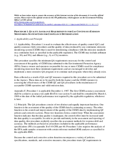
While we have taken steps to ensure the accuracy of this Internet vers
by smith
version Please refer to the official version in th...
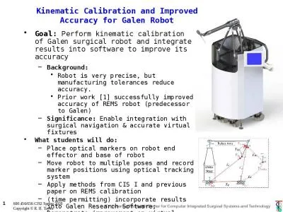
Kinematic Calibration and Improved Accuracy for Galen Robot
by elyana
Goal: . Perform kinematic calibration of Galen sur...
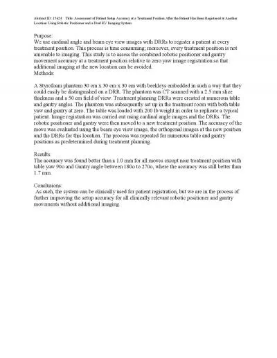
Abstract ID 15624 Title Assessment of Patient Setup Accuracy at a
by teresa
ed at Another Location Using Robotic Positioner a...
Claims Accuracy RequestClaims Accuracy Request CAR PiIn close collabor
by emily
losecollaborationtheteranservicerganizationSO part...
Forecast Accuracy and
by roy
InventoryStrategiesDemand Planning LLC03/25/2009Re...
All possible care has been taken to assure the accuracy of this patter
by sylvia
Big Charmer Quilt All possible care has been taken...
Associated Top-pair Production with a heavy boson through NNLL+NLO accuracy
by bikersjoker
at the LHC. Anna Kulesza. University of . Münster...
Accuracy of dual-Doppler
by impristic
lidar . retrievals . of . near-shore winds. Nikola...
Numerical accuracy of mean-field calculations
by nullitiva
The case of the 3-dimensional mesh scheme. The Lag...
Accuracy & Precision
by projoutr
Friday. , September 2. nd. , 2016. Accuracy . vs. ...
Accuracy vs. Precision Accuracy
by startlecisco
Accuracy of a measurement:. An indication of how c...
PRECISION and ACCURACY How low can you go?
by min-jolicoeur
CONTEXT. There are two . contexts precision . and...
Informant Accuracy Christopher McCarty
by jane-oiler
The Problem. Social network data often rely on co...
Accuracy and Reproducibility of Data
by mitsue-stanley
What is . accuracy. ?. Accuracy. refers to how ....
Improving the maximum attainable accuracy of communication-avoiding
by tatyana-admore
Krylov. . s. ubspace . m. ethods . Erin Carson a...
FAVOR II China Diagnostic Accuracy of the Angiographic Quantitative Flow Ratio in Patients With
by danika-pritchard
Bo Xu, MBBS. On behalf of the FAVOR II China Inve...
On Quantification of Accuracy Loss in Approximate Computing
by faustina-dinatale
Ulya. . R. . Karpuzcu. ukarpuzc@umn.edu. . 12/0...
Accuracy-Aware Program Transformations
by sherrill-nordquist
Sasa . Misailovic. MIT CSAIL. Collaborators. Mart...
Accuracy of dual-Doppler
by cheryl-pisano
lidar . retrievals . of . near-shore winds. Nikol...
Accuracy-Configurable Adder for Approximate Arithmetic Desi
by olivia-moreira
Andrew B. Kahng, . Seokhyeong Kang . VLSI CAD LAB...
Accuracy
by liane-varnes
An introduction to GPS technology. Acknowledgemen...
Accuracy Assessment
by min-jolicoeur
Landsat Classification of. Twin Cities Metro Area...
Accuracy Assessment
by liane-varnes
The Error Matrix. Error matrix for a 5-class clas...
Making Sense of Accuracy Repeatability and Specification Making Sense of Accuracy Repeatability and Specification for Automated Fluid Dispensing Systems INTRODUCTION Understanding accuracy and rep ea
by calandra-battersby
T hey can also be prone to misinterpretation when...
Improving the maximum attainable accuracy of communication-
by danika-pritchard
Krylov. . s. ubspace . m. ethods . Erin Carson a...
Accuracy
by pamella-moone
S5 . Accuracy. All Sections. Security. Today’s ...
Accuracy
by danika-pritchard
Chapter . 5.1 . Dat. a Screening. Data Screening....
Improving the maximum attainable accuracy of communication-
by olivia-moreira
Krylov. . s. ubspace . m. ethods . Erin Carson a...
Image Segmentation without Feature Definition
by mitsue-stanley
The Briefest Presentation by. N. . Kharma. &...
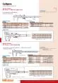
CalipersAn industry149 Fineadjustment ai149 Allows step measure
by gabriella
D-13 532-101 A E E G H D D C A FB BFL 531-101 Fine...
Year 7 Rounding & Approximation
by jane-oiler
Year 7 Rounding & Approximation Dr J Frost (...
Trade-offs in Explanatory
by mitsue-stanley
Model Learning . DCAP Meeting. Madalina Fite...
Trade-offs in Explanatory
by lois-ondreau
Model Learning . DCAP Meeting. Madalina Fite...
Trade-offs in Explanatory
by luanne-stotts
Model Learning . DCAP Meeting. Madalina Fite...
Microsoft® SharePoint® Step by Step Kit Microsoft® SharePoint® Designer 200 Step by Step Microsoft® SharePoint® Foundation 200 Step by Step
by xayvionrandon
Experience learning made easy, and quickly teach y...
Step 1 Step 3 Step 2 Step 5
by mitsue-stanley
Step 4. START. END. Finding a . flatmate. Types o...
Load More...