Explore
Featured
Recent
Articles
Topics
Login
Upload
Featured
Recent
Articles
Topics
Login
Upload
Search Results for 'Geospatial-Open'
Geospatial-Open published presentations and documents on DocSlides.
Copyright © 2017 Open Geospatial Consortium
by luanne-stotts
. Copyright © 2017 Open Geospatial Consortium. ...
Free and Open Source Geospatial Software and Data
by tawny-fly
Ioannis. . Kokkinidis. Geospatial and Environmen...
Geospatial Platform Update
by isaac463
NGAC Meeting. December 7, 2010. Karen Siderelis. G...
NGAC Geospatial Workforce Development Subcommittee
by osiris
Subcommittee Members. Dave DiSera (Chair). Joanne ...
NGAC Geospatial Partnerships with Tribes
by westley354
Chair: . David Wyatt. Members:. . J. Johnston, ...
GDRS and you! Geospatial Data Resource Sites
by leah
Tim Loesch, MN DNR. Presentation to the . Statewid...
Geospatial Analysis and Modeling - NCSU MEAS – Helena Mitasova
by ivy
Geomorphometry I: . Terrain modeling. Geospatial A...
EVOLUTION OF THE BCC GEOSPATIAL CENTER OF THE
by angelina
CUNY CREST INSTITUTE (2010-). Growth of the BCC Ge...
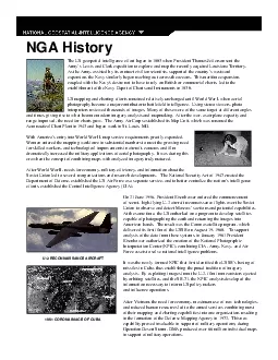
The US geospatial intelligence effort began in 1803 when President Tho
by callie
On 21 June 1956 President Eisenhower ordered the c...
Welcome to the VCCS Geospatial Institute
by scoopulachanel
With support from:. NSF DUE-0903270. Hosted by the...
September 23, 2015 Statewide Geospatial Advisory Council
by briana-ranney
Call to order and . introductions. Approval . of ...
Integrating Official Statistics and Geospatial Information
by danika-pritchard
– ABS experience . Frank Yu. First Assistant St...
Geospatial Data Abstraction Library (GDAL) Enhancement for
by giovanna-bartolotta
). Increasing . Accessibility and Interoperabilit...
The X3D Geospatial Component: X3DOM implementation of
by alexa-scheidler
GeoOrigin. , . GeoLocation. , . GeoViewpoint. , a...
Free and Open Source Geospatial Software and Data
by tawny-fly
Ioannis. . Kokkinidis. Geospatial and Environmen...
A Vision for an Exchangeable
by tatyana-admore
UxS. Mission Plan. Scott Simmons. Executive Dire...
© 2011
by alida-meadow
Open Geospatial Consortium, Inc.. FAA Special Act...
The Open Group OG0-061 Exam Prep Guide You’ll Need
by Amaairajohns
Click Here---> https://bit.ly/3NteI3P <---Get comp...
Open Group OG0-061 Certification Study Guide
by Amaairajohns
Click Here--- https://shorturl.at/6N01W ---Get com...
Midyear Meeting National States Geographic Information Council
by elise
Review of NSGIC Midyear Meeting. Feb 27 – Mar 2,...
Seeing
by lois-ondreau
Is . Believing. visualizing. . geospatial. dat...
Opening and Closing Ranks Second Round of Seat Allocation Open Close Open Close Open Close Open Close Open Close Open Close Open Close Open Close A A A A A
by faustina-dinatale
1 716 60 382 16 73 18 18 20 25 D4110 98 91 58 10 4...
Opening and Closing Ranks Second Round of Seat Allocation Open Close Open Close Open Close Open Close Open Close Open Close Open Close Open Close A A A A A
by alida-meadow
1 716 60 382 16 73 18 18 20 25 D4110 98 91 58 10 4...
Statewide Geospatial Advisory council November 28,
by tatyana-admore
Statewide Geospatial Advisory council November 28,...
The Cloud Services Innovation Platform:
by jaxon
Platform:. Enabling Service Based Environmental . ...
Geospatial Portfolio Management, Theme Lead and Dataset Manger Roles and Responsibilities, and the Investment Collaboration Process
by rudy
Theme Lead and Dataset Manger Roles and Responsibi...
Adding Value to Registries through Geospatial Big Data Fusion
by angelina
Geospatial Health Context Big Table . Facilitating...
GLOBAL NEAR-REAL-TIME INTERDISCIPLINARY
by megan
GEOSPATIAL DATA DEVELOPMENT,. ANALYSIS, ARCHIVING,...
IAO Geospatial professionals Certificate Certification Exam
by Empire
kindly visit us at www.nexancourse.com. Prepare yo...
Publishing in Development Engineering
by Dollface
Berber Kramer, International Food Policy Research ...
by rayfantasy
Department of Information Technology. May . 2018. ...
The National Geospatial Program,
by genderadidas
The National Map. , and A-16. FGDC Coordination Gr...
Replacing Bluebooking Modern Data Submission to NGS
by briana-ranney
by. Dru. Smith . NSRS Modernization Manager. Dav...
Department of Homeland Security Science & Technology
by lindy-dunigan
Up. date to NGAC:. Geospatial Interoperability Re...
G eospatial predictive modeling of the
by calandra-battersby
V-2 Ballistic Missile. Andrew Stangl, MGIS Candid...
Battlefield GEOINT : Describing Why
by debby-jeon
We . Fight . Where We Fight, to Anticipate the Ba...
Geospatial Technology and Data for Volunteer-based Wilderness Search and Rescue
by lois-ondreau
GEOG 596A Capstone Peer Review. Loren Pfau, MGIS ...
LUNASERV:
by cheryl-pisano
Adding a geospatial FRAMEWORK to Apollo . sampleS...
LUNASERV:
by tawny-fly
Adding a geospatial FRAMEWORK to Apollo . sampleS...
Spatial Cloud Computing:
by kittie-lecroy
Usage in Geo-Spatial Sciences. Topics. Problem St...
Load More...