Explore
Featured
Recent
Articles
Topics
Login
Upload
Featured
Recent
Articles
Topics
Login
Upload
Search Results for 'gis web'
gis web published presentations and documents on DocSlides.
The Geo-Web: Enabling GIS on the Internet
by pamella-moone
IT4GIS. Keith T. Weber, GISP. GIS Director. ISU-G...
GIS for Information Technology
by helene
Prepared by . Information . Technology Services . ...
Douglas County’s GIS &
by pasty-toler
Web Analytics for Public Mapping Applications. AR...
Jennifer Lana, GISP GIS Manager
by kittie-lecroy
Cobb County, GA. October 3, 2012. Cobb County use...
Ten Years of Gulfport GIS
by kittie-lecroy
Survival and Evolution . since . Hurricane Katrin...
Use of GIS a s a Decision Support System
by belinda
GEOM 4008 - November 2, 2015. Group 2 : Fernanda ....
Cultivating GIS at the Brooklyn Botanic Garden
by yoshiko-marsland
Kyle Heulitt. Advisor: . Professor . Ken . Tammin...
GIS in Sports Analytics Samantha Duff
by sherrill-nordquist
Introduction. Sports as geographic activities. GI...
Streamlining GIS Data & Solution Management
by phoebe-click
Stephen Hale. GIMS DB Administrator. ODOT. Ohio G...
Part I: GIS Tools for Water Planners
by lois-ondreau
and. Part II: Sierra Nevada Conservancy . GIS Wat...
An ISO 9001:2008 Registered
by freya
CMMI Maturity Level 3 Company. 1430 Spring Hill Rd...
Web Map Applications: The Geo-Web Revisited
by faustina-dinatale
IT4GIS. Keith T. Weber, GISP. GIS Director. ISU-G...
GIS APPLICATION IN FIREWALL LOG VISUALIZATION
by tawny-fly
Penn State MGIS 596A Peer Review. Presenter: Juli...
Utilization
by pamella-moone
. of GIS in Japan. Hiroyuki KITADA , Yumi SEKINE...
Cloud Computing and GIS
by pamella-moone
IT4GIS. Keith T. Weber, GISP. GIS Director. ISU-G...
How does a community utilize ESRI’s
by min-jolicoeur
ArcGIS Online functionality and incorporate. into...
IMPLEMENTING GOVERNMENT-WIDE ENTERPRISE
by ellena-manuel
GIS;. THE FEDERATED MODEL. James E. Mitchell, Ph....
Geographic Information
by pasty-toler
Systems. ASM 215. Feb 2013. Larry Theller. Schedu...
Making NASA Data Sets Available
by stella
with . GIS-based Web-Applications . for Energy: PO...
Understanding Networks
by marcellus
Keith T. Weber, GISP. GIS Director. ISU-GIS Traini...
VEGA-GEOGLAM Web-based GIS for crop monitoring
by caroline
and decision support . in agriculture. Evgeniya . ...
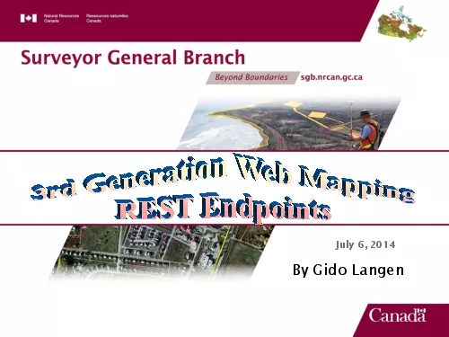
By Gido Langen
by ashley
July 6 2014The MissionREST Endpoints-Establish a n...
2100 Riverchase Center Suite 105
by ashley
GISi-Birmingham AL 35244 Phone 205 941-0442 Fax 20...
Jim Graham Bachelor's in CS and Math from Chico State
by liane-varnes
Over 20 years as a software engineer. 15 with HP ...
Jim Graham Bachelor's in CS and Math from Chico State
by debby-jeon
Over 20 years as a software engineer. 15 with HP ...
Craig Robinson Harnessing Configuration
by jane-oiler
for web GIS Application Development. June 4, 2014...
Jesse Greenough Ryan Mun
by olivia-moreira
Adnan Shabir. Stephany Wei. Where can an Onsite W...
The Nuts & Bolts of GIS:
by giovanna-bartolotta
Dealing With “Dirty” Data!. Presented by:. Jo...
Roberto Lucchi
by olivia-moreira
Esri. INSPIRE Discovery, View and Download and OG...
Stormwater utility management system (SUMS)
by marina-yarberry
GIS Application with Web Service Data Access. Int...
ICEWATER: INRA
by sherrill-nordquist
Constellation of Experimental . Watersheds. Cyber...
Load More...