Explore
Featured
Recent
Articles
Topics
Login
Upload
Featured
Recent
Articles
Topics
Login
Upload
Search Results for 'raster vector'
raster vector published presentations and documents on DocSlides.
Understanding Vector and Raster
by liane-varnes
DataTitle. Larry C. . Shubat. Professor. The Univ...
Rastor vs Vector Higher Graphics
by solidbyte
Miss Airlie . What will we learn?. I will learn ab...
Digital Graphics (Unit 19.1/54.1)
by marina-yarberry
Introduction. In digital media, there are differe...
Printing 101
by calandra-battersby
SWHIG Seminar. Ian Kim. 1/18/12. General overview...
RNR 419/519
by yoshiko-marsland
Introduction to . Cartographic Modeling . Analysi...
Geographic Information Systems
by ellena-manuel
Department of Surveying and . Geomatics. By Shoko...
Vector Graphics 2.01 Investigate graphic image design
by fluenter
.. 1.01 Investigate graphic types and file formats...
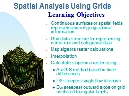
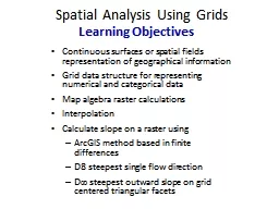
Spatial Analysis Using Grids
by test
Continuous surfaces or spatial fields representat...
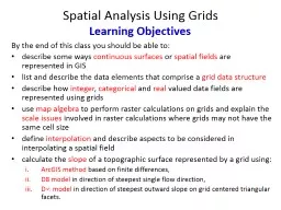
Spatial Analysis Using Grids
by trish-goza
By the end of this class you should be able to: ....
Spatial Analysis Using Grids
by giovanna-bartolotta
Continuous surfaces or spatial fields representat...
Intro to Spatial Analysis with
by luanne-stotts
What can we do with GIS?. SPATIAL STATISTICS. Wha...
Images, spatial data and
by sherrill-nordquist
matlab. Data. types and storage:. Vector data. -...
A Summary of Some Key Points from Chapters
by daisy
1 and 2 of Peterson. On page 1 Peterson indicates ...
Content included in posters that would be displayed in a gym and methods by which these posters can
by ripplas
Link to the scenario. Tom wants to attract more m...
Lesson 3 GIS Fundamentals
by lois-ondreau
MEASURE Evaluation. PHFI Training of Trainers. Ma...
9. GIS Data Collection
by tawny-fly
Overview. Introduction. Primary data capture. Sec...
GIS Matthew Rosencrans
by test
Tom . DiLiberto. Outline . What is GIS?. What can...
An Introduction to GIS
by myesha-ticknor
Karen Hogenboom (with thanks to Leo Dion). Numeri...
Converting paper based drawing systems to electronic cad fi
by giovanna-bartolotta
. And the paperless. office. Technical Departmen...
Data Representation
by myesha-ticknor
Wednesday, May 25, 2011. Bits and Bytes. 4 bytes ...
Lecture 2:
by kittie-lecroy
Part 1. Understanding Spatial Data Structures. Pa...
Grid-based Analysis in
by danika-pritchard
GIS . Prof. Yuji Murayama - Instructor. Hao. . H...
Geographic Information Systems
by giovanna-bartolotta
Department of Survey and . Geomatics. By Shoko M....
Digimap – Data Download
by alexa-scheidler
25 May 2016. . Tom Armitage and Ian Holmes. EDI...
Introduction to Laser Cutters
by liane-varnes
Laser cutters are . useful for . cutting. . and ...
Image Processing Chapter 14
by trish-goza
Landsat 7 image of the retreating . Malaspina. G...
Image and Sound Editing Raed
by ellena-manuel
S. . Rasheed. 2012. Image. Image.. Digital image...
Preliminaries: -- vector, raster,
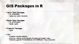
by olivia-moreira
shapefiles. , feature classes. Mapping Tabular Da...
Chapter 3 Image Files © 2013
by aaron
Cengage. Learning. All Rights Reserved. May not ...
GIS and Network Analyst A. Goodchild
by jane-oiler
CEE 587. 25 . April . 2011. What is GIS?. Geograp...
B-TEC level 3 Unit 30 task 1
by thesoysi
Thomas Harker. Thomas Harker. Task 01 - (P1) (P2)....
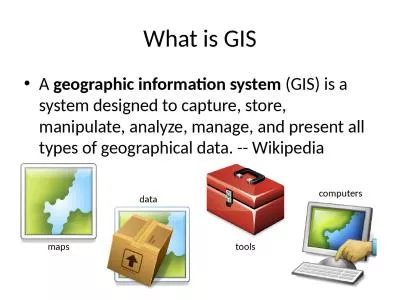
What is GIS A geographic information system
by hadley
(GIS) is a system designed to capture, store, mani...
Display CMSC 435/634 1 Light
by ceila
Visible Range: 390-700nm. Luminance has large dyna...
Esri’s ArcGIS Enterprise
by luna
IT4GIS. Keith T. Weber, GISP. GIS Director. ISU-GI...
Load More...