Explore
Featured
Recent
Articles
Topics
Login
Upload
Featured
Recent
Articles
Topics
Login
Upload
Search Results for 'Raster-Vector'
Raster-Vector published presentations and documents on DocSlides.
Understanding Vector and Raster
by liane-varnes
DataTitle. Larry C. . Shubat. Professor. The Univ...
Raster Graphics 2.01 Understand Digital Raster Graphics
by celsa-spraggs
Raster Graphics. Also called . bitmap . graphics ...
Rastor vs Vector Higher Graphics
by solidbyte
Miss Airlie . What will we learn?. I will learn ab...
Working with Raster Grids and Map Algebra
by mitsue-stanley
Katherine Paybins, USGS. Basic Ingredien. ts. Gri...
S patial Analysis: Raster
by marina-yarberry
Rasters. are . beautiful.. Rasters. don’t dep...
Raster Analysis
by test
Apr. 5. th. , 2017. Wenwen Zhang. CP6514/Spring 2...
Raster GIS
by marina-yarberry
Objectives. To review the definition of raster GI...
Compressing Imagery and Building a Raster Mosaic Dataset
by sherrill-nordquist
Ken Carrier, . GISP. Senior GIS Specialist. Strat...
Digital Graphics (Unit 19.1/54.1)
by marina-yarberry
Introduction. In digital media, there are differe...
Printing 101
by calandra-battersby
SWHIG Seminar. Ian Kim. 1/18/12. General overview...
RNR 419/519
by yoshiko-marsland
Introduction to . Cartographic Modeling . Analysi...
Geographic Information Systems
by ellena-manuel
Department of Surveying and . Geomatics. By Shoko...
A Summary of Some Key Points from Chapters
by daisy
1 and 2 of Peterson. On page 1 Peterson indicates ...
Images, spatial data and
by sherrill-nordquist
matlab. Data. types and storage:. Vector data. -...
Intro to Spatial Analysis with
by luanne-stotts
What can we do with GIS?. SPATIAL STATISTICS. Wha...
Spatial Analysis Using Grids
by giovanna-bartolotta
Continuous surfaces or spatial fields representat...
Spatial Analysis Using Grids
by trish-goza
By the end of this class you should be able to: ....
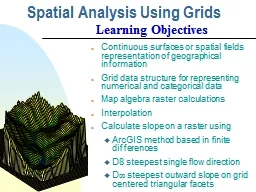
Spatial Analysis Using Grids
by test
Continuous surfaces or spatial fields representat...
Vector-Scanned Microcrystallographic
by vivian
Data Collection Techniques. Malcolm Capel. NE-CAT....
Vector Graphics 2.01 Investigate graphic image design
by fluenter
.. 1.01 Investigate graphic types and file formats...
Living up to the Hype(- rion
by byrne
)! – observations on ion microprobe geochronolog...
NHD Plus V2 Raster Components:
by lois-ondreau
Catchments and Related Raster Components. . . ...
Chapter 6 Raster Editing
by karlyn-bohler
© 2013 . Cengage. Learning. All Rights Reserved...
Preinjectors Status D. Raparia
by myesha-ticknor
May . 23. . , 2017. Time Meeting. EBIS. . NSRL ...
Preinjectors Status D. Raparia
by tatiana-dople
May . 30. . , 2017. Time Meeting. EBIS. NSRL ru...
Glacial Lake Outburst Floods in the Nepal Himalaya
by alexa-scheidler
Jonathan M. . Lala. December 1, 2016. CE 394K.3...
2014 ESIP Summer Meeting
by alida-meadow
July 8–11, 2014 . |. Frisco, Colorado. Advanci...
Trends in DBMS
by trish-goza
Learning Objectives. After this segment, students...
Working with the Raster Calculator | Page
by kittie-lecroy
1 Working with the Raster Calculator The Raster Ca...
Interactive Screen-Space Accurate Photon Tracing on GPUs
by min-jolicoeur
Our GPU Photon Tracing Pipeline. 5/153. Our GPU P...
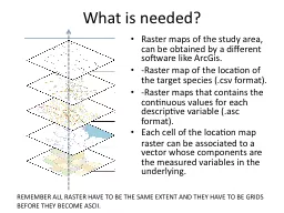
What is needed?
by liane-varnes
Raster maps of the study area, can be obtained by...
Computer Graphics- SCC 342
by ellena-manuel
Chapter 2: . Computer Graphics Hardware. Dr. Doa...
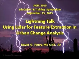
AGIC 2015
by lindy-dunigan
Education & Training Symposium. September . 2...
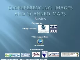
Georeferencing
by luanne-stotts
images and scanned maps. Basics. With support fr...
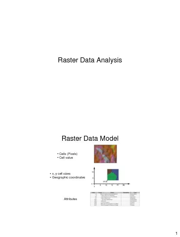
Raster Data Analysis
by pamella-moone
1 Raster Data Model • Cells (Pixels) Ȃ...
Content included in posters that would be displayed in a gym and methods by which these posters can
by ripplas
Link to the scenario. Tom wants to attract more m...
Lesson 3 GIS Fundamentals
by lois-ondreau
MEASURE Evaluation. PHFI Training of Trainers. Ma...
9. GIS Data Collection
by tawny-fly
Overview. Introduction. Primary data capture. Sec...
GIS Matthew Rosencrans
by test
Tom . DiLiberto. Outline . What is GIS?. What can...
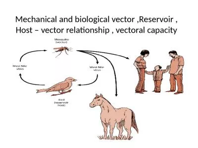
Mechanical and biological vector ,Reservoir , Host – vector relationship , vectoral capacity
by jasmine
Mechanical and biological vectors. A vector is an ...
Load More...