Explore
Featured
Recent
Articles
Topics
Login
Upload
Featured
Recent
Articles
Topics
Login
Upload
Search Results for 'usgs http'
usgs http published presentations and documents on DocSlides.
Welcome to the USGS Webinar:
by liane-varnes
New Science and Online Management Tools to Help G...
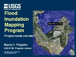
Marie C. Peppler USGS FIM Program Liaison
by mentegor
Flood . Inundation . Mapping. Program. Project nee...
Analysis of Remote Sensing Data for Tornado Damage Assessment
by ellena-manuel
Presented by: Justin Novak. Advisor: Guido Cerv...
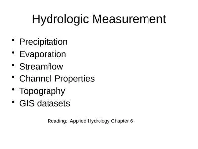
Hydrologic Measurement
by mitsue-stanley
Precipitation. Evaporation. Streamflow. Channel ....
Hydrologic Measurement Precipitation
by ida
Evaporation. Streamflow. Channel . Properties. Top...
Introduction to ArcGIS Planetary Data Analysis
by min-jolicoeur
Peter Fawdon. Department of Earth and Planetary S...
Dune Stabilization and WIND-Blown dust
by pasty-toler
Cristina González-Maddux. Institute for Tribal E...
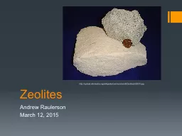
Zeolites
by stefany-barnette
Andrew Raulerson. March 12, 2015. http://. upload...
Cascadia Earthquake Facts
by pasty-toler
:. What You Need To Know. Tsunami Outreach Oregon...
GFSAD 30 Website Update
by olivia-moreira
with inputs from:. PRASAD THENKABAIL, Cristina Mi...
Deadly Earthquakes
by danika-pritchard
-Black. Shensi, China. When did this happen?. Jan...
Plate Tectonics
by tatyana-admore
Liz LaRosa for use with my 5. th. Grade Science ...
Sean DeRosa
by tatiana-dople
Modeling Natural Gas Liquid Infrastructure in the...
Aquatic Invasive Species Distribution
by conchita-marotz
Geography 1820. Background Information. Aquatic i...
CEMENT
by pasty-toler
http://www.math.lsu.edu/~bogdan/photo-albums/pola...
Williston, north
by tawny-fly
dakota. Changes in Land Use, 2005 - 2012. ©www.a...
Flooding
by debby-jeon
Coastal and River Flooding in Louisiana. What iss...
Spatial Distribution of
by sherrill-nordquist
Arsenic in Ohio Soils. Nate Wanner, CPG. MGIS Cap...
River Channels CE 397 Flood Forecasting
by celsa-spraggs
David R. Maidment. Center for Research in Water R...
Iskorištavanje voda Raspodijela stanovništva i zaliha vode
by undialto
Voda se koristi za:. Kupanje. WC. . Čišćenje....
U.S. Department of the Interior
by della
making it easy for emergency mangers to identify p...
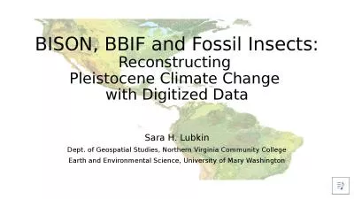
BISON, BBIF and Fossil Insects:
by danya
Reconstructing . Pleistocene Climate Change . with...
WED V15
by phoebe-click
Wind erosion & Deposition. What is wind?. Win...
Taking the Pulse of
by sherrill-nordquist
Yellowstone’. s. “. Breathing. ”. Caldera....
Types of Plate Boundaries in California
by lindy-dunigan
The Great California . ShakeOut. . Divergent . B...
Dasymetric Mapping
by test
Improving estimates of vulnerable coastal populat...
Types of Plate Boundaries in California
by kittie-lecroy
The Great California . ShakeOut. . Divergent . B...
Capturing
by trish-goza
Disasters. with Terra . ASTER. 1. Chris . Doesche...
The New Madrid Earthquakes
by karlyn-bohler
8.53. Write a narrative with supporting text des...
Observational
by stefany-barnette
. Uncertainties. in . Water-Resources. . Model...
A 8.0 magnitude earthquake occurred offshore in the Solomon
by giovanna-bartolotta
Magnitude 8.0 SOLOMON ISLANDS . Wednesday, 6 Febr...
Qiang
by luanne-stotts
. Gao. 10/13/2009. 3D Terrain Modeling with Real...
Hydrologic Measurement
by myesha-ticknor
Precipitation. Evaporation. Streamflow. Channel ....
Hall Process for Aluminum Production
by giovanna-bartolotta
Charles Martin Hall. (1863 – 1914). Aluminum. B...
Presentation Basics
by calandra-battersby
Computer Skills and Applications. 8. th. Grade. ...
ATM 301 Lecture #16 (sections
by briana-ranney
9.1-9.2). . Groundwater:. . Aquifers and Groun...
Case study group activity: Science and ethics of sinkholes
by natalia-silvester
Living with sinkholes. Cathy Pappas-. Maenz. Dep...
http://www.usgs.gov/blogs/features/slidedeck2/soil-geochemistry-maps/arsenic/
by faustina-dinatale
Arsenic in the . Soils, USGS. How much of this so...
Aluminum Haley Tole, Tom Nagy, Jon Tosh
by cora
How it’s Used in the US. Package beverages. Car ...
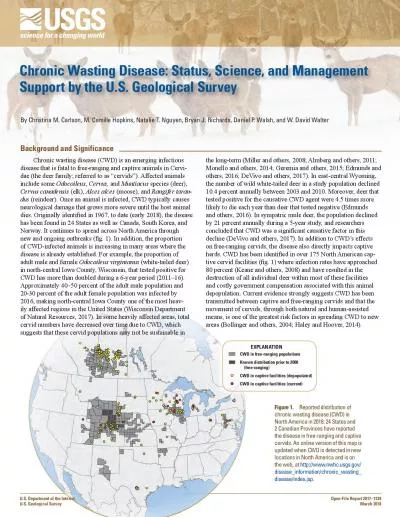
Chronic Wasting Disease Status Science and Management
by queenie
Support by the U.S. Geological Survey Known distri...
Load More...