/
Field-level adaptation to floods and sea level rise in coas Field-level adaptation to floods and sea level rise in coas

Field-level adaptation to floods and sea level rise in coas - PowerPoint Presentation

tatiana-dople
tatiana-dople . @tatiana-dople
Follow
429 views
Uploaded On 2017-05-08

Field-level adaptation to floods and sea level rise in coas - PPT Presentation

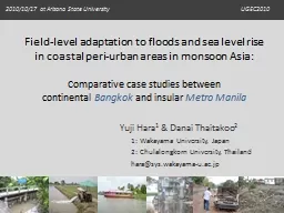
Comparative case studies between continental Bangkok and insular Metro Manila Yuji Hara 1 amp Danai Thaitakoo 2 1 Wakayama University Japan 2 Chulalongkorn University Thailand harasyswakayamauacjp ID: 545958

flood level hara fill level flood fill hara planning built water area land adaptation areas insular temporal continental case

Share:

Link:

Embed:

Download Presentation from below link

Download Presentation The PPT/PDF document "Field-level adaptation to floods and sea..." is the property of its rightful owner. Permission is granted to download and print the materials on this web site for personal, non-commercial use only, and to display it on your personal computer provided you do not modify the materials and that you retain all copyright notices contained in the materials. By downloading content from our website, you accept the terms of this agreement.


Presentation Transcript

Slide1

Field-level adaptation to floods and sea level rise in coastal peri-urban areas in monsoon Asia:

Comparative case studies betweencontinental Bangkok and insular Metro Manila

Yuji Hara1 & Danai Thaitakoo21: Wakayama University, Japan2: Chulalongkorn University, Thailandhara@sys.wakayama-u.ac.jpSlide2

Asian large cities (population > 5million);Located on continental delta

/ insular lowlands2Slide3

Purpose of this presentation

To show present case studies on landform transformation (LT) in response to flooding in continental Bangkok and insular Metro ManilaHorizontal land-use changesLT processesLT and floodsField-level responses to floods (by local people and government)Toward land-use and LT integrated planning for minimizing a flood hazard

3Slide4

0

100km

Built-up area

Continental

Bangkok

Built-up area

0

100km

Insular

Metro Manila

Case study cities

4Slide5
Slide6

(Hara et al. 2005)

Horizontal land-use change:From rice fields to townhouses6Slide7

Vertical LT process:From dig & fill to introduced fill

(Hara et al. 2008a)

7Slide8

Introduced fill from further areas (the rim of delta)

Fill volume

(Hara et al. 2008a)

Production: 5.5×10⁷ m3 year−1

Input: 5.7×10³ m3 km−2

 year−1

8Slide9

Flood characteristics:Sheet flow and parcel-level water management

Floods come graduallyWater level is manageable per each parcel using

private pump with gasoline engine

(using RID data)

9Slide10

Temporal adaptation to sheet flow flooding

Using sandbags to build

temporal banks to protect water coming in, and then releasing floodwater to the canal by pumping

Using a

boat

, that was traditionally utilized as a main transportation mode and still kept along the canal

10Slide11

10 – 20 years adaptation to rising water baseline due to the loss of flood retention capacity by introduced fill

11

Lifting up a

pathway and a road

Lifting up a

floor

(as their traditional house structure)Slide12

Suggestions for spatial planning

Main problem on the current planning processNo linkage between land-use plan and water management planToward better planningZoning based on acceptable fill (water) volume that can induce field-level adaptation using inherent LT methodsFocusing not only on regulative measures but more on

incentive ones (for instance bonus floor area ratio for preparing ponds)12Slide13

0

100km

Built-up area

Continental

Bangkok

Built-up area

0

100km

Insular

Metro Manila

13Slide14

Coastal Plain – Central Upland – Eastern Plain

14Slide15

Horizontal land-use change:

From natural micro landform basis to LT basis(Hara et al. 2008b)15Slide16

Vertical LT process: Landfilling on lower landforms

(Hara et al. 2008b)

16Slide17

Flood characteristics: Flash flowEastern plain as “flood control pond” to protect downstream central Manila

(Hara et al. 2002)17Slide18

10 – 20 years adaptation: Individual landfilling up to the highest flood level

in their experiences

Adapting themselves to their own experiences without any consideration of neighbors and flood control scheme by the government18Slide19

It has caused changes in distribution of flood-prone

areas and required temporal adaptation

SPOT 1987/11/18SPOT 1997/10/26

(Hara et al. 2002)

Emerging submerged areas with poor drainage surrounded by landfill corridor

19Slide20

New threat due to infrastructural development

Tropical Storm

OndoyFlooded Areas (NAMRIA 2009)

20Slide21

New infrastructures accelerated flash flow hazard

ALOS PALSAR image soon after Ondoy(Modified after NAMRIA 2009)Newly built bridges trapped a lot of debris, and functioned as temporal dam during Ondoy

21Slide22

Failure of planning: Subdivision out of lakeshore dike

It was built before the construction of lakeshore dike in 2004

(not subject to zoning code?)

22Slide23

Suggestions for spatial planning

Main problem on the current planning processLand-use plan is based only on road networkToward better planningLandfill practice should be subject to micro landform to avoid poor drainage area surrounded by landfill corridorNeed to coordinate landfill material flows between suppliers and consumersLink between infrastructures (including non flood protection ones) and land uses

23Slide24

Summary matrix

BangkokMetro ManilaLandform

Continental deltaHomogeneous flat plainInsular lowlandsVisible micro

landformsFloods

Sheet flowWater level is manageable per each parcel using pumping

Flash flowWater level is unmanageable without public infrastructures

LT methodsDig and fill development

Fill from further

area

Landfilling using

construction debris

Field-level

adaptation

Temporal banks

Changing transportation

Lifting up pathway & floor

Individual fill on the floor

Evacuation boat

Staying upper floorsSimilar case studies are being carried out in other Asian low-lying cities…24