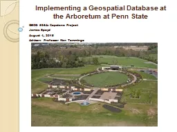
GEOG 596A Capstone Project James Spayd August 4 2015 Advisor Professor Ken Tamminga Presentation Overview History of PSU Arboretum Goals Timeline Data Collection Methods Data Storage CurrentFuture ID: 702716
Download Presentation The PPT/PDF document "Implementing a Geospatial Database at th..." is the property of its rightful owner. Permission is granted to download and print the materials on this web site for personal, non-commercial use only, and to display it on your personal computer provided you do not modify the materials and that you retain all copyright notices contained in the materials. By downloading content from our website, you accept the terms of this agreement.
Slide1
Implementing a Geospatial Database at the Arboretum at Penn State
GEOG 596A: Capstone ProjectJames SpaydAugust 4, 2015Advisor: Professor Ken TammingaSlide2
Presentation Overview
History of PSU ArboretumGoalsTimelineData Collection Methods
Data Storage (Current/Future)
Application Development
Future ConsiderationsInterpretative Signs Slide3
Study Area
Arboretum at Penn State(400 acres) Big Hollow (232 acres)
Overlook
Heights Upland
(90 acres)Mitchell Tract (73 acres)
The main focus of this project is the mapping of the H.O Smith Botanical Gardens located on the Mitchell TractBig Hollow and Overlook Heights
Currently managed as Pennsylvania natural areas.Slide4
1938
1993
2005
2012
2014Slide5
Goals and Outcomes
PRIMARY GOALMISSIONThe mission of The Arboretum at Penn State is to engage the
academic
strengths of the University in promoting scholarship and education about plants and their history and importance on earth.
VISION
The Arboretum at Penn State strives to be a place of beauty and renewal, a venue for the arts, and a pathway to discovery and enrichment for all who visit.CORE VALUES
Above all else, the staff and supporters of The Arboretum at Penn State are dedicated to excellence, emphasizing the quality of collections, materials, function, and design.
Mission, Vision, and Core Values from The Arboretum at Penn State website (http://arboretum.psu.edu
/)Expected Outcomes from Primary Goal
Create a
spatial system, from planting to online mapping
Create base
m
aps
of gardens, lands, and facilities
Map memorial/commemorative
i
tems
Spatially enable
p
lant
a
ccession
d
atabase (
Lat
/Long all plant centers)
Migrate existing database from
BG B
ase
to Iris BG
Create desktop
a
pplication
of
memorial/commemorative
i
tems
Create desktop
a
pplication
of
all plant accessions locations
Create mobile
application of all plant accessions locations Slide6
2015
2016
05
06
07
08
09
10
11
12
2016
02
03
31 days
5/1/15 - 5/31/15
Populate ArcGIS Public Garden Data Model w/Base Data
49 days
5/13/15 - 6/30/15
Digitize Commemorative Items (Trees, Benches, Plaques)
49 days
5/13/15 - 6/30/15
Digitize Initial Base Maps (Lawns, Walkways, Buildings, Walls)
30 days
6/1/15 - 6/30/15
Setup ArcGIS Collector App.
245 days
5/1/15 - 12/31/15
Data Collection/Coordinated with ARB Staff
1 day
7/3/15
Meet with Arboretum Web Developer
31 days
7/1/15 - 7/31/15
Expected 2015 Imagery - PSU OPP
31 days
7/1/15 - 7/31/15
Setup Arrow GPS Booster and RTK System
1 day
8/9/15
Migration of Accession Database from BG Base to Iris BG
29 days
8/4/15 - 9/1/15
Build Prototype Applications Commemorative Items
36 days
9/1/15 – 10/1/15
Gather Prototype Feedback
41 days
10/1/15 - 11/1/15
Build Full Application
91 days
1/1/16 - 3/31/16
Construct Mobile Application
TimelineSlide7
Comparative Review
Arnold Arboretum (Harvard)Database
– BG Base
C
ollection Method
– various (survey, hand held) GIS Data - Alliance for Public Gardens data model
UC Davis
Database
– Iris BGCollection
M
ethod
– iPad
GIS Data
- Alliance for Public Gardens data
model
Hoyt
Arboretum (Portland, OR)
D
atabase
– Iris BG, Iris BG mapping component
Collection
M
ethod
– azimuth and distance
from
known
point
GIS
Data
–
esri in house model
Denver
Botanical Gardens
D
atabase
– BG-Base\BG-Map
C
ollection
M
ethod
– GPS data with a Trimble
GeoXT
GIS Data
- NA
Longwood
Gardens
D
atabase
– BG-Base
Collection M
ethod – iPad Garden Notepad +GIS Data
- Alliance for Public Gardens data modelNorfolk Botanical Gardens
Database – Iris BG (switch from BG-Base\BG-Map)Collection
Method – hand held WindowCE,
Digitizing, GIS Data
–Iris MapSlide8
Data Collection Methods
DigitizeGardens, structuresCommemorative items (benches, trees, plaques)
Mobile
Data Collection
ArcGIS
collector appiPad
Arrow GPS Booster (next slide)Aerial photography/CAD
(base map navigation)
Join Point to Database
Extract from online
Link to accession database
by Accession ID Slide9
GPS
BoosterArrow 100 GNSS Receiver by EOS Positioning
Systems
Key Features
Full GNSS : GPS/GLONASS/Galileo/
BeiDou/QZSS
iOS compatible 60cm
real-time accuracy
Supports Esri
software
Accuracy
checked against
Geodetic
Control Stations
(State College, Black Moshannon)
Still testing to improve performance
Improved - 2.5 meters to sub meter. Slide10
Database Migration
Current
Query
B
ased I
nterface (Not User Friendly), Lacks Good Spatial Functionality
Future
GUI Interface (User Friendly), Excellent Spatial Functionally (esri) , Integrated with
ArcGIS Public Garden Data Model, Mapping Component, Good SupportSlide11
Data and Version Documentation
This Database will grow with the Growth of the Arboretum. Many different people will be involved over time. The key to successfully accomplishing this, is good documentation.Slide12
Application Needs Assessment
(personas of potential application users)Arboretum Staff
I
nternal
mechanism to maintain the day-to-day
operations. (update/move accessions, measure areas for planting or burning, quickly make maps)
Development Staff
Show off Donated Items to Donors and Potential DonorsStudents
University and K –
12
Volunteers
E
xtension
of the
Staff, Uses Applications to Assist Visitors or Help with Daily
O
perations
Public
Visitor
Main Target for Mobile Application - Enhance
the
Visitors Experience with Navigation and Plant Knowledge
Online
Visitor
Main Target for Desktop Application - Virtually Visit
the
Arboretum,
H
ave Experience
as if
They
are
Actually
on the
Garden
G
roundsSlide13
Application Layers and Functionality
Base Layers:Arboretum polygon base maps Arboretum
Imagery 2012
Arboretum
Imagery 2010Arboretum Imagery 2005
Google, Bing, esri Base maps
ArcGIS Public Garden Data Model:
Accession database (
plant points Lat/Long)
Mass plantings
Benches
Plaques
Signs
Path and access lanes
Water
streams\ponds
R
oads
(used for geocoding)
Tools and
Functions:
Ability
to view
plant ,query ,read
attributes
Download
plant locations as shapefile/geodatabase/excel/CSV
Make and download map w/ title
Search
commemorative items by Donor and Honoree
Search plants by Accession ID,
Common
Name, Scientific
Name
Navigation functions:
Zoom to plant
by
Accession ID, Common Name,
Scientific Name
Featured
tours
(see layer
of
all conifer
, maple, lilac, etc
.)
Destinations
(
zoom to Meadow
Marsh
, Strolling G
arden, etc
.)Slide14
Commemorative
Items TreesPlaquesBenches1. Large Items, Digitize
2. Pictures
3. Thank You to Sponsors
(potential for more s
ponsors)Slide15
Prototype
ASimple DesignGoogle Maps JavaScript API and KMLIdentify with Species Information and PictureSlide16
Prototype B
More Complex designArcGIS JavaScript API and ArcGIS server Perform Simple Queries and Print MapsSlide17
Evaluate Beta
Applications/Full Accession Application Discussion5 Scenarios Tests (likes, dislikes, and usability)
1. Toggle Features and Base maps 4. Print Usability
2. Zoom and Navigation Functions 5. Overall look and feel
3. Search
Usability Factor in likes, dislikes, and usability into final
application of all p
lant accessions
Slide18
Future Considerations
new aerial photography on a yearly base from PSU OPP (digitize new features – Children’s Garden)Methods for better point accuracy
Collect
New Plants
, Commemorative items
Expand to New Areas (Big Hollow, Overlook Heights)Remove ArcGIS component by using Feature Services at Penn State (for editing)
Mobile app (ability to tour the Arb Grounds – Hand held knowledge)Slide19
References
Alliance for Public Gardens GIS (2015), Retrieved 1 July, 2015 from
http://publicgardensgis.ucdavis.edu
/
EOS Positioning Systems (2015),
Retrieved 27 July, 2015 from
http://www.eos-gnss.com/arrow-100/
ESRI. ArcGIS Online for Public
Gardens (2015),
Retrieved
7
July, 2015 from
http://solutions.arcgis.com/parks-gardens/help/arcgis-online-for-public-gardens
/
Penn
Pilot (2015), Retrieved 9 July, 2015 from
http://www.pennpilot.psu.edu/
Pennsylvania
Spatial Data Access (PASDA) (2015), Retrieved 6 July, 2015 from
http://www.pasda.psu.edu/
Sasaki
Associates Inc
.
(1999), Preliminary Master Plan for the Penn State Arboretum Urban Forest Management
The
Arboretum at Penn State
(
2015
),
Retrieved
9
July, 2015 from
http://arboretum.psu.edu
/
Slide20
Acknowledgements
Ken TammingaDoug MillerBeth KingMaurie KellyRyan Baxter
Arboretum Staff
Alisha Barton
Shari EdelsonPatrick Williams
Kathleen ReederSlide21
Questions??????????