/
Mapping our world Mapping our world

Mapping our world - PowerPoint Presentation

tawny-fly
tawny-fly . @tawny-fly
Follow
404 views
Uploaded On 2017-10-10

Mapping our world - PPT Presentation

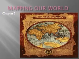
Chapter 2 Section 21 Latitude and Longitude Cartography is the science of mapmaking where cartographers use an imaginary grid of parallel lines and vertical lines to locate exact points on Earth ID: 594689

map lines latitude maps lines map maps latitude north landmasses ocean regions earth time longitude earth

Share:

Link:

Embed:

Download Presentation from below link

Download Presentation The PPT/PDF document "Mapping our world" is the property of its rightful owner. Permission is granted to download and print the materials on this web site for personal, non-commercial use only, and to display it on your personal computer provided you do not modify the materials and that you retain all copyright notices contained in the materials. By downloading content from our website, you accept the terms of this agreement.


Presentation Transcript

Slide1

Mapping our world

Chapter 2Slide2

Section 2.1

Latitude and Longitude

Cartography is the science of mapmaking, where cartographers use an imaginary grid of parallel lines and vertical lines to locate exact points on Earth.

On this grid, the equator (an imaginary parallel splitting the Earth in half at 0

o) separates the Northern and Southern hemispheres.Slide3

Latitude Longitude

Refers

to lines that measure distances north and south of the equator, running east and west.

Each degree of latitude is about 111km on the Earth’s surface.

To locate positions more exactly, degrees of latitude are broken into smaller units called minutesThere are two points of latitude… the North Pole and the South Pole.Lines of latitude are parallel

Latitude will have 90

o

north and south of the equator

Refers to lines that measure east and west of the Prime Meridian (0

o

), running north and south.

Also referred to as meridians

The Prime Meridian runs through Greenwich, England (the home of the royal Naval Observatory).

Lines of longitude are NOT parallel, but are instead large semicircles that extend vertically from pole to pole.

Longitude will have 180

o

east and west of the Prime Meridian.Slide4

World Mapping:

Points of Interest

Latitude:

Equator (0

o)Tropics Zone (between 30oN and 30 S of the equator)

Tropic of Cancer (23.5

o

N)

Tropic of Capricorn (23.5

o

S)

Arctic Circle (66.5

o

N)

Antarctic Circle (66.5

o

S)

Longitude:

Prime Meridian (0

o

)

International Date Line (180

o

)Slide5

Where in the World?

Throughout this course, you will need to know the geographical location of many different places, regions, landmasses, and bodies of water:

Continents

Oceans

Large bodies of water (Great Lakes, Rivers) in USA

Mountain Ranges in the USA

Time Zones with the USA

Land description Regions within the USA

Individual

states within YOUR regionSlide6

Large Bodies of Water

The location of the United States, with its Atlantic and Pacific coasts, has provided access to other areas of the world.

The

Atlantic Ocean

not only serves as our eastern border, but has also served as the “highway”

for explorers, early settlers, and

now…

immigrants.

The

Pacific Ocean was

also an

early exploration route.

The

Gulf of Mexico provided the French and Spanish with exploration routes to Mexico and other parts of America.

Bodies

of water support interaction among regions, form borders, and create links to other areas. Slide7

Relevant land and bodies of water within the United States of America

Appalachian Mountains

Great Lakes

Rocky

Mountains

Mississippi River

The Gulf of MexicoSlide8

Regions of the

United States of America

The United States of America is divided into 5 main regions:

West

MidwestNortheastSoutheast

South

The United States is further broken into regions by landmasses / land features… Slide9

Breaking down Regions by landform descriptions

1

Coastal

Plain

2

Appalachian Highlands

3

Canadian

Shield

4

Interior

Lowlands

5

Great Plains

6

Rocky Mountains

(CONTINENTAL DIVIDE)

7

Basin And Range

8

Coastal RangeSlide10

TIME ZONES

The Earth is divided into 24 time zones… because there are 24 hours in the day!

There are SIX designated time zones in the USA:

EST (Raleigh) -- TIME

CST (Chicago) – (-1)

MST (Denver) – (-2)

PST (Los Angeles) – (-3)

AKST (Alaska) – (-4)

HST (Hawaii) – (-5)Slide11
Slide12

Each line of longitude, although some have been adjusted for convenience, is represented by 15

o on the map.

Each time you travel through a time zone, you gain or lose time until at some point, you gain or lose an entire day!

The International Date Line is located at 180

o

E/W of the Prime Meridian. When you cross this line, you either advance or go back one day.

If you are traveling west, you advance your calendar one day. If you are traveling east, you go back.

Memory Clue

… “we

W

ant to stay ahead, but it is

E

asy to fall behind.” (Note the “W” stands for west and the “E” stands for east.)Slide13

Section 2.2

Types of Maps

Maps are flat models of a three-dimensional object, Earth.

As the Earth is curved, it is difficult to represent on a piece of paper.

Thus, all flat maps distort the shapes or landmasses to some degree.Slide14

Layout of a Map

Map Legends

Map Scales

Most maps include both human-made and natural features that are located on the Earth’s surface.

These features are represented by symbols.

A map legend simply explains what these symbols mean.

When using a map, it is imperative that you understand how to measure distances.

The map scale is a tool used to detail the ratio between distances on a map and actual distances on the Earth’s surface.

There are three types:

1. Verbal Scales

2. Graphic Scales

3. Fractional ScalesSlide15

Mercator Projections

A map that has parallel lines of latitude and longitude.

On a mercator projection, the shapes of landmasses are correct but their areas are distorted.

Used for navigation of ships and planes and automobile road maps.Slide16

Conic Projections

Made by projecting points and lines from a globe onto a cone.

The cone touches the globe at a particular line of latitude.

There is little distortion in the areas or shapes of landmasses that fall along this line of latitude; however, distortion occurs near the top and bottom of the projection.

Used to make weather maps.Slide17

Gnomic Projections

Made by projecting points and lines from a globe onto a piece of paper that touches the globe at a single point, mainly over the poles.

Accurate shapes of landmasses, but distorted direction and distance between landmasses.

Useful in plotting long-distance trips by air and by sea. Slide18

Topographic Maps

Show the changes in elevation of the Earth’s surface, allowing you to determine how steep slopes or depressions of a land area are.

Topographic, or Topo, maps use contour lines to connect areas that have the same elevations. Distances between these lines are referred to as the contour interval and allow you to determine how steep a slope is.

Rules to remember…

Contour lines are closer around hills and basins or depressionsHachures (dash marks around a circular region) designate a depression.

Contour lines never cross, as one point cannot have two elevations.

Contour lines form upward V’s, which tell you that there is a stream present in that location.Slide19
Slide20

Section 2.3

Remote Sensing

Until recently, mapmakers had to go on-site to collect data needed to make maps.

Today, advanced technology has changed this – enabling data to be collected by satellites from far above the Earth’s surface.

This process is referred to as remote sensing.Slide21

Remote Sensing (cont.)

Electromagnetic spectrum

Satellites

The arrangement of electromagnetic radiation according to wavelength.

An electromagnetic wave also can be described according to its frequency, which refers to the number of waves that pass a particular point each second.

Landsat

Topex

/ Poseidon

Use visible light and infrared radiation

to map the Earth.

Features on the Earth’s surface radiate warmth at different frequencies (such as rivers and forests) and show up as different colors.

Use radar to map ocean floor features.

Based on data received, computers are able to create maps of ocean-floor features.

Also

used to study tidal changes and global ocean currents.Slide22

Seabeam Technology

Seabeam technology is used to map the ocean floor using the bottom of different ships.

Seabeam technology relies on sonar, which is the use of sound waves to detect and measure objects underwater.

Basically, a sound wave is sent from a ship to the ocean floor. It is then received by a specific device, and ship computers then calculate the distance to the bottom based on the speed of sound.Slide23

Global Positioning System (GPS)

GPS is a satellite based navigation system to pinpoint your exact location on Earth.

GPS utilizes at least 24 different satellites to ensure accuracy.

GPS technology is used extensively for navigation by ships and airplanes and can also be used to detect earthquakes, create maps, and track wildlife.

Lately, GPS has increased in popularity among all travelers.Slide24

Compass

A compass is used to determine direction

On a compass, the red needle should always be pointing North; however, this does not mean that it is pointing to the North Pole as there is a geographic north and a magnetic north

To determine the difference, the magnetic declination must be determined, which is the difference between geographic north and magnetic north

Depending on your location, the angle of declination will be different