PPT-Improving assessment of flood Inundation of Navsari (India) via Open-source data and HEC-RAS
Author : thomas | Published Date : 2022-06-14
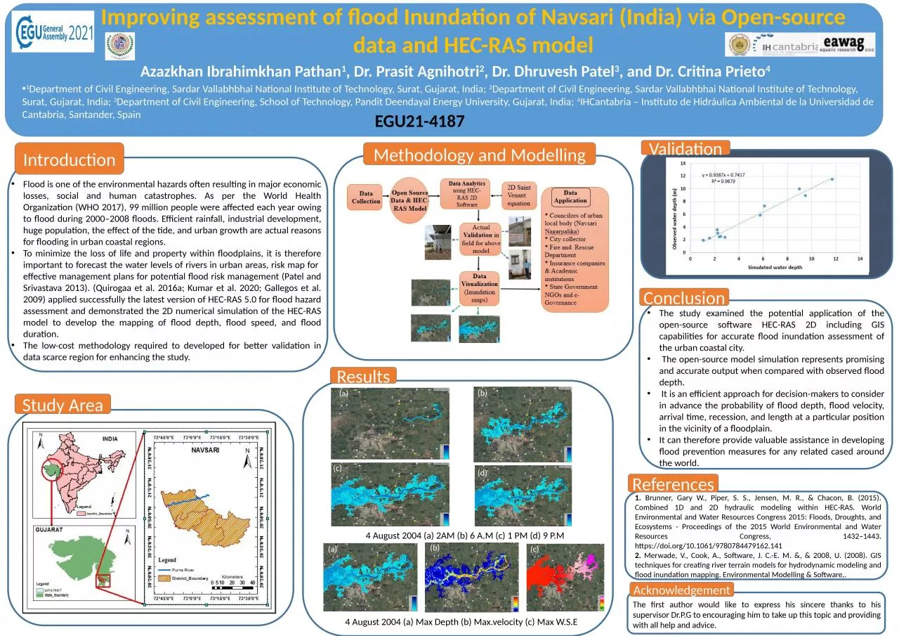
Azazkhan Ibrahimkhan Pathan 1 Dr Prasit Agnihotri 2 Dr Dhruvesh Patel 3 and Dr Critina Prieto 4 1 Department of Civil Engineering Sardar Vallabhbhai National
Presentation Embed Code
Download Presentation
Download Presentation The PPT/PDF document "Improving assessment of flood Inundation..." is the property of its rightful owner. Permission is granted to download and print the materials on this website for personal, non-commercial use only, and to display it on your personal computer provided you do not modify the materials and that you retain all copyright notices contained in the materials. By downloading content from our website, you accept the terms of this agreement.
Improving assessment of flood Inundation of Navsari (India) via Open-source data and HEC-RAS: Transcript
Download Rules Of Document
"Improving assessment of flood Inundation of Navsari (India) via Open-source data and HEC-RAS"The content belongs to its owner. You may download and print it for personal use, without modification, and keep all copyright notices. By downloading, you agree to these terms.
Related Documents