
AP Human Geography Summer Assignment Part I - Map

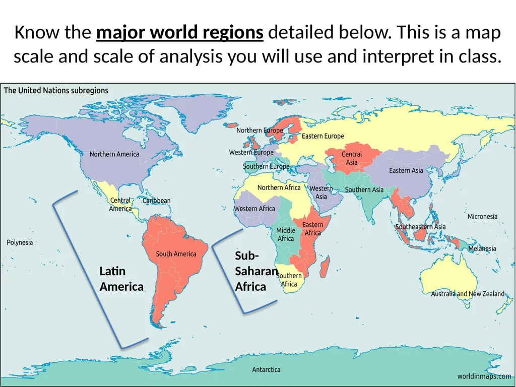




Description: AP Human Geography Summer Assignment Part I - Map Practice Walton High School Know the major world regions detailed below. This is a map scale and scale of analysis you will use and interpret in class. Latin America Sub-Saharan Africa
Related Topics
Download Presentation
"AP Human Geography Summer Assignment Part I - Map" is the property of its rightful owner. Permission is granted to download and print the materials on this website for personal, non-commercial use only, and to display it on your personal computer provided you do not modify the materials and that you retain all copyright notices contained in the materials. By downloading content from our website, you accept the terms of this agreement.
Presentation Transcript
slide1. AP Human Geography
Summer Assignment
Part I - Map Practice
Walton High School<br>
slide2. Know the major world regions detailed below. This is a map scale and scale of analysis you will use and interpret in class. Latin
America Sub-Saharan Africa<br>
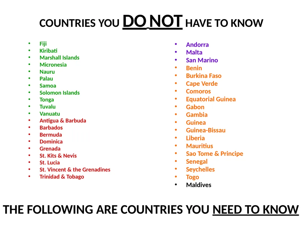
slide3. COUNTRIES YOU DO NOT HAVE TO KNOW Fiji
Kiribati
Marshall Islands
Micronesia
Nauru
Palau
Samoa
Solomon Islands
Tonga
Tuvalu
Vanuatu
Antigua & Barbuda
Barbados
Bermuda
Dominica
Grenada
St. Kits & Nevis
St. Lucia
St. Vincent & the Grenadines
Trinidad & Tobago Andorra
Malta
San Marino
Benin
Burkina Faso
Cape Verde
Comoros
Equatorial Guinea
Gabon
Gambia
Guinea
Guinea-Bissau
Liberia
Mauritius
Sao Tome & Principe
Senegal
Seychelles
Togo
Maldives THE FOLLOWING ARE COUNTRIES YOU NEED TO KNOW<br>
slide4. NORTH AMERICA<br>
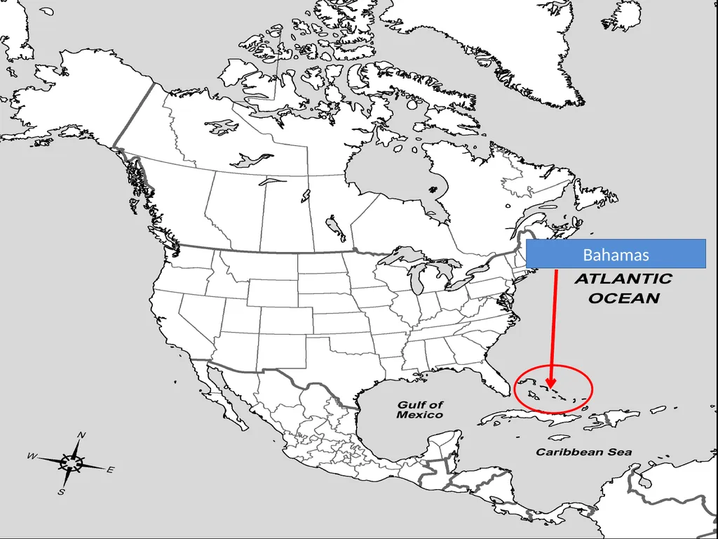
slide5. Bahamas<br>
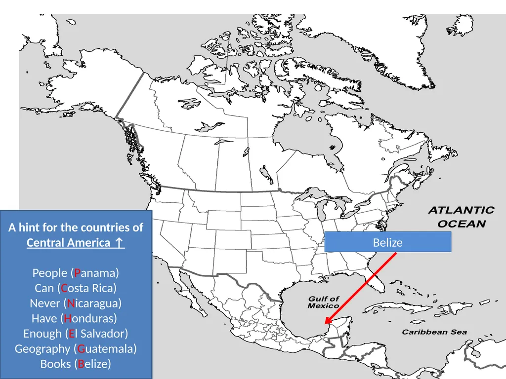
slide6. Belize A hint for the countries of Central America ↑
People (Panama)
Can (Costa Rica)
Never (Nicaragua)
Have (Honduras)
Enough (El Salvador)
Geography (Guatemala)
Books (Belize)<br>
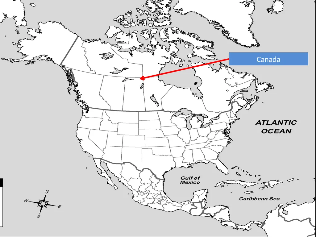
slide7. Canada<br>
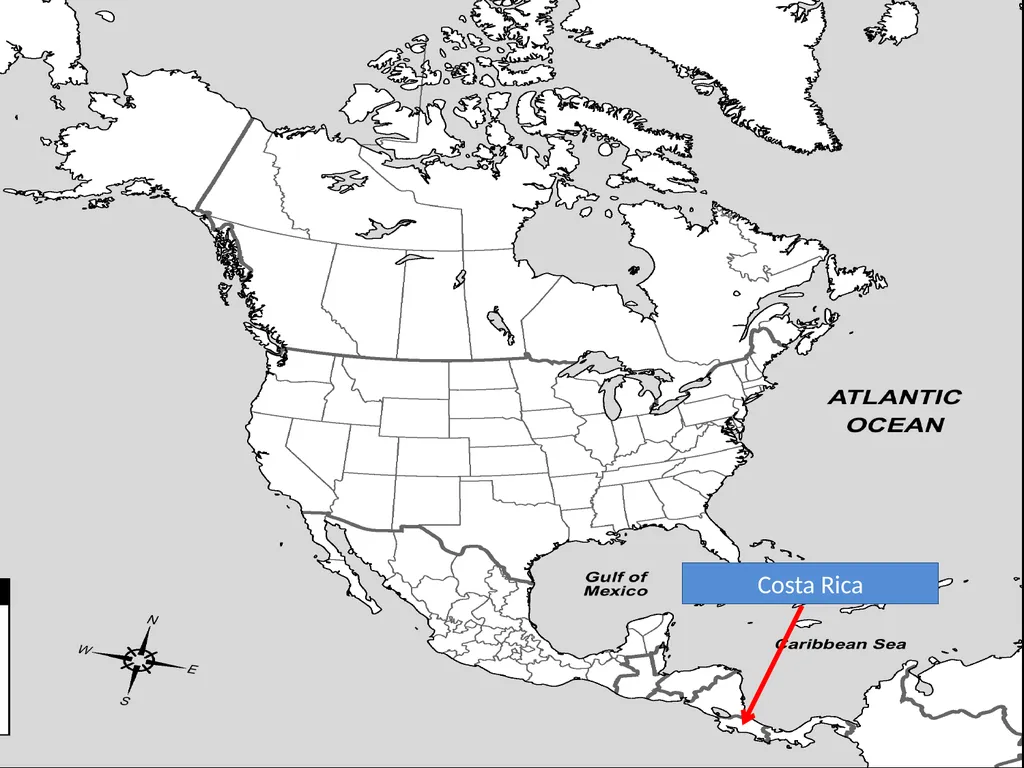
slide8. Costa Rica<br>
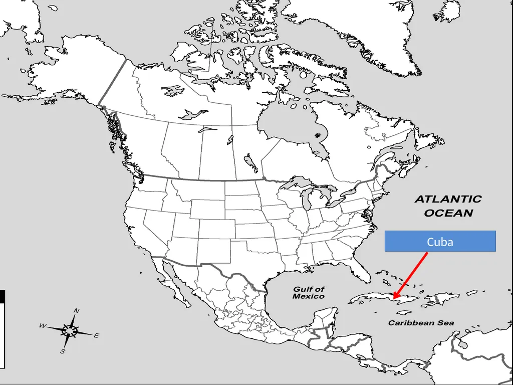
slide9. Cuba<br>
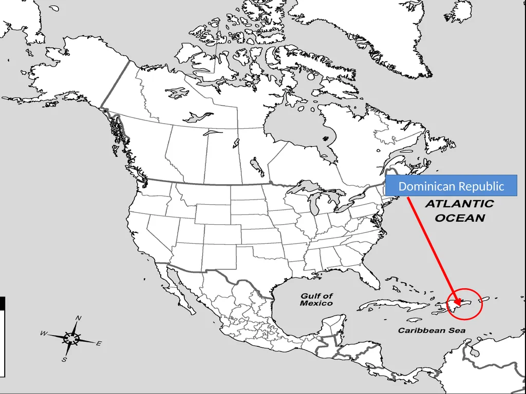
slide10. Dominican Republic<br>
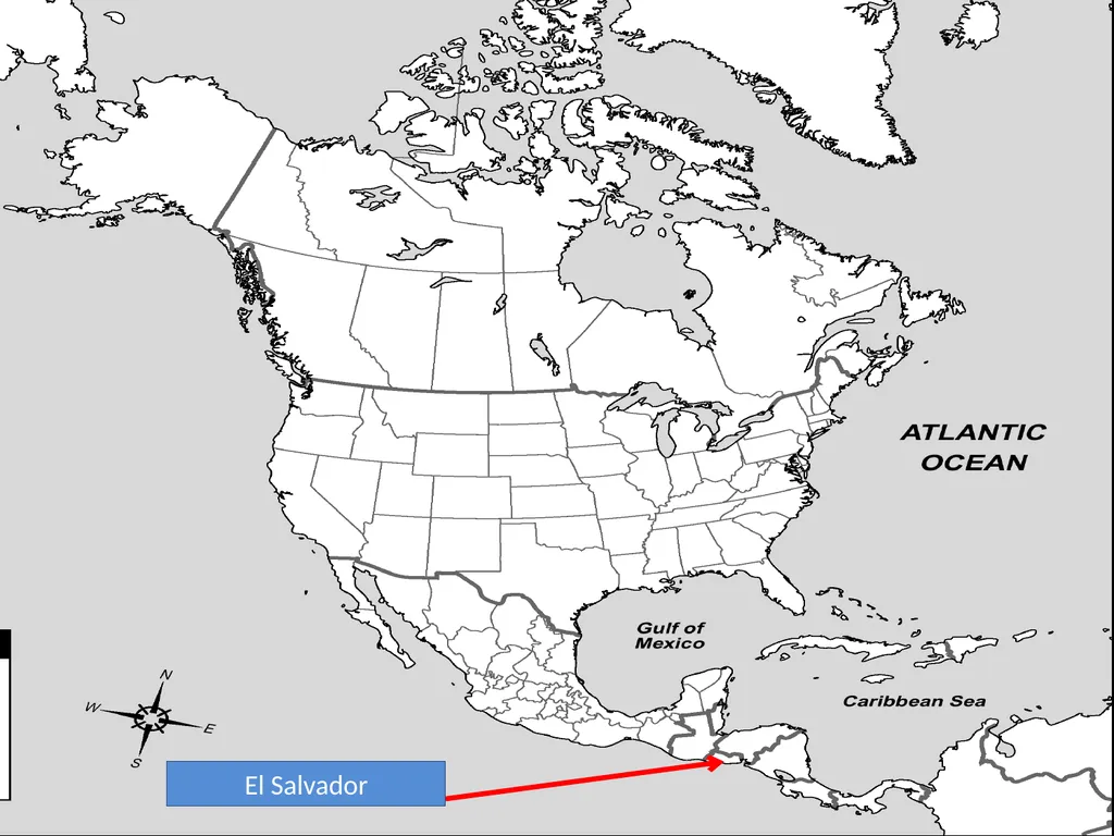
slide11. El Salvador<br>
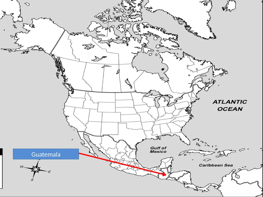
slide12. Guatemala<br>
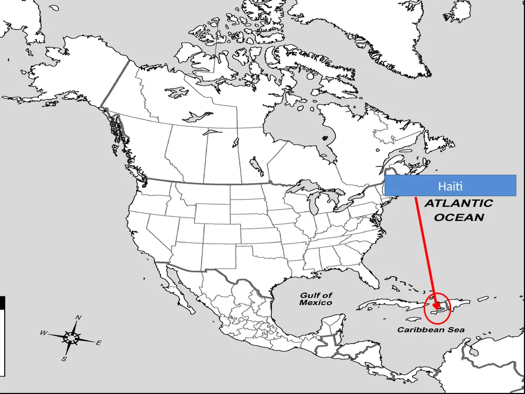
slide13. Haiti<br>
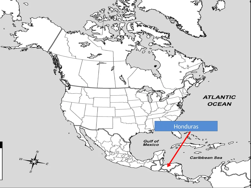
slide14. Honduras<br>
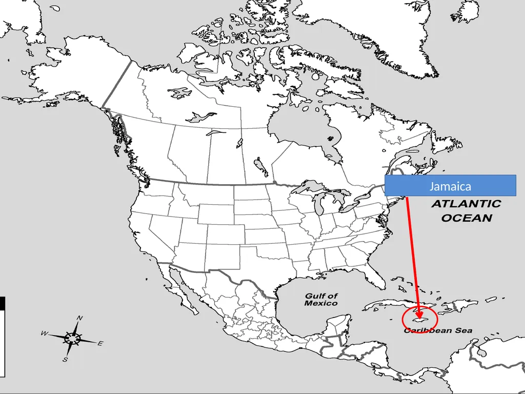
slide15. Jamaica<br>
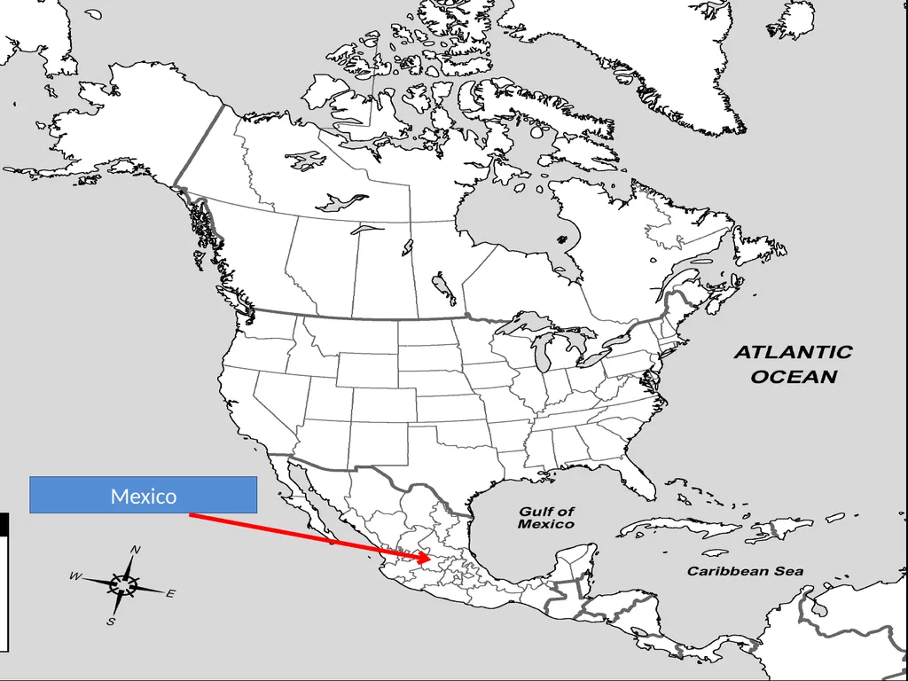
slide16. Mexico<br>
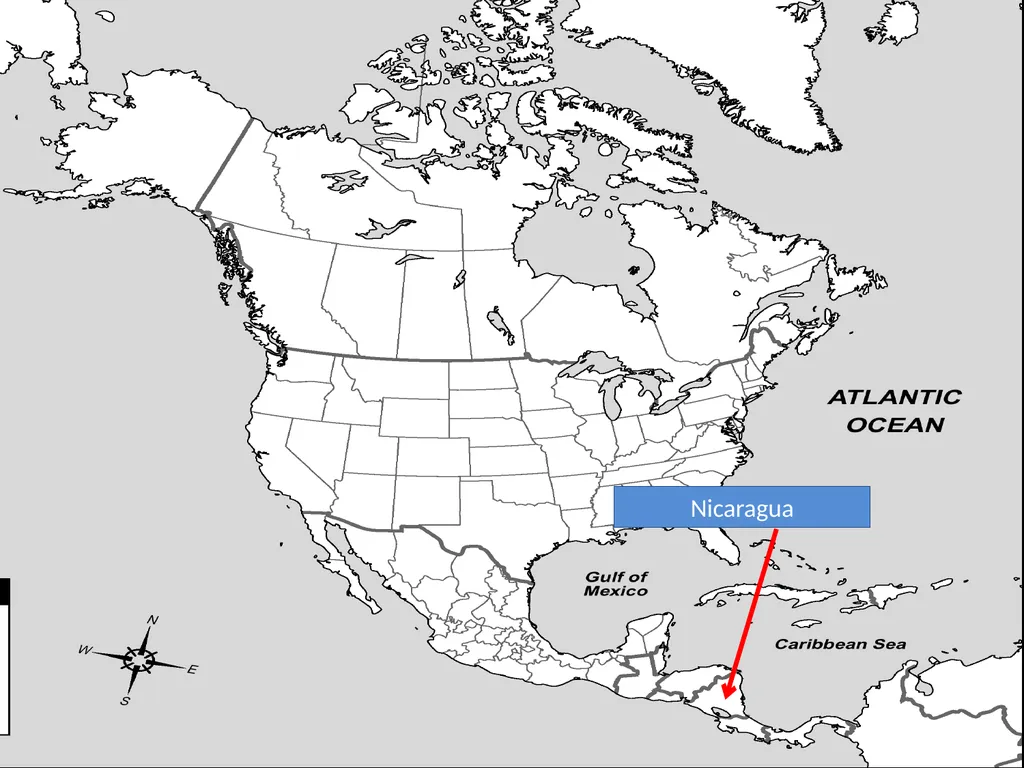
slide17. Nicaragua<br>
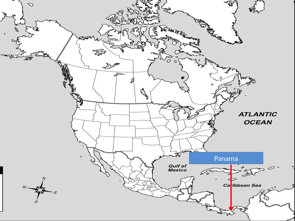
slide18. Panama<br>
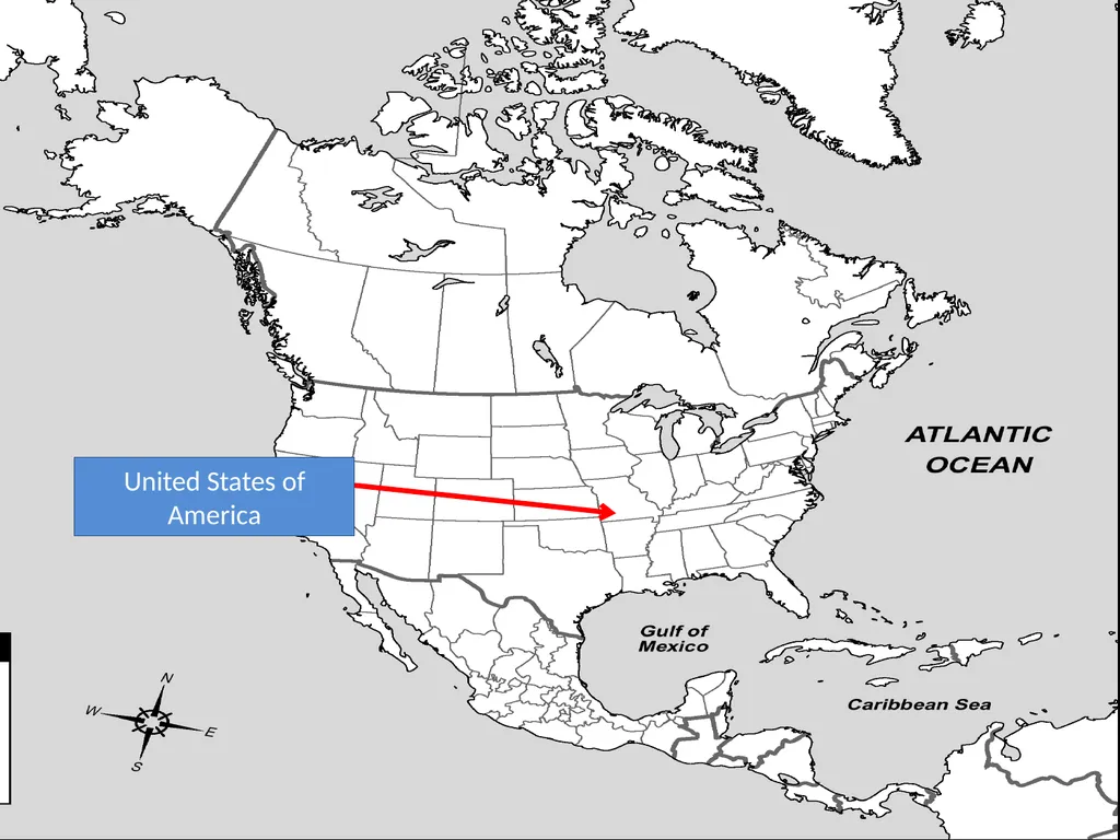
slide19. United States of America<br>
slide20. SOUTH AMERICA<br>
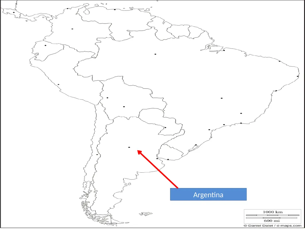
slide21. Argentina<br>
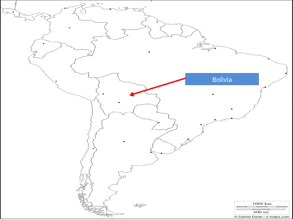
slide22. Bolivia<br>
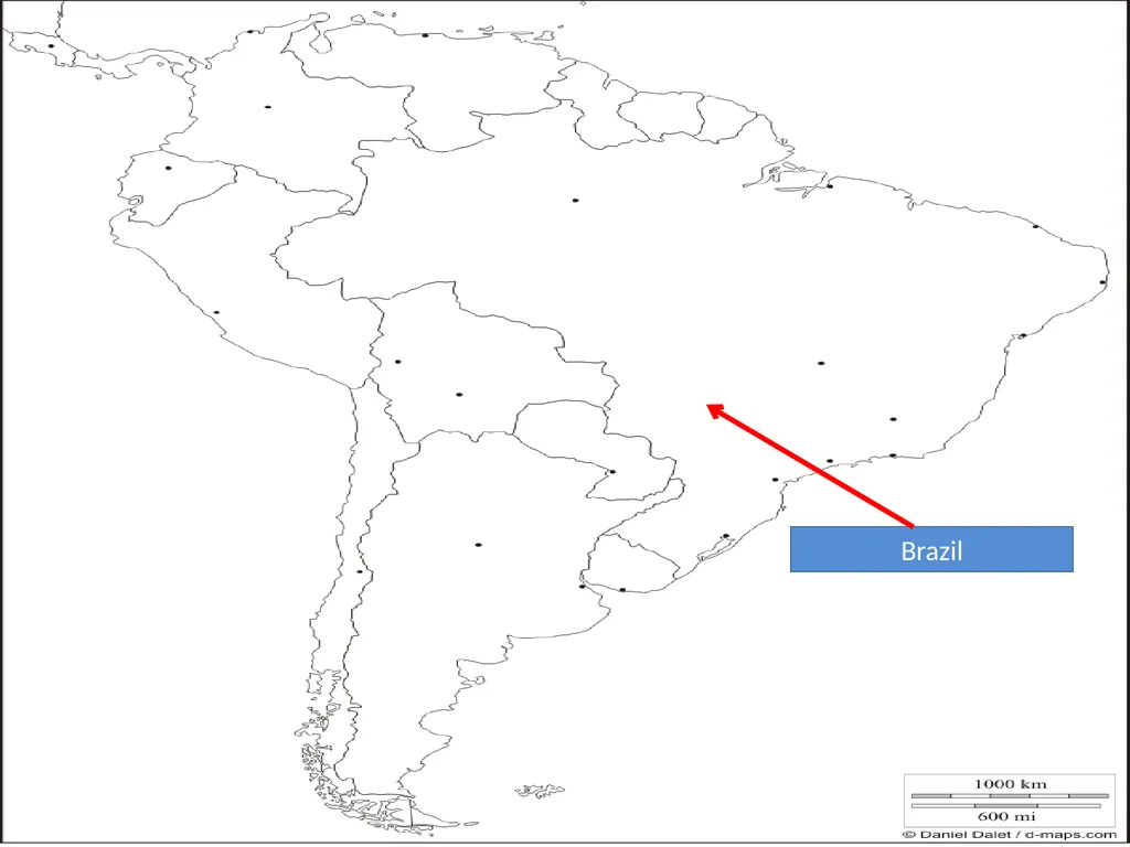
slide23. Brazil<br>
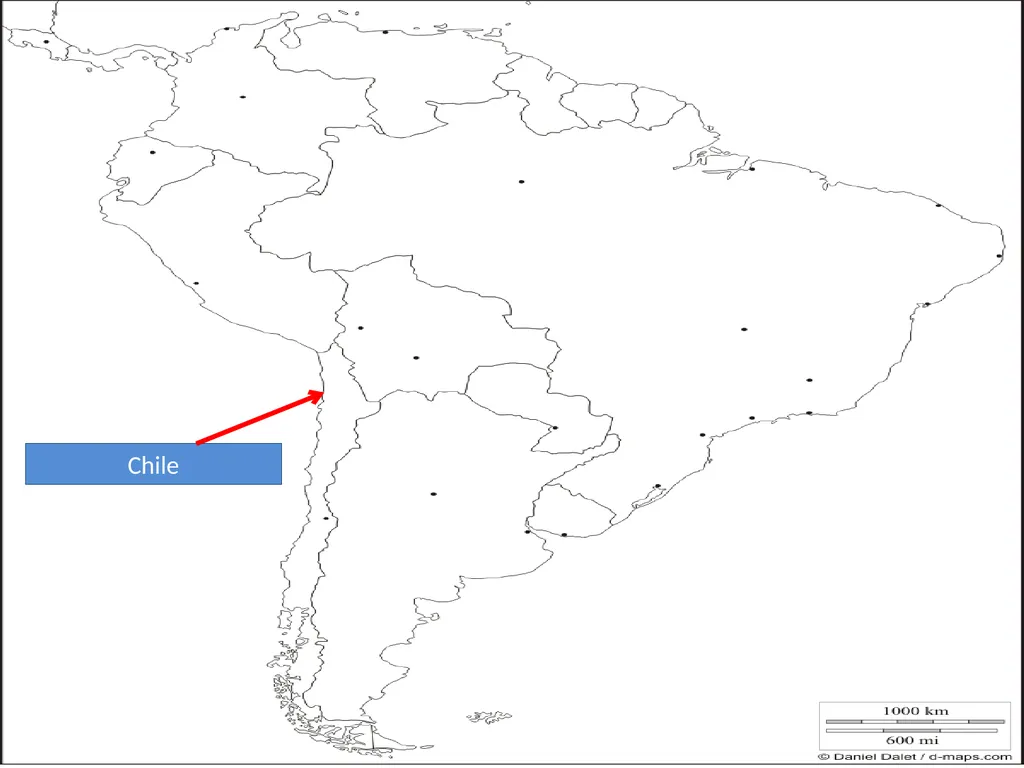
slide24. Chile<br>
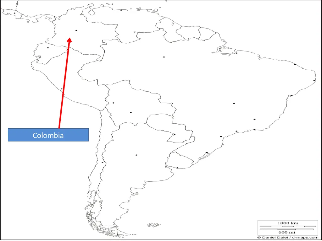
slide25. Colombia<br>
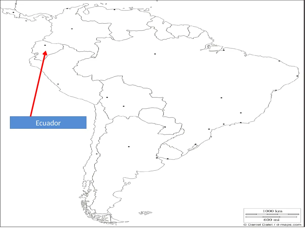
slide26. Ecuador<br>
slide27. French Guiana
(not a sovereign state)<br>
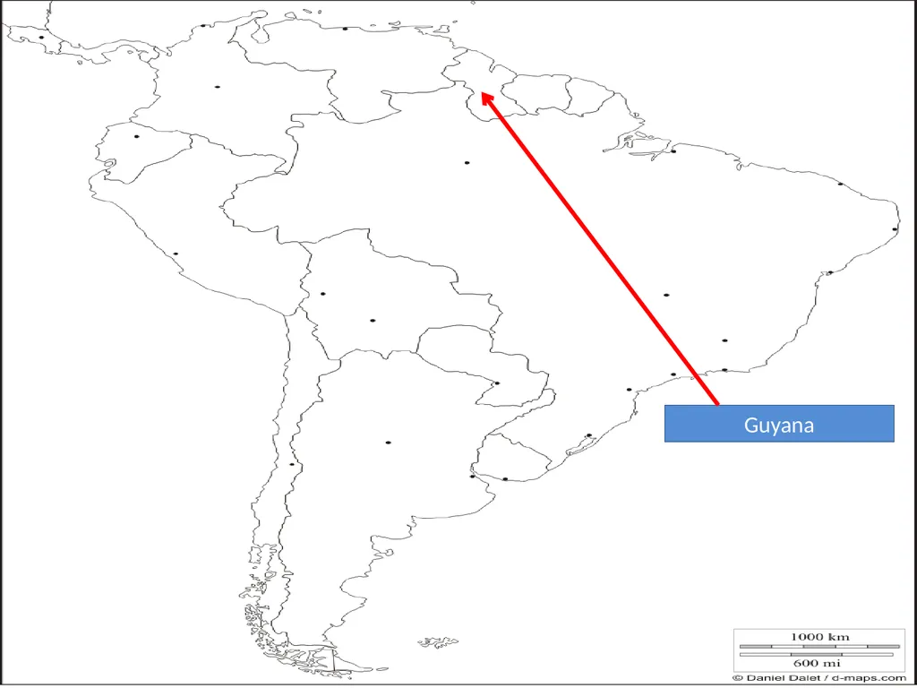
slide28. Guyana<br>
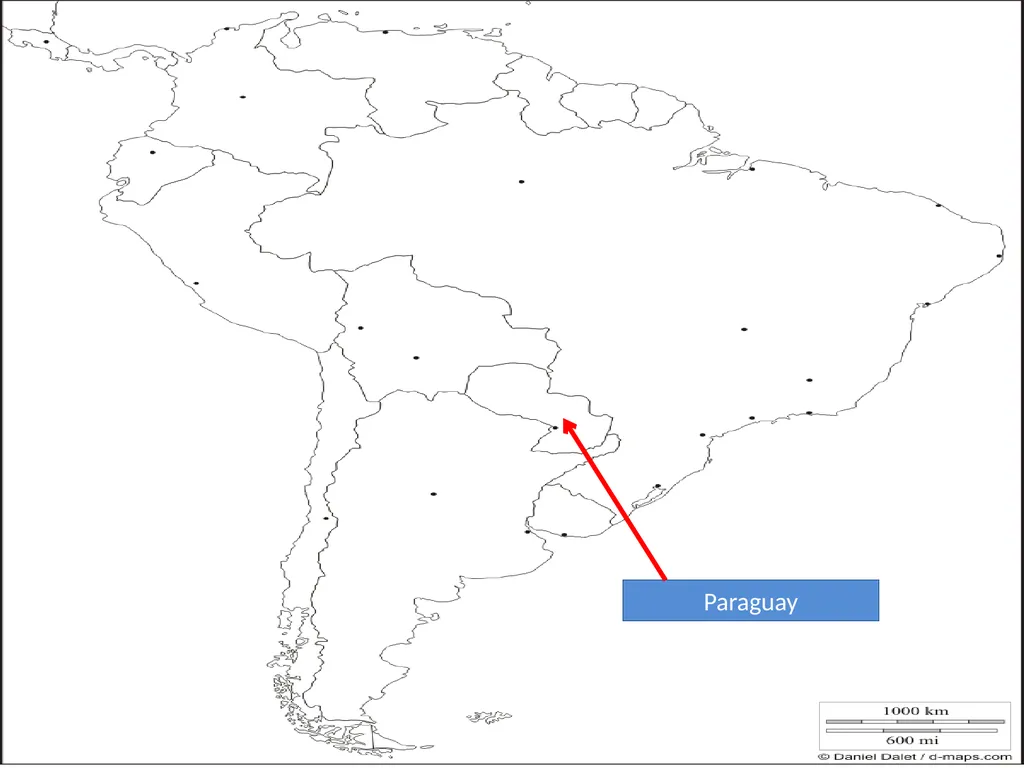
slide29. Paraguay<br>
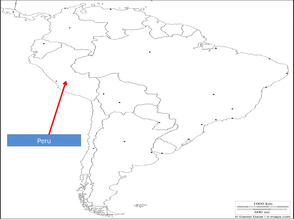
slide30. Peru<br>
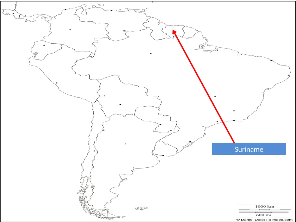
slide31. Suriname<br>
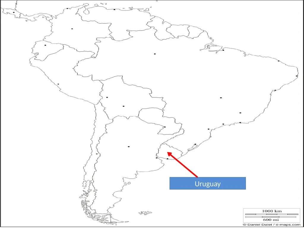
slide32. Uruguay<br>
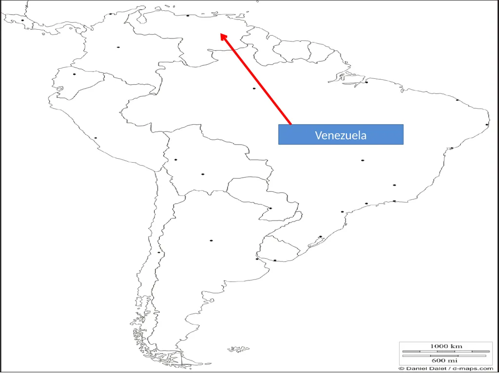
slide33. Venezuela<br>
slide34. EUROPE<br>
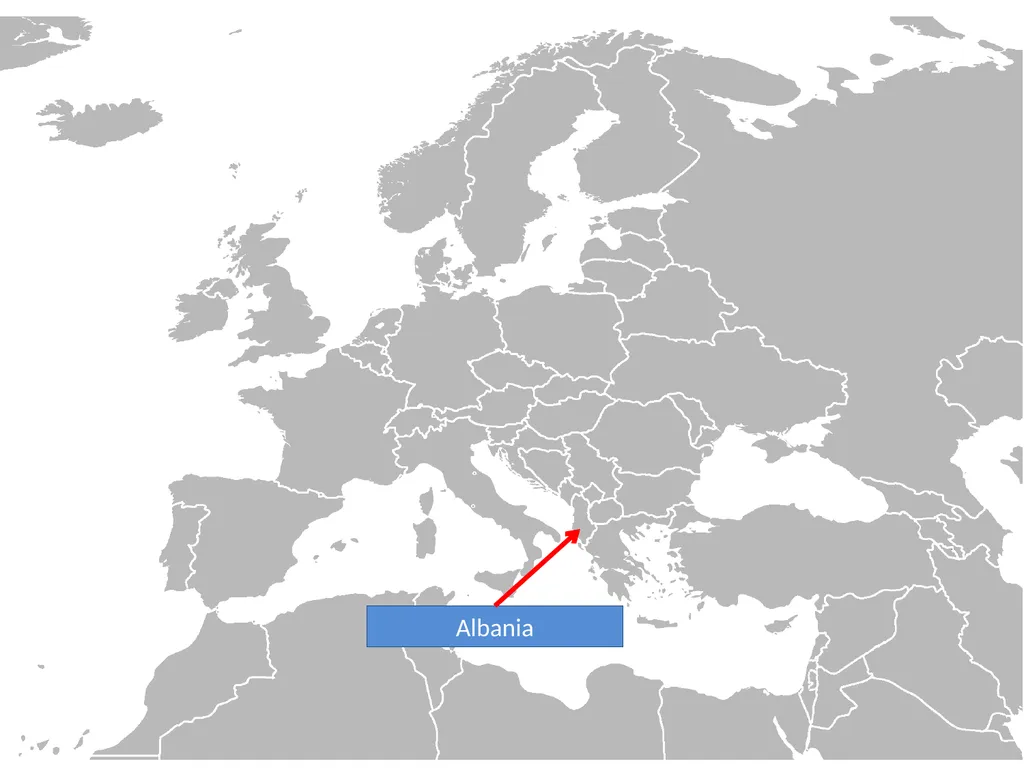
slide35. Albania<br>
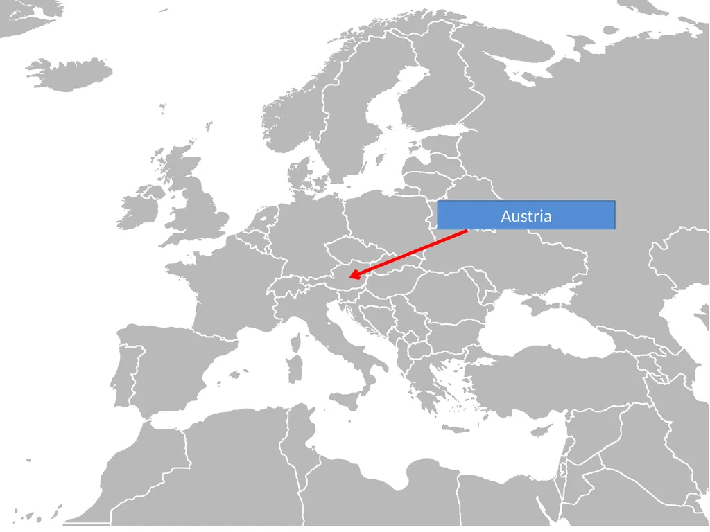
slide36. Austria<br>
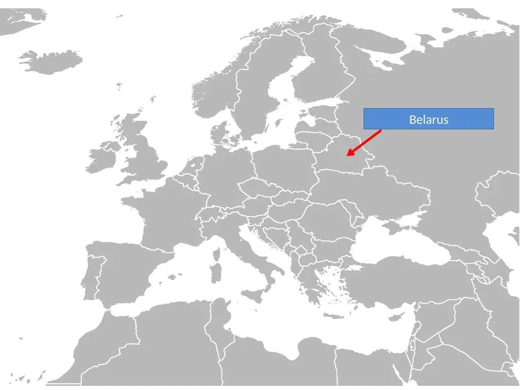
slide37. Belarus<br>
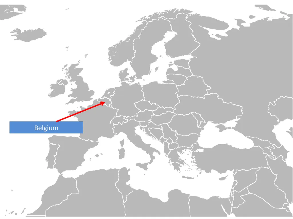
slide38. Belgium<br>
slide39. Bosnia & Herzegovina<br>
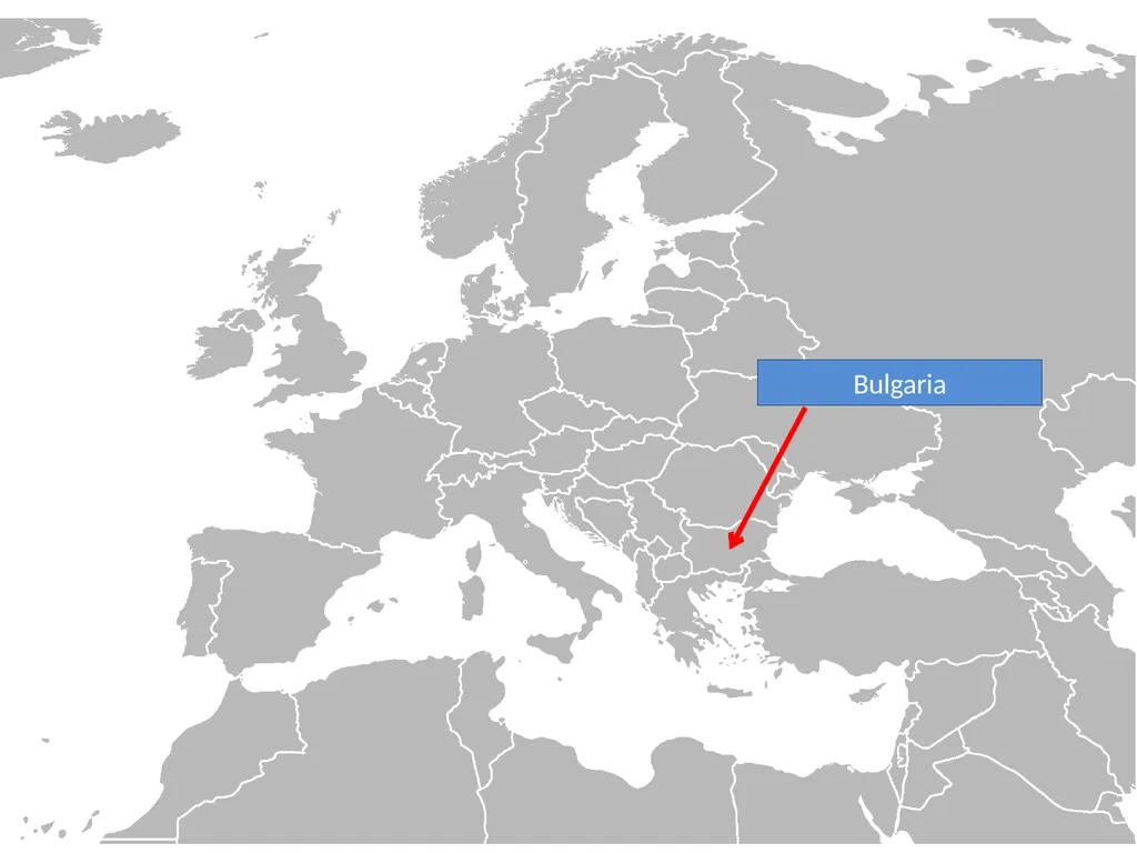
slide40. Bulgaria<br>
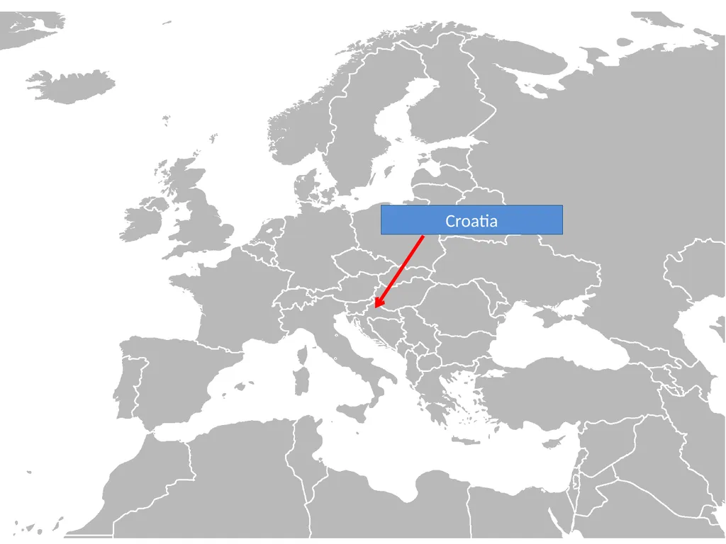
slide41. Croatia<br>
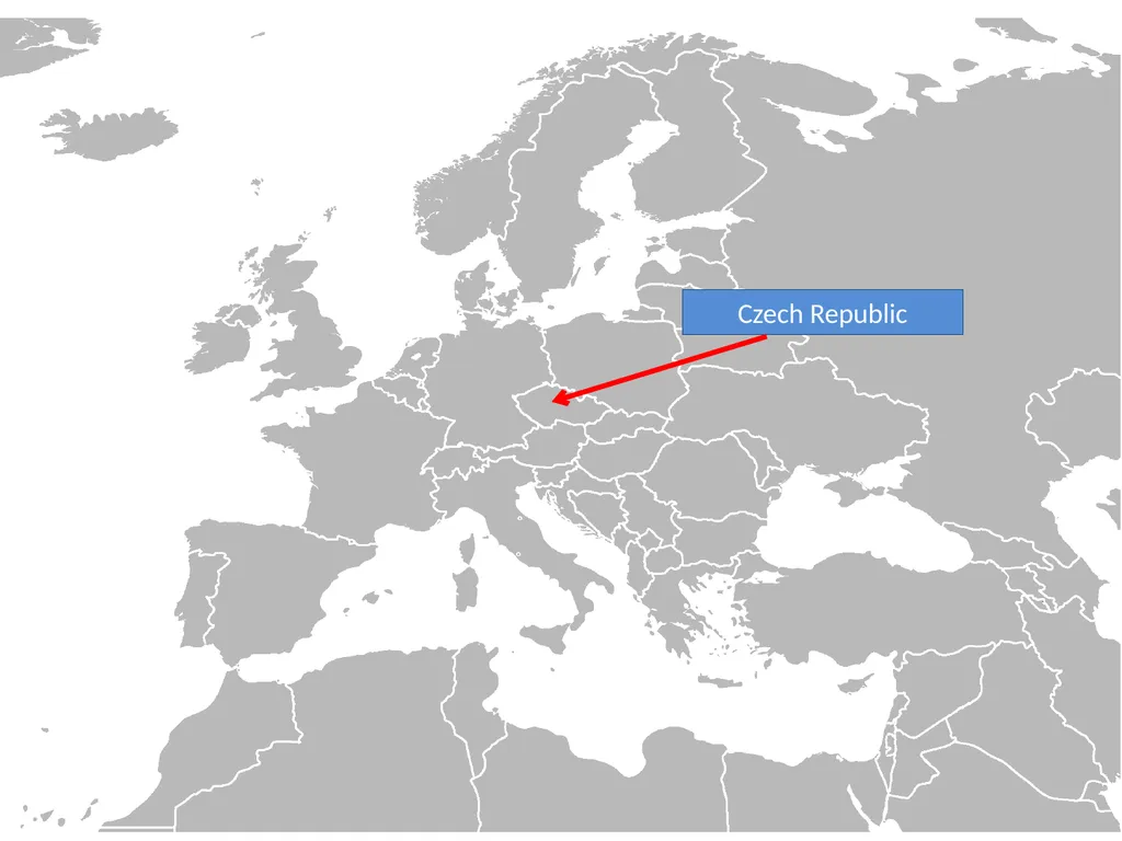
slide42. Czech Republic<br>
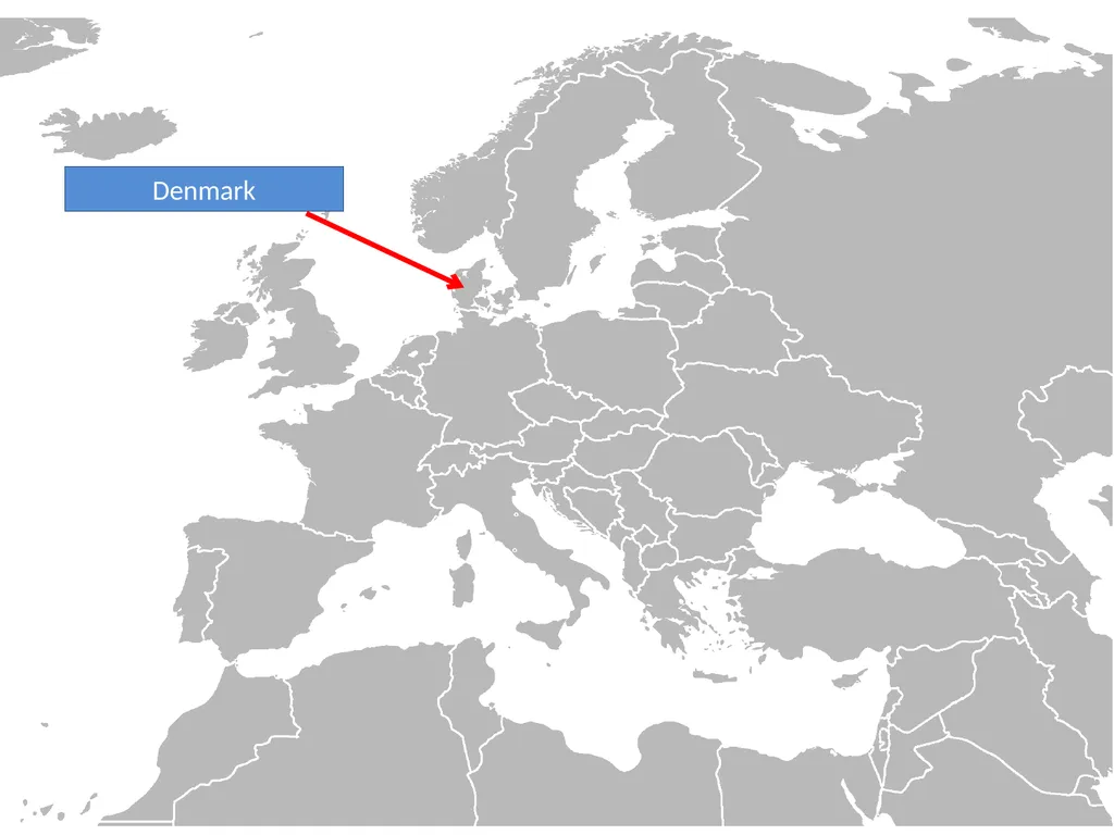
slide43. Denmark<br>
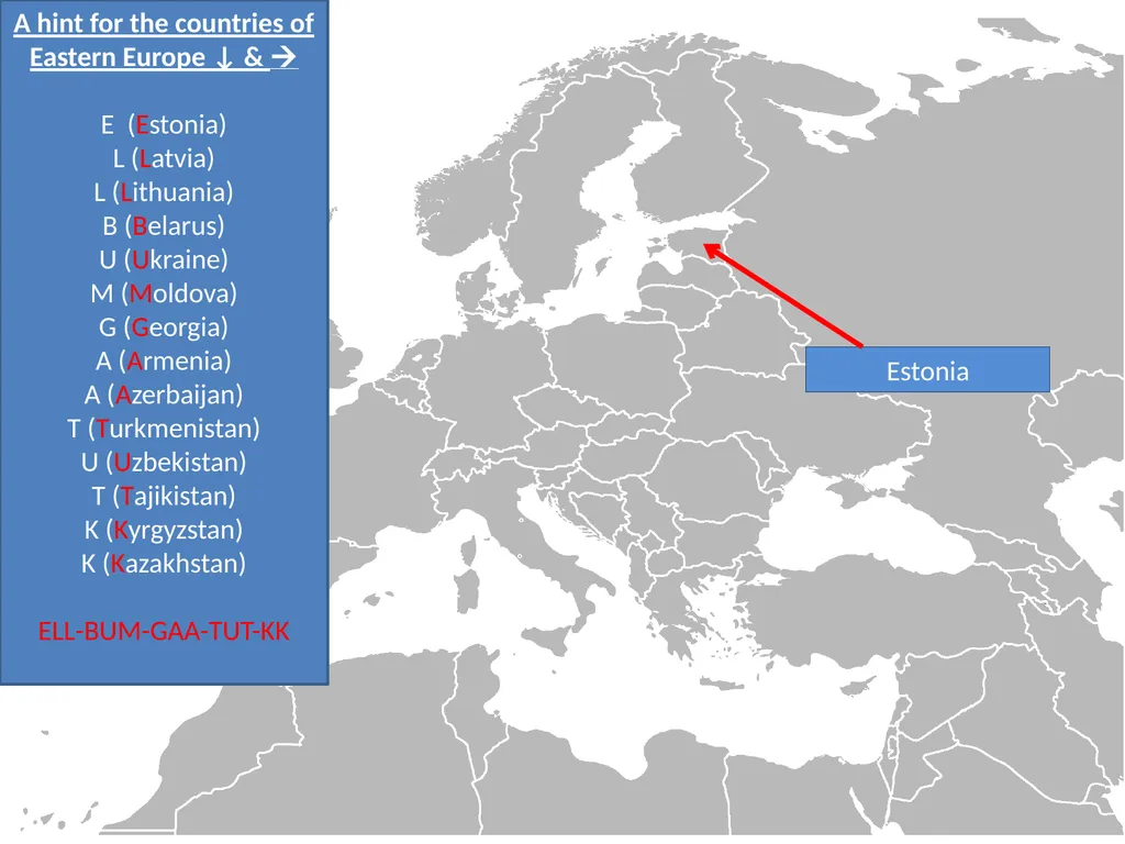
slide44. Estonia A hint for the countries of Eastern Europe ↓ &
E (Estonia)
L (Latvia)
L (Lithuania)
B (Belarus)
U (Ukraine)
M (Moldova)
G (Georgia)
A (Armenia)
A (Azerbaijan)
T (Turkmenistan)
U (Uzbekistan)
T (Tajikistan)
K (Kyrgyzstan)
K (Kazakhstan)
ELL-BUM-GAA-TUT-KK<br>
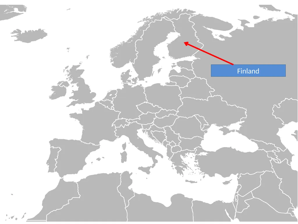
slide45. Finland<br>
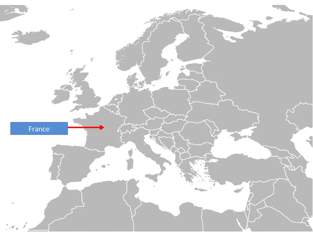
slide46. France<br>
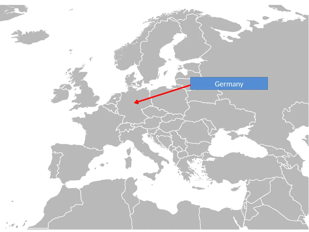
slide47. Germany<br>
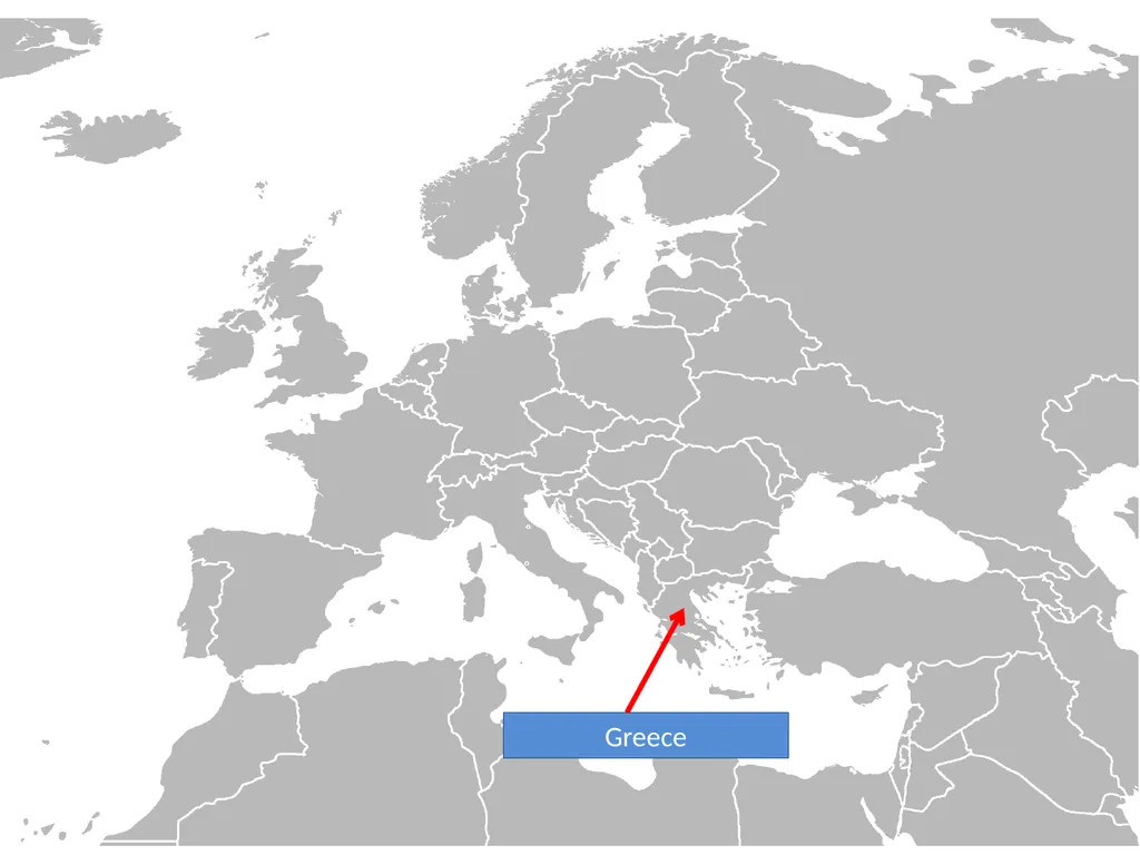
slide48. Greece<br>
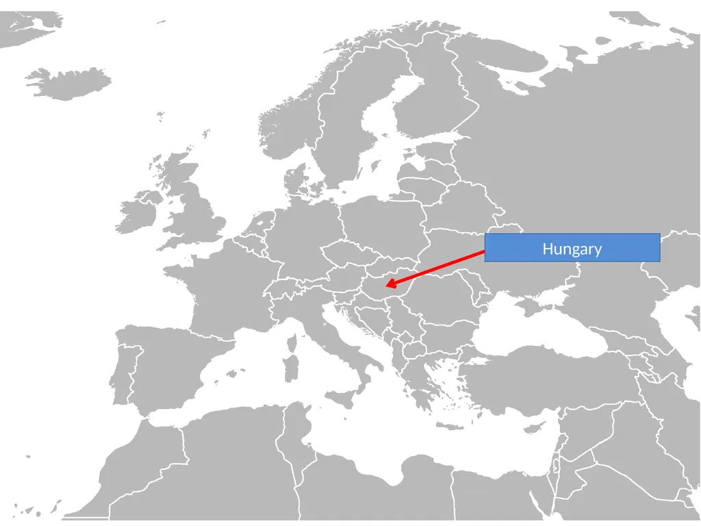
slide49. Hungary<br>
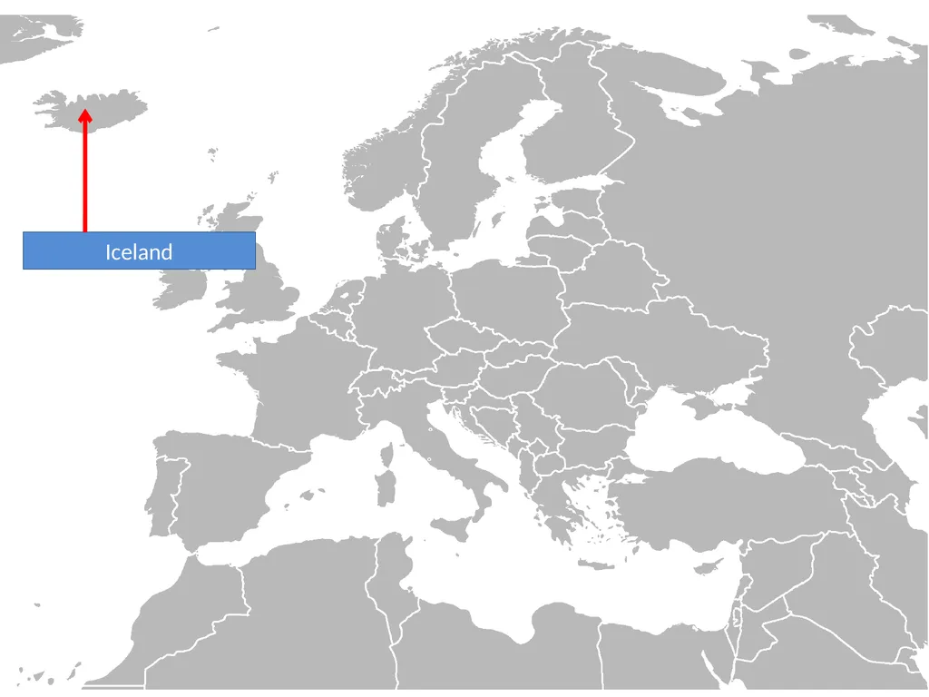
slide50. Iceland<br>
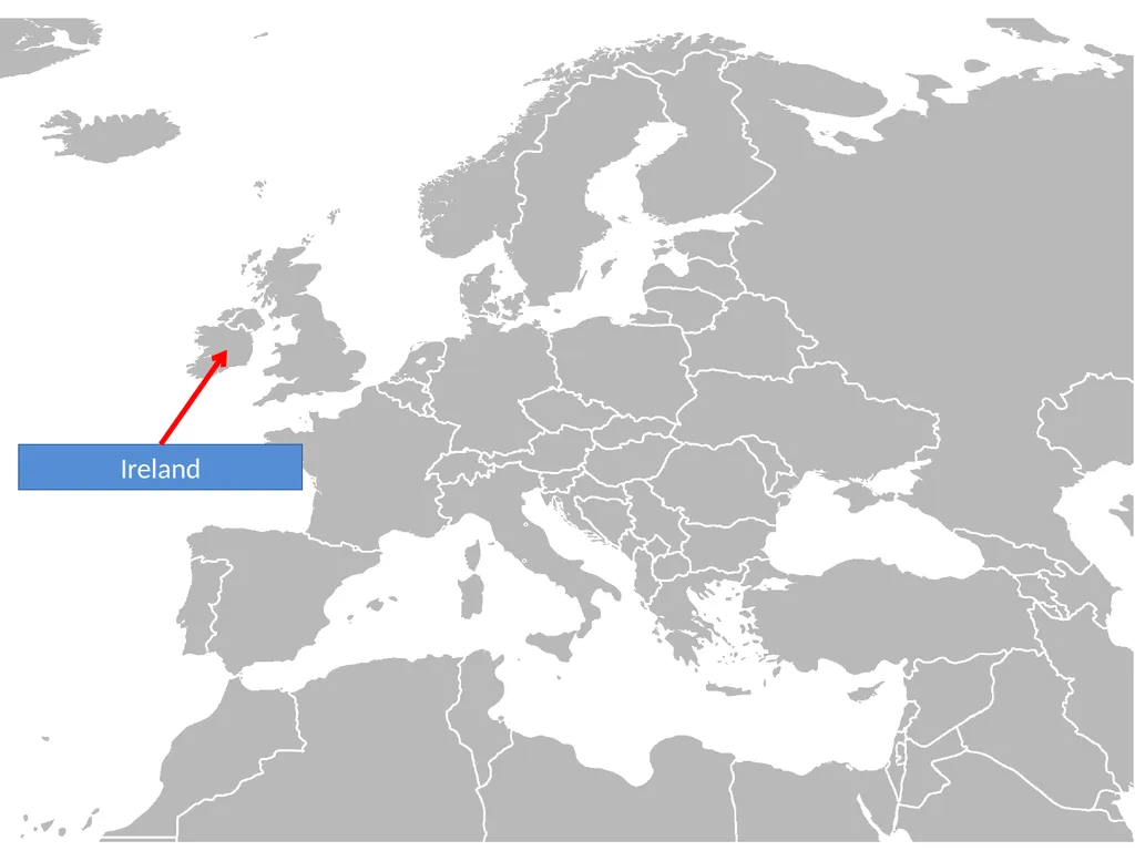
slide51. Ireland<br>
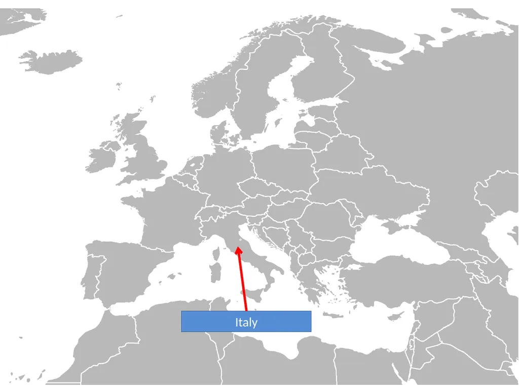
slide52. Italy<br>
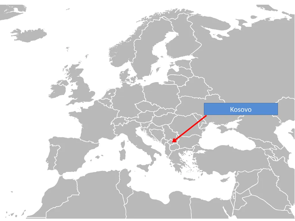
slide53. Kosovo<br>
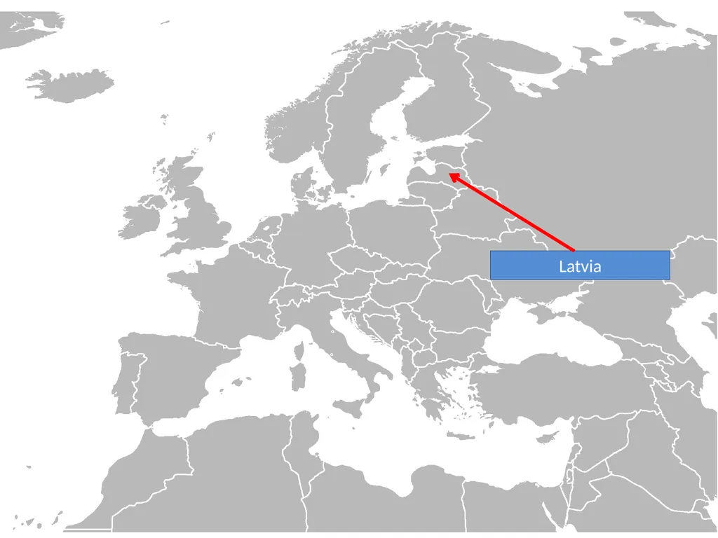
slide54. Latvia<br>
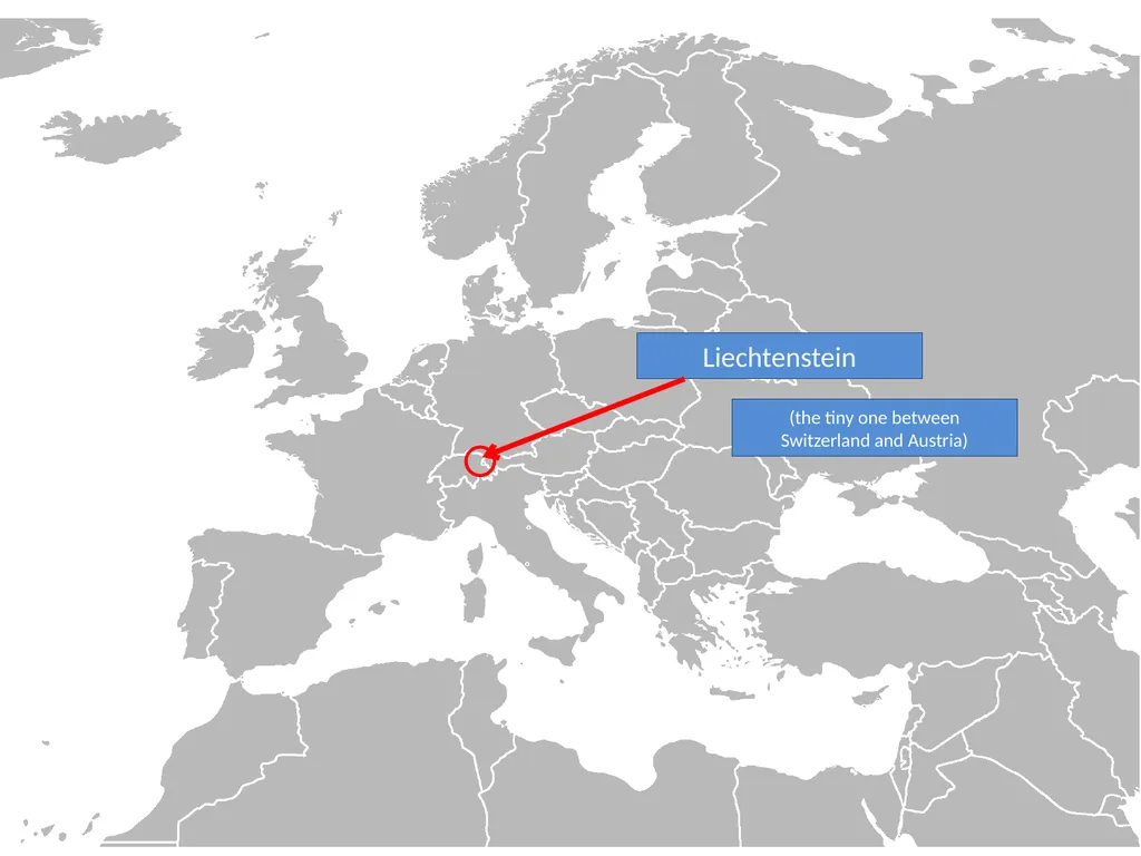
slide55. Liechtenstein (the tiny one between Switzerland and Austria)<br>
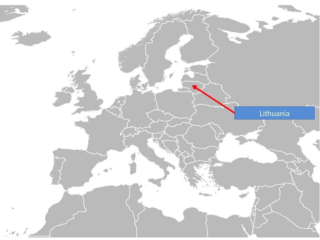
slide56. Lithuania<br>
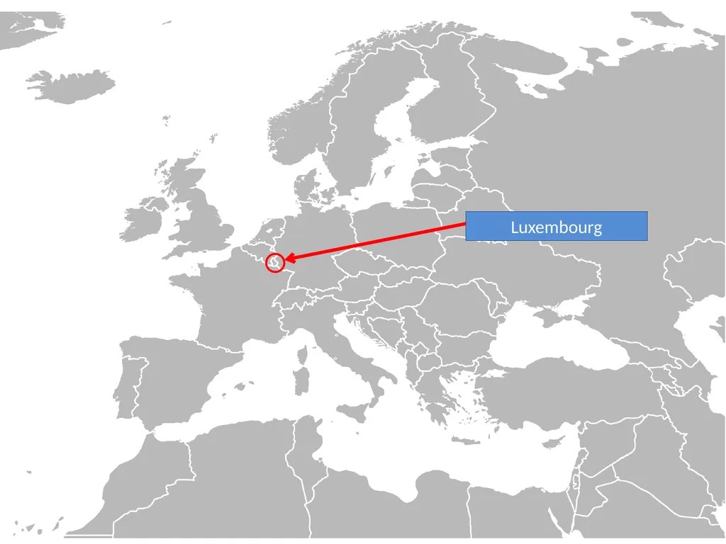
slide57. Luxembourg<br>
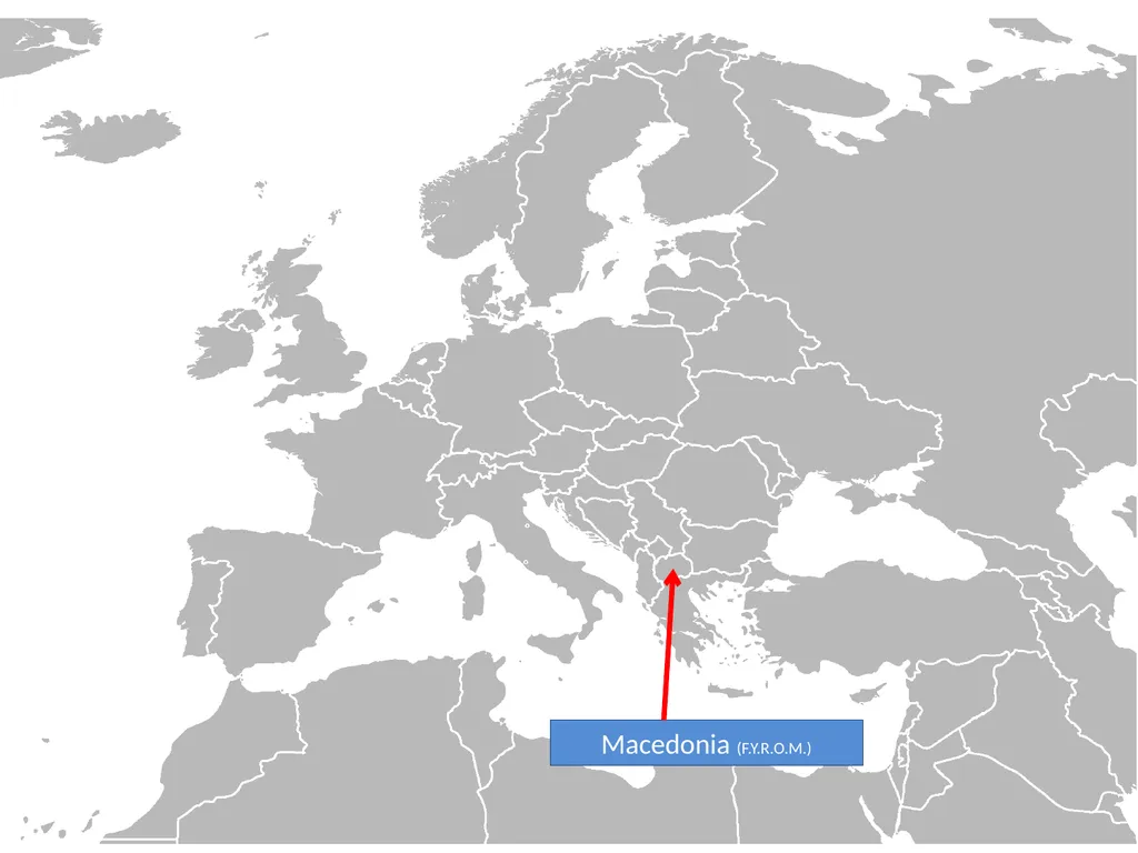
slide58. Macedonia (F.Y.R.O.M.)<br>
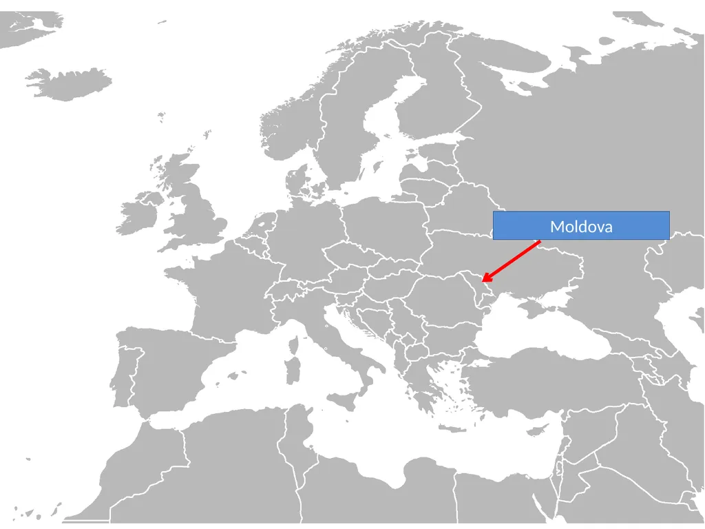
slide59. Moldova<br>
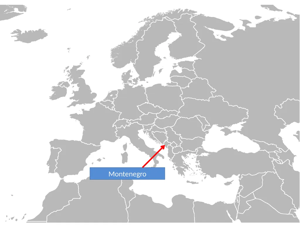
slide60. Montenegro<br>
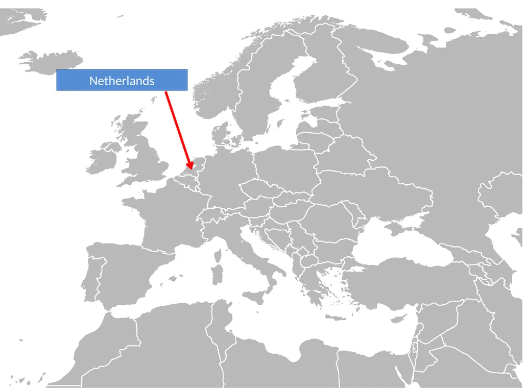
slide61. Netherlands<br>
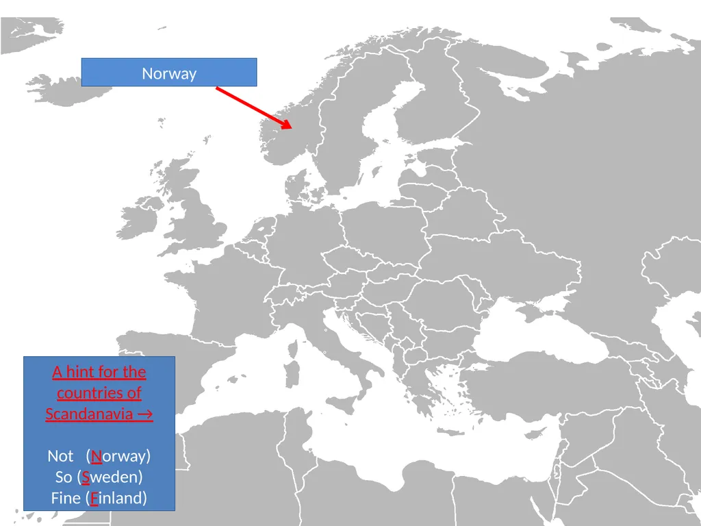
slide62. Norway A hint for the countries of Scandanavia →
Not (Norway)
So (Sweden)
Fine (Finland)<br>
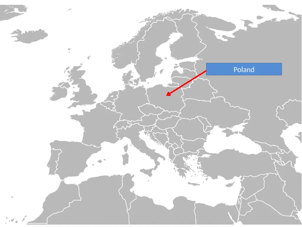
slide63. Poland<br>
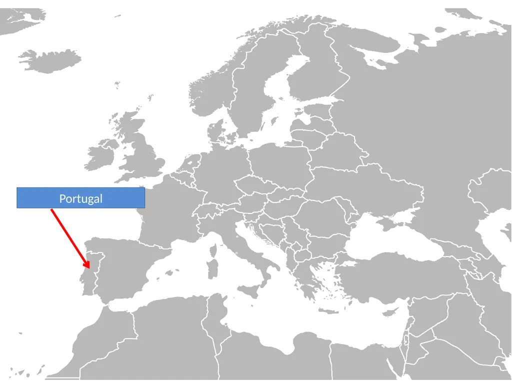
slide64. Portugal<br>
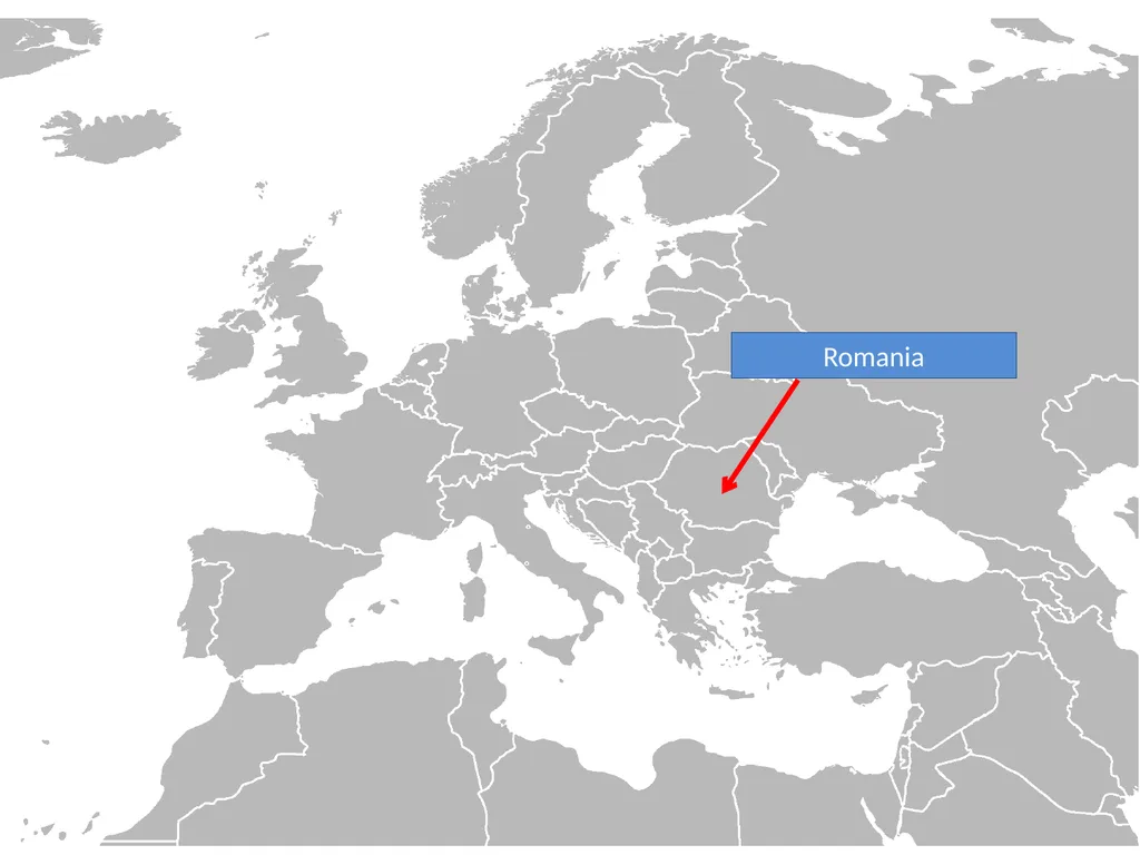
slide65. Romania<br>
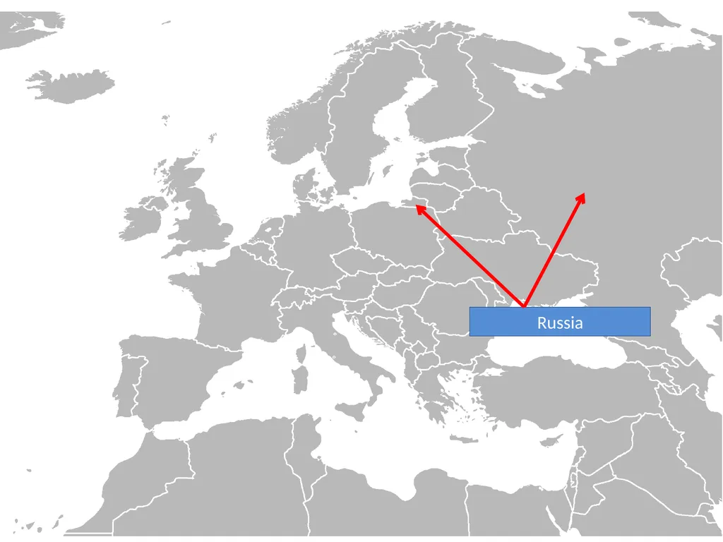
slide66. Russia<br>
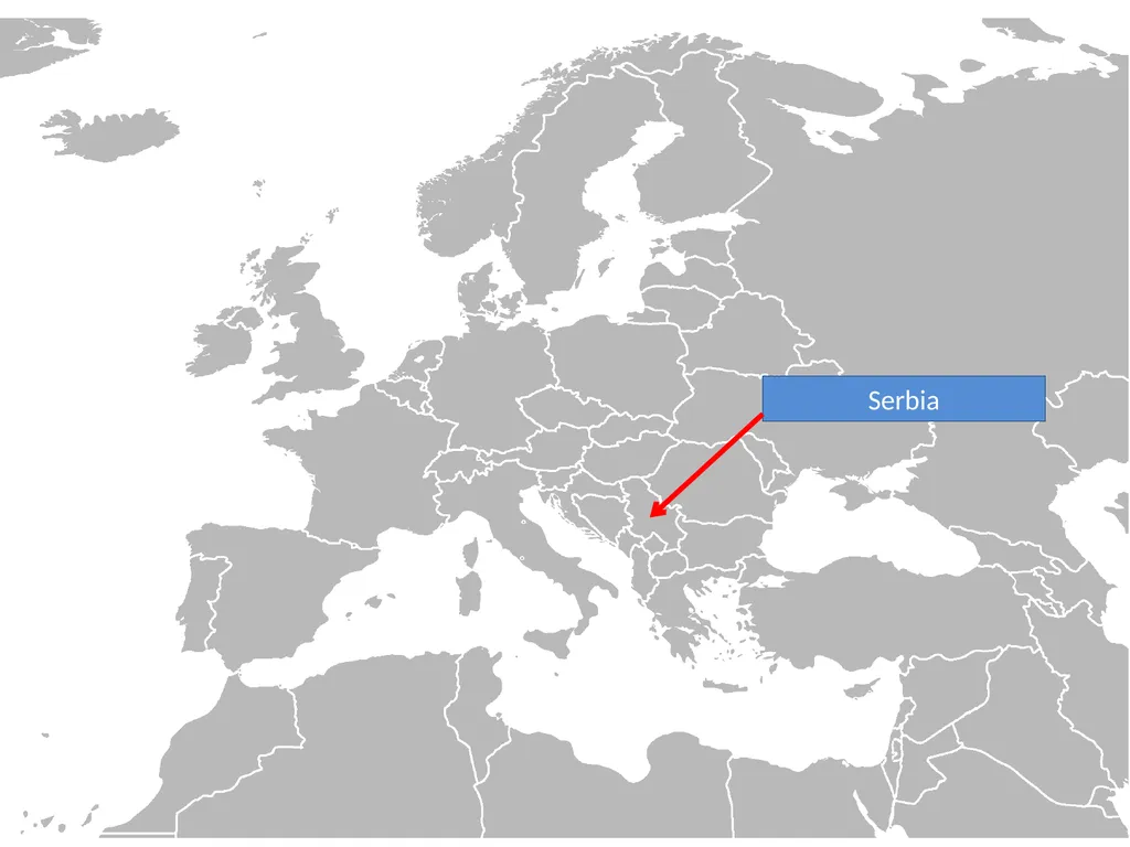
slide67. Serbia<br>
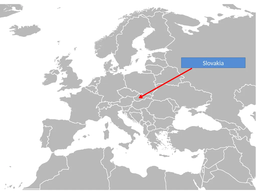
slide68. Slovakia<br>
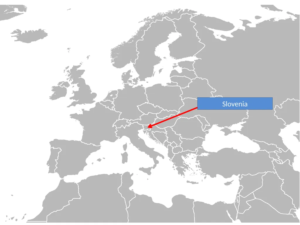
slide69. Slovenia<br>
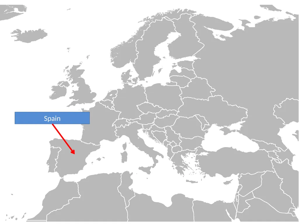
slide70. Spain<br>
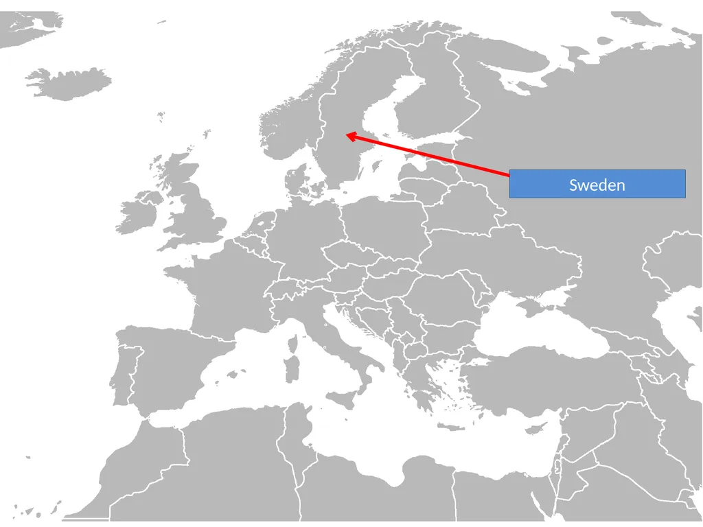
slide71. Sweden<br>
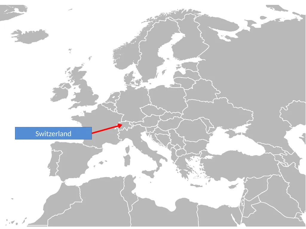
slide72. Switzerland<br>
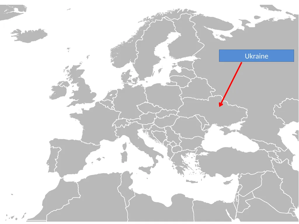
slide73. Ukraine<br>
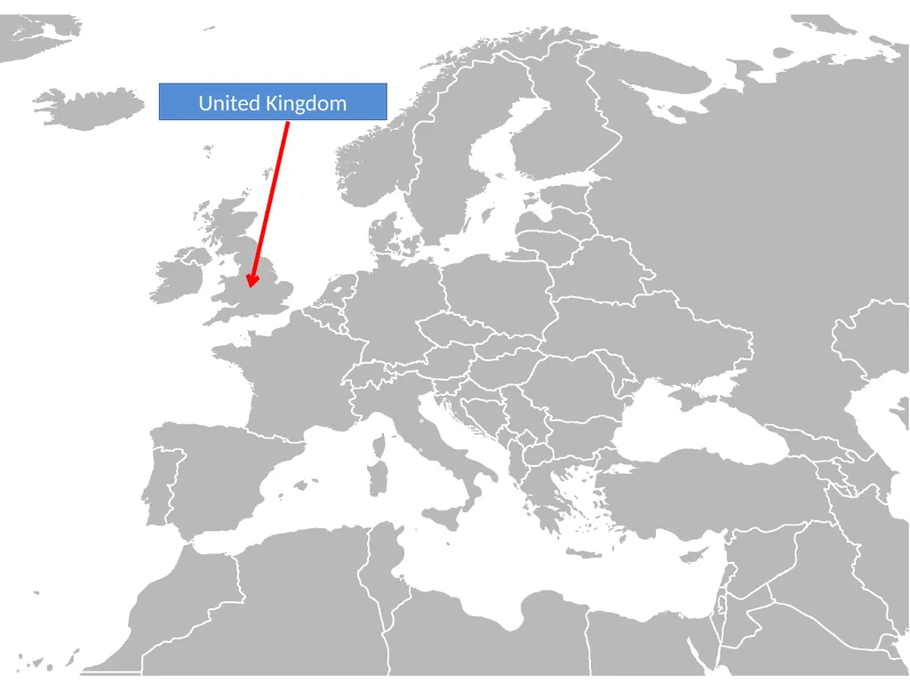
slide74. United Kingdom<br>
slide75. AFRICA<br>
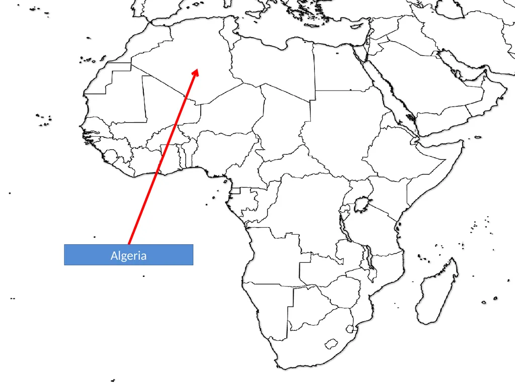
slide76. Algeria<br>
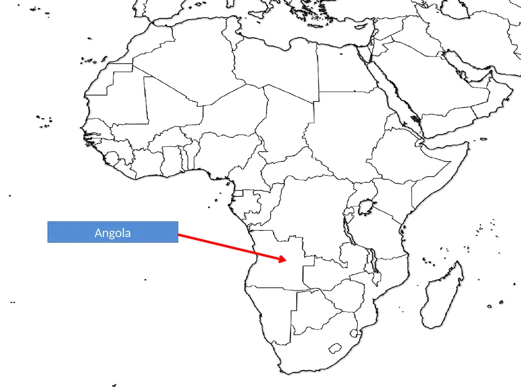
slide77. Angola<br>
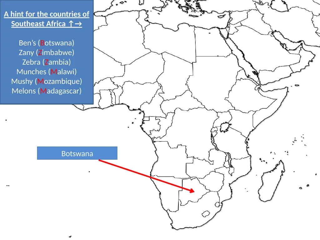
slide78. Botswana A hint for the countries of Southeast Africa ↑→
Ben’s (Botswana)
Zany (Zimbabwe)
Zebra (Zambia)
Munches (Malawi)
Mushy (Mozambique)
Melons (Madagascar)<br>
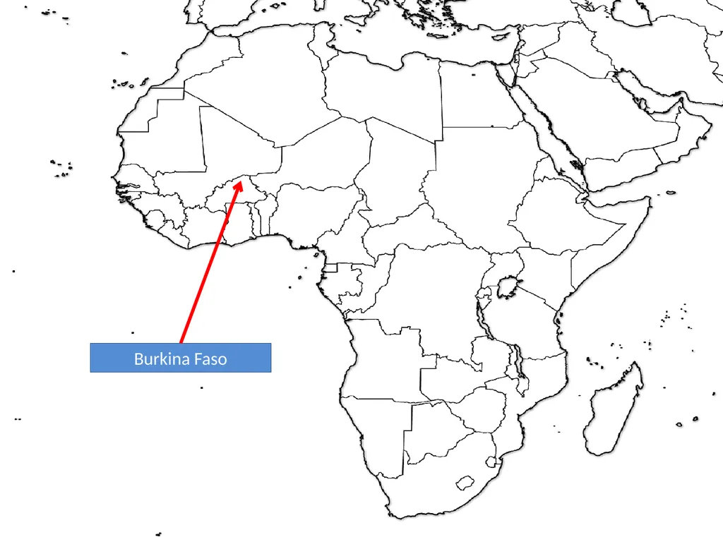
slide79. Burkina Faso<br>
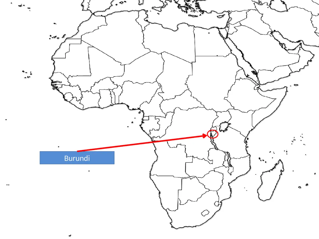
slide80. Burundi<br>
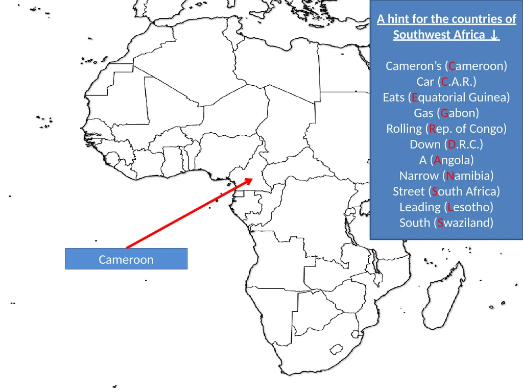
slide81. Cameroon A hint for the countries of Southwest Africa ↓
Cameron’s (Cameroon)
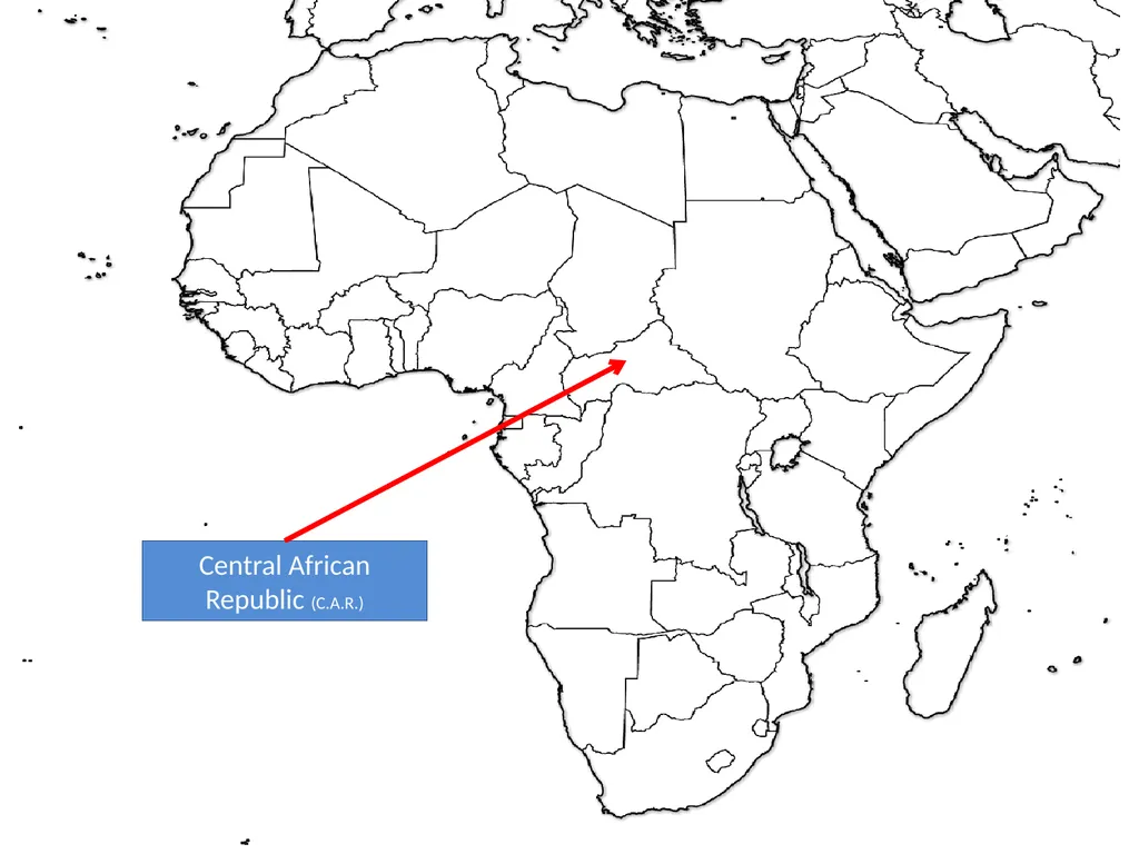
Car (C.A.R.)
Eats (Equatorial Guinea)
Gas (Gabon)
Rolling (Rep. of Congo)
Down (D.R.C.)
A (Angola)
Narrow (Namibia)
Street (South Africa)
Leading (Lesotho)
South (Swaziland)<br>
slide82. Central African Republic (C.A.R.)<br>
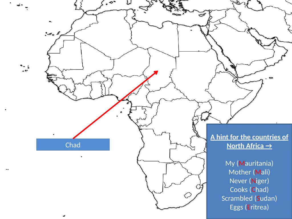
slide83. Chad A hint for the countries of North Africa →
My (Mauritania)
Mother (Mali)
Never (Niger)
Cooks (Chad)
Scrambled (Sudan)
Eggs (Eritrea)<br>
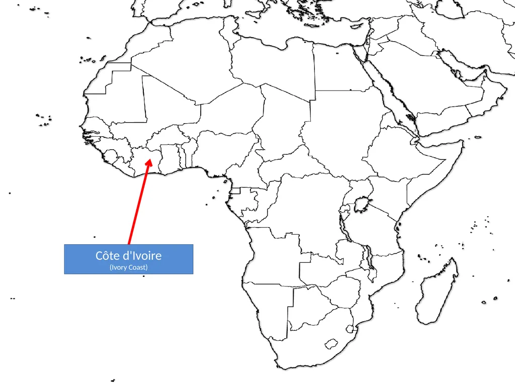
slide84. Côte d'Ivoire
(Ivory Coast)<br>
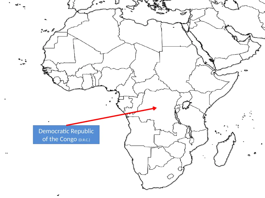
slide85. Democratic Republic of the Congo (D.R.C.)<br>
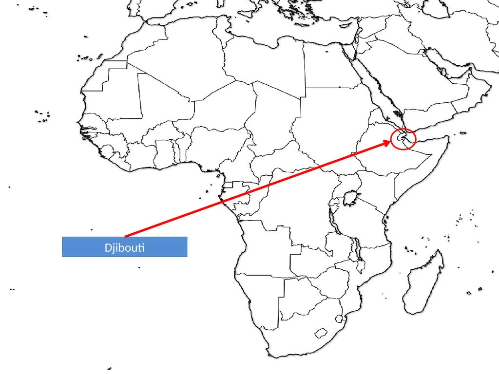
slide86. Djibouti<br>
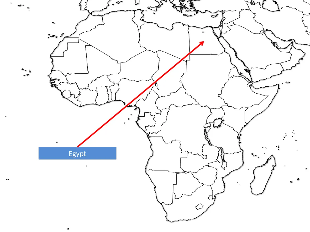
slide87. Egypt<br>
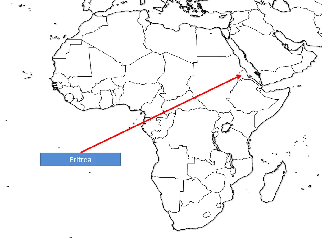
slide88. Eritrea<br>
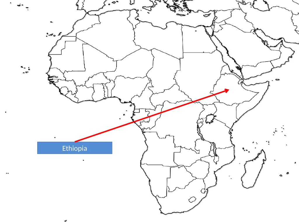
slide89. Ethiopia<br>
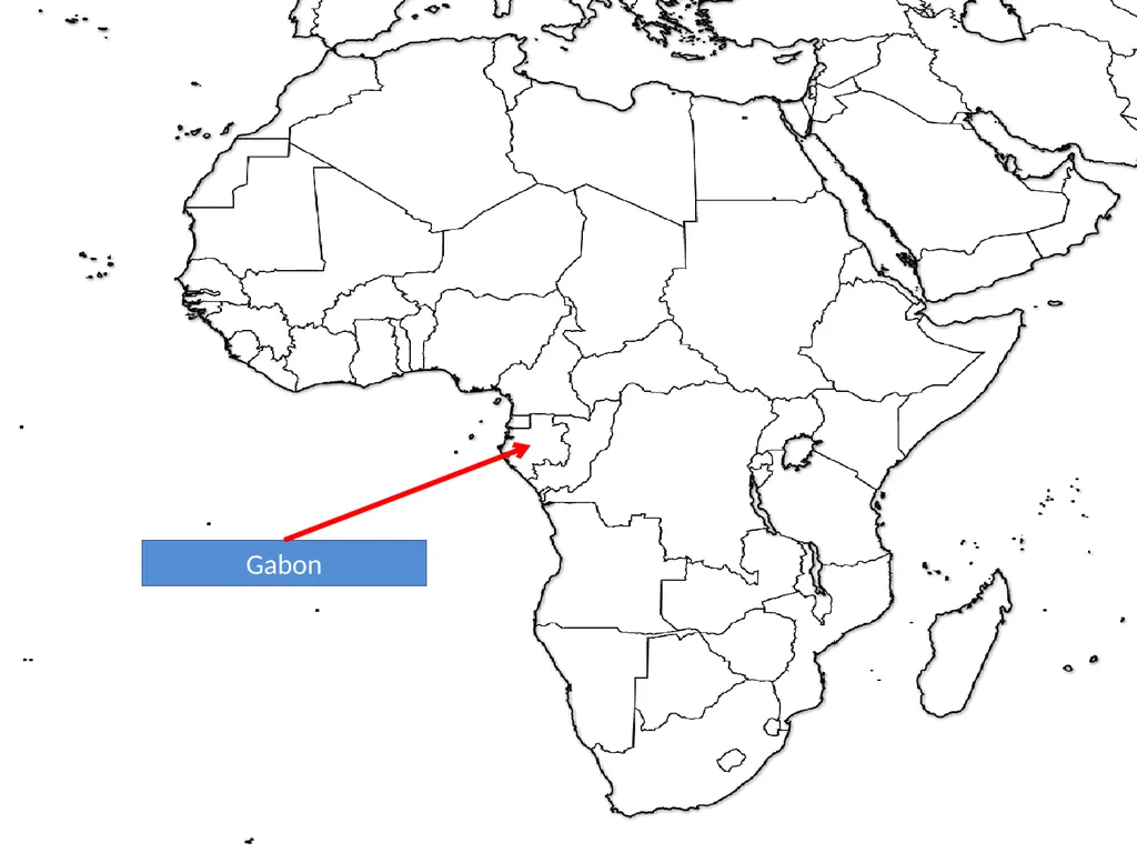
slide90. Gabon<br>
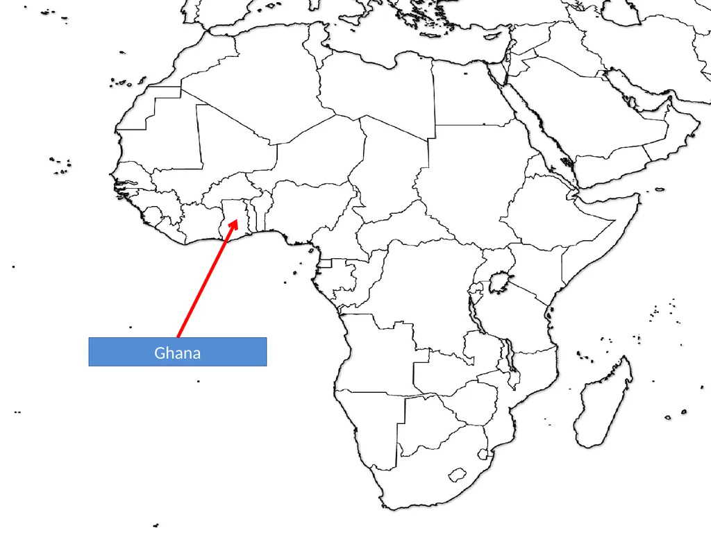
slide91. Ghana<br>
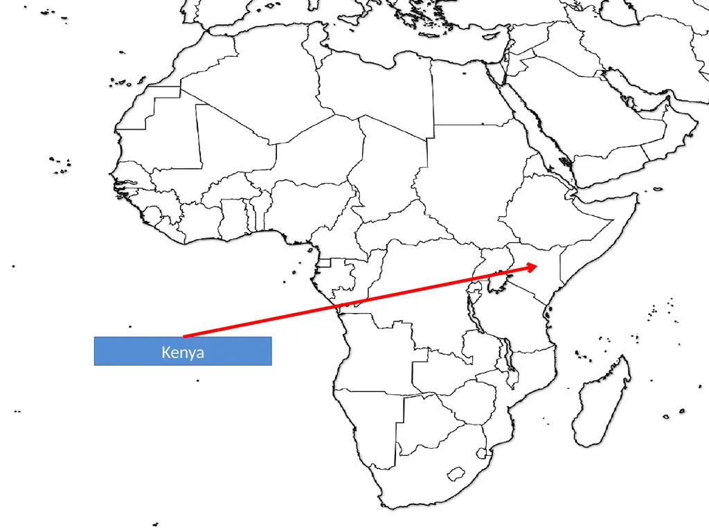
slide92. Kenya<br>
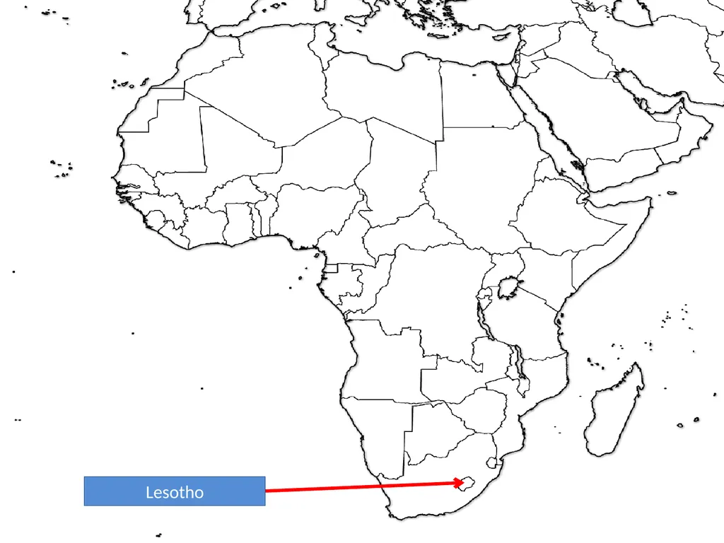
slide93. Lesotho<br>
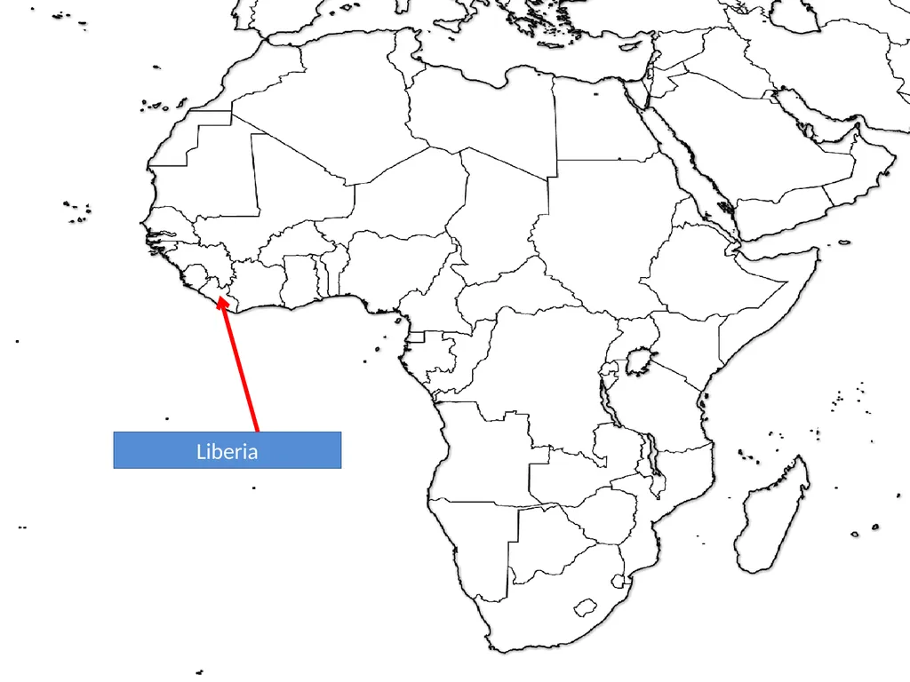
slide94. Liberia<br>
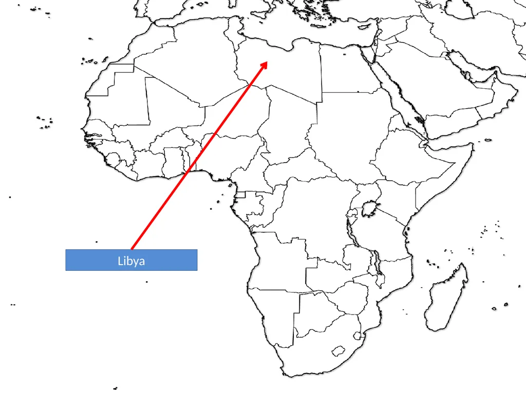
slide95. Libya<br>
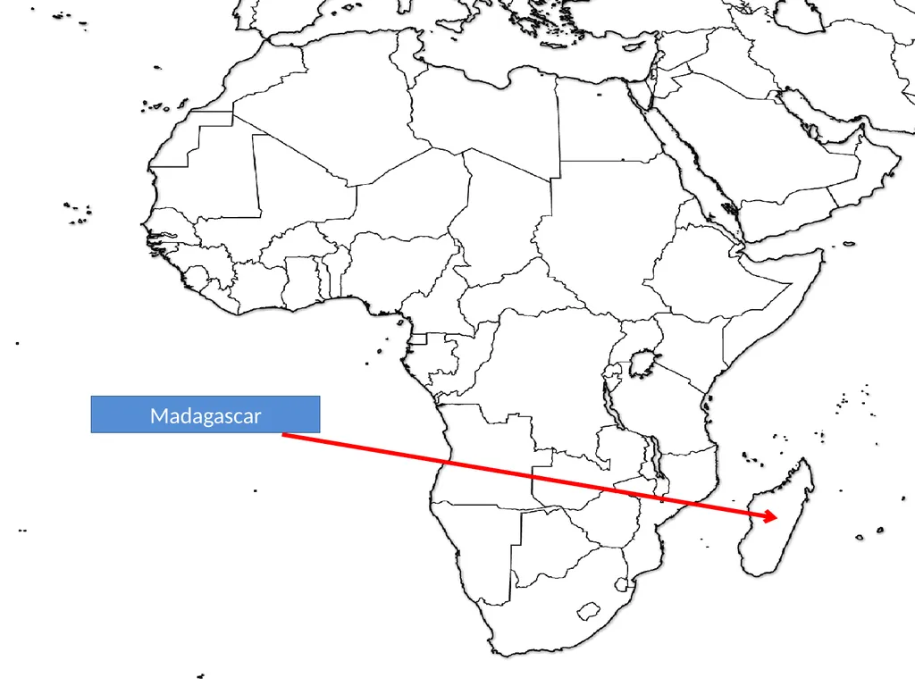
slide96. Madagascar<br>
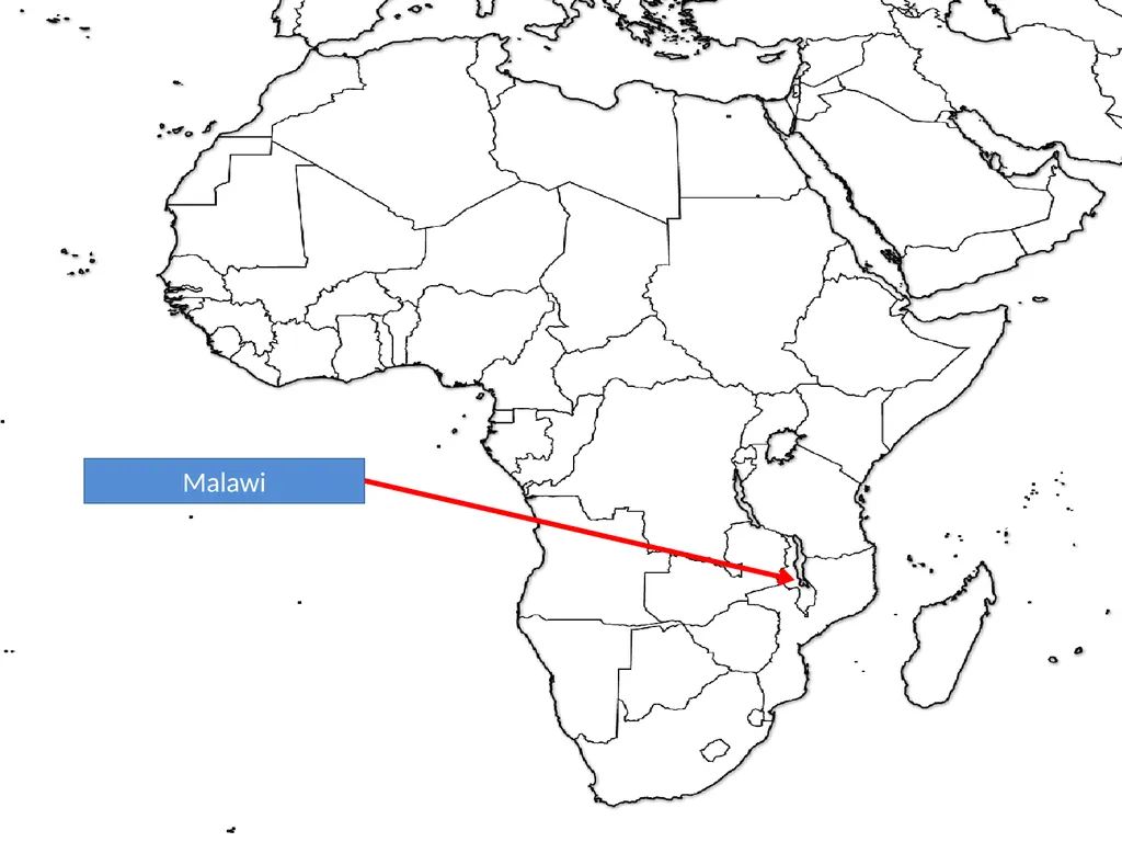
slide97. Malawi<br>
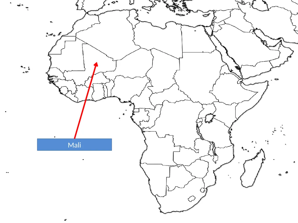
slide98. Mali<br>
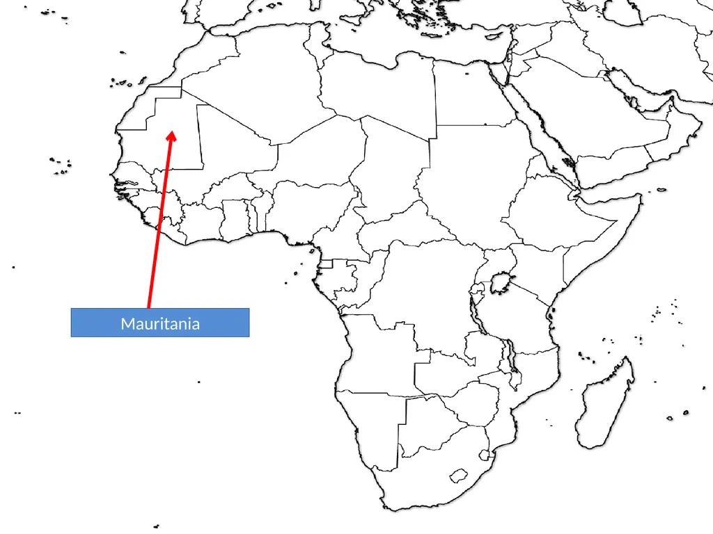
slide99. Mauritania<br>
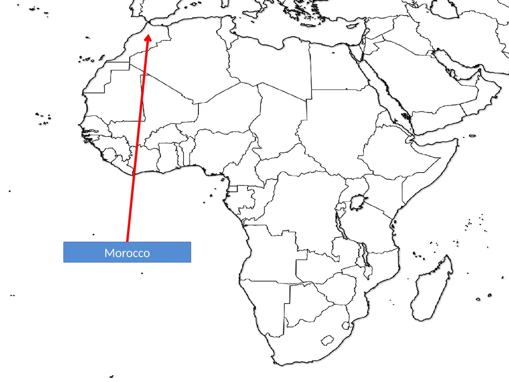
slide100. Morocco<br>
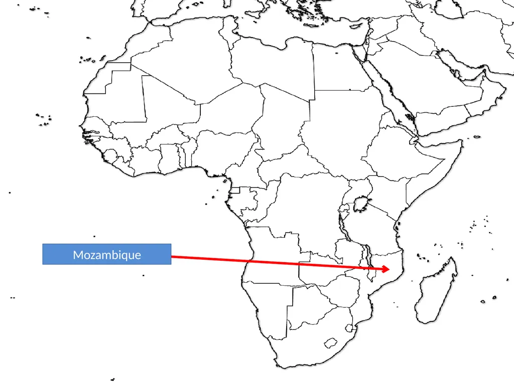
slide101. Mozambique<br>
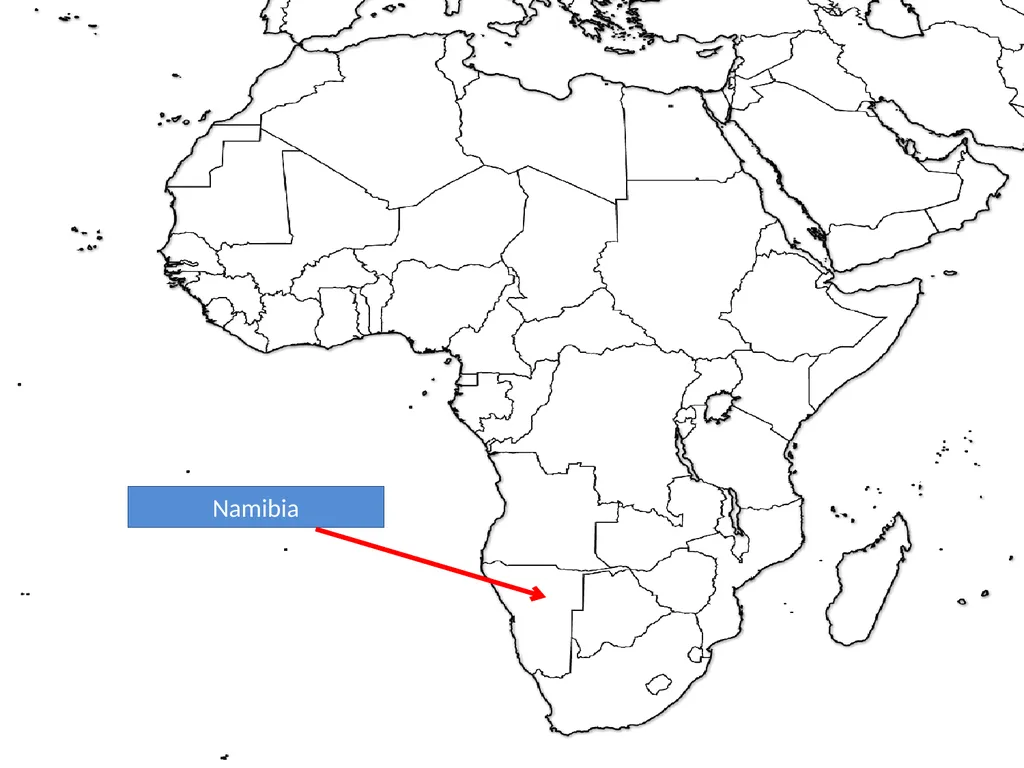
slide102. Namibia<br>
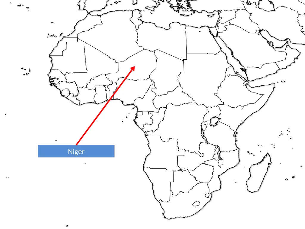
slide103. Niger<br>
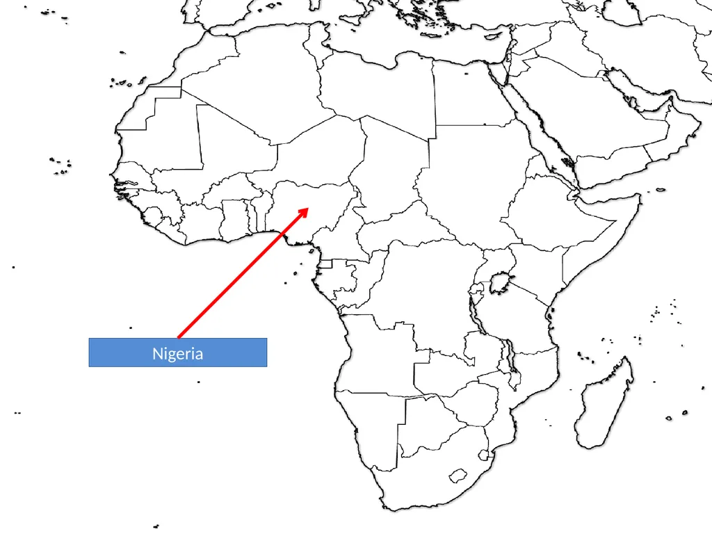
slide104. Nigeria<br>
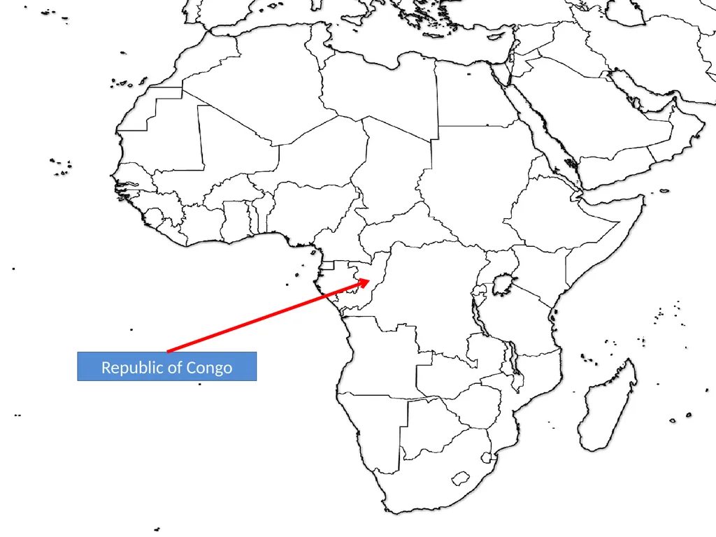
slide105. Republic of Congo<br>
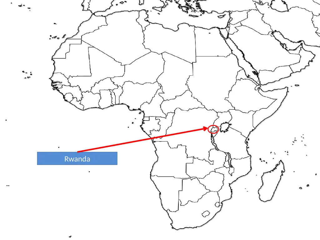
slide106. Rwanda<br>
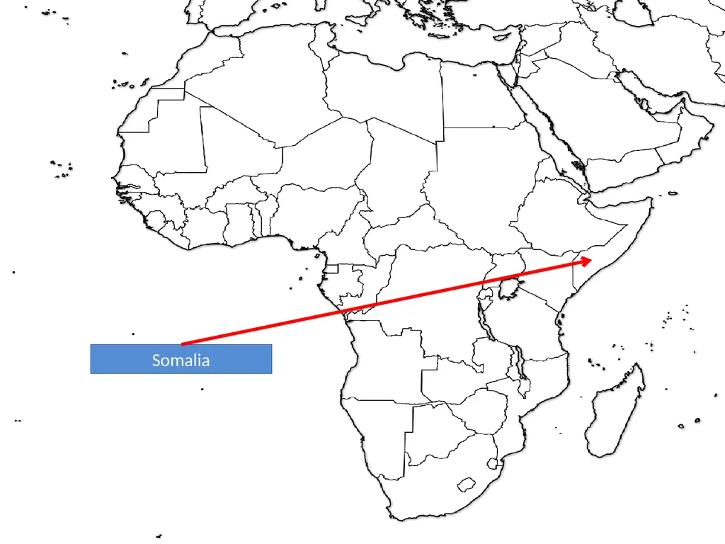
slide107. Somalia<br>
slide108. South Africa<br>
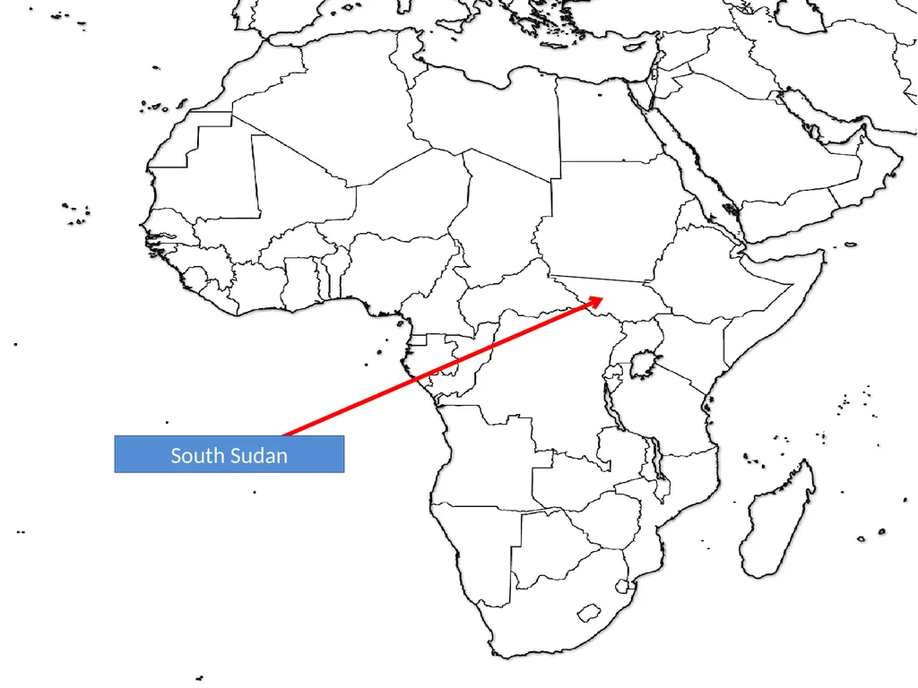
slide109. South Sudan<br>
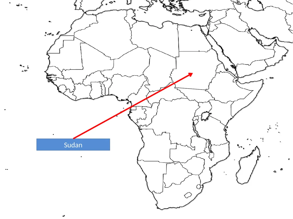
slide110. Sudan<br>
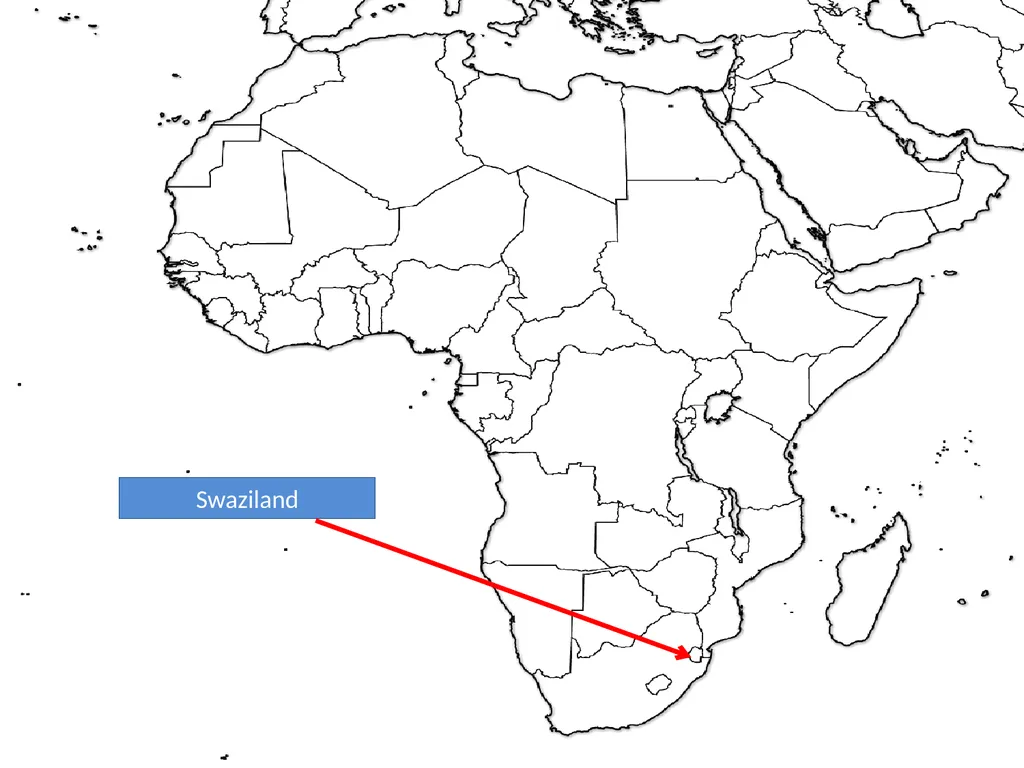
slide111. Swaziland<br>
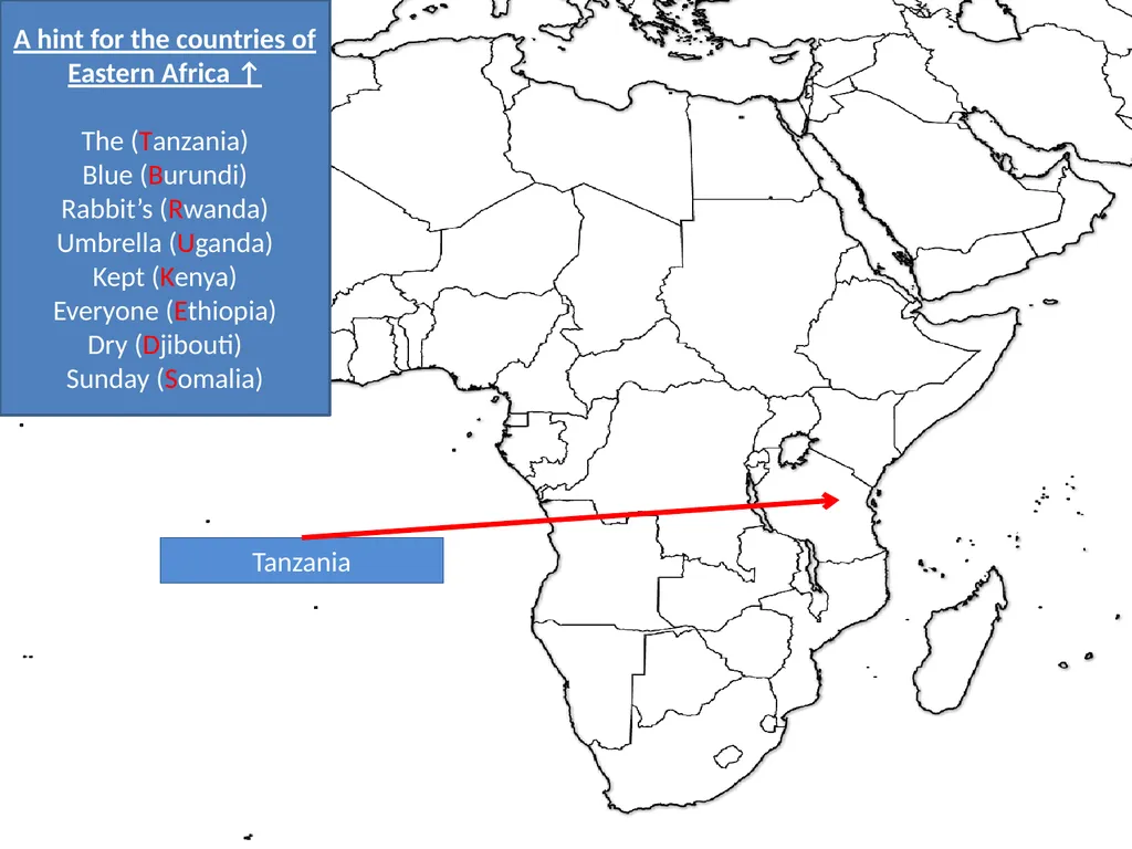
slide112. Tanzania A hint for the countries of Eastern Africa ↑
The (Tanzania)
Blue (Burundi)
Rabbit’s (Rwanda)
Umbrella (Uganda)
Kept (Kenya)
Everyone (Ethiopia)
Dry (Djibouti)
Sunday (Somalia)<br>
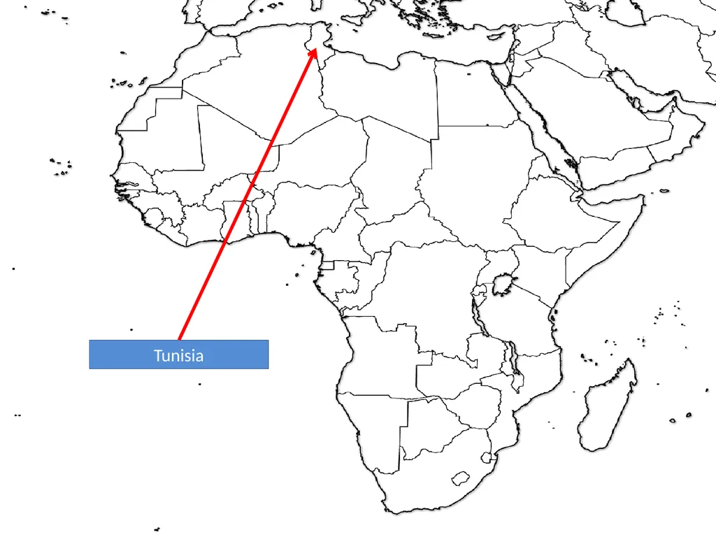
slide113. Tunisia<br>
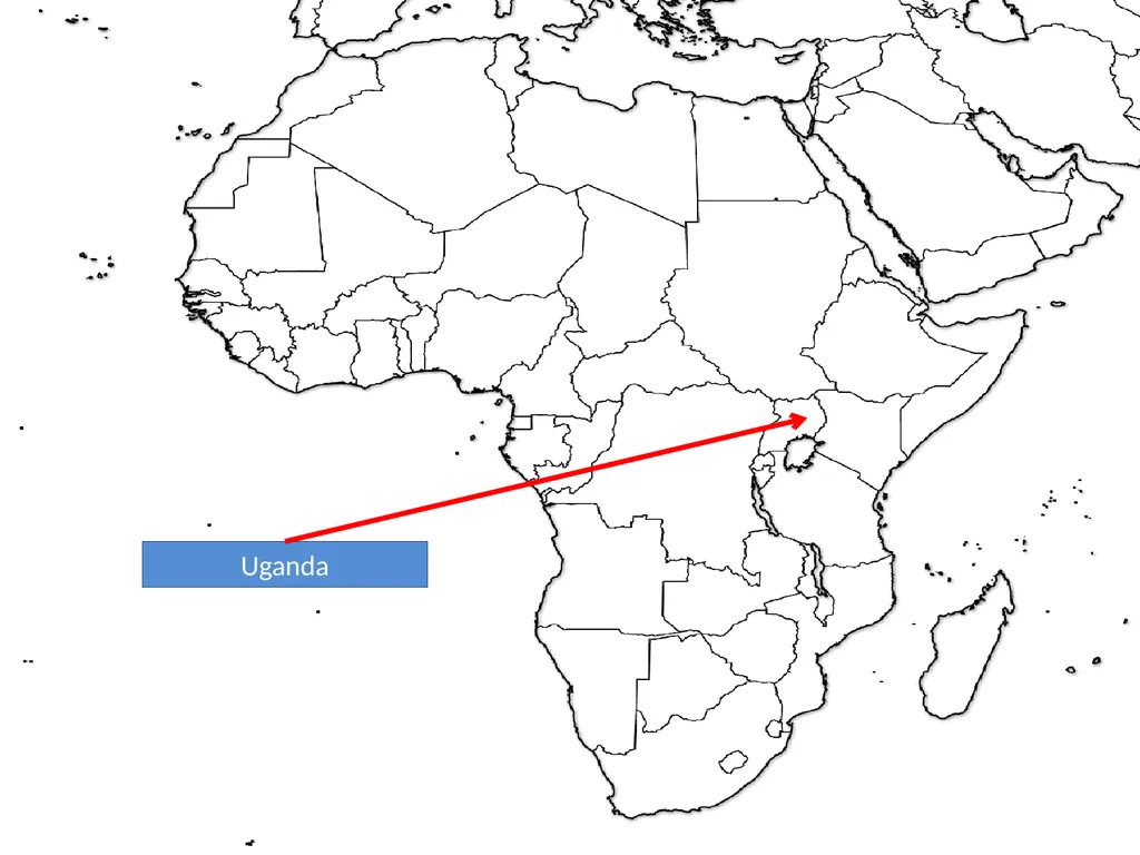
slide114. Uganda<br>
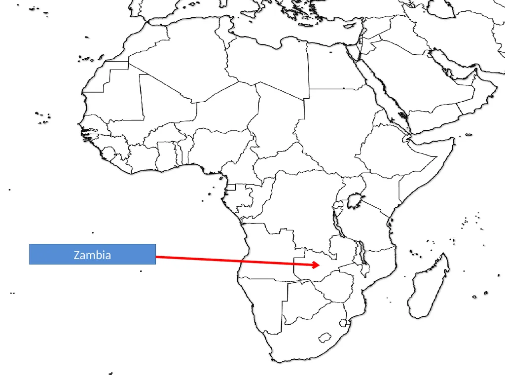
slide115. Zambia<br>
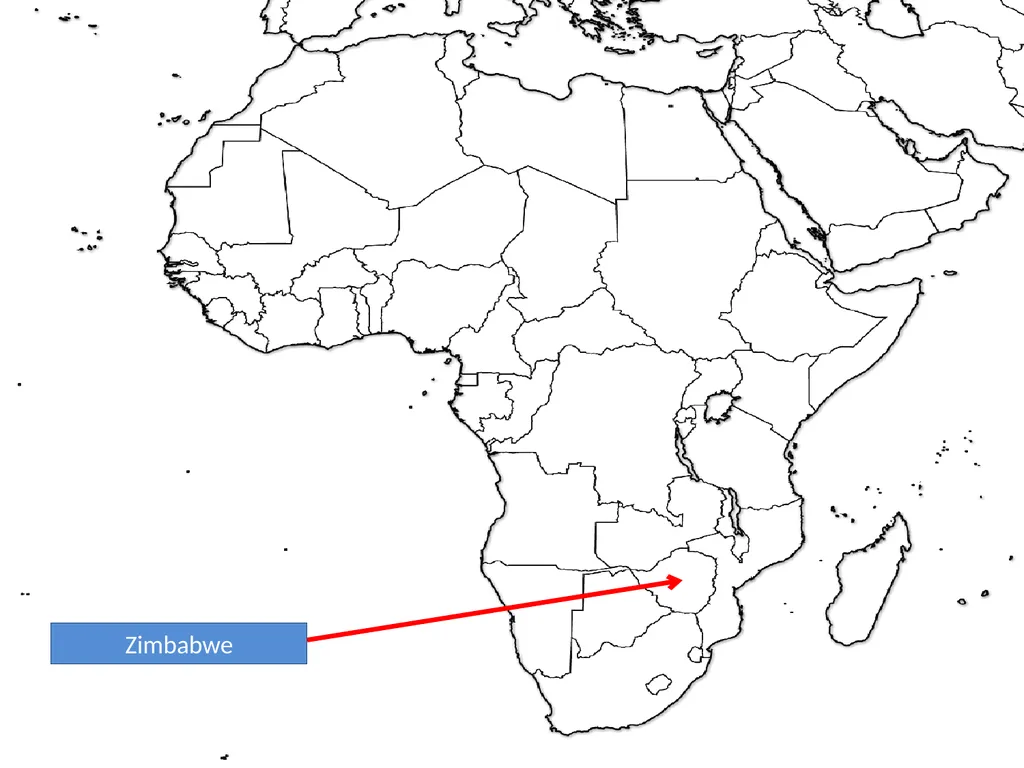
slide116. Zimbabwe<br>
slide117. ASIA<br>
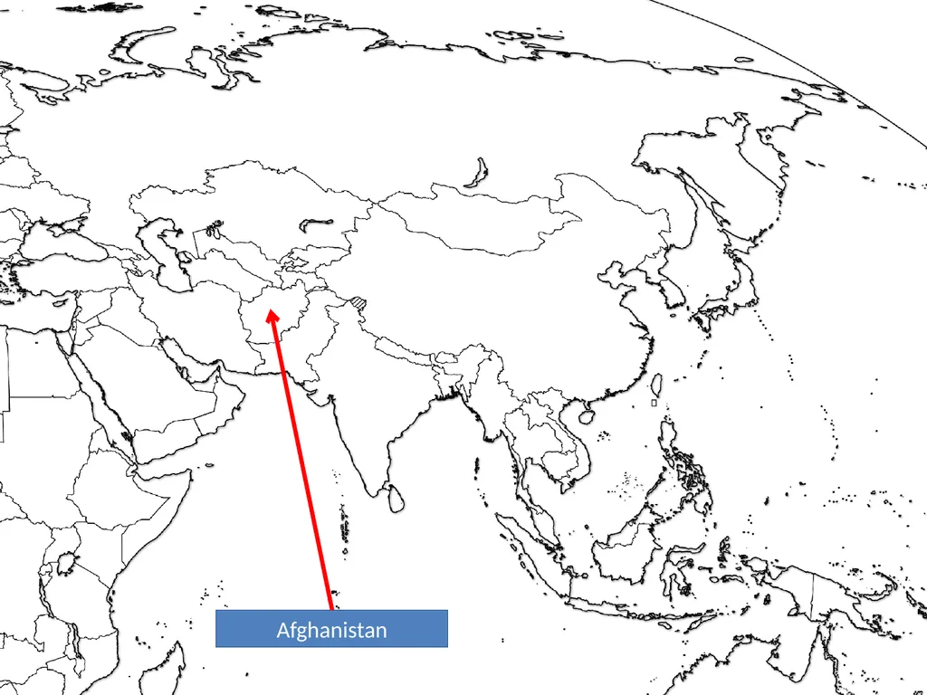
slide118. Afghanistan<br>
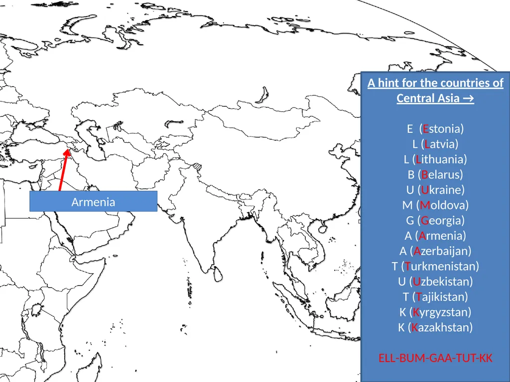
slide119. Armenia A hint for the countries of Central Asia →
E (Estonia)
L (Latvia)
L (Lithuania)
B (Belarus)
U (Ukraine)
M (Moldova)
G (Georgia)
A (Armenia)
A (Azerbaijan)
T (Turkmenistan)
U (Uzbekistan)
T (Tajikistan)
K (Kyrgyzstan)
K (Kazakhstan)
ELL-BUM-GAA-TUT-KK<br>
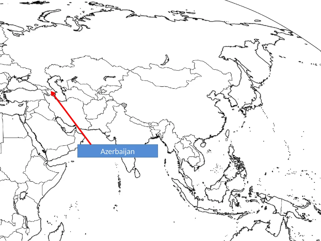
slide120. Azerbaijan<br>
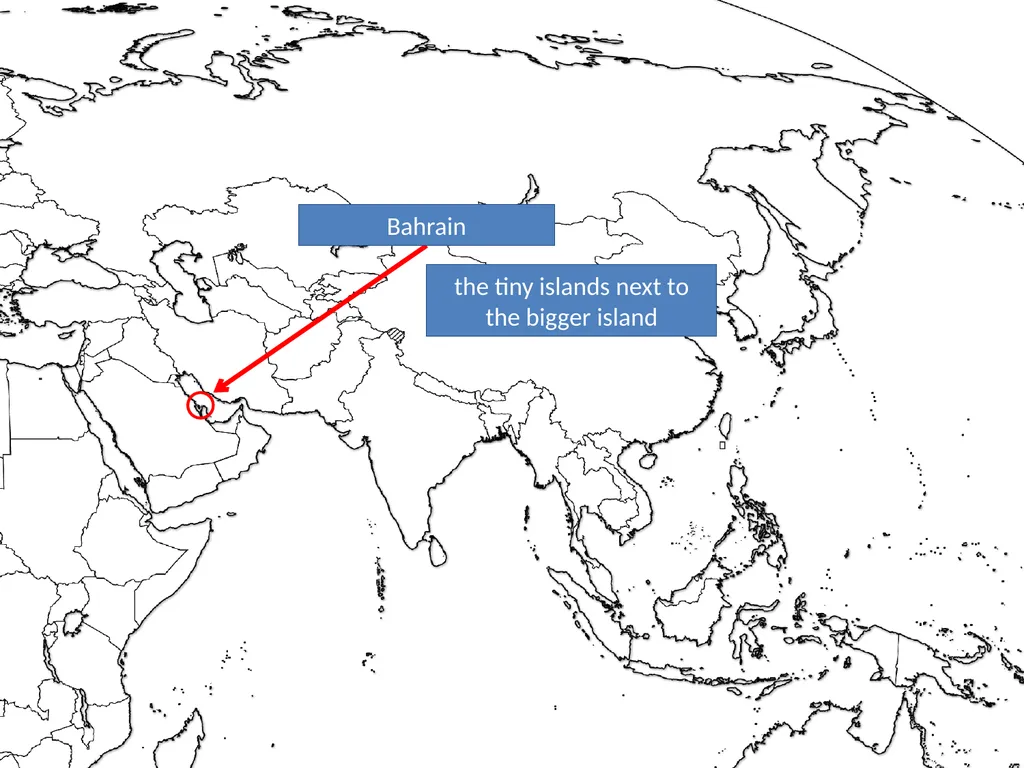
slide121. Bahrain the tiny islands next to the bigger island<br>
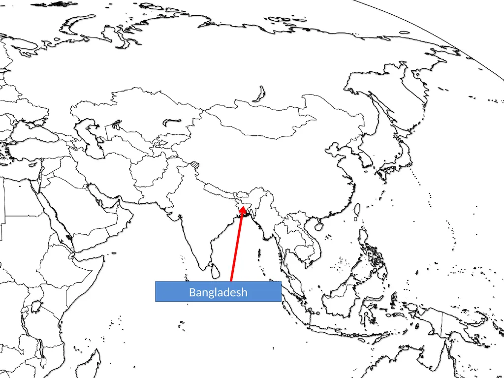
slide122. Bangladesh<br>
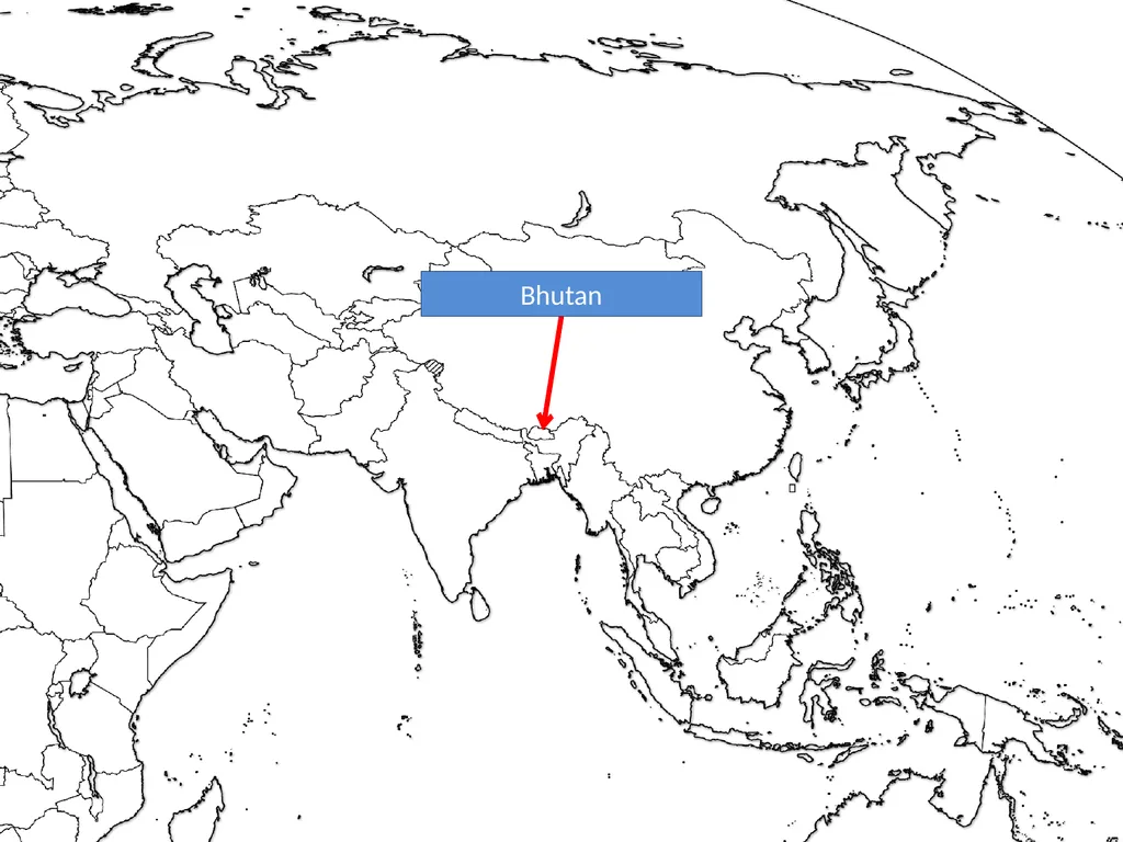
slide123. Bhutan<br>
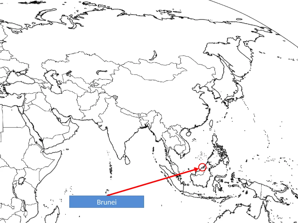
slide124. Brunei<br>
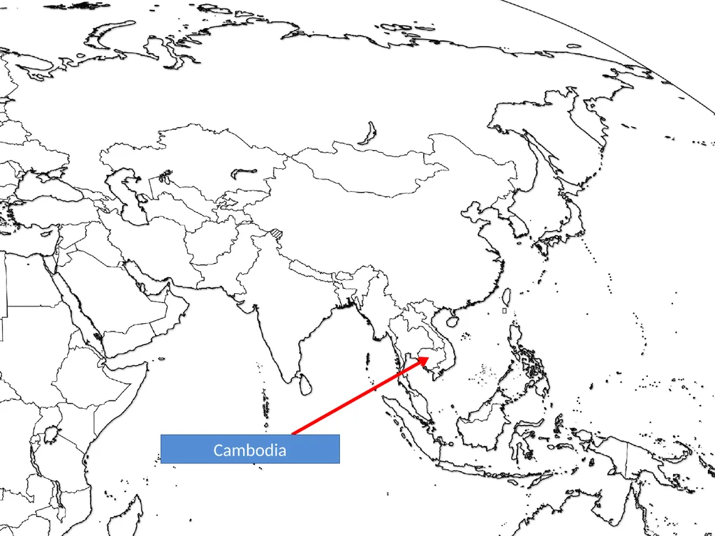
slide125. Cambodia<br>
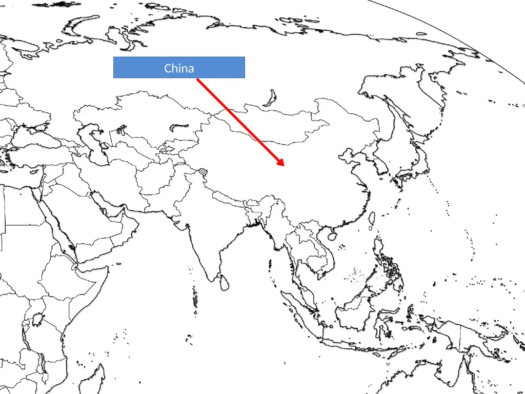
slide126. China<br>
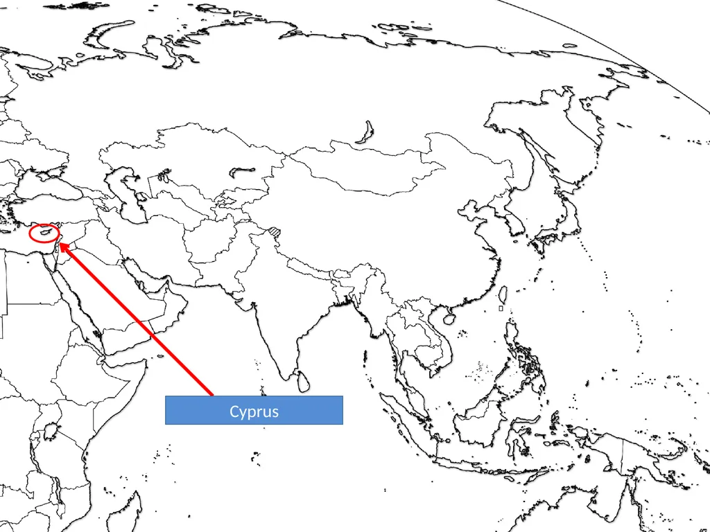
slide127. Cyprus<br>
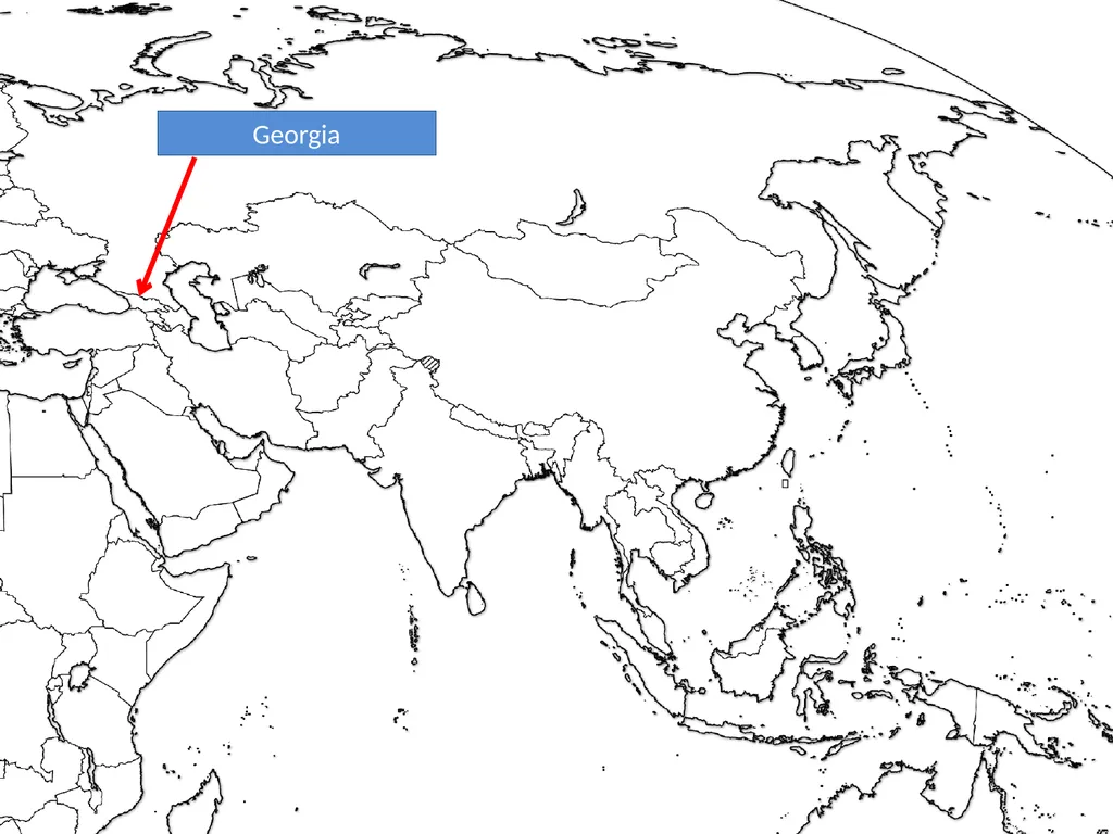
slide128. Georgia<br>
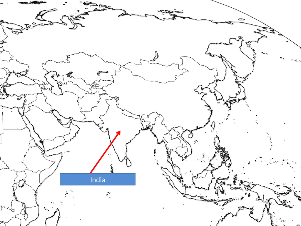
slide129. India<br>
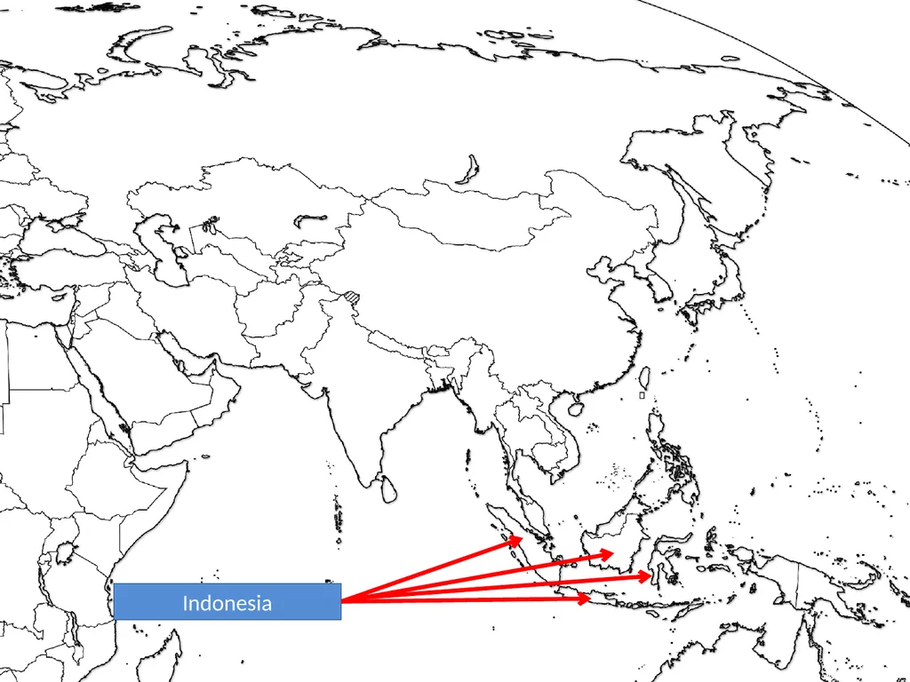
slide130. Indonesia<br>
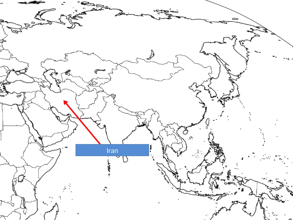
slide131. Iran<br>
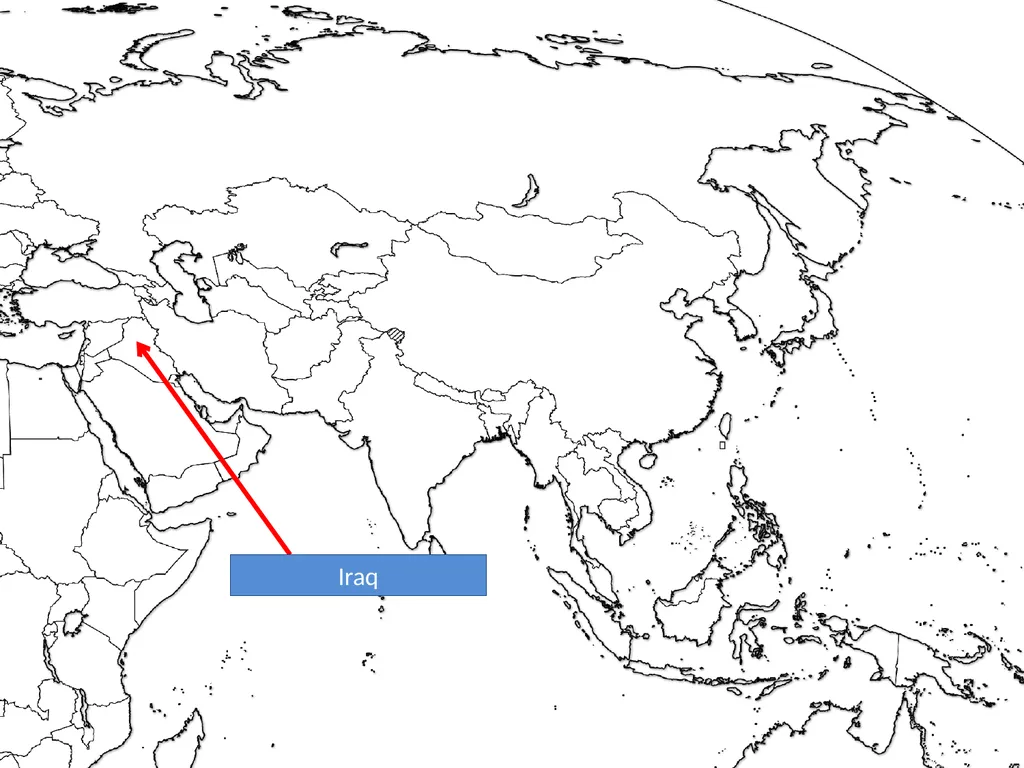
slide132. Iraq<br>
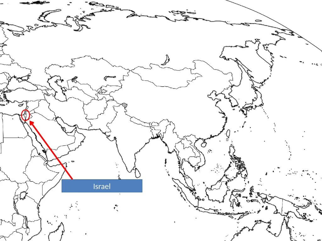
slide133. Israel<br>
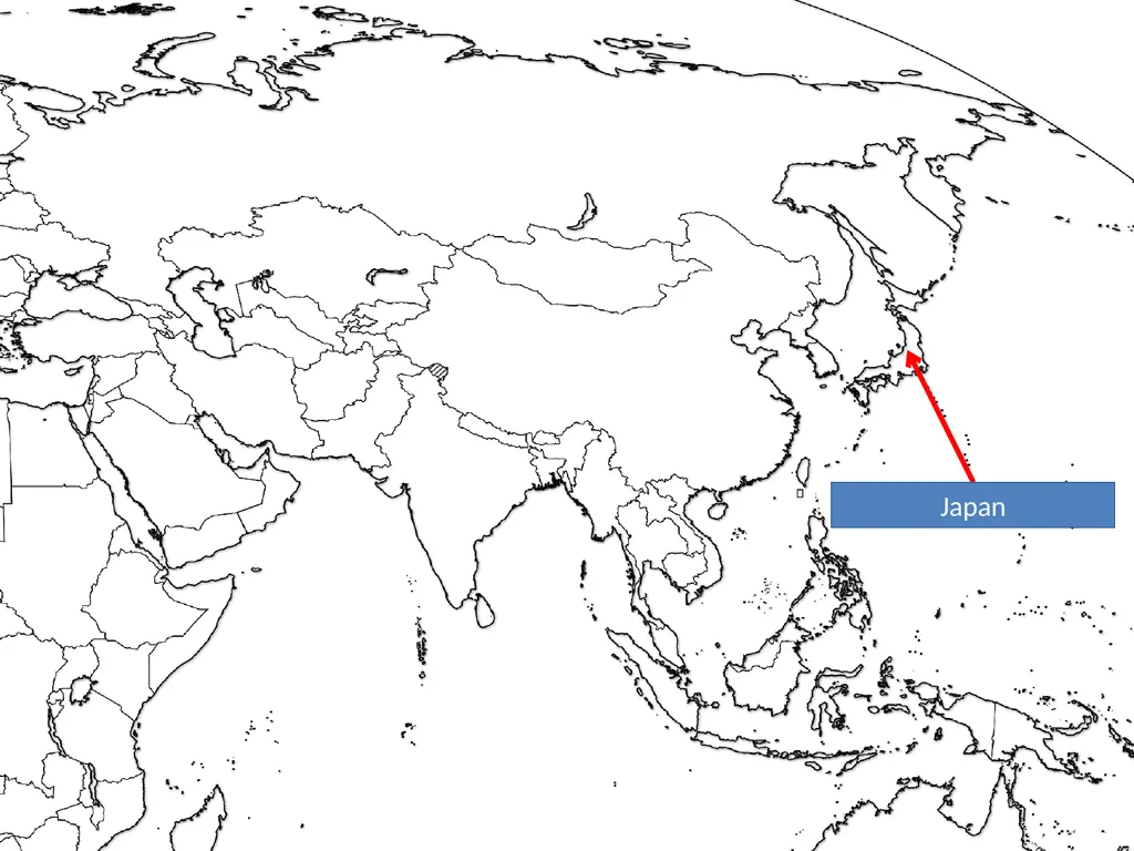
slide134. Japan<br>
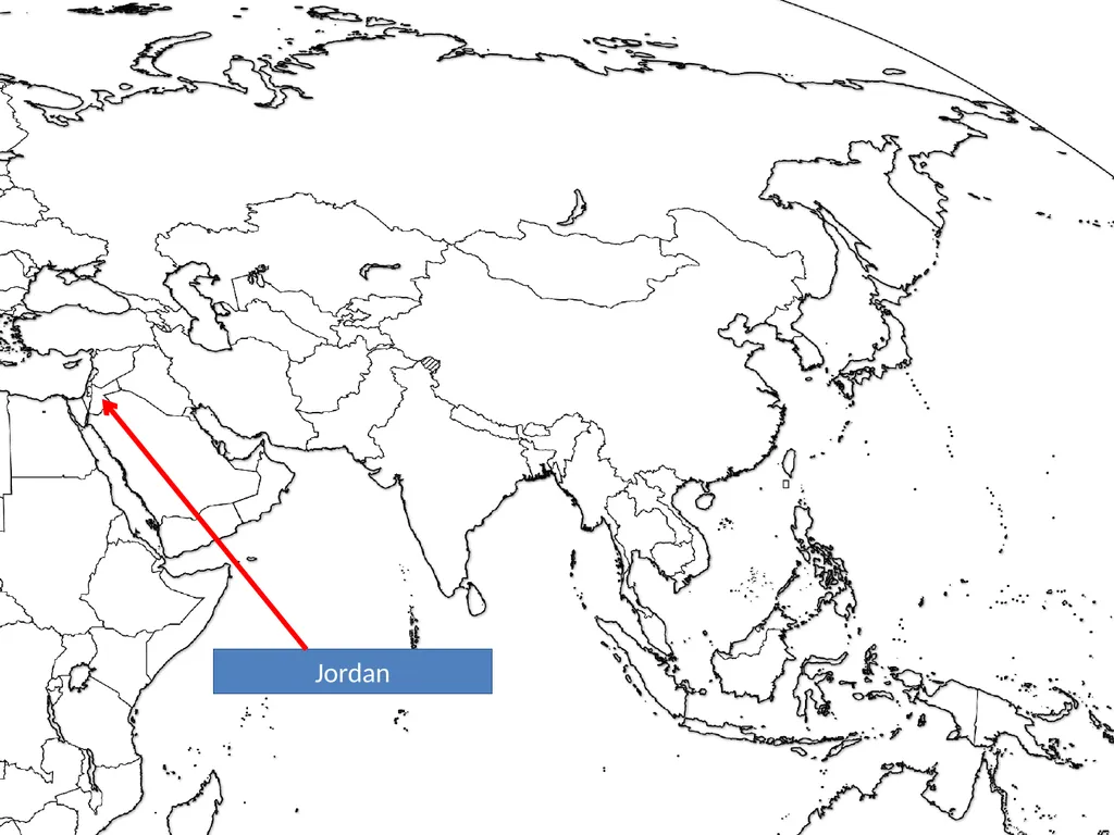
slide135. Jordan<br>
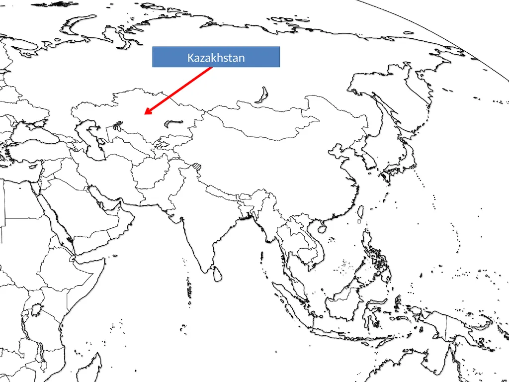
slide136. Kazakhstan<br>
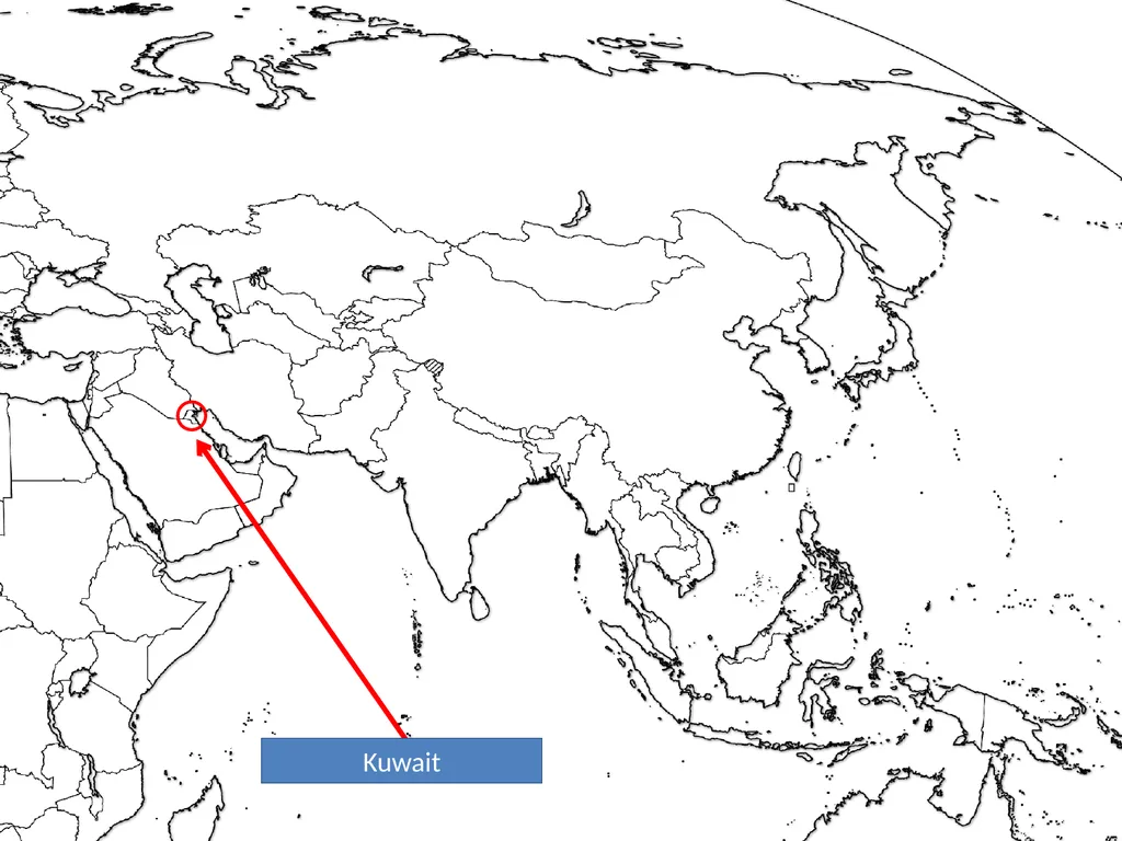
slide137. Kuwait<br>
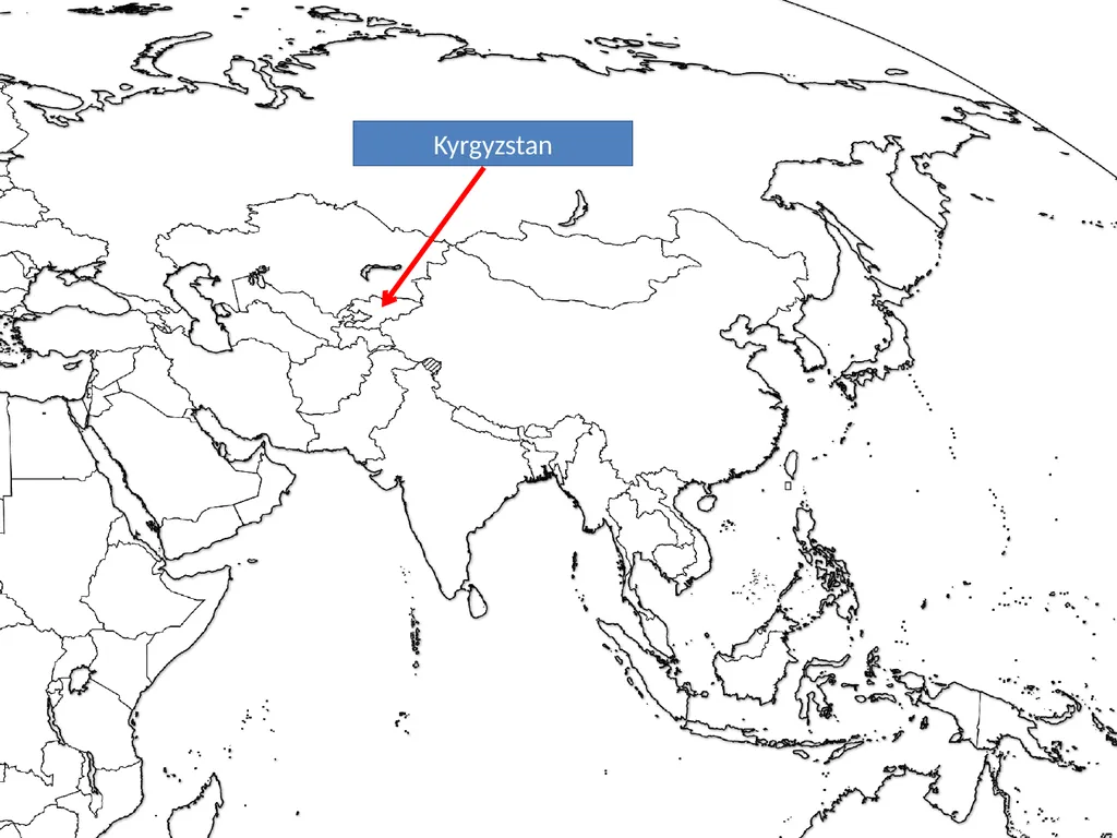
slide138. Kyrgyzstan<br>
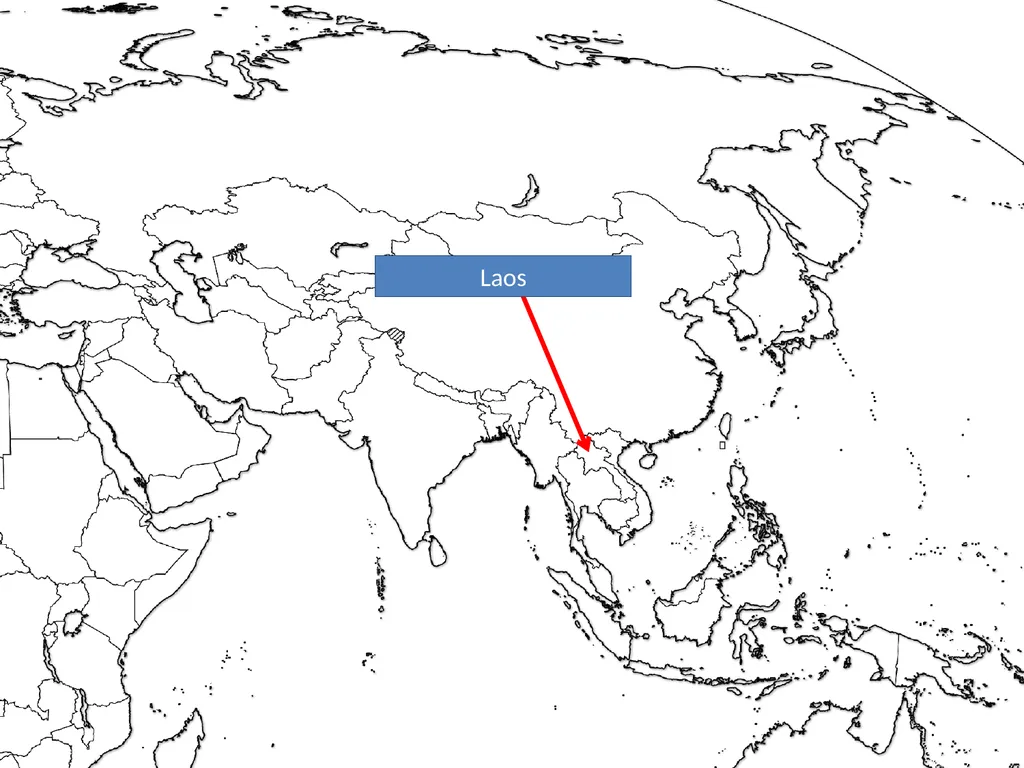
slide139. Laos<br>
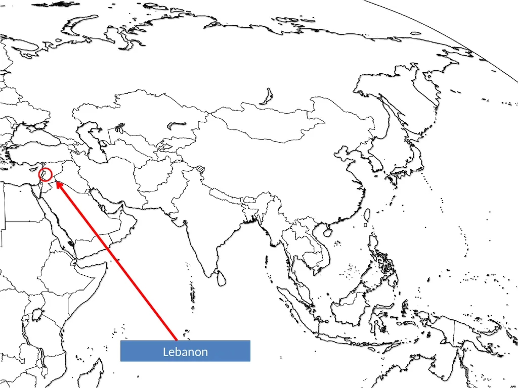
slide140. Lebanon<br>
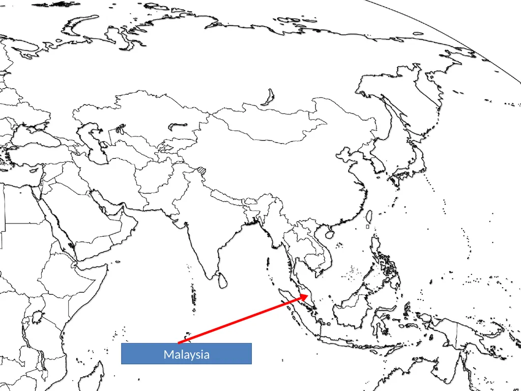
slide141. Malaysia<br>
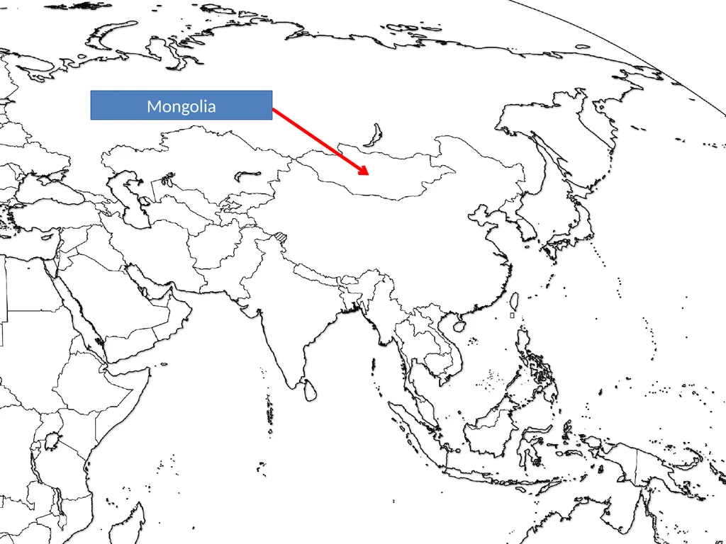
slide142. Mongolia<br>
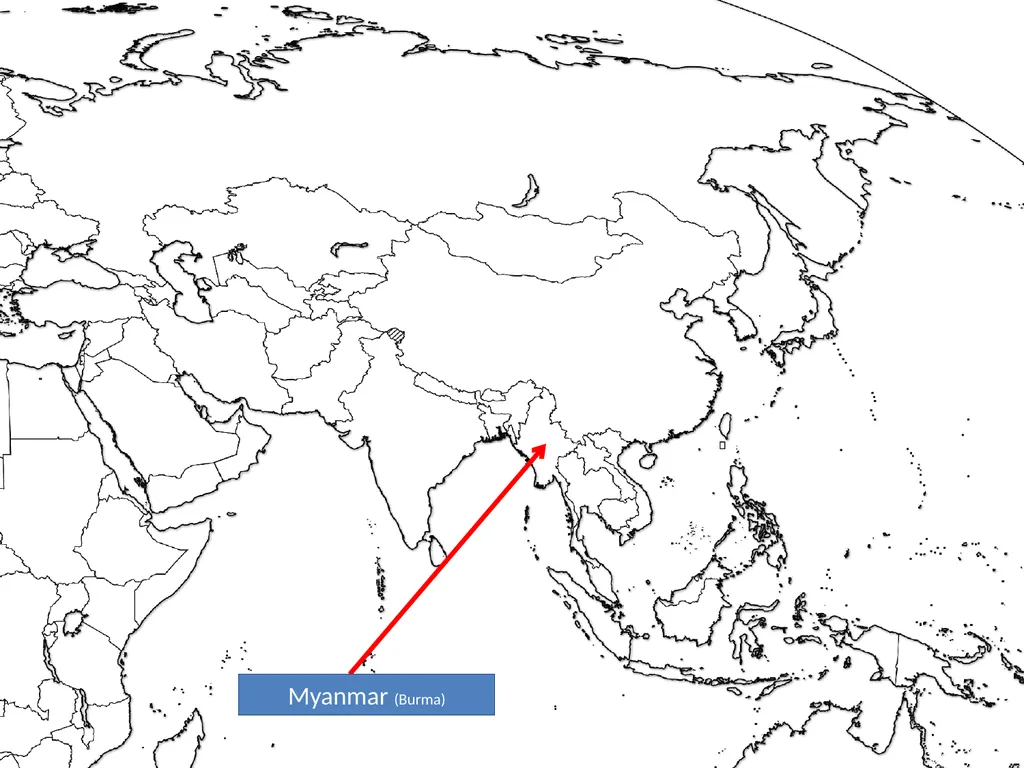
slide143. Myanmar (Burma)<br>
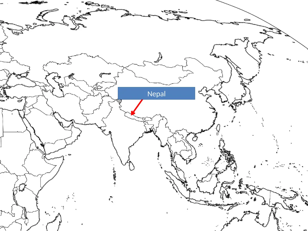
slide144. Nepal<br>
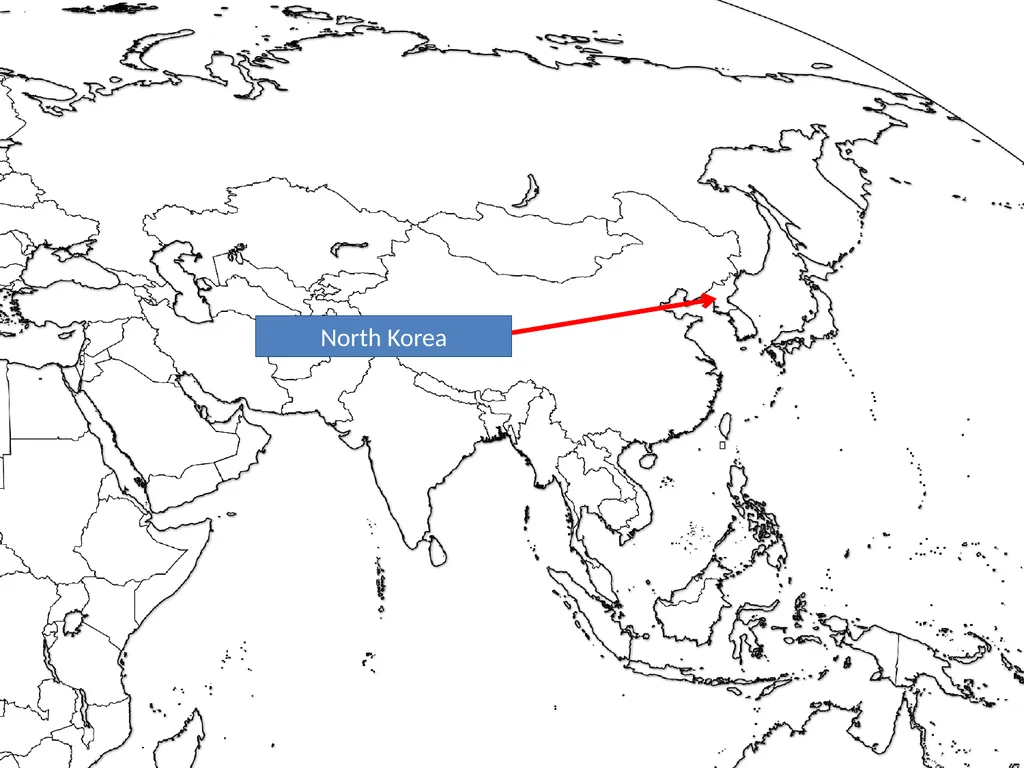
slide145. North Korea<br>
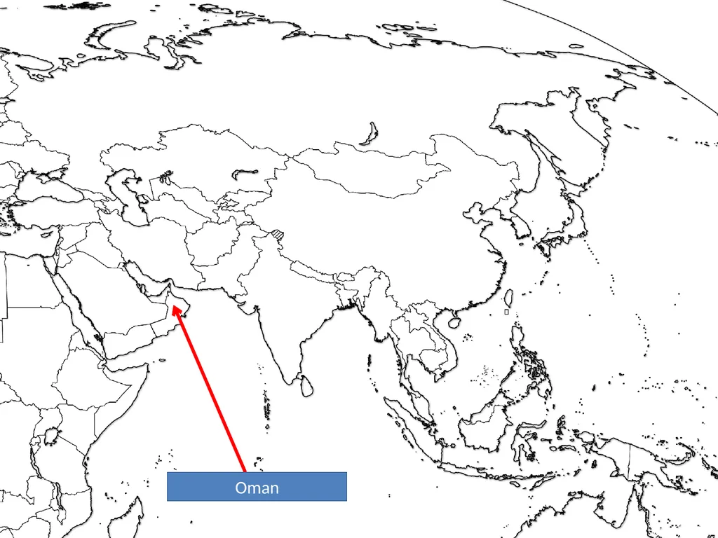
slide146. Oman<br>
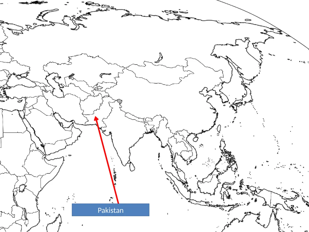
slide147. Pakistan<br>
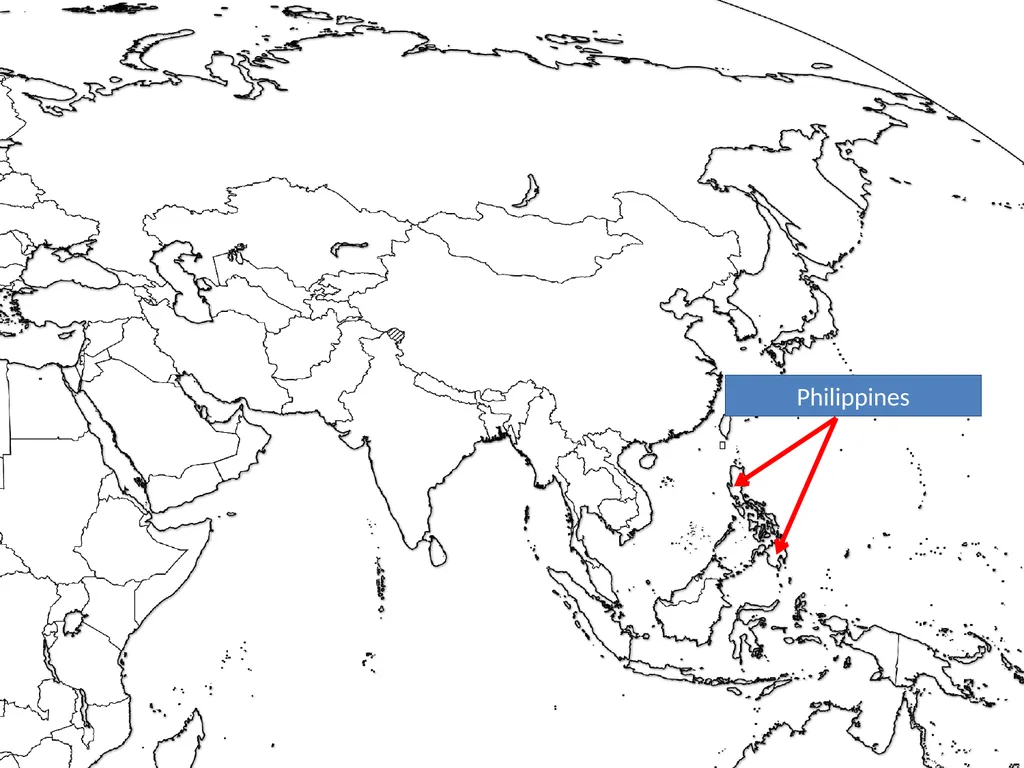
slide148. Philippines<br>
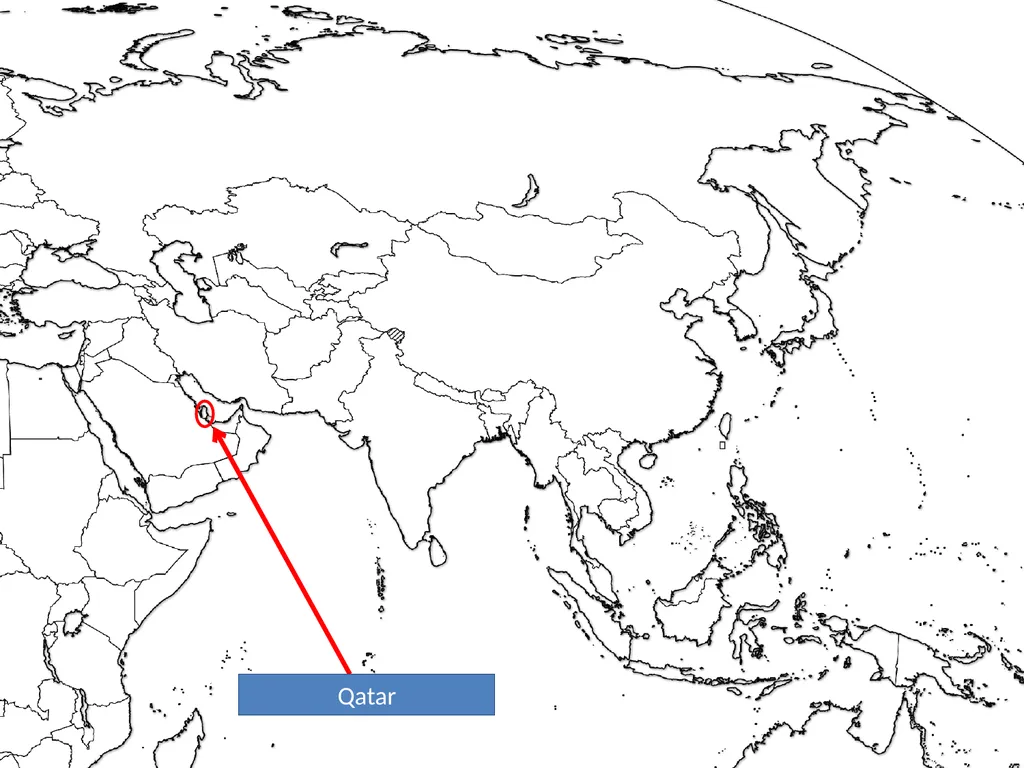
slide149. Qatar<br>
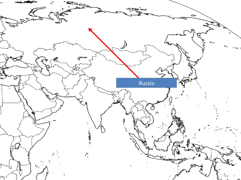
slide150. Russia<br>
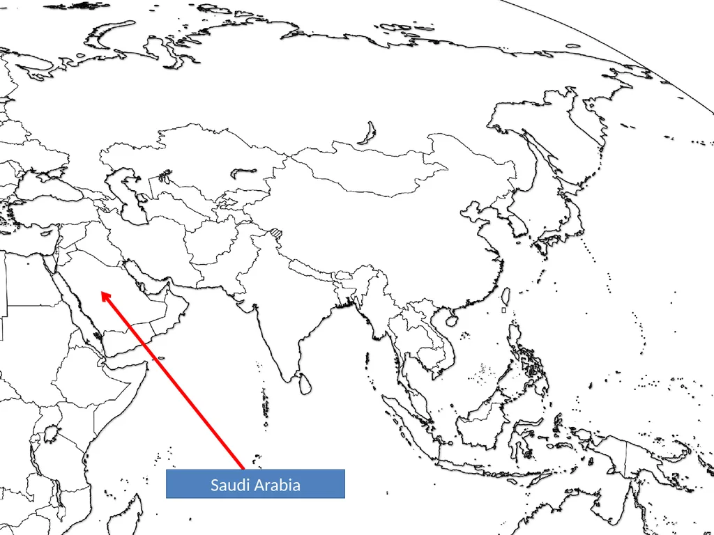
slide151. Saudi Arabia<br>
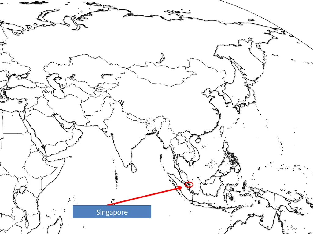
slide152. Singapore<br>
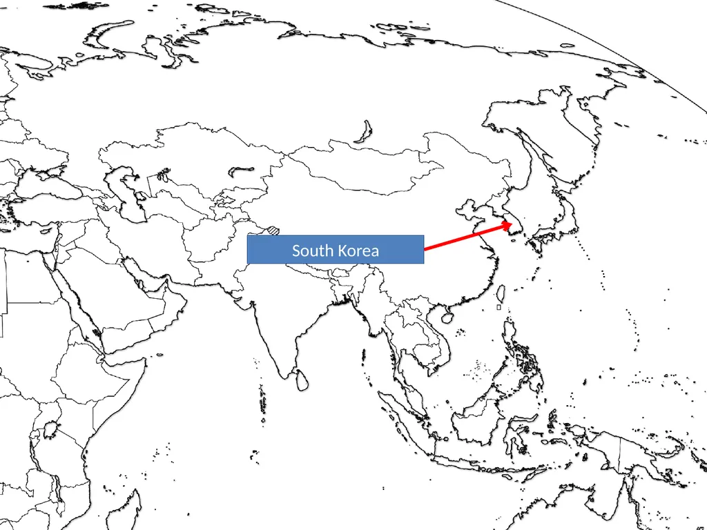
slide153. South Korea<br>
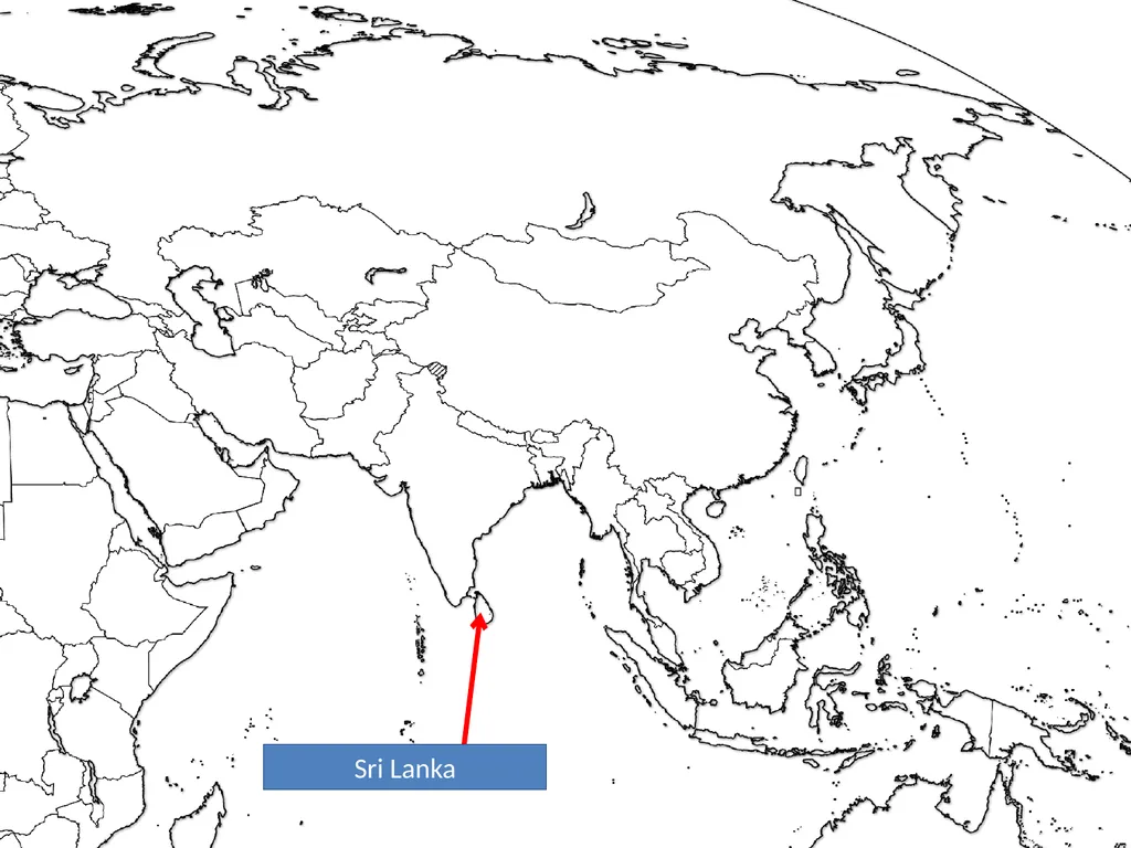
slide154. Sri Lanka<br>
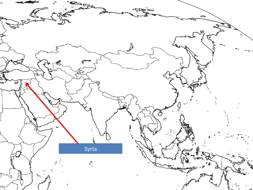
slide155. Syria<br>
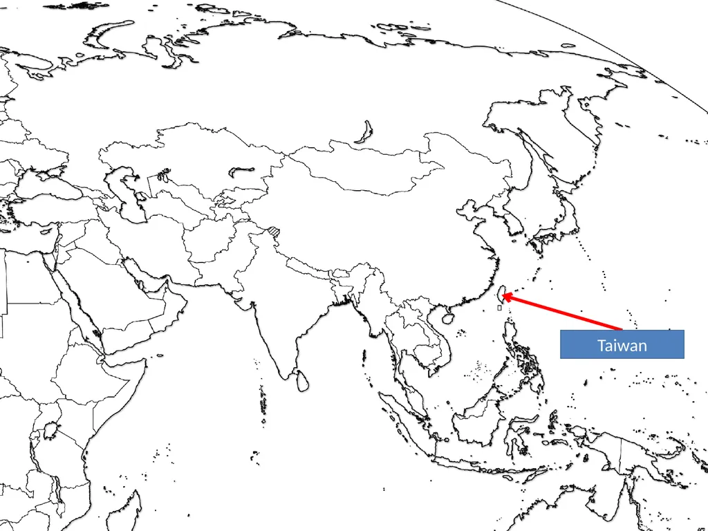
slide156. Taiwan<br>
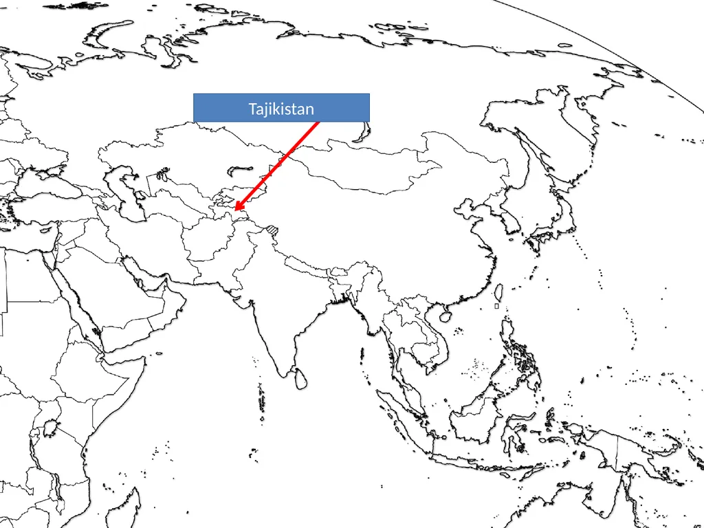
slide157. Tajikistan<br>
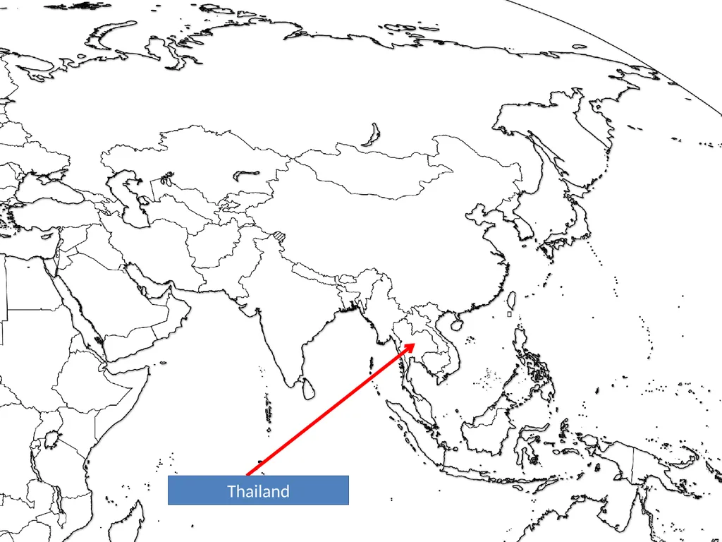
slide158. Thailand<br>
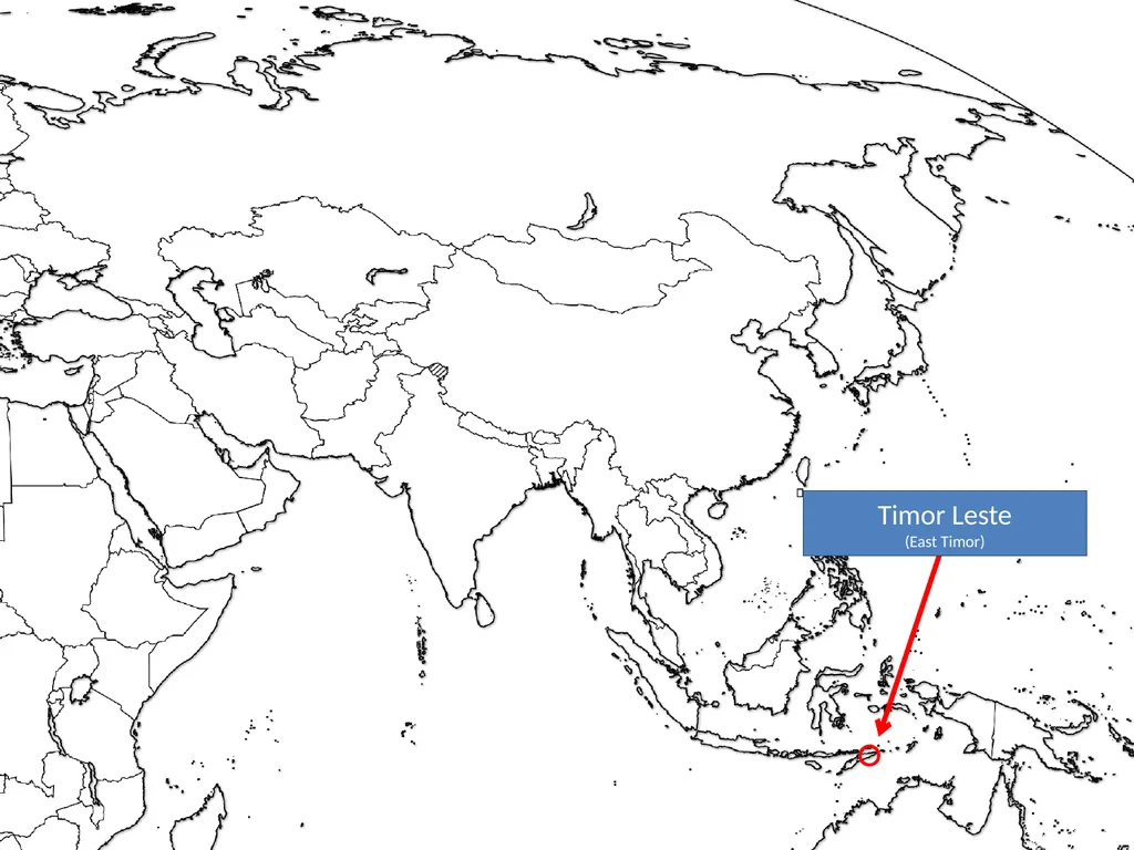
slide159. Timor Leste
(East Timor)<br>
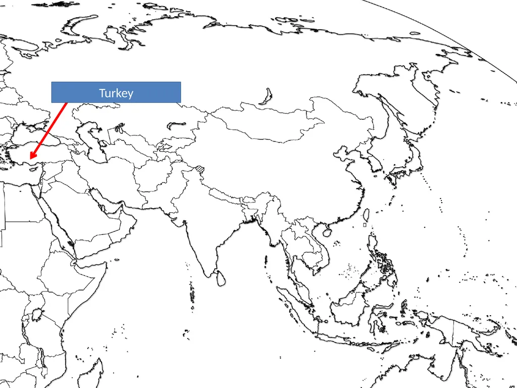
slide160. Turkey<br>
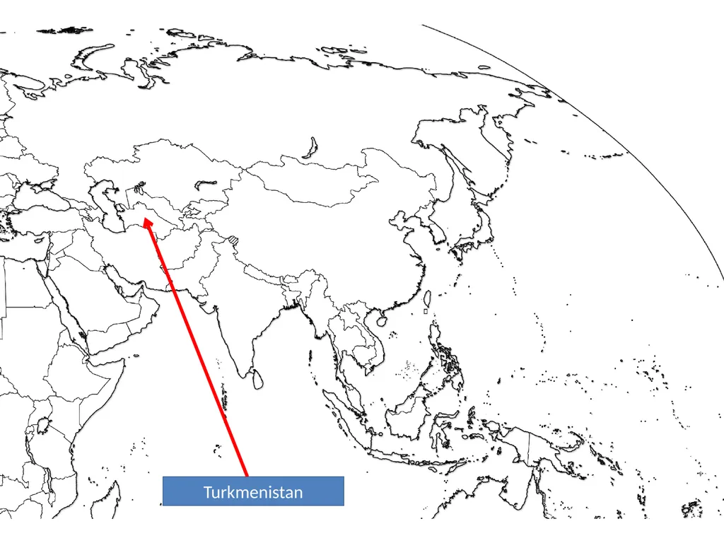
slide161. Turkmenistan<br>
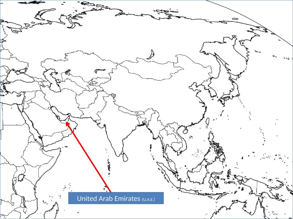
slide162. United Arab Emirates (U.A.E.)<br>
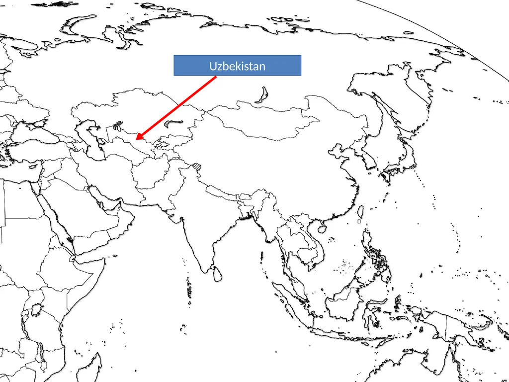
slide163. Uzbekistan<br>
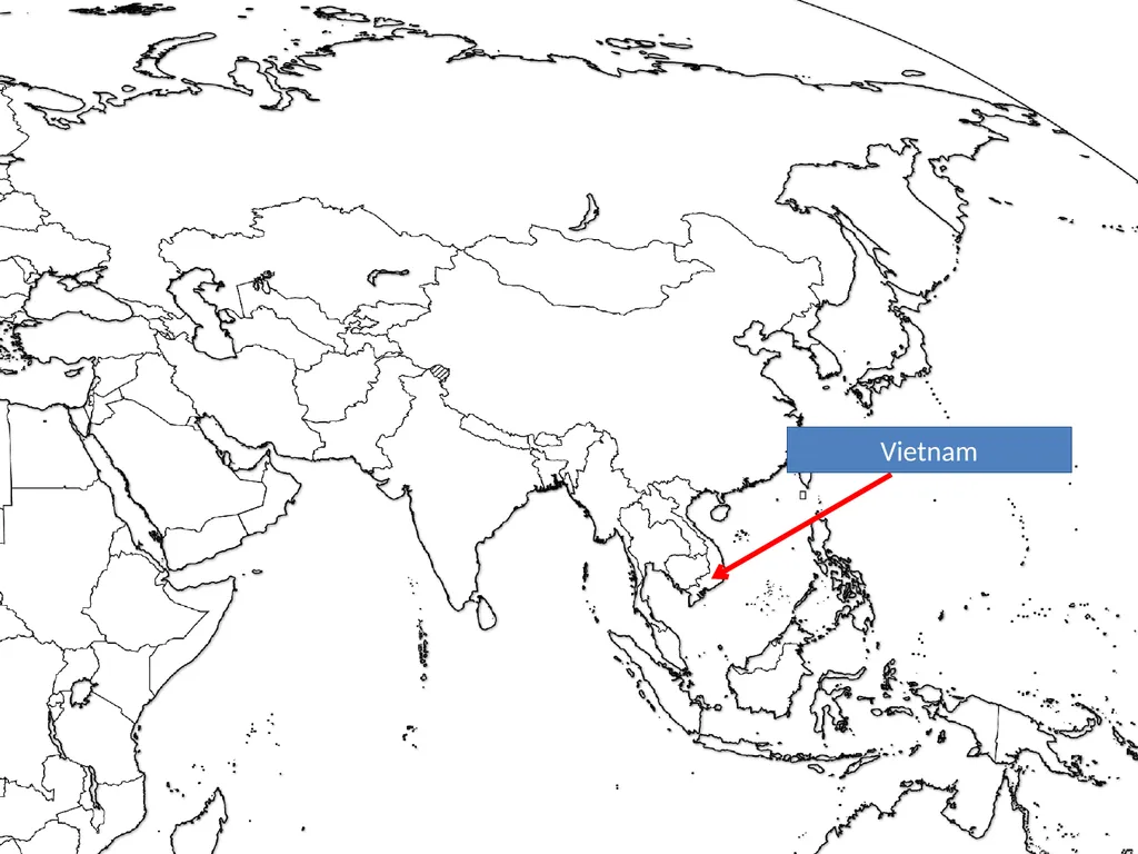
slide164. Vietnam<br>
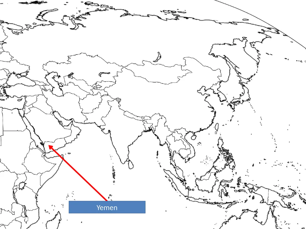
slide165. Yemen<br>
slide166. AUSTRALIA & OCEANIA<br>
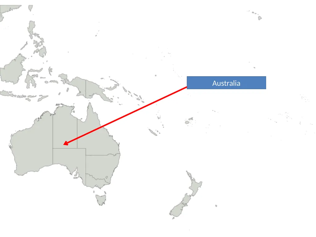
slide167. Australia<br>
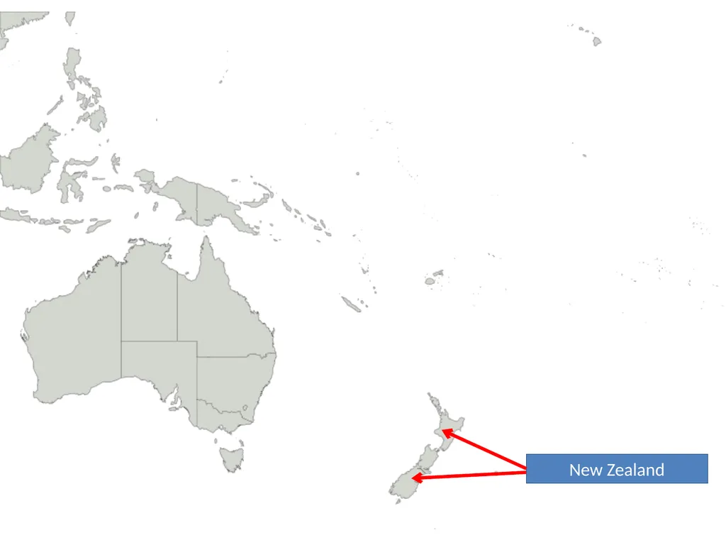
slide168. New Zealand<br>
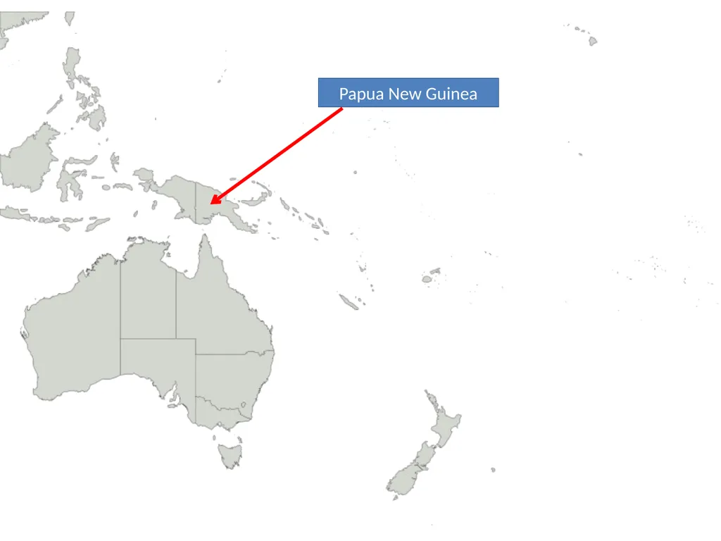
slide169. Papua New Guinea<br>
slide170. Test Yourself http://www.sporcle.com/
http://www.purposegames.com/
http://www.lizardpoint.com/fun/geoquiz/
http://www.travelpod.com/traveler-iq
http://www.ilike2learn.com/ilike2learn/geography.asp
http://www.maps.com/funfacts.aspx
http://www.sheppardsoftware.com/Geography.htm
http://www.funbrain.com/where/
http://www.jetpunk.com/quizzes/map-quiz-europe.php
http://www.yourchildlearns.com/map-puzzles.htm
http://sites.google.com/site/geogeomania/geographygames
Tap Quiz Apps (for your smart phone)
or print one of these regional maps and try to label it - Under “geography”
- Search for “parisaday”<br>
slide171. Global & Local Regions or Areas of Interest<br>
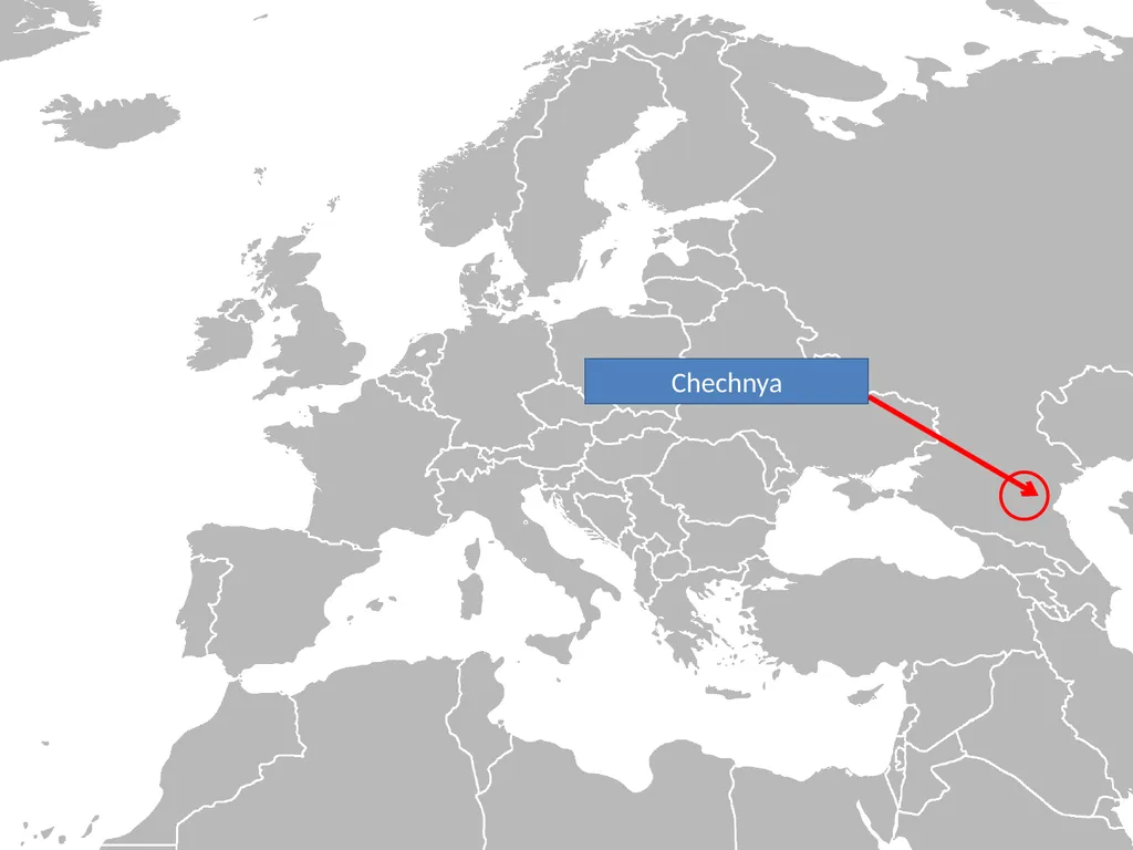
slide172. Chechnya<br>
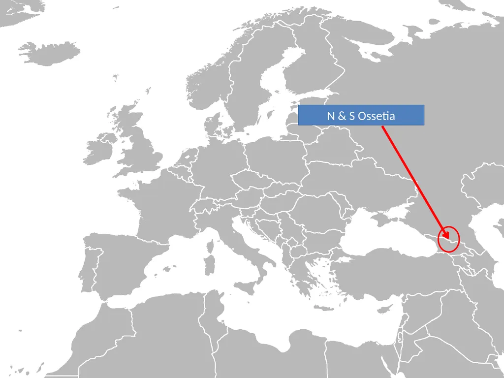
slide173. N & S Ossetia<br>
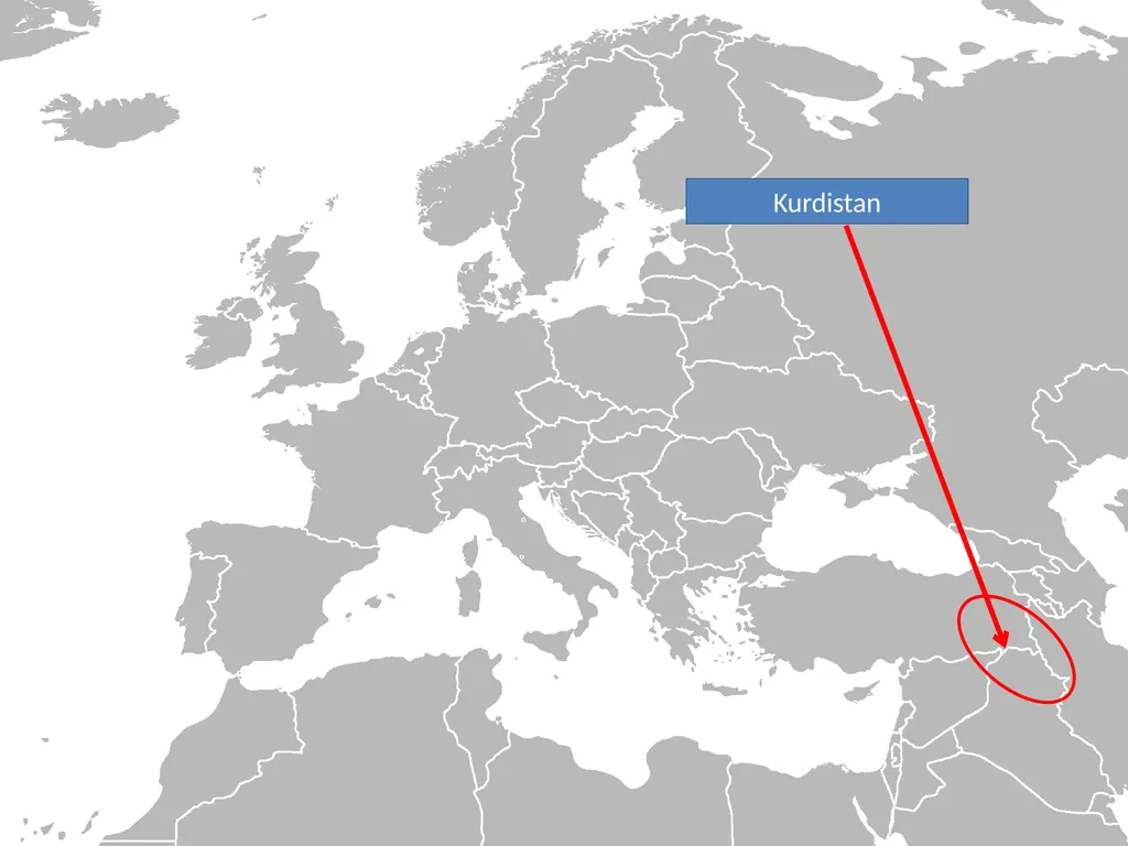
slide174. Kurdistan<br>
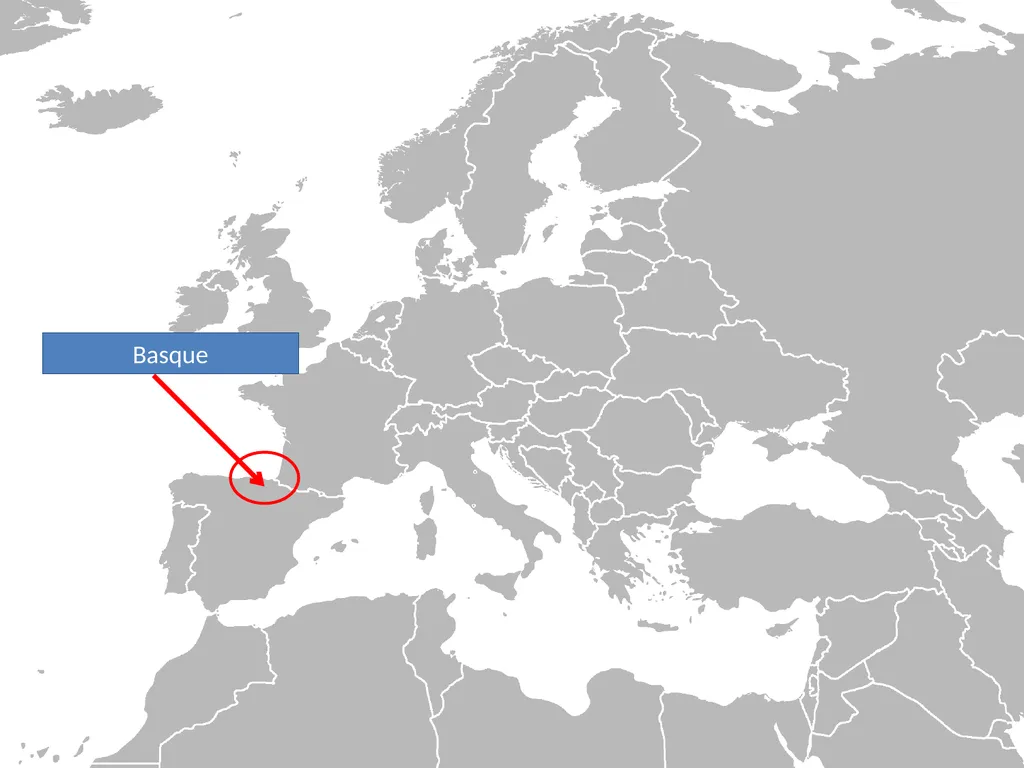
slide175. Basque<br>
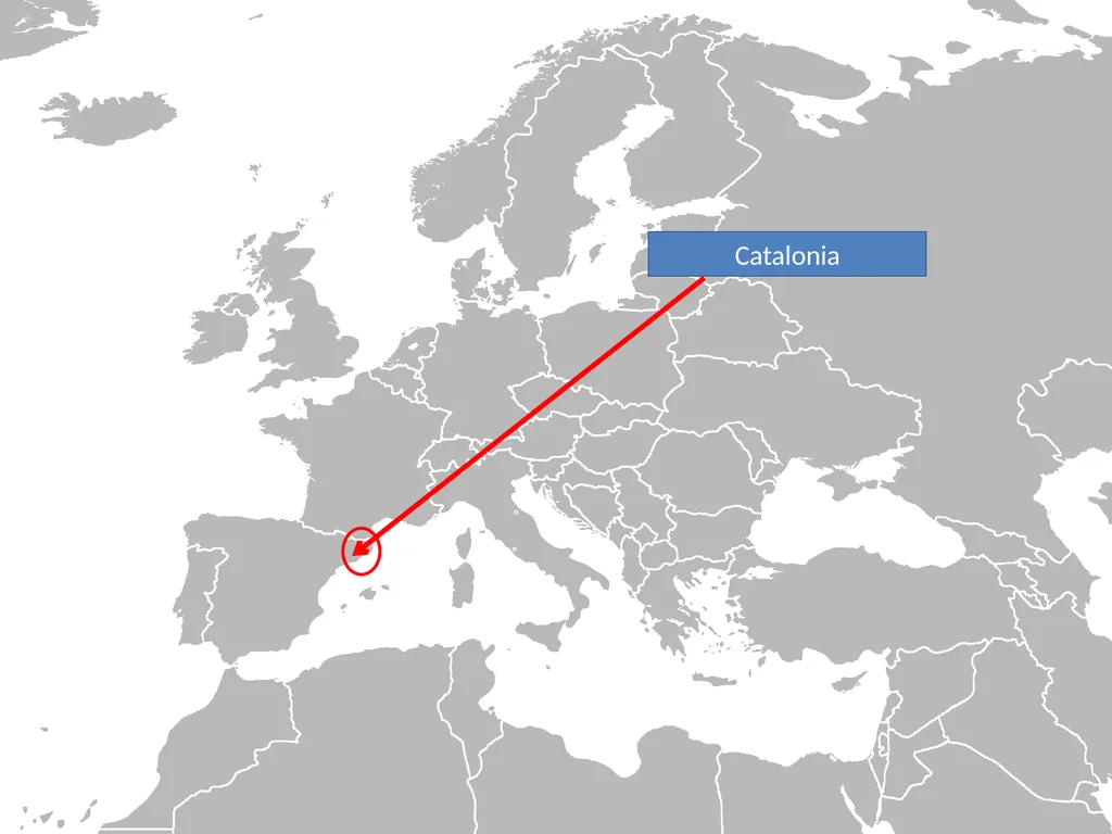
slide176. Catalonia<br>
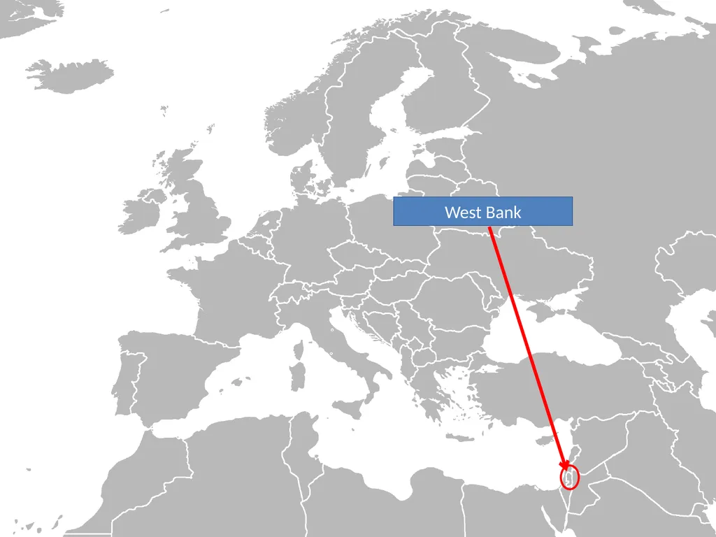
slide177. West Bank<br>
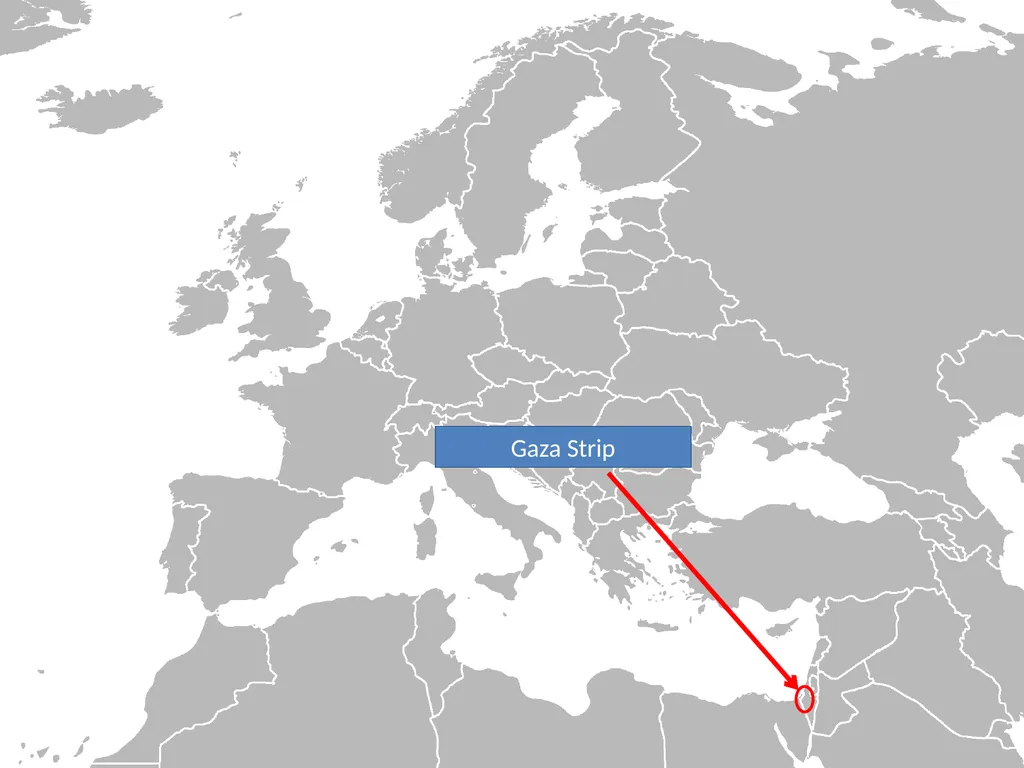
slide178. Gaza Strip<br>
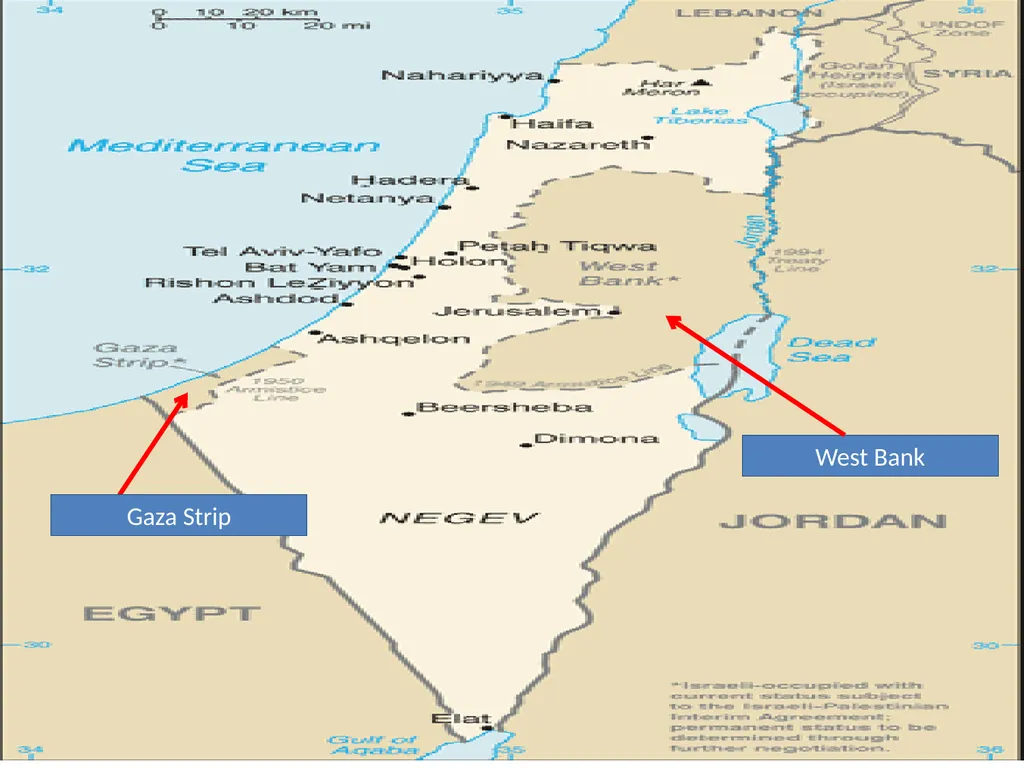
slide179. West Bank Gaza Strip<br>
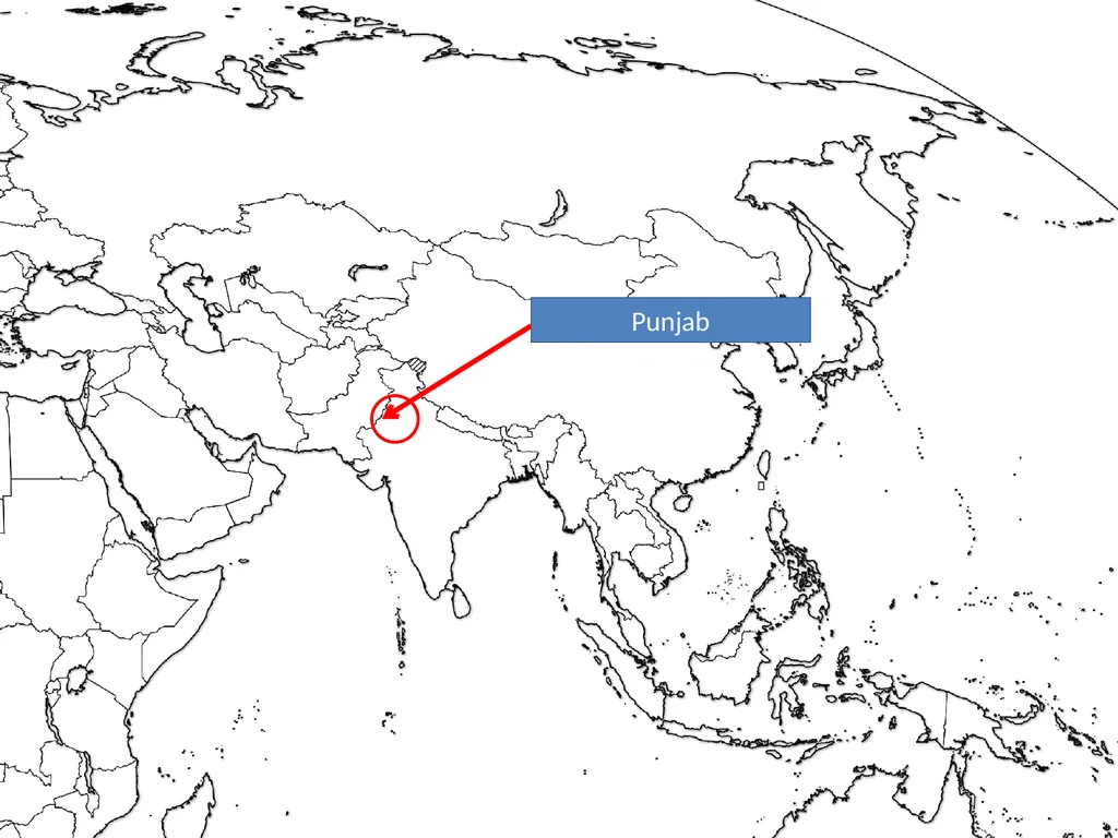
slide180. Punjab<br>
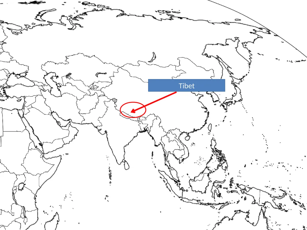
slide181. Tibet<br>
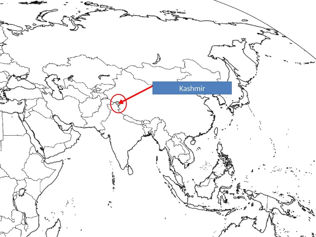
slide182. Kashmir<br>
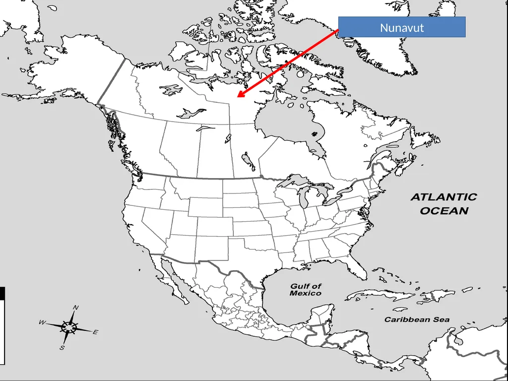
slide183. Nunavut<br>
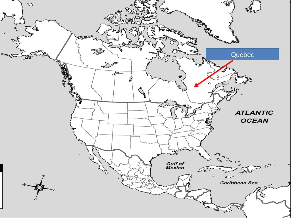
slide184. Quebec<br>
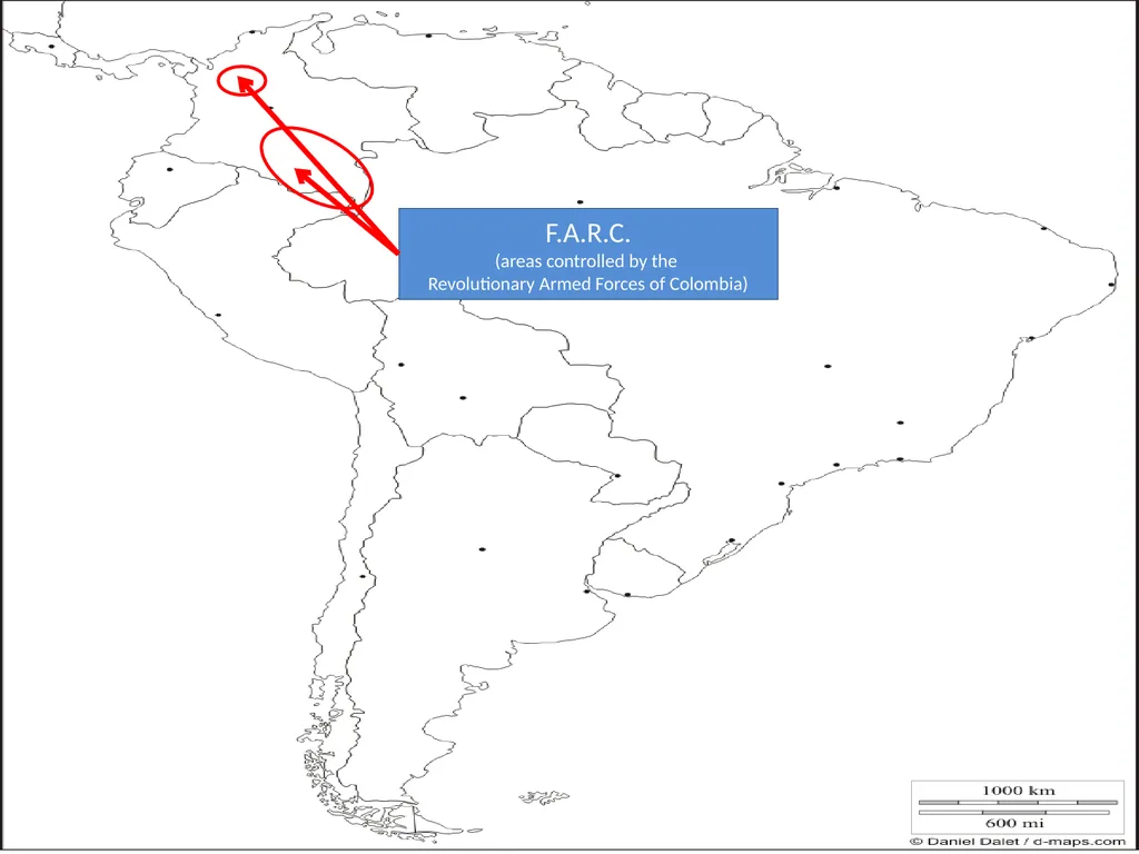
slide185. F.A.R.C.
(areas controlled by the
Revolutionary Armed Forces of Colombia)<br>
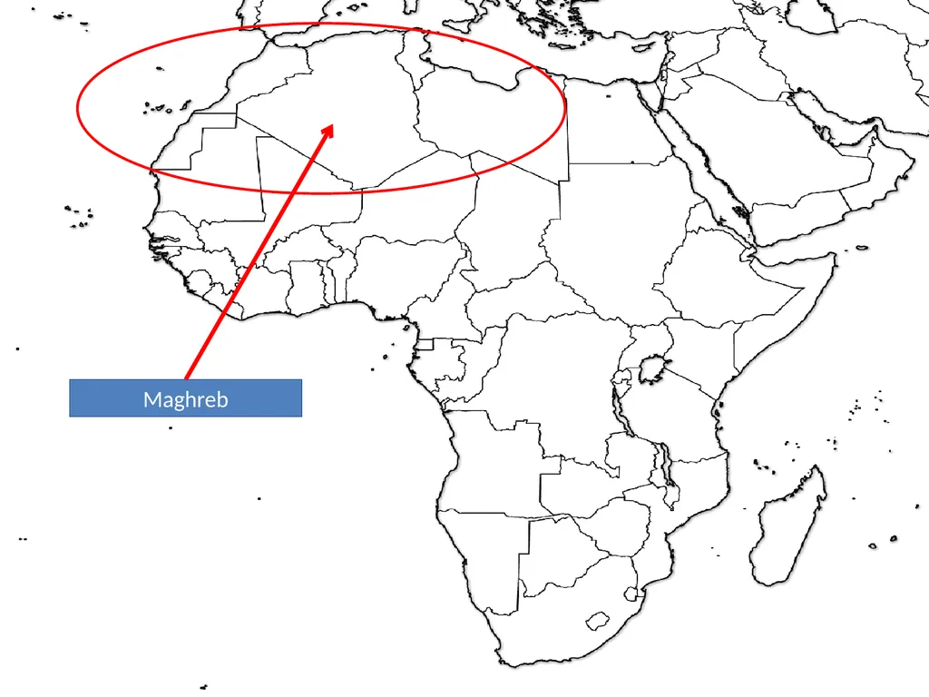
slide186. Maghreb<br>
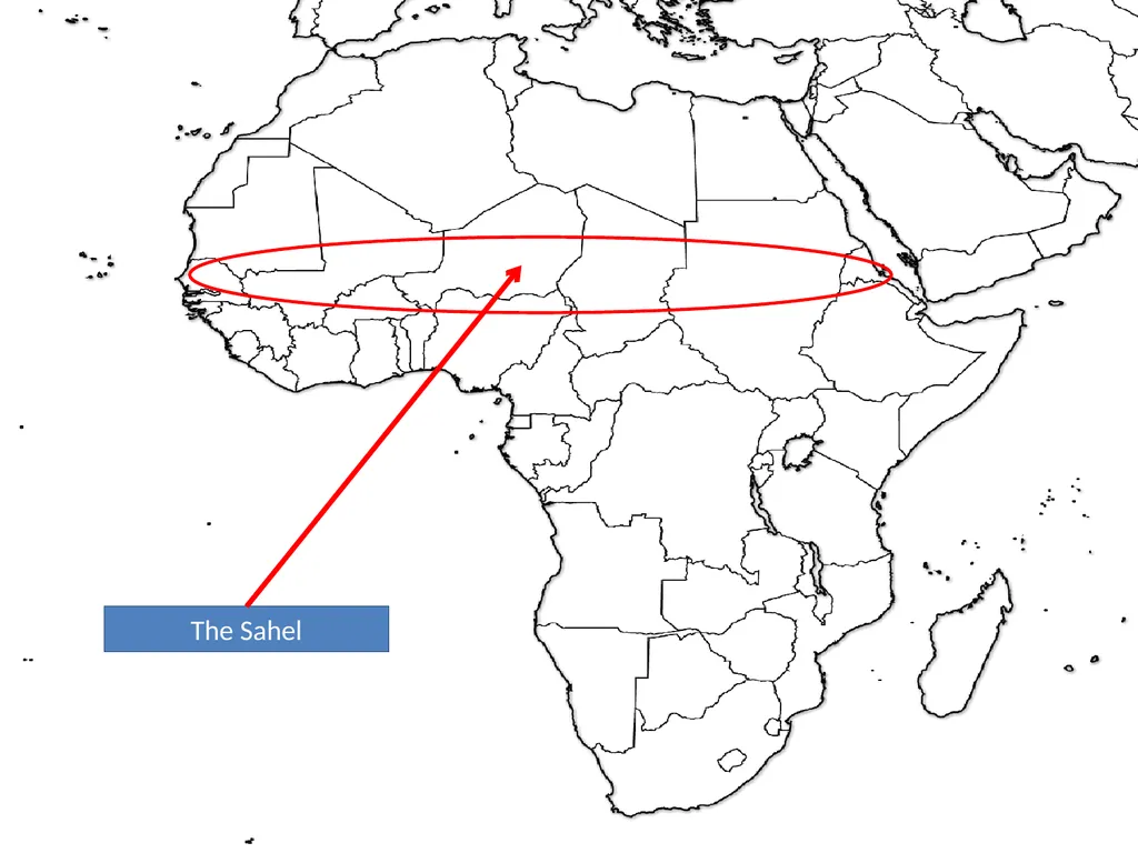
slide187. The Sahel<br>
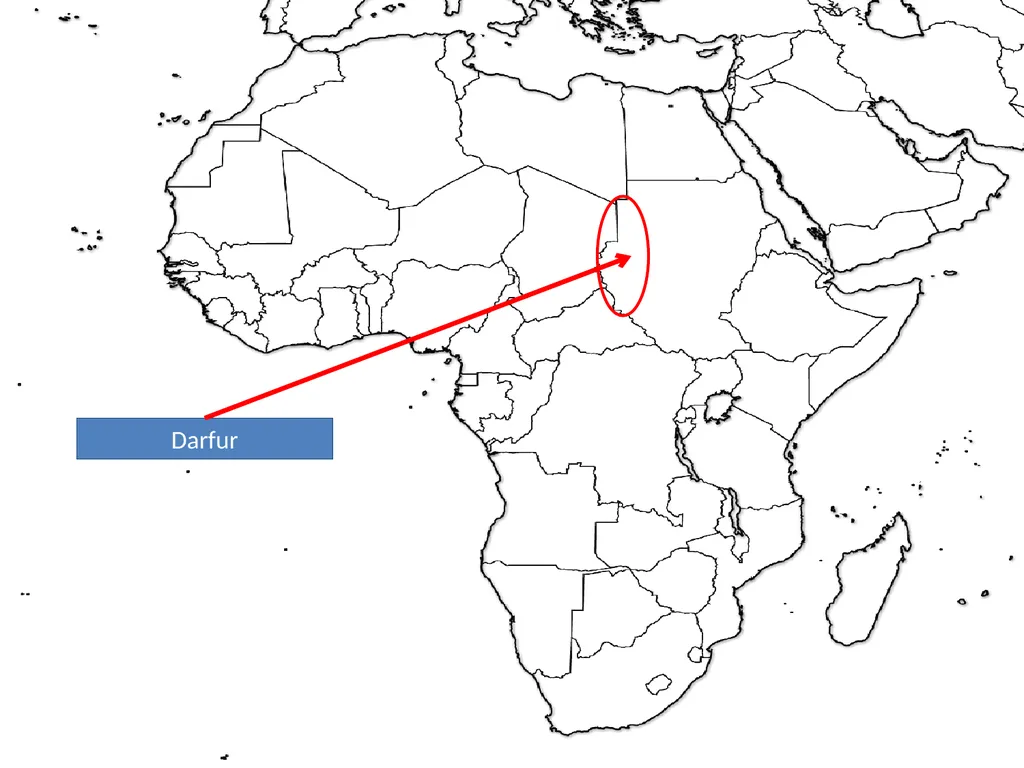
slide188. Darfur<br>
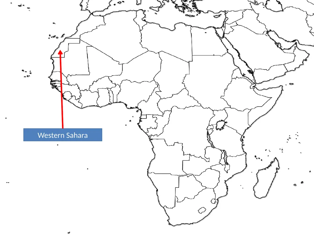
slide189. Western Sahara<br>
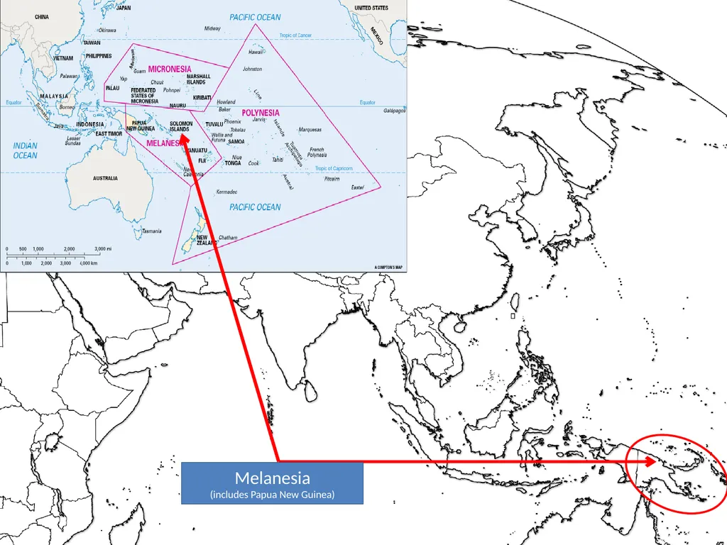
slide190. Melanesia
(includes Papua New Guinea)<br>
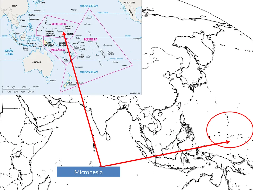
slide191. Micronesia<br>
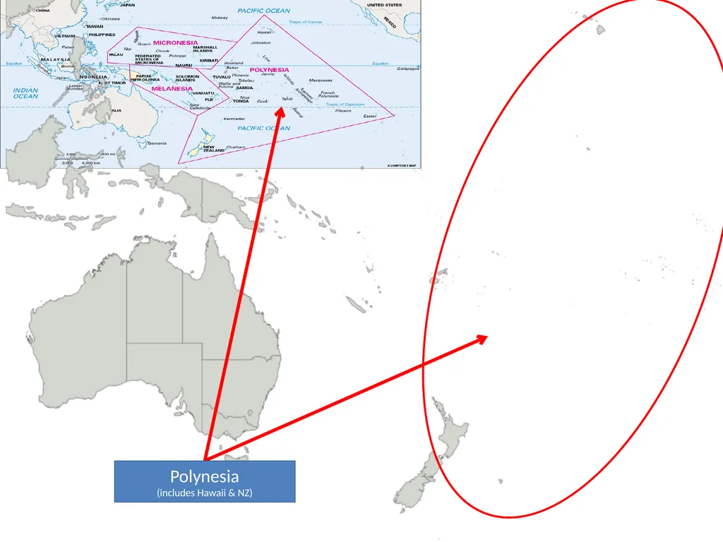
slide192. Polynesia
(includes Hawaii & NZ)<br>
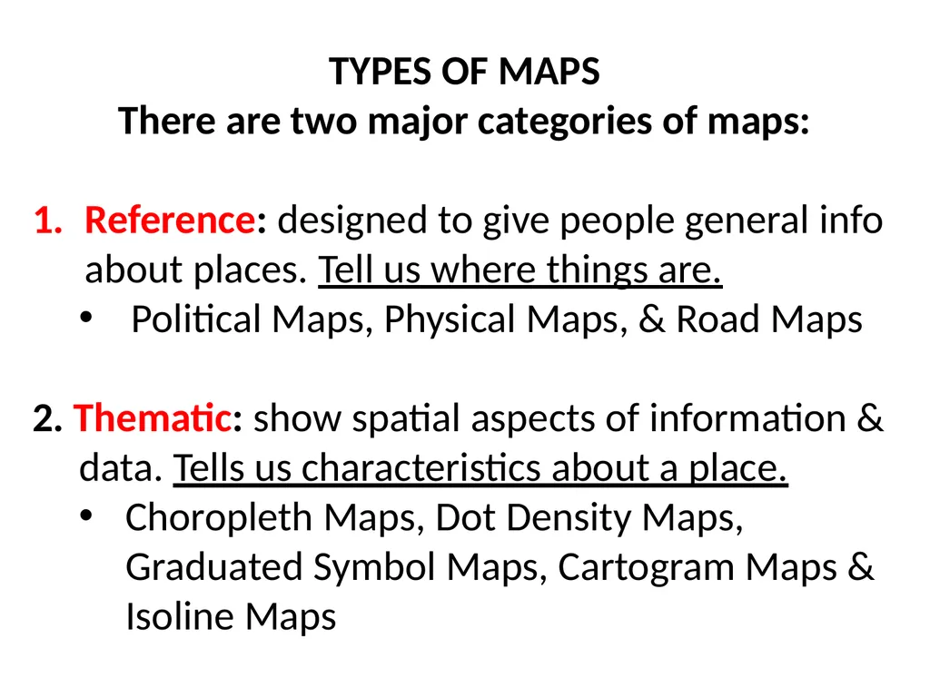
slide193. TYPES OF MAPS
There are two major categories of maps:
Reference: designed to give people general info about places. Tell us where things are.
Political Maps, Physical Maps, & Road Maps
2. Thematic: show spatial aspects of information &
data. Tells us characteristics about a place.
Choropleth Maps, Dot Density Maps,
Graduated Symbol Maps, Cartogram Maps &
Isoline Maps<br>
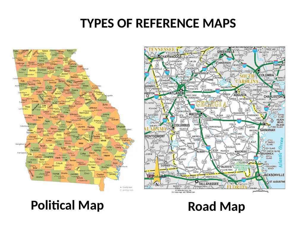
slide194. TYPES OF REFERENCE MAPS Political Map Road Map<br>
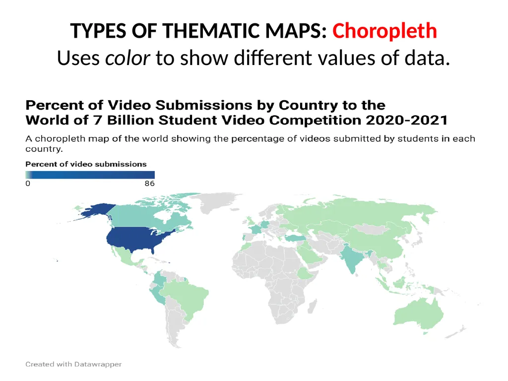
slide195. TYPES OF THEMATIC MAPS: Choropleth
Uses color to show different values of data.<br>
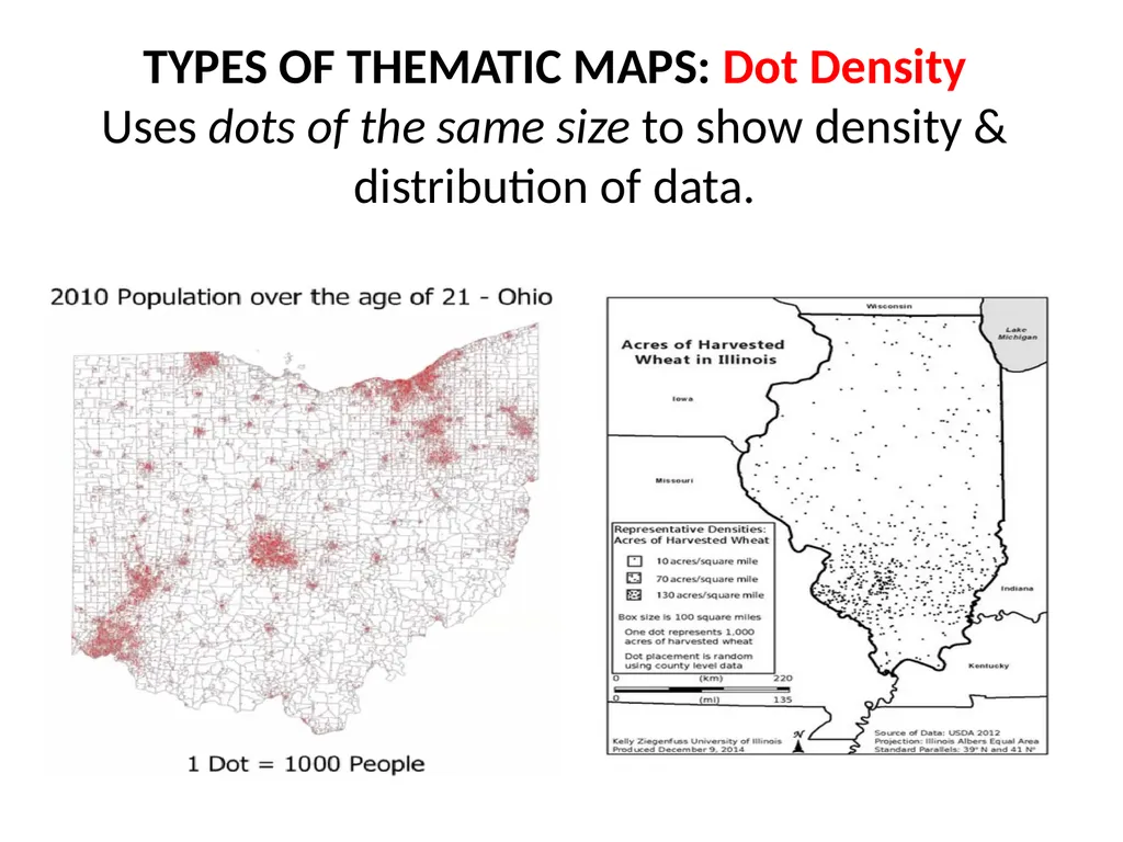
slide196. TYPES OF THEMATIC MAPS: Dot Density
Uses dots of the same size to show density & distribution of data.<br>
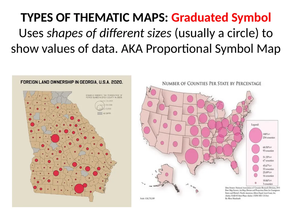
slide197. TYPES OF THEMATIC MAPS: Graduated Symbol
Uses shapes of different sizes (usually a circle) to show values of data. AKA Proportional Symbol Map<br>
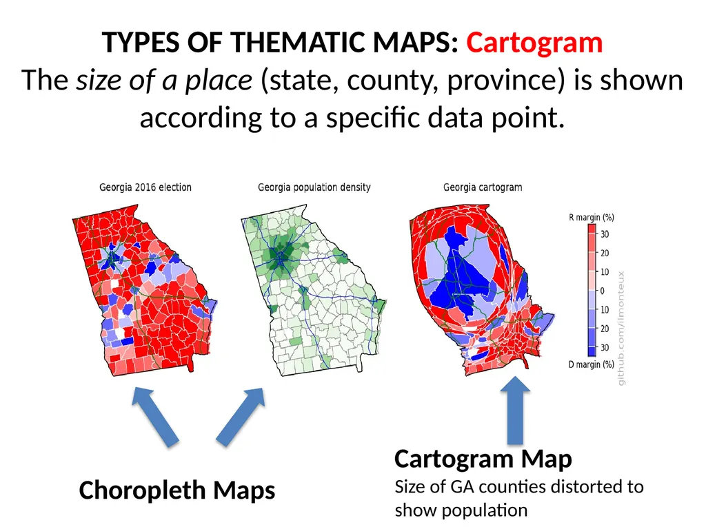
slide198. TYPES OF THEMATIC MAPS: Cartogram
The size of a place (state, county, province) is shown according to a specific data point.<br>
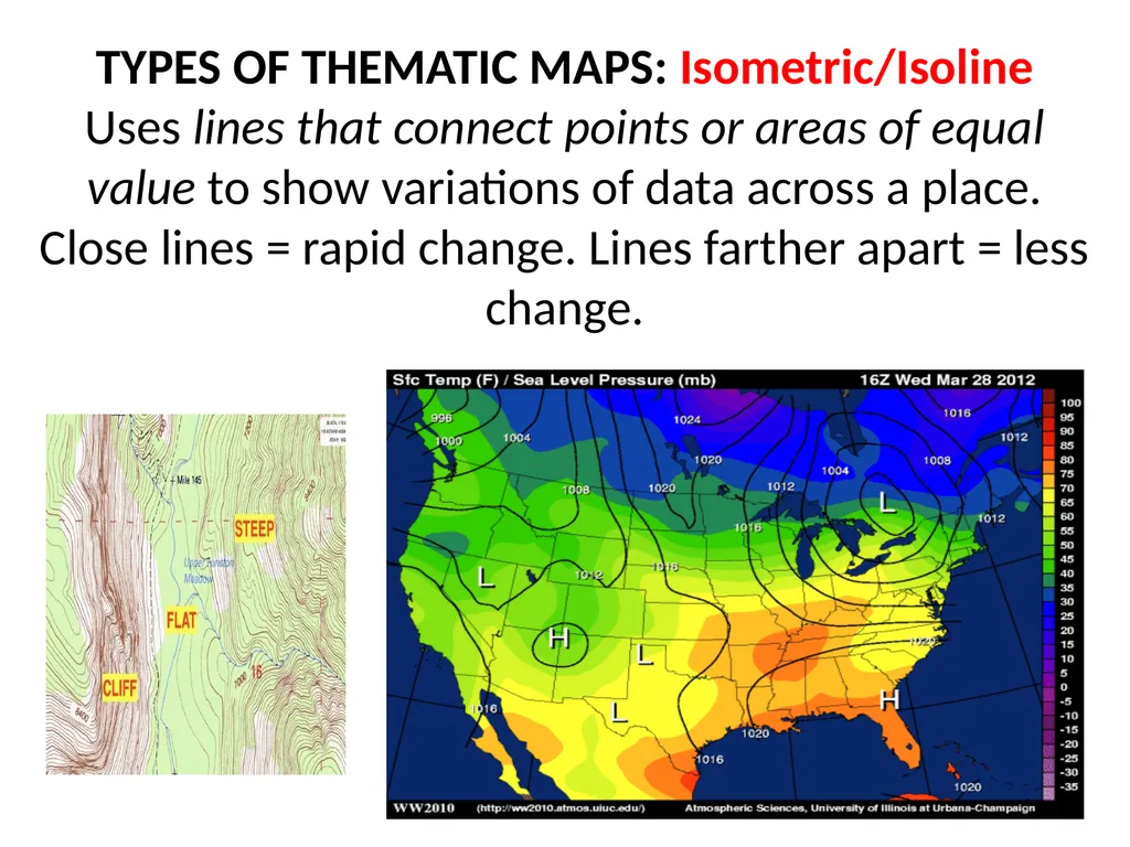
slide199. TYPES OF THEMATIC MAPS: Isometric/Isoline
Uses lines that connect points or areas of equal value to show variations of data across a place. Close lines = rapid change. Lines farther apart = less change.<br>
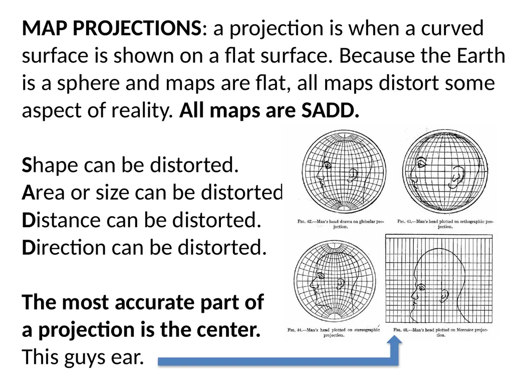
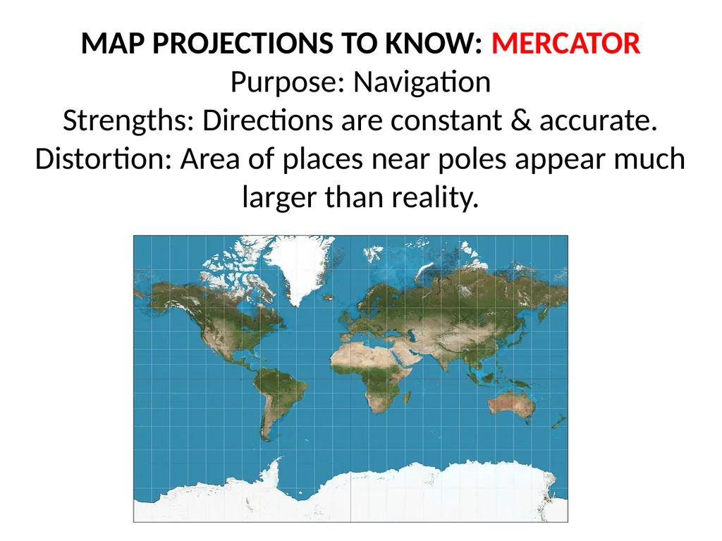
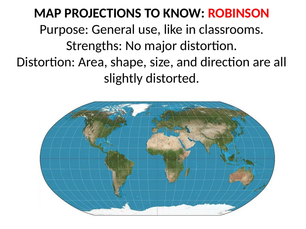
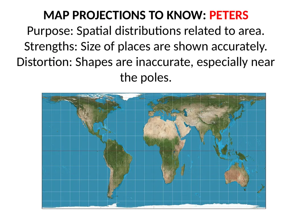
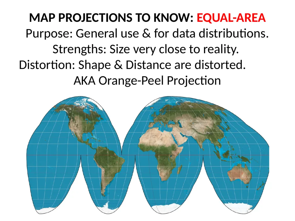
slide200. MAP PROJECTIONS: a projection is when a curved surface is shown on a flat surface. Because the Earth is a sphere and maps are flat, all maps distort some aspect of reality. All maps are SADD.
Shape can be distorted.
Area or size can be distorted.
Distance can be distorted.
Direction can be distorted.
The most accurate part of
a projection is the center.
This guys ear.<br>
slide201. MAP PROJECTIONS TO KNOW: MERCATOR
Purpose: Navigation
Strengths: Directions are constant & accurate.
Distortion: Area of places near poles appear much larger than reality.<br>
slide202. MAP PROJECTIONS TO KNOW: ROBINSON
Purpose: General use, like in classrooms.
Strengths: No major distortion.
Distortion: Area, shape, size, and direction are all slightly distorted.<br>
slide203. MAP PROJECTIONS TO KNOW: PETERS
Purpose: Spatial distributions related to area.
Strengths: Size of places are shown accurately.
Distortion: Shapes are inaccurate, especially near the poles.<br>
slide204. MAP PROJECTIONS TO KNOW: EQUAL-AREA
Purpose: General use & for data distributions.
Strengths: Size very close to reality.
Distortion: Shape & Distance are distorted. AKA Orange-Peel Projection<br>
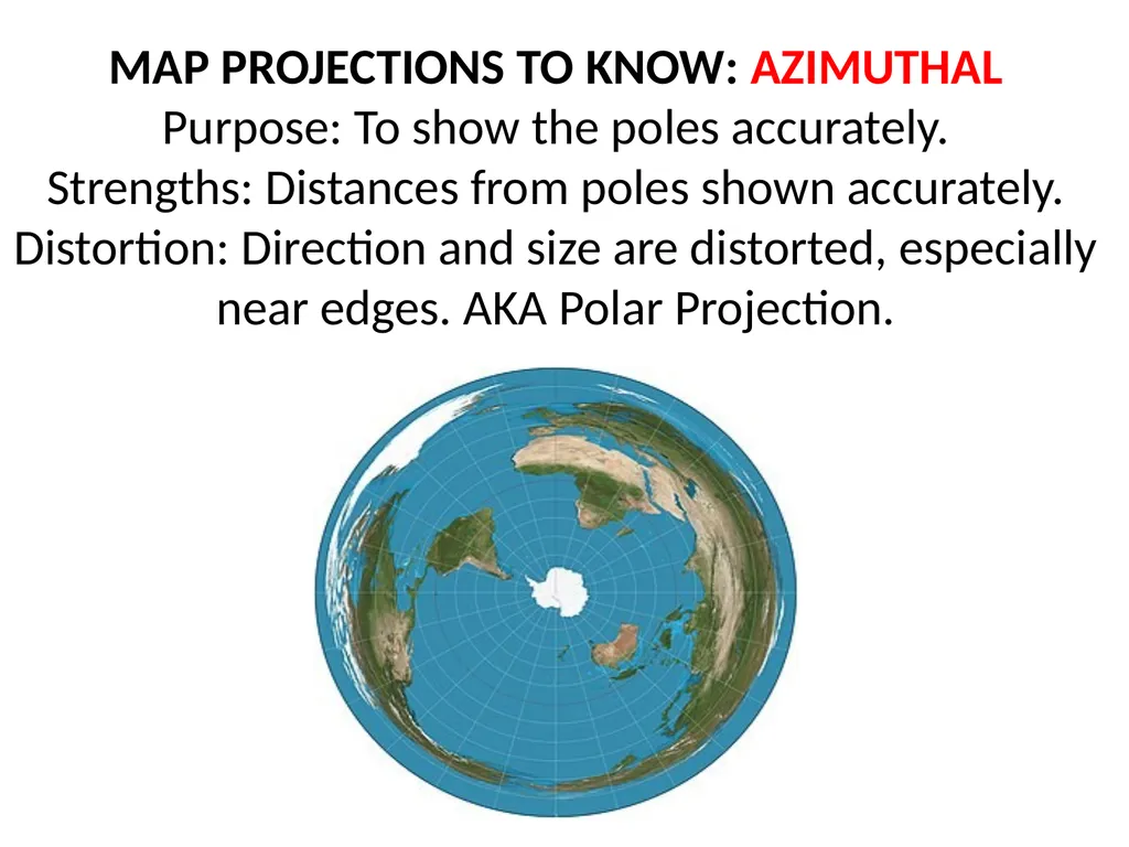
slide205. MAP PROJECTIONS TO KNOW: AZIMUTHAL
Purpose: To show the poles accurately.
Strengths: Distances from poles shown accurately.
Distortion: Direction and size are distorted, especially near edges. AKA Polar Projection.<br>
slide2. Know the major world regions detailed below. This is a map scale and scale of analysis you will use and interpret in class. Latin
America Sub-Saharan Africa<br>
slide3. COUNTRIES YOU DO NOT HAVE TO KNOW Fiji
Kiribati
Marshall Islands
Micronesia
Nauru
Palau
Samoa
Solomon Islands
Tonga
Tuvalu
Vanuatu
Antigua & Barbuda
Barbados
Bermuda
Dominica
Grenada
St. Kits & Nevis
St. Lucia
St. Vincent & the Grenadines
Trinidad & Tobago Andorra
Malta
San Marino
Benin
Burkina Faso
Cape Verde
Comoros
Equatorial Guinea
Gabon
Gambia
Guinea
Guinea-Bissau
Liberia
Mauritius
Sao Tome & Principe
Senegal
Seychelles
Togo
Maldives THE FOLLOWING ARE COUNTRIES YOU NEED TO KNOW<br>
slide4. NORTH AMERICA<br>
slide5. Bahamas<br>
slide6. Belize A hint for the countries of Central America ↑
People (Panama)
Can (Costa Rica)
Never (Nicaragua)
Have (Honduras)
Enough (El Salvador)
Geography (Guatemala)
Books (Belize)<br>
slide7. Canada<br>
slide8. Costa Rica<br>
slide9. Cuba<br>
slide10. Dominican Republic<br>
slide11. El Salvador<br>
slide12. Guatemala<br>
slide13. Haiti<br>
slide14. Honduras<br>
slide15. Jamaica<br>
slide16. Mexico<br>
slide17. Nicaragua<br>
slide18. Panama<br>
slide19. United States of America<br>
slide20. SOUTH AMERICA<br>
slide21. Argentina<br>
slide22. Bolivia<br>
slide23. Brazil<br>
slide24. Chile<br>
slide25. Colombia<br>
slide26. Ecuador<br>
slide27. French Guiana
(not a sovereign state)<br>
slide28. Guyana<br>
slide29. Paraguay<br>
slide30. Peru<br>
slide31. Suriname<br>
slide32. Uruguay<br>
slide33. Venezuela<br>
slide34. EUROPE<br>
slide35. Albania<br>
slide36. Austria<br>
slide37. Belarus<br>
slide38. Belgium<br>
slide39. Bosnia & Herzegovina<br>
slide40. Bulgaria<br>
slide41. Croatia<br>
slide42. Czech Republic<br>
slide43. Denmark<br>
slide44. Estonia A hint for the countries of Eastern Europe ↓ &
E (Estonia)
L (Latvia)
L (Lithuania)
B (Belarus)
U (Ukraine)
M (Moldova)
G (Georgia)
A (Armenia)
A (Azerbaijan)
T (Turkmenistan)
U (Uzbekistan)
T (Tajikistan)
K (Kyrgyzstan)
K (Kazakhstan)
ELL-BUM-GAA-TUT-KK<br>
slide45. Finland<br>
slide46. France<br>
slide47. Germany<br>
slide48. Greece<br>
slide49. Hungary<br>
slide50. Iceland<br>
slide51. Ireland<br>
slide52. Italy<br>
slide53. Kosovo<br>
slide54. Latvia<br>
slide55. Liechtenstein (the tiny one between Switzerland and Austria)<br>
slide56. Lithuania<br>
slide57. Luxembourg<br>
slide58. Macedonia (F.Y.R.O.M.)<br>
slide59. Moldova<br>
slide60. Montenegro<br>
slide61. Netherlands<br>
slide62. Norway A hint for the countries of Scandanavia →
Not (Norway)
So (Sweden)
Fine (Finland)<br>
slide63. Poland<br>
slide64. Portugal<br>
slide65. Romania<br>
slide66. Russia<br>
slide67. Serbia<br>
slide68. Slovakia<br>
slide69. Slovenia<br>
slide70. Spain<br>
slide71. Sweden<br>
slide72. Switzerland<br>
slide73. Ukraine<br>
slide74. United Kingdom<br>
slide75. AFRICA<br>
slide76. Algeria<br>
slide77. Angola<br>
slide78. Botswana A hint for the countries of Southeast Africa ↑→
Ben’s (Botswana)
Zany (Zimbabwe)
Zebra (Zambia)
Munches (Malawi)
Mushy (Mozambique)
Melons (Madagascar)<br>
slide79. Burkina Faso<br>
slide80. Burundi<br>
slide81. Cameroon A hint for the countries of Southwest Africa ↓
Cameron’s (Cameroon)
Car (C.A.R.)
Eats (Equatorial Guinea)
Gas (Gabon)
Rolling (Rep. of Congo)
Down (D.R.C.)
A (Angola)
Narrow (Namibia)
Street (South Africa)
Leading (Lesotho)
South (Swaziland)<br>
slide82. Central African Republic (C.A.R.)<br>
slide83. Chad A hint for the countries of North Africa →
My (Mauritania)
Mother (Mali)
Never (Niger)
Cooks (Chad)
Scrambled (Sudan)
Eggs (Eritrea)<br>
slide84. Côte d'Ivoire
(Ivory Coast)<br>
slide85. Democratic Republic of the Congo (D.R.C.)<br>
slide86. Djibouti<br>
slide87. Egypt<br>
slide88. Eritrea<br>
slide89. Ethiopia<br>
slide90. Gabon<br>
slide91. Ghana<br>
slide92. Kenya<br>
slide93. Lesotho<br>
slide94. Liberia<br>
slide95. Libya<br>
slide96. Madagascar<br>
slide97. Malawi<br>
slide98. Mali<br>
slide99. Mauritania<br>
slide100. Morocco<br>
slide101. Mozambique<br>
slide102. Namibia<br>
slide103. Niger<br>
slide104. Nigeria<br>
slide105. Republic of Congo<br>
slide106. Rwanda<br>
slide107. Somalia<br>
slide108. South Africa<br>
slide109. South Sudan<br>
slide110. Sudan<br>
slide111. Swaziland<br>
slide112. Tanzania A hint for the countries of Eastern Africa ↑
The (Tanzania)
Blue (Burundi)
Rabbit’s (Rwanda)
Umbrella (Uganda)
Kept (Kenya)
Everyone (Ethiopia)
Dry (Djibouti)
Sunday (Somalia)<br>
slide113. Tunisia<br>
slide114. Uganda<br>
slide115. Zambia<br>
slide116. Zimbabwe<br>
slide117. ASIA<br>
slide118. Afghanistan<br>
slide119. Armenia A hint for the countries of Central Asia →
E (Estonia)
L (Latvia)
L (Lithuania)
B (Belarus)
U (Ukraine)
M (Moldova)
G (Georgia)
A (Armenia)
A (Azerbaijan)
T (Turkmenistan)
U (Uzbekistan)
T (Tajikistan)
K (Kyrgyzstan)
K (Kazakhstan)
ELL-BUM-GAA-TUT-KK<br>
slide120. Azerbaijan<br>
slide121. Bahrain the tiny islands next to the bigger island<br>
slide122. Bangladesh<br>
slide123. Bhutan<br>
slide124. Brunei<br>
slide125. Cambodia<br>
slide126. China<br>
slide127. Cyprus<br>
slide128. Georgia<br>
slide129. India<br>
slide130. Indonesia<br>
slide131. Iran<br>
slide132. Iraq<br>
slide133. Israel<br>
slide134. Japan<br>
slide135. Jordan<br>
slide136. Kazakhstan<br>
slide137. Kuwait<br>
slide138. Kyrgyzstan<br>
slide139. Laos<br>
slide140. Lebanon<br>
slide141. Malaysia<br>
slide142. Mongolia<br>
slide143. Myanmar (Burma)<br>
slide144. Nepal<br>
slide145. North Korea<br>
slide146. Oman<br>
slide147. Pakistan<br>
slide148. Philippines<br>
slide149. Qatar<br>
slide150. Russia<br>
slide151. Saudi Arabia<br>
slide152. Singapore<br>
slide153. South Korea<br>
slide154. Sri Lanka<br>
slide155. Syria<br>
slide156. Taiwan<br>
slide157. Tajikistan<br>
slide158. Thailand<br>
slide159. Timor Leste
(East Timor)<br>
slide160. Turkey<br>
slide161. Turkmenistan<br>
slide162. United Arab Emirates (U.A.E.)<br>
slide163. Uzbekistan<br>
slide164. Vietnam<br>
slide165. Yemen<br>
slide166. AUSTRALIA & OCEANIA<br>
slide167. Australia<br>
slide168. New Zealand<br>
slide169. Papua New Guinea<br>
slide170. Test Yourself http://www.sporcle.com/
http://www.purposegames.com/
http://www.lizardpoint.com/fun/geoquiz/
http://www.travelpod.com/traveler-iq
http://www.ilike2learn.com/ilike2learn/geography.asp
http://www.maps.com/funfacts.aspx
http://www.sheppardsoftware.com/Geography.htm
http://www.funbrain.com/where/
http://www.jetpunk.com/quizzes/map-quiz-europe.php
http://www.yourchildlearns.com/map-puzzles.htm
http://sites.google.com/site/geogeomania/geographygames
Tap Quiz Apps (for your smart phone)
or print one of these regional maps and try to label it - Under “geography”
- Search for “parisaday”<br>
slide171. Global & Local Regions or Areas of Interest<br>
slide172. Chechnya<br>
slide173. N & S Ossetia<br>
slide174. Kurdistan<br>
slide175. Basque<br>
slide176. Catalonia<br>
slide177. West Bank<br>
slide178. Gaza Strip<br>
slide179. West Bank Gaza Strip<br>
slide180. Punjab<br>
slide181. Tibet<br>
slide182. Kashmir<br>
slide183. Nunavut<br>
slide184. Quebec<br>
slide185. F.A.R.C.
(areas controlled by the
Revolutionary Armed Forces of Colombia)<br>
slide186. Maghreb<br>
slide187. The Sahel<br>
slide188. Darfur<br>
slide189. Western Sahara<br>
slide190. Melanesia
(includes Papua New Guinea)<br>
slide191. Micronesia<br>
slide192. Polynesia
(includes Hawaii & NZ)<br>
slide193. TYPES OF MAPS
There are two major categories of maps:
Reference: designed to give people general info about places. Tell us where things are.
Political Maps, Physical Maps, & Road Maps
2. Thematic: show spatial aspects of information &
data. Tells us characteristics about a place.
Choropleth Maps, Dot Density Maps,
Graduated Symbol Maps, Cartogram Maps &
Isoline Maps<br>
slide194. TYPES OF REFERENCE MAPS Political Map Road Map<br>
slide195. TYPES OF THEMATIC MAPS: Choropleth
Uses color to show different values of data.<br>
slide196. TYPES OF THEMATIC MAPS: Dot Density
Uses dots of the same size to show density & distribution of data.<br>
slide197. TYPES OF THEMATIC MAPS: Graduated Symbol
Uses shapes of different sizes (usually a circle) to show values of data. AKA Proportional Symbol Map<br>
slide198. TYPES OF THEMATIC MAPS: Cartogram
The size of a place (state, county, province) is shown according to a specific data point.<br>
slide199. TYPES OF THEMATIC MAPS: Isometric/Isoline
Uses lines that connect points or areas of equal value to show variations of data across a place. Close lines = rapid change. Lines farther apart = less change.<br>
slide200. MAP PROJECTIONS: a projection is when a curved surface is shown on a flat surface. Because the Earth is a sphere and maps are flat, all maps distort some aspect of reality. All maps are SADD.
Shape can be distorted.
Area or size can be distorted.
Distance can be distorted.
Direction can be distorted.
The most accurate part of
a projection is the center.
This guys ear.<br>
slide201. MAP PROJECTIONS TO KNOW: MERCATOR
Purpose: Navigation
Strengths: Directions are constant & accurate.
Distortion: Area of places near poles appear much larger than reality.<br>
slide202. MAP PROJECTIONS TO KNOW: ROBINSON
Purpose: General use, like in classrooms.
Strengths: No major distortion.
Distortion: Area, shape, size, and direction are all slightly distorted.<br>
slide203. MAP PROJECTIONS TO KNOW: PETERS
Purpose: Spatial distributions related to area.
Strengths: Size of places are shown accurately.
Distortion: Shapes are inaccurate, especially near the poles.<br>
slide204. MAP PROJECTIONS TO KNOW: EQUAL-AREA
Purpose: General use & for data distributions.
Strengths: Size very close to reality.
Distortion: Shape & Distance are distorted. AKA Orange-Peel Projection<br>
slide205. MAP PROJECTIONS TO KNOW: AZIMUTHAL
Purpose: To show the poles accurately.
Strengths: Distances from poles shown accurately.
Distortion: Direction and size are distorted, especially near edges. AKA Polar Projection.<br>