Decided that future development to assume ArcPro
Description: Decided that future development to assume ArcPro capability Example: Attribute Rules, etc. Formalizing interactions between: (1) AK Field DBs, (2) AK Map Production DB, (3) AK Mulitmap Feature DB, and (4) Federal GeMS Deliverable DB
Related Topics
Download Presentation
"Decided that future development to assume ArcPro" is the property of its rightful owner. Permission is granted to download and print the materials on this website for personal, non-commercial use only, and to display it on your personal computer provided you do not modify the materials and that you retain all copyright notices contained in the materials. By downloading content from our website, you accept the terms of this agreement.
Presentation Transcript
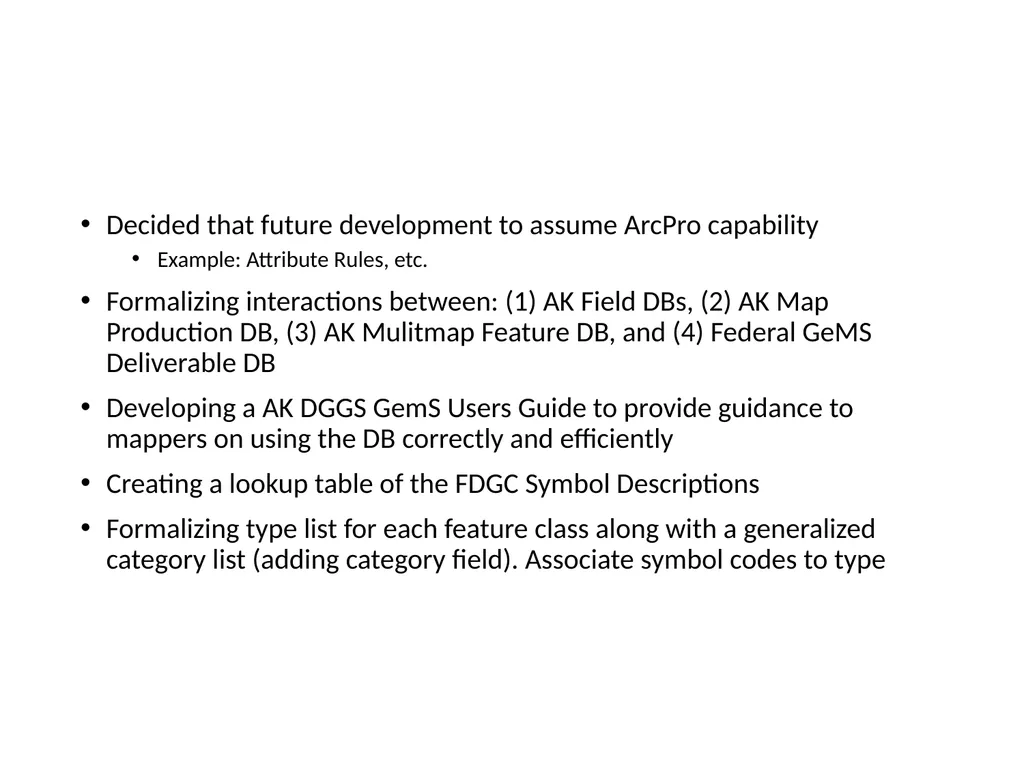
slide1. Decided that future development to assume ArcPro capability
Example: Attribute Rules, etc.
Formalizing interactions between: (1) AK Field DBs, (2) AK Map Production DB, (3) AK Mulitmap Feature DB, and (4) Federal GeMS Deliverable DB
Developing a AK DGGS GemS Users Guide to provide guidance to mappers on using the DB correctly and efficiently
Creating a lookup table of the FDGC Symbol Descriptions
Formalizing type list for each feature class along with a generalized category list (adding category field). Associate symbol codes to type<br>
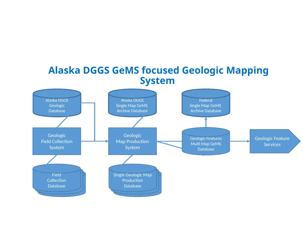
slide2. Alaska DGGS GeMS focused Geologic Mapping System Geologic
Field Collection
System Geologic
Map Production
System Alaska DGGS
Single Map GeMS
Archive Database Field
Collection
Database Single Geologic Map
Production
Database Geologic Features
Multi Map GeMS
Database Federal
Single Map GeMS
Archive Database Geologic Feature
Services Alaska DGGS
Geologic
Database<br>
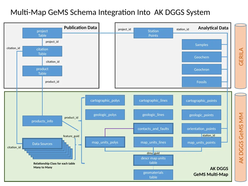
slide3. geomaterials
table descr map units
table map_units_polys map_units_lines map_units_points orientation_points Station
Points Samples Geochem Geochron station_id dmu_guid Fossils contacts_and_faults products_info product_id product
Table cartographic_polys cartographic_lines cartographic_points citation
Table project
Table project_id citation_id product_id feature_guid project_id citation_id citation_id station_id Analytical Data Publication Data GERILA AK DGGS GeMS MM AK DGGS
GeMS Multi-Map Multi-Map GeMS Schema Integration Into AK DGGS System Data Sources Relationship Class for each table
Many to Many geologic_polys geologic_lines geologic_points<br>
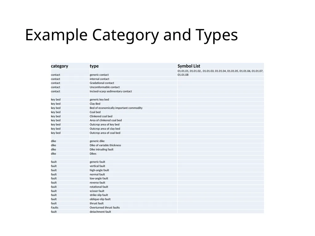
slide4. Example Category and Types<br>
Example: Attribute Rules, etc.
Formalizing interactions between: (1) AK Field DBs, (2) AK Map Production DB, (3) AK Mulitmap Feature DB, and (4) Federal GeMS Deliverable DB
Developing a AK DGGS GemS Users Guide to provide guidance to mappers on using the DB correctly and efficiently
Creating a lookup table of the FDGC Symbol Descriptions
Formalizing type list for each feature class along with a generalized category list (adding category field). Associate symbol codes to type<br>
slide2. Alaska DGGS GeMS focused Geologic Mapping System Geologic
Field Collection
System Geologic
Map Production
System Alaska DGGS
Single Map GeMS
Archive Database Field
Collection
Database Single Geologic Map
Production
Database Geologic Features
Multi Map GeMS
Database Federal
Single Map GeMS
Archive Database Geologic Feature
Services Alaska DGGS
Geologic
Database<br>
slide3. geomaterials
table descr map units
table map_units_polys map_units_lines map_units_points orientation_points Station
Points Samples Geochem Geochron station_id dmu_guid Fossils contacts_and_faults products_info product_id product
Table cartographic_polys cartographic_lines cartographic_points citation
Table project
Table project_id citation_id product_id feature_guid project_id citation_id citation_id station_id Analytical Data Publication Data GERILA AK DGGS GeMS MM AK DGGS
GeMS Multi-Map Multi-Map GeMS Schema Integration Into AK DGGS System Data Sources Relationship Class for each table
Many to Many geologic_polys geologic_lines geologic_points<br>
slide4. Example Category and Types<br>