Deserts and Desertification lecture 1 collected by : Maher M Mahdi Definitions: Desert: A region which has an arid climate or where evaporation exceeds precipitation, Concentrated in sub-tropics, mid-latitudes, and polar regions Steppe:
"Deserts and Desertification lecture 1 collected by" is the property of its rightful owner. Permission is granted to
download and print the materials on this website for personal, non-commercial use only, and to display it
on your personal computer provided you do not modify the materials and that you retain all copyright
notices contained in the materials. By downloading content from our website, you accept the terms of this
agreement.
Presentation Transcript
01
Deserts and Desertification lecture 1 collected by : Maher M Mahdi<br>
02
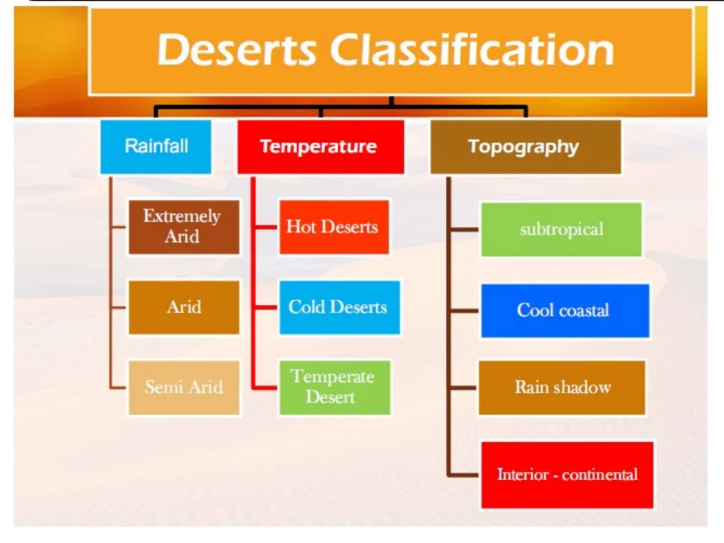
Definitions: Desert: A region which has an arid climate or where evaporation exceeds precipitation, Concentrated in sub-tropics, mid-latitudes, and polar regions Steppe: region often adjacent to a desert, steppe (semi-arid, surrounds deserts) Semiarid climate: irregular precipitation, enough to generate minimal plant growth<br>
03
A common definition distinguishes between true deserts, which receive less than 250 millimetres (10 in) of average annual precipitation, and semideserts or steppes, which receive between 250 millimetres (10 in) and 400 to 500 millimetres (16 to 20 in).<br>
04
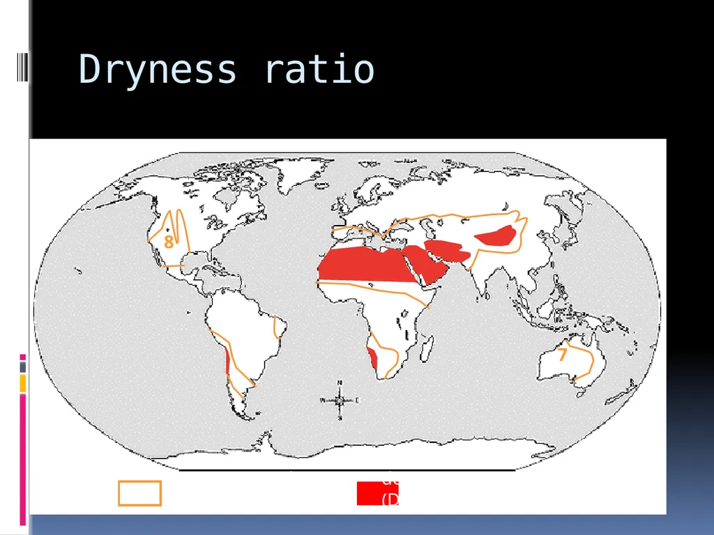
Budyko-Lettau dryness ratio D = R / (L x P) where D = dryness ratio; R = mean ann. net radiation; P = mean ann. precipitation; L = latent heat of vaporization of water Original definition:
D > 2.3 = semi-desert; D ≥ 3.4 = desert.
UNESCO: D ≥ 10 = “extreme desert”<br>
05
Dryness ratio semiarid desert
(D≥2.3) (D≥10) 8 7<br>
06
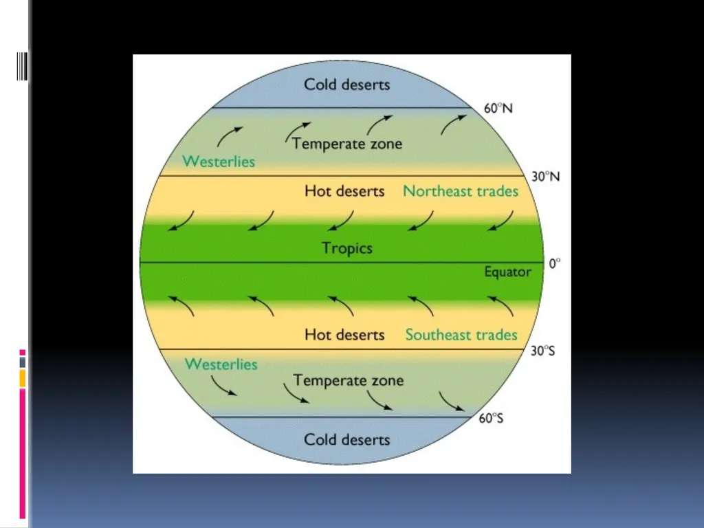
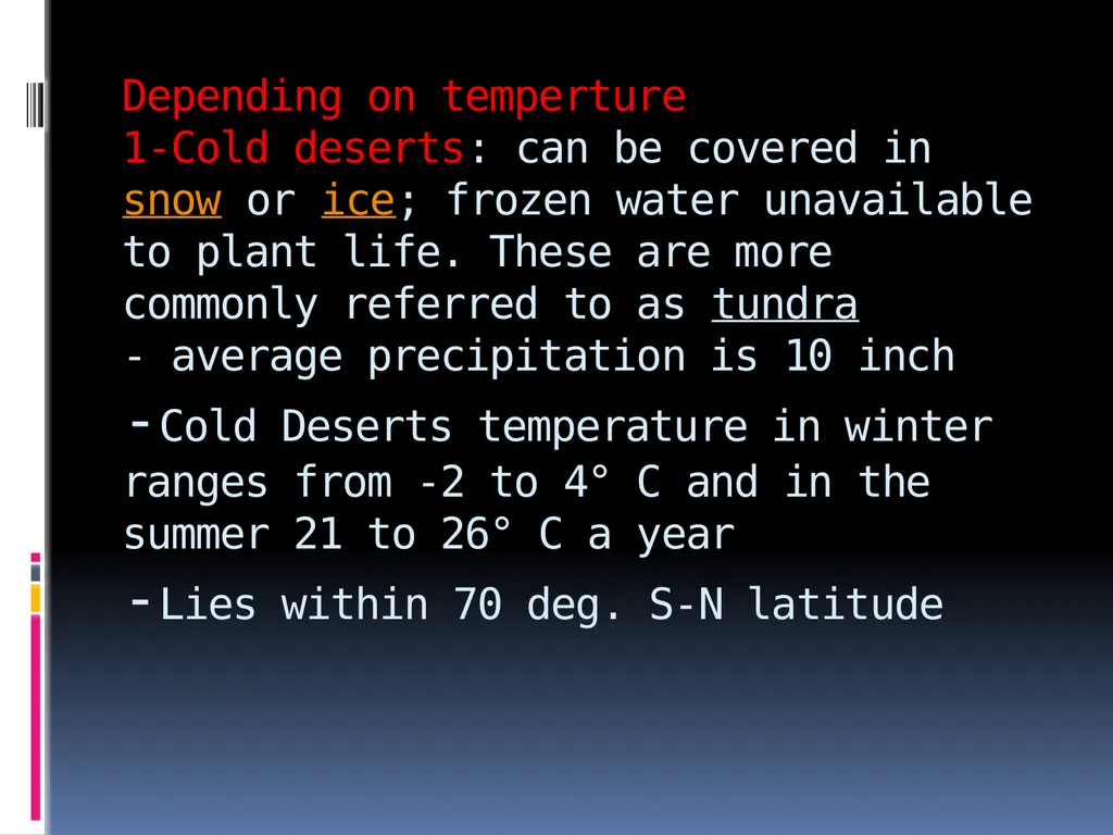
Depending on temperture 1-Cold deserts: can be covered in snow or ice; frozen water unavailable to plant life. These are more commonly referred to as tundra - average precipitation is 10 inch -Cold Deserts temperature in winter ranges from -2 to 4° C and in the summer 21 to 26° C a year -Lies within 70 deg. S-N latitude<br>
07
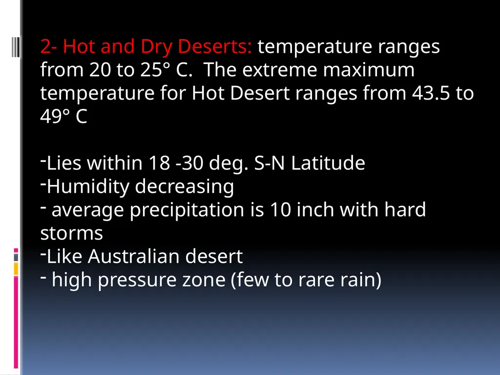
2- Hot and Dry Deserts: temperature ranges from 20 to 25° C. The extreme maximum temperature for Hot Desert ranges from 43.5 to 49° C
Lies within 18 -30 deg. S-N Latitude
Humidity decreasing
average precipitation is 10 inch with hard storms
Like Australian desert
high pressure zone (few to rare rain)<br>
08
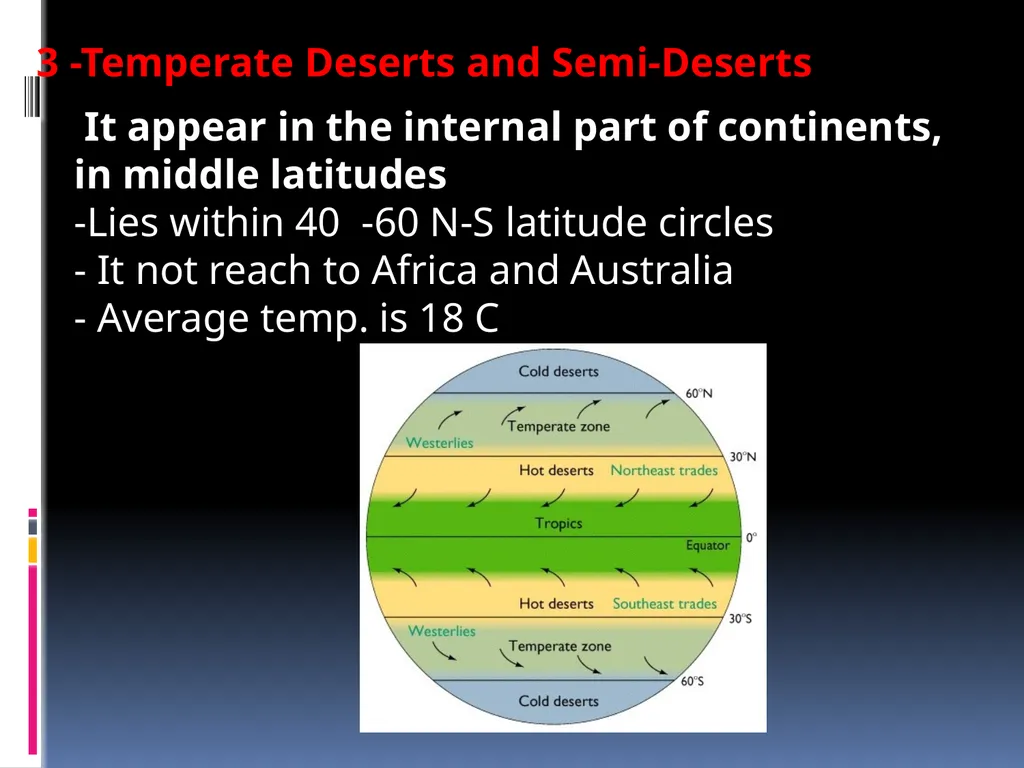
It appear in the internal part of continents, in middle latitudes
-Lies within 40 -60 N-S latitude circles
- It not reach to Africa and Australia
- Average temp. is 18 C 3 -Temperate Deserts and Semi-Deserts<br>
09
Another classification depending on topography :
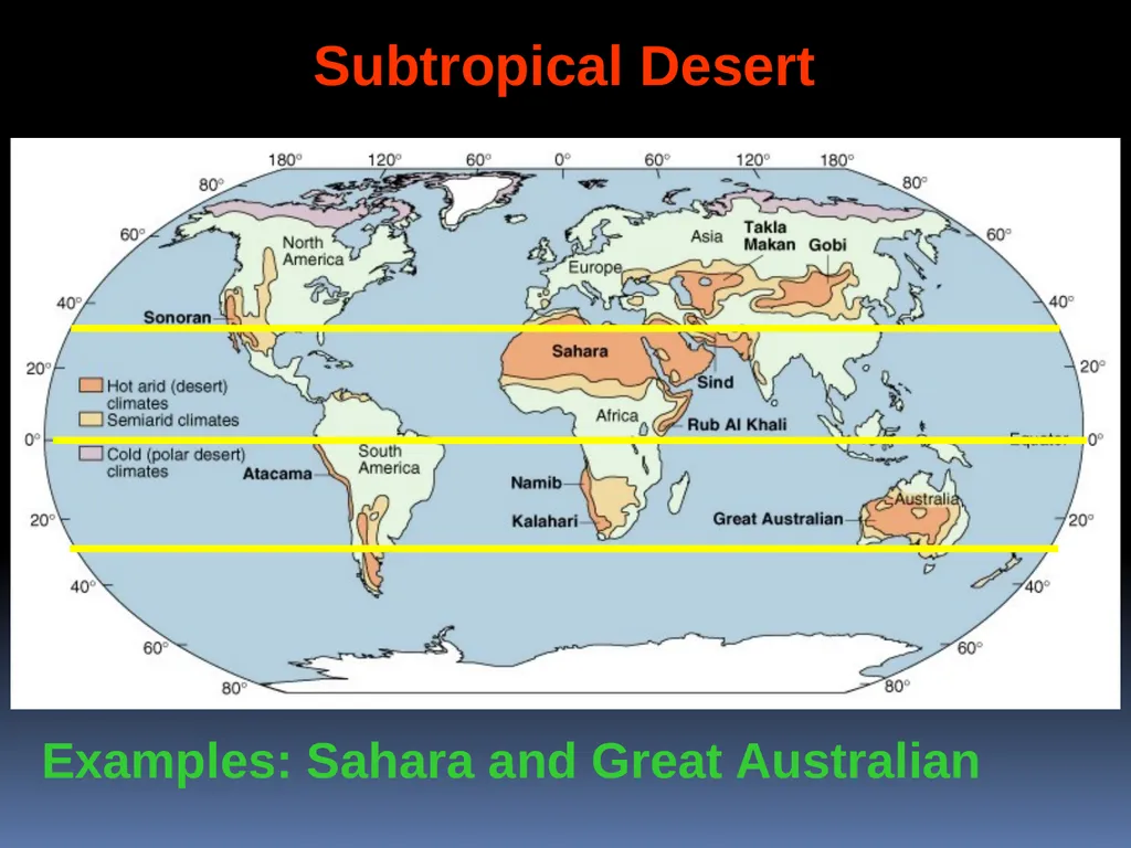
1. Subtropical: Those associated with the circum-global belts of dry, subtropical air (Sahara, Kalahari, Great Australian)
2. Rain shadow: Lee side of mountain ranges in the rain shadow (Sonoran).
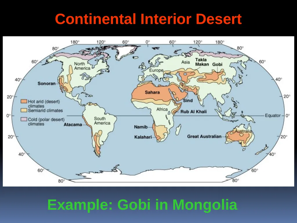
3. Continental interiors: with low rainfall (Gobi, Takla Makan in Asia)
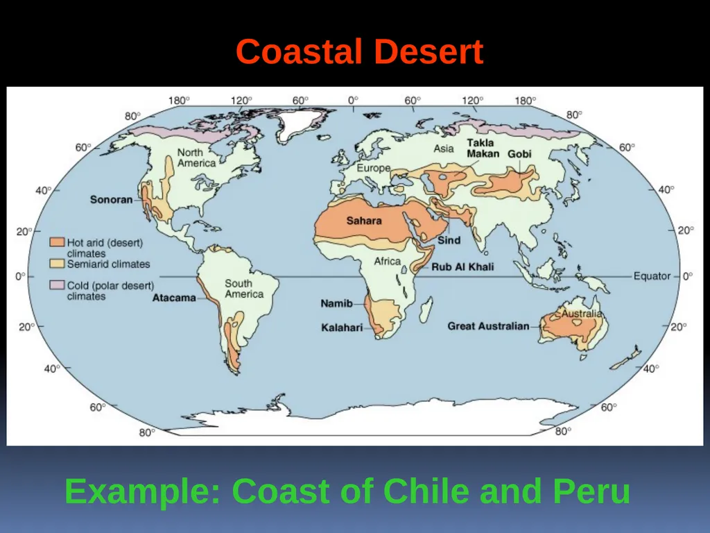
4. Coastal deserts, near the coast (Peru, Chile, SW Africa)
5. Polar deserts (N. Greenland, ice-free areas in Antarctica)<br>
10
Controlled by air circulation Subtropical –
Centered around 30o N and S latitude Geographically extensive<br>
11
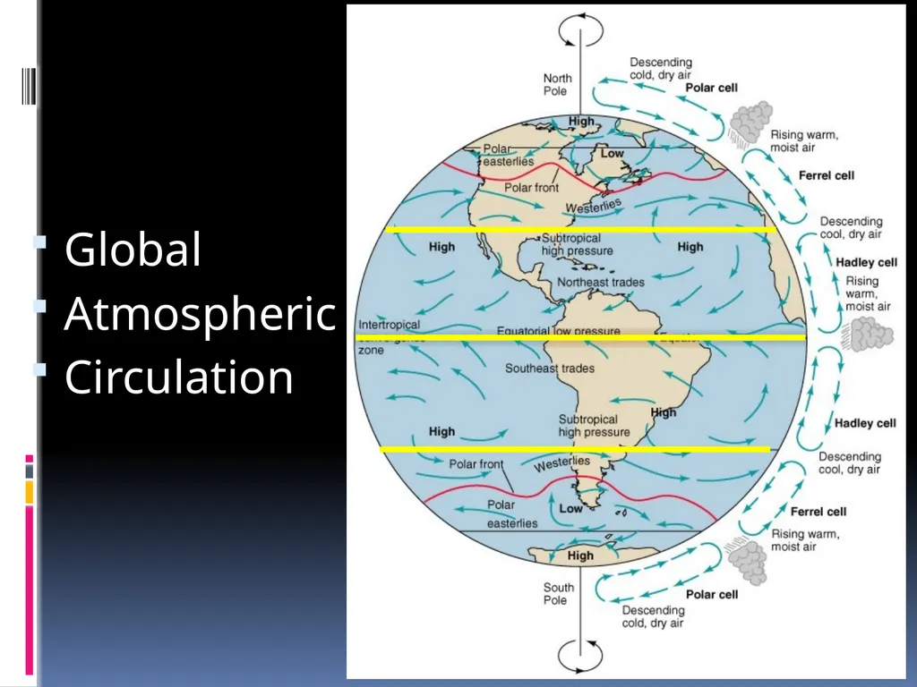
Global
Atmospheric
Circulation<br>
12
Examples: Sahara and Great Australian Subtropical Desert<br>
13
Continental Interior-
Far from sources of moisture (ocean)<br>
14
Example: Gobi in Mongolia Continental Interior Desert<br>
15
Types of Deserts Rainshadow-
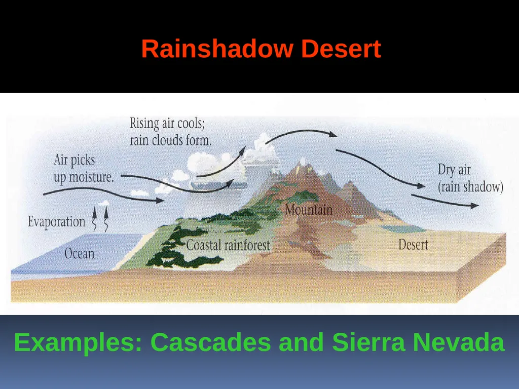
Rain shadow deserts are formed because tall mountain ranges prevent moisture-rich clouds from reaching areas on the lee, or protected side, of the range.<br>
16
Rainshadow Desert Examples: Cascades and Sierra Nevada<br>
17
Coastal Desert -
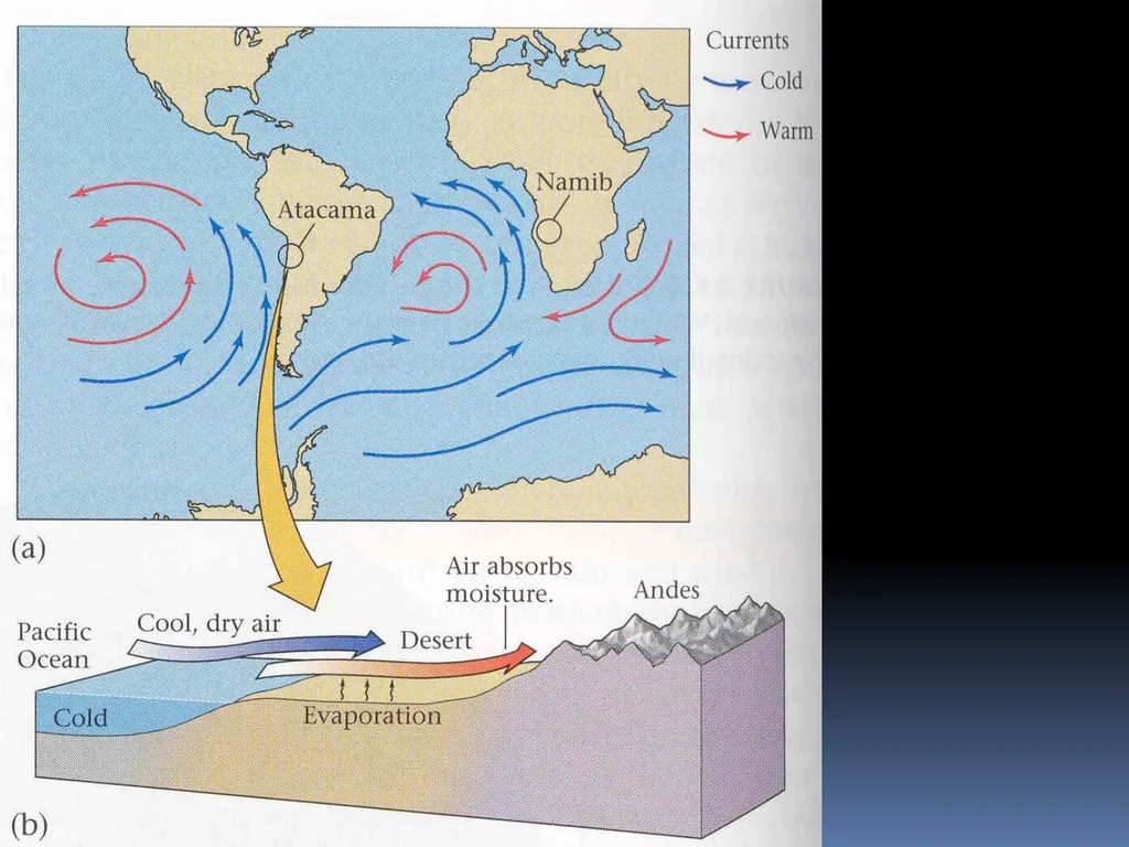
Cool dry air blows in from the ocean and evaporates occurs as it warms.<br>
18
Example: Coast of Chile and Peru Coastal Desert<br>
19
Polar –
Cold air holds very little moisture. What little precipitation falls remains as ice for 1000's of years. Examples: Greenland and Antarctica<br>