InFORM CDAT - 2026 Overview, Updates, Data Statistics Julie Osterkamp USWFS InFORM Business Lead NWCG Fire Reporting Subcommittee Chair NWCG Geospatial Subcommittee Member GISS on IMTs for 19 Years Day Job: USWFS National Fire
"InFORM – CDAT - 2026 Overview, Updates, Data &" is the property of its rightful owner. Permission is granted to
download and print the materials on this website for personal, non-commercial use only, and to display it
on your personal computer provided you do not modify the materials and that you retain all copyright
notices contained in the materials. By downloading content from our website, you accept the terms of this
agreement.
Share
Embed code
Presentation Transcript
01
InFORM – CDAT - 2026 Overview, Updates, Data & Statistics Julie Osterkamp
USWFS InFORM Business Lead
NWCG Fire Reporting Subcommittee Chair
NWCG Geospatial Subcommittee Member
GISS on IMTs for 19 Years
Day Job: USWFS National Fire Geospatial Analyst, NIFC<br>
02
Overview Interagency Fire Occurrence Reporting Modules (InFORM)
InFORM is the final fire reporting application used by all five federal fire management agencies and 16 state fire management agencies (so far).
Most other applications are for operational reporting, data exchange, ordering, information sharing, etc. (WildCADe, WFDSS, IROC, IAA, EGP, SIT-209)
InFORM is the application used for fire data QA/QC and certification after the operational phase of a fire is over.
Operational fire data is fed into InFORM via IRWIN and then is QA/QC’d, Certified, and becomes final fire data.<br>
03
Some Recent’ish Updates Merge Records: Previously had capability to splice duplicate records. New capability to merge incidents that merged on the landscape (make two records become one) so acres are not double counted. Splice and merge two different operations. (Merges come from IRWIN as a relationship between two records, but both records still exist).
Initial Response Agencies: new field that shows every agency that IA’d a fire. So can query for “all fires USFS IA’d”, etc.
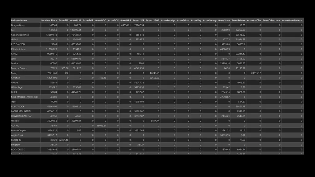
Agency acres burned fields for each fire. How many acres of each agency’s lands burned within each fire (16 different fields).
Bulk Uploaded Records vetted for duplication much better and not allowed in. Also, no records allowed in with Incident Size NULL or 0.<br>
04
InFORM Demo<br>
05
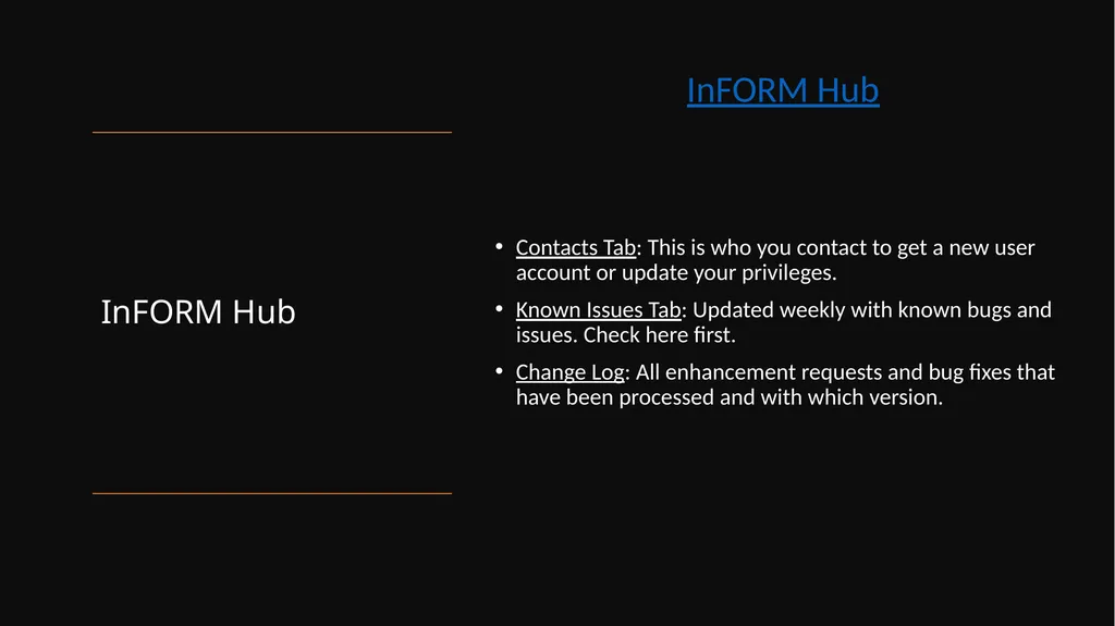
InFORM Hub Contacts Tab: This is who you contact to get a new user account or update your privileges.
Known Issues Tab: Updated weekly with known bugs and issues. Check here first.
Change Log: All enhancement requests and bug fixes that have been processed and with which version. InFORM Hub<br>
06
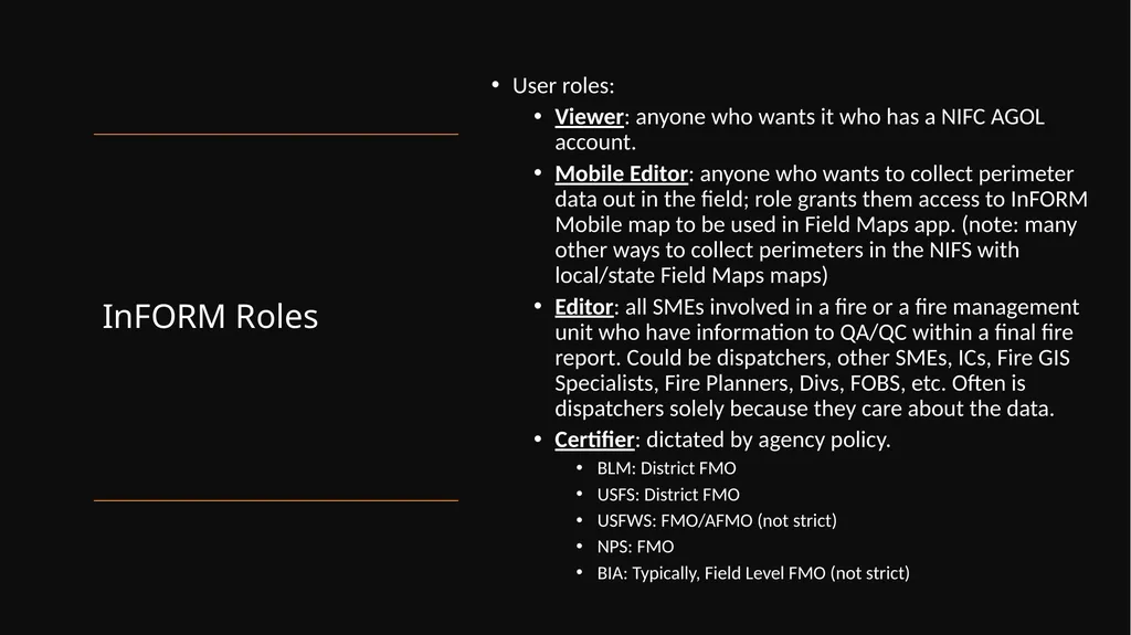
InFORM Roles User roles:
Viewer: anyone who wants it who has a NIFC AGOL account.
Mobile Editor: anyone who wants to collect perimeter data out in the field; role grants them access to InFORM Mobile map to be used in Field Maps app. (note: many other ways to collect perimeters in the NIFS with local/state Field Maps maps)
Editor: all SMEs involved in a fire or a fire management unit who have information to QA/QC within a final fire report. Could be dispatchers, other SMEs, ICs, Fire GIS Specialists, Fire Planners, Divs, FOBS, etc. Often is dispatchers solely because they care about the data.
Certifier: dictated by agency policy.
BLM: District FMO
USFS: District FMO
USFWS: FMO/AFMO (not strict)
NPS: FMO
BIA: Typically, Field Level FMO (not strict)<br>
07
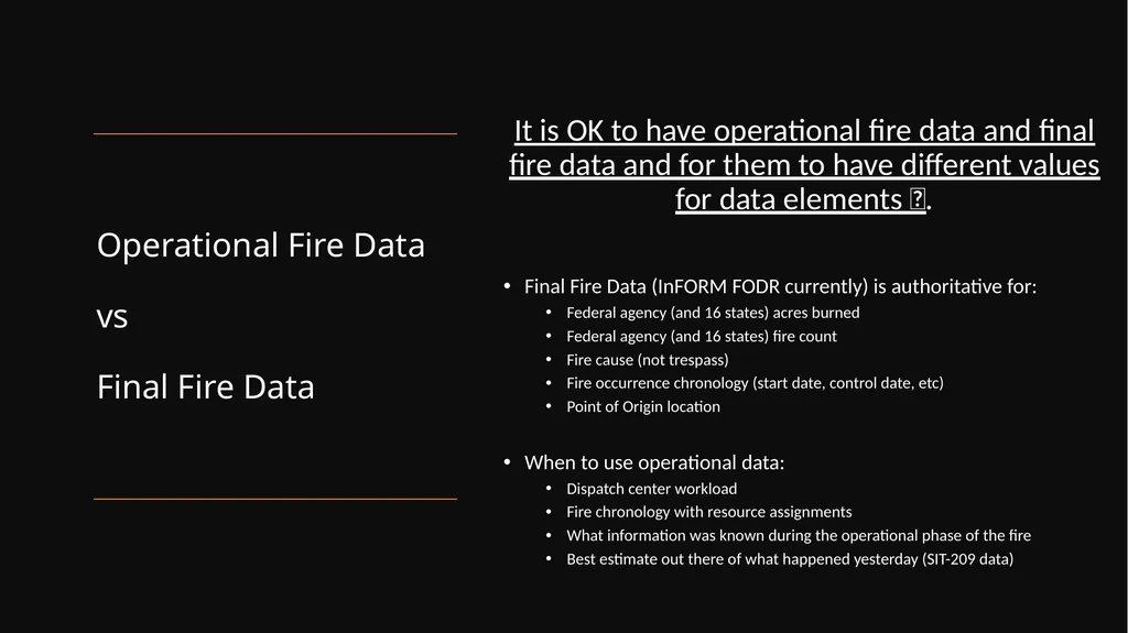
Operational Fire Data vs Final Fire Data It is OK to have operational fire data and final fire data and for them to have different values for data elements 😬.
Final Fire Data (InFORM FODR currently) is authoritative for:
Federal agency (and 16 states) acres burned
Federal agency (and 16 states) fire count
Fire cause (not trespass)
Fire occurrence chronology (start date, control date, etc)
Point of Origin location
When to use operational data:
Dispatch center workload
Fire chronology with resource assignments
What information was known during the operational phase of the fire
Best estimate out there of what happened yesterday (SIT-209 data)<br>
08
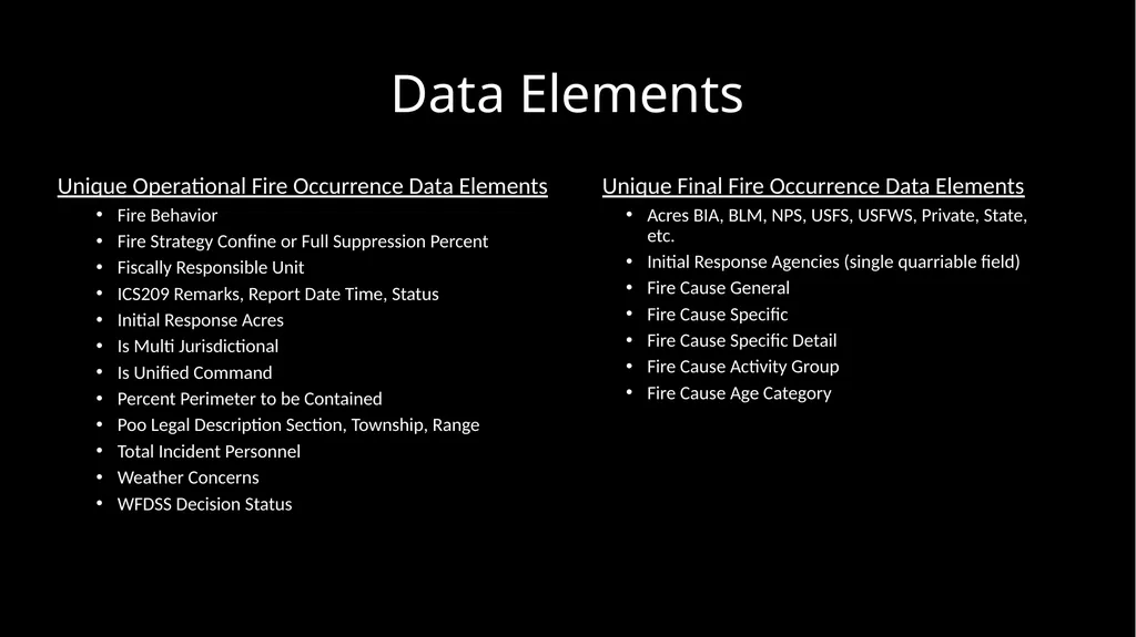
Data Elements Unique Final Fire Occurrence Data Elements
Acres BIA, BLM, NPS, USFS, USFWS, Private, State, etc.
Initial Response Agencies (single quarriable field)
Fire Cause General
Fire Cause Specific
Fire Cause Specific Detail
Fire Cause Activity Group
Fire Cause Age Category Unique Operational Fire Occurrence Data Elements
Fire Behavior
Fire Strategy Confine or Full Suppression Percent
Fiscally Responsible Unit
ICS209 Remarks, Report Date Time, Status
Initial Response Acres
Is Multi Jurisdictional
Is Unified Command
Percent Perimeter to be Contained
Poo Legal Description Section, Township, Range
Total Incident Personnel
Weather Concerns
WFDSS Decision Status<br>
09
1. Acres Burned By Jurisdiction
Use the Acres BLM, Acres USFS, Acres NPS, etc. fields to see each agency’s acres burned. These fields are populated by intersecting the fire perimeter with the Jurisdictional Agency layer. 2. Acres Burned By Protection at Point of Origin
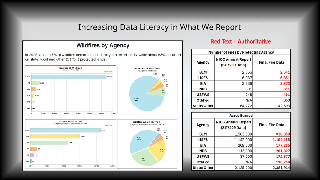
Identify the point of origin Protecting Agency, use field Incident Size showing total acres, assign all acres to that agency. This method will give the total amount of acres for fires under that agency’s protection. Accurate Acres Burned on the Ground Acres Tabulation Differences<br>
10
Increasing Data Literacy in What We Report Red Text = Authoritative<br>
11
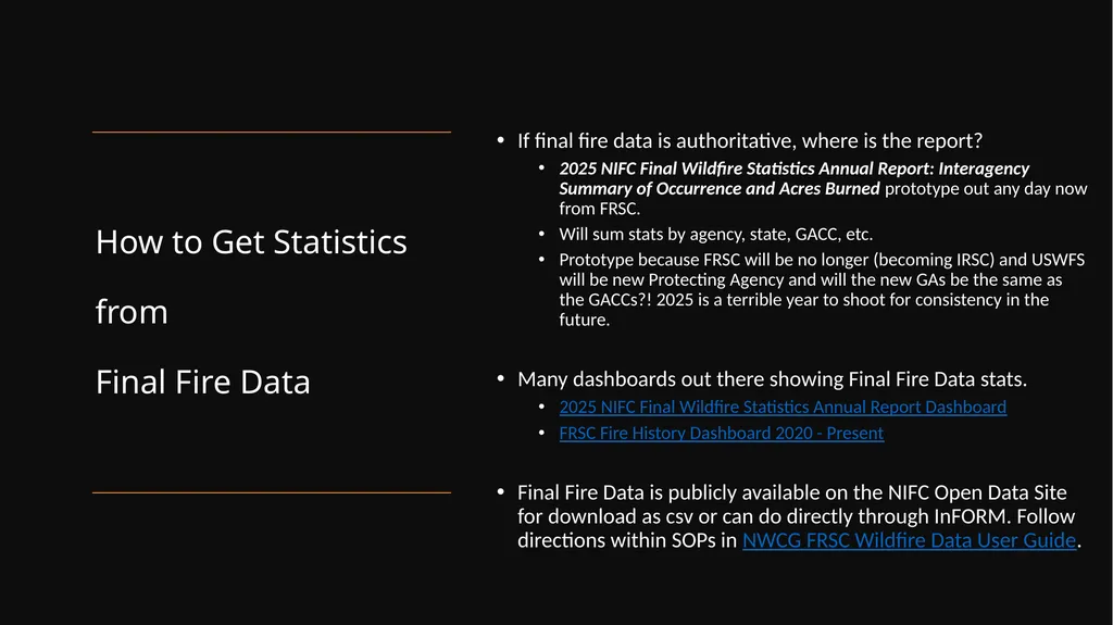
How to Get Statistics from Final Fire Data If final fire data is authoritative, where is the report?
2025 NIFC Final Wildfire Statistics Annual Report: Interagency Summary of Occurrence and Acres Burned prototype out any day now from FRSC.
Will sum stats by agency, state, GACC, etc.
Prototype because FRSC will be no longer (becoming IRSC) and USWFS will be new Protecting Agency and will the new GAs be the same as the GACCs?! 2025 is a terrible year to shoot for consistency in the future.
Many dashboards out there showing Final Fire Data stats.
2025 NIFC Final Wildfire Statistics Annual Report Dashboard
FRSC Fire History Dashboard 2020 - Present
Final Fire Data is publicly available on the NIFC Open Data Site for download as csv or can do directly through InFORM. Follow directions within SOPs in NWCG FRSC Wildfire Data User Guide.<br>
12
Wildfire Data User Guide NWCG FRSC Wildfire Data User Guide
SOP Acres Burned
SOP Fire Count
SOP Cost
SOP Resources
Fire Occurrence and Perimeters
Acres Tabulation Differences<br>
13
Wildfire Data User Guide Bulk Uploaded Records Very important when talking about InFORM Data: Bulk Uploaded Records.
Wildfire Data User Guide talks a lot about these.
Take very careful note of Created by System = Bulk Uploaded Records (within InFORM FODR). They are not authoritative records within InFORM and should often just be filtered out. Note this in any reporting you do.
Bulk Uploaded Records are a thorn in the side of InFORM FODR data, they are of very low data integrity, often “outside” fires in the middle of cities and contain many duplicates.
Amazing things are happening to get rid of this issue. NERIS is the new state/local/rural fire reporting system and all data will now come from NERIS instead of Bulk Uploads and NERIS might possibly integrate with IRWIN.<br>
14
The End
Please use the Contact Tab on the InFORM Hub to reach out to your Agency Reps with any questions. Feel free to reach out directly to me too.<br>