
Scheme for the CBCS Curriculum General Course:

Description: Scheme for the CBCS Curriculum General Course: Core Subjects GEO-G-CC-1-01-TH Physical Geography GEO-G-CC-1-01-TH Physical Geography Lab GEO-G-CC-2-02-TH Environmental Geography GEO-G-CC-2-02-P Environmental Geography Lab
Related Topics
Download Presentation
"Scheme for the CBCS Curriculum General Course:" is the property of its rightful owner. Permission is granted to download and print the materials on this website for personal, non-commercial use only, and to display it on your personal computer provided you do not modify the materials and that you retain all copyright notices contained in the materials. By downloading content from our website, you accept the terms of this agreement.
Presentation Transcript
slide1. Scheme for the CBCS Curriculum
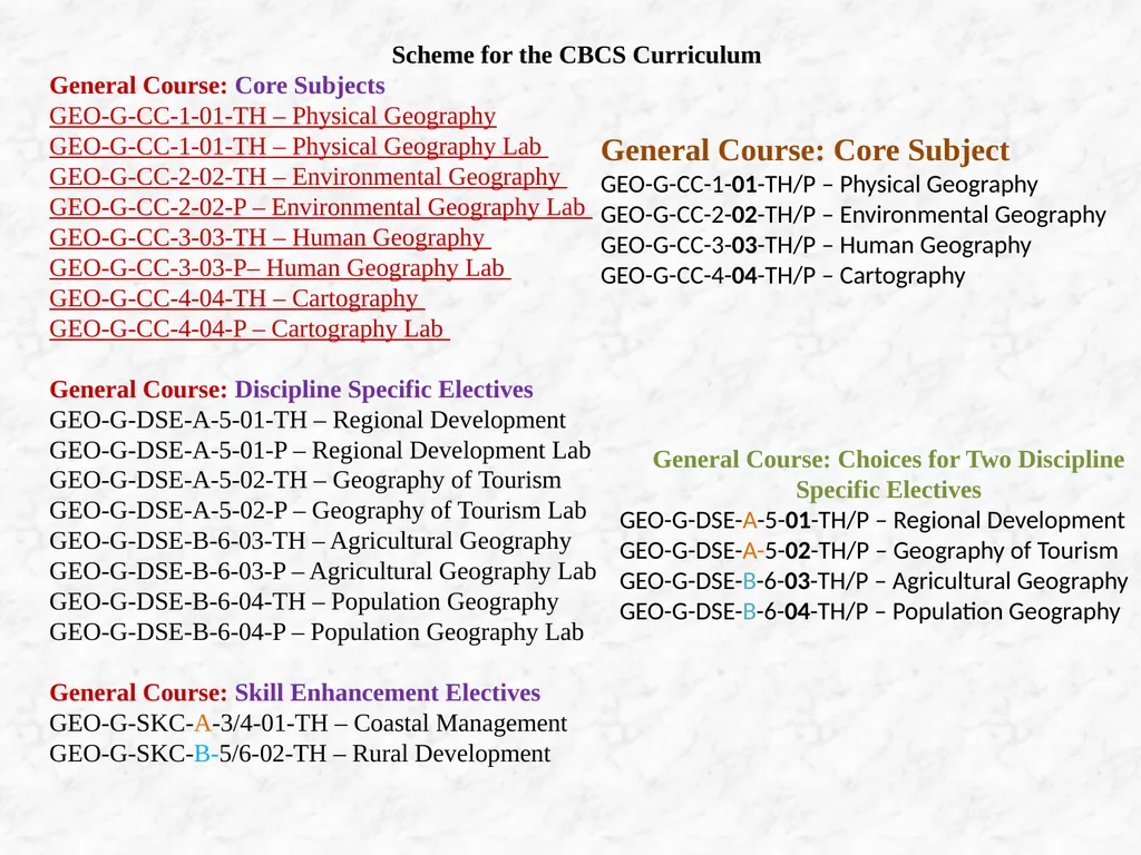
General Course: Core Subjects
GEO-G-CC-1-01-TH – Physical Geography
GEO-G-CC-1-01-TH – Physical Geography Lab
GEO-G-CC-2-02-TH – Environmental Geography
GEO-G-CC-2-02-P – Environmental Geography Lab
GEO-G-CC-3-03-TH – Human Geography
GEO-G-CC-3-03-P– Human Geography Lab
GEO-G-CC-4-04-TH – Cartography
GEO-G-CC-4-04-P – Cartography Lab
General Course: Discipline Specific Electives
GEO-G-DSE-A-5-01-TH – Regional Development
GEO-G-DSE-A-5-01-P – Regional Development Lab
GEO-G-DSE-A-5-02-TH – Geography of Tourism
GEO-G-DSE-A-5-02-P – Geography of Tourism Lab
GEO-G-DSE-B-6-03-TH – Agricultural Geography
GEO-G-DSE-B-6-03-P – Agricultural Geography Lab
GEO-G-DSE-B-6-04-TH – Population Geography
GEO-G-DSE-B-6-04-P – Population Geography Lab
General Course: Skill Enhancement Electives
GEO-G-SKC-A-3/4-01-TH – Coastal Management
GEO-G-SKC-B-5/6-02-TH – Rural Development General Course: Core Subject
GEO-G-CC-1-01-TH/P – Physical Geography
GEO-G-CC-2-02-TH/P – Environmental Geography
GEO-G-CC-3-03-TH/P – Human Geography
GEO-G-CC-4-04-TH/P – Cartography General Course: Choices for Two Discipline Specific Electives
GEO-G-DSE-A-5-01-TH/P – Regional Development
GEO-G-DSE-A-5-02-TH/P – Geography of Tourism
GEO-G-DSE-B-6-03-TH/P – Agricultural Geography
GEO-G-DSE-B-6-04-TH/P – Population Geography<br>
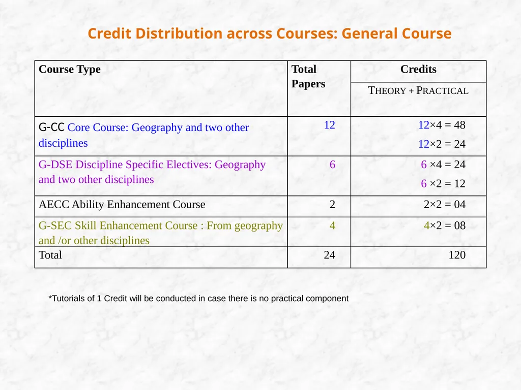
slide2. Credit Distribution across Courses: General Course *Tutorials of 1 Credit will be conducted in case there is no practical component<br>
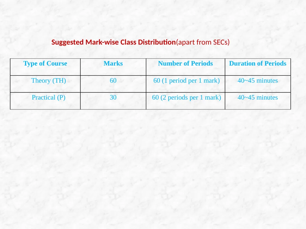
slide3. Suggested Mark-wise Class Distribution(apart from SECs)<br>
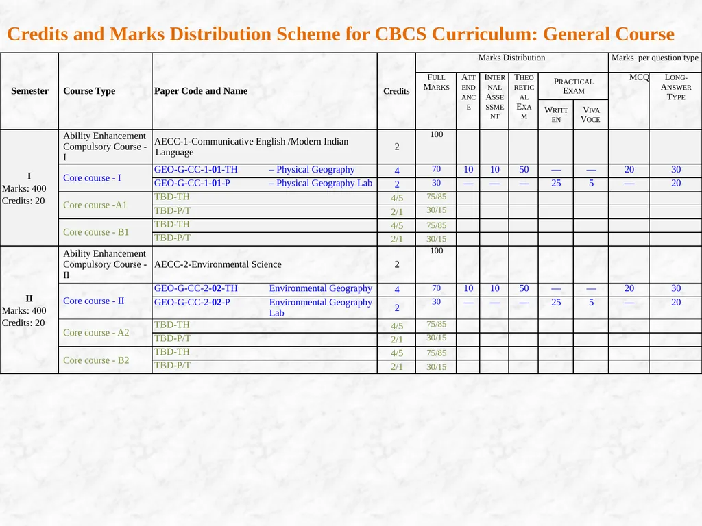
slide4. Credits and Marks Distribution Scheme for CBCS Curriculum: General Course<br>
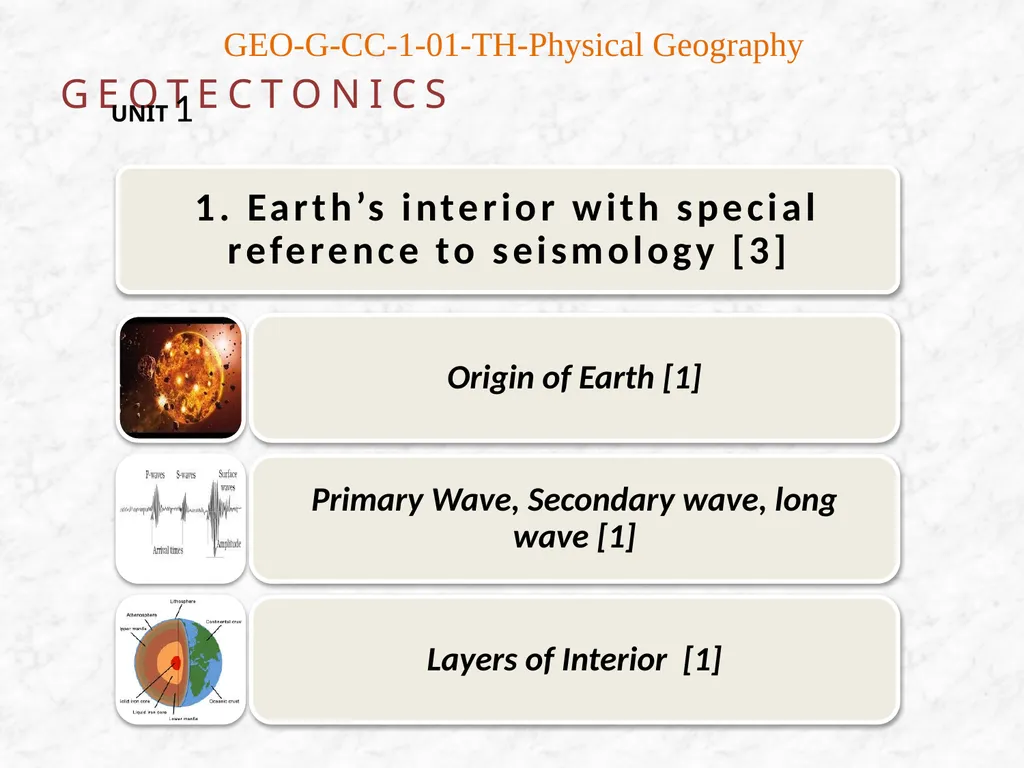
slide5. GEOTECTONICS UNIT 1 GEO-G-CC-1-01-TH-Physical Geography<br>
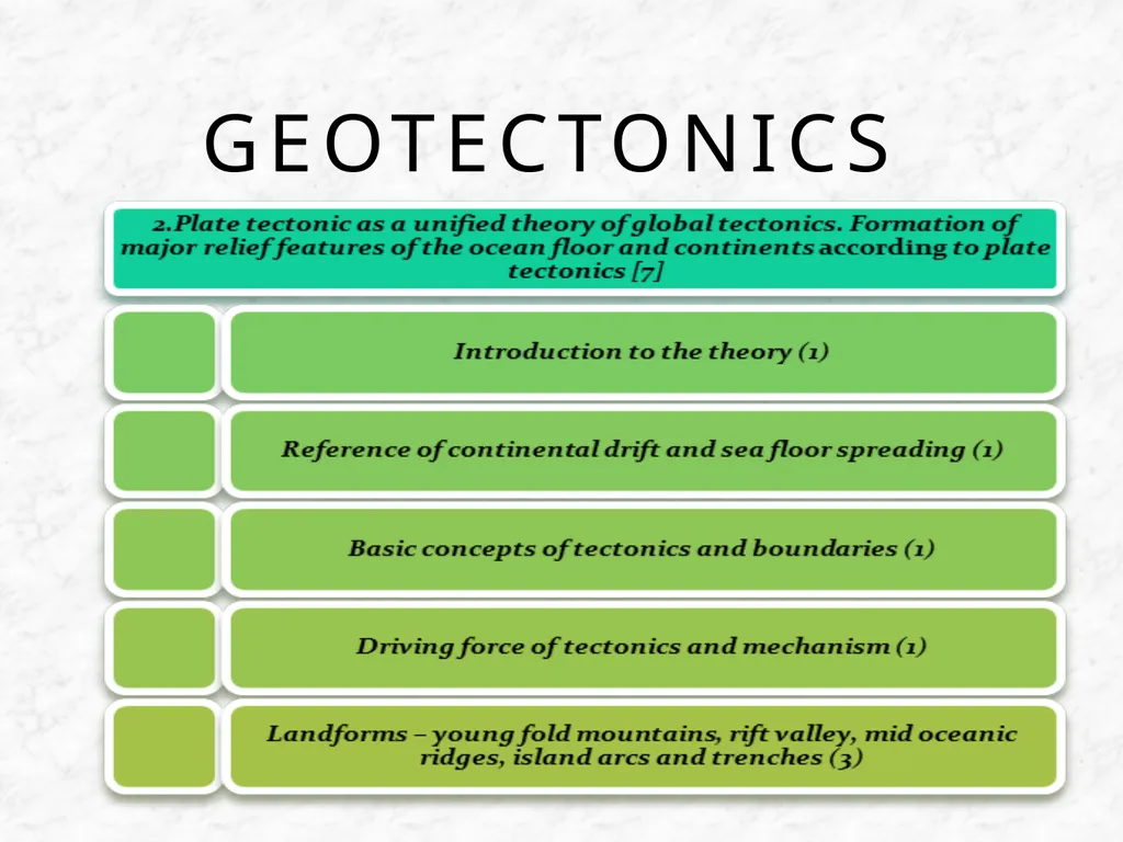
slide6. GEOTECTONICS<br>
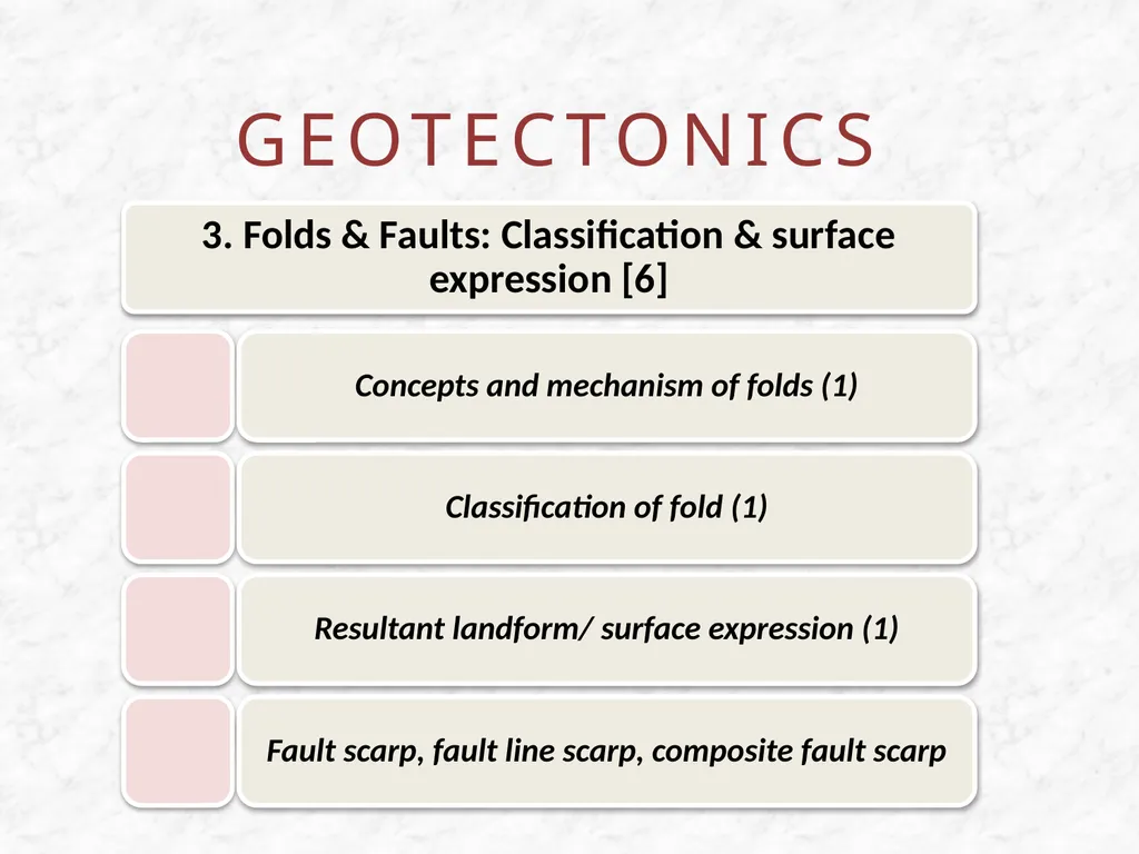
slide7. GEOTECTONICS<br>
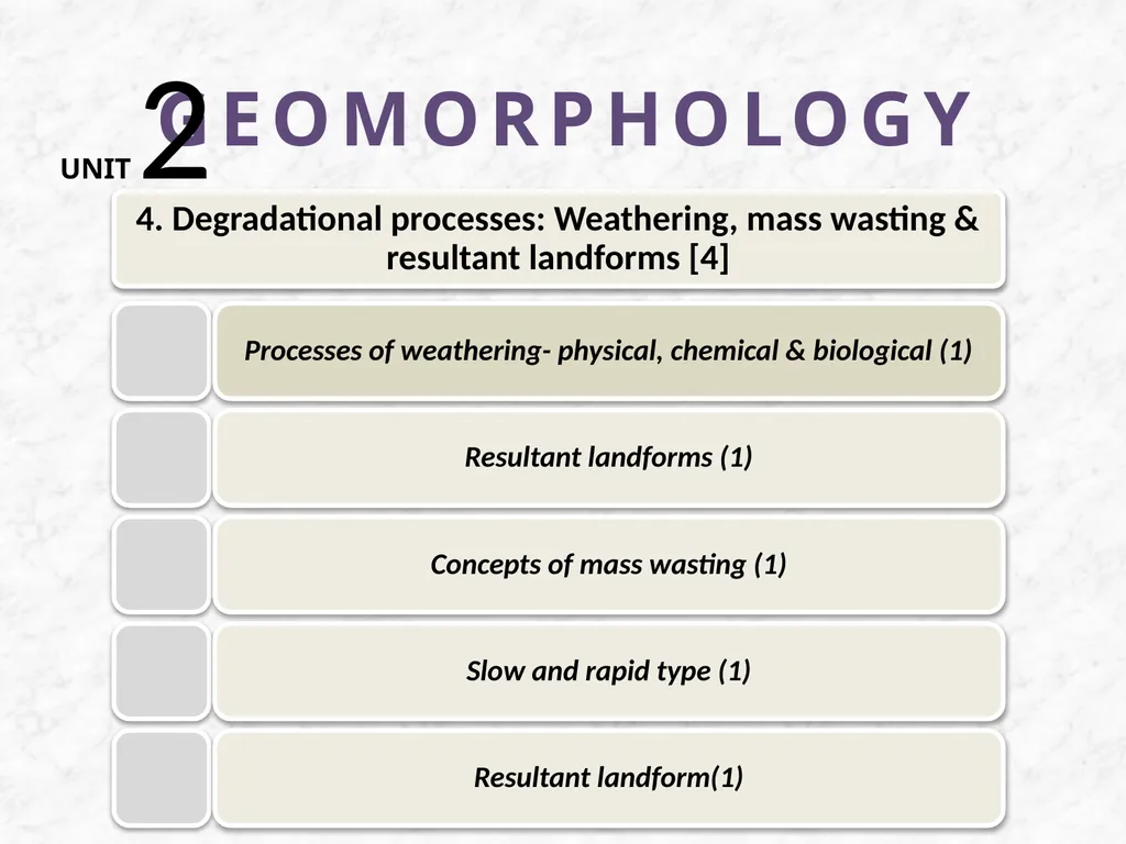
slide8. GEOMORPHOLOGY UNIT 2<br>
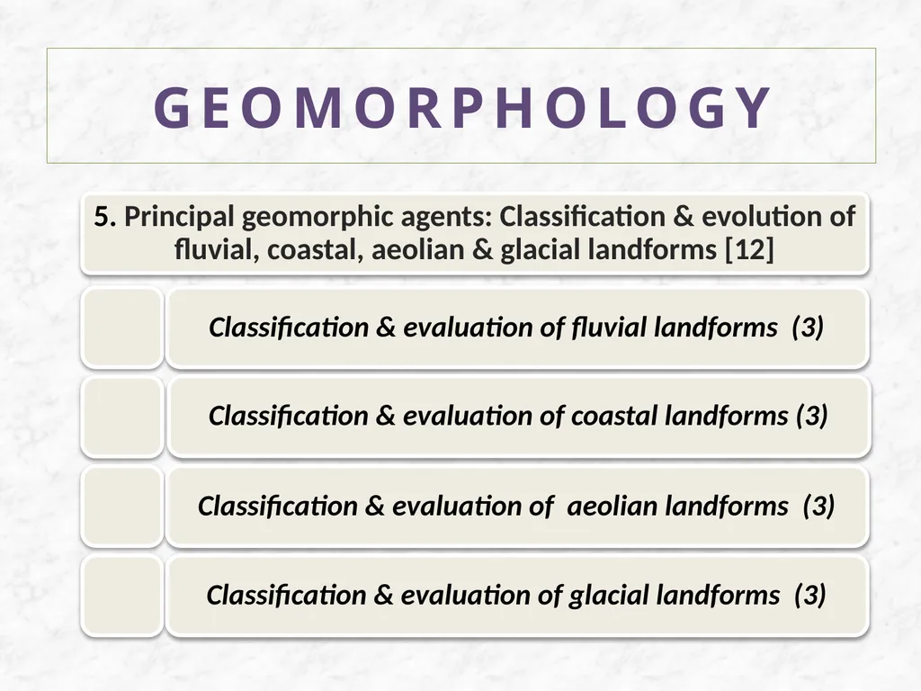
slide9. GEOMORPHOLOGY<br>
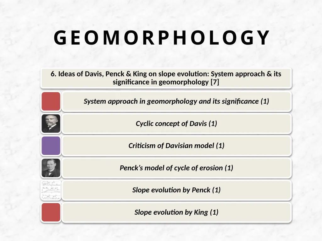
slide10. GEOMORPHOLOGY<br>
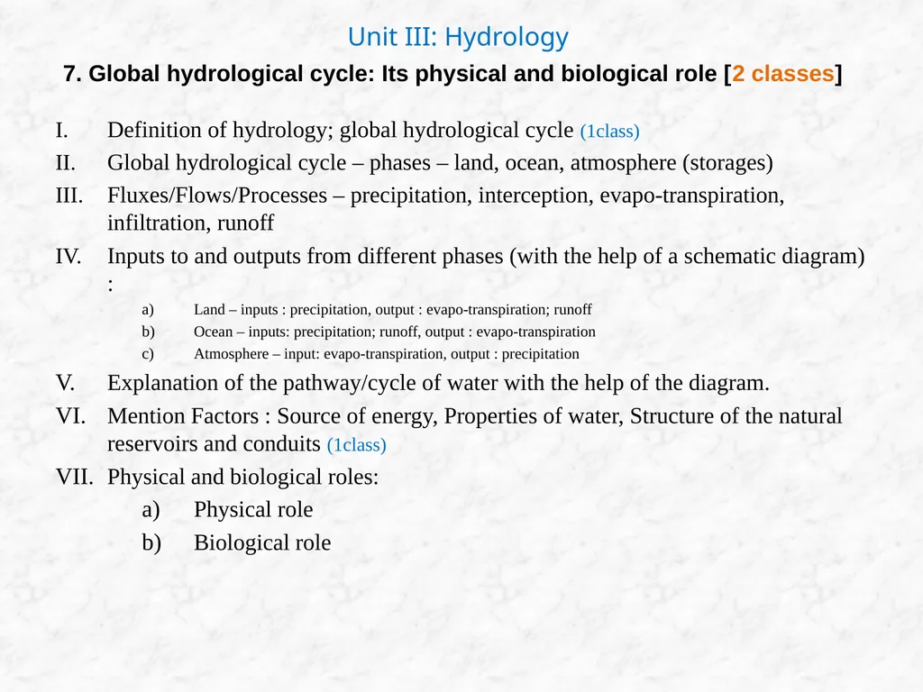
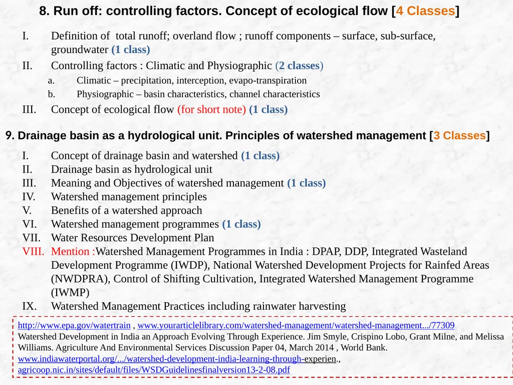
slide11. Definition of hydrology; global hydrological cycle (1class)
Global hydrological cycle – phases – land, ocean, atmosphere (storages)
Fluxes/Flows/Processes – precipitation, interception, evapo-transpiration, infiltration, runoff
Inputs to and outputs from different phases (with the help of a schematic diagram) :
Land – inputs : precipitation, output : evapo-transpiration; runoff
Ocean – inputs: precipitation; runoff, output : evapo-transpiration
Atmosphere – input: evapo-transpiration, output : precipitation
Explanation of the pathway/cycle of water with the help of the diagram.
Mention Factors : Source of energy, Properties of water, Structure of the natural reservoirs and conduits (1class)
Physical and biological roles:
Physical role
Biological role Unit III: Hydrology 7. Global hydrological cycle: Its physical and biological role [2 classes]<br>
slide12. Definition of total runoff; overland flow ; runoff components – surface, sub-surface, groundwater (1 class)
Controlling factors : Climatic and Physiographic (2 classes)
Climatic – precipitation, interception, evapo-transpiration
Physiographic – basin characteristics, channel characteristics
Concept of ecological flow (for short note) (1 class) 8. Run off: controlling factors. Concept of ecological flow [4 Classes] 9. Drainage basin as a hydrological unit. Principles of watershed management [3 Classes] Concept of drainage basin and watershed (1 class)
Drainage basin as hydrological unit
Meaning and Objectives of watershed management (1 class)
Watershed management principles
Benefits of a watershed approach
Watershed management programmes (1 class)
Water Resources Development Plan
Mention :Watershed Management Programmes in India : DPAP, DDP, Integrated Wasteland Development Programme (IWDP), National Watershed Development Projects for Rainfed Areas (NWDPRA), Control of Shifting Cultivation, Integrated Watershed Management Programme (IWMP)
Watershed Management Practices including rainwater harvesting http://www.epa.gov/watertrain , www.yourarticlelibrary.com/watershed-management/watershed-management.../77309
Watershed Development in India an Approach Evolving Through Experience. Jim Smyle, Crispino Lobo, Grant Milne, and Melissa Williams. Agriculture And Environmental Services Discussion Paper 04, March 2014 , World Bank. www.indiawaterportal.org/.../watershed-development-india-learning-through-experien., agricoop.nic.in/sites/default/files/WSDGuidelinesfinalversion13-2-08.pdf<br>
slide13. Unit-IV: Oceanography
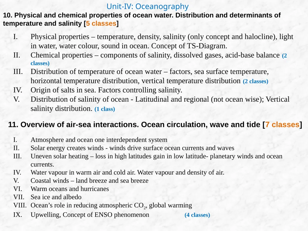
10. Physical and chemical properties of ocean water. Distribution and determinants of temperature and salinity [5 classes] Physical properties – temperature, density, salinity (only concept and halocline), light in water, water colour, sound in ocean. Concept of TS-Diagram.
Chemical properties – components of salinity, dissolved gases, acid-base balance (2 classes)
Distribution of temperature of ocean water – factors, sea surface temperature, horizontal temperature distribution, vertical temperature distribution (2 classes)
Origin of salts in sea. Factors controlling salinity.
Distribution of salinity of ocean - Latitudinal and regional (not ocean wise); Vertical salinity distribution. (1 class) 11. Overview of air-sea interactions. Ocean circulation, wave and tide [7 classes] Atmosphere and ocean one interdependent system
Solar energy creates winds - winds drive surface ocean currents and waves
Uneven solar heating – loss in high latitudes gain in low latitude- planetary winds and ocean currents.
Water vapour in warm air and cold air. Water vapour and density of air.
Coastal winds – land breeze and sea breeze
Warm oceans and hurricanes
Sea ice and albedo
Ocean’s role in reducing atmospheric CO2, global warming
Upwelling, Concept of ENSO phenomenon (4 classes)<br>
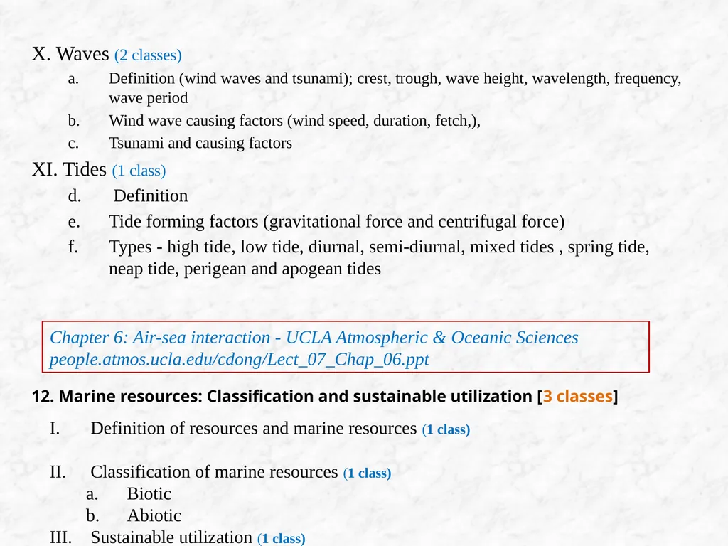
slide14. X. Waves (2 classes)
Definition (wind waves and tsunami); crest, trough, wave height, wavelength, frequency, wave period
Wind wave causing factors (wind speed, duration, fetch,),
Tsunami and causing factors
XI. Tides (1 class)
Definition
Tide forming factors (gravitational force and centrifugal force)
Types - high tide, low tide, diurnal, semi-diurnal, mixed tides , spring tide, neap tide, perigean and apogean tides Chapter 6: Air-sea interaction - UCLA Atmospheric & Oceanic Sciences
people.atmos.ucla.edu/cdong/Lect_07_Chap_06.ppt 12. Marine resources: Classification and sustainable utilization [3 classes] Definition of resources and marine resources (1 class)
Classification of marine resources (1 class)
Biotic
Abiotic
Sustainable utilization (1 class)<br>
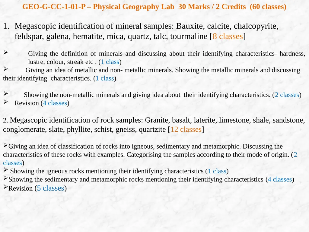
slide15. GEO-G-CC-1-01-P – Physical Geography Lab 30 Marks / 2 Credits (60 classes)
Megascopic identification of mineral samples: Bauxite, calcite, chalcopyrite, feldspar, galena, hematite, mica, quartz, talc, tourmaline [8 classes]
Giving the definition of minerals and discussing about their identifying characteristics- hardness, lustre, colour, streak etc . (1 class)
Giving an idea of metallic and non- metallic minerals. Showing the metallic minerals and discussing their identifying characteristics. (1 class)
Showing the non-metallic minerals and giving idea about their identifying characteristics. (2 classes)
Revision (4 classes)
2. Megascopic identification of rock samples: Granite, basalt, laterite, limestone, shale, sandstone, conglomerate, slate, phyllite, schist, gneiss, quartzite [12 classes]
Giving an idea of classification of rocks into igneous, sedimentary and metamorphic. Discussing the characteristics of these rocks with examples. Categorising the samples according to their mode of origin. (2 classes)
Showing the igneous rocks mentioning their identifying characteristics (1 class)
Showing the sedimentary and metamorphic rocks mentioning their identifying characteristics (4 classes)
Revision (5 classes)<br>
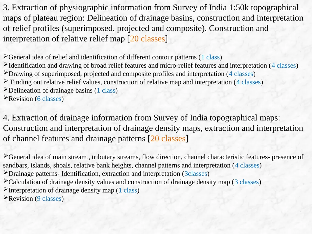
slide16. 3. Extraction of physiographic information from Survey of India 1:50k topographical maps of plateau region: Delineation of drainage basins, construction and interpretation of relief profiles (superimposed, projected and composite), Construction and interpretation of relative relief map [20 classes]
General idea of relief and identification of different contour patterns (1 class)
Identification and drawing of broad relief features and micro-relief features and interpretation (4 classes)
Drawing of superimposed, projected and composite profiles and interpretation (4 classes)
Finding out relative relief values, construction of relative map and interpretation (4 classes)
Delineation of drainage basins (1 class)
Revision (6 classes)
4. Extraction of drainage information from Survey of India topographical maps: Construction and interpretation of drainage density maps, extraction and interpretation of channel features and drainage patterns [20 classes]
General idea of main stream , tributary streams, flow direction, channel characteristic features- presence of sandbars, islands, shoals, relative bank heights, channel patterns and interpretation (4 classes)
Drainage patterns- Identification, extraction and interpretation (3classes)
Calculation of drainage density values and construction of drainage density map (3 classes)
Interpretation of drainage density map (1 class)
Revision (9 classes)<br>
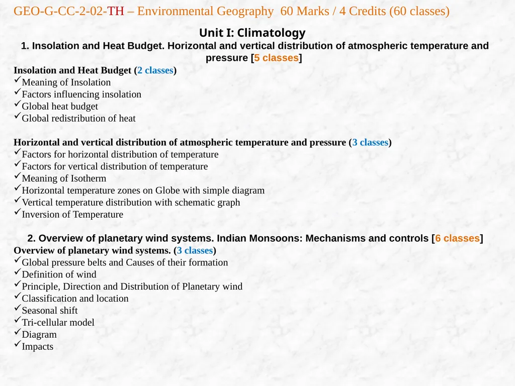
slide17. Unit I: Climatology 1. Insolation and Heat Budget. Horizontal and vertical distribution of atmospheric temperature and pressure [5 classes]
Insolation and Heat Budget (2 classes)
Meaning of Insolation
Factors influencing insolation
Global heat budget
Global redistribution of heat
Horizontal and vertical distribution of atmospheric temperature and pressure (3 classes)
Factors for horizontal distribution of temperature
Factors for vertical distribution of temperature
Meaning of Isotherm
Horizontal temperature zones on Globe with simple diagram
Vertical temperature distribution with schematic graph
Inversion of Temperature
2. Overview of planetary wind systems. Indian Monsoons: Mechanisms and controls [6 classes]
Overview of planetary wind systems. (3 classes)
Global pressure belts and Causes of their formation
Definition of wind
Principle, Direction and Distribution of Planetary wind
Classification and location
Seasonal shift
Tri-cellular model
Diagram
Impacts GEO-G-CC-2-02-TH – Environmental Geography 60 Marks / 4 Credits (60 classes)<br>
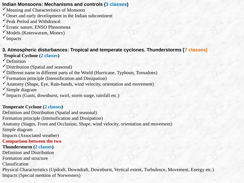
slide18. Indian Monsoons: Mechanisms and controls (3 classes)
Meaning and Characteristics of Monsoon
Onset and early development in the Indian subcontinent
Peak Period and Withdrawal
Erratic nature, ENSO Phenomena
Models (Koteswaram, Monex)
Impacts
3. Atmospheric disturbances: Tropical and temperate cyclones. Thunderstorms [7 classes] Tropical Cyclone (2 classes)
Definition
Distribution (Spatial and seasonal)
Different name in different parts of the World (Hurricane, Typhoon, Tornadoes)
Formation principle (Intensification and Dissipation)
Anatomy (Shape, Eye, Rain-bands, wind velocity, orientation and movement)
Simple diagram
Impacts (Gusts, downburst, swirl, storm surge, rainfall etc.)
Temperate Cyclone (2 classes)
Definition and Distribution (Spatial and seasonal)
Formation principle (Intensification and Dissipation)
Anatomy (Stages, Front and Occlusion, Shape, wind velocity, orientation and movement)
Simple diagram
Impacts (Associated weather)
Comparison between the two
Thunderstorm (2 classes)
Definition and Distribution
Formation and structure
Classification
Physical Characteristics (Updraft, Downdraft, Downburst, Vertical extent, Turbulence, Movement, Energy etc.)
Impacts (Special mention of Norwesters)<br>
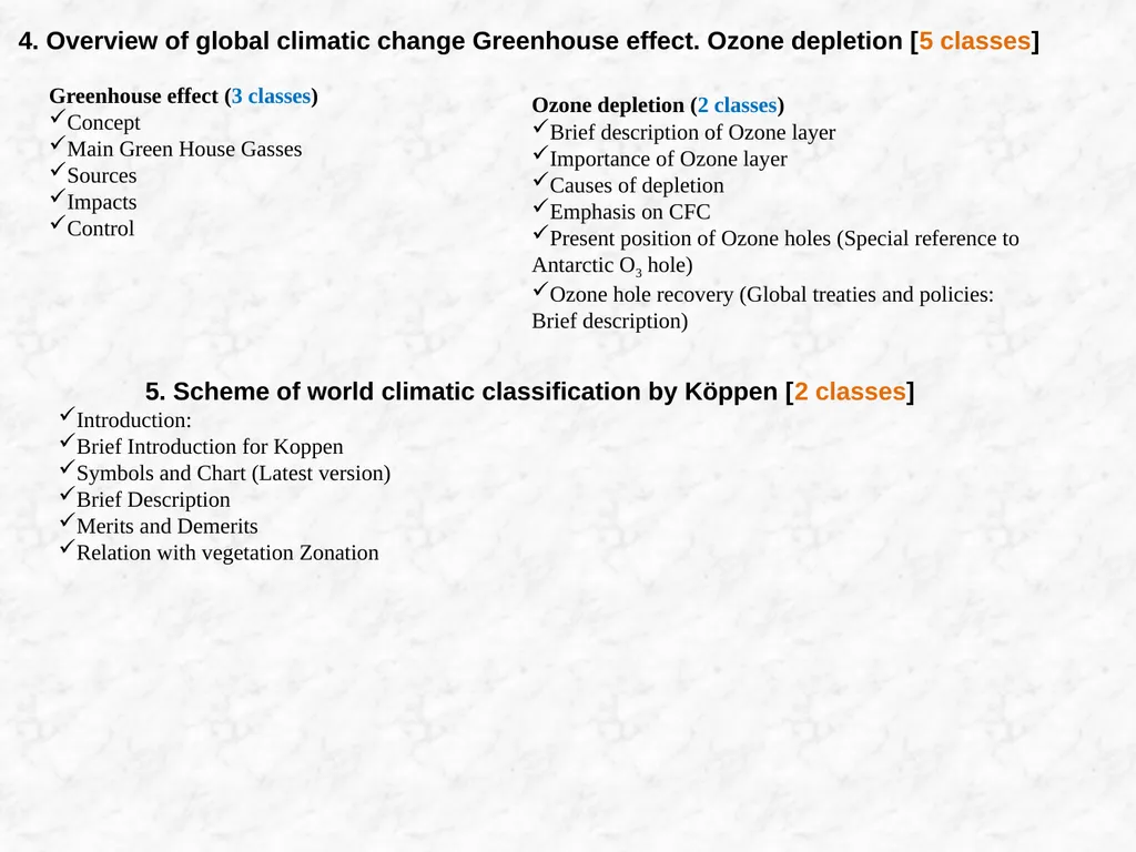
slide19. 4. Overview of global climatic change Greenhouse effect. Ozone depletion [5 classes] Greenhouse effect (3 classes)
Concept
Main Green House Gasses
Sources
Impacts
Control Ozone depletion (2 classes)
Brief description of Ozone layer
Importance of Ozone layer
Causes of depletion
Emphasis on CFC
Present position of Ozone holes (Special reference to Antarctic O3 hole)
Ozone hole recovery (Global treaties and policies: Brief description) 5. Scheme of world climatic classification by Köppen [2 classes]
Introduction:
Brief Introduction for Koppen
Symbols and Chart (Latest version)
Brief Description
Merits and Demerits
Relation with vegetation Zonation<br>
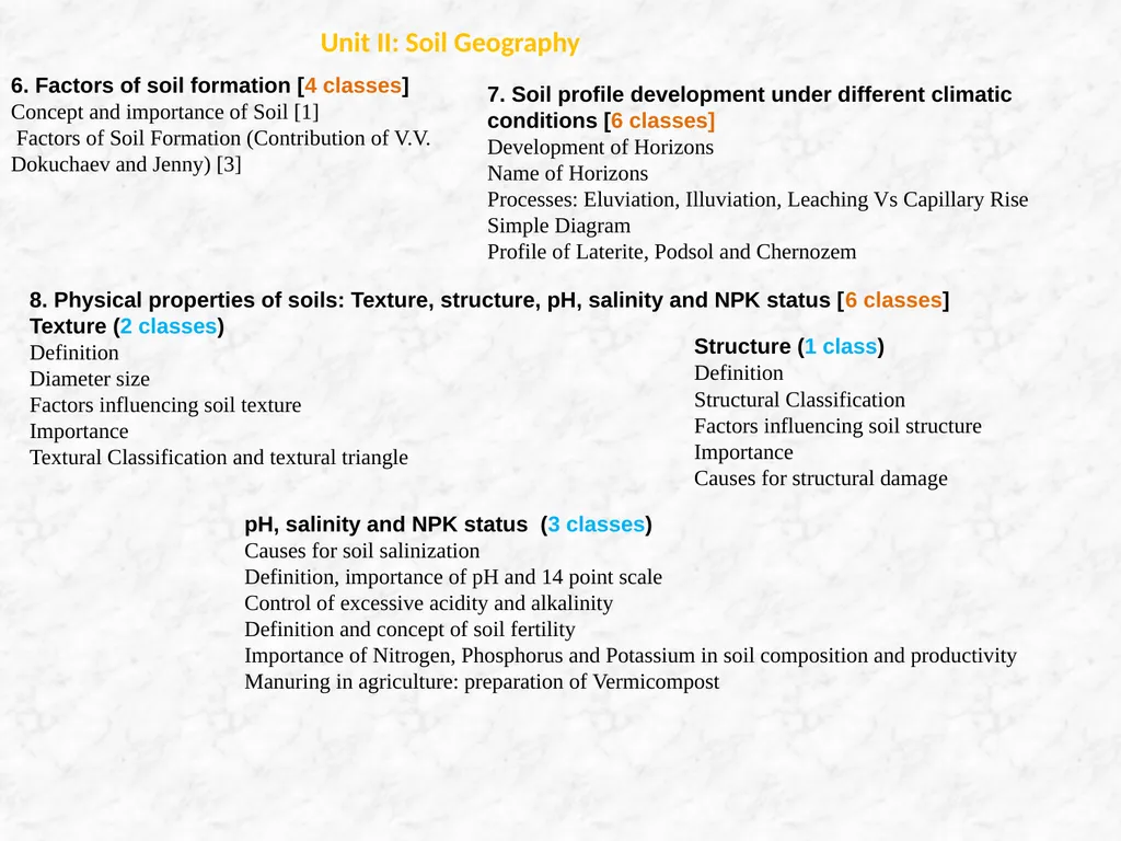
slide20. Unit II: Soil Geography 6. Factors of soil formation [4 classes]
Concept and importance of Soil [1]
Factors of Soil Formation (Contribution of V.V. Dokuchaev and Jenny) [3] 7. Soil profile development under different climatic conditions [6 classes]
Development of Horizons
Name of Horizons
Processes: Eluviation, Illuviation, Leaching Vs Capillary Rise
Simple Diagram
Profile of Laterite, Podsol and Chernozem 8. Physical properties of soils: Texture, structure, pH, salinity and NPK status [6 classes]
Texture (2 classes)
Definition
Diameter size
Factors influencing soil texture
Importance
Textural Classification and textural triangle Structure (1 class)
Definition
Structural Classification
Factors influencing soil structure
Importance
Causes for structural damage pH, salinity and NPK status (3 classes)
Causes for soil salinization
Definition, importance of pH and 14 point scale
Control of excessive acidity and alkalinity
Definition and concept of soil fertility
Importance of Nitrogen, Phosphorus and Potassium in soil composition and productivity
Manuring in agriculture: preparation of Vermicompost<br>
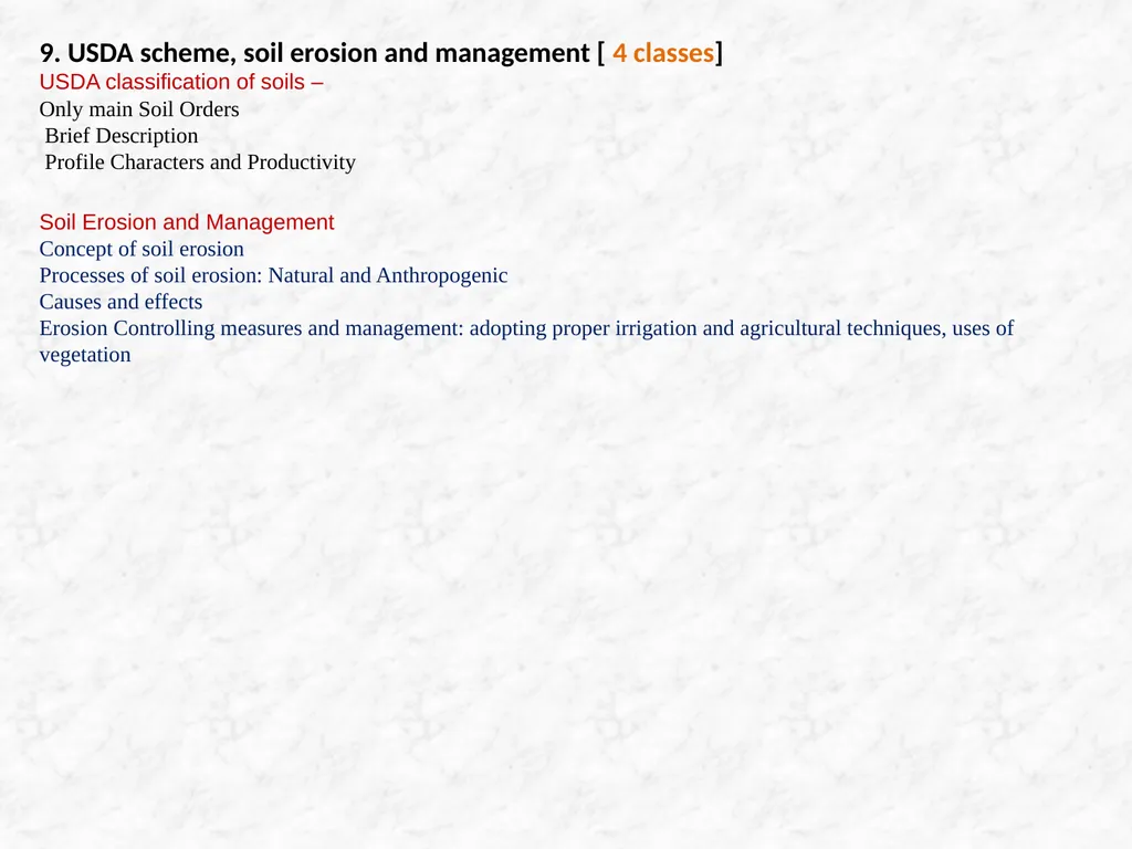
slide21. 9. USDA scheme, soil erosion and management [ 4 classes]
USDA classification of soils –
Only main Soil Orders
Brief Description
Profile Characters and Productivity
Soil Erosion and Management
Concept of soil erosion
Processes of soil erosion: Natural and Anthropogenic
Causes and effects
Erosion Controlling measures and management: adopting proper irrigation and agricultural techniques, uses of vegetation<br>
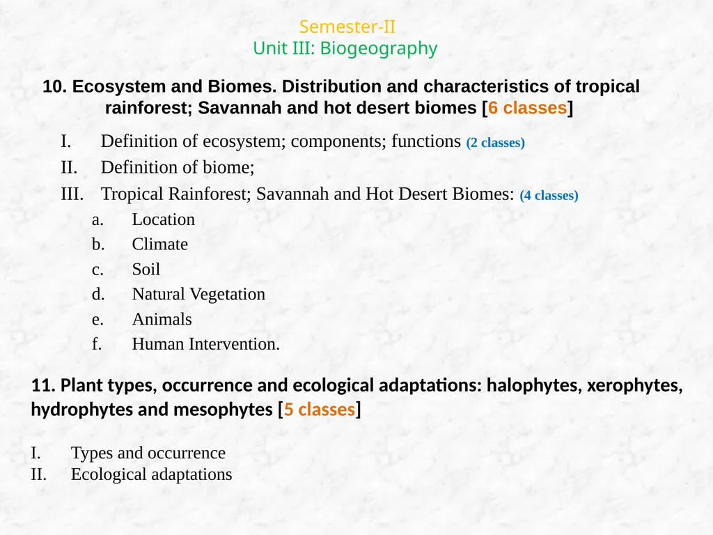
slide22. Semester-II
Unit III: Biogeography 10. Ecosystem and Biomes. Distribution and characteristics of tropical rainforest; Savannah and hot desert biomes [6 classes] Definition of ecosystem; components; functions (2 classes)
Definition of biome;
Tropical Rainforest; Savannah and Hot Desert Biomes: (4 classes)
Location
Climate
Soil
Natural Vegetation
Animals
Human Intervention. 11. Plant types, occurrence and ecological adaptations: halophytes, xerophytes, hydrophytes and mesophytes [5 classes]
Types and occurrence
Ecological adaptations<br>
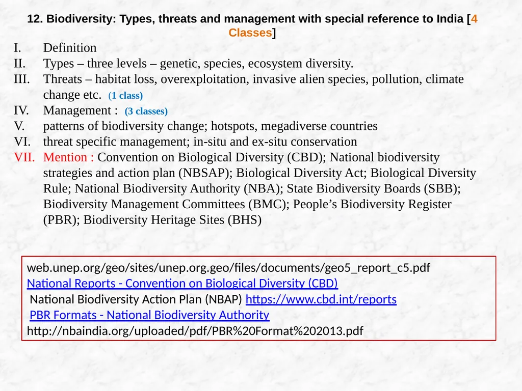
slide23. 12. Biodiversity: Types, threats and management with special reference to India [4 Classes]
Definition
Types – three levels – genetic, species, ecosystem diversity.
Threats – habitat loss, overexploitation, invasive alien species, pollution, climate change etc. (1 class)
Management : (3 classes)
patterns of biodiversity change; hotspots, megadiverse countries
threat specific management; in-situ and ex-situ conservation
Mention : Convention on Biological Diversity (CBD); National biodiversity strategies and action plan (NBSAP); Biological Diversity Act; Biological Diversity Rule; National Biodiversity Authority (NBA); State Biodiversity Boards (SBB); Biodiversity Management Committees (BMC); People’s Biodiversity Register (PBR); Biodiversity Heritage Sites (BHS) web.unep.org/geo/sites/unep.org.geo/files/documents/geo5_report_c5.pdf
National Reports - Convention on Biological Diversity (CBD)
National Biodiversity Action Plan (NBAP) https://www.cbd.int/reports
PBR Formats - National Biodiversity Authority
http://nbaindia.org/uploaded/pdf/PBR%20Format%202013.pdf<br>
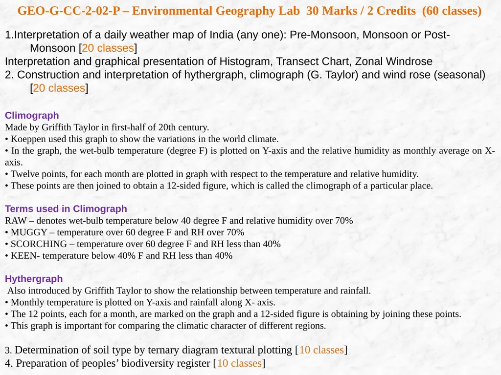
slide24. GEO-G-CC-2-02-P – Environmental Geography Lab 30 Marks / 2 Credits (60 classes) 1.Interpretation of a daily weather map of India (any one): Pre-Monsoon, Monsoon or Post-Monsoon [20 classes]
Interpretation and graphical presentation of Histogram, Transect Chart, Zonal Windrose
2. Construction and interpretation of hythergraph, climograph (G. Taylor) and wind rose (seasonal) [20 classes]
Climograph
Made by Griffith Taylor in first-half of 20th century.
• Koeppen used this graph to show the variations in the world climate.
• In the graph, the wet-bulb temperature (degree F) is plotted on Y-axis and the relative humidity as monthly average on X- axis.
• Twelve points, for each month are plotted in graph with respect to the temperature and relative humidity.
• These points are then joined to obtain a 12-sided figure, which is called the climograph of a particular place.
Terms used in Climograph
RAW – denotes wet-bulb temperature below 40 degree F and relative humidity over 70%
• MUGGY – temperature over 60 degree F and RH over 70%
• SCORCHING – temperature over 60 degree F and RH less than 40%
• KEEN- temperature below 40% F and RH less than 40%
Hythergraph
Also introduced by Griffith Taylor to show the relationship between temperature and rainfall.
• Monthly temperature is plotted on Y-axis and rainfall along X- axis.
• The 12 points, each for a month, are marked on the graph and a 12-sided figure is obtaining by joining these points.
• This graph is important for comparing the climatic character of different regions.
3. Determination of soil type by ternary diagram textural plotting [10 classes]
4. Preparation of peoples’ biodiversity register [10 classes]<br>
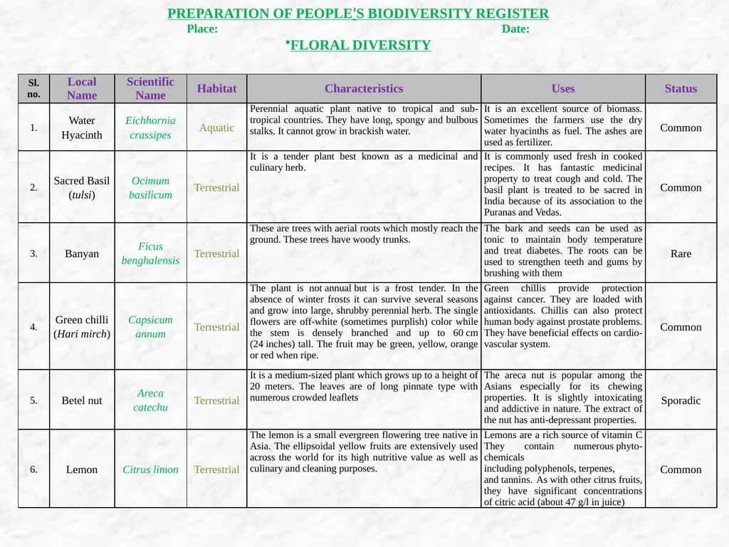
slide25. PREPARATION OF PEOPLE’S BIODIVERSITY REGISTER
Place: Date:
FLORAL DIVERSITY<br>
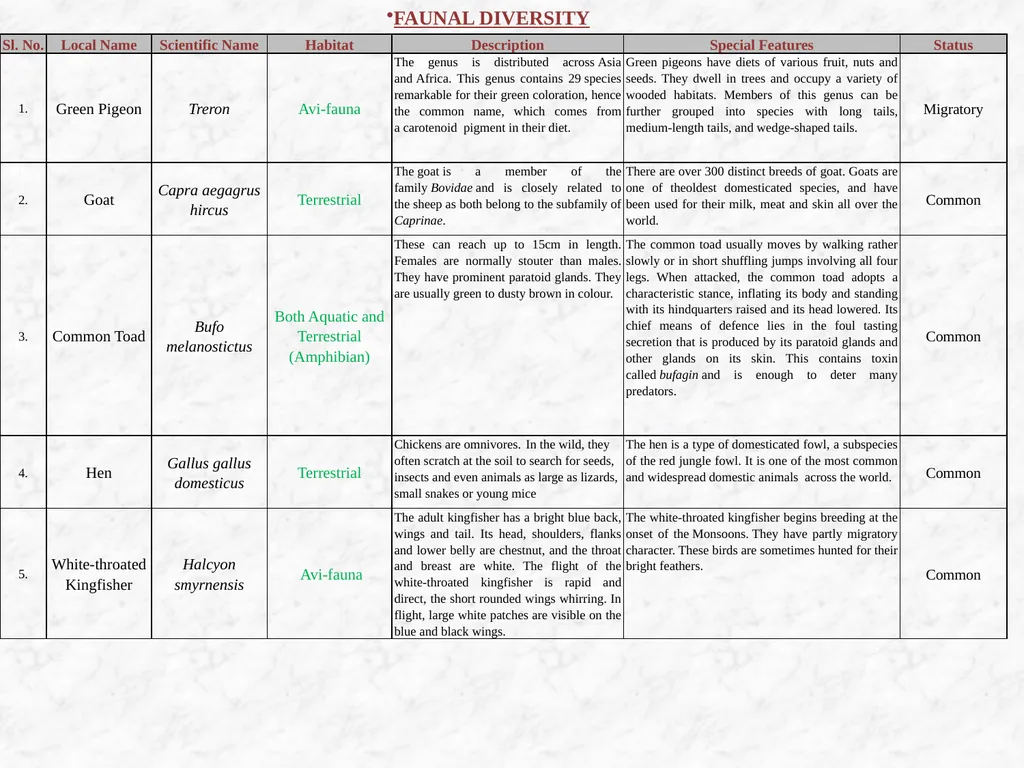
slide26. FAUNAL DIVERSITY<br>
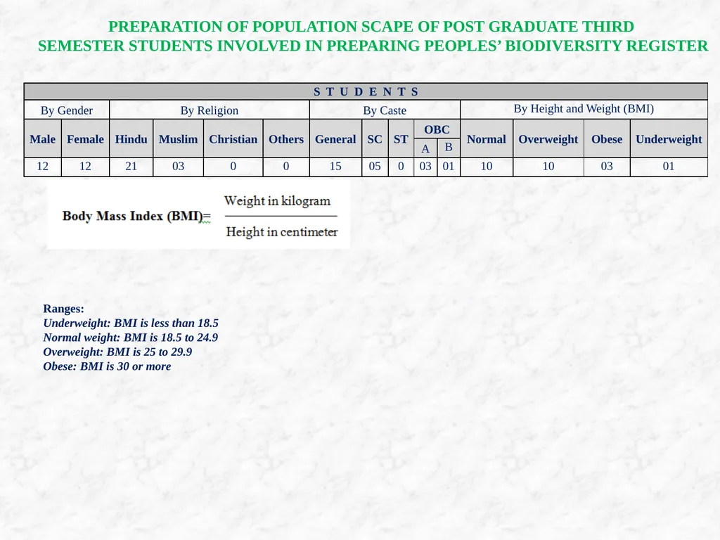
slide27. PREPARATION OF POPULATION SCAPE OF POST GRADUATE THIRD
SEMESTER STUDENTS INVOLVED IN PREPARING PEOPLES’ BIODIVERSITY REGISTER Ranges:
Underweight: BMI is less than 18.5
Normal weight: BMI is 18.5 to 24.9
Overweight: BMI is 25 to 29.9
Obese: BMI is 30 or more<br>
slide28. Thank you<br>
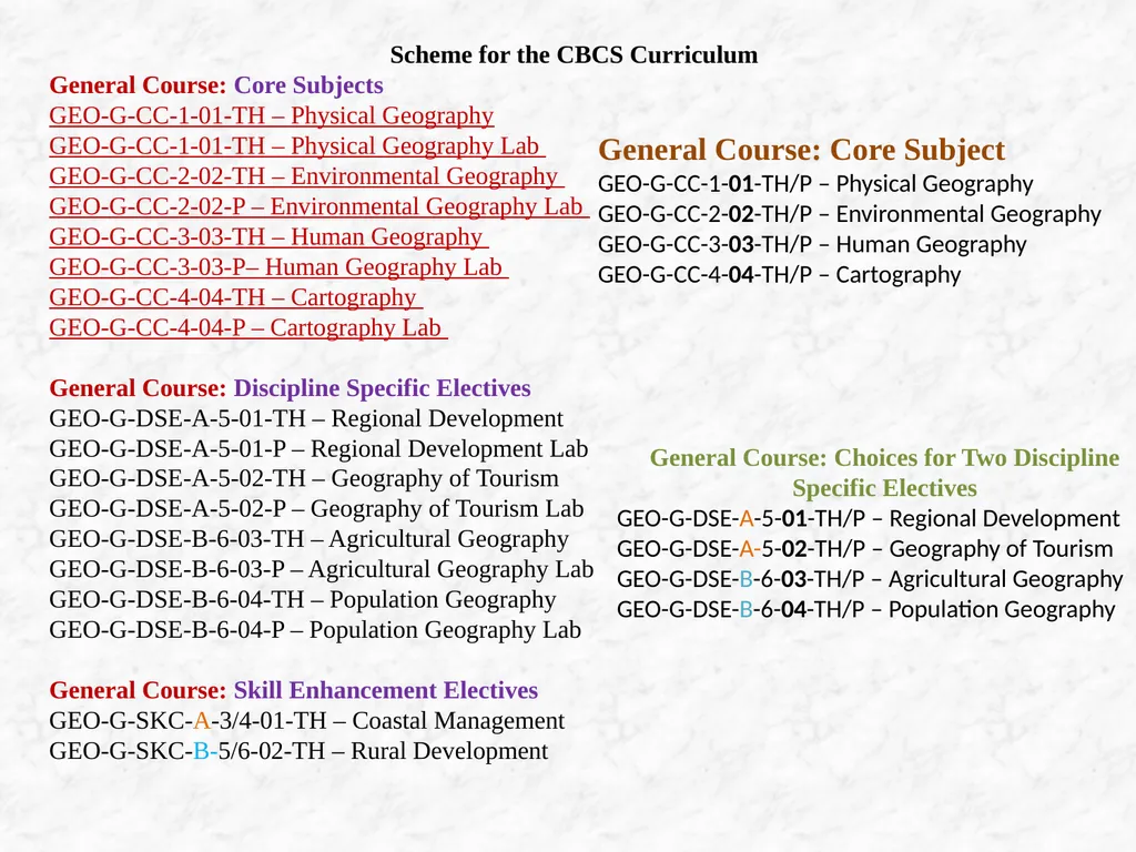
General Course: Core Subjects
GEO-G-CC-1-01-TH – Physical Geography
GEO-G-CC-1-01-TH – Physical Geography Lab
GEO-G-CC-2-02-TH – Environmental Geography
GEO-G-CC-2-02-P – Environmental Geography Lab
GEO-G-CC-3-03-TH – Human Geography
GEO-G-CC-3-03-P– Human Geography Lab
GEO-G-CC-4-04-TH – Cartography
GEO-G-CC-4-04-P – Cartography Lab
General Course: Discipline Specific Electives
GEO-G-DSE-A-5-01-TH – Regional Development
GEO-G-DSE-A-5-01-P – Regional Development Lab
GEO-G-DSE-A-5-02-TH – Geography of Tourism
GEO-G-DSE-A-5-02-P – Geography of Tourism Lab
GEO-G-DSE-B-6-03-TH – Agricultural Geography
GEO-G-DSE-B-6-03-P – Agricultural Geography Lab
GEO-G-DSE-B-6-04-TH – Population Geography
GEO-G-DSE-B-6-04-P – Population Geography Lab
General Course: Skill Enhancement Electives
GEO-G-SKC-A-3/4-01-TH – Coastal Management
GEO-G-SKC-B-5/6-02-TH – Rural Development General Course: Core Subject
GEO-G-CC-1-01-TH/P – Physical Geography
GEO-G-CC-2-02-TH/P – Environmental Geography
GEO-G-CC-3-03-TH/P – Human Geography
GEO-G-CC-4-04-TH/P – Cartography General Course: Choices for Two Discipline Specific Electives
GEO-G-DSE-A-5-01-TH/P – Regional Development
GEO-G-DSE-A-5-02-TH/P – Geography of Tourism
GEO-G-DSE-B-6-03-TH/P – Agricultural Geography
GEO-G-DSE-B-6-04-TH/P – Population Geography<br>
slide2. Credit Distribution across Courses: General Course *Tutorials of 1 Credit will be conducted in case there is no practical component<br>
slide3. Suggested Mark-wise Class Distribution(apart from SECs)<br>
slide4. Credits and Marks Distribution Scheme for CBCS Curriculum: General Course<br>
slide5. GEOTECTONICS UNIT 1 GEO-G-CC-1-01-TH-Physical Geography<br>
slide6. GEOTECTONICS<br>
slide7. GEOTECTONICS<br>
slide8. GEOMORPHOLOGY UNIT 2<br>
slide9. GEOMORPHOLOGY<br>
slide10. GEOMORPHOLOGY<br>
slide11. Definition of hydrology; global hydrological cycle (1class)
Global hydrological cycle – phases – land, ocean, atmosphere (storages)
Fluxes/Flows/Processes – precipitation, interception, evapo-transpiration, infiltration, runoff
Inputs to and outputs from different phases (with the help of a schematic diagram) :
Land – inputs : precipitation, output : evapo-transpiration; runoff
Ocean – inputs: precipitation; runoff, output : evapo-transpiration
Atmosphere – input: evapo-transpiration, output : precipitation
Explanation of the pathway/cycle of water with the help of the diagram.
Mention Factors : Source of energy, Properties of water, Structure of the natural reservoirs and conduits (1class)
Physical and biological roles:
Physical role
Biological role Unit III: Hydrology 7. Global hydrological cycle: Its physical and biological role [2 classes]<br>
slide12. Definition of total runoff; overland flow ; runoff components – surface, sub-surface, groundwater (1 class)
Controlling factors : Climatic and Physiographic (2 classes)
Climatic – precipitation, interception, evapo-transpiration
Physiographic – basin characteristics, channel characteristics
Concept of ecological flow (for short note) (1 class) 8. Run off: controlling factors. Concept of ecological flow [4 Classes] 9. Drainage basin as a hydrological unit. Principles of watershed management [3 Classes] Concept of drainage basin and watershed (1 class)
Drainage basin as hydrological unit
Meaning and Objectives of watershed management (1 class)
Watershed management principles
Benefits of a watershed approach
Watershed management programmes (1 class)
Water Resources Development Plan
Mention :Watershed Management Programmes in India : DPAP, DDP, Integrated Wasteland Development Programme (IWDP), National Watershed Development Projects for Rainfed Areas (NWDPRA), Control of Shifting Cultivation, Integrated Watershed Management Programme (IWMP)
Watershed Management Practices including rainwater harvesting http://www.epa.gov/watertrain , www.yourarticlelibrary.com/watershed-management/watershed-management.../77309
Watershed Development in India an Approach Evolving Through Experience. Jim Smyle, Crispino Lobo, Grant Milne, and Melissa Williams. Agriculture And Environmental Services Discussion Paper 04, March 2014 , World Bank. www.indiawaterportal.org/.../watershed-development-india-learning-through-experien., agricoop.nic.in/sites/default/files/WSDGuidelinesfinalversion13-2-08.pdf<br>
slide13. Unit-IV: Oceanography
10. Physical and chemical properties of ocean water. Distribution and determinants of temperature and salinity [5 classes] Physical properties – temperature, density, salinity (only concept and halocline), light in water, water colour, sound in ocean. Concept of TS-Diagram.
Chemical properties – components of salinity, dissolved gases, acid-base balance (2 classes)
Distribution of temperature of ocean water – factors, sea surface temperature, horizontal temperature distribution, vertical temperature distribution (2 classes)
Origin of salts in sea. Factors controlling salinity.
Distribution of salinity of ocean - Latitudinal and regional (not ocean wise); Vertical salinity distribution. (1 class) 11. Overview of air-sea interactions. Ocean circulation, wave and tide [7 classes] Atmosphere and ocean one interdependent system
Solar energy creates winds - winds drive surface ocean currents and waves
Uneven solar heating – loss in high latitudes gain in low latitude- planetary winds and ocean currents.
Water vapour in warm air and cold air. Water vapour and density of air.
Coastal winds – land breeze and sea breeze
Warm oceans and hurricanes
Sea ice and albedo
Ocean’s role in reducing atmospheric CO2, global warming
Upwelling, Concept of ENSO phenomenon (4 classes)<br>
slide14. X. Waves (2 classes)
Definition (wind waves and tsunami); crest, trough, wave height, wavelength, frequency, wave period
Wind wave causing factors (wind speed, duration, fetch,),
Tsunami and causing factors
XI. Tides (1 class)
Definition
Tide forming factors (gravitational force and centrifugal force)
Types - high tide, low tide, diurnal, semi-diurnal, mixed tides , spring tide, neap tide, perigean and apogean tides Chapter 6: Air-sea interaction - UCLA Atmospheric & Oceanic Sciences
people.atmos.ucla.edu/cdong/Lect_07_Chap_06.ppt 12. Marine resources: Classification and sustainable utilization [3 classes] Definition of resources and marine resources (1 class)
Classification of marine resources (1 class)
Biotic
Abiotic
Sustainable utilization (1 class)<br>
slide15. GEO-G-CC-1-01-P – Physical Geography Lab 30 Marks / 2 Credits (60 classes)
Megascopic identification of mineral samples: Bauxite, calcite, chalcopyrite, feldspar, galena, hematite, mica, quartz, talc, tourmaline [8 classes]
Giving the definition of minerals and discussing about their identifying characteristics- hardness, lustre, colour, streak etc . (1 class)
Giving an idea of metallic and non- metallic minerals. Showing the metallic minerals and discussing their identifying characteristics. (1 class)
Showing the non-metallic minerals and giving idea about their identifying characteristics. (2 classes)
Revision (4 classes)
2. Megascopic identification of rock samples: Granite, basalt, laterite, limestone, shale, sandstone, conglomerate, slate, phyllite, schist, gneiss, quartzite [12 classes]
Giving an idea of classification of rocks into igneous, sedimentary and metamorphic. Discussing the characteristics of these rocks with examples. Categorising the samples according to their mode of origin. (2 classes)
Showing the igneous rocks mentioning their identifying characteristics (1 class)
Showing the sedimentary and metamorphic rocks mentioning their identifying characteristics (4 classes)
Revision (5 classes)<br>
slide16. 3. Extraction of physiographic information from Survey of India 1:50k topographical maps of plateau region: Delineation of drainage basins, construction and interpretation of relief profiles (superimposed, projected and composite), Construction and interpretation of relative relief map [20 classes]
General idea of relief and identification of different contour patterns (1 class)
Identification and drawing of broad relief features and micro-relief features and interpretation (4 classes)
Drawing of superimposed, projected and composite profiles and interpretation (4 classes)
Finding out relative relief values, construction of relative map and interpretation (4 classes)
Delineation of drainage basins (1 class)
Revision (6 classes)
4. Extraction of drainage information from Survey of India topographical maps: Construction and interpretation of drainage density maps, extraction and interpretation of channel features and drainage patterns [20 classes]
General idea of main stream , tributary streams, flow direction, channel characteristic features- presence of sandbars, islands, shoals, relative bank heights, channel patterns and interpretation (4 classes)
Drainage patterns- Identification, extraction and interpretation (3classes)
Calculation of drainage density values and construction of drainage density map (3 classes)
Interpretation of drainage density map (1 class)
Revision (9 classes)<br>
slide17. Unit I: Climatology 1. Insolation and Heat Budget. Horizontal and vertical distribution of atmospheric temperature and pressure [5 classes]
Insolation and Heat Budget (2 classes)
Meaning of Insolation
Factors influencing insolation
Global heat budget
Global redistribution of heat
Horizontal and vertical distribution of atmospheric temperature and pressure (3 classes)
Factors for horizontal distribution of temperature
Factors for vertical distribution of temperature
Meaning of Isotherm
Horizontal temperature zones on Globe with simple diagram
Vertical temperature distribution with schematic graph
Inversion of Temperature
2. Overview of planetary wind systems. Indian Monsoons: Mechanisms and controls [6 classes]
Overview of planetary wind systems. (3 classes)
Global pressure belts and Causes of their formation
Definition of wind
Principle, Direction and Distribution of Planetary wind
Classification and location
Seasonal shift
Tri-cellular model
Diagram
Impacts GEO-G-CC-2-02-TH – Environmental Geography 60 Marks / 4 Credits (60 classes)<br>
slide18. Indian Monsoons: Mechanisms and controls (3 classes)
Meaning and Characteristics of Monsoon
Onset and early development in the Indian subcontinent
Peak Period and Withdrawal
Erratic nature, ENSO Phenomena
Models (Koteswaram, Monex)
Impacts
3. Atmospheric disturbances: Tropical and temperate cyclones. Thunderstorms [7 classes] Tropical Cyclone (2 classes)
Definition
Distribution (Spatial and seasonal)
Different name in different parts of the World (Hurricane, Typhoon, Tornadoes)
Formation principle (Intensification and Dissipation)
Anatomy (Shape, Eye, Rain-bands, wind velocity, orientation and movement)
Simple diagram
Impacts (Gusts, downburst, swirl, storm surge, rainfall etc.)
Temperate Cyclone (2 classes)
Definition and Distribution (Spatial and seasonal)
Formation principle (Intensification and Dissipation)
Anatomy (Stages, Front and Occlusion, Shape, wind velocity, orientation and movement)
Simple diagram
Impacts (Associated weather)
Comparison between the two
Thunderstorm (2 classes)
Definition and Distribution
Formation and structure
Classification
Physical Characteristics (Updraft, Downdraft, Downburst, Vertical extent, Turbulence, Movement, Energy etc.)
Impacts (Special mention of Norwesters)<br>
slide19. 4. Overview of global climatic change Greenhouse effect. Ozone depletion [5 classes] Greenhouse effect (3 classes)
Concept
Main Green House Gasses
Sources
Impacts
Control Ozone depletion (2 classes)
Brief description of Ozone layer
Importance of Ozone layer
Causes of depletion
Emphasis on CFC
Present position of Ozone holes (Special reference to Antarctic O3 hole)
Ozone hole recovery (Global treaties and policies: Brief description) 5. Scheme of world climatic classification by Köppen [2 classes]
Introduction:
Brief Introduction for Koppen
Symbols and Chart (Latest version)
Brief Description
Merits and Demerits
Relation with vegetation Zonation<br>
slide20. Unit II: Soil Geography 6. Factors of soil formation [4 classes]
Concept and importance of Soil [1]
Factors of Soil Formation (Contribution of V.V. Dokuchaev and Jenny) [3] 7. Soil profile development under different climatic conditions [6 classes]
Development of Horizons
Name of Horizons
Processes: Eluviation, Illuviation, Leaching Vs Capillary Rise
Simple Diagram
Profile of Laterite, Podsol and Chernozem 8. Physical properties of soils: Texture, structure, pH, salinity and NPK status [6 classes]
Texture (2 classes)
Definition
Diameter size
Factors influencing soil texture
Importance
Textural Classification and textural triangle Structure (1 class)
Definition
Structural Classification
Factors influencing soil structure
Importance
Causes for structural damage pH, salinity and NPK status (3 classes)
Causes for soil salinization
Definition, importance of pH and 14 point scale
Control of excessive acidity and alkalinity
Definition and concept of soil fertility
Importance of Nitrogen, Phosphorus and Potassium in soil composition and productivity
Manuring in agriculture: preparation of Vermicompost<br>
slide21. 9. USDA scheme, soil erosion and management [ 4 classes]
USDA classification of soils –
Only main Soil Orders
Brief Description
Profile Characters and Productivity
Soil Erosion and Management
Concept of soil erosion
Processes of soil erosion: Natural and Anthropogenic
Causes and effects
Erosion Controlling measures and management: adopting proper irrigation and agricultural techniques, uses of vegetation<br>
slide22. Semester-II
Unit III: Biogeography 10. Ecosystem and Biomes. Distribution and characteristics of tropical rainforest; Savannah and hot desert biomes [6 classes] Definition of ecosystem; components; functions (2 classes)
Definition of biome;
Tropical Rainforest; Savannah and Hot Desert Biomes: (4 classes)
Location
Climate
Soil
Natural Vegetation
Animals
Human Intervention. 11. Plant types, occurrence and ecological adaptations: halophytes, xerophytes, hydrophytes and mesophytes [5 classes]
Types and occurrence
Ecological adaptations<br>
slide23. 12. Biodiversity: Types, threats and management with special reference to India [4 Classes]
Definition
Types – three levels – genetic, species, ecosystem diversity.
Threats – habitat loss, overexploitation, invasive alien species, pollution, climate change etc. (1 class)
Management : (3 classes)
patterns of biodiversity change; hotspots, megadiverse countries
threat specific management; in-situ and ex-situ conservation
Mention : Convention on Biological Diversity (CBD); National biodiversity strategies and action plan (NBSAP); Biological Diversity Act; Biological Diversity Rule; National Biodiversity Authority (NBA); State Biodiversity Boards (SBB); Biodiversity Management Committees (BMC); People’s Biodiversity Register (PBR); Biodiversity Heritage Sites (BHS) web.unep.org/geo/sites/unep.org.geo/files/documents/geo5_report_c5.pdf
National Reports - Convention on Biological Diversity (CBD)
National Biodiversity Action Plan (NBAP) https://www.cbd.int/reports
PBR Formats - National Biodiversity Authority
http://nbaindia.org/uploaded/pdf/PBR%20Format%202013.pdf<br>
slide24. GEO-G-CC-2-02-P – Environmental Geography Lab 30 Marks / 2 Credits (60 classes) 1.Interpretation of a daily weather map of India (any one): Pre-Monsoon, Monsoon or Post-Monsoon [20 classes]
Interpretation and graphical presentation of Histogram, Transect Chart, Zonal Windrose
2. Construction and interpretation of hythergraph, climograph (G. Taylor) and wind rose (seasonal) [20 classes]
Climograph
Made by Griffith Taylor in first-half of 20th century.
• Koeppen used this graph to show the variations in the world climate.
• In the graph, the wet-bulb temperature (degree F) is plotted on Y-axis and the relative humidity as monthly average on X- axis.
• Twelve points, for each month are plotted in graph with respect to the temperature and relative humidity.
• These points are then joined to obtain a 12-sided figure, which is called the climograph of a particular place.
Terms used in Climograph
RAW – denotes wet-bulb temperature below 40 degree F and relative humidity over 70%
• MUGGY – temperature over 60 degree F and RH over 70%
• SCORCHING – temperature over 60 degree F and RH less than 40%
• KEEN- temperature below 40% F and RH less than 40%
Hythergraph
Also introduced by Griffith Taylor to show the relationship between temperature and rainfall.
• Monthly temperature is plotted on Y-axis and rainfall along X- axis.
• The 12 points, each for a month, are marked on the graph and a 12-sided figure is obtaining by joining these points.
• This graph is important for comparing the climatic character of different regions.
3. Determination of soil type by ternary diagram textural plotting [10 classes]
4. Preparation of peoples’ biodiversity register [10 classes]<br>
slide25. PREPARATION OF PEOPLE’S BIODIVERSITY REGISTER
Place: Date:
FLORAL DIVERSITY<br>
slide26. FAUNAL DIVERSITY<br>
slide27. PREPARATION OF POPULATION SCAPE OF POST GRADUATE THIRD
SEMESTER STUDENTS INVOLVED IN PREPARING PEOPLES’ BIODIVERSITY REGISTER Ranges:
Underweight: BMI is less than 18.5
Normal weight: BMI is 18.5 to 24.9
Overweight: BMI is 25 to 29.9
Obese: BMI is 30 or more<br>
slide28. Thank you<br>