
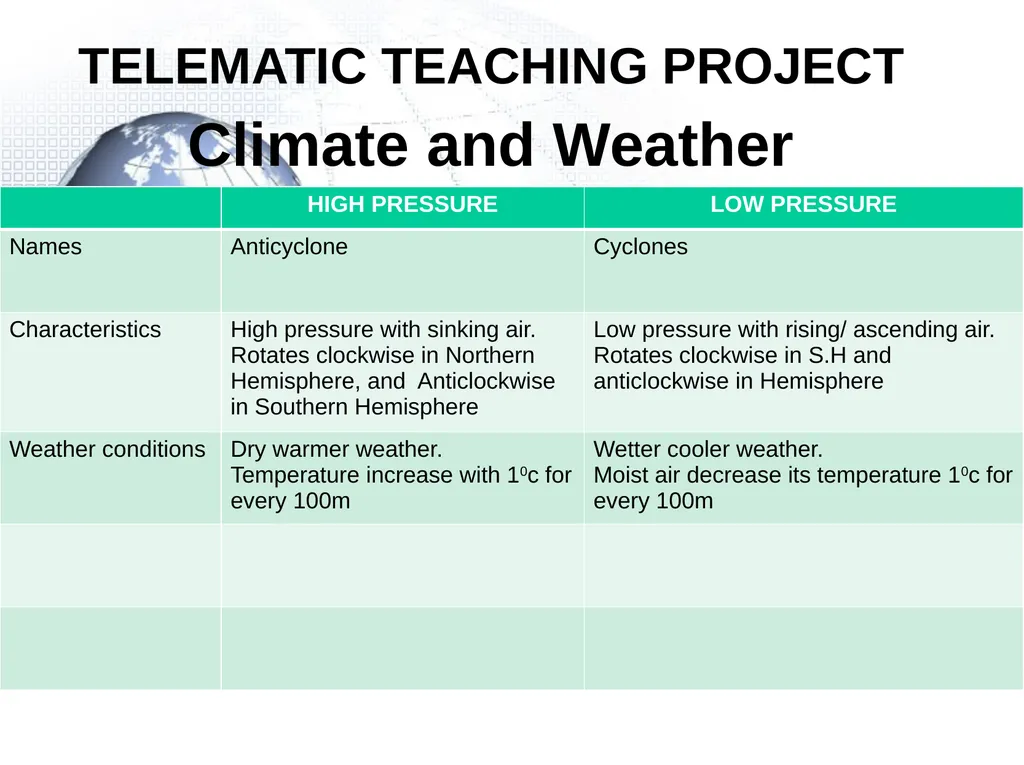
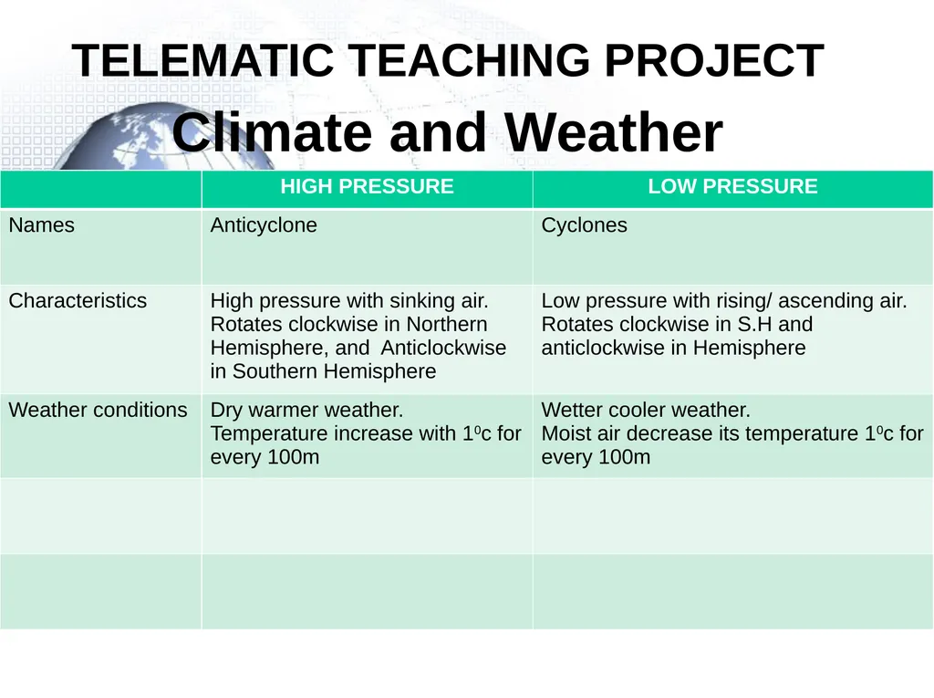
TELEMATIC TEACHING PROJECT Climate and Weather
Description: TELEMATIC TEACHING PROJECT Climate and Weather General characteristics of Midlatitude cyclone Other names: Frontal depression, temperate cyclone, extra tropical cyclone Midlatitude cyclone are found between400-60o N and S Hemisphere These
Related Topics
Download Presentation
"TELEMATIC TEACHING PROJECT Climate and Weather" is the property of its rightful owner. Permission is granted to download and print the materials on this website for personal, non-commercial use only, and to display it on your personal computer provided you do not modify the materials and that you retain all copyright notices contained in the materials. By downloading content from our website, you accept the terms of this agreement.
Presentation Transcript
slide1. TELEMATIC TEACHING PROJECT Climate and Weather<br>
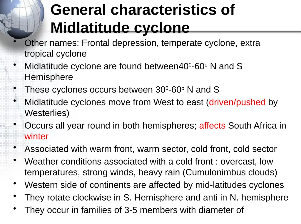
slide2. General characteristics of Midlatitude cyclone Other names: Frontal depression, temperate cyclone, extra tropical cyclone
Midlatitude cyclone are found between400-60o N and S Hemisphere
These cyclones occurs between 300-60o N and S
Midlatitude cyclones move from West to east (driven/pushed by Westerlies)
Occurs all year round in both hemispheres; affects South Africa in winter
Associated with warm front, warm sector, cold front, cold sector
Weather conditions associated with a cold front : overcast, low temperatures, strong winds, heavy rain (Cumulonimbus clouds)
Western side of continents are affected by mid-latitudes cyclones
They rotate clockwise in S. Hemisphere and anti in N. hemisphere
They occur in families of 3-5 members with diameter of<br>
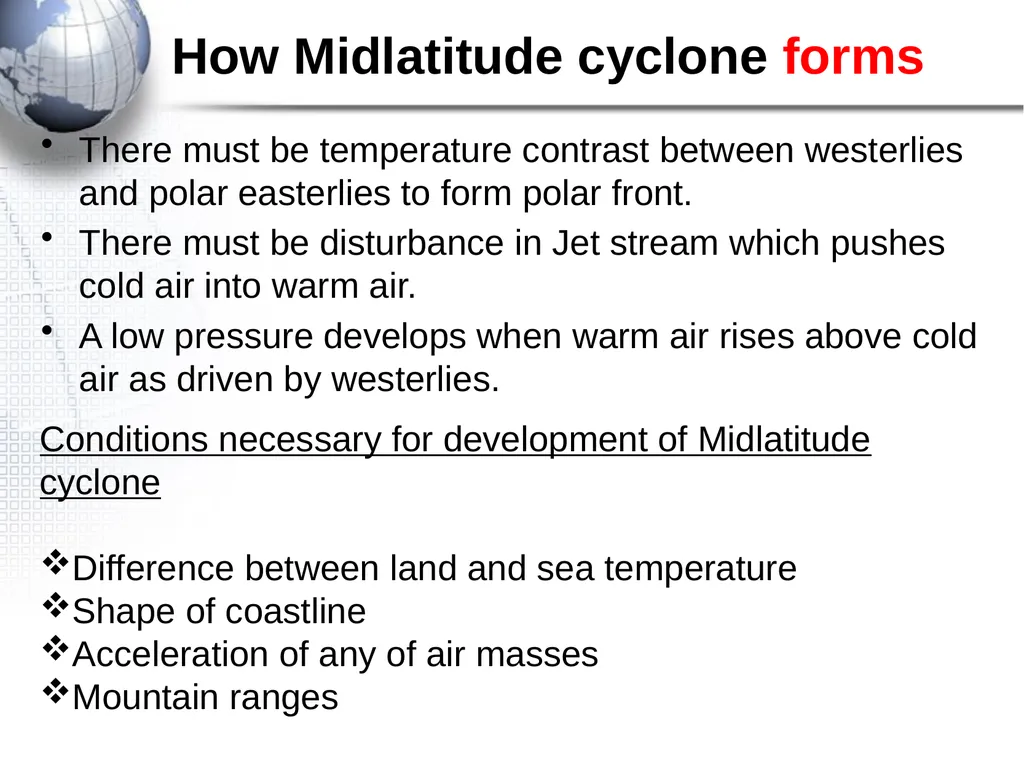
slide3. How Midlatitude cyclone forms There must be temperature contrast between westerlies and polar easterlies to form polar front.
There must be disturbance in Jet stream which pushes cold air into warm air.
A low pressure develops when warm air rises above cold air as driven by westerlies. Conditions necessary for development of Midlatitude cyclone
Difference between land and sea temperature
Shape of coastline
Acceleration of any of air masses
Mountain ranges<br>
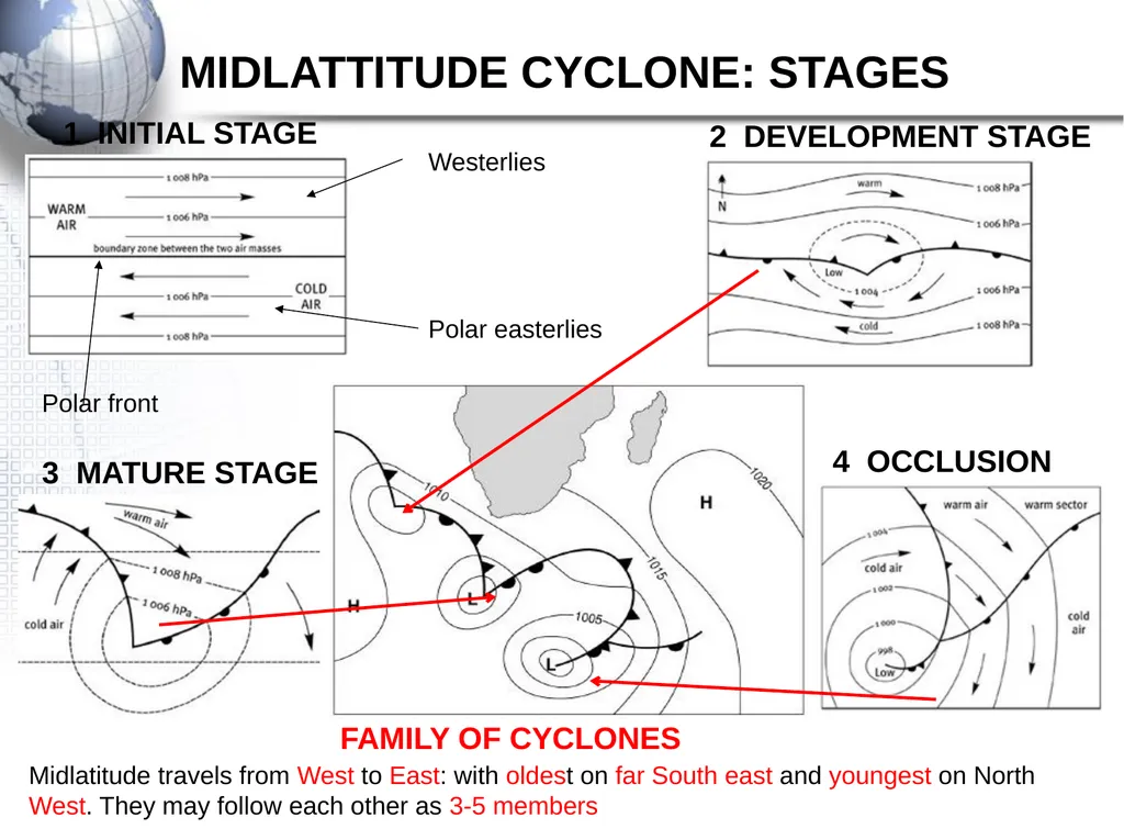
slide4. MIDLATTITUDE CYCLONE: STAGES FAMILY OF CYCLONES Polar front Westerlies Polar easterlies Midlatitude travels from West to East: with oldest on far South east and youngest on North West. They may follow each other as 3-5 members<br>
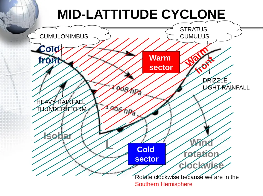
slide5. MID-LATTITUDE CYCLONE Warm front Cold front L Wind rotation clockwise Isobar STRATUS, CUMULUS CUMULONIMBUS DRIZZLE
LIGHT RAINFALL HEAVY RAINFALL
THUNDERSTORM Rotate clockwise because we are in the Southern Hemisphere<br>
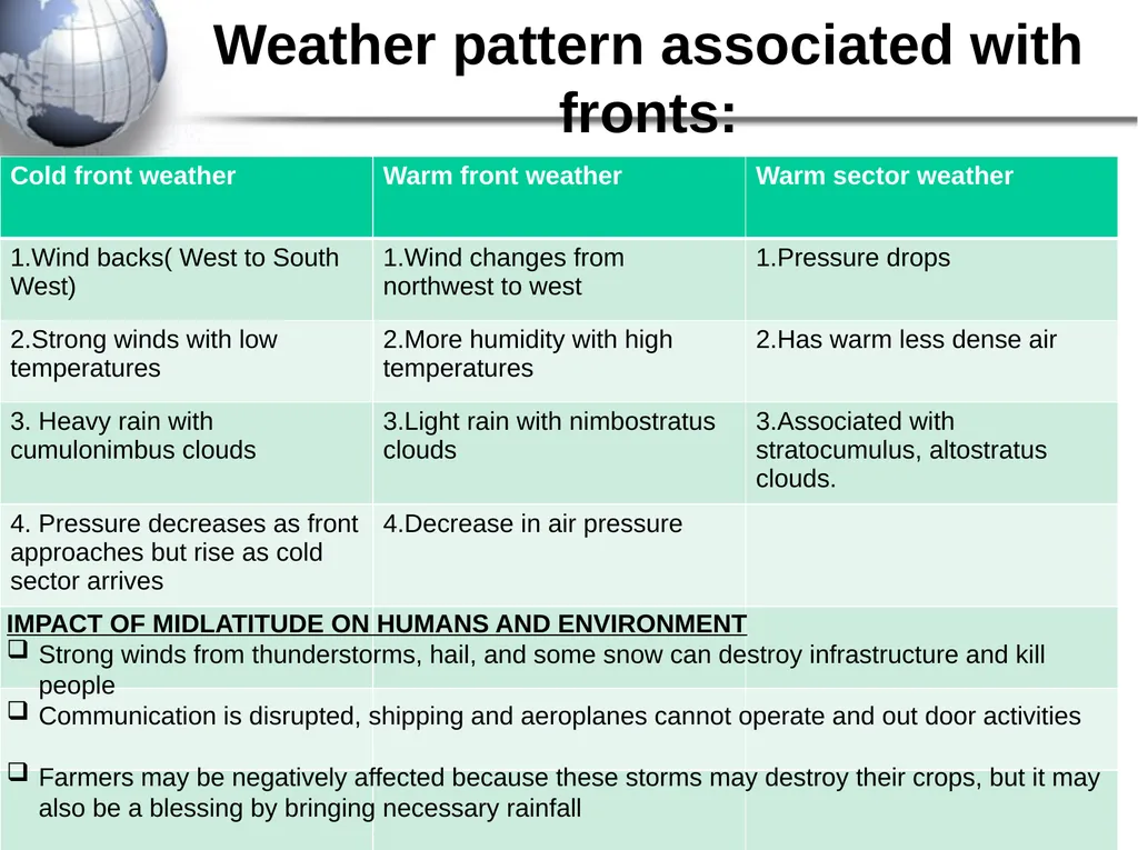
slide6. Weather pattern associated with fronts: IMPACT OF MIDLATITUDE ON HUMANS AND ENVIRONMENT
Strong winds from thunderstorms, hail, and some snow can destroy infrastructure and kill people
Communication is disrupted, shipping and aeroplanes cannot operate and out door activities
Farmers may be negatively affected because these storms may destroy their crops, but it may also be a blessing by bringing necessary rainfall<br>
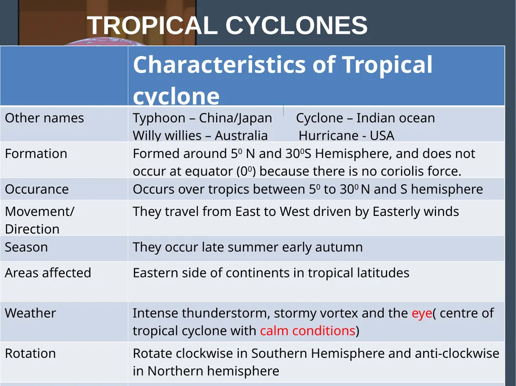
slide7. TROPICAL CYCLONES Stages
How managed<br>
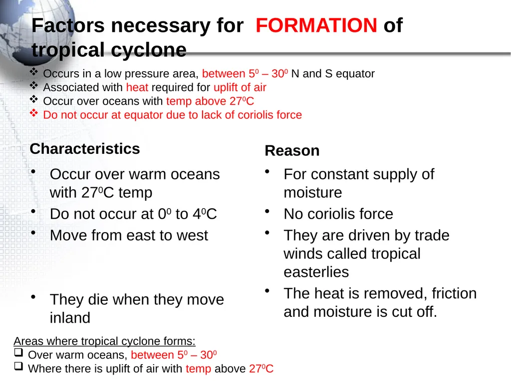
slide8. Factors necessary for FORMATION of tropical cyclone Characteristics Occur over warm oceans with 270C temp
Do not occur at 00 to 40C
Move from east to west
They die when they move inland Reason For constant supply of moisture
No coriolis force
They are driven by trade winds called tropical easterlies
The heat is removed, friction and moisture is cut off. Occurs in a low pressure area, between 50 – 300 N and S equator
Associated with heat required for uplift of air
Occur over oceans with temp above 270C
Do not occur at equator due to lack of coriolis force Areas where tropical cyclone forms:
Over warm oceans, between 50 – 300
Where there is uplift of air with temp above 270C<br>
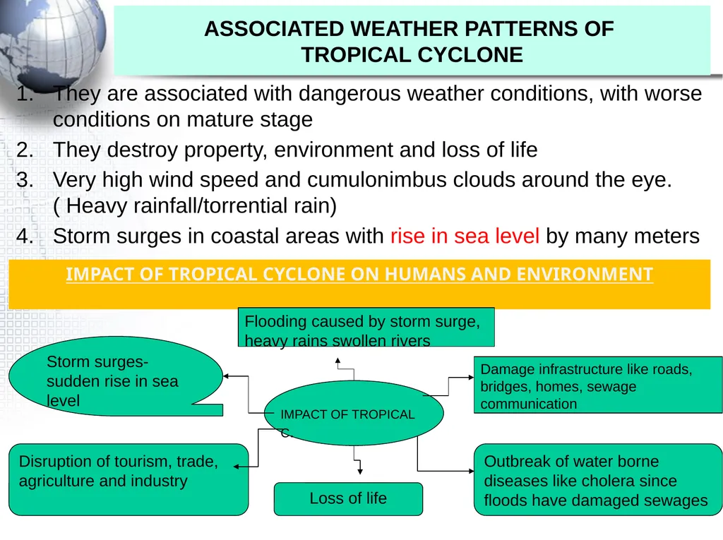
slide9. ASSOCIATED WEATHER PATTERNS OF TROPICAL CYCLONE They are associated with dangerous weather conditions, with worse conditions on mature stage
They destroy property, environment and loss of life
Very high wind speed and cumulonimbus clouds around the eye. ( Heavy rainfall/torrential rain)
Storm surges in coastal areas with rise in sea level by many meters IMPACT OF TROPICAL CYCLONE ON HUMANS AND ENVIRONMENT IMPACT OF TROPICAL C. Flooding caused by storm surge, heavy rains swollen rivers Damage infrastructure like roads, bridges, homes, sewage communication Outbreak of water borne diseases like cholera since floods have damaged sewages Loss of life Disruption of tourism, trade, agriculture and industry Storm surges-sudden rise in sea level<br>
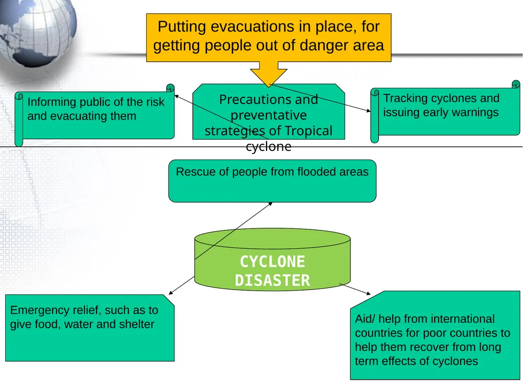
slide10. Precautions and preventative strategies of Tropical cyclone Putting evacuations in place, for getting people out of danger area Tracking cyclones and issuing early warnings Informing public of the risk and evacuating them CYCLONE DISASTER MANAGEMENT Rescue of people from flooded areas Aid/ help from international countries for poor countries to help them recover from long term effects of cyclones Emergency relief, such as to give food, water and shelter<br>
slide11. REGIONAL CLIMATE Line thunderstorms
Berg winds<br>
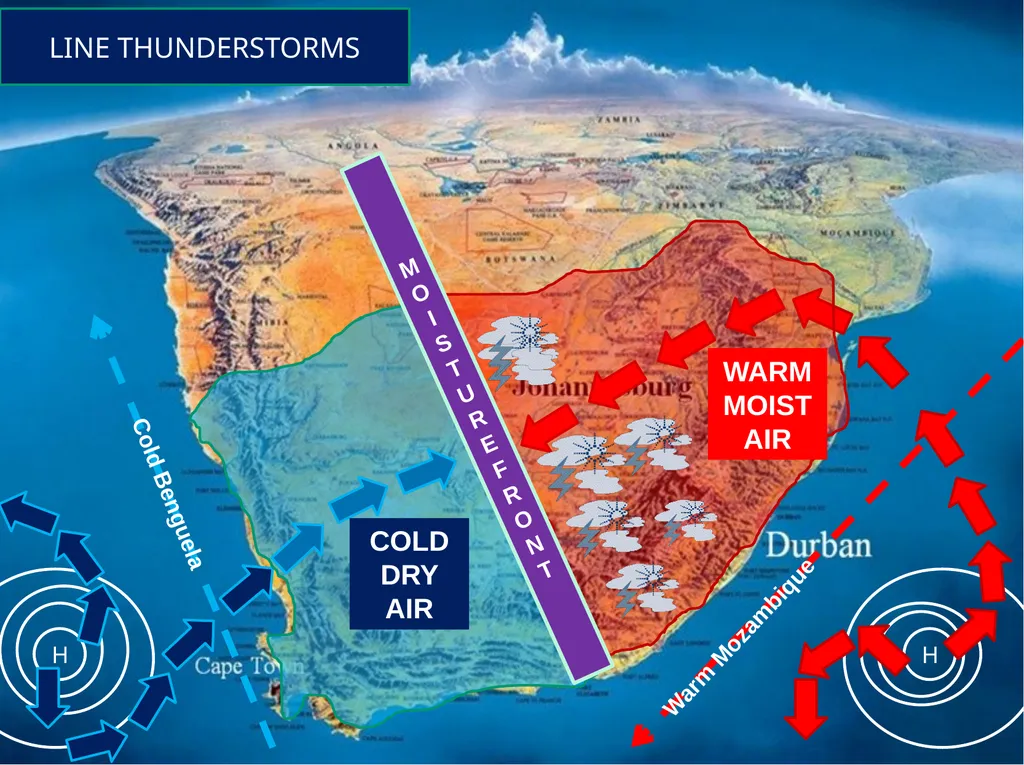
slide12. H H MOI STURE FRONT WARM MOIST AIR COLD DRY AIR LINE THUNDERSTORMS<br>
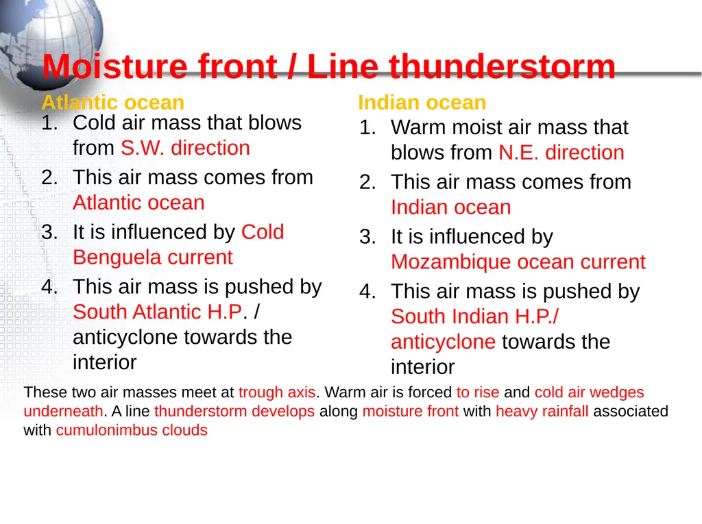
slide13. Moisture front / Line thunderstorm Atlantic ocean Cold air mass that blows from S.W. direction
This air mass comes from Atlantic ocean
It is influenced by Cold Benguela current
This air mass is pushed by South Atlantic H.P. / anticyclone towards the interior Indian ocean Warm moist air mass that blows from N.E. direction
This air mass comes from Indian ocean
It is influenced by Mozambique ocean current
This air mass is pushed by South Indian H.P./ anticyclone towards the interior These two air masses meet at trough axis. Warm air is forced to rise and cold air wedges underneath. A line thunderstorm develops along moisture front with heavy rainfall associated with cumulonimbus clouds<br>
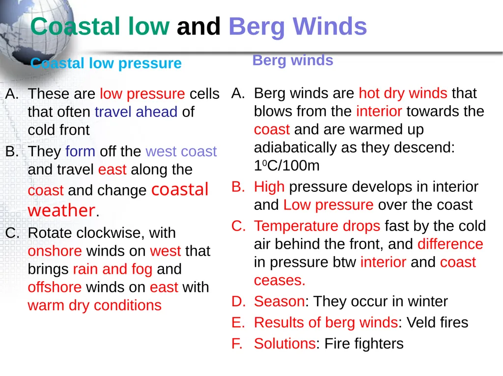
slide14. Coastal low and Berg Winds Coastal low pressure These are low pressure cells that often travel ahead of cold front
They form off the west coast and travel east along the coast and change coastal weather.
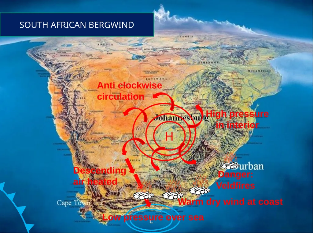
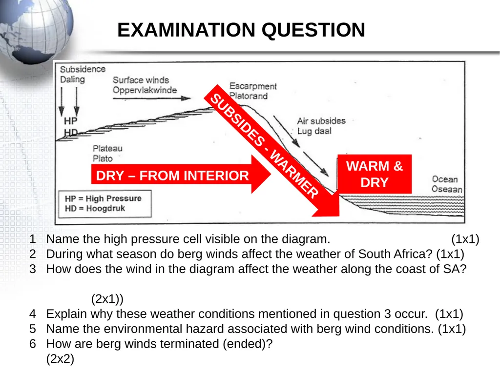
Rotate clockwise, with onshore winds on west that brings rain and fog and offshore winds on east with warm dry conditions Berg winds Berg winds are hot dry winds that blows from the interior towards the coast and are warmed up adiabatically as they descend: 10C/100m
High pressure develops in interior and Low pressure over the coast
Temperature drops fast by the cold air behind the front, and difference in pressure btw interior and coast ceases.
Season: They occur in winter
Results of berg winds: Veld fires
Solutions: Fire fighters<br>
slide15. SOUTH AFRICAN BERGWIND High pressure in interior Low pressure over sea Anti clockwise circulation Warm dry wind at coast<br>
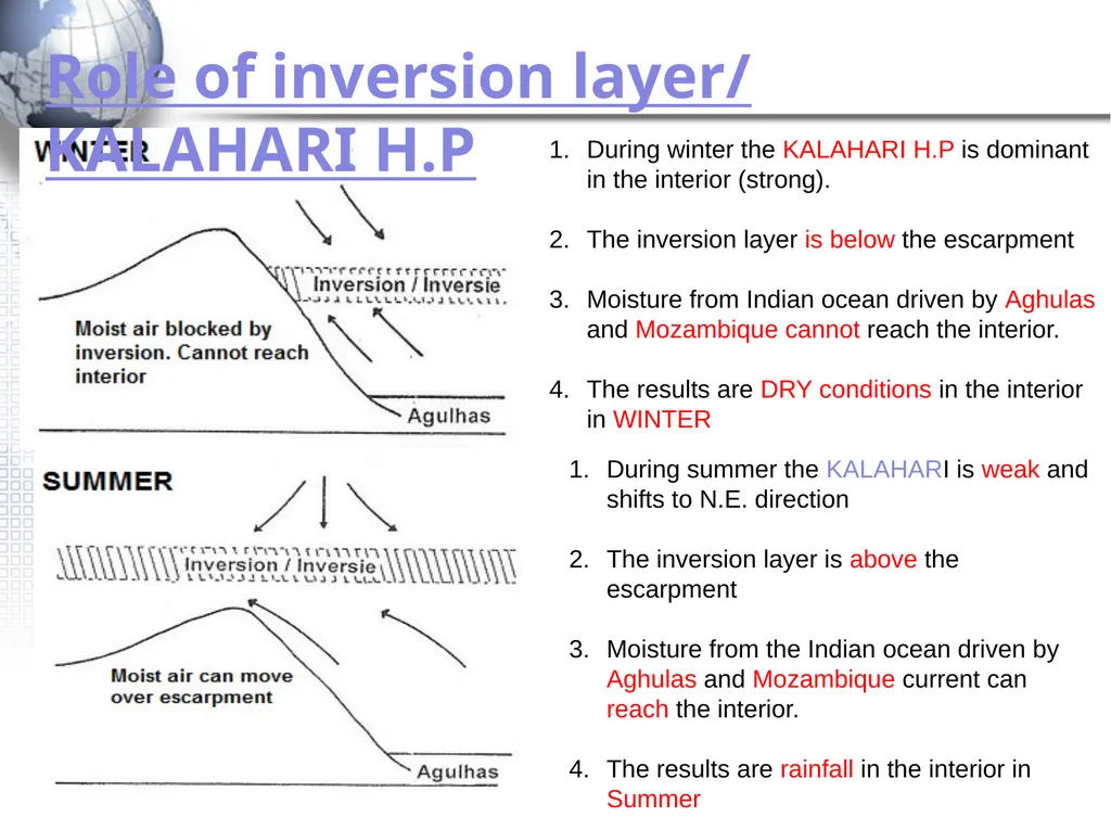
slide16. Role of inversion layer/ KALAHARI H.P During winter the KALAHARI H.P is dominant in the interior (strong).
The inversion layer is below the escarpment
Moisture from Indian ocean driven by Aghulas and Mozambique cannot reach the interior.
The results are DRY conditions in the interior in WINTER During summer the KALAHARI is weak and shifts to N.E. direction
The inversion layer is above the escarpment
Moisture from the Indian ocean driven by Aghulas and Mozambique current can reach the interior.
The results are rainfall in the interior in Summer<br>
slide17. Name the high pressure cell visible on the diagram. (1x1)
During what season do berg winds affect the weather of South Africa? (1x1)
How does the wind in the diagram affect the weather along the coast of SA? (2x1))
Explain why these weather conditions mentioned in question 3 occur. (1x1)
Name the environmental hazard associated with berg wind conditions. (1x1)
How are berg winds terminated (ended)? (2x2) EXAMINATION QUESTION WARM &
DRY SUBSIDES - WARMER DRY – FROM INTERIOR<br>
slide18. VALLEY CLIMATES Aspect : The direction in which the slope faces.
In Southern H. people chose North facing slope.
Why: They are warmer because the sun is direct.
Middle slopes are preferred
In Katabatic: Bottom of valley has frost/fog<br>
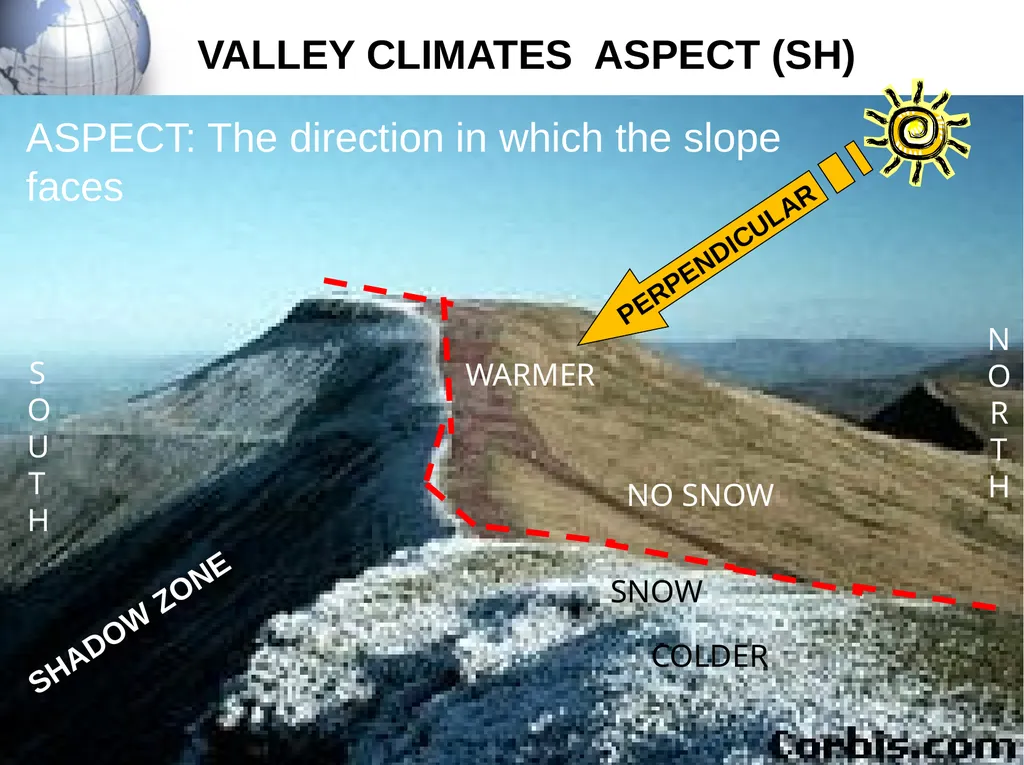
slide19. PERPENDICULAR SNOW NO SNOW WARMER COLDER SHADOW ZONE NORTH SOUTH VALLEY CLIMATES ASPECT (SH) ASPECT: The direction in which the slope faces<br>
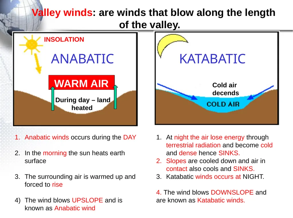
slide20. Valley winds: are winds that blow along the length of the valley. WARM AIR ANABATIC KATABATIC Anabatic winds occurs during the DAY
In the morning the sun heats earth surface
The surrounding air is warmed up and forced to rise
The wind blows UPSLOPE and is known as Anabatic wind At night the air lose energy through terrestrial radiation and become cold and dense hence SINKS.
Slopes are cooled down and air in contact also cools and SINKS.
Katabatic winds occurs at NIGHT.
4. The wind blows DOWNSLOPE and are known as Katabatic winds.<br>
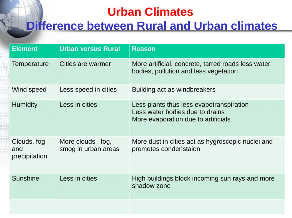
slide21. URBAN CLIMATES : High temperature in CBD than the surrounding rural areas Urban Climates Difference between Rural and Urban climates<br>
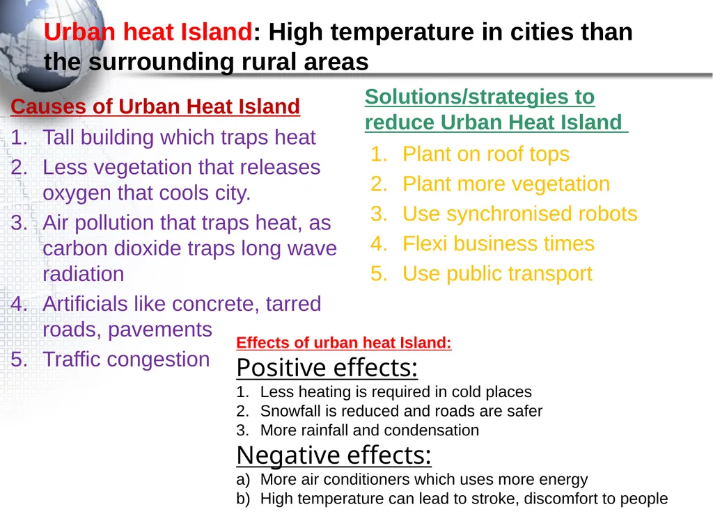
slide22. Urban heat Island: High temperature in cities than the surrounding rural areas Causes of Urban Heat Island Tall building which traps heat
Less vegetation that releases oxygen that cools city.
Air pollution that traps heat, as carbon dioxide traps long wave radiation
Artificials like concrete, tarred roads, pavements
Traffic congestion Solutions/strategies to reduce Urban Heat Island Plant on roof tops
Plant more vegetation
Use synchronised robots
Flexi business times
Use public transport Effects of urban heat Island:
Positive effects:
Less heating is required in cold places
Snowfall is reduced and roads are safer
More rainfall and condensation
Negative effects:
More air conditioners which uses more energy
High temperature can lead to stroke, discomfort to people<br>
slide2. General characteristics of Midlatitude cyclone Other names: Frontal depression, temperate cyclone, extra tropical cyclone
Midlatitude cyclone are found between400-60o N and S Hemisphere
These cyclones occurs between 300-60o N and S
Midlatitude cyclones move from West to east (driven/pushed by Westerlies)
Occurs all year round in both hemispheres; affects South Africa in winter
Associated with warm front, warm sector, cold front, cold sector
Weather conditions associated with a cold front : overcast, low temperatures, strong winds, heavy rain (Cumulonimbus clouds)
Western side of continents are affected by mid-latitudes cyclones
They rotate clockwise in S. Hemisphere and anti in N. hemisphere
They occur in families of 3-5 members with diameter of<br>
slide3. How Midlatitude cyclone forms There must be temperature contrast between westerlies and polar easterlies to form polar front.
There must be disturbance in Jet stream which pushes cold air into warm air.
A low pressure develops when warm air rises above cold air as driven by westerlies. Conditions necessary for development of Midlatitude cyclone
Difference between land and sea temperature
Shape of coastline
Acceleration of any of air masses
Mountain ranges<br>
slide4. MIDLATTITUDE CYCLONE: STAGES FAMILY OF CYCLONES Polar front Westerlies Polar easterlies Midlatitude travels from West to East: with oldest on far South east and youngest on North West. They may follow each other as 3-5 members<br>
slide5. MID-LATTITUDE CYCLONE Warm front Cold front L Wind rotation clockwise Isobar STRATUS, CUMULUS CUMULONIMBUS DRIZZLE
LIGHT RAINFALL HEAVY RAINFALL
THUNDERSTORM Rotate clockwise because we are in the Southern Hemisphere<br>
slide6. Weather pattern associated with fronts: IMPACT OF MIDLATITUDE ON HUMANS AND ENVIRONMENT
Strong winds from thunderstorms, hail, and some snow can destroy infrastructure and kill people
Communication is disrupted, shipping and aeroplanes cannot operate and out door activities
Farmers may be negatively affected because these storms may destroy their crops, but it may also be a blessing by bringing necessary rainfall<br>
slide7. TROPICAL CYCLONES Stages
How managed<br>
slide8. Factors necessary for FORMATION of tropical cyclone Characteristics Occur over warm oceans with 270C temp
Do not occur at 00 to 40C
Move from east to west
They die when they move inland Reason For constant supply of moisture
No coriolis force
They are driven by trade winds called tropical easterlies
The heat is removed, friction and moisture is cut off. Occurs in a low pressure area, between 50 – 300 N and S equator
Associated with heat required for uplift of air
Occur over oceans with temp above 270C
Do not occur at equator due to lack of coriolis force Areas where tropical cyclone forms:
Over warm oceans, between 50 – 300
Where there is uplift of air with temp above 270C<br>
slide9. ASSOCIATED WEATHER PATTERNS OF TROPICAL CYCLONE They are associated with dangerous weather conditions, with worse conditions on mature stage
They destroy property, environment and loss of life
Very high wind speed and cumulonimbus clouds around the eye. ( Heavy rainfall/torrential rain)
Storm surges in coastal areas with rise in sea level by many meters IMPACT OF TROPICAL CYCLONE ON HUMANS AND ENVIRONMENT IMPACT OF TROPICAL C. Flooding caused by storm surge, heavy rains swollen rivers Damage infrastructure like roads, bridges, homes, sewage communication Outbreak of water borne diseases like cholera since floods have damaged sewages Loss of life Disruption of tourism, trade, agriculture and industry Storm surges-sudden rise in sea level<br>
slide10. Precautions and preventative strategies of Tropical cyclone Putting evacuations in place, for getting people out of danger area Tracking cyclones and issuing early warnings Informing public of the risk and evacuating them CYCLONE DISASTER MANAGEMENT Rescue of people from flooded areas Aid/ help from international countries for poor countries to help them recover from long term effects of cyclones Emergency relief, such as to give food, water and shelter<br>
slide11. REGIONAL CLIMATE Line thunderstorms
Berg winds<br>
slide12. H H MOI STURE FRONT WARM MOIST AIR COLD DRY AIR LINE THUNDERSTORMS<br>
slide13. Moisture front / Line thunderstorm Atlantic ocean Cold air mass that blows from S.W. direction
This air mass comes from Atlantic ocean
It is influenced by Cold Benguela current
This air mass is pushed by South Atlantic H.P. / anticyclone towards the interior Indian ocean Warm moist air mass that blows from N.E. direction
This air mass comes from Indian ocean
It is influenced by Mozambique ocean current
This air mass is pushed by South Indian H.P./ anticyclone towards the interior These two air masses meet at trough axis. Warm air is forced to rise and cold air wedges underneath. A line thunderstorm develops along moisture front with heavy rainfall associated with cumulonimbus clouds<br>
slide14. Coastal low and Berg Winds Coastal low pressure These are low pressure cells that often travel ahead of cold front
They form off the west coast and travel east along the coast and change coastal weather.
Rotate clockwise, with onshore winds on west that brings rain and fog and offshore winds on east with warm dry conditions Berg winds Berg winds are hot dry winds that blows from the interior towards the coast and are warmed up adiabatically as they descend: 10C/100m
High pressure develops in interior and Low pressure over the coast
Temperature drops fast by the cold air behind the front, and difference in pressure btw interior and coast ceases.
Season: They occur in winter
Results of berg winds: Veld fires
Solutions: Fire fighters<br>
slide15. SOUTH AFRICAN BERGWIND High pressure in interior Low pressure over sea Anti clockwise circulation Warm dry wind at coast<br>
slide16. Role of inversion layer/ KALAHARI H.P During winter the KALAHARI H.P is dominant in the interior (strong).
The inversion layer is below the escarpment
Moisture from Indian ocean driven by Aghulas and Mozambique cannot reach the interior.
The results are DRY conditions in the interior in WINTER During summer the KALAHARI is weak and shifts to N.E. direction
The inversion layer is above the escarpment
Moisture from the Indian ocean driven by Aghulas and Mozambique current can reach the interior.
The results are rainfall in the interior in Summer<br>
slide17. Name the high pressure cell visible on the diagram. (1x1)
During what season do berg winds affect the weather of South Africa? (1x1)
How does the wind in the diagram affect the weather along the coast of SA? (2x1))
Explain why these weather conditions mentioned in question 3 occur. (1x1)
Name the environmental hazard associated with berg wind conditions. (1x1)
How are berg winds terminated (ended)? (2x2) EXAMINATION QUESTION WARM &
DRY SUBSIDES - WARMER DRY – FROM INTERIOR<br>
slide18. VALLEY CLIMATES Aspect : The direction in which the slope faces.
In Southern H. people chose North facing slope.
Why: They are warmer because the sun is direct.
Middle slopes are preferred
In Katabatic: Bottom of valley has frost/fog<br>
slide19. PERPENDICULAR SNOW NO SNOW WARMER COLDER SHADOW ZONE NORTH SOUTH VALLEY CLIMATES ASPECT (SH) ASPECT: The direction in which the slope faces<br>
slide20. Valley winds: are winds that blow along the length of the valley. WARM AIR ANABATIC KATABATIC Anabatic winds occurs during the DAY
In the morning the sun heats earth surface
The surrounding air is warmed up and forced to rise
The wind blows UPSLOPE and is known as Anabatic wind At night the air lose energy through terrestrial radiation and become cold and dense hence SINKS.
Slopes are cooled down and air in contact also cools and SINKS.
Katabatic winds occurs at NIGHT.
4. The wind blows DOWNSLOPE and are known as Katabatic winds.<br>
slide21. URBAN CLIMATES : High temperature in CBD than the surrounding rural areas Urban Climates Difference between Rural and Urban climates<br>
slide22. Urban heat Island: High temperature in cities than the surrounding rural areas Causes of Urban Heat Island Tall building which traps heat
Less vegetation that releases oxygen that cools city.
Air pollution that traps heat, as carbon dioxide traps long wave radiation
Artificials like concrete, tarred roads, pavements
Traffic congestion Solutions/strategies to reduce Urban Heat Island Plant on roof tops
Plant more vegetation
Use synchronised robots
Flexi business times
Use public transport Effects of urban heat Island:
Positive effects:
Less heating is required in cold places
Snowfall is reduced and roads are safer
More rainfall and condensation
Negative effects:
More air conditioners which uses more energy
High temperature can lead to stroke, discomfort to people<br>