
YR Geography knowledge Starry night Winter
PC
Published · 7 slides · 0 views
1 / 1
Description
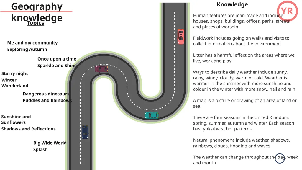
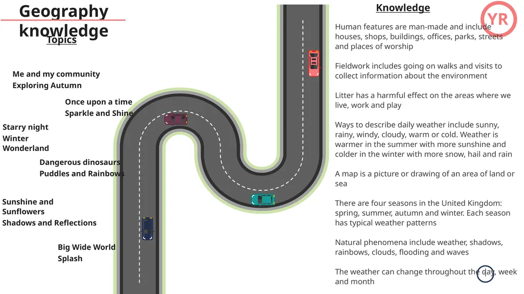
YR Geography knowledge Starry night Winter Wonderland Me and my community Exploring Autumn Dangerous dinosaurs Puddles and Rainbows Topics Once upon a time Sparkle and Shine Sunshine and Sunflowers Shadows and Reflections Big Wide World
Related Topics
Share
Embed code
Download this presentation From Below
"YR Geography knowledge Starry night Winter" is the property of its rightful owner. Permission is granted to download and print the materials on this website for personal, non-commercial use only, and to display it on your personal computer provided you do not modify the materials and that you retain all copyright notices contained in the materials. By downloading content from our website, you accept the terms of this agreement.
Presentation Transcript
01
YR Geography knowledge Starry night
Winter Wonderland Me and my community
Exploring Autumn Dangerous dinosaurs
Puddles and Rainbows Topics Once upon a time
Sparkle and Shine Sunshine and Sunflowers
Shadows and Reflections Big Wide World
Splash Knowledge Human features are man-made and include houses, shops, buildings, offices, parks, streets and places of worship
Fieldwork includes going on walks and visits to collect information about the environment
Litter has a harmful effect on the areas where we live, work and play
Ways to describe daily weather include sunny, rainy, windy, cloudy, warm or cold. Weather is warmer in the summer with more sunshine and colder in the winter with more snow, hail and rain
A map is a picture or drawing of an area of land or sea
There are four seasons in the United Kingdom: spring, summer, autumn and winter. Each season has typical weather patterns
Natural phenomena include weather, shadows, rainbows, clouds, flooding and waves
The weather can change throughout the day, week and month
Places can have different climates, weather, food, religions, culture, wildlife, transport and amenities
Globes and maps can show us the location of different places around the world<br>
Winter Wonderland Me and my community
Exploring Autumn Dangerous dinosaurs
Puddles and Rainbows Topics Once upon a time
Sparkle and Shine Sunshine and Sunflowers
Shadows and Reflections Big Wide World
Splash Knowledge Human features are man-made and include houses, shops, buildings, offices, parks, streets and places of worship
Fieldwork includes going on walks and visits to collect information about the environment
Litter has a harmful effect on the areas where we live, work and play
Ways to describe daily weather include sunny, rainy, windy, cloudy, warm or cold. Weather is warmer in the summer with more sunshine and colder in the winter with more snow, hail and rain
A map is a picture or drawing of an area of land or sea
There are four seasons in the United Kingdom: spring, summer, autumn and winter. Each season has typical weather patterns
Natural phenomena include weather, shadows, rainbows, clouds, flooding and waves
The weather can change throughout the day, week and month
Places can have different climates, weather, food, religions, culture, wildlife, transport and amenities
Globes and maps can show us the location of different places around the world<br>
02
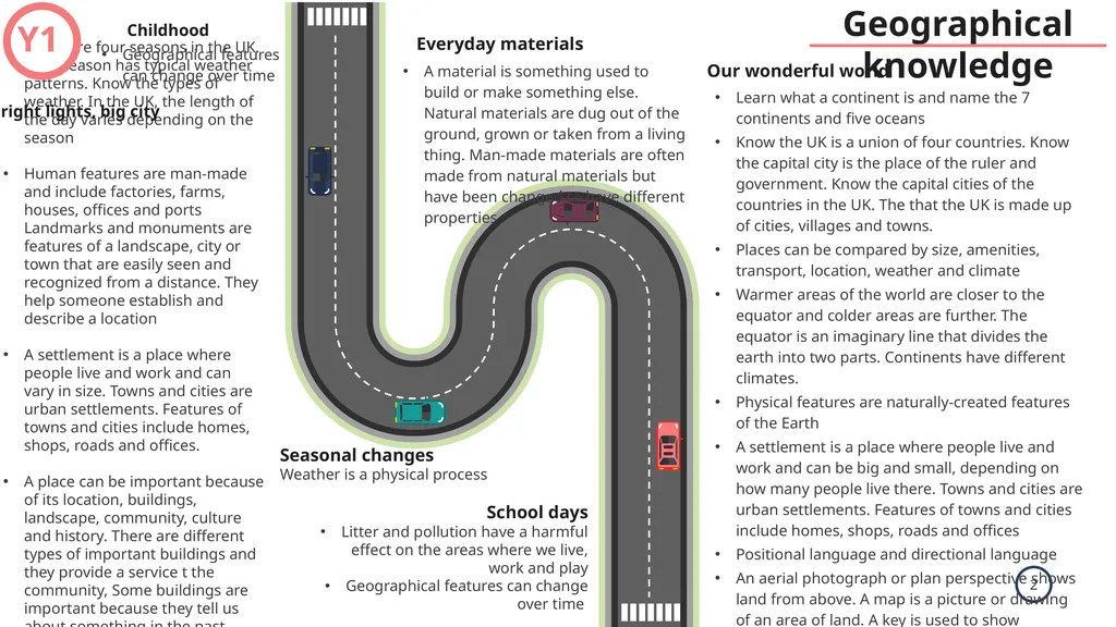
Geographical knowledge There are four seasons in the UK. Each season has typical weather patterns. Know the types of weather. In the UK, the length of the day varies depending on the season
Human features are man-made and include factories, farms, houses, offices and ports Landmarks and monuments are features of a landscape, city or town that are easily seen and recognized from a distance. They help someone establish and describe a location
A settlement is a place where people live and work and can vary in size. Towns and cities are urban settlements. Features of towns and cities include homes, shops, roads and offices.
A place can be important because of its location, buildings, landscape, community, culture and history. There are different types of important buildings and they provide a service t the community, Some buildings are important because they tell us about something in the past. Learn what a continent is and name the 7 continents and five oceans
Know the UK is a union of four countries. Know the capital city is the place of the ruler and government. Know the capital cities of the countries in the UK. The that the UK is made up of cities, villages and towns.
Places can be compared by size, amenities, transport, location, weather and climate
Warmer areas of the world are closer to the equator and colder areas are further. The equator is an imaginary line that divides the earth into two parts. Continents have different climates.
Physical features are naturally-created features of the Earth
A settlement is a place where people live and work and can be big and small, depending on how many people live there. Towns and cities are urban settlements. Features of towns and cities include homes, shops, roads and offices
Positional language and directional language
An aerial photograph or plan perspective shows land from above. A map is a picture or drawing of an area of land. A key is used to show features. A map has symbols
Data is information collected to answer a geographical question. Know what fieldwork is
Natural environments can be affected by the actions of humans and humans can protect the environment Our wonderful world Seasonal changes
Weather is a physical process A material is something used to build or make something else. Natural materials are dug out of the ground, grown or taken from a living thing. Man-made materials are often made from natural materials but have been changed to have different properties Y1 Childhood
Geographical features can change over time Bright lights, big city Everyday materials School days
Litter and pollution have a harmful effect on the areas where we live, work and play
Geographical features can change over time<br>
Human features are man-made and include factories, farms, houses, offices and ports Landmarks and monuments are features of a landscape, city or town that are easily seen and recognized from a distance. They help someone establish and describe a location
A settlement is a place where people live and work and can vary in size. Towns and cities are urban settlements. Features of towns and cities include homes, shops, roads and offices.
A place can be important because of its location, buildings, landscape, community, culture and history. There are different types of important buildings and they provide a service t the community, Some buildings are important because they tell us about something in the past. Learn what a continent is and name the 7 continents and five oceans
Know the UK is a union of four countries. Know the capital city is the place of the ruler and government. Know the capital cities of the countries in the UK. The that the UK is made up of cities, villages and towns.
Places can be compared by size, amenities, transport, location, weather and climate
Warmer areas of the world are closer to the equator and colder areas are further. The equator is an imaginary line that divides the earth into two parts. Continents have different climates.
Physical features are naturally-created features of the Earth
A settlement is a place where people live and work and can be big and small, depending on how many people live there. Towns and cities are urban settlements. Features of towns and cities include homes, shops, roads and offices
Positional language and directional language
An aerial photograph or plan perspective shows land from above. A map is a picture or drawing of an area of land. A key is used to show features. A map has symbols
Data is information collected to answer a geographical question. Know what fieldwork is
Natural environments can be affected by the actions of humans and humans can protect the environment Our wonderful world Seasonal changes
Weather is a physical process A material is something used to build or make something else. Natural materials are dug out of the ground, grown or taken from a living thing. Man-made materials are often made from natural materials but have been changed to have different properties Y1 Childhood
Geographical features can change over time Bright lights, big city Everyday materials School days
Litter and pollution have a harmful effect on the areas where we live, work and play
Geographical features can change over time<br>
03
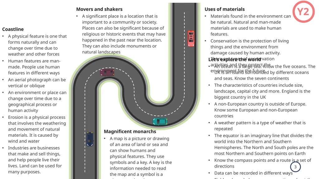
Y2 Movers and shakers
A significant place is a location that is important to a community or society. Places can also be significant because of religious or historic events that may have happened in the past near the location. They can also include monuments or natural landscapes Magnificent monarchs
A map is a picture or drawing of an area of land or sea and can show humans and physical features. They use symbols and a key. A key is the information needed to read the map and a symbol is a picture used to show a geographical feature. Uses of materials
Materials found in the environment can be natural. Natural and man-made materials are used to make human features.
Conservation is the protection of living things and the environment from damage caused by human activity. There are types of conservation activities and they protect the environment for the future. Let’s explore the world
An ocean is a large sea. Know the five oceans. The UK is an island surrounded by different oceans and seas. Know the seven continents
The characteristics of countries include size, landscape, capital city and more. England is the biggest country in the UK
A non-European country is outside of Europe. Know some European and non-European countries
A weather pattern is a type of weather that is repeated
The equator is an imaginary line that divides the world into the Northern and Southern Hemispheres. The North and South poles are the most Northern and Southern points on Earth
Know the compass points and a route is a set of directions
Data can be recorded in different ways
Fieldwork can help answer a questions about the local environment
The local environment can be improved by picking up litter, planting flowers and improving amenities Coastline
A physical feature is one that forms naturally and can change over time due to weather and other forces
Human features are man-made. People use human features in different ways
An aerial photograph can be vertical or oblique
An environment or place can change over time due to a geographical process or human activity
Erosion is a physical process that involves the weathering and movement of natural materials. It is caused by wind and water
Industries are businesses that make and sell things, and help people live their lives. Land can be used for many purposes.<br>
A significant place is a location that is important to a community or society. Places can also be significant because of religious or historic events that may have happened in the past near the location. They can also include monuments or natural landscapes Magnificent monarchs
A map is a picture or drawing of an area of land or sea and can show humans and physical features. They use symbols and a key. A key is the information needed to read the map and a symbol is a picture used to show a geographical feature. Uses of materials
Materials found in the environment can be natural. Natural and man-made materials are used to make human features.
Conservation is the protection of living things and the environment from damage caused by human activity. There are types of conservation activities and they protect the environment for the future. Let’s explore the world
An ocean is a large sea. Know the five oceans. The UK is an island surrounded by different oceans and seas. Know the seven continents
The characteristics of countries include size, landscape, capital city and more. England is the biggest country in the UK
A non-European country is outside of Europe. Know some European and non-European countries
A weather pattern is a type of weather that is repeated
The equator is an imaginary line that divides the world into the Northern and Southern Hemispheres. The North and South poles are the most Northern and Southern points on Earth
Know the compass points and a route is a set of directions
Data can be recorded in different ways
Fieldwork can help answer a questions about the local environment
The local environment can be improved by picking up litter, planting flowers and improving amenities Coastline
A physical feature is one that forms naturally and can change over time due to weather and other forces
Human features are man-made. People use human features in different ways
An aerial photograph can be vertical or oblique
An environment or place can change over time due to a geographical process or human activity
Erosion is a physical process that involves the weathering and movement of natural materials. It is caused by wind and water
Industries are businesses that make and sell things, and help people live their lives. Land can be used for many purposes.<br>
04
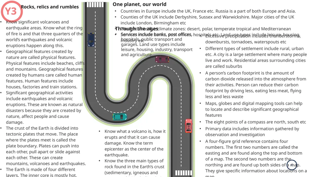
Excessive precipitation includes thunderstorms, downbursts, tornadoes, waterspouts etc
Different types of settlement include rural, urban etc. A city is a large settlement where many people live and work. Residential areas surrounding cities are called suburbs
A person’s carbon footprint is the amount of carbon dioxide released into the atmosphere from their activities. Person can reduce their carbon footprint by driving less, eating less meat, flying less and less waste
Maps, globes and digital mapping tools can help to locate and describe significant geographical features
The eight points of a compass are north, south etc
Primary data includes information gathered by observation and investigation
A four-figure grid reference contains four numbers. The first two numbers are called the easting and are found along the top and bottom of a map. The second two numbers are the northing and are found up both sides of a map. They give specific information about locations on a map.
The term ‘geographical evidence’ relates to facts, information and numerical data
Latitude is the distance north or south of the equator and longitude is the distance east or west of the Prime Meridian. One planet, our world Through the ages
Services include banks, post offices, hospitals, public transport and garages. Land use types include leisure, housing, industry, transport and agriculture. Y3 Rocks, relics and rumbles Countries in Europe include the UK, France etc. Russia is a part of both Europe and Asia.
Counties of the UK include Derbyshire, Sussex and Warwickshire. Major cities of the UK include London, Birmingham etc
The Earth has five climate zones: desert, polar, temperate tropical and Mediterranean
Services include banks, post offices, hospitals etc. Land use types include leisure, housing, industry etc Know significant volcanoes and earthquake areas. Know what the ring of fire is and that three quarters of the world’s earthquakes and volcanic eruptions happen along this.
Geographical features created by nature are called physical features. Physical features include beaches, cliffs and mountains. Geographical features created by humans care called human features. Human features include houses, factories and train stations.
Significant geographical activities include earthquakes and volcanic eruptions. These are known as natural disasters because they are created by nature, affect people and cause damage.
The crust of the Earth is divided into tectonic plates that move. The place where the plates meet is called the plate boundary. Plates can push into each other, pull apart or slide against each other. These can create mountains, volcanoes and earthquakes.
The Earth is made of four different layers. The inner core is mostly hot, solid iron and nickel and the outer core is made of liquid iron and nickel. The mantle is made of solid rock and molten rock called magma. The crust is a thin layer of solid rock that is broken into large pieces called tectonic plates. These pieces move very slowly across the mantle. Know what a volcano is, how it erupts and that it can cause damage. Know the term epicenter as the center of the earthquake.
Know the three main types of rock found in the Earth’s crust (sedimentary, igneous and metamorphic) including their features and how they are formed<br>
Different types of settlement include rural, urban etc. A city is a large settlement where many people live and work. Residential areas surrounding cities are called suburbs
A person’s carbon footprint is the amount of carbon dioxide released into the atmosphere from their activities. Person can reduce their carbon footprint by driving less, eating less meat, flying less and less waste
Maps, globes and digital mapping tools can help to locate and describe significant geographical features
The eight points of a compass are north, south etc
Primary data includes information gathered by observation and investigation
A four-figure grid reference contains four numbers. The first two numbers are called the easting and are found along the top and bottom of a map. The second two numbers are the northing and are found up both sides of a map. They give specific information about locations on a map.
The term ‘geographical evidence’ relates to facts, information and numerical data
Latitude is the distance north or south of the equator and longitude is the distance east or west of the Prime Meridian. One planet, our world Through the ages
Services include banks, post offices, hospitals, public transport and garages. Land use types include leisure, housing, industry, transport and agriculture. Y3 Rocks, relics and rumbles Countries in Europe include the UK, France etc. Russia is a part of both Europe and Asia.
Counties of the UK include Derbyshire, Sussex and Warwickshire. Major cities of the UK include London, Birmingham etc
The Earth has five climate zones: desert, polar, temperate tropical and Mediterranean
Services include banks, post offices, hospitals etc. Land use types include leisure, housing, industry etc Know significant volcanoes and earthquake areas. Know what the ring of fire is and that three quarters of the world’s earthquakes and volcanic eruptions happen along this.
Geographical features created by nature are called physical features. Physical features include beaches, cliffs and mountains. Geographical features created by humans care called human features. Human features include houses, factories and train stations.
Significant geographical activities include earthquakes and volcanic eruptions. These are known as natural disasters because they are created by nature, affect people and cause damage.
The crust of the Earth is divided into tectonic plates that move. The place where the plates meet is called the plate boundary. Plates can push into each other, pull apart or slide against each other. These can create mountains, volcanoes and earthquakes.
The Earth is made of four different layers. The inner core is mostly hot, solid iron and nickel and the outer core is made of liquid iron and nickel. The mantle is made of solid rock and molten rock called magma. The crust is a thin layer of solid rock that is broken into large pieces called tectonic plates. These pieces move very slowly across the mantle. Know what a volcano is, how it erupts and that it can cause damage. Know the term epicenter as the center of the earthquake.
Know the three main types of rock found in the Earth’s crust (sedimentary, igneous and metamorphic) including their features and how they are formed<br>
05
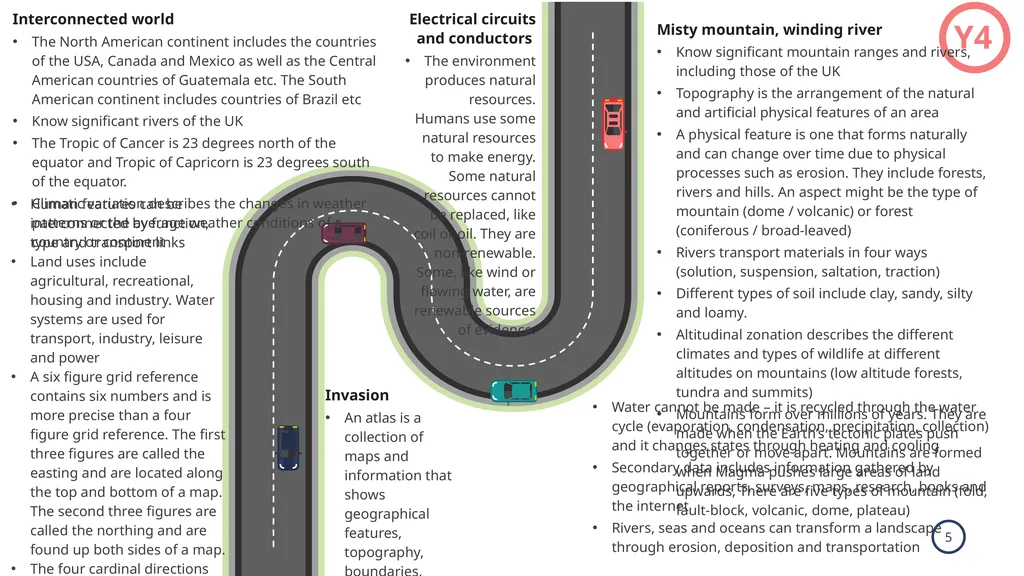
Y4 Electrical circuits and conductors
The environment produces natural resources. Humans use some natural resources to make energy. Some natural resources cannot be replaced, like coil or oil. They are non-renewable. Some, like wind or flowing water, are renewable sources of evidence. Invasion
An atlas is a collection of maps and information that shows geographical features, topography, boundaries, climatic, social and economic statistics of an area Misty mountain, winding river
Know significant mountain ranges and rivers, including those of the UK
Topography is the arrangement of the natural and artificial physical features of an area
A physical feature is one that forms naturally and can change over time due to physical processes such as erosion. They include forests, rivers and hills. An aspect might be the type of mountain (dome / volcanic) or forest (coniferous / broad-leaved)
Rivers transport materials in four ways (solution, suspension, saltation, traction)
Different types of soil include clay, sandy, silty and loamy.
Altitudinal zonation describes the different climates and types of wildlife at different altitudes on mountains (low altitude forests, tundra and summits)
Mountains form over millions of years. They are made when the Earth’s tectonic plates push together or move apart. Mountains are formed when Magma pushes large areas of land upwards, There are five types of mountain (fold, fault-block, volcanic, dome, plateau) Interconnected world
The North American continent includes the countries of the USA, Canada and Mexico as well as the Central American countries of Guatemala etc. The South American continent includes countries of Brazil etc
Know significant rivers of the UK
The Tropic of Cancer is 23 degrees north of the equator and Tropic of Capricorn is 23 degrees south of the equator.
Climatic variation describes the changes in weather patterns or the average weather conditions of a country or continent Human features can be interconnected by function, type and transport links
Land uses include agricultural, recreational, housing and industry. Water systems are used for transport, industry, leisure and power
A six figure grid reference contains six numbers and is more precise than a four figure grid reference. The first three figures are called the easting and are located along the top and bottom of a map. The second three figures are called the northing and are found up both sides of a map.
The four cardinal directions are at 90 degree angles on the compass rose. The four intercardinal points are halfway between the cardinal points.
Field techniques can provide evidence to support and answer a geographical hypothesis. Water cannot be made – it is recycled through the water cycle (evaporation, condensation, precipitation, collection) and it changes states through heating and cooling
Secondary data includes information gathered by geographical reports, surveys, maps, research, books and the internet
Rivers, seas and oceans can transform a landscape through erosion, deposition and transportation<br>
The environment produces natural resources. Humans use some natural resources to make energy. Some natural resources cannot be replaced, like coil or oil. They are non-renewable. Some, like wind or flowing water, are renewable sources of evidence. Invasion
An atlas is a collection of maps and information that shows geographical features, topography, boundaries, climatic, social and economic statistics of an area Misty mountain, winding river
Know significant mountain ranges and rivers, including those of the UK
Topography is the arrangement of the natural and artificial physical features of an area
A physical feature is one that forms naturally and can change over time due to physical processes such as erosion. They include forests, rivers and hills. An aspect might be the type of mountain (dome / volcanic) or forest (coniferous / broad-leaved)
Rivers transport materials in four ways (solution, suspension, saltation, traction)
Different types of soil include clay, sandy, silty and loamy.
Altitudinal zonation describes the different climates and types of wildlife at different altitudes on mountains (low altitude forests, tundra and summits)
Mountains form over millions of years. They are made when the Earth’s tectonic plates push together or move apart. Mountains are formed when Magma pushes large areas of land upwards, There are five types of mountain (fold, fault-block, volcanic, dome, plateau) Interconnected world
The North American continent includes the countries of the USA, Canada and Mexico as well as the Central American countries of Guatemala etc. The South American continent includes countries of Brazil etc
Know significant rivers of the UK
The Tropic of Cancer is 23 degrees north of the equator and Tropic of Capricorn is 23 degrees south of the equator.
Climatic variation describes the changes in weather patterns or the average weather conditions of a country or continent Human features can be interconnected by function, type and transport links
Land uses include agricultural, recreational, housing and industry. Water systems are used for transport, industry, leisure and power
A six figure grid reference contains six numbers and is more precise than a four figure grid reference. The first three figures are called the easting and are located along the top and bottom of a map. The second three figures are called the northing and are found up both sides of a map.
The four cardinal directions are at 90 degree angles on the compass rose. The four intercardinal points are halfway between the cardinal points.
Field techniques can provide evidence to support and answer a geographical hypothesis. Water cannot be made – it is recycled through the water cycle (evaporation, condensation, precipitation, collection) and it changes states through heating and cooling
Secondary data includes information gathered by geographical reports, surveys, maps, research, books and the internet
Rivers, seas and oceans can transform a landscape through erosion, deposition and transportation<br>
06
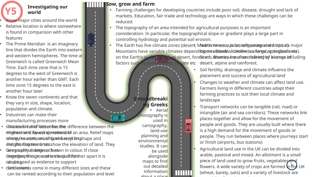
North America is broadly categorized into six major biomes (tundra, coniferous forest, grasslands etc). South America has a vast variety of biomes including desert, alpine and rainforest.
Soil fertility, drainage and climate influence the placement and success of agricultural land
Changes to weather and climate can affect land use. Farmers living in different countries adapt their farming practices to suit their local climate and landscape
Transport networks can be tangible (rail, road) or intangible (air and sea corridors). These networks link places together and allow for the movement of people and goods. They are usually built where there is a high demand for the movement of goods or people. They run between places where journeys start or finish (airports, bus stations)
Agricultural land use in the UK can be divided into arable, pastoral and mixed. An allotment is a small piece of land used to grow fruits, vegetables and flowers. A wide variety of crops are farmed in the UK (wheat, barely, oats) and a variety of livestock are reared (beef, poultry and pigs)
Compass points can be used to describe the relationship of features to each other or to describe the direction of travel. Accurate grid references identify the position of key physical and human features
A geographical enquiry can help us to understand the physical geography (rivers, coasts) or human geography (population changes, migration) of an area and the impacts on the surrounding environment Sow, grow and farm Groundbreaking Greeks
Aerial photography is used in cartography, land-use planning and environmental studies. It can be used alongside maps to find out detailed information about a place or places Y5 Investigating our world Farming challenges for developing countries include poor soil, disease, drought and lack of markets. Education, fair trade and technology are ways in which these challenges can be reduced.
The topography of an area intended for agricultural purposes is an important consideration. In particular, the topographical slope or gradient plays a large part in controlling hydrology and potential soil erosion.
The Earth has five climate zones (desert, Mediterranean, polar, temperate and tropical). Mountains have variable climates depending on altitude. A biome is a large ecological area on the Earth’s surface, such as desert, forest etc. Biomes are often defined by a range of factors such as temperature, climate etc Know major cities around the world
Relative location is where somewhere is found in comparison with other features
The Prime Meridian is an imaginary line that divides the Earth into eastern and western hemispheres. The time at Greenwich is called Greenwich Mean Time. Each time zone that is 15 degrees to the west of Greenwich is another hour earlier than GMT. Each time zone 15 degrees to the east is another hour later
Know the seven continents and that they vary in size, shape, location, population and climate.
Industries can make their manufacturing processes more sustainable and better for the environment by using renewable energy sources, reusing and recycling and sharing resources.
Geographical data such as demographics or economic statistics can be used as evidence to support conclusions The term ‘relief’ describes the difference between the highest and lowest elevations of an area. Relief maps show the contours of land based on shape and height. Contour lines show the elevation of land. They are usually orange or brown in colour. If close together, the ground is steep, if further apart it is sloping.
Settlements come in many different sizes and these can be ranked according to their population and level of services. A hierarchy includes hamlet, village, town, city and large city<br>
Soil fertility, drainage and climate influence the placement and success of agricultural land
Changes to weather and climate can affect land use. Farmers living in different countries adapt their farming practices to suit their local climate and landscape
Transport networks can be tangible (rail, road) or intangible (air and sea corridors). These networks link places together and allow for the movement of people and goods. They are usually built where there is a high demand for the movement of goods or people. They run between places where journeys start or finish (airports, bus stations)
Agricultural land use in the UK can be divided into arable, pastoral and mixed. An allotment is a small piece of land used to grow fruits, vegetables and flowers. A wide variety of crops are farmed in the UK (wheat, barely, oats) and a variety of livestock are reared (beef, poultry and pigs)
Compass points can be used to describe the relationship of features to each other or to describe the direction of travel. Accurate grid references identify the position of key physical and human features
A geographical enquiry can help us to understand the physical geography (rivers, coasts) or human geography (population changes, migration) of an area and the impacts on the surrounding environment Sow, grow and farm Groundbreaking Greeks
Aerial photography is used in cartography, land-use planning and environmental studies. It can be used alongside maps to find out detailed information about a place or places Y5 Investigating our world Farming challenges for developing countries include poor soil, disease, drought and lack of markets. Education, fair trade and technology are ways in which these challenges can be reduced.
The topography of an area intended for agricultural purposes is an important consideration. In particular, the topographical slope or gradient plays a large part in controlling hydrology and potential soil erosion.
The Earth has five climate zones (desert, Mediterranean, polar, temperate and tropical). Mountains have variable climates depending on altitude. A biome is a large ecological area on the Earth’s surface, such as desert, forest etc. Biomes are often defined by a range of factors such as temperature, climate etc Know major cities around the world
Relative location is where somewhere is found in comparison with other features
The Prime Meridian is an imaginary line that divides the Earth into eastern and western hemispheres. The time at Greenwich is called Greenwich Mean Time. Each time zone that is 15 degrees to the west of Greenwich is another hour earlier than GMT. Each time zone 15 degrees to the east is another hour later
Know the seven continents and that they vary in size, shape, location, population and climate.
Industries can make their manufacturing processes more sustainable and better for the environment by using renewable energy sources, reusing and recycling and sharing resources.
Geographical data such as demographics or economic statistics can be used as evidence to support conclusions The term ‘relief’ describes the difference between the highest and lowest elevations of an area. Relief maps show the contours of land based on shape and height. Contour lines show the elevation of land. They are usually orange or brown in colour. If close together, the ground is steep, if further apart it is sloping.
Settlements come in many different sizes and these can be ranked according to their population and level of services. A hierarchy includes hamlet, village, town, city and large city<br>
07
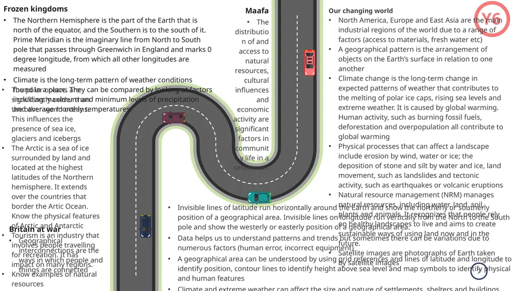
Y6 Invisible lines of latitude run horizontally around the Earth and show the northerly or southerly position of a geographical area. Invisible lines on longitude run vertically from the North to the South pole and show the westerly or easterly position of a geographical area.
Data helps us to understand patterns and trends but sometimes there can be variations due to numerous factors (human error, incorrect equipment)
A geographical area can be understood by using grid references and lines of latitude and longitude to identify position, contour lines to identify height above sea level and map symbols to identify physical and human features
Climate and extreme weather can affect the size and nature of settlements, shelters and buildings, diet, lifestyle, jobs, clothing and more
Representing, analyzing, concluding, communicating, reflecting and responding are helpful strategies to answer geographical questions Frozen kingdoms
The Northern Hemisphere is the part of the Earth that is north of the equator, and the Southern is to the south of it. Prime Meridian is the imaginary line from North to South pole that passes through Greenwich in England and marks 0 degree longitude, from which all other longitudes are measured
Climate is the long-term pattern of weather conditions found in a place. They can be compared by looking at factors including maximum and minimum levels of precipitation and average monthly temperatures Maafa
The distribution of and access to natural resources, cultural influences and economic activity are significant factors in community life in a settlement Our changing world
North America, Europe and East Asia are the main industrial regions of the world due to a range of factors (access to materials, fresh water etc)
A geographical pattern is the arrangement of objects on the Earth’s surface in relation to one another
Climate change is the long-term change in expected patterns of weather that contributes to the melting of polar ice caps, rising sea levels and extreme weather. It is caused by global warming. Human activity, such as burning fossil fuels, deforestation and overpopulation all contribute to global warming
Physical processes that can affect a landscape include erosion by wind, water or ice; the deposition of stone and silt by water and ice, land movement, such as landslides and tectonic activity, such as earthquakes or volcanic eruptions
Natural resource management (NRM) manages natural resources, including water, land, soil, plants and animals. It recognizes that people rely on healthy landscapes to live and aims to create sustainable ways of using land now and in the future.
Satellite images are photographs of Earth taken by satellite images The polar oceans are significantly colder than the other world oceans. This influences the presence of sea ice, glaciers and icebergs
The Arctic is a sea of ice surrounded by land and located at the highest latitudes of the Northern hemisphere. It extends over the countries that border the Artic Ocean. Know the physical features of Arctic and Antarctic
Tourism is an industry that involves people travelling for recreation. It has impact on many regions.
Know examples of natural resources Britain at war
Geographical interconnections are the ways in which people and things are connected<br>
Data helps us to understand patterns and trends but sometimes there can be variations due to numerous factors (human error, incorrect equipment)
A geographical area can be understood by using grid references and lines of latitude and longitude to identify position, contour lines to identify height above sea level and map symbols to identify physical and human features
Climate and extreme weather can affect the size and nature of settlements, shelters and buildings, diet, lifestyle, jobs, clothing and more
Representing, analyzing, concluding, communicating, reflecting and responding are helpful strategies to answer geographical questions Frozen kingdoms
The Northern Hemisphere is the part of the Earth that is north of the equator, and the Southern is to the south of it. Prime Meridian is the imaginary line from North to South pole that passes through Greenwich in England and marks 0 degree longitude, from which all other longitudes are measured
Climate is the long-term pattern of weather conditions found in a place. They can be compared by looking at factors including maximum and minimum levels of precipitation and average monthly temperatures Maafa
The distribution of and access to natural resources, cultural influences and economic activity are significant factors in community life in a settlement Our changing world
North America, Europe and East Asia are the main industrial regions of the world due to a range of factors (access to materials, fresh water etc)
A geographical pattern is the arrangement of objects on the Earth’s surface in relation to one another
Climate change is the long-term change in expected patterns of weather that contributes to the melting of polar ice caps, rising sea levels and extreme weather. It is caused by global warming. Human activity, such as burning fossil fuels, deforestation and overpopulation all contribute to global warming
Physical processes that can affect a landscape include erosion by wind, water or ice; the deposition of stone and silt by water and ice, land movement, such as landslides and tectonic activity, such as earthquakes or volcanic eruptions
Natural resource management (NRM) manages natural resources, including water, land, soil, plants and animals. It recognizes that people rely on healthy landscapes to live and aims to create sustainable ways of using land now and in the future.
Satellite images are photographs of Earth taken by satellite images The polar oceans are significantly colder than the other world oceans. This influences the presence of sea ice, glaciers and icebergs
The Arctic is a sea of ice surrounded by land and located at the highest latitudes of the Northern hemisphere. It extends over the countries that border the Artic Ocean. Know the physical features of Arctic and Antarctic
Tourism is an industry that involves people travelling for recreation. It has impact on many regions.
Know examples of natural resources Britain at war
Geographical interconnections are the ways in which people and things are connected<br>