PPT-Using GPS data in undergraduate courses: from tectonic motions to water resources and
Author : asmurgas | Published Date : 2020-06-23
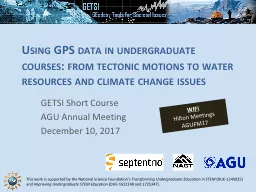
GETSI Short Course AGU Annual Meeting December 10 2017 WIFI Hilton Meetings AGUFM17 History behind resources Geosciencegeodesy community members with great ideas
Presentation Embed Code
Download Presentation
Download Presentation The PPT/PDF document "Using GPS data in undergraduate courses:..." is the property of its rightful owner. Permission is granted to download and print the materials on this website for personal, non-commercial use only, and to display it on your personal computer provided you do not modify the materials and that you retain all copyright notices contained in the materials. By downloading content from our website, you accept the terms of this agreement.
Using GPS data in undergraduate courses: from tectonic motions to water resources and: Transcript
Download Rules Of Document
"Using GPS data in undergraduate courses: from tectonic motions to water resources and"The content belongs to its owner. You may download and print it for personal use, without modification, and keep all copyright notices. By downloading, you agree to these terms.
Related Documents