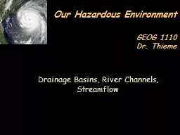
/
Drainage Basins, River Channels, Streamflow Drainage Basins, River Channels, Streamflow

Drainage Basins, River Channels, Streamflow - PowerPoint Presentation

faustina-dinatale
faustina-dinatale . @faustina-dinatale
Follow
346 views
Uploaded On 2018-09-26

Drainage Basins, River Channels, Streamflow - PPT Presentation

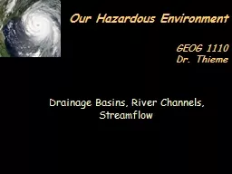
Our Hazardous Environment GEOG 1110 Dr Thieme Drainage Basin the fundamental landscape unit for collection and distribution of water and sediment separated from the adjacent basin by a divide ID: 680393

river channel level water channel river water level flood flow discharge velocity base stream drainage depth figure meters downstream

Share:

Link:

Embed:

Download Presentation from below link

Download Presentation The PPT/PDF document "Drainage Basins, River Channels, Streamf..." is the property of its rightful owner. Permission is granted to download and print the materials on this web site for personal, non-commercial use only, and to display it on your personal computer provided you do not modify the materials and that you retain all copyright notices contained in the materials. By downloading content from our website, you accept the terms of this agreement.


Presentation Transcript

Slide1

Drainage Basins, River Channels, Streamflow

Our Hazardous Environment

GEOG 1110

Dr. ThiemeSlide2

Drainage Basin

the fundamental landscape unit for collection and distribution of water and sediment.separated from the adjacent basin by a divide.Slide3
Slide4
Slide5
Slide6

Gradient

- the vertical drop over a certain horizontal distance

“rise over run”Slide7

Drainage

PatternSlide8

Channel PatternSlide9

Sinuosity reduces grade.

Medium grade

Steep grade

Low grade

100’

90’Slide10

Sinuosity reduces velocity

More deposition will occur in a sinuous stream.If the channel is blocked, it may change course or widen to a “braided” condition.Excessive sinuosity may result in severe degradation of the stream.Slide11
Slide12

Braided Rivers

The following conditions favor the braided channel pattern:erodible banksabundant coarse sediment supplyrapid fluctuations in dischargeSlide13

Base Level is the lower limit to which to which a river

can downcut its channel.Slide14

A

meander

increases in amplitude by erosion of the

cutbank

and deposition on the

point bar

.

A cut-off meander forms an

oxbow lake

.Slide15

Meander Scrolls

indicate historical migration of meander bends.

Meanders rapidly abandoned by avulsion become

oxbow lakes

.Slide16

Features of a Meandering River Valley:

Cutbanks

Point Bars

Floodplains

Oxbow Lakes (Cut-off Meanders)

Natural Levees

Yazoo Streams

Backswamps

TerracesSlide17

Figure 4.7Slide18

Flood

natural process of overbank flowcan be characterized by a discharge (cfs or m

3

s

-1

) at the point where water overflows the banks

also by a

stage

(feet or meters) or depth of flowSlide19
Slide20

Discharge

(Q) is the amount of water passing a given

cross-section of a river in a given unit of time.Slide21

Continuity Equation

Similar to Principle of Conservation of Mass and Energy in Physics

Q = w * d * v

discharge width depth velocity

cross-section

timeSlide22

Hydraulic Geometry

channel width, depth, and velocity all increase in the downstream

direction

Depth increases at

the fastest rate

Why does

velocity

increase?Slide23

Mountain streams have

turbulent flow

Water molecules and sediment particles are moving at many angles which are not parallel to streamflow

Boulders or large woody debris in a channel introduce more frictional dragSlide24

Turbulent and Laminar Flow

Deep, narrow channel at upstream end.More of the water comes in contact with channel walls.Velocity is decreased by

frictional drag

.

Wide, shallow channel at downstream end has

laminar flow

.

Most of the resistance to flow comes from shear between water planes.Slide25

Streams and Erosion

base level – the lowest level to which a stream can erodelocal base level

– controlled by local features such as a larger river or a lake or a resistant bed

ultimate (absolute) base level

– sealevelSlide26

Graded Stream

has just the velocity required for the load supplied from the drainage basinStream adjustments toward equilibrium or “graded” condition: Raising base level causes

deposition

Lowering base level causes

erosion

Increasing gradient causes

meanderingSlide27

River Terraces

abandoned floodplains formed when the river flowed at a higher level than at present Slide28

Floodplain

(T-0)

Terrace

(T-2)

Terrace

(T-1)Slide29

Valley Cross-Section

Floodplain

“Normal” flow Channel

Cut

bank

Terrace

Terrace

Flood flow channelSlide30

Stream Gage

measure discharge in cubic feet per second (

cfs

) or cubic meters per second (

cumecs

)Slide31
Slide32

Figure 5.DSlide33

Rating Curve - used to convert water height (stage) to dischargeSlide34

Hydrograph

a graph showing changes through time inriver discharge (cfs or m

3

s

-1

)

water

depth

(feet or meters)

stage

(feet or meters) relative to some datumSlide35

Recurrence Interval

- Average number of years within which a flood of a given magnitude occurs in the period of record Slide36

N + 1

R.I. = _______

M

N = total number of years of record

M = rank of magnitude of floodSlide37
Slide38

FLOODPLAIN MAPPING

Based on contours that correspond to depths of gaged floods

Used for land use planning

Used for determining eligibility for flood insurance

Subject to uncertainties in the

statistical analysis of flood

frequencySlide39

Figure 4.8a

Morning StreamflowSlide40

Figure 4.8b

Afternoon Meltwater FloodSlide41

Flash Floods

typically occur in the upper part of a drainage basin.

generally produced by intense rainfall of short duration

falling over a small area.Slide42

Santa Elena Canyon of Big Bend National Park

March 20, 2004

over 2 m (6 ft) high wall of water

surprised group of five canoeists from the University of Wisconsin-WhitewaterSlide43

Big Thompson Canyon

in the Colorado Front Range

July, 1976

triggered by system of thunderstorms

up to 25 cm (9.8 in) of rain fell in a few hoursSlide44

Downstream Floods

cover a wide area

generally produced by storms of long duration that

saturate the soil and produce increased runoff.Slide45

Downstream Movement of a Flood Crest:

Chattooga River near Clayton, GA

Savannah River near Calhoun, S.C.

Savannah River near Clyo, Ga.Slide46
Slide47