PPT-Remote sensing Arctic lake
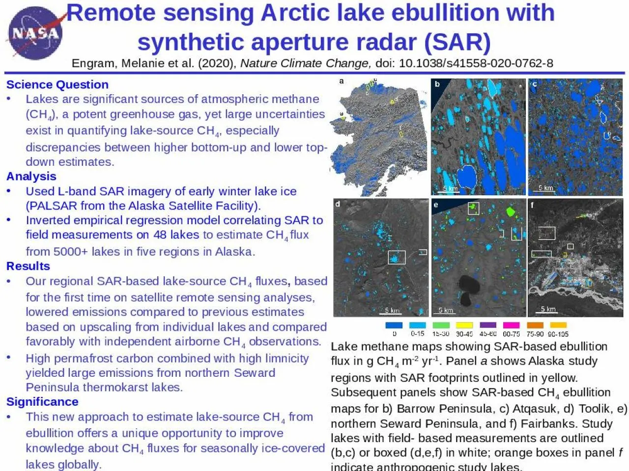
ebullition with synthetic aperture radar SAR Engram Melanie et al 2020 Nature Climate Change doi 101038s4155802007628 Science Question Lakes are significant sources
Download Presentation
"Remote sensing Arctic lake" is the property of its rightful owner. Permission is granted to download and print materials on this website for personal, non-commercial use only, provided you retain all copyright notices. By downloading content from our website, you accept the terms of this agreement.
Presentation Transcript
Transcript not available.