/
A Vision for Early Detection and Rapid Response to Invasive A Vision for Early Detection and Rapid Response to Invasive

A Vision for Early Detection and Rapid Response to Invasive - PowerPoint Presentation

jane-oiler
jane-oiler . @jane-oiler
Follow
459 views
Uploaded On 2016-04-10

A Vision for Early Detection and Rapid Response to Invasive - PPT Presentation

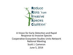
Cooperative Ecosystem Studies Units Network National Meeting Scott J Cameron June 5 2014 Why care about invasives Earths most serious and least understood ecological problem 14 trillion annual hit to global economy ID: 277893

species invasive plant park invasive species park plant data provide application uga national task rrisc nps edrr regional public

Share:

Link:

Embed:

Download Presentation from below link

Download Presentation The PPT/PDF document "A Vision for Early Detection and Rapid R..." is the property of its rightful owner. Permission is granted to download and print the materials on this web site for personal, non-commercial use only, and to display it on your personal computer provided you do not modify the materials and that you retain all copyright notices contained in the materials. By downloading content from our website, you accept the terms of this agreement.


Presentation Transcript

Slide1

A Vision for Early Detection and Rapid Response to Invasive SpeciesCooperative Ecosystem Studies Units Network National MeetingScott J. CameronJune 5, 2014Slide2

Why care about invasives?Earth’s most serious and least understood ecological problem$1.4 trillion annual hit to global economy$128 billion annual hit to US economy43% of listings under the Endangered Species Act

Caused 20% of global extinctions since 1600

Contributed to 50% of extinctions since 1600

Invasive diseases kill and hospitalize thousands

2Slide3

What is RRISC?Mission: RRISC educates Americans on the risks posed by invasive species to the economy, environment, and public health of the United States, and promotes cost-effective strategies to reduce those risks.Vision: Engage a broad-based group of stakeholders and all levels of government in non-regulatory risk-based strategies to accomplish the mission.

3Slide4

RRISC ChronologyIncorporated in the District of Columbia, 3/7/14Website launched, www.rrisc.org, 3/18/14Officers elected, 3/24/14Distinguished Advisory Board appointed, 5/2/14

Presentation to Invasive Species Advisory Committee, 5/13/14

Presentation to Office of Management and Budget, 5/16/14

Presentation to US Fish and Wildlife Service, 5/21/14

Filing with IRS for 501(c)(3) status, 6/2/14Official Launch Event on Capitol Hill, 6/17/14

4Slide5

RRISC GoalsProtect biodiversity Reduce industry operating costs Create business opportunities

Reduce the regulatory burden of the ESA

Demonstrate success

of nonregulatory solutions

Focus public and Congressional attention Foster programs in conjunction with CongressHarness bipartisan

Distinguished Advisory

Board

Recognize

successful

best

practices

5Slide6

RRISC StrategiesShow how invasives threaten people, the economy, and the environment of every Congressional DistrictSupport the annual National Invasive Species Awareness WeekPromote annual President’s budget

request

Lay the groundwork for a national network of regional early detection and rapid response capabilities by sponsoring multi-stakeholder educational regional workshops around the country, in cooperation with State governments, federal agencies, and land grant universities

6Slide7

Why Early Detection andRapid Response (EDRR)? Prevention is imperfectPerfect prevention would be exorbitantly expensive and socially unacceptableEDRR represents defense in depth to eliminate new populations of invasives that infiltrate new habitats before they have time to get established

7Slide8

Hypotheses for EDRRRegionally managed, not centrally directedState government leadership, not federally drivenMulti-stakeholder, not single agencyRegions defined ecologically, and/or socioeconomically, politicallyLand grant universities play critical role

Sensitive to regional priorities

8Slide9

Strategies for EDRRLeverage existing modelsExplore other models: CDC, National Contingency Plan (oil spills), Boise Fire CenterExpand APHIS authorityFederal cost-sharingFacilitate improved federal partnering

9Slide10

Existing models for pieces of EDRR Following slides courtesy of Chuck Bargeron, University of Georgia

10Slide11
Slide12
Slide13

Everglades Invasive Animal Web and Mobile Reporting System10/1/2010 – 9/30/2015Funded by National Park Service - Everglades

Task 1: Provide for and make minor changes/additions/maintenance to

EvergladesCISMA

website and Animal portion of EDDMapS

for Florida over five years.Task 2: Share data with Florida Fish and Wildlife Conservation Commission on monthly basis.

Task 3: Attend Everglades CISMA Annual Summit on yearly basis

.

Task 4: Develop interface for “Power Users” to easily edit and amend reports to

EDDMapS

.

Task 5: Streamline verification process with Florida Fish and Wildlife Conservation Commission

.

Task 6: Develop multi-page reporting form and integrate ID resources into reporting form

.

Task 7: Integrate NPS and FWC images into

EDDMapS

.

 Task 8: Develop EDDMapS Animals report App for Apple iPhone and submit to Apple for availability through Apple iTunes App Store that include ability to report exotic animal sightings and includes reptile identification guide.Slide14
Slide15

Detecting and Mapping New Invasive Species Occurrences4/15/2010 – 12/30/

2014

Funded by National Park Service

– National Capital Region

Provide distribution maps for selected invasive species across the mid-Atlantic states at point to County level through individual species reports entered by online reporting form and through the compilation and conversion of data from existing electronic data sets into one central location.

Establish a user-driven system for automatic e-mail notification when data on selected species is submitted for selected areas. This will make reporting of new detections easier and decrease response times which will lead to more efficient and cost effective control programs.

Create an avenue for knowledge sharing between the Mid-Atlantic region parks and other agencies, organizations, and individuals.

Provide data to refine regional, state and park priority lists and determine incipient invasive species.

Provide color-coded or other method for identifying and distinguishing initial infestations, treated infestations, and eradicated infestations, so as to maintain and not lose invasion history.

Share data with other projects and national databases such as the USDA NRCS PLANTS Database. Slide16
Slide17

Implement web template for any new CISMA (needing a web presence)Host and update www.FloridaInvasives.org website.Host and update CISMA web sites on www.FloridaInvasives.org website.Maintain

EDDMapS

for any hosted CISMA website

Share invasive plant data with Florida Natural Areas Inventory

Florida Invasive Species Partnership & Cooperative Invasive Species Management Area Website Development, Enhancement & Implementation

Multiple Projects

Funded by U.S. Fish and Wildlife ServiceSlide18
Slide19

NPS/UGA to identify and outline all pertinent user workflows (and inherent requirements) that this project is intended to accommodate. NPS/UGA to refine design of mobile application and park configuration interface to ensure accommodation of all workflows/requirements and adoption of pertinent technology. UGA to develop NPS-branded mobile application (for iOS).

UGA to develop website that facilitates administration of both user accounts and park/site configuration details (i.e. park list of invasive plant species).

NPS to review, test, and approve functional operation of application and website prior to publishing/release.

UGA to make application available through iTunes (App Store).

NPS/UGA to jointly conduct announcement/training to priority park unit staff. UGA to provide comprehensive application hosting and technical support to priority parks for one year following initial implementation of the application.

UGA to specify the cost, on a park-by-park basis, of establishing additional park units for application use/support.

UGA to specify the annual application hosting/support cost on a park-by-park or Service-wide basis

.

NPS Invasive Plant Alert – a mobile app

9/4/2012 – 2/28/2014

Funded by National Park Service –

Biological Resource Management Division

To Be Released Summer 2014Slide20

Evaluating Potential Resources to Track and Warn the Public of Invasive Plant Species Impacts in Southern Florida9/1/2013

8/

30/2015

Funded by U.S. Army Corps of Engineers

The University of Georgia will work with the U.S. Army Corps of Engineers to complete the following tasks:

Evaluate

existing watershed scale / GIS-based data sets of invasive plant species to locate, establish persistence, and track movement of invasive species in their respective ecosystems

Test

resources for their capability of generating public warning reports of invasive species distribution and possible negative impacts from these colonies

Provide

public access to this information for situational awareness and strategic planning for the control and management of increasing invasive species populations

Under DevelopmentSlide21

This project will develop applications for Apple iOS (iPhone/iPad/iPod Touch) and Google Android devices. This application will:Provide information about invasive plants already known to be in the area based on the user’s phone GPS location and/or community reference in comparison to the Alaska Exotic Plants Information Clearinghouse (AKEPIC) database

Provide (limited) decision support to assist in properly identifying the invasive plant and distinguishing it from native plants that may be similar in description.

Provide very basic control information letting users know if it is safe to pull up the invasive plant by hand or directing them to a site for more detailed treatment information.

Have low band-width requirements so as to facilitate use in remote regions of Alaska.

Allow the user to upload data (photo, GPS location, date, size of plant cluster, etc.) into a database for review by an expert in invasive plant identification and potential eventual addition to the AKEPIC database.

Invasive Plant Identification and Record Input Smartphone App for Western Alaska

3/1/2014

9/

30/

2015

Funded by Western Alaska Landscape Conservation

Cooperative

Under DevelopmentSlide22

Issues to exploreAppropriate functions?Interdiction at the borders/ports?Monitoring?

Identification

?

Reporting?

Research?Education?

Rapid response

?

Post-eradication surveillance?

How does one define the “region”?

Will deferring to regional priorities cause gaps?

Terrestrial

and

aquatic?

Animal

and

plant?

Diseases?

22Slide23

The right regions??23Slide24

Issues to exploreHow to leverage technology?Smart phones with GPSToo many apps?Standards?Software compatibility?Authoritative information?

How to leverage CESUs?

24Slide25

Issues to exploreWhat capabilities would a regional EDRR network need?Program Management Office?Volunteer coordination?Rapid Response dispatch function

?

Database management, distributed or centralized?

GIS?

Public outreach/alert capability?Public Affairs?Intergovernmental coordination?

Research?

Systematics?

Budget?

Staff, dedicated/virtual?

25Slide26

Issues to exploreGovernance?Role of federal agencies?Role of state agencies?Role of local governments?Role of industry, individually and/or through trade associations?Role of universities?Role of non-governmental organizations

?

26Slide27

SuggestionOrganize regional EDRR workshops in conjunction with leading land grant university/CESU sponsorInvite all stakeholders in defined regionGoal: Define what EDRR would look like in the regionCapabilitiesPriorities

Functions

Governance

Funding

27Slide28

Contact Scott CameronScott.Cameron@rrisc.org703 909 2880

28