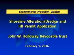
PPT-Shoreline Alteration/Dredge & Fill Permit Application
Author : karlyn-bohler | Published Date : 2015-10-17
Gary Elbers District 5 May 5 2015 Environmental Protection Division Location Map 8626 Port Said Street Parcel ID 122230337902190 Aerial 8626 Port Said Street Parcel
Presentation Embed Code
Download Presentation
Download Presentation The PPT/PDF document "Shoreline Alteration/Dredge & Fill P..." is the property of its rightful owner. Permission is granted to download and print the materials on this website for personal, non-commercial use only, and to display it on your personal computer provided you do not modify the materials and that you retain all copyright notices contained in the materials. By downloading content from our website, you accept the terms of this agreement.
Shoreline Alteration/Dredge & Fill Permit Application: Transcript
Download Rules Of Document
"Shoreline Alteration/Dredge & Fill Permit Application"The content belongs to its owner. You may download and print it for personal use, without modification, and keep all copyright notices. By downloading, you agree to these terms.
Related Documents