/
Physical Geography of Russia and the Republics Physical Geography of Russia and the Republics

Physical Geography of Russia and the Republics - PowerPoint Presentation

lindy-dunigan
lindy-dunigan . @lindy-dunigan
Follow
421 views
Uploaded On 2017-06-15

Physical Geography of Russia and the Republics - PPT Presentation

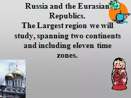
Northern Landforms Russia and the Republics in size About 3x of the US 11 times zones nearly 16 th of Earths land surface It is the only country to reach two continents Europe and Asia ID: 559720

rivers russia republics largest russia rivers largest republics mountains siberian russian sea aral region caucasus black government union 000

Share:

Link:

Embed:

Download Presentation from below link

Download Presentation The PPT/PDF document "Physical Geography of Russia and the Rep..." is the property of its rightful owner. Permission is granted to download and print the materials on this web site for personal, non-commercial use only, and to display it on your personal computer provided you do not modify the materials and that you retain all copyright notices contained in the materials. By downloading content from our website, you accept the terms of this agreement.


Presentation Transcript

Slide1

Physical Geography of Russia and the RepublicsSlide2

Northern Landforms

Russia and the Republics in size: About 3(x) of the U.S. / 11 times zones/ nearly 1/6

th

of Earth’s land surface. It is the only country to reach two continents (Europe and Asia). Northern European Plain is a lowland area in the west that has black earth, or chernozem, the world’s most fertile soil. The soil meant many agricultural areas are located here along with more than 75% of the region’s population.Three of the region’s largest cities are located here: Moscow, St. Petersburg, and Kiev.Slide3

Northern Landforms

West Siberian Plain: The

Ural Mountains

separate the Northern European and West Siberian Plains or dividing line between Europe and Asia. Central Siberian Plateau: Mostly has uplands and mountains for landforms. High plateaus averaging heights of 1,000-2,000 feet that make Central Siberian Plateau between Lena and Yenisey rivers. Russian Far East: A region of complex volcano systems. The Kamchatka Peninsula has

120 alone with 20 still active. The islands of Sakhalin and Kuril islands are south of the peninsula. Slide4

Southern Landforms

The

Turan

Plain has two major rivers, the Syr Darya and Amu Darya, and two large deserts, the Kara Kum and Kyzyl Kum. The Caucasus Mountains separates the Black and Caspian seas while forming a boarder between Russia and Transcaucasia.

The Tian Shan Mountains are located along southeastern border of Central Asia. This is a region of republics of Kazakhstan, Kyrgyzstan, Tajikistan, Turkmenistan, and Uzbekistan. Slide5

Rivers and Lakes

Some

of the world’s longest

rivers and largest and deepest lakes. The Volga River longest in Europe and carries about 60% of Russia’s river traffic. Six main drainage basins include Arctic (largest) and Pacific Oceans, Caspian, Baltic, Black, and Aral Sea basins. Two of Earth’s largest lakes are the Caspian (largest inland sea) and Aral Seas. The Aral has lost about 87% of water volume from irrigation projects. Lake Baikal is the deepest in the world (a mile to the bottom) and holds 20% of world’s freshwater. The Volga River longest in Europe and carries about 60% of Russia’s river traffic.Slide6

Regional Resources

Huge reserves of coal, iron ore, nickel, oil, natural gas, petroleum (world’s largest), and timber were a great wealth and powerful rivers allowed Russia to become world’s largest producers of hydroelectric power.

Challenges arose in removal and transporting from harsh, remote regions with many located in frigid arctic and subarctic

Siberia and using without harming environment. Until 1990’s the government provided money for willing people.Mining, oil, gas, and hydroelectric operations caused thermal pollution and damaged plant and animal habitats. Slide7

Human-Environment Interaction

Beginning in the1950’s, the Kara

Kum

canal irrigation project took so much water from rivers for cotton fields that the Aral Sea began evaporating. Agricultural problems occurred from use of pesticides and fertilizers with runoff.Runoff- unabsorbed rainfall that runs into streams and rivers. Runoff carried chemicals to the Aral Sea and eventually killed 24 native fish species. As Aral Sea evaporated, exposed salt and chemicals picked up in windstorms created pollution and respiratory diseases. Removal of 9 of 18 million acres of farming to keep current sea levels. Slide8

Coping in Russian Winter

Over 32 million people reside in Siberia. Siberian workers have to cover everything and leave on their eye, or eyes, exposed. Even during spring, black clouds of either misquotes or black flies attack Siberian residents.

In construction, thawing grounds would sink, tilt, or collapse unless built on concrete supports. Harsh, frigid climate and landscape became a defense mechanism against French leader Napoleon Bonaparte and forced him to retreat as troops were unprepared Slide9

Trans-Siberian Railroad

Travel through region was dangerous and slow but railroad linked Moscow to the Pacific through 7 time zones and over several rivers. The project took about 12 years with about 70,000 workers while moving 77 million cubic feet of earth and clearing of 100,000 acres of forest

Railroad not built just for speed, but to profit from resources. Ten years after its completion, about five million settlers moved to Siberia, really boosting the economy.Slide10

A Troubled Caucasus

Powerful central government of the Soviet Union in Russia collapsed in 1991. After the collapse of the Soviets, conflict arose in seek of control over other areas. The Caucasus region dealt with some of the most violent conflicts.

Republics south of Caucasus Mountains (republics of Transcaucasia) were once apart of the Soviet Union but now independent countries. Republics north of the mountains remained under the control of Russia. The whole region had about 50 different ethnic groups.Slide11

Chechnya

Chechnya, among the other republics north of the Caucasus Mountains remained under Russian control. As the Soviet Union began to break up, ethnic groups began to fight for their independence but in a decade later, hundreds of thousands died in conflicts.

Chechnya experienced the worst violence. When Chechnya demanded for independence, Russia invaded the republic twice and caused over 100,000 casualties. Bombings occurred in 2010 in Russia which continues the conflict. Slide12

Obstacles to Economic Reform

In 1992, Russia removed price controls on sales that had been previously set by Soviet Union. Russia quickly tried to changed to a capitalists society.

This meant that the government had to release control over their country, and the price of many goods went up 250% and led to Russia selling government-owned businesses – the process of

privatizing. Economy really struggling so in Spring 2000, Russian President Vladimir Putin divided country into different federal districts. Slide13

Organized Crime

The “Russian Mafia” provided a challenge for the government. Russia has been going through economic hardships since the Soviet Union fell, making crime seem very appealing. The Russian Mafia controls 40% of private business and 60% of state business by purchasing these companies.

Mafia attempted to expand outside Russia by trying to sell a submarine to the Columbian mafia.