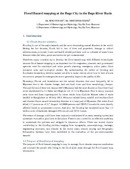
/
Work Package 3:  Transforming Rainfall Nowcasts into Flash Flood Hazard Products Work Package 3:  Transforming Rainfall Nowcasts into Flash Flood Hazard Products

Work Package 3: Transforming Rainfall Nowcasts into Flash Flood Hazard Products - PowerPoint Presentation

mercynaybor
mercynaybor . @mercynaybor
Follow
344 views
Uploaded On 2020-06-17

Work Package 3: Transforming Rainfall Nowcasts into Flash Flood Hazard Products - PPT Presentation

Calum Baugh Christel Prudhomme Marc Berenguer WaiKin Wong calumbaughecmwfint Aim To translate rainfall nowcasts WP 2 into probabilistic flash flood hazard nowcasts Existing Methods ID: 780582

probabilistic hazard flash nowcasts hazard probabilistic nowcasts flash flood range time forecasts hourly days blended amp weather medium centre

Share:

Link:

Embed:

Download Presentation from below link

Download The PPT/PDF document "Work Package 3: Transforming Rainfall N..." is the property of its rightful owner. Permission is granted to download and print the materials on this web site for personal, non-commercial use only, and to display it on your personal computer provided you do not modify the materials and that you retain all copyright notices contained in the materials. By downloading content from our website, you accept the terms of this agreement.


Presentation Transcript

Slide1

Work Package 3: Transforming Rainfall Nowcasts into Flash Flood Hazard Products

Calum Baugh, Christel Prudhomme, Marc Berenguer, Wai-Kin Wong

calum.baugh@ecmwf.int

Slide2

Aim:

To translate rainfall nowcasts (WP 2) into (probabilistic) flash flood hazard nowcastsExisting Methods:

2

European Centre for Medium-Range Weather Forecasts

ERICHA:

WP 3.1 & 3.4 Transformation of Blended Nowcasts into FF Hazard Predictions

Limitations:

Deterministic only

Short lead time (4 hours)

Real world thresholds difficult to exceed when using radar accumulations

Slide3

Aim:

To translate rainfall nowcasts (WP 2) into (probabilistic) flash flood hazard nowcastsExisting Methods:

3

European Centre for Medium-Range Weather Forecasts

EPIC:

(pre-cursor to current ERIC method on EFAS)

WP 3.1 & 3.4 Transformation of Blended Nowcasts into FF Hazard Predictions

COSMO-LEPS ensemble precipitation forecast

Twice daily

6-hourly time steps

5 days lead time

7 × 7 km

Maximum accumulated precipitation

Over all 3 accumulation periods

Accumulated precipitation

Grid cells with upstream area <2000 km

2

6, 12 & 24-hour accumulations

Mean annual maximum

From 19-year climatology (COSMO-LEPS reforecast)

EPIC flash flood indicators

Twice daily6-hourly time steps5 days lead time1 × 1 km

Advantages:

Probabilistic

Warnings account for NWP bias

Limitations:

No short range detail for first 4 hours

Slide4

WP 3.1 & 3.4 Transformation of Blended Nowcasts into FF Hazard Predictions

Solution:

Combine ERICHA and EPIC Methodologies

Probabilistic information

Extended lead time up to 5 days (whilst preserving detail in first 4 hours)

Warnings not affected by biasInput: Blended probabilistic rainfall nowcasts (WP2)Output: Probabilistic flash flood hazard nowcasts

4

European Centre for Medium-Range Weather Forecasts

0h

6h

120h (5 days)

Blending Window

ECMWF NWP only

(1 hourly timestep)

(6 hourly timestep)

At each timestep show probability of exceeding mean annual maximum

Probabilistic product:

Slide5

WP 3.3 Simplified Rapid Risk Forecasts

Currently no way of knowing which locations will have the most impactPopulation density is a key driver

Solution:

Intersect probabilistic flash flood hazard with population density

5

European Centre for Medium-Range Weather Forecasts

1km Probabilistic FF Hazard

100m Population Density

pop/km

2

1km Rapid Risk Product