Explore
Featured
Recent
Articles
Topics
Login
Upload
Featured
Recent
Articles
Topics
Login
Upload
Search Results for 'Lidar-Analysis'
Lidar-Analysis published presentations and documents on DocSlides.
LiDAR Overview What LiDAR is . . .
by yoshiko-marsland
. . . . Li. ght . D. etection . A. nd . R. angin...
FPGA Programming for Real Time Analysis of Lidar
by lindy-dunigan
Systems. Dr. Sameh Abdelazim. Assistant Professor...
LiDAR Enhanced Forest Inventory in British Columbia
by chaptoe
Challenges and Opportunities. By. Xiaoping Yuan. F...
Minnesota LiDAR: Minnesota
by danika-pritchard
LiDAR. Wednesday , November 4. th . 2015, 1:00 pm...
LiDAR Analysis of Mixed-Species, Multi-Cohort Stands
by tatyana-admore
Dr. John A. Kershaw, Jr.. Western . M. ensuration...
Overview of upcoming lidar wake experiments at DTU
by clustik
Elliot Simon. DTU Wind Energy (. RISØ. ). ellsim@...
Characterizing CA Spotted Owl Habitat with Lidar
by verticalbikers
Jonathan Kane. Malcolm North. Van Kane. Greg Asner...
Community-wide urban stormwater planning utilizing LiDAR, the WinSLAMM model and GIS
by cheryl-pisano
Dan Murphy. Rebecca Gronewold. UNI GeoTREE Center...
Estimating Rooftop Solar Electricity Potential in Seattle from LiDAR Data
by pamella-moone
Ryan M. Liddell. Faculty advisor: Dr. Joe Bishop....
AIMS use of Lidar Primary uses
by lois-ondreau
Contour creation. DTM/DSM generation. Ortho photo...
LiDAR Cave Mapper
by alexa-scheidler
FAMU-FSU College of Engineering. ME & ECE Sen...
Using LiDAR Data to Automatically Delineate Sinkholes in So
by natalia-silvester
Nate Green and Jacob Hartle. Forest and Natural R...
LiDAR Cave Mapper
by calandra-battersby
FAMU-FSU College of Engineering. ME & ECE Sen...
THE LIGHT FANTASTIC USING AIRBORNE LIDAR IN ARCHAEOLOGICAL SURVEY S
by cheryl-pisano
Crutchley Aerial Survey Investigation Research D...
BSHC LIDAR
by faustina-dinatale
S. eminar. SMA . e. xperiences. . from and . fut...
LiDAR
by alexa-scheidler
Compressor 1.1. Compression. Lossless. 25. % or s...
High Accuracy Helicopter Lidar & Mapping
by natalia-silvester
Jeffrey B. Stroub, CP,RLS,PPS,SP. Vice President ...
Raster lidar data visualizations for
by tatiana-dople
interpretation. . of. . microrelief. . structu...
CWNP Wi-Fi Analysis CWAP-405 Certification Study Guide
by NWExam
Start here---https://shorturl.at/omMgb---Get compl...
Professional Literature Review & Gap Analysis Service
by Pubrica106
Enhance your research with our literature review w...
Citation:
by debby-jeon
Vaughn, N. and L.M. . Moskal. , 2011. Identificat...
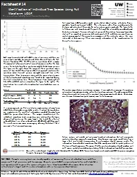
Nihanth W.
by pamella-moone
Cherukuru. a. Ronald . Calhoun. a. Manuela . Lehn...
AGIC 2015
by lindy-dunigan
Education & Training Symposium. September . 2...
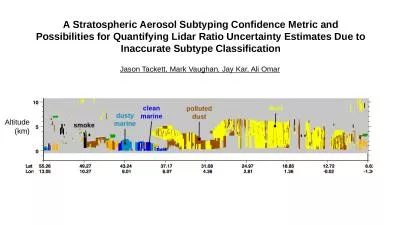
A Stratospheric Aerosol Subtyping Confidence Metric and Possibilities for Quantifying Lidar Ratio U
by barbara
Jason Tackett, Mark Vaughan, Jay Kar, Ali Omar. Al...
Elevate Accuracy and Efficiency with Lidar Surveys: Precision Mapping and Data Insights
by garudsurvey
Lidar surveys are a game-changer for precision map...
USDA Forest Service, Remote Sensing Applications Center,
by queenie
FSWeb: http://fsweb.rsac.fs.fed.us. WWW: http://ww...
The Status of
by jovita
Vegetation Lidar MOLITadashi Imaia Rei Mitsuhashia...
Use of Solar Induced Fluorescence and LIDAR to Assess Vegetation
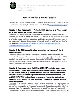
by barbara
Change and VulnerabilityMarch 16 25 2021Part 2 Que...
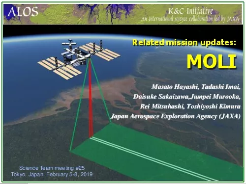
Masato Hayashi Tadashi Imai
by kimberly
Daisuke SakaizawaJumpeiMurookaRei Mitsuhashi Toshi...
Press Release
by beatrice
August 2 7 , 2020 LYON, France LiDAR is facing he...
Atmospheric Monitoring
by sylvia
in . the. TA experiment. Takayuki . Tomida. . an...
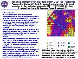
Predicting biomass over large areas from GEDI lidar footprints ...
by mila-milly
Patterson, P. L., Healey, S. P., St
Status of t he ADM-Aeolus wind
by doggcandy
lidar. . mission. A.G. . Straume. 1. , . A. . Elf...
Accuracy of dual-Doppler
by impristic
lidar . retrievals . of . near-shore winds. Nikola...
image structures: rain shafts, cold pools, gusts
by tickorekk
Separate rain fall velocity from air velocity. tur...
Techniques for Improving Water Vapor Trend Detection Using Raman Lidar
by jane-oiler
Techniques for Improving Water Vapor Trend Detect...
Heterodyne high spectral resolution lidar
by phoebe-click
Fernando . Chouza. 1,2. , Benjamin Witschas. 1. ,...
Kentucky Aerial Photography and Elevation Data Program - KYAPED
by pasty-toler
National Height Mod Partner Meeting. M. ay 1, 201...
A View From Afar: The Use of Remote Sensing
by jane-oiler
Technologies to Examine Hopewell . Sites in Ohio ...
Slope Shading Techniques for
by jane-oiler
LiDAR. Visualization. Thomas J. Pingel. Departme...
Load More...