Explore
Featured
Recent
Articles
Topics
Login
Upload
Featured
Recent
Articles
Topics
Login
Upload
Search Results for 'topographic'
topographic published presentations and documents on DocSlides.
Introduction to Cut Slope Design & Topographic Surveying
by felicity
Yonathan Admassu, PhD. James Madison . University....
Topographic Maps TEKS 8.9 C
by natalia-silvester
interpret topographic maps and satellite views to...
Topographic Maps
by luanne-stotts
Aim: To be able to interpret a topographic Map.....
Topographic Map Skills
by jane-oiler
Topographic notes. Topographic Map-includes conto...
Topographic
by marina-yarberry
Maps. Topographic Map. :. A . contour map. -. Co...
topographic Map
by tatyana-admore
exit ticket. Topographic Map Exit Ticket. 1) What...
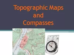
Topographic Maps
by briana-ranney
and . Compasses. Navigation Tools. Maps. Road map...
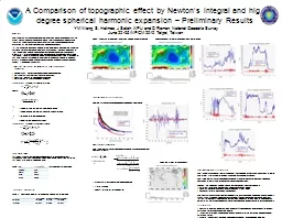
A Comparison of topographic effect by Newton’s integral a
by debby-jeon
YM . Wang, . S. . Holmes, J Saleh, XP Li . and D ...
Reading Contour Maps (Including Topographic Maps):
by badra
Visualizing 3D Surfaces. Carol J. Ormand. , . SERC...
Hydro Treatments of
by alida-meadow
Lidar-Derived DEMs. Stereo DTM. (Topographic Surf...
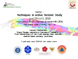
Pelatihan :
by stefany-barnette
Techniques in Active Tectonic Study. Juni 20-Juli...
Office Hours
by tatyana-admore
Mon: 11:30 AM to 12:30 PM & 1:45 PM to 3:0...
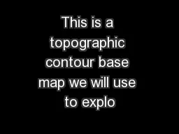
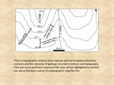
This is a topographic contour base map we will use to explo
by debby-jeon
a ridge. a valley. g. oing uphill. closer . con...
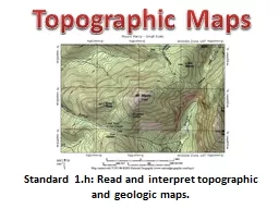
Standard 1.h: Read and interpret topographic and geologic m
by briana-ranney
Topographic Maps. Contouring. Topographic contour...
The study of the shapes and features of the Earth’s su
by alexa-scheidler
Topography. Shows the three dimensional shape ...
Architectural Design
by jane-oiler
Mapping Mechanics: . An introduction to topograp...
Topographic Mapping
by kittie-lecroy
Goals. Define and describe topographic maps.. Def...
Land Navigation Identify Topographic Symbols
by luanne-stotts
on a Military Map. Action: . Identify Topographi...
SAINIK SCHOOL GOALPARA CHAPTER-4
by morgan
TOPIC-MAPS. GEOGRAPHY. CLASS-VI. WHAT ARE MAPS?. A...
This is a topographic contour base map we will use to explore structure contours and the interplay
by natalie
a ridge. a valley. g. oing uphill. closer . cont...
Survey Services Company
by surveyservices
http://www.surveyservicescompany.com | SURVEY SERV...
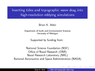
Inserting tides and topographic wave drag into highres
by yoshiko-marsland
Arbic Department of Earth and Environmental Scien...
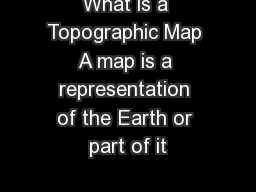
What is a Topographic Map A map is a representation of the Earth or part of it
by sherrill-nordquist
The distinctive character istic of a topographic ...
Generative Topographic Mapping by Deterministic Annealing
by min-jolicoeur
Jong Youl Choi, Judy . Qiu. , Marlon Pierce, and ...
Oceanographic and Topographic Control Of
by tatiana-dople
Macrobenthic. Distributions In The Chukchi Sea. ...
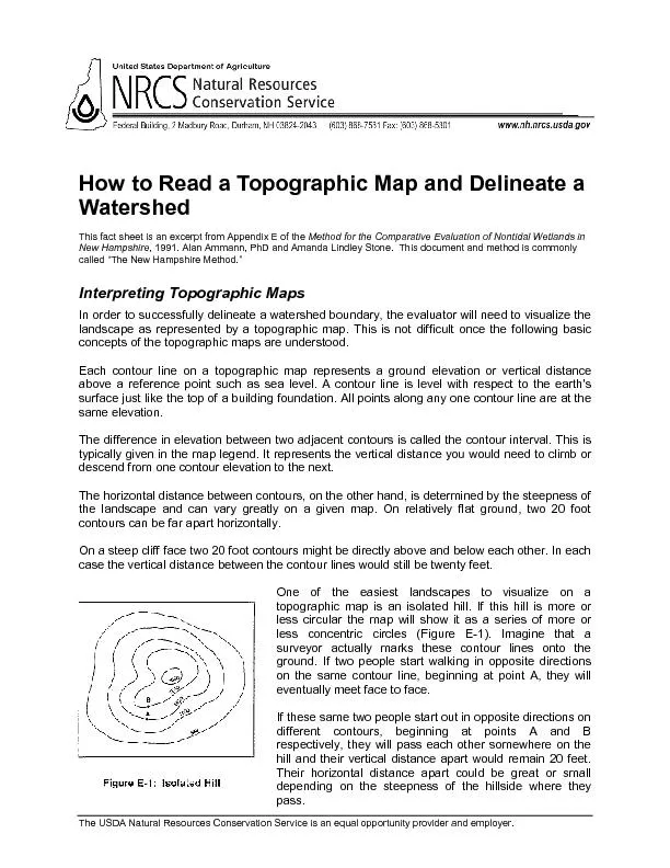
How to Read a Topographic Map and Delineate a Watershed
by calandra-battersby
This fact sheet is an excerpt from Appendix E of t...
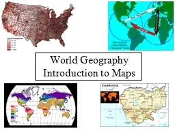
World Geography
by debby-jeon
Introduction to . Maps. What . is. a map?. A gen...
Qatar’s Nation-Wide GIS
by natalia-silvester
Cooperation on Local and Regional Levels. Dr. Moh...
TOPOGRAPHIC INSTRUMENT
by phoebe-click
The topography (from the . greek. . topos. , pla...
As we go through the power point, please do the followin
by min-jolicoeur
Match your cards.. Take notes in your science not...
Constructing a Geological Cross Section
by debby-jeon
Select a section line. Construct a topographic pr...
Rotating Scheimpflug Topographic Parameters Important in Di
by marina-yarberry
Clayton Falknor, MD, Orkun Muftuoglu, MD, . R. Wa...
Mapping What is a map? It is a representation of
by yoshiko-marsland
Mapping What is a map? It is a representation of s...
Tiffany L. Caudle, Thomas A. Tremblay, Jeffrey G. Paine, Jo
by marina-yarberry
Bureau of Economic Geology. Jackson School of Geo...
IMPACT OF DIFFERENT
by faustina-dinatale
TOPOGRAPHIC CORRECTIONS ON PREDICTION ACCURACY O...
Femtosecond Laser-Assisted Intrastromal Astigmatic Keratoto
by conchita-marotz
- Month . Outcomes of a Prospective Interventiona...
Classroom Lessons Based on Surname Study
by stefany-barnette
Tapping into the Linguistic. Connections between ...
Generative Topographic Mapping
by debby-jeon
in Life Science. Jong Youl Choi. School of Inform...
Generative Topographic Mapping by Deterministic Annealing
by debby-jeon
Jong Youl Choi, Judy . Qiu. , Marlon Pierce, and ...
Oceanographic and Topographic Control Of
by pasty-toler
Macrobenthic. Distributions In The Chukchi Sea. ...
Load More...