Explore
Featured
Recent
Articles
Topics
Login
Upload
Featured
Recent
Articles
Topics
Login
Upload
Search Results for 'usgs water'
usgs water published presentations and documents on DocSlides.
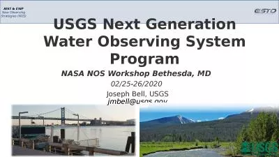
USGS Next Generation Water Observing System Program
by valerie
NASA NOS Workshop Bethesda, MD . 02/25-26/2020 . J...
USGS Science for a Changing Everglades
by bikersnomercy
Vic Engel. Wetland and Aquatic Research . Center. ...
Welcome to the USGS Webinar:
by liane-varnes
New Science and Online Management Tools to Help G...
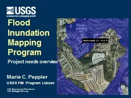
Marie C. Peppler USGS FIM Program Liaison
by mentegor
Flood . Inundation . Mapping. Program. Project nee...
USGS Training and Special Projects
by alida-meadow
Training: 3 Annual technical training courses hel...
Marie C. Peppler USGS FIM
by liane-varnes
Coordinator. Flood . Inundation . Mapping. Progra...
USGS Kentucky Water Science Center
by pamella-moone
Potential . CHIA. application for . WATER. (. W....
Water-level monitoring and a groundwater model in the
by tatyana-admore
Big Wood River Valley. Presented by Mike McVay No...
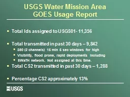
USGS Water Mission Area
by stefany-barnette
GOES Usage Report. Total Ids assigned to USGS01- ...
Hydrologic Measurement
by mitsue-stanley
Precipitation. Evaporation. Streamflow. Channel ....
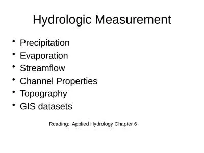
Hydrologic Measurement Precipitation
by ida
Evaporation. Streamflow. Channel . Properties. Top...
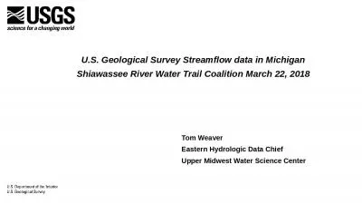
Tom Weaver Eastern Hydrologic Data Chief
by brianna
Upper Midwest Water Science Center. . U.S. Geolo...
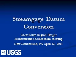
Streamgage Datum Conversion
by pasty-toler
Great Lakes Region Height Modernization Consortiu...
High Accuracy Helicopter Lidar & Mapping
by natalia-silvester
Jeffrey B. Stroub, CP,RLS,PPS,SP. Vice President ...
Marie C. Peppler
by faustina-dinatale
USGS FIM Program Liaison. Flood . Inundation . Ma...
A National Water Census * Part of the Initiative
by belinda
U.S. Department of the Interior. U.S. Geological S...
A Hydrologist national perspective on the Energy-Water Nexus
by calandra-battersby
Eric J. . Evenson. US Geological Survey. Energy ...
Update on A National Water Census
by stefany-barnette
* Part of the Initiative....
Ven
by ellena-manuel
Te. Chow Award Lecture. David R. . Maidment. ASC...
Southwest Regional
by olivia-moreira
Climate Hub. Developed by . the . Asombro Institu...
Groundwater Resources of Parowan Valley
by mitsue-stanley
Tom M. Marston, U. S. Geological Survey. In coope...
Ven
by tawny-fly
Te. Chow Award Lecture. David R. . Maidment. ASC...
Observational
by stefany-barnette
. Uncertainties. in . Water-Resources. . Model...
Applications of the U.S. Geological Survey Produced Waters
by pamella-moone
Mark A. Engle. 1. , . Kathleen D. . Gans. 2. , . ...
Global Croplands Project
by myesha-ticknor
Remote Sensing of Global Croplands and their Wate...
Aberdeen, ID Groundwater Analysis
by pasty-toler
Jerimiah Fenton. Aberdeen Wetlands. During the 19...
ATM 301 Lecture #16 (sections
by briana-ranney
9.1-9.2). . Groundwater:. . Aquifers and Groun...
TMDL Development for the Floyds
by kittie-lecroy
Fork . Watershed. Draft Watershed Hydrology and W...
committed to our coast Report Summary
by celsa-spraggs
March 2014. Senate Concurrent Resolution 39 of th...
Make a list of at least five questions or ideas from the show(s) you w
by abigail
Wade! related sciences and technologies. D...
U.S. Department of the Interior
by breezeibm
U.S. Geological Survey. USGS Science Strategy Plan...
MODFLOW-OWHM v 2 Features
by elise
and . Updates . The . next generation in fully int...
Natural Capital Accounting in the United States:
by caitlin
Recent Efforts in Developing Land and Water Accoun...
Aquifer Testing Purpose WHY
by nicole
—Can’t stick a flow meter in ground . See resp...
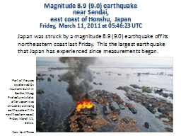
Magnitude 8.9 (9.0) earthquake
by daisy
near . Sendai, . east coast of Honshu, Japan. Frid...
Mercury Information on Mercury (Hg)
by isla
Symbol: Hg. Classified as a heavy metal (in red). ...
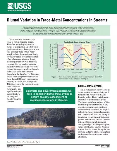
of metals dissolved in stream water vary by time of day
by martin
- rence of diurnal metal cycles has significant im...
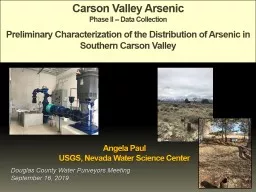
Carson Valley Arsenic Phase II -- Data Collection
by delcy
Preliminary Characterization of the Distribution o...
COMMUNITY CLEAN WATER TOOLBOX
by taylor
YORKCOUNTYA County-Based Action Plan for Clean Wat...
Zeolites
by stefany-barnette
Andrew Raulerson. March 12, 2015. http://. upload...
Load More...