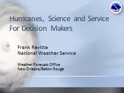
Frank Revitte National Weather Service Weather Forecast Office New OrleansBaton Rouge This is just a CAT 1 hurricane It has never flooded here before Ive been through Katrina and Gustav this is nothing ID: 913709
Download Presentation The PPT/PDF document "Hurricanes, Science and Service For Dec..." is the property of its rightful owner. Permission is granted to download and print the materials on this web site for personal, non-commercial use only, and to display it on your personal computer provided you do not modify the materials and that you retain all copyright notices contained in the materials. By downloading content from our website, you accept the terms of this agreement.
Slide1
Hurricanes, Science and Service For Decision Makers
Frank
Revitte
National Weather Service
Weather Forecast Office
New Orleans/Baton Rouge
Slide2“This is just a CAT 1 hurricane”
“It has never flooded here before”
“I’ve been through Katrina and Gustav, this is nothing”“I saw the news break into programming, that GFS thing says it won’t come here, phew!”“This is the same surge forecast as Gustav and I didn’t flood then”“My app has most of those lines way east of here. I like the one that says CLIPER”“We are going to evacuate for all CAT1 hurricanes from now on”“Ah great, I have a GIS map. Finally something accurate”“We just had our 100 year storm last year”
Communicating R
i
sk
Slide3Categories based on wind speed
Ignores other threats such as wind duration, storm surge, heavy rainfall, river flooding,
etcNo such thing as “just a category 1” or “only a tropical storm” Can give people a dangerous and false sense of safety/securitySaffir-Simpson Wind Scale
Slide42015
Average
Colo. State
NOAA
Named Storms
11
121210-16Hurricanes4654-8Major Hurricanes2321-4Accumulated Cyclone Energy (ACE)62929060-129
Weakening El Nino or possibly La Nina could be a major player
*CAUTION* It only takes one storm to make a “bad” season
2016 Seasonal Forecast
Slide52016 Atlantic Hurricane Season
Slide62015
Average
Colo. State
NOAA
Actual
Named Storms
11121210-1616Hurricanes4654-86Major Hurricanes2321-43Accumulated Cyclone Energy (ACE)62929060-129138
2016 Seasonal Forecast
Slide7Slide8Moderate El Niño
Below normal activity
8 Named Storms2 Hurricanes 1 Major HurricaneAudrey – Cat 41957: Inactive Season, but High Impact for FL and LS
Slide9Neutral El Niño
Well below normal activity
7 Named Storms3 Tropical Storms 4 HurricanesAndrew caused significant impacts across FL and LA1992: Inactive Season, but High Impact for FL and LS
Slide10Strong El Niño
Well below normal activity
6 Named Storms1 Tropical Storm5 HurricanesBetsy caused significant impacts across FL and LA1965: Inactive Season, but High Impact for FL and LS
Slide112005: Active Season with High Impact for FL and LS
Slide122010: Active Season, but Low Impact for FL and LS
Slide13Hurricane Audrey (1957)
Landfall 9AM June 27 in SW LA as a cat 4 with winds of 105 mph and gusts up to 140 mph
Was not classified as TD until late June 24; less than 72 hrs prior to landfallWas not classified as TS until early June 25; about 48 hrs prior to landfallLead Time is Great, but…
Slide14Hurricane Camille (1969)
Landfall 9PM Aug 17 in SE LA/MS as cat 5 with estimated gusts of 150-170 mph
Classified as a TS near Grand Cayman at 2PM Aug 14th; about 80 hrs prior to landfallLead Time is Great, but…
Slide15Tropical Storm Bill (2003)
Landfall 4PM June 30 in SE LA as a TS with winds of 60 mph
Classified as a TD at 10AM June 29; only 30 hrs prior to landfallLead Time is Great, but…
Slide16Hurricane Cindy (2005)
Landfall 10PM July 5 in SE LA as a cat 1 with winds of 75 mph. Most areas experienced TS winds around 60 mph.
Classified as a TD at 4PM July 3; about 48 hrs prior to landfallLead Time is Great, but…
Slide17Forecast
Position
1PM Mon Verified Position 1PM MonAlong track errors can
reduce lead time.
TS winds started about 12 hours earlier than forecast 72 hrs prior
Lead Time is Great, but
…
Slide18Average Tropical Storm Return Period = 2 years
Average Hurricane Return Period = 6.3 years
Most Recent Landfall: Hurricane Isaac (2012)Large, slow moving category 1 hurricane12-14 ft of storm surge on the coast (8.5 ft in Lake Pontchartrain)Heavy rain, river floodingOver $1 Billion in damage (Approx. $612 million in LA)
Local H
u
rricane Statistics
Slide19Causes of
deaths
directly attributable to Atlantic tropical cyclones1963-2012
Slide20Slide21Slide22Storm Surge Events 1880-2011
Slide23Where the circulation center crosses the coast
Direction of storm motion relative to the coast
Wind strength (storm intensity)Radius of maximum windsOverall size of storm (outer wind radii)Slope of the continental shelfShape of the coastline and other coastal features (barrier islands, bays, rivers, levees, etc)Factors Influencing Storm Surge
Slide24Is there anywhere water can be “funneled”?Any inlets/rivers for water to travel inland?
How quickly does land elevation increase?
Storm Surge Influences:Shape of the Coastline
Slide25Single Track Storm Surge Plot
Slide26Single Track Storm Surge Plot (moved track west)
Slide27Single Track Storm Surge Plot (moved track east)
Slide28Slide29Slide30SLOSH Grid Resolution Greatly Increased in 2013
Slide311962 TD- 23.14”
2. 1989 TS Allison- 25.67”
3. 1998 TS Frances- 22.39”4. 2001 TS Allison- 25” with >40+” in Texas 5. 2008 Hurricane Gustav- 21.00”* Recent studies indicate that the probability of high intensity/excessive rain events will increase
Historic Heavy Rain Events
Slide32Hurricane Isaac Rainfall Impacts
Slide33Hurricane Isaac Rainfall Impacts
Location
Crest (feet)Wolf near Landon31.36 (record)Wolf near Gulfport16.50 (record)Hobolochitto near Caesar21.48 (record)Tangipahoa near Kentwood16.86 (major)Tangipahoa near Robert 24.02 (major)Amite near Maurepas7.48 (major)Pearl near Pearl River
18.54 (major)
Bogue
Chitto near Tylertown29.81 (major)Bogue Chitto near Franklinton22.13 (major)Bogue Chitto near Bush19.82 (major)Biloxi near Wortham26.38 (major)
Slide34Information Timeline Scenariofrom pre-formation to landfall
Slide35There’s a Tropical Wave Moving Toward The Caribbean…
Slide36Tropical Weather OutlookAvailable on the NHC website for easy access
Issued for both a 2-day and 5-day period
Issued in both graphical and text format
Slide37Tropical Weather Outlook
Potential development areas are numbered and each is assigned a probability of development over the next 2 days and 5 days
Any systems for which advisories are being issued will be listed first
Slide38Tropical Weather Outlook
5-day graphic does NOT include current systems
All potential development areas includedFor more detail, click on one of the disturbances
Slide39Tropical Weather Outlook
Disturbance number
Probability of
Development
Current Location
of Disturbance
Possible “track”Of DisturbanceIndicates this is a graphic for a single disturbance
Slide40How To Use:
Highlights areas where development might occur over the next 2-5 days
Gain an overall sense of the likelihood a given disturbance will develop
Can infer a VERY GENERAL idea of how a disturbance might move
Things To Be Aware Of:
Shaded areas are NOT actual forecast tracks, but a broad area over which development may occur
For development probabilities of 50% or higher, there has been a slight low bias in the forecast the last few years (in other words more than 50% of the disturbances with a 50% probability of development actually developed)Tropical Weather Outlook
Slide41A Note About Spaghetti Plots…Models notoriously struggle before an actual low pressure center has formed (i.e. for “invests”), so take any guidance with a grain of salt
These plots can sometimes be used as a gauge of forecast confidence, but be careful, even a confident forecast can be wrong
NWS meteorologists have years of experience and know the strengths and weaknesses of the different models
Model tracks for Isaac on Aug 22, 2012
Model tracks for Debby on Jun 24, 2012
Slide42Social Media Alarmism
7K
476 Comments 23,582 Shares
THE Armchair
Weatherologist
4
hrs · My Mom’s Basement Look out Louisiana, latest GFS says you’ll be dealing with a category 3 hurricane in 10 days. Better start getting ready!!!Just because something goes “viral” doesn’t mean it’s true Unfortunately, alarmism tends to spread much faster than level-headed reasonNever take a 10 day model forecast as gospelIf you have questions, just call us!
Slide43A Tropical Storm Has Been Named in the Caribbean…
Slide44Slide45What The Forecast Cone Isn’t…
The cone is NOT a forecast of the impact area.
Impacts can extend well beyond the cone, especially for large storms.
At left, Hurricane Ike remained well south of the LA coast, and southeast LA was never in the cone, but storm surge from Ike exceeded that of Gustav in some places.
Slide46Wind Speed Probabilities
Don’t focus on exact numbers since probabilities will almost always be low several days from landfall
Focus on trendsFor example, despite little change in the forecast track, probability of tropical storm force winds INCREASED across SE LA and S MS between the two forecasts depicted
Hurricane Isaac Forecast at 11am 8/24/12
Hurricane Isaac Forecast at 11am 8/25/12
Maximum probability: 20-30%
Maximum probability: 40-50%
Slide47Storm Surge Products – MEOWs
Uses multiple tracks and sizes, then keeps the highest value for each grid square
Can be displayed reference to NAVD88 or above ground levelEvacuation Decisions made with the MEOWMEOW – Category 2, NW 10mph, High TideWater levels noted feet above terrain (AGL)
Slide48How To Use:Use in the pre-watch phaseShould preference at least 2 categories and/or speeds (depending on forecast confidence)
If our office is sending briefing updates (typical for any potential threat to SE LA or S MS), reference the briefing for the most likely scenarios
If there are any questions, contact usStorm Surge Products – MEOWs
Things To Be Aware Of:
Levees are included, and overtopping of levees is displayed
The MEOW will likely be overdone in some areas since it is based on multiple tracks and sizes
Color bars in the SLOSH display program change based on the actual values displayed unless manually edited. This could lead to misleading representation when comparing multiple MEOWs
Slide49A Tropical Storm or Hurricane Watch Has Been Issued (Major trigger for many additional products)
Slide50Probabilistic Surge (P-Surge) 2.0
Initiated when Watches and Warnings are in effect (48
hrs prior to onset of TS winds)Based on the current stormAccounts for errors in speed, direction, intensity, and sizeAccounts for tideAvailable approximately 60 minutes after each advisory is issued
Slide51Hurricane Advisory – Approximately 12 hr. before landfall
NHC TRACK ERROR 12 hr. OUT
133 mph, 933 mb.
Slide52Rmax
=25 mi
(forecast)
Surge Based on NHC -12 hr. Advisory
Slide53Actual Hurricane Track 30 mi. E of -12 hr. Advisory Forecast Track
TRACK FORECAST
ACTUAL TRACK
133 mph, 933
mb
.
Slide54Rmax
=40 mi
Surge Based on NHC Storm Best Track
Slide55Probabilistic product shows considerable surge threat to Pensacola area
Slide56Actual storm caused highest surge in Pensacola area
Slide57P-Surge 2.0
How To Use:
The 10% exceedance provides a “reasonable” worst case storm surge forecast based on the current track and intensity forecast
Experienced users can gain better understanding of storm surge timing by using the “incremental” option
Things To Be Aware Of:
Potential for BIG changes to storm surge representation from MEOWs to P-Surge – especially on fringes
Will be available to everyone at the same timeSmall changes can occur from one advisory to the nextCan be displayed above NAVD88 datum or above ground level. Be sure you know which one you’re looking at
Slide58Potential Storm Surge Flooding Map (Inundation)
IMPORTANT: This is ONLY surge flooding
Based on P-Surge 2.0 10% exceedance (90% of solution this value or lower)“Reasonable” worst case scenarioAvailable when watches/warnings are in effect (48 hrs prior to onset of TS winds, same as p-surge)Will be available approximately 80 minutes after each advisoryNew map generated for each advisory – some subtle changes possibleRisk Reduction System includedOutside of system: values will match p-surge
Inside of system: hatched area with no overtopping shown
Slide59Potential Storm Surge Flooding Map (Inundation)
How To Use:
Graphical depiction of “reasonable” worst case scenario with easy to understand color scale
Things To Be Aware Of:
Only accounts for storm surge flooding
Does NOT include fresh water (rain) flooding
Does NOT include any drainage flooding (water flowing downstream)Will be available to everyone at the same timeSubtle changes can occur with each advisory, so do not focus on hard boundaries
Slide60Storm Surge Watch/Warning
“Experimental” for 2016
Graphic only, no text watch/warning productIssued for areas where inundation greater than 3 feet is possibleexceedance, but with some “buffer”CAN be issued for areas inside the risk reduction system
Slide61Storm Surge Watch/Warning
How To Use:
Determine areas where “life threatening” storm surge flooding will be possible (greater than 3
ft
)
Can help support evacuation decisions – especially inside levee systems
Things To Be Aware Of:Only accounts for storm surge floodingDoes NOT include fresh water (rain) floodingDoes NOT include any drainage flooding (water flowing downstream)Will be available to everyone at the same time
Slide62Storm Surge Watch/Warning
How To Use:
Graphical representation of hurricane local statement which is issued by local NWS offices and discusses individual threats and threat areas
Determine risk of each individual threat
Storm Surge
Wind
Inland flooding (fresh water)TornadoThings To Be Aware Of:Based on current advisory, so there could be subtle changes with each updateOnly issued by coastal offices, so there will be discontinuities for inland threats
Slide63Some Final Thoughts…Issuance of a tropical storm or hurricane watch/warning triggers the production of several other products and represents the biggest change in product usage
Every storm is different, please attend our webinars and read the emails to determine the greatest threats and impacts – if there are questions, just ask!
In a social media world, those you serve will get information at the same time as you doBriefing schedules may not align well with forecast/advisory timing Be careful where you get your information
Slide64National Weather ServiceNew Orleans/Baton Rouge
www.weather.gov/neworleans
Facebook: NWSNewOrleansTwitter: @NWSNewOrleans985-649-0429x4504-522-7330x4Email:Ken Graham – Meteorologist-in-ChargeKenneth.Graham@noaa.gov Frank Revitte – Warning Coordination MeteorologistFrank.Revitte@noaa.gov