PPT-Developing a GIS-Based Soil Erosion Potential Model for the
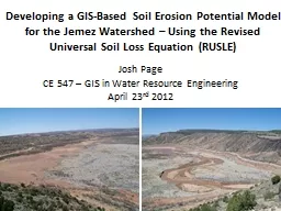
Josh Page CE 547 GIS in Water Resource Engineering April 23 rd 2012 Revised Universal Soil Loss Equation RUSLE RUSLE computes average annual erosion from field slopes
Download Presentation
"Developing a GIS-Based Soil Erosion Potential Model for the" is the property of its rightful owner. Permission is granted to download and print materials on this website for personal, non-commercial use only, provided you retain all copyright notices. By downloading content from our website, you accept the terms of this agreement.
Presentation Transcript
Transcript not available.