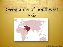
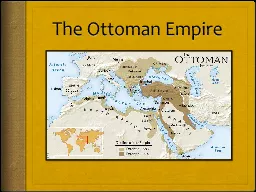
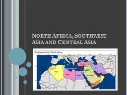
2011 Clairmont Press Southwest Asia Other names Middle East Near East These other names are an indicator of location relative to Europe Many international groups have chosen to name the region based on the relative location within the continent of Asia ID: 622141
Download Presentation The PPT/PDF document "Geography of Southwest Asia" is the property of its rightful owner. Permission is granted to download and print the materials on this web site for personal, non-commercial use only, and to display it on your personal computer provided you do not modify the materials and that you retain all copyright notices contained in the materials. By downloading content from our website, you accept the terms of this agreement.
Slide1
Geography of Southwest Asia
© 2011
Clairmont
PressSlide2
Southwest Asia
Other names:Middle EastNear EastThese other names are an indicator of location relative to Europe. Many international groups have chosen to name the region based on the relative location within the continent of Asia. Slide3
Rivers in Southwest Asia
The Euphrates River begins in Turkey and flows through Syria and Iraq.The Tigris River
begins in the mountains of Turkey and flows south through Iraq.
The Tigris and Euphrates join together in southern Iraq to create the
Shatt al-Arab
which empties into the Persian Gulf.
Rivers in Southwest Asia provide water for both drinking and farming in a very dry region.Slide4
Persian Gulf
One of the main ways oil is shipped from oil-rich Kuwait, Saudi Arabia, Iran, and other countriesShips that come in and out of the
Persian Gulf
must pass through the narrow Strait of Hormuz, which connects the Arabian Sea to the Persian Gulf.Slide5
Suez Canal
The Suez Canal connects the Mediterranean Sea with the Red Sea, which saves ships from having to travel around the entire continent of Africa.The Red Sea separates Egypt and Saudi Arabia.
Click for map
Bridge open to allow U.S. Navy ships to pass on the Suez Canal. Slide6
Jordan River
Begins in the mountains of Lebanon and Syria and flows down into northern Israel, through the Sea of Galilee, and ends at the Dead SeaProvides water for Israel, Jordan, parts of Syria, and the West Bank and Gaza StripForms the political boundary between Israel and the West Bank, a small part of Syria, and the country of Jordan
Click for photoSlide7
Afghanistan
Located at the far eastern edge of Southwest AsiaLandlocked, which means it has no seacoastVery mountainousPeople who live there are divided into a number of different ethnic groups or tribes.Slide8
Iran
West of AfghanistanOne of the largest countries in Southwest AsiaMountainous, but also has a long coast along both the Persian Gulf and Arabian SeaSlide9
Iraq
West of IranThe Tigris and Euphrates Rivers flow through it.The Shatt al-Arab, formed by the Tigris and Euphrates joining together, forms the boundary between Iraq and Iran.
Click for photoSlide10
Saudi Arabia
Largest country on the Arabian PeninsulaPersian Gulf is to the northeastRed Sea is to the west
Click for photoSlide11
Turkey
Located to the north and west of IraqShares a border with Iraq, Syria, and IranEuphrates and Tigris both begin in Turkey.Turkey has built several dams along the rivers recently to try and save water for the Turkish farms, villages, and towns.
Click for photoSlide12
Israel and the
West BankIsrael was created by the United Nations in 1948 as a homeland for the Jews after World War II and the Holocaust.Israel is bordered by the Gaza Strip to the south and the West Bank to the east.
The Jordan River forms the boundary between the West Bank and the country of Jordan.
Click for photo