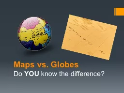
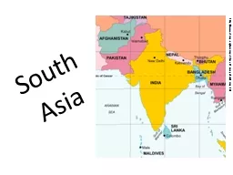
/
South Asia http://www.vbmap.org/asia-maps-7/south-asia-political-map-91/ South Asia http://www.vbmap.org/asia-maps-7/south-asia-political-map-91/

South Asia http://www.vbmap.org/asia-maps-7/south-asia-political-map-91/ - PowerPoint Presentation

brambani
brambani . @brambani
Follow
361 views
Uploaded On 2020-06-23

South Asia http://www.vbmap.org/asia-maps-7/south-asia-political-map-91/ - PPT Presentation

Chapter 24 Physical Geography of South Asia The Land Where Continents Collided South Asias major landforms including the massive Himalayan Mountains were created when the subcontinent broke off from Africa and drifted into Asia ID: 784780

south india asia pakistan india south pakistan asia indian bangladesh sri river section people population mountains lanka maldives bhutan

Share:

Link:

Embed:

Download Presentation from below link

Download The PPT/PDF document "South Asia http://www.vbmap.org/asia-map..." is the property of its rightful owner. Permission is granted to download and print the materials on this web site for personal, non-commercial use only, and to display it on your personal computer provided you do not modify the materials and that you retain all copyright notices contained in the materials. By downloading content from our website, you accept the terms of this agreement.


Presentation Transcript

Slide1

South Asia

http://www.vbmap.org/asia-maps-7/south-asia-political-map-91/

Slide2

Chapter 24: Physical Geography of South Asia: The Land Where Continents Collided

South Asia’s major landforms, including the massive Himalayan Mountains, were created when the subcontinent broke off from Africa and drifted into Asia.

Section 1: Landforms and Resources

Section 2: Climate and Vegetation

Section 3: Human-Environment InteractionSection 1: Landforms and Resources South Asia is a subcontinent of peninsulas bordered by mountains and oceans.A wide variety of natural resources helps sustain life in the region.

2

Slide3

Mountains and Plateaus

The Indian Subcontinent

India, Pakistan, Bangladesh, Bhutan, Nepal, Sri Lanka, the Maldives

Subcontinent

—large landmass that’s smaller than a continentcalled Indian Subcontinent because India dominates the region

Though half the size of U.S., area has 1/5 of world’s people

Natural barriers separate subcontinent from rest of Asia

mountains form northern border, Indian Ocean surrounds rest

Arabian Sea to west, Bay of Bengal to east

3

Slide4

Northern Mountains

South Asia was once part of East Africasplit off 50 million years ago and collided with Central Asiacollision of tectonic plates pushed land into huge mountain ranges

Himalaya Mountains

—1,500 mile-long system of parallel ranges

include world’s tallest mountain—Mt. Everestform barrier between Indian subcontinent and Chinakingdoms of Nepal, Bhutan are also in these mountainsNorthern

Mountains

At west end,

Hindu Kush

mountains separate Pakistan, Afghanistanhistorically blocked invasions from Central Asian tribes

Khyber Pass is one of the major land routes through the mountainsKarakoram Mountains are in northeastern part of Himalayas

include world’s second highest peak, K2

4

Slide5

Southern

PlateausTectonic plate collision also created smaller mountain rangesVindhya Rang in central India

Deccan Plateau

covers much of southern India

Western, Eastern Ghats: mountain ranges flank Deccan Plateaublock moist winds and rain, making Deccan mostly arid5

Slide6

Rivers, Deltas, and Plains

Great RiversNorthern Indian, or Indo-

Gangetic

, Plain:

lies between Deccan Plateau, northern mountain rangesis formed by three river systems that originate in HimalayasIndus River flows west, then south through Pakistan to Arabian SeaGanges River flows east across northern IndiaBrahmaputra winds east, then west, south through Bangladesh

Ganges and

Bramaputra

meet, form delta, flow into Bay of Bengal

6

Slide7

Fertile Plains

Rivers irrigate farmlands, carry rich alluvial soiloverflow deposits this soil on alluvial plains—rich farmlands

Indo-

Gangetic

Plain has some of the world’s most fertile farmsHeavily populated area has 3/5 of India’s peoplearea’s big cities: New Delhi, Kolkata in India; Dakha in BangladeshPlain is drier to west between Indus, GangesThe Thar, or Great Indian Desert, lies to the south

7

Slide8

Offshore Islands

Sri Lanka: The Subcontinent’s “Tear Drop”

Island in Indian Ocean, off India’s southeastern tip

Large, tear-shaped country with lush tropical land

Range of high, rugged, 8,000-foot mountains dominate centerMany small rivers flow from mountains down to lowlandsNorthern side has low hills, rolling farmlandIsland is circled by coastal plain, long palm-fringed beaches

8

Slide9

The Maldives Archipelago

Maldives is archipelago—island group—of 1,200 small islandsstretch north to south for 500 miles off Indian coast, near equator

Islands are

atolls

—low-lying tops of submerged volcanoessurrounded by coral reefs, shallow lagoonsTotal land area of Maldives is 115 square milesonly 200 islands are inhabited

9

http://www.travel-visit-places.com/en/maldives/

Slide10

Natural Resources

Water and Soil

Water and soil resources provide food through farming, fishing

River systems help enrich land with alluvial soil, water

large- and small-scale irrigation projects divert water to farmlandsTypes of fish include mackerel, sardines, carp, catfishWaters provide transportation, powerIndia, Pakistan work to harness hydroelectric power

10

Slide11

Forests

Indian rain forests produce hardwoods like sal and teakalso bamboo and fragrant sandalwood

Bhutan’s and Nepal’s highland forests have pine, fir, softwoods

Deforestation

is a severe problemcauses soil erosion, flooding, landslides, loss of wildlife habitatsovercutting has devastated forests in India, Bangladesh, Sri Lanka11

Slide12

Minerals

India is fourth in world in coal production, has petroleum, uraniumPakistan, Bangladesh have natural gas resourcesIron ore from India’s Deccan Plateau used in steel industry, exported

Other minerals: manganese, gypsum, chromium, bauxite, copper

India has mica for electrical equipment and growing computer industry

India is known for diamonds; Sri Lanka for sapphires, rubies12

Slide13

Section 2: Climate and Vegetation

Climate Zones

Cold highland zone in Himalayas, other northern mountains

Humid subtropical in foothills (Nepal, Bhutan), Indo-

Gangetic PlainSemiarid zone of west Plain, Deccan Plateau is warm with light rainDesert zone covers lower Indus Valley, west India, south Pakistan

Thar

Desert is driest area, with 10 inches of rain annually

Tropical wet zone in Sri Lanka and coasts of India, Bangladesh

Cherrapunji, India, holds rainfall record—366 inches in one month

13

Climate—Wet and Dry, Hot and Cold

Climate conditions in South Asia range from frigid cold in the high mountains to intense heat in the deserts.

Seasonal

winds affect both the climate and vegetation of South Asia.

Slide14

Monsoons and Cyclones

Monsoons—seasonal winds that affect entire regiondry winds blow from northeast October–Februarymoist ocean winds blow from southwest June–September

moist winds bring heavy rainfall, especially in southwest, Ganges Delta

unpredictable; cause hardship in lowlands of India, Bangladesh

Cyclone—violent storm with fierce winds, heavy rainin Bangladesh low coastal region swamped by high waves

14

Slide15

Vegetation: Desert to Rain

Forest

Vegetation Zones

Forested tropical wet zone in India’s west coast, south Bangladesh

lush rain forests of teak, ebony, bambooHighland forests of pine, fir in north India, Nepal, Bhutan

Humid subtropical river valleys; foothills have

sal

, oak, chestnut

Less vegetation in semiarid areas; desert shrubs, grassesDeccan Plateau, Thar Desert

Sri Lanka’s tropical wet and dry climate produces grasses, trees

15

Slide16

Section 3: Human-Environment Interaction

Rivers play a central role in the lives of South Asians, but water pollution and flooding pose great challenges to South Asian countries.

Mother Ganges

Ganges is the best-known South Asian river

it’s shorter than the Indus, Brahmaputraflows 1,500 miles from Himalayan glacier to Bay of Bengaldrains area three times France; home to 350 million people

Provides drinking and farming water, transportation

Known as

Gangamai

—“Mother Ganges”becomes the Padma where it meets the Brahmaputra

16

Living Along the Ganges

Slide17

A Sacred River

Hinduism is the religion of most IndiansTo Hindus, the Ganges River

is the sacred home of the goddess Ganga

Hindus believe waters have healing powers; temples line its banks

pilgrims come to bathe, scatter ashes of deadat sacred site of Varanasi they gather daily for prayer, purificationfloat baskets of flowers, burning candles on water

17

Slide18

A Polluted River

Centuries of use have made Ganges most polluted river in worldsewage, industrial waste, human bodies poison the waterusers get stomach and intestinal diseases, hepatitis, typhoid, cholera

In 1986, government plans sewage treatment plants, regulations

today few plants are operational, factories still dump waste

Clean up will take time, money, a change in how people see river18

http://in.reuters.com/article/2007/09/16/idINIndia-29492620070916

Slide19

Controlling the Feni River

A River Overflows

Feni

River flows from Chittagong Hills to Bay of Bengal

Wide, slow-moving river flows through low-lying coastal plainflat, marshy area floods during wet season due to monsoon rainsCyclones bring storm surges—high waters that swamp low areassea water surges up river into flatlands, flooding villagesIn 1980s, Bangladesh builds earthen dam over river’s mile-wide mouth

19

Slide20

Using People Power

Bangladesh uses large population’s unskilled workers to build damUse cheap materials, low-tech processlay bamboo mats, weight with boulders, cover with bags of clay

Build partial closure, then close

Feni

completely February 28, 1985when tide goes out 15,000 workers fill gaps with 600,000 bagsseven hours later the dam is closed20

Slide21

Completing the Dam

Dump trucks, earthmovers raise clay dam to height of 30 feetput concrete, brick over sides, build road on topSouth Asia’s largest estuary—arm of sea at river’s lower end—dam

Dam holds against cyclones and storm surges

villages and lands are protected

21

Slide22

Chapter 25: Human Geography of South Asia: A Region of Contrasts

Both South Asia’s rich and ancient history, and its religious and ethnic diversity, have strongly shaped and defined its people’s lives.Section 1: IndiaSection 2: Pakistan and Bangladesh

Section 3: Nepal and Bhutan

Section 4: Sri Lanka and the Maldives

22

Slide23

Section 1: India

India is the largest country in South Asia and has the most developed economy. Indian culture is deeply influenced by religion.

23

Slide24

Invasions, Empires, and Independence

Early HistoryIndian civilization begins in Indus Valley in 2500 B.C.

Aryans from north of Iran invade in 1500 B.C.

establish kingdoms on Ganges Plain, push Dravidians south

Persians, Greeks later invade Indus ValleyMauryan Empire unites India in 321 B.C.; Asoka spreads BuddhismGupta Empire later rules northern IndiaMuslim Mughal Empire

rules much of India by early 1500s

24

Slide25

Europeans Arrive

In 1500s, French, Dutch, Portuguese build cloth, spice tradesBritish East India Company controls Indian trade by 1757British establish direct rule in 1857

Raj

—90-year period of direct British control, opposed by most Indians

Mohandas Gandhi’s nonviolent resistance achieves goals peacefullyIndia gains its independence from Britain in 1947Muslim Pakistan splits from Hindu India; violence, migrations result

25

Slide26

Governing the World’s Largest Democracy

India After Independence

Constitution is created under first prime minister, Jawaharlal Nehru

a democratic republic since 1950

System has federation of states, strong central government, like U.S.Parliamentary system, like U.K.India is mostly Hindu, but with large Muslim, Sikh, Tamil minoritiesSikhs kill Gandhi’s daughter, Prime Minister Indira Gandhi, 1984

Tamils assassinate her son, Prime Minister Rajiv Gandhi, 1991

26

Slide27

Economic Challenges

Dependence on FarmingIndia has large economy, but half its people live in poverty

Two-thirds of people farm; most farms are small with low crop yields

Land reform

—more balanced distribution of land among farmers5 percent of farm families own 25 percent of farmlandland-reform proposals make little progressAfter famines of 1960s, scientists improve farm techniques, crops

Green Revolution

increases crop yields for wheat, rice

27

Slide28

Growing Industry

Cotton textiles have long been a major productiron, steel, chemical, food industries develop after 1940s

Main industrial regions include:

Kolkata (Calcutta), Ahmadabad, Chennai (Madras), Delhi

Mumbai (Bombay) is India’s most prosperous citya commercial center which produces metals, chemicals, electronicsBangalore is the high-tech center, home to software companies

28

Slide29

Life in Modern

India

Education

Indian economy is changing; more people work in factories, offices

Education is key to change, most middle-class kids go to schoolLiteracy has risen steadily since the 1950sIn slums and rural areas, school attendance, literacy still low

29

Slide30

Indian Culture

Many Languages Constitution recognizes 18 major languagesIndia has over 1,000 languages and dialects

Hindi is the official language, but English is widely used by government, business workers

30

Slide31

Hinduism

80% of Indians are Hindu; complex Aryan religion includes many godsreincarnation—rebirth of the soul after death Original Aryan caste system

of social classes:

Brahmans—priests, scholars; Kshatriyas—rulers, warriorsVaisyas—farmers, merchants; Sudras—artisans, laborersDalits (untouchables) are outside caste system—lowest statusDharma

is a caste’s moral duty; only reincarnation changes caste

31

Slide32

Other Religions

India’s other faiths include Jainism, Christianity, Sikhism, BuddhismBuddhism originated in northern India, but Islam is still strong in certain parts of IndiaMillions of Muslims left after 1947 independence

32

Slide33

Section 2: Pakistan and Bangladesh

Pakistan and Bangladesh are Muslim countries formed as a result of the partition of British India.Both Pakistan and Bangladesh have large populations and face great economic challenges.

33

Slide34

New Countries, Ancient Lands

Early HistoryIndus Valley civilization—largest of early civilizations

arises around 2500 B.C. in what is now Pakistan

Civilization falls around 1500 B.C.; Aryans invade soon after

Mauryan, Gupta, Mughal empires all rule entire regionArea is then ruled by British Empire until 1947

34

Slide35

Partition and War

1947 partition creates Hindu India, Muslim Pakistan

Hindu-Muslim violence killed one million people

10 million crossed borders: Hindus to India, Muslims to Pakistan

Ethnic differences led to civil war between West and East PakistanEast Pakistan won independence in 1971, became Bangladesh35

Slide36

Struggling Economies

Subsistence FarmingRapidly growing populations, low per capita income in both countries

Small plots farmed with old methods struggle to feed families

Climate hurts yields: arid Pakistan, Bangladesh, stormy

Pakistan’s irrigated Indus Valley grows wheat, cotton, riceBangladesh’s deltas produce rice, jute (used for rope, carpets)freshwater fishing is also vital to economy

36

Slide37

Small Industry

Neither country is highly industrializedsmall factories lack capital, resources, markets to expandBoth export cotton clothes; Pakistan exports wool, leather goods

Microcredit

policy allows small loans to poor entrepreneursentrepreneurs—people who start and build businessessmall businesses join together to get microloans

37

Slide38

One Religion, Many Peoples

Islamic CultureCustoms include daily prayer

Ramadan

—month of fasting from sunrise to sunset

Pakistan’s stricter Islamic law includes purdah—women’s seclusionwomen have no contact with men they are not related to, must wear veils in publicBangladesh’s religious practices are less strict

38

Slide39

Ethnic Diversity

Pakistan is more diverse: five main groups, each with own languagePunjabis, Sindhis, Pathans,

Muhajirs

,

BalochsPunjabis are half the population, Muhajirs left India in 1947national language is Muhajirs’ UrduMajority of people in Bangladesh are BengaliBengali language based on

Sanskit

, ancient Indo-Aryan language

39

Slide40

Section 3: Nepal and Bhutan

Nepal and Bhutan are landlocked Himalayan kingdoms.Rugged terrain and an isolated location have had a great impact on life in Nepal and Bhutan.

40

Slide41

Mountain Kingdoms

Geographic IsolationBoth countries are located in Himalayas

; each has:

central upland of ridges, valleys leading to high mountains

small lowland area along Indian borderMountain landscape isolates Nepal, Bhutan: hard to reach, conquerChina controlled Bhutan briefly in 18th centuryBoth remained mostly independent, rarely visited by foreigners

41

Slide42

Evolving Monarchies

In past, both countries split into religious kingdoms, ruling statesUnified kingdoms emerge, led by hereditary monarchsToday both are constitutional monarchies

kingdoms where ruler’s power is limited by constitution

Bhutan’s king is supreme ruler, Nepal’s shares power with parliament

42

Slide43

Developing Economies

Limited ResourcesBoth countries are poor: agricultural economies, but little farmland

mountainous terrain, poor soil, erosion

terraced farms grow rice, corn, potatoes, wheat

livestock include cattle, sheep, yaksTimber industry is important, but has led to deforestation43

Slide44

Developing

Economies

Increasing Tourism

Tourism is fastest-growing industry in Nepal

people visit capital at Kathmandu, climb Himalayashotels, restaurants, services grow but tourism also hurts Nepal’s environment; trash left on mountains• Bhutan regulates, limits tourism, keeps some areas off-limits

44

Slide45

Rich Cultural Traditions

A Mix of PeopleNepal’s Indo-Nepalese, Hindu majority came from India centuries ago

speak Nepali, variation of Sanskrit

Nepal also has groups of Tibetan ancestry, including

Sherpashigh-Himalayan people; traditional mountain guides of Everest areaBhutan’s main ethnic group is the Bhote, who trace origins to Tibet

45

Slide46

Religious Customs

Siddhartha

Gutama

, the Buddha, born in 500s B.C.

Nepalese were Buddhist; today most are HinduTibetan-style Buddhism is official religion of Bhutanuses mandalas—symbolic geometric designs for meditation

46

Slide47

Section 4: Sri Lanka and the Maldives

Sri Lanka and the Maldives are island countries with strong connections to the South Asian subcontinent.Sri Lanka and the Maldives face difficult challenges that affect their political and economic development.

47

Slide48

History of the Islands

Settlement of Sri LankaIn 500s B.C. Indians cross strait to Sri Lanka, become Sinhalese

In A.D. 300s,

Tamils

—Indian Dravidian Hindus—settle in north endPortuguese, Dutch come in 1500s; British rule in 1796, call it Ceylonisland gains independence in 1948, becomes Sri Lanka in 1972

48

Slide49

A Muslim State in the Maldives

Buddhists, Hindus from India, Sri Lanka settle islands in 500s B.C.Arab traders visit often, population converts to Islam by 1100s

Governed by six dynasties of Muslim

sultans

—rulersDeclares itself a republic in 1968, headed by elected president1,200 islands; a land area of 115 square miles; population 300,000one of the world’s smallest independent country

49

Slide50

Life in the Islands

Cultural Life in Sri LankaBuddhist, Hindu temples, Muslim mosques dot landscape

art, literature strongly influenced by religions

Cultural Life in the Maldives

Culture is strongly influenced by Muslim customsIslam is state religion—no others allowed50

Slide51

Economic Activity in the Islands

Economic StrengthsSri Lanka has South Asia’s highest per capita income

agricultural economy: rice farms; tea, rubber, coconut exports

manufacturing is increasing

famous for gemstones like sapphires, rubies, topazMaldives has limited farming, food is importedfishing for tuna, marlin, shark still provides 1/4 of jobsmain economy is now tourism centered on beaches, reefs

51

Slide52

Tough Challenges

Tourism in Sri Lanka grew until civil war began in early 1980swar has also damaged infrastructure, disrupted economic activities

Maldives

must deal with

global warmingif polar icecaps melt at all, islands could flood completely52

Slide53

Chapter 26: Today’s Issues: South Asia

South Asia faces the challenges of rapid population growth, destructive weather, and territorial disputes caused by religious and ethnic differences.Section 1: Population Explosion

Section 2: Living with Extreme Weather

Case Study: Territorial Dispute

53

Slide54

Section 1: Population Explosion

Explosive population growth in South Asia has contributed to social and economic ills in the region.Education is key to controlling population growth and improving the quality of life in South Asia.

54

Slide55

Growing Pains

Rapid growth

In 2000, India’s population reached 1 billion

Rapid growth means many citizens lack life’s

basic necessitiesPopulation GrowsIndia’s population was 300 million in 1947; has since tripledSo large that even 2% growth rate produces population explosion

Unless rate slows, India will have 1.5 billion by 2045

India, Pakistan, Bangladesh among top 10 most populous countries

region has 22% of world’s population, lives on 3% of world’s land

55

Slide56

Inadequate Resources

Region has widespread poverty,

illiteracy

—inability to read or write

poor sanitation, health education lead to disease outbreaksEvery year, to keep pace, India would have to:build 127,000 new schools and 2.5 million new homescreate 4 million new jobs and produce 6 million more tons of food

56

Slide57

Managing Population Growth

Smaller FamiliesIndia spends nearly $1 billion a year encouraging smaller families

Programs have only limited success

Indian women marry before age 18, start having babies early

to poor, children are source of money (begging, working fields), and can later take care of elderly parents57

Slide58

Education is a Key

Growth factors can be changed with education, but funds are limited

India spends under $6 per pupil a year on education while the U.S. spends $6,320 per pupil a year

Education

could break cycle of poverty, raise living standardsimproves females’ status with job opportunitiesbetter health care education could lower infant mortality rates

58

Slide59

Section 2: Living with Extreme Weather

South Asia experiences a yearly cycle of floods, often followed by drought.The extreme weather in South Asia leads to serious physical, economic, and political consequences.

59

Slide60

The Monsoon Seasons

Summer and Winter Wind SystemsAnnual cycle of extreme weather makes life difficult

Monsoon is wind system, not a rainstorm; two monsoon seasons

Summer monsoon

—blows moist from southwest, across Indian Oceanblows June through September, causes rainstorms, floodingWinter monsoon—blows cool from northeast, across Himalayas, to seablows October through February, can cause drought

60

Slide61

Impact of the Monsoons

Physical ImpactSummer monsoons nourish rainforests, irrigate crops

floodwaters bring rich sediment to soil, but can also damage crops

Cyclones are common with summer monsoons

Winter monsoon droughts turn lush lands into arid wastelands61

Slide62

Economic Impact

Floods, droughts make agriculture difficultcountries buy what they can’t grow; famine looms

Weather catastrophes also destroy homes, families

people often too poor to rebuild, governments lack funds to help

People build: houses on stilts, concrete cyclone shelters, dams62

Slide63

Case Study

Territorial Dispute: How Can India and Pakistan Resolve Their Dispute Over Kashmir?

Kashmir

territory is a territory of 12 million people surrounded by Pakistan, China, India

India and Pakistan have fought three wars over Kashmir since 1947Danger increases now that both countries have nuclear weapons63

http://www.worldatlas.com/webimage/countrys/asia/kashmir.htm

Slide64

A Controversy Over Territory

Partitioning British left India in 1947 and partitioned—divided—the subcontinent

created two independent countries

India is predominantly Hindu, Pakistan is mostly Muslim

Britain lets each Indian state choose which country to joinMuslim states join Pakistan, Hindu states remain in India64

Slide65

Politics and Religion

Kashmir’s problem: population is Muslim, but its leader was HinduMaharajah of Kashmir wants an independent nation

but is forced to cede territory to India in 1947

Pakistan invades; a year later India still controls much of Kashmir

India, Pakistan fight two more wars over Kashmir in 1965, 1971dispute remains unresolved; each country still controls partChina has had a small portion since 1962

65

Slide66

A Question of Economics

Indus River flows through Kashmirmany of its tributaries originate in the territory

Indus is critical source of drinking, irrigation water in Pakistan

Pakistan doesn’t want India to control that resource

Kashmir is a strategic prize neither side will give up66

Slide67

Bibliography

Mcdougal Littell, World Geography. Houghton Mifflin Company. 2012

67