Depressions- associated weather Be able to describe and explain the type of weather associated with the different fronts in a depression. Be able to describe how the weather changes with the passage of a depression. Be able to reproduce a
"Depressions- associated weather Be able to" is the property of its rightful owner. Permission is granted to
download and print the materials on this website for personal, non-commercial use only, and to display it
on your personal computer provided you do not modify the materials and that you retain all copyright
notices contained in the materials. By downloading content from our website, you accept the terms of this
agreement.
Presentation Transcript
01
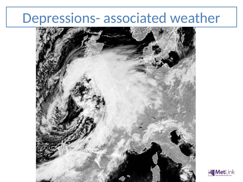
Depressions- associated weather<br>
02
Be able to describe and explain the type of weather associated with the different fronts in a depression.
Be able to describe how the weather changes with the passage of a depression.
Be able to reproduce a diagram of a cross-section of a depression. Objectives<br>
03
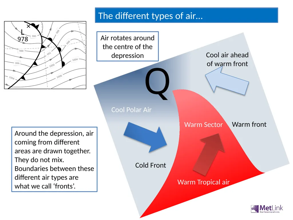
Cool air ahead of warm front Warm Sector The different types of air… Warm front Cold Front Air rotates around the centre of the depression Q Warm Tropical air Cool Polar Air Around the depression, air coming from different areas are drawn together. They do not mix. Boundaries between these different air types are what we call ‘fronts’.<br>
04
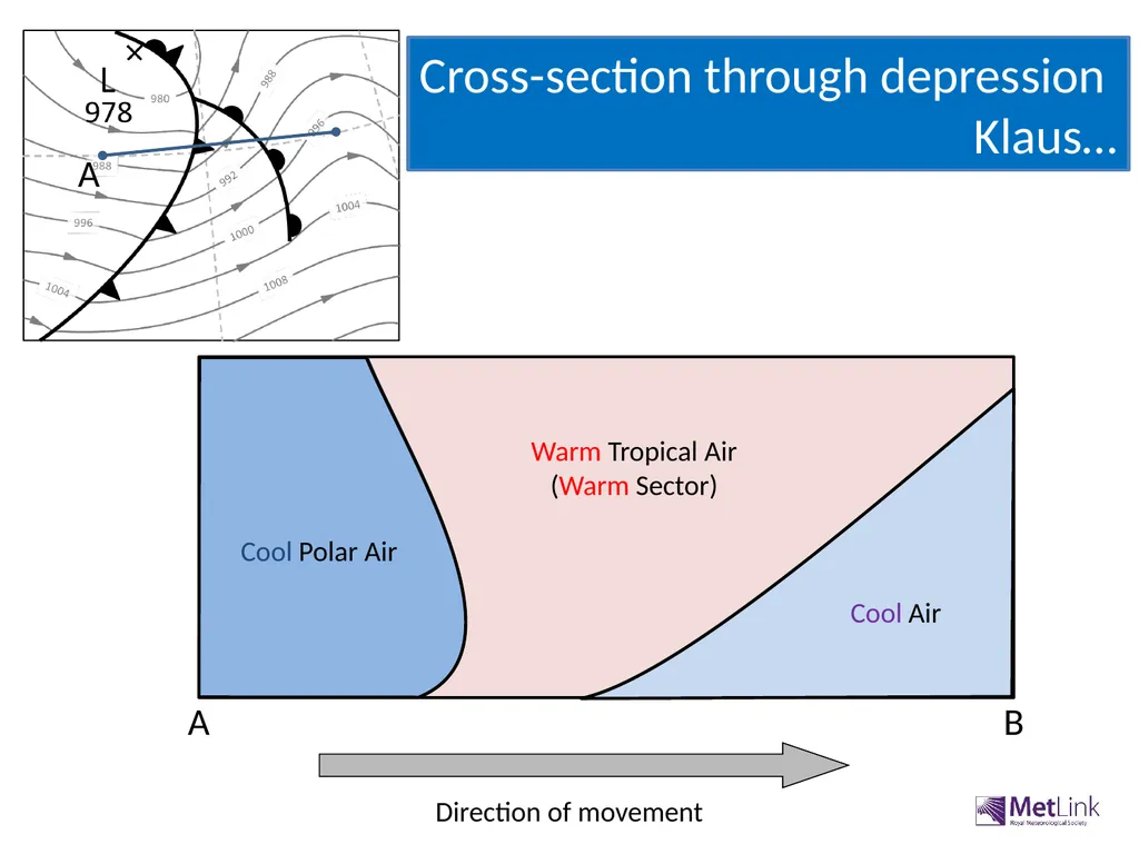
Direction of movement A B A Cool Polar Air Warm Tropical Air
(Warm Sector) Cool Air Cross-section through depression
Klaus…<br>
05
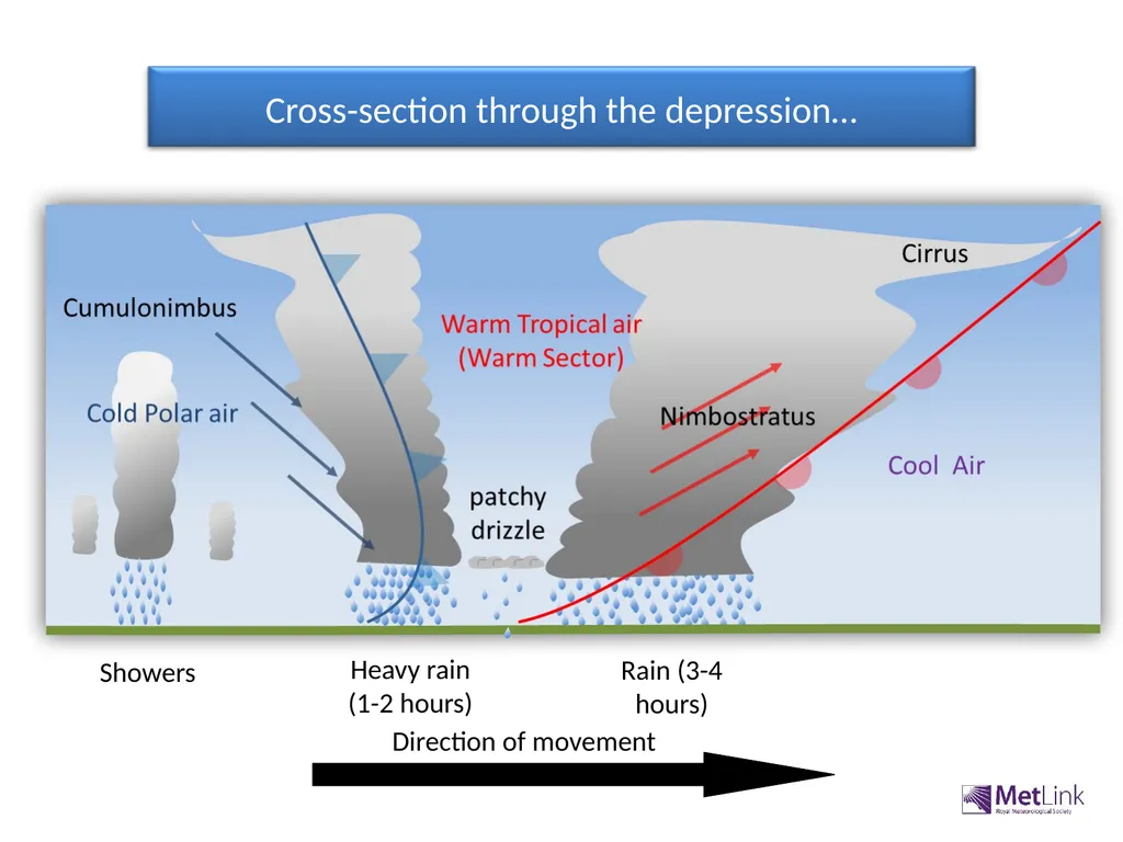
Cross-section through the depression… Direction of movement Showers Rain (3-4 hours) Heavy rain (1-2 hours)<br>
06
As the warm air meets the cool air it is forced to rise, as it is less dense. As it rises the air cools allowing moisture to condense. Clouds form. Clouds are found along the boundary between the warm air and cool air. This is the warm front. Where the front is high in the sky, temperatures are low and the clouds are made of ice, These are Cirrus clouds. The passage of a warm front<br>
07
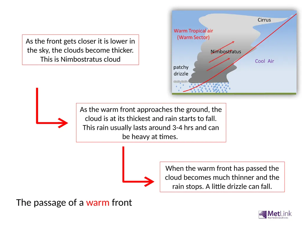
As the warm front approaches the ground, the cloud is at its thickest and rain starts to fall. This rain usually lasts around 3-4 hrs and can be heavy at times. As the front gets closer it is lower in the sky, the clouds become thicker. This is Nimbostratus cloud When the warm front has passed the cloud becomes much thinner and the rain stops. A little drizzle can fall. The passage of a warm front<br>
08
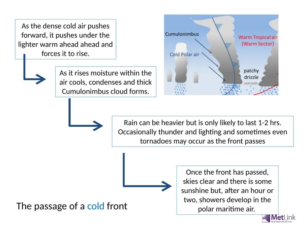
The passage of a cold front As the dense cold air pushes forward, it pushes under the lighter warm ahead ahead and forces it to rise. As it rises moisture within the air cools, condenses and thick Cumulonimbus cloud forms. Rain can be heavier but is only likely to last 1-2 hrs. Occasionally thunder and lighting and sometimes even tornadoes may occur as the front passes Once the front has passed, skies clear and there is some sunshine but, after an hour or two, showers develop in the polar maritime air.<br>