
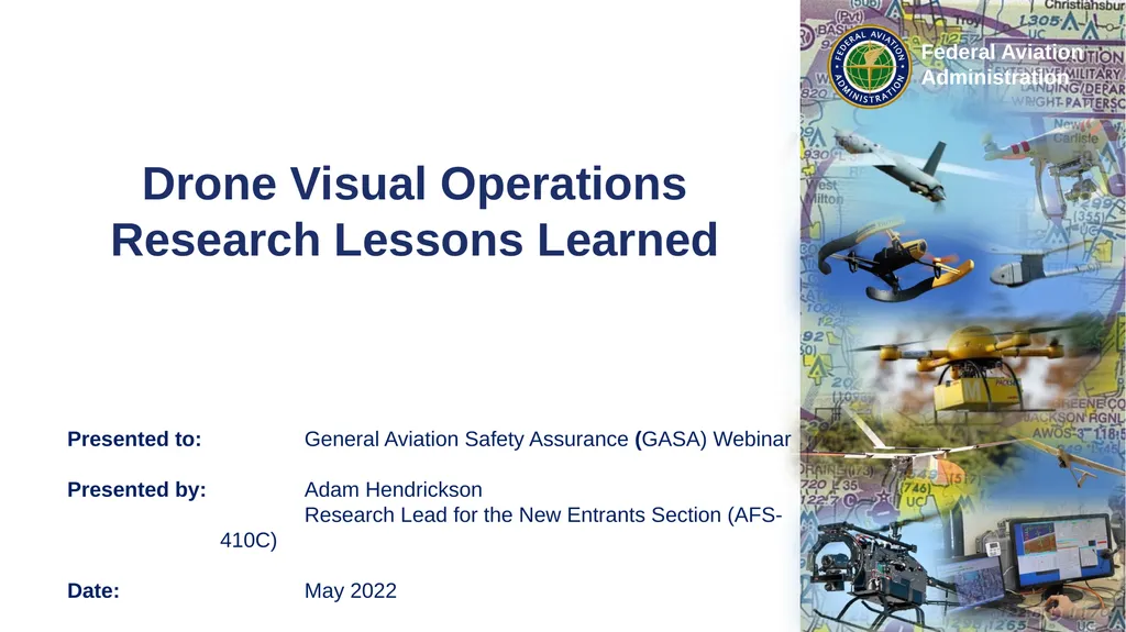
Drone Visual Operations Research Lessons Learned
CP
Published · 29 slides · 0 views
1 / 1

Description
Drone Visual Operations Research Lessons Learned Presented to: General Aviation Safety Assurance (GASA) Webinar Presented by: Adam Hendrickson Research Lead for the New Entrants Section (AFS-410C) Date: May 2022 Bottom Line Up Front Optical
Related Topics
Download this presentation From Below
"Drone Visual Operations Research Lessons Learned" is the property of its rightful owner. Permission is granted to download and print the materials on this website for personal, non-commercial use only, and to display it on your personal computer provided you do not modify the materials and that you retain all copyright notices contained in the materials. By downloading content from our website, you accept the terms of this agreement.
Share
Embed code
Presentation Transcript
01
Drone Visual Operations Research Lessons Learned Presented to: General Aviation Safety Assurance (GASA) Webinar
Presented by: Adam Hendrickson
Research Lead for the New Entrants Section (AFS-410C)
Date: May 2022<br>
Presented by: Adam Hendrickson
Research Lead for the New Entrants Section (AFS-410C)
Date: May 2022<br>
02
Bottom Line Up Front Optical illusions make it difficult to visually maneuver around an approaching aircraft. The safer maneuver is often for the drone to exit the airspace or go to a protected area.
Part 107 requires more than seeing the drone as a dot in the sky
Example timeline analysis for maneuvering the drone to a protected area can take longer than expected. This may result in shorter operational ranges than some people realize.
Detect, Decide, Command, Complete Maneuver 2<br>
Part 107 requires more than seeing the drone as a dot in the sky
Example timeline analysis for maneuvering the drone to a protected area can take longer than expected. This may result in shorter operational ranges than some people realize.
Detect, Decide, Command, Complete Maneuver 2<br>
03
Optical Illusions Human depth perception only works at short distances based on the different perception of each eye and the muscles used to focus on an object.
At long ranges, relative range is inferred in the brain through relative motion, perspective, image recognition and relative size, shadow, interposition (overlapping images), relative brightness, texture gradients, and so forth
Visual limitations to directly measure range (rather than just infer range) can lead to strong optical illusions as aircraft approach one another. These optical illusions can prevent an RPIC from safely maneuvering around an approaching aircraft. They can even tempt RPICs to fly towards an approaching aircraft rather than fly away from them.<br>
At long ranges, relative range is inferred in the brain through relative motion, perspective, image recognition and relative size, shadow, interposition (overlapping images), relative brightness, texture gradients, and so forth
Visual limitations to directly measure range (rather than just infer range) can lead to strong optical illusions as aircraft approach one another. These optical illusions can prevent an RPIC from safely maneuvering around an approaching aircraft. They can even tempt RPICs to fly towards an approaching aircraft rather than fly away from them.<br>
04
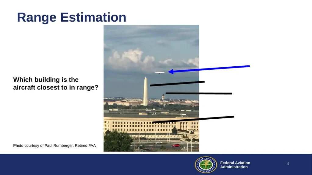
Range Estimation 4 Photo courtesy of Paul Rumberger, Retired FAA Which building is the aircraft closest to in range?<br>
05
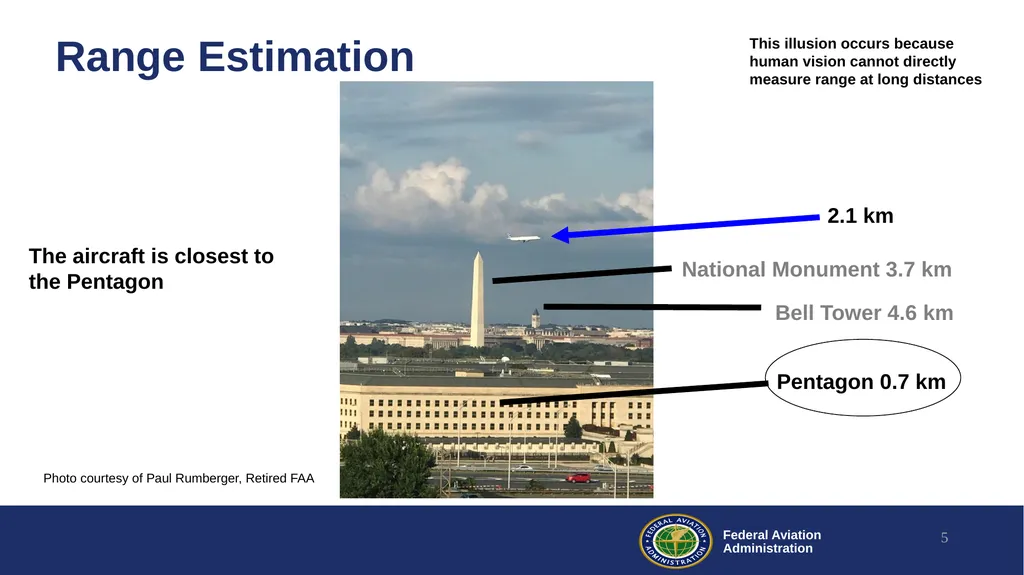
Range Estimation 5 National Monument 3.7 km 2.1 km Bell Tower 4.6 km Pentagon 0.7 km The aircraft is closest to the Pentagon Photo courtesy of Paul Rumberger, Retired FAA This illusion occurs because human vision cannot directly measure range at long distances<br>
06
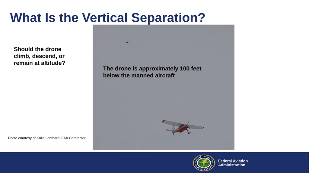
What Is the Vertical Separation? The drone is approximately 100 feet below the manned aircraft Photo courtesy of Kolie Lombard, FAA Contractor Should the drone climb, descend, or remain at altitude?<br>
07
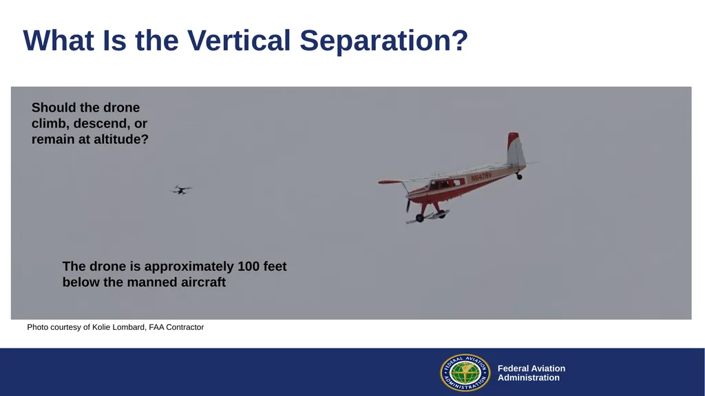
What Is the Vertical Separation? The drone is approximately 100 feet below the manned aircraft Photo courtesy of Kolie Lombard, FAA Contractor Should the drone climb, descend, or remain at altitude?<br>
08
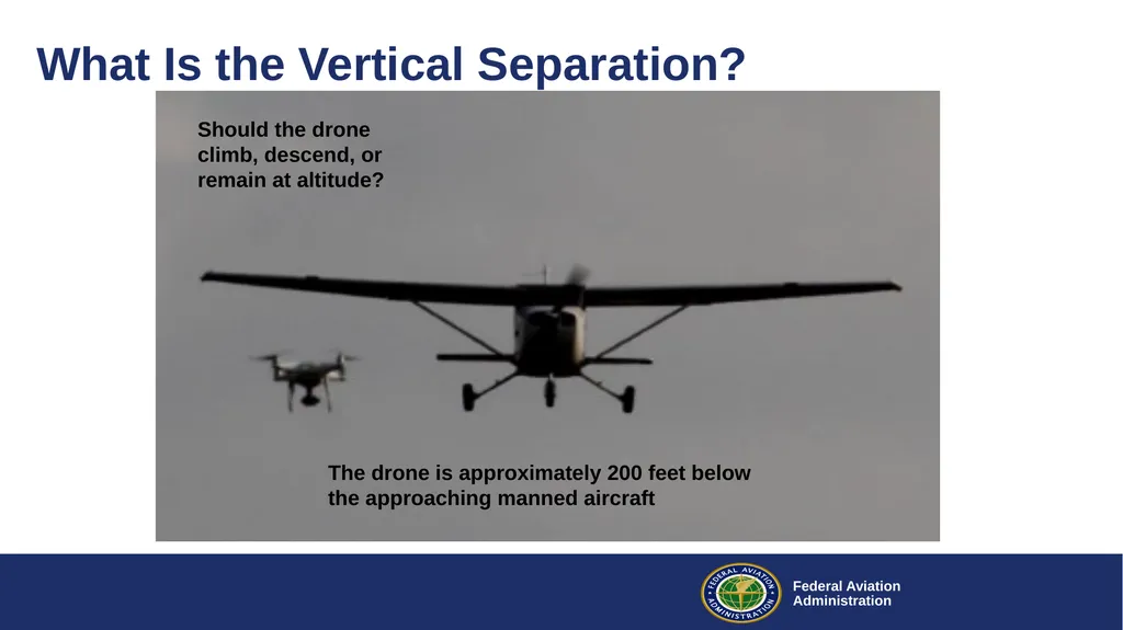
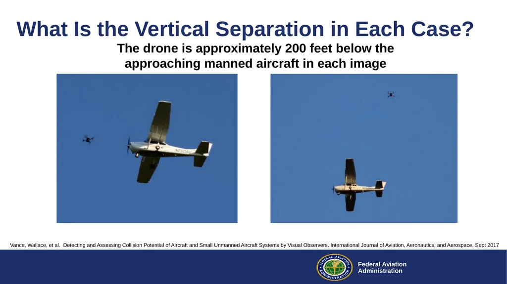
What Is the Vertical Separation? The drone is approximately 200 feet below the approaching manned aircraft Should the drone climb, descend, or remain at altitude?<br>
09
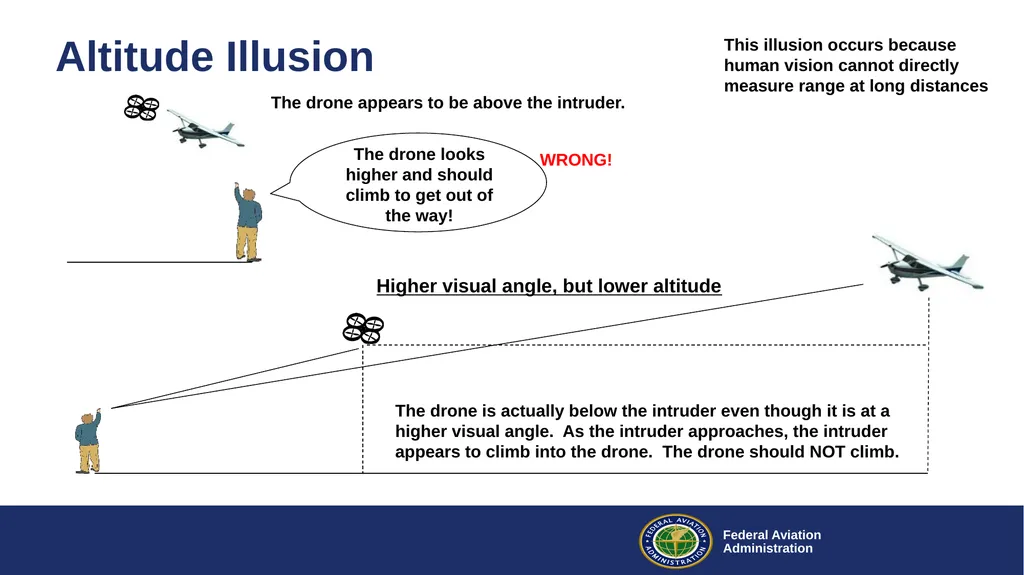
Altitude Illusion The drone appears to be above the intruder. The drone is actually below the intruder even though it is at a higher visual angle. As the intruder approaches, the intruder appears to climb into the drone. The drone should NOT climb. The drone looks higher and should climb to get out of the way! Higher visual angle, but lower altitude This illusion occurs because human vision cannot directly measure range at long distances WRONG!<br>
10
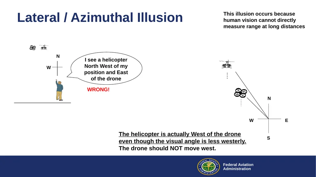
Lateral / Azimuthal Illusion I see a helicopter North West of my position and East of the drone N S E W N The helicopter is actually West of the drone even though the visual angle is less westerly. The drone should NOT move west. W This illusion occurs because human vision cannot directly measure range at long distances WRONG!<br>
11
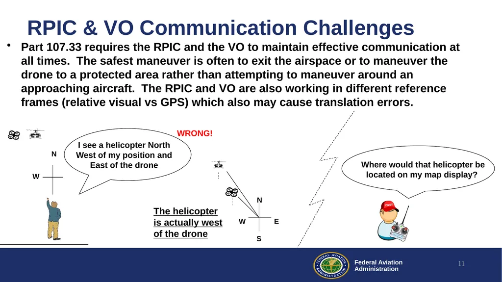
RPIC & VO Communication Challenges Part 107.33 requires the RPIC and the VO to maintain effective communication at all times. The safest maneuver is often to exit the airspace or to maneuver the drone to a protected area rather than attempting to maneuver around an approaching aircraft. The RPIC and VO are also working in different reference frames (relative visual vs GPS) which also may cause translation errors. 11 Where would that helicopter be located on my map display? The helicopter is actually west of the drone WRONG!<br>
12
Air Traffic Controller Visual Study In a study of Air Traffic Controllers, controllers generally overestimated the altitude of the sUAS and provided inaccurate position and distance information. The data indicates that the information provided by a controller to a manned aircraft pilot regarding an observed sUAS may be incorrect.
Lennertz, et al. Tower Controllers’ Visual Detection of Small Unmanned Aircraft System, DOT VOLPE report, 15 Nov 2019 12<br>
Lennertz, et al. Tower Controllers’ Visual Detection of Small Unmanned Aircraft System, DOT VOLPE report, 15 Nov 2019 12<br>
13
Air Traffic Controller Visual Study “In some cases, controllers in our study estimated the UAS was flying above the altitude of the manned aircraft, when in fact it was hundreds of feet below it.”
“In many cases, the controller provided the complete wrong direction, for example telling the pilot to look for UAS traffic on the right when it was really on the left.”
“Controllers also tended to overestimate the distance of the sUAS to the manned aircraft.”
Lennertz, et al. Tower Controllers’ Visual Detection of Small Unmanned Aircraft System, DOT VOLPE report, page 21, 15 Nov 2019 13<br>
“In many cases, the controller provided the complete wrong direction, for example telling the pilot to look for UAS traffic on the right when it was really on the left.”
“Controllers also tended to overestimate the distance of the sUAS to the manned aircraft.”
Lennertz, et al. Tower Controllers’ Visual Detection of Small Unmanned Aircraft System, DOT VOLPE report, page 21, 15 Nov 2019 13<br>
14
§ 107.37 Operation near aircraft; right-of-way rules Each small unmanned aircraft must yield the right of way to all aircraft, airborne vehicles, and launch and reentry vehicles. Yielding the right of way means that the small unmanned aircraft must give way to the aircraft or vehicle and may not pass over, under, or ahead of it unless well clear
No person may operate a small unmanned aircraft so close to another aircraft as to create a collision hazard.
Because of strong optical illusions as aircraft approach close to one another, the safest drone maneuver when giving way is often to exit the airspace or go to a protected area. It may not always be possible by vision alone to safely pass over or ahead of a nearby approaching aircraft. 14<br>
No person may operate a small unmanned aircraft so close to another aircraft as to create a collision hazard.
Because of strong optical illusions as aircraft approach close to one another, the safest drone maneuver when giving way is often to exit the airspace or go to a protected area. It may not always be possible by vision alone to safely pass over or ahead of a nearby approaching aircraft. 14<br>
15
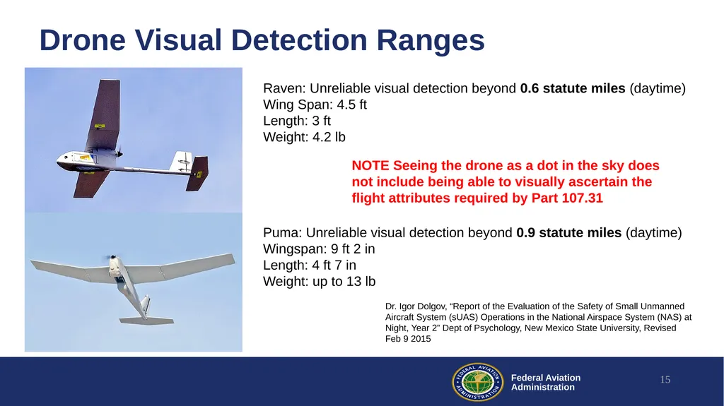
Drone Visual Detection Ranges Dr. Igor Dolgov, “Report of the Evaluation of the Safety of Small Unmanned Aircraft System (sUAS) Operations in the National Airspace System (NAS) at Night, Year 2” Dept of Psychology, New Mexico State University, Revised Feb 9 2015 15 Puma: Unreliable visual detection beyond 0.9 statute miles (daytime)
Wingspan: 9 ft 2 in
Length: 4 ft 7 in
Weight: up to 13 lb Raven: Unreliable visual detection beyond 0.6 statute miles (daytime)
Wing Span: 4.5 ft
Length: 3 ft
Weight: 4.2 lb NOTE Seeing the drone as a dot in the sky does not include being able to visually ascertain the flight attributes required by Part 107.31<br>
Wingspan: 9 ft 2 in
Length: 4 ft 7 in
Weight: up to 13 lb Raven: Unreliable visual detection beyond 0.6 statute miles (daytime)
Wing Span: 4.5 ft
Length: 3 ft
Weight: 4.2 lb NOTE Seeing the drone as a dot in the sky does not include being able to visually ascertain the flight attributes required by Part 107.31<br>
16
§ 107.31 Visual line of sight aircraft operation With vision that is unaided by any device other than corrective lenses, the remote pilot in command, the visual observer (if one is used), and the person manipulating the flight control of the small unmanned aircraft system must be able to see the unmanned aircraft throughout the entire flight in order to:
Know the unmanned aircraft's location;
Determine the unmanned aircraft's attitude, altitude, and direction of flight;
Observe the airspace for other air traffic or hazards; and
Determine that the unmanned aircraft does not endanger the life or property of another.
The intent of Part 107.31 does not allow for operating at the maximum visual range where the drone appears as a dot in the sky. The intent is to be able to see that it is flying safely and be able to maneuver it out of the way when a manned aircraft approaches. 16<br>
Know the unmanned aircraft's location;
Determine the unmanned aircraft's attitude, altitude, and direction of flight;
Observe the airspace for other air traffic or hazards; and
Determine that the unmanned aircraft does not endanger the life or property of another.
The intent of Part 107.31 does not allow for operating at the maximum visual range where the drone appears as a dot in the sky. The intent is to be able to see that it is flying safely and be able to maneuver it out of the way when a manned aircraft approaches. 16<br>
17
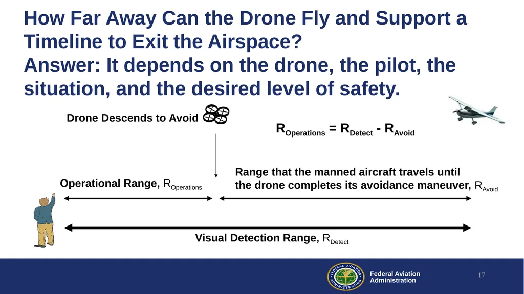
How Far Away Can the Drone Fly and Support a Timeline to Exit the Airspace?
Answer: It depends on the drone, the pilot, the situation, and the desired level of safety. 17 Operational Range, ROperations Visual Detection Range, RDetect Range that the manned aircraft travels until
the drone completes its avoidance maneuver, RAvoid Drone Descends to Avoid ROperations = RDetect - RAvoid<br>
18
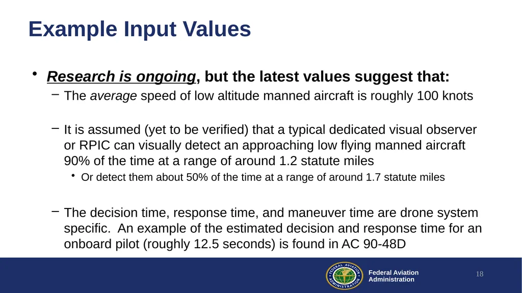
Example Input Values Research is ongoing, but the latest values suggest that:
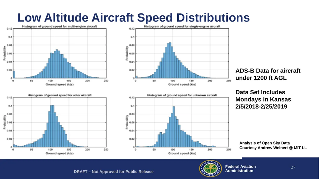
The average speed of low altitude manned aircraft is roughly 100 knots
It is assumed (yet to be verified) that a typical dedicated visual observer or RPIC can visually detect an approaching low flying manned aircraft 90% of the time at a range of around 1.2 statute miles
Or detect them about 50% of the time at a range of around 1.7 statute miles
The decision time, response time, and maneuver time are drone system specific. An example of the estimated decision and response time for an onboard pilot (roughly 12.5 seconds) is found in AC 90-48D 18<br>
The average speed of low altitude manned aircraft is roughly 100 knots
It is assumed (yet to be verified) that a typical dedicated visual observer or RPIC can visually detect an approaching low flying manned aircraft 90% of the time at a range of around 1.2 statute miles
Or detect them about 50% of the time at a range of around 1.7 statute miles
The decision time, response time, and maneuver time are drone system specific. An example of the estimated decision and response time for an onboard pilot (roughly 12.5 seconds) is found in AC 90-48D 18<br>
19
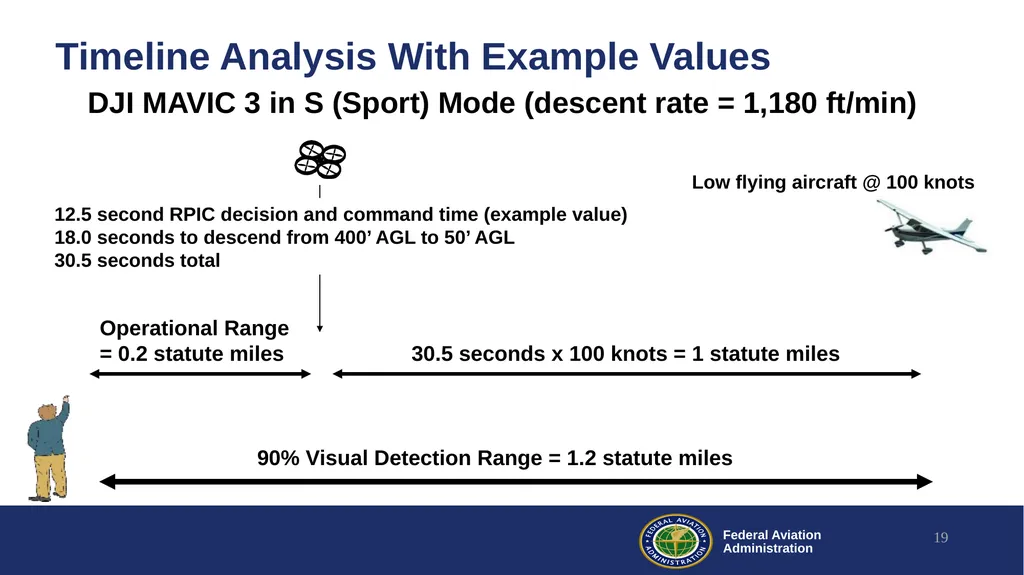
Timeline Analysis With Example Values 19 Operational Range
= 0.2 statute miles 90% Visual Detection Range = 1.2 statute miles 30.5 seconds x 100 knots = 1 statute miles DJI MAVIC 3 in S (Sport) Mode (descent rate = 1,180 ft/min) 12.5 second RPIC decision and command time (example value)
18.0 seconds to descend from 400’ AGL to 50’ AGL
30.5 seconds total Low flying aircraft @ 100 knots<br>
= 0.2 statute miles 90% Visual Detection Range = 1.2 statute miles 30.5 seconds x 100 knots = 1 statute miles DJI MAVIC 3 in S (Sport) Mode (descent rate = 1,180 ft/min) 12.5 second RPIC decision and command time (example value)
18.0 seconds to descend from 400’ AGL to 50’ AGL
30.5 seconds total Low flying aircraft @ 100 knots<br>
20
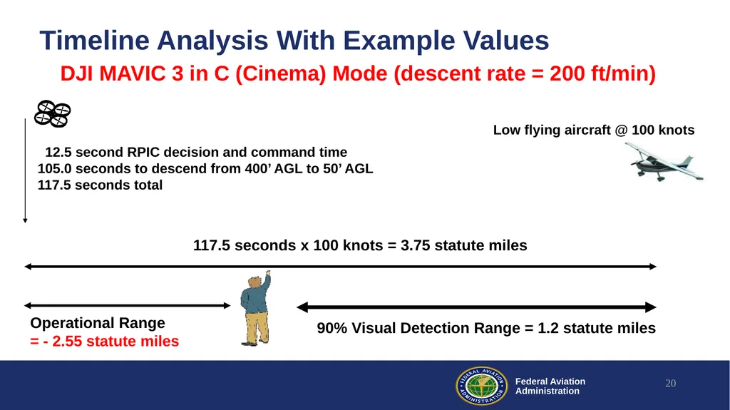
Timeline Analysis With Example Values 20 Operational Range
= - 2.55 statute miles 90% Visual Detection Range = 1.2 statute miles 117.5 seconds x 100 knots = 3.75 statute miles DJI MAVIC 3 in C (Cinema) Mode (descent rate = 200 ft/min) 012.5 second RPIC decision and command time
105.0 seconds to descend from 400’ AGL to 50’ AGL
117.5 seconds total Low flying aircraft @ 100 knots<br>
= - 2.55 statute miles 90% Visual Detection Range = 1.2 statute miles 117.5 seconds x 100 knots = 3.75 statute miles DJI MAVIC 3 in C (Cinema) Mode (descent rate = 200 ft/min) 012.5 second RPIC decision and command time
105.0 seconds to descend from 400’ AGL to 50’ AGL
117.5 seconds total Low flying aircraft @ 100 knots<br>
21
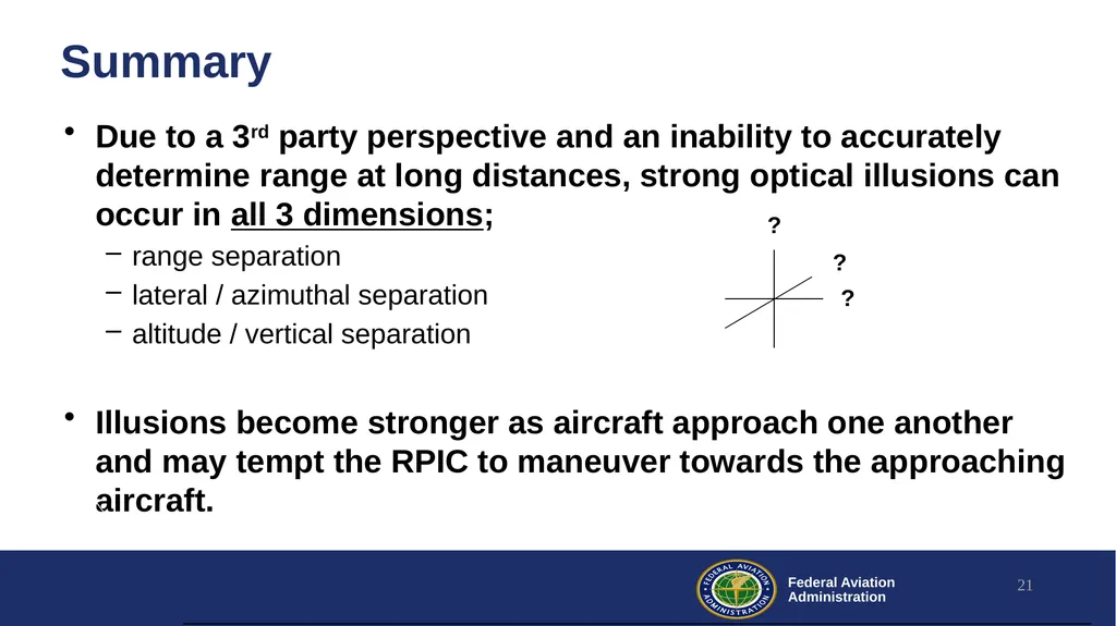
Due to a 3rd party perspective and an inability to accurately determine range at long distances, strong optical illusions can occur in all 3 dimensions;
range separation
lateral / azimuthal separation
altitude / vertical separation
Illusions become stronger as aircraft approach one another and may tempt the RPIC to maneuver towards the approaching aircraft. Summary 21<br>
range separation
lateral / azimuthal separation
altitude / vertical separation
Illusions become stronger as aircraft approach one another and may tempt the RPIC to maneuver towards the approaching aircraft. Summary 21<br>
22
Summary Rather than attempting to maneuver around a nearby approaching aircraft, the safest visual maneuver is often to exit the airspace or go to a protected area
Part 107 requires more than just seeing the drone as a dot in the sky
The time to exit the airspace depends on the drone and the specific operation. In some cases it may take longer than expected. 22<br>
Part 107 requires more than just seeing the drone as a dot in the sky
The time to exit the airspace depends on the drone and the specific operation. In some cases it may take longer than expected. 22<br>
23
Ongoing Visual Research Alliance for System Safety of UAS through Research Excellence (ASSURE)
https://www.assureuas.org/
Validation of Visual Operation Standards for Small UAS (sUAS)
Deliverables include training recommendations for visual observers and an assessment of the safety of Extended Visual Line Of Sight (EVLOS) concepts 23<br>
https://www.assureuas.org/
Validation of Visual Operation Standards for Small UAS (sUAS)
Deliverables include training recommendations for visual observers and an assessment of the safety of Extended Visual Line Of Sight (EVLOS) concepts 23<br>
24
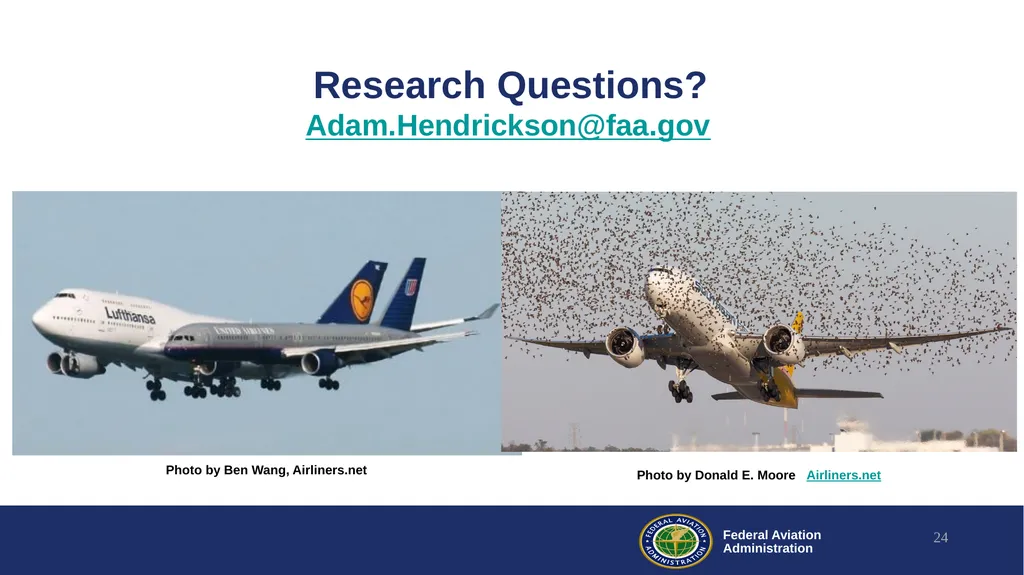
Research Questions? Adam.Hendrickson@faa.gov 24 Photo by Ben Wang, Airliners.net Photo by Donald E. Moore Airliners.net<br>
25
What Is the Vertical Separation in Each Case? The drone is approximately 200 feet below the approaching manned aircraft in each image Vance, Wallace, et al. Detecting and Assessing Collision Potential of Aircraft and Small Unmanned Aircraft Systems by Visual Observers. International Journal of Aviation, Aeronautics, and Aerospace, Sept 2017<br>
26
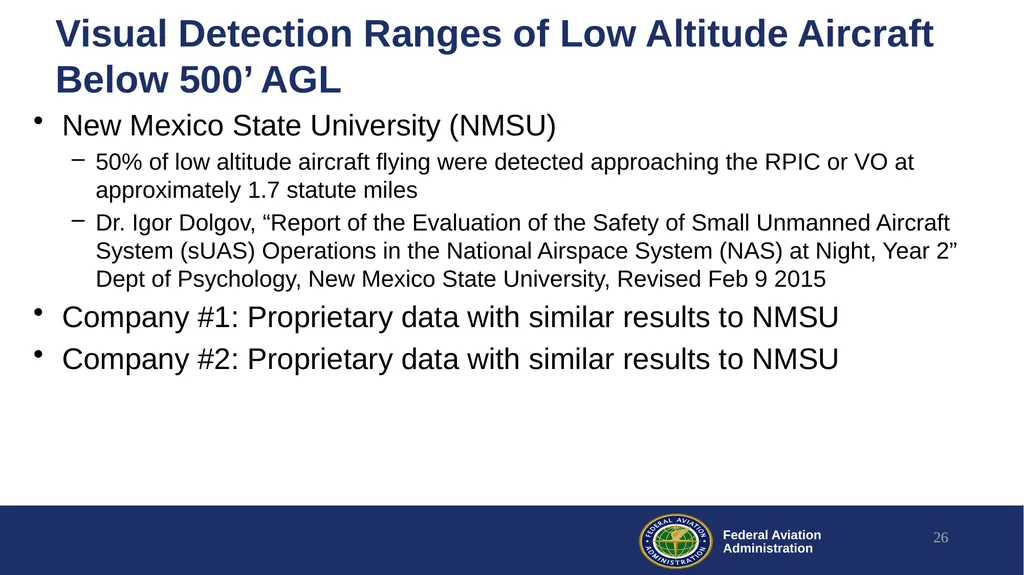
Visual Detection Ranges of Low Altitude Aircraft Below 500’ AGL New Mexico State University (NMSU)
50% of low altitude aircraft flying were detected approaching the RPIC or VO at approximately 1.7 statute miles
Dr. Igor Dolgov, “Report of the Evaluation of the Safety of Small Unmanned Aircraft System (sUAS) Operations in the National Airspace System (NAS) at Night, Year 2” Dept of Psychology, New Mexico State University, Revised Feb 9 2015
Company #1: Proprietary data with similar results to NMSU
Company #2: Proprietary data with similar results to NMSU 26<br>
50% of low altitude aircraft flying were detected approaching the RPIC or VO at approximately 1.7 statute miles
Dr. Igor Dolgov, “Report of the Evaluation of the Safety of Small Unmanned Aircraft System (sUAS) Operations in the National Airspace System (NAS) at Night, Year 2” Dept of Psychology, New Mexico State University, Revised Feb 9 2015
Company #1: Proprietary data with similar results to NMSU
Company #2: Proprietary data with similar results to NMSU 26<br>
27
Low Altitude Aircraft Speed Distributions 27 Analysis of Open Sky Data
Courtesy Andrew Weinert @ MIT LL DRAFT – Not Approved for Public Release ADS-B Data for aircraft under 1200 ft AGL
Data Set Includes Mondays in Kansas 2/5/2018-2/25/2019<br>
Data Set Includes Mondays in Kansas 2/5/2018-2/25/2019<br>
28
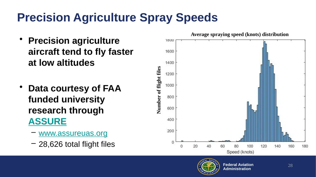
Precision Agriculture Spray Speeds Precision agriculture aircraft tend to fly faster at low altitudes
Data courtesy of FAA funded university research through ASSURE
www.assureuas.org
28,626 total flight files 28 Average spraying speed (knots) distribution Number of flight files<br>
Data courtesy of FAA funded university research through ASSURE
www.assureuas.org
28,626 total flight files 28 Average spraying speed (knots) distribution Number of flight files<br>
29
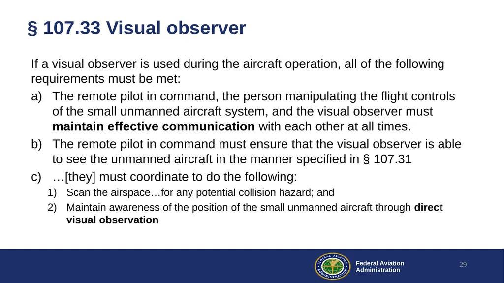
§ 107.33 Visual observer If a visual observer is used during the aircraft operation, all of the following requirements must be met:
The remote pilot in command, the person manipulating the flight controls of the small unmanned aircraft system, and the visual observer must maintain effective communication with each other at all times.
The remote pilot in command must ensure that the visual observer is able to see the unmanned aircraft in the manner specified in § 107.31
…[they] must coordinate to do the following:
Scan the airspace…for any potential collision hazard; and
Maintain awareness of the position of the small unmanned aircraft through direct visual observation 29<br>
The remote pilot in command, the person manipulating the flight controls of the small unmanned aircraft system, and the visual observer must maintain effective communication with each other at all times.
The remote pilot in command must ensure that the visual observer is able to see the unmanned aircraft in the manner specified in § 107.31
…[they] must coordinate to do the following:
Scan the airspace…for any potential collision hazard; and
Maintain awareness of the position of the small unmanned aircraft through direct visual observation 29<br>