
Instructions for use This resource is not a








Description: Instructions for use This resource is not a teaching and learning program. It should be used in conjunction with Landscapes and landforms. Classroom teachers are encouraged to add and adapt slides as required to meet the needs of their
Related Topics
Download Presentation
"Instructions for use This resource is not a" is the property of its rightful owner. Permission is granted to download and print the materials on this website for personal, non-commercial use only, and to display it on your personal computer provided you do not modify the materials and that you retain all copyright notices contained in the materials. By downloading content from our website, you accept the terms of this agreement.
Presentation Transcript
slide1. Instructions for use This resource is not a teaching and learning program. It should be used in conjunction with Landscapes and landforms.
Classroom teachers are encouraged to add and adapt slides as required to meet the needs of their students.
Save a copy of the file to make changes to the slide deck. Go to File > Download a Copy (this downloads a copy to the computer to edit in the PowerPoint app).
To convert the PowerPoint to Google Slides:
Upload the file into Google Drive and open it.
Go to File > Save as Google Slides.
(Note – conversion may cause formatting changes in the slides.) 1<br>
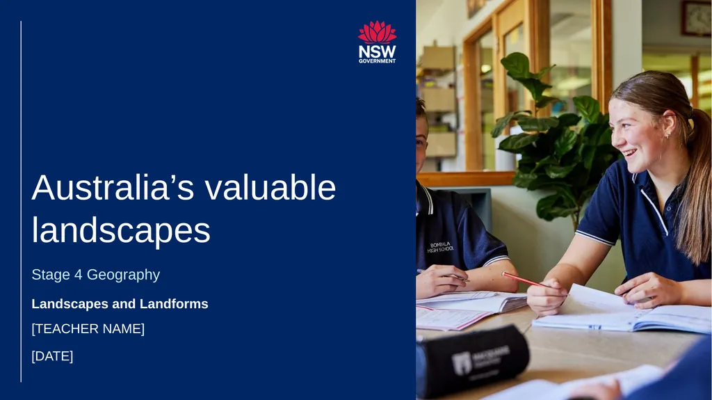
slide2. Australia’s valuable landscapes Stage 4 Geography Landscapes and Landforms [TEACHER NAME] [DATE]<br>
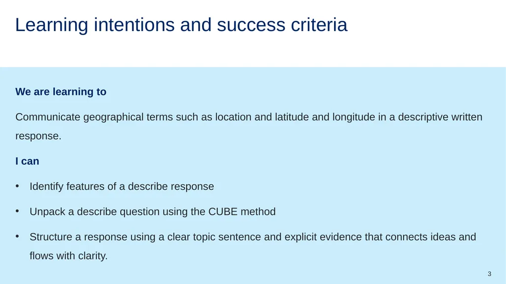
slide3. Learning intentions and success criteria We are learning to
Communicate geographical terms such as location and latitude and longitude in a descriptive written response.
I can
Identify features of a describe response
Unpack a describe question using the CUBE method
Structure a response using a clear topic sentence and explicit evidence that connects ideas and flows with clarity. 3<br>
slide4. How to respond to a describe question<br>
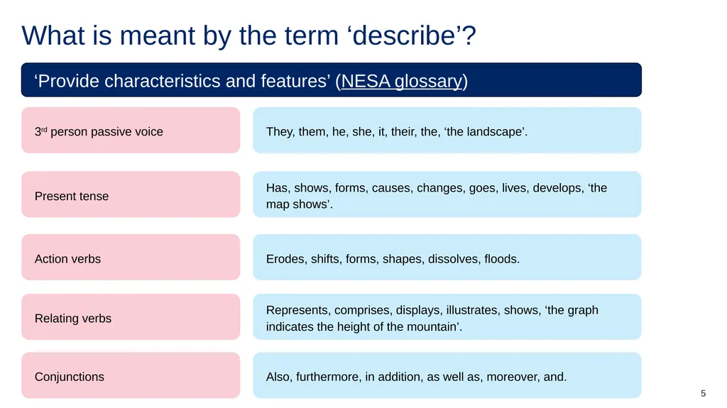
slide5. What is meant by the term ‘describe’? ‘Provide characteristics and features’ (NESA glossary) 3rd person passive voice They, them, he, she, it, their, the, ‘the landscape’. Present tense Has, shows, forms, causes, changes, goes, lives, develops, ‘the map shows’. Action verbs Erodes, shifts, forms, shapes, dissolves, floods. Relating verbs Represents, comprises, displays, illustrates, shows, ‘the graph indicates the height of the mountain’. Conjunctions Also, furthermore, in addition, as well as, moreover, and. 5<br>
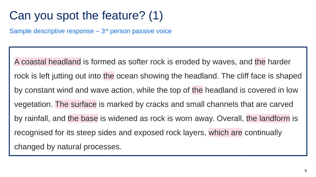
slide6. Can you spot the feature? (1) Sample descriptive response – 3rd person passive voice A coastal headland is formed as softer rock is eroded by waves, and the harder rock is left jutting out into the ocean showing the headland. The cliff face is shaped by constant wind and wave action, while the top of the headland is covered in low vegetation. The surface is marked by cracks and small channels that are carved by rainfall, and the base is widened as rock is worn away. Overall, the landform is recognised for its steep sides and exposed rock layers, which are continually changed by natural processes. A coastal headland is formed as softer rock is eroded by waves, and the harder rock is left jutting out into the ocean showing the headland. The cliff face is shaped by constant wind and wave action, while the top of the headland is covered in low vegetation. The surface is marked by cracks and small channels that are carved by rainfall, and the base is widened as rock is worn away. Overall, the landform is recognised for its steep sides and exposed rock layers, which are continually changed by natural processes. 6<br>
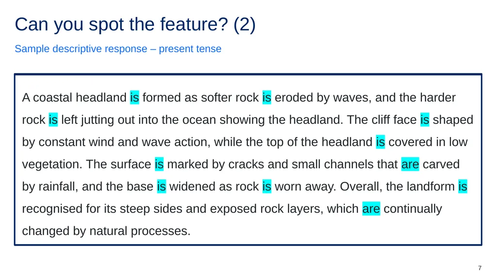
slide7. Can you spot the feature? (2) Sample descriptive response – present tense A coastal headland is formed as softer rock is eroded by waves, and the harder rock is left jutting out into the ocean showing the headland. The cliff face is shaped by constant wind and wave action, while the top of the headland is covered in low vegetation. The surface is marked by cracks and small channels that are carved by rainfall, and the base is widened as rock is worn away. Overall, the landform is recognised for its steep sides and exposed rock layers, which are continually changed by natural processes. A coastal headland is formed as softer rock is eroded by waves, and the harder rock is left jutting out into the ocean showing the headland. The cliff face is shaped by constant wind and wave action, while the top of the headland is covered in low vegetation. The surface is marked by cracks and small channels that are carved by rainfall, and the base is widened as rock is worn away. Overall, the landform is recognised for its steep sides and exposed rock layers, which are continually changed by natural processes. 7<br>
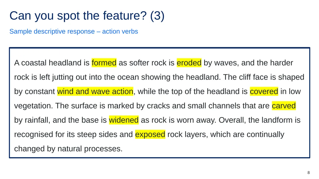
slide8. Can you spot the feature? (3) Sample descriptive response – action verbs A coastal headland is formed as softer rock is eroded by waves, and the harder rock is left jutting out into the ocean showing the headland. The cliff face is shaped by constant wind and wave action, while the top of the headland is covered in low vegetation. The surface is marked by cracks and small channels that are carved by rainfall, and the base is widened as rock is worn away. Overall, the landform is recognised for its steep sides and exposed rock layers, which are continually changed by natural processes. A coastal headland is formed as softer rock is eroded by waves, and the harder rock is left jutting out into the ocean showing the headland. The cliff face is shaped by constant wind and wave action, while the top of the headland is covered in low vegetation. The surface is marked by cracks and small channels that are carved by rainfall, and the base is widened as rock is worn away. Overall, the landform is recognised for its steep sides and exposed rock layers, which are continually changed by natural processes. 8<br>
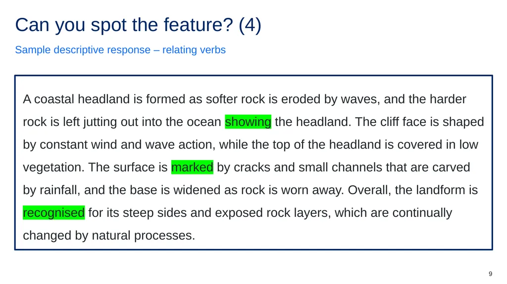
slide9. Can you spot the feature? (4) Sample descriptive response – relating verbs A coastal headland is formed as softer rock is eroded by waves, and the harder rock is left jutting out into the ocean showing the headland. The cliff face is shaped by constant wind and wave action, while the top of the headland is covered in low vegetation. The surface is marked by cracks and small channels that are carved by rainfall, and the base is widened as rock is worn away. Overall, the landform is recognised for its steep sides and exposed rock layers, which are continually changed by natural processes. A coastal headland is formed as softer rock is eroded by waves, and the harder rock is left jutting out into the ocean showing the headland. The cliff face is shaped by constant wind and wave action, while the top of the headland is covered in low vegetation. The surface is marked by cracks and small channels that are carved by rainfall, and the base is widened as rock is worn away. Overall, the landform is recognised for its steep sides and exposed rock layers, which are continually changed by natural processes. 9<br>
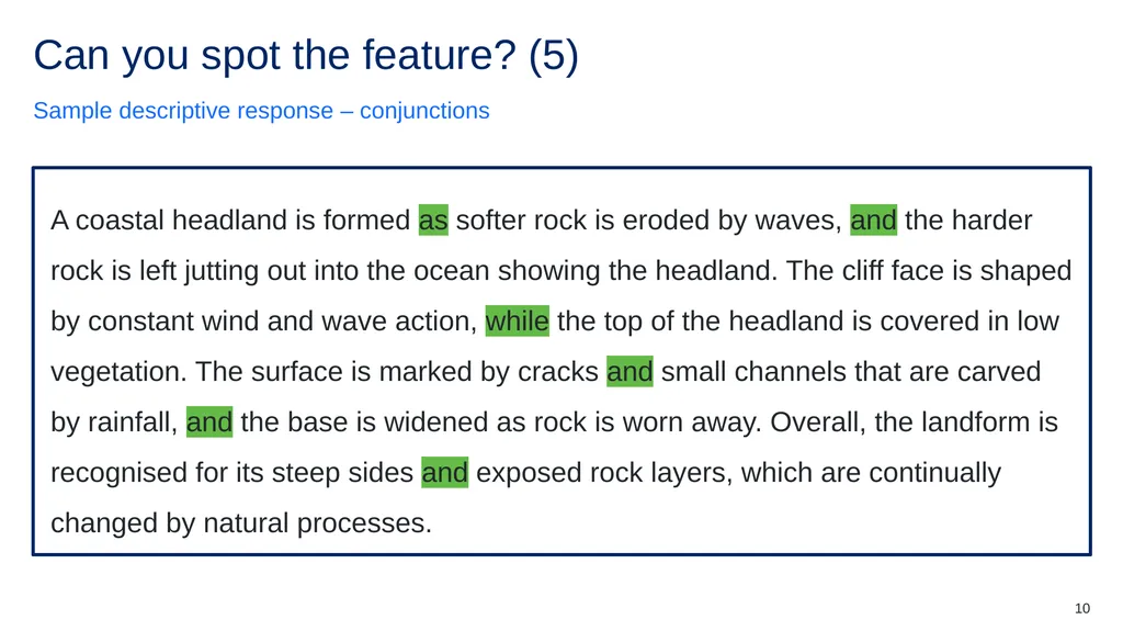
slide10. Can you spot the feature? (5) Sample descriptive response – conjunctions A coastal headland is formed as softer rock is eroded by waves, and the harder rock is left jutting out into the ocean showing the headland. The cliff face is shaped by constant wind and wave action, while the top of the headland is covered in low vegetation. The surface is marked by cracks and small channels that are carved by rainfall, and the base is widened as rock is worn away. Overall, the landform is recognised for its steep sides and exposed rock layers, which are continually changed by natural processes. A coastal headland is formed as softer rock is eroded by waves, and the harder rock is left jutting out into the ocean showing the headland. The cliff face is shaped by constant wind and wave action, while the top of the headland is covered in low vegetation. The surface is marked by cracks and small channels that are carved by rainfall, and the base is widened as rock is worn away. Overall, the landform is recognised for its steep sides and exposed rock layers, which are continually changed by natural processes. 10<br>
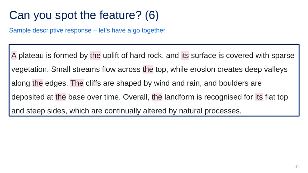
slide11. Can you spot the feature? (6) Sample descriptive response – let’s have a go together A plateau is formed by the uplift of hard rock, and its surface is covered with sparse vegetation. Small streams flow across the top, while erosion creates deep valleys along the edges. The cliffs are shaped by wind and rain, and boulders are deposited at the base over time. Overall, the landform is recognised for its flat top and steep sides, which are continually altered by natural processes. A plateau is formed by the uplift of hard rock, and its surface is covered with sparse vegetation. Small streams flow across the top, while erosion creates deep valleys along the edges. The cliffs are shaped by wind and rain, and boulders are deposited at the base over time. Overall, the landform is recognised for its flat top and steep sides, which are continually altered by natural processes. 11<br>
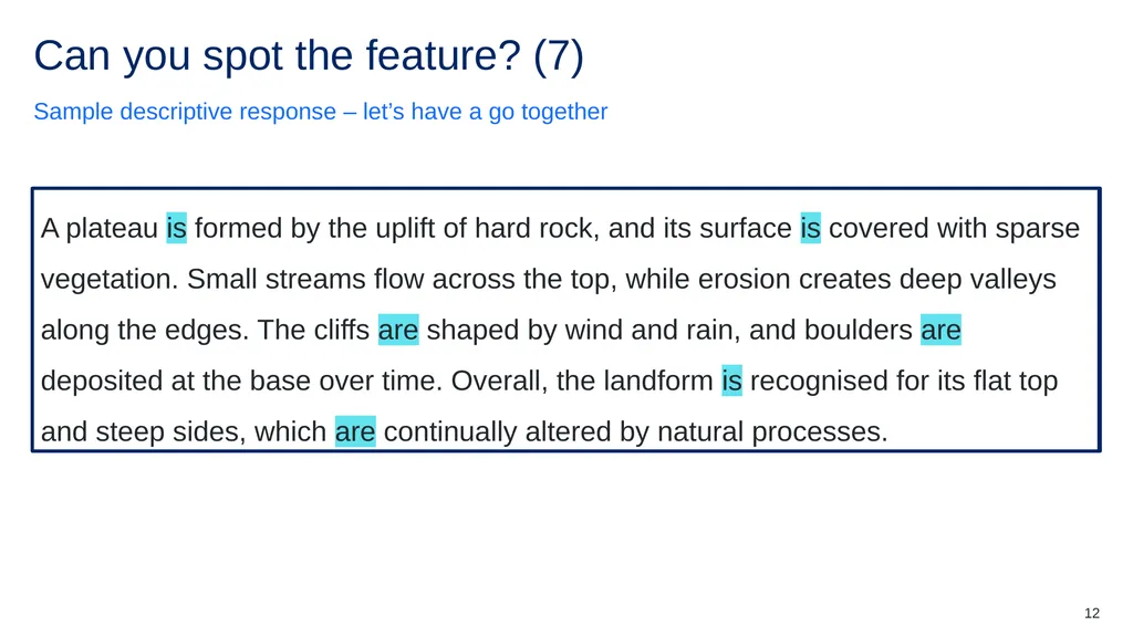
slide12. Can you spot the feature? (7) Sample descriptive response – let’s have a go together A plateau is formed by the uplift of hard rock, and its surface is covered with sparse vegetation. Small streams flow across the top, while erosion creates deep valleys along the edges. The cliffs are shaped by wind and rain, and boulders are deposited at the base over time. Overall, the landform is recognised for its flat top and steep sides, which are continually altered by natural processes. A plateau is formed by the uplift of hard rock, and its surface is covered with sparse vegetation. Small streams flow across the top, while erosion creates deep valleys along the edges. The cliffs are shaped by wind and rain, and boulders are deposited at the base over time. Overall, the landform is recognised for its flat top and steep sides, which are continually altered by natural processes. 12<br>
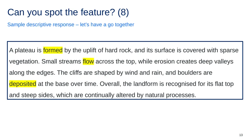
slide13. Can you spot the feature? (8) Sample descriptive response – let’s have a go together A plateau is formed by the uplift of hard rock, and its surface is covered with sparse vegetation. Small streams flow across the top, while erosion creates deep valleys along the edges. The cliffs are shaped by wind and rain, and boulders are deposited at the base over time. Overall, the landform is recognised for its flat top and steep sides, which are continually altered by natural processes. A plateau is formed by the uplift of hard rock, and its surface is covered with sparse vegetation. Small streams flow across the top, while erosion creates deep valleys along the edges. The cliffs are shaped by wind and rain, and boulders are deposited at the base over time. Overall, the landform is recognised for its flat top and steep sides, which are continually altered by natural processes. 13<br>
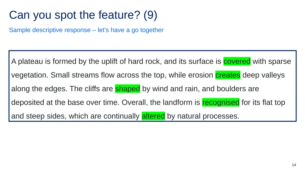
slide14. Can you spot the feature? (9) Sample descriptive response – let’s have a go together A plateau is formed by the uplift of hard rock, and its surface is covered with sparse vegetation. Small streams flow across the top, while erosion creates deep valleys along the edges. The cliffs are shaped by wind and rain, and boulders are deposited at the base over time. Overall, the landform is recognised for its flat top and steep sides, which are continually altered by natural processes. A plateau is formed by the uplift of hard rock, and its surface is covered with sparse vegetation. Small streams flow across the top, while erosion creates deep valleys along the edges. The cliffs are shaped by wind and rain, and boulders are deposited at the base over time. Overall, the landform is recognised for its flat top and steep sides, which are continually altered by natural processes. 14<br>
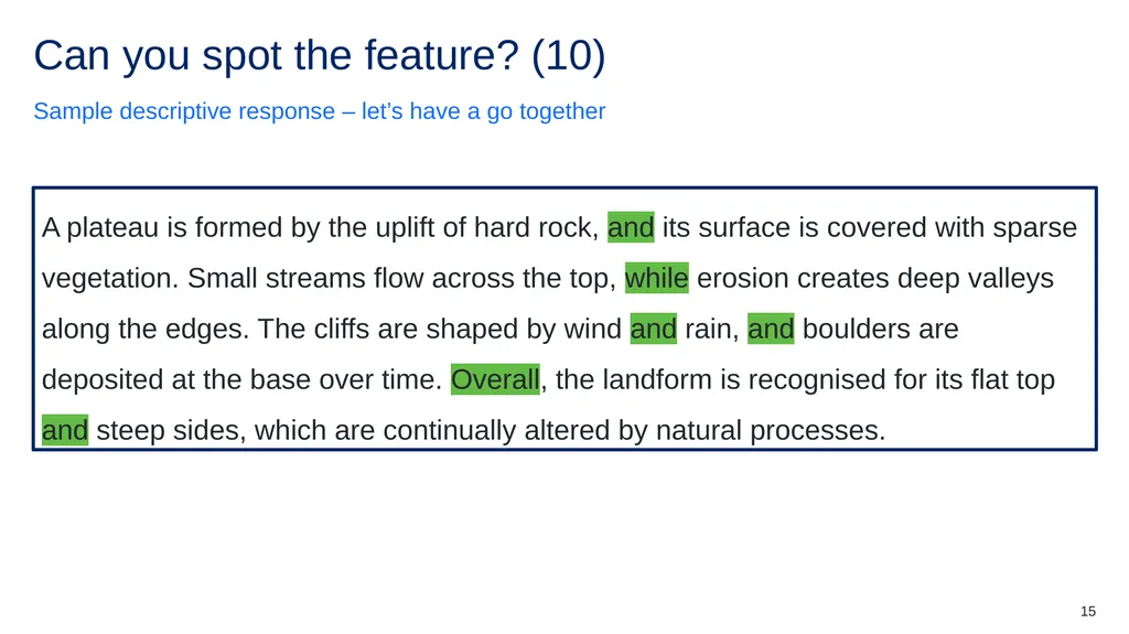
slide15. Can you spot the feature? (10) Sample descriptive response – let’s have a go together A plateau is formed by the uplift of hard rock, and its surface is covered with sparse vegetation. Small streams flow across the top, while erosion creates deep valleys along the edges. The cliffs are shaped by wind and rain, and boulders are deposited at the base over time. Overall, the landform is recognised for its flat top and steep sides, which are continually altered by natural processes. A plateau is formed by the uplift of hard rock, and its surface is covered with sparse vegetation. Small streams flow across the top, while erosion creates deep valleys along the edges. The cliffs are shaped by wind and rain, and boulders are deposited at the base over time. Overall, the landform is recognised for its flat top and steep sides, which are continually altered by natural processes. 15<br>
slide16. Check for understanding (1) Features in a ‘describe’ question 16<br>
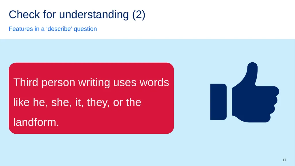
slide17. Check for understanding (2) Features in a ‘describe’ question Third person writing uses words like he, she, it, they, or the landform. 17<br>
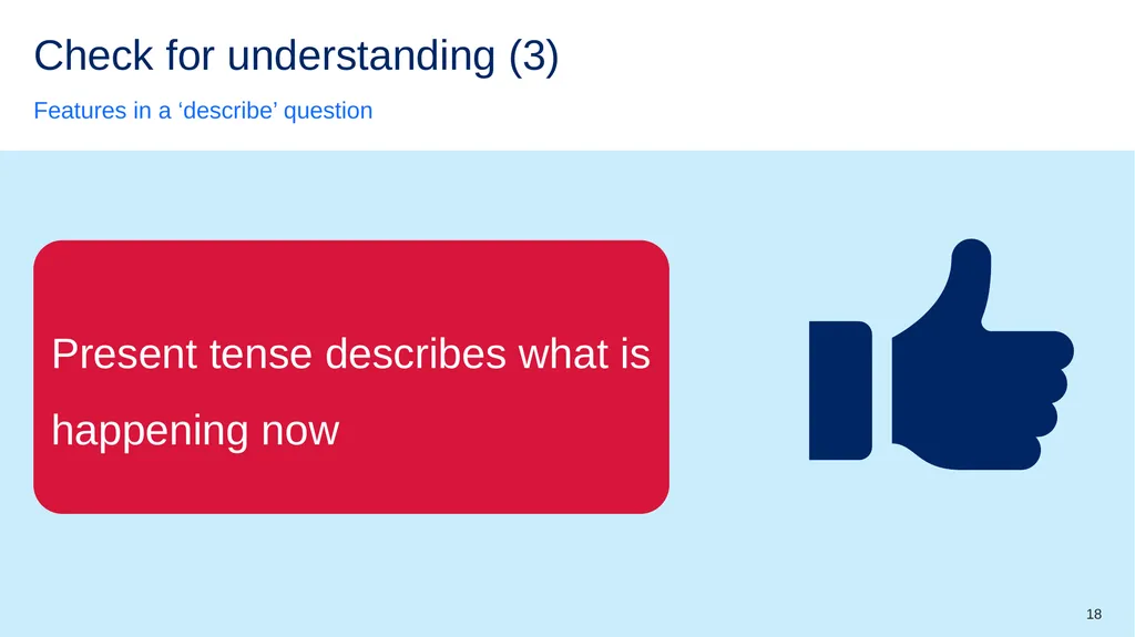
slide18. Check for understanding (3) Features in a ‘describe’ question Present tense describes what is happening now 18<br>
slide19. Check for understanding (4) Features in a ‘describe’ question Action verbs stay still and do not show any movement or activity 19<br>
slide20. Check for understanding (5) Features in a ‘describe’ question Conjunctions are words that name people, places, or things. 20<br>
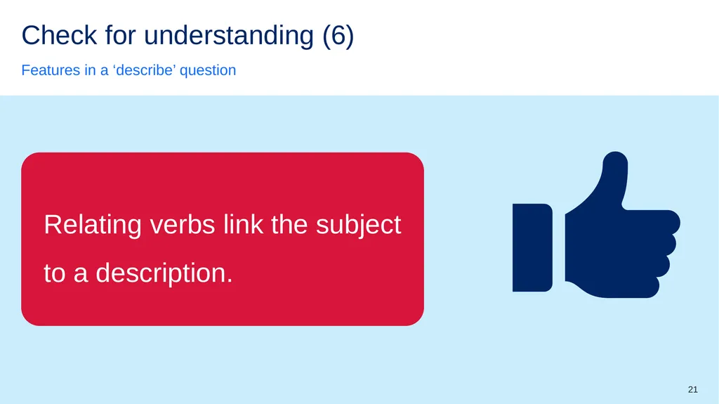
slide21. Check for understanding (6) Features in a ‘describe’ question Relating verbs link the subject to a description. 21<br>
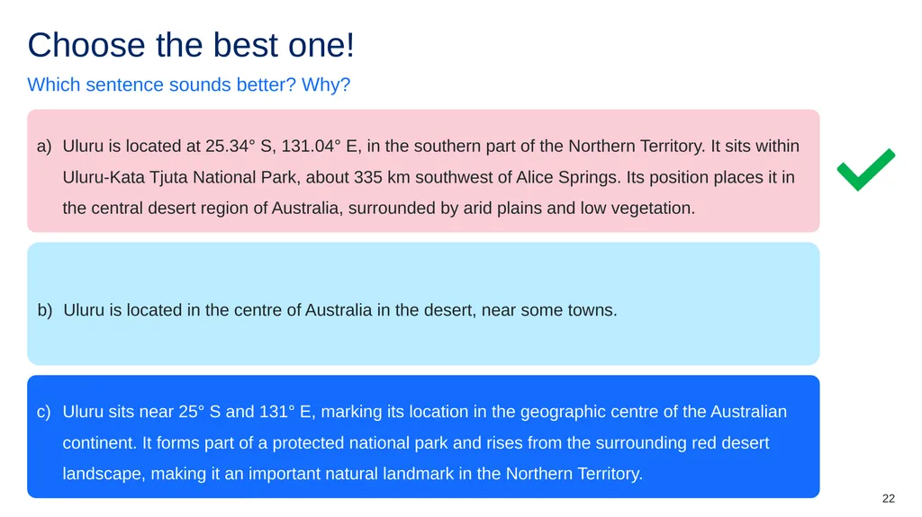
slide22. Choose the best one! Which sentence sounds better? Why? Uluru is located at 25.34° S, 131.04° E, in the southern part of the Northern Territory. It sits within Uluru-Kata Tjuta National Park, about 335 km southwest of Alice Springs. Its position places it in the central desert region of Australia, surrounded by arid plains and low vegetation. Uluru is located in the centre of Australia in the desert, near some towns. Uluru sits near 25° S and 131° E, marking its location in the geographic centre of the Australian continent. It forms part of a protected national park and rises from the surrounding red desert landscape, making it an important natural landmark in the Northern Territory. 22<br>
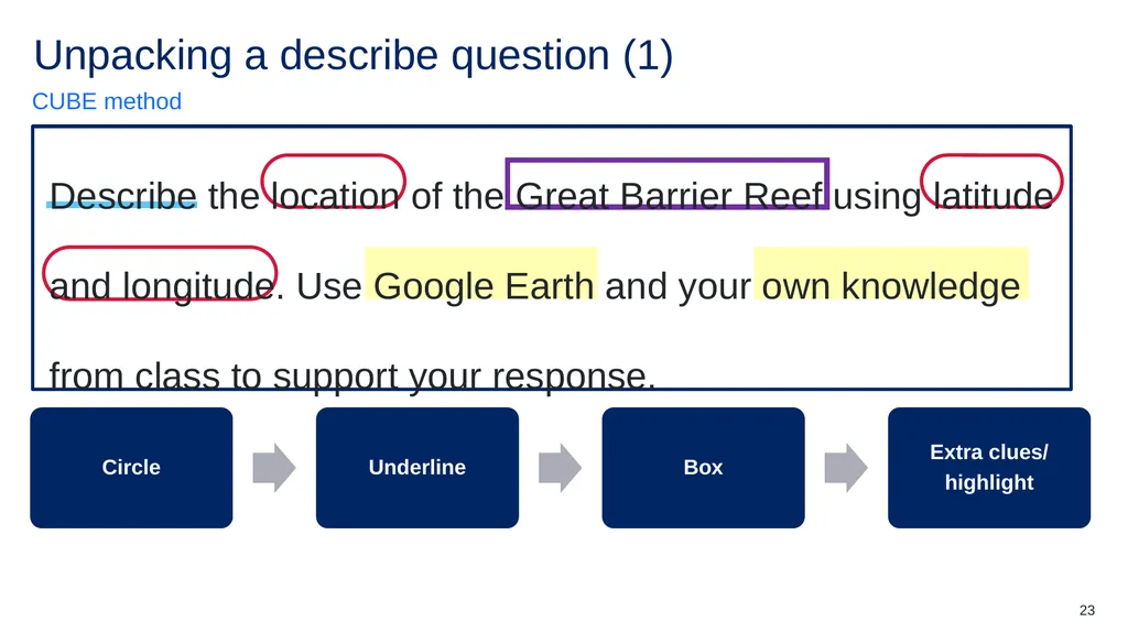
slide23. Unpacking a describe question (1) CUBE method Describe the location of the Great Barrier Reef using latitude and longitude. Use Google Earth and your own knowledge from class to support your response. Circle Underline Box Extra clues/
highlight 23<br>
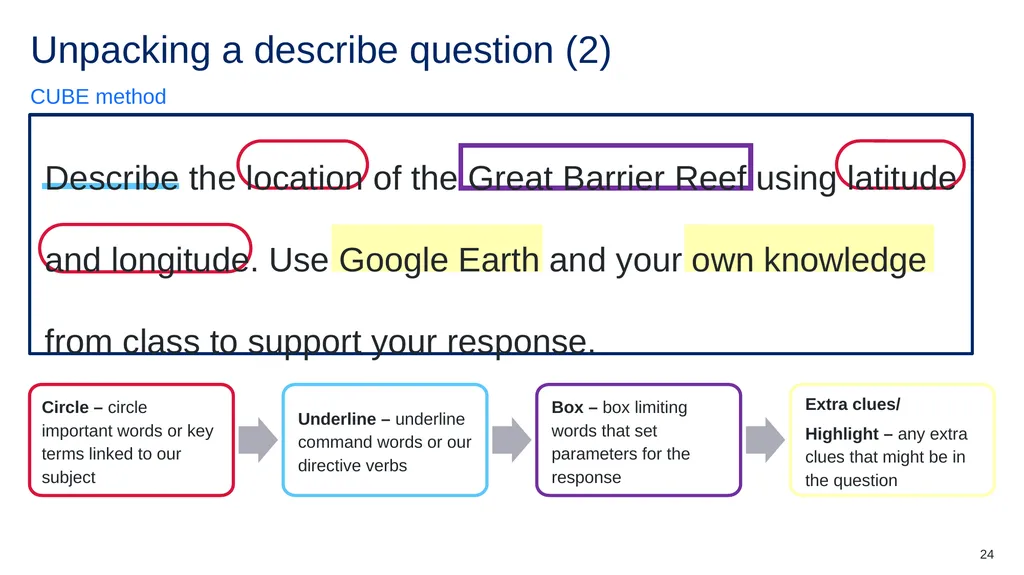
slide24. Unpacking a describe question (2) CUBE method Describe the location of the Great Barrier Reef using latitude and longitude. Use Google Earth and your own knowledge from class to support your response. Circle – circle important words or key terms linked to our subject Underline – underline command words or our directive verbs Box – box limiting words that set parameters for the response Extra clues/
Highlight – any extra clues that might be in the question 24<br>
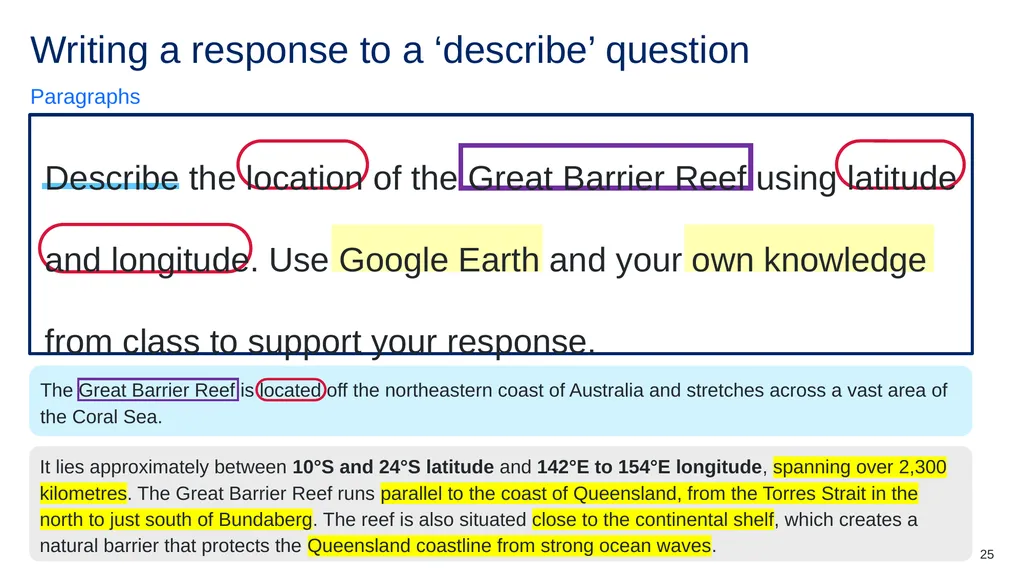
slide25. Writing a response to a ‘describe’ question Paragraphs Describe the location of the Great Barrier Reef using latitude and longitude. Use Google Earth and your own knowledge from class to support your response. The Great Barrier Reef is located off the northeastern coast of Australia and stretches across a vast area of the Coral Sea. It lies approximately between 10°S and 24°S latitude and 142°E to 154°E longitude, spanning over 2,300 kilometres. The Great Barrier Reef runs parallel to the coast of Queensland, from the Torres Strait in the north to just south of Bundaberg. The reef is also situated close to the continental shelf, which creates a natural barrier that protects the Queensland coastline from strong ocean waves. 25<br>
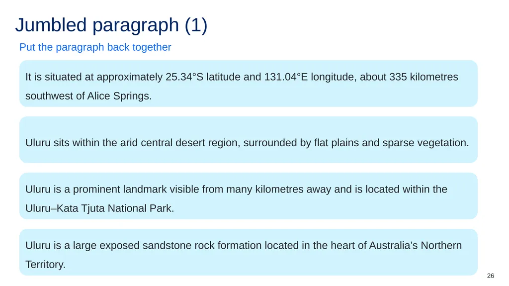
slide26. Jumbled paragraph (1) Put the paragraph back together It is situated at approximately 25.34°S latitude and 131.04°E longitude, about 335 kilometres southwest of Alice Springs. Uluru sits within the arid central desert region, surrounded by flat plains and sparse vegetation. Uluru is a prominent landmark visible from many kilometres away and is located within the Uluru–Kata Tjuta National Park. Uluru is a large exposed sandstone rock formation located in the heart of Australia’s Northern Territory. 26<br>
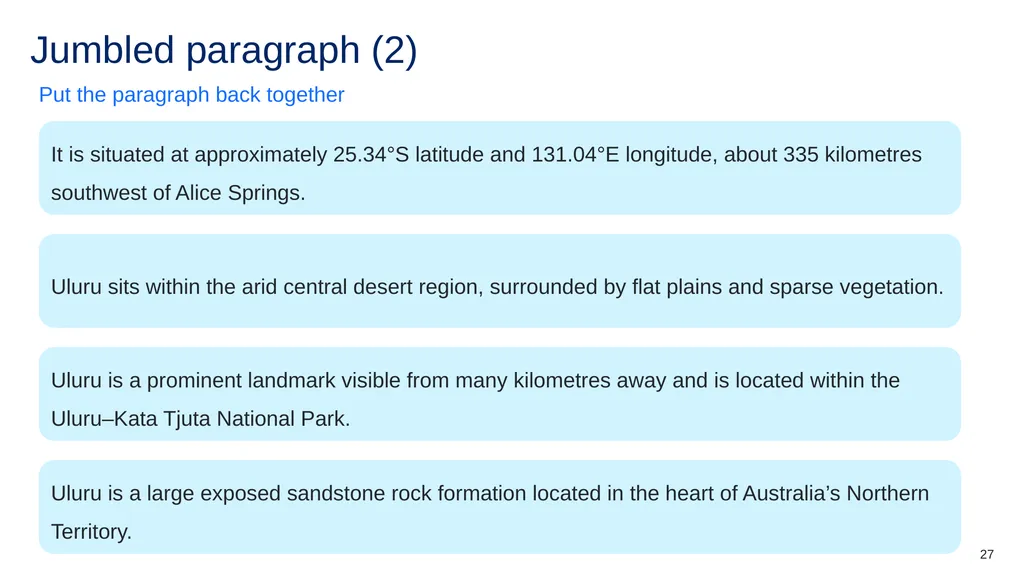
slide27. Jumbled paragraph (2) Put the paragraph back together It is situated at approximately 25.34°S latitude and 131.04°E longitude, about 335 kilometres southwest of Alice Springs. Uluru sits within the arid central desert region, surrounded by flat plains and sparse vegetation. Uluru is a prominent landmark visible from many kilometres away and is located within the Uluru–Kata Tjuta National Park. Uluru is a large exposed sandstone rock formation located in the heart of Australia’s Northern Territory. 27<br>
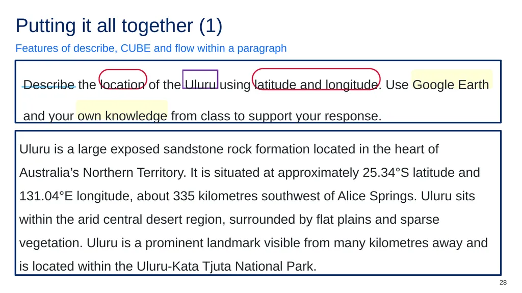
slide28. Putting it all together (1) Features of describe, CUBE and flow within a paragraph Describe the location of the Uluru using latitude and longitude. Use Google Earth and your own knowledge from class to support your response. Uluru is a large exposed sandstone rock formation located in the heart of Australia’s Northern Territory. It is situated at approximately 25.34°S latitude and 131.04°E longitude, about 335 kilometres southwest of Alice Springs. Uluru sits within the arid central desert region, surrounded by flat plains and sparse vegetation. Uluru is a prominent landmark visible from many kilometres away and is located within the Uluru-Kata Tjuta National Park. 28<br>
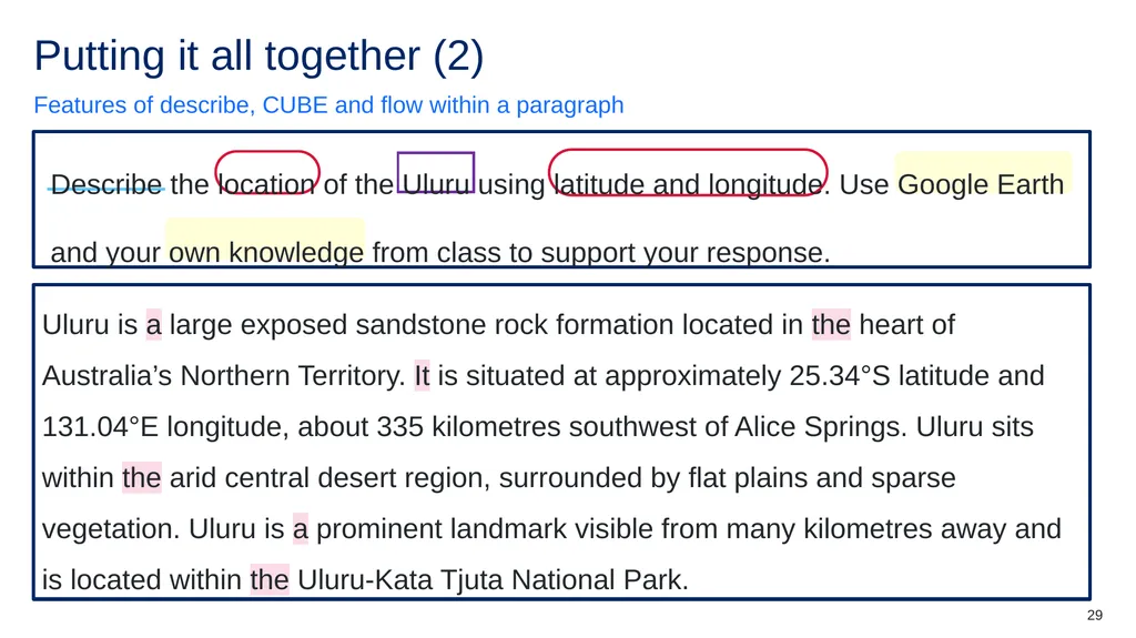
slide29. Putting it all together (2) Features of describe, CUBE and flow within a paragraph Describe the location of the Uluru using latitude and longitude. Use Google Earth and your own knowledge from class to support your response. Uluru is a large exposed sandstone rock formation located in the heart of Australia’s Northern Territory. It is situated at approximately 25.34°S latitude and 131.04°E longitude, about 335 kilometres southwest of Alice Springs. Uluru sits within the arid central desert region, surrounded by flat plains and sparse vegetation. Uluru is a prominent landmark visible from many kilometres away and is located within the Uluru-Kata Tjuta National Park. 29<br>
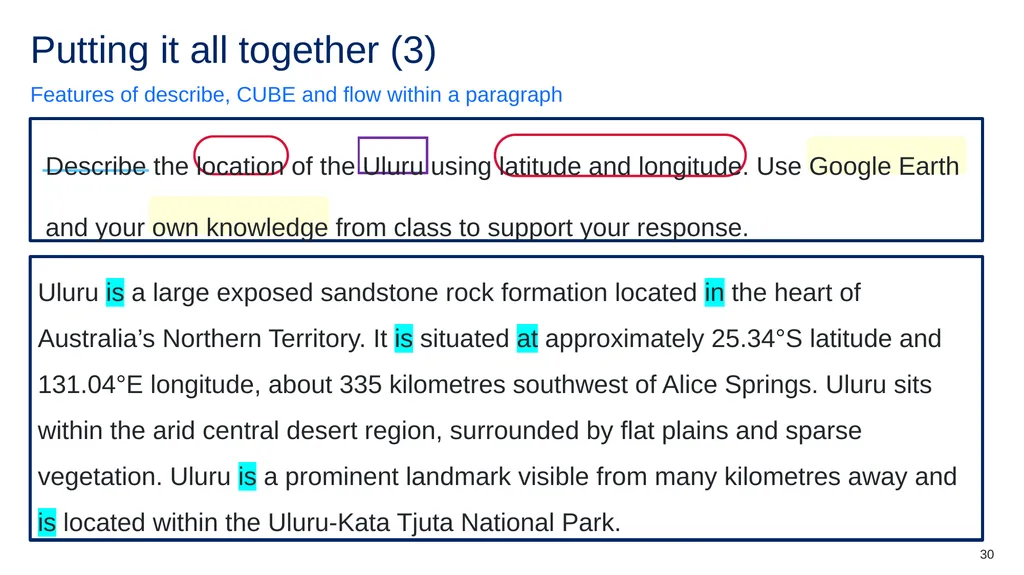
slide30. Putting it all together (3) Features of describe, CUBE and flow within a paragraph Describe the location of the Uluru using latitude and longitude. Use Google Earth and your own knowledge from class to support your response. Uluru is a large exposed sandstone rock formation located in the heart of Australia’s Northern Territory. It is situated at approximately 25.34°S latitude and 131.04°E longitude, about 335 kilometres southwest of Alice Springs. Uluru sits within the arid central desert region, surrounded by flat plains and sparse vegetation. Uluru is a prominent landmark visible from many kilometres away and is located within the Uluru-Kata Tjuta National Park. 30<br>
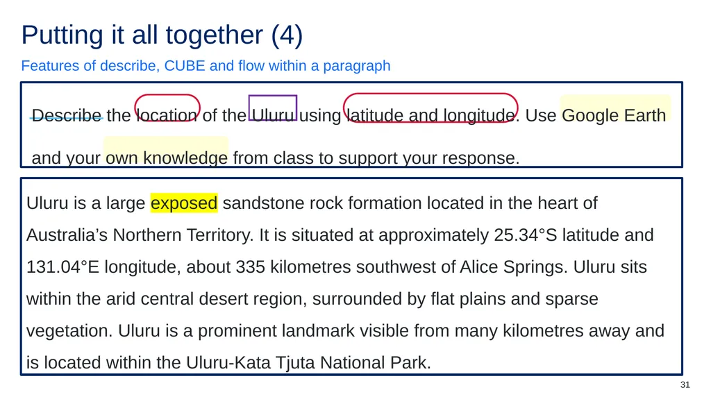
slide31. Putting it all together (4) Features of describe, CUBE and flow within a paragraph Describe the location of the Uluru using latitude and longitude. Use Google Earth and your own knowledge from class to support your response. Uluru is a large exposed sandstone rock formation located in the heart of Australia’s Northern Territory. It is situated at approximately 25.34°S latitude and 131.04°E longitude, about 335 kilometres southwest of Alice Springs. Uluru sits within the arid central desert region, surrounded by flat plains and sparse vegetation. Uluru is a prominent landmark visible from many kilometres away and is located within the Uluru-Kata Tjuta National Park. 31<br>
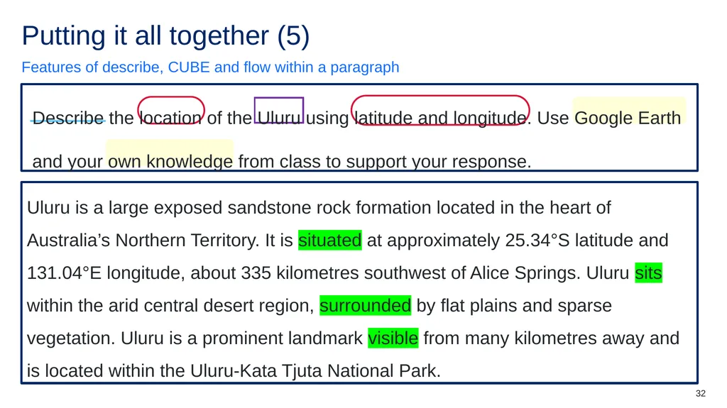
slide32. Putting it all together (5) Features of describe, CUBE and flow within a paragraph Describe the location of the Uluru using latitude and longitude. Use Google Earth and your own knowledge from class to support your response. Uluru is a large exposed sandstone rock formation located in the heart of Australia’s Northern Territory. It is situated at approximately 25.34°S latitude and 131.04°E longitude, about 335 kilometres southwest of Alice Springs. Uluru sits within the arid central desert region, surrounded by flat plains and sparse vegetation. Uluru is a prominent landmark visible from many kilometres away and is located within the Uluru-Kata Tjuta National Park. 32<br>
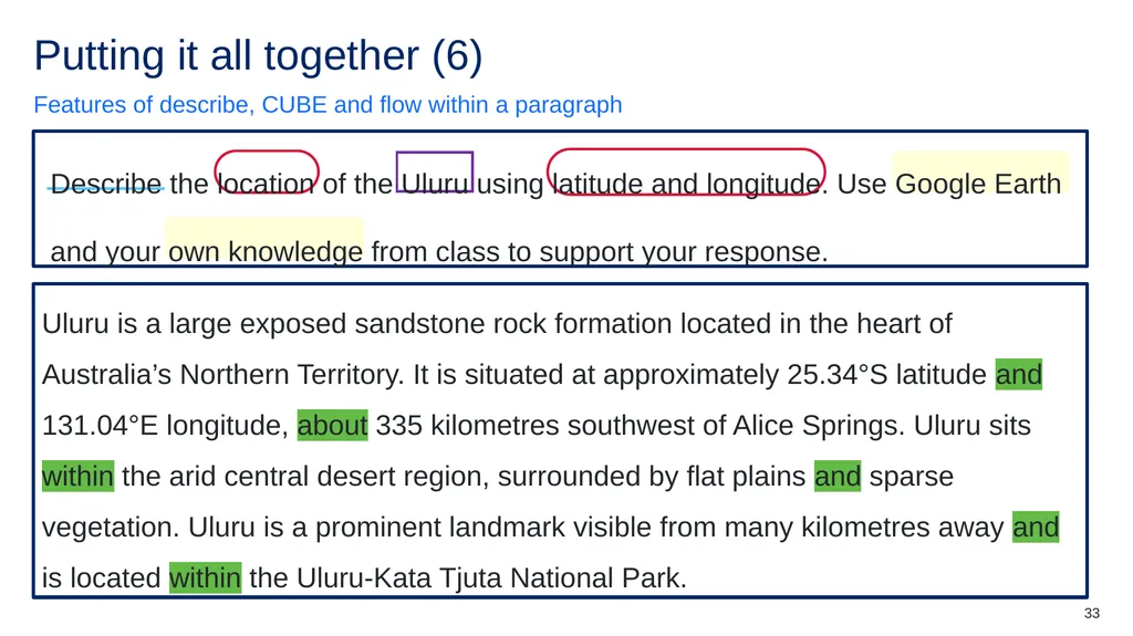
slide33. Putting it all together (6) Features of describe, CUBE and flow within a paragraph Describe the location of the Uluru using latitude and longitude. Use Google Earth and your own knowledge from class to support your response. Uluru is a large exposed sandstone rock formation located in the heart of Australia’s Northern Territory. It is situated at approximately 25.34°S latitude and 131.04°E longitude, about 335 kilometres southwest of Alice Springs. Uluru sits within the arid central desert region, surrounded by flat plains and sparse vegetation. Uluru is a prominent landmark visible from many kilometres away and is located within the Uluru-Kata Tjuta National Park. 33<br>
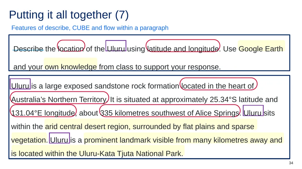
slide34. Putting it all together (7) Features of describe, CUBE and flow within a paragraph Describe the location of the Uluru using latitude and longitude. Use Google Earth and your own knowledge from class to support your response. Uluru is a large exposed sandstone rock formation located in the heart of Australia’s Northern Territory. It is situated at approximately 25.34°S latitude and 131.04°E longitude, about 335 kilometres southwest of Alice Springs. Uluru sits within the arid central desert region, surrounded by flat plains and sparse vegetation. Uluru is a prominent landmark visible from many kilometres away and is located within the Uluru-Kata Tjuta National Park. 34<br>
slide35. Check for understanding (7) Multiple choice question Why is having clear flow and structure important when writing a paragraph?
It makes the paragraph look longer and more impressive.
It helps the reader understand the main idea and how each sentence connects.
It allows the writer to include as many unrelated facts as possible.
It ensures the paragraph follows the same format as every other subject. 35<br>
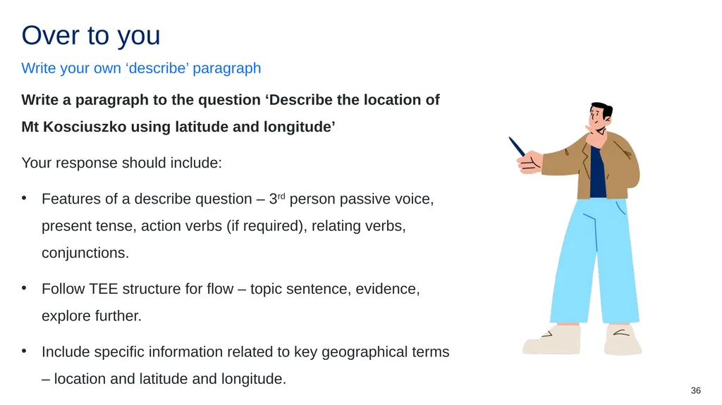
slide36. Over to you Write your own ‘describe’ paragraph Write a paragraph to the question ‘Describe the location of Mt Kosciuszko using latitude and longitude’
Your response should include:
Features of a describe question – 3rd person passive voice, present tense, action verbs (if required), relating verbs, conjunctions.
Follow TEE structure for flow – topic sentence, evidence, explore further.
Include specific information related to key geographical terms – location and latitude and longitude. 36<br>
slide37. References This presentation contains NSW Curriculum and syllabus content. The NSW Curriculum is developed by the NSW Education Standards Authority. This content is prepared by NESA for and on behalf of the Crown in the right of the State of New South Wales. The material is protected by Crown copyright.
Please refer to the NESA Copyright Disclaimer for more information https://educationstandards.nsw.edu.au/wps/portal/nesa/mini-footer/copyright.
NESA holds the only official and up-to-date versions of the NSW Curriculum and syllabus documents. Please visit the NSW Education Standards Authority (NESA) website https://educationstandards.nsw.edu.au/wps/portal/nesa/home and the NSW Curriculum website https://curriculum.nsw.edu.au. Geography 7–10 © Syllabus NSW Education Standards Authority (NESA) for and on behalf of the Crown in right of the State of New South Wales, 2024. 37<br>
slide38. Copyright © State of New South Wales (Department of Education), 2025 The copyright material published in this resource is subject to the Copyright Act 1968 (Cth) and is owned by the NSW Department of Education or, where indicated, by a party other than the NSW Department of Education (third-party material).
Copyright material available in this resource and owned by the NSW Department of Education is licensed under a Creative Commons Attribution 4.0 International (CC BY 4.0) license.
This license allows you to share and adapt the material for any purpose, even commercially.
Attribution should be given to © State of New South Wales (Department of Education), 2025.
Material in this resource not available under a Creative Commons license:
the NSW Department of Education logo, other logos and trademark-protected material
Material owned by a third party that has been reproduced with permission. You will need to obtain permission from the third party to reuse its material.
Links to third-party material and websites
Please note that the provided (reading/viewing material/list/links/texts) are a suggestion only and implies no endorsement, by the New South Wales Department of Education, of any author, publisher, or book title. School principals and teachers are best placed to assess the suitability of resources that would complement the curriculum and reflect the needs and interests of their students.
If you use the links provided in this document to access a third-party’s website, you acknowledge that the terms of use, including licence terms set out on the third-party’s website apply to the use which may be made of the materials on that third-party website or where permitted by the Copyright Act 1968 (Cth). The department accepts no responsibility for content on third-party websites.<br>
Classroom teachers are encouraged to add and adapt slides as required to meet the needs of their students.
Save a copy of the file to make changes to the slide deck. Go to File > Download a Copy (this downloads a copy to the computer to edit in the PowerPoint app).
To convert the PowerPoint to Google Slides:
Upload the file into Google Drive and open it.
Go to File > Save as Google Slides.
(Note – conversion may cause formatting changes in the slides.) 1<br>
slide2. Australia’s valuable landscapes Stage 4 Geography Landscapes and Landforms [TEACHER NAME] [DATE]<br>
slide3. Learning intentions and success criteria We are learning to
Communicate geographical terms such as location and latitude and longitude in a descriptive written response.
I can
Identify features of a describe response
Unpack a describe question using the CUBE method
Structure a response using a clear topic sentence and explicit evidence that connects ideas and flows with clarity. 3<br>
slide4. How to respond to a describe question<br>
slide5. What is meant by the term ‘describe’? ‘Provide characteristics and features’ (NESA glossary) 3rd person passive voice They, them, he, she, it, their, the, ‘the landscape’. Present tense Has, shows, forms, causes, changes, goes, lives, develops, ‘the map shows’. Action verbs Erodes, shifts, forms, shapes, dissolves, floods. Relating verbs Represents, comprises, displays, illustrates, shows, ‘the graph indicates the height of the mountain’. Conjunctions Also, furthermore, in addition, as well as, moreover, and. 5<br>
slide6. Can you spot the feature? (1) Sample descriptive response – 3rd person passive voice A coastal headland is formed as softer rock is eroded by waves, and the harder rock is left jutting out into the ocean showing the headland. The cliff face is shaped by constant wind and wave action, while the top of the headland is covered in low vegetation. The surface is marked by cracks and small channels that are carved by rainfall, and the base is widened as rock is worn away. Overall, the landform is recognised for its steep sides and exposed rock layers, which are continually changed by natural processes. A coastal headland is formed as softer rock is eroded by waves, and the harder rock is left jutting out into the ocean showing the headland. The cliff face is shaped by constant wind and wave action, while the top of the headland is covered in low vegetation. The surface is marked by cracks and small channels that are carved by rainfall, and the base is widened as rock is worn away. Overall, the landform is recognised for its steep sides and exposed rock layers, which are continually changed by natural processes. 6<br>
slide7. Can you spot the feature? (2) Sample descriptive response – present tense A coastal headland is formed as softer rock is eroded by waves, and the harder rock is left jutting out into the ocean showing the headland. The cliff face is shaped by constant wind and wave action, while the top of the headland is covered in low vegetation. The surface is marked by cracks and small channels that are carved by rainfall, and the base is widened as rock is worn away. Overall, the landform is recognised for its steep sides and exposed rock layers, which are continually changed by natural processes. A coastal headland is formed as softer rock is eroded by waves, and the harder rock is left jutting out into the ocean showing the headland. The cliff face is shaped by constant wind and wave action, while the top of the headland is covered in low vegetation. The surface is marked by cracks and small channels that are carved by rainfall, and the base is widened as rock is worn away. Overall, the landform is recognised for its steep sides and exposed rock layers, which are continually changed by natural processes. 7<br>
slide8. Can you spot the feature? (3) Sample descriptive response – action verbs A coastal headland is formed as softer rock is eroded by waves, and the harder rock is left jutting out into the ocean showing the headland. The cliff face is shaped by constant wind and wave action, while the top of the headland is covered in low vegetation. The surface is marked by cracks and small channels that are carved by rainfall, and the base is widened as rock is worn away. Overall, the landform is recognised for its steep sides and exposed rock layers, which are continually changed by natural processes. A coastal headland is formed as softer rock is eroded by waves, and the harder rock is left jutting out into the ocean showing the headland. The cliff face is shaped by constant wind and wave action, while the top of the headland is covered in low vegetation. The surface is marked by cracks and small channels that are carved by rainfall, and the base is widened as rock is worn away. Overall, the landform is recognised for its steep sides and exposed rock layers, which are continually changed by natural processes. 8<br>
slide9. Can you spot the feature? (4) Sample descriptive response – relating verbs A coastal headland is formed as softer rock is eroded by waves, and the harder rock is left jutting out into the ocean showing the headland. The cliff face is shaped by constant wind and wave action, while the top of the headland is covered in low vegetation. The surface is marked by cracks and small channels that are carved by rainfall, and the base is widened as rock is worn away. Overall, the landform is recognised for its steep sides and exposed rock layers, which are continually changed by natural processes. A coastal headland is formed as softer rock is eroded by waves, and the harder rock is left jutting out into the ocean showing the headland. The cliff face is shaped by constant wind and wave action, while the top of the headland is covered in low vegetation. The surface is marked by cracks and small channels that are carved by rainfall, and the base is widened as rock is worn away. Overall, the landform is recognised for its steep sides and exposed rock layers, which are continually changed by natural processes. 9<br>
slide10. Can you spot the feature? (5) Sample descriptive response – conjunctions A coastal headland is formed as softer rock is eroded by waves, and the harder rock is left jutting out into the ocean showing the headland. The cliff face is shaped by constant wind and wave action, while the top of the headland is covered in low vegetation. The surface is marked by cracks and small channels that are carved by rainfall, and the base is widened as rock is worn away. Overall, the landform is recognised for its steep sides and exposed rock layers, which are continually changed by natural processes. A coastal headland is formed as softer rock is eroded by waves, and the harder rock is left jutting out into the ocean showing the headland. The cliff face is shaped by constant wind and wave action, while the top of the headland is covered in low vegetation. The surface is marked by cracks and small channels that are carved by rainfall, and the base is widened as rock is worn away. Overall, the landform is recognised for its steep sides and exposed rock layers, which are continually changed by natural processes. 10<br>
slide11. Can you spot the feature? (6) Sample descriptive response – let’s have a go together A plateau is formed by the uplift of hard rock, and its surface is covered with sparse vegetation. Small streams flow across the top, while erosion creates deep valleys along the edges. The cliffs are shaped by wind and rain, and boulders are deposited at the base over time. Overall, the landform is recognised for its flat top and steep sides, which are continually altered by natural processes. A plateau is formed by the uplift of hard rock, and its surface is covered with sparse vegetation. Small streams flow across the top, while erosion creates deep valleys along the edges. The cliffs are shaped by wind and rain, and boulders are deposited at the base over time. Overall, the landform is recognised for its flat top and steep sides, which are continually altered by natural processes. 11<br>
slide12. Can you spot the feature? (7) Sample descriptive response – let’s have a go together A plateau is formed by the uplift of hard rock, and its surface is covered with sparse vegetation. Small streams flow across the top, while erosion creates deep valleys along the edges. The cliffs are shaped by wind and rain, and boulders are deposited at the base over time. Overall, the landform is recognised for its flat top and steep sides, which are continually altered by natural processes. A plateau is formed by the uplift of hard rock, and its surface is covered with sparse vegetation. Small streams flow across the top, while erosion creates deep valleys along the edges. The cliffs are shaped by wind and rain, and boulders are deposited at the base over time. Overall, the landform is recognised for its flat top and steep sides, which are continually altered by natural processes. 12<br>
slide13. Can you spot the feature? (8) Sample descriptive response – let’s have a go together A plateau is formed by the uplift of hard rock, and its surface is covered with sparse vegetation. Small streams flow across the top, while erosion creates deep valleys along the edges. The cliffs are shaped by wind and rain, and boulders are deposited at the base over time. Overall, the landform is recognised for its flat top and steep sides, which are continually altered by natural processes. A plateau is formed by the uplift of hard rock, and its surface is covered with sparse vegetation. Small streams flow across the top, while erosion creates deep valleys along the edges. The cliffs are shaped by wind and rain, and boulders are deposited at the base over time. Overall, the landform is recognised for its flat top and steep sides, which are continually altered by natural processes. 13<br>
slide14. Can you spot the feature? (9) Sample descriptive response – let’s have a go together A plateau is formed by the uplift of hard rock, and its surface is covered with sparse vegetation. Small streams flow across the top, while erosion creates deep valleys along the edges. The cliffs are shaped by wind and rain, and boulders are deposited at the base over time. Overall, the landform is recognised for its flat top and steep sides, which are continually altered by natural processes. A plateau is formed by the uplift of hard rock, and its surface is covered with sparse vegetation. Small streams flow across the top, while erosion creates deep valleys along the edges. The cliffs are shaped by wind and rain, and boulders are deposited at the base over time. Overall, the landform is recognised for its flat top and steep sides, which are continually altered by natural processes. 14<br>
slide15. Can you spot the feature? (10) Sample descriptive response – let’s have a go together A plateau is formed by the uplift of hard rock, and its surface is covered with sparse vegetation. Small streams flow across the top, while erosion creates deep valleys along the edges. The cliffs are shaped by wind and rain, and boulders are deposited at the base over time. Overall, the landform is recognised for its flat top and steep sides, which are continually altered by natural processes. A plateau is formed by the uplift of hard rock, and its surface is covered with sparse vegetation. Small streams flow across the top, while erosion creates deep valleys along the edges. The cliffs are shaped by wind and rain, and boulders are deposited at the base over time. Overall, the landform is recognised for its flat top and steep sides, which are continually altered by natural processes. 15<br>
slide16. Check for understanding (1) Features in a ‘describe’ question 16<br>
slide17. Check for understanding (2) Features in a ‘describe’ question Third person writing uses words like he, she, it, they, or the landform. 17<br>
slide18. Check for understanding (3) Features in a ‘describe’ question Present tense describes what is happening now 18<br>
slide19. Check for understanding (4) Features in a ‘describe’ question Action verbs stay still and do not show any movement or activity 19<br>
slide20. Check for understanding (5) Features in a ‘describe’ question Conjunctions are words that name people, places, or things. 20<br>
slide21. Check for understanding (6) Features in a ‘describe’ question Relating verbs link the subject to a description. 21<br>
slide22. Choose the best one! Which sentence sounds better? Why? Uluru is located at 25.34° S, 131.04° E, in the southern part of the Northern Territory. It sits within Uluru-Kata Tjuta National Park, about 335 km southwest of Alice Springs. Its position places it in the central desert region of Australia, surrounded by arid plains and low vegetation. Uluru is located in the centre of Australia in the desert, near some towns. Uluru sits near 25° S and 131° E, marking its location in the geographic centre of the Australian continent. It forms part of a protected national park and rises from the surrounding red desert landscape, making it an important natural landmark in the Northern Territory. 22<br>
slide23. Unpacking a describe question (1) CUBE method Describe the location of the Great Barrier Reef using latitude and longitude. Use Google Earth and your own knowledge from class to support your response. Circle Underline Box Extra clues/
highlight 23<br>
slide24. Unpacking a describe question (2) CUBE method Describe the location of the Great Barrier Reef using latitude and longitude. Use Google Earth and your own knowledge from class to support your response. Circle – circle important words or key terms linked to our subject Underline – underline command words or our directive verbs Box – box limiting words that set parameters for the response Extra clues/
Highlight – any extra clues that might be in the question 24<br>
slide25. Writing a response to a ‘describe’ question Paragraphs Describe the location of the Great Barrier Reef using latitude and longitude. Use Google Earth and your own knowledge from class to support your response. The Great Barrier Reef is located off the northeastern coast of Australia and stretches across a vast area of the Coral Sea. It lies approximately between 10°S and 24°S latitude and 142°E to 154°E longitude, spanning over 2,300 kilometres. The Great Barrier Reef runs parallel to the coast of Queensland, from the Torres Strait in the north to just south of Bundaberg. The reef is also situated close to the continental shelf, which creates a natural barrier that protects the Queensland coastline from strong ocean waves. 25<br>
slide26. Jumbled paragraph (1) Put the paragraph back together It is situated at approximately 25.34°S latitude and 131.04°E longitude, about 335 kilometres southwest of Alice Springs. Uluru sits within the arid central desert region, surrounded by flat plains and sparse vegetation. Uluru is a prominent landmark visible from many kilometres away and is located within the Uluru–Kata Tjuta National Park. Uluru is a large exposed sandstone rock formation located in the heart of Australia’s Northern Territory. 26<br>
slide27. Jumbled paragraph (2) Put the paragraph back together It is situated at approximately 25.34°S latitude and 131.04°E longitude, about 335 kilometres southwest of Alice Springs. Uluru sits within the arid central desert region, surrounded by flat plains and sparse vegetation. Uluru is a prominent landmark visible from many kilometres away and is located within the Uluru–Kata Tjuta National Park. Uluru is a large exposed sandstone rock formation located in the heart of Australia’s Northern Territory. 27<br>
slide28. Putting it all together (1) Features of describe, CUBE and flow within a paragraph Describe the location of the Uluru using latitude and longitude. Use Google Earth and your own knowledge from class to support your response. Uluru is a large exposed sandstone rock formation located in the heart of Australia’s Northern Territory. It is situated at approximately 25.34°S latitude and 131.04°E longitude, about 335 kilometres southwest of Alice Springs. Uluru sits within the arid central desert region, surrounded by flat plains and sparse vegetation. Uluru is a prominent landmark visible from many kilometres away and is located within the Uluru-Kata Tjuta National Park. 28<br>
slide29. Putting it all together (2) Features of describe, CUBE and flow within a paragraph Describe the location of the Uluru using latitude and longitude. Use Google Earth and your own knowledge from class to support your response. Uluru is a large exposed sandstone rock formation located in the heart of Australia’s Northern Territory. It is situated at approximately 25.34°S latitude and 131.04°E longitude, about 335 kilometres southwest of Alice Springs. Uluru sits within the arid central desert region, surrounded by flat plains and sparse vegetation. Uluru is a prominent landmark visible from many kilometres away and is located within the Uluru-Kata Tjuta National Park. 29<br>
slide30. Putting it all together (3) Features of describe, CUBE and flow within a paragraph Describe the location of the Uluru using latitude and longitude. Use Google Earth and your own knowledge from class to support your response. Uluru is a large exposed sandstone rock formation located in the heart of Australia’s Northern Territory. It is situated at approximately 25.34°S latitude and 131.04°E longitude, about 335 kilometres southwest of Alice Springs. Uluru sits within the arid central desert region, surrounded by flat plains and sparse vegetation. Uluru is a prominent landmark visible from many kilometres away and is located within the Uluru-Kata Tjuta National Park. 30<br>
slide31. Putting it all together (4) Features of describe, CUBE and flow within a paragraph Describe the location of the Uluru using latitude and longitude. Use Google Earth and your own knowledge from class to support your response. Uluru is a large exposed sandstone rock formation located in the heart of Australia’s Northern Territory. It is situated at approximately 25.34°S latitude and 131.04°E longitude, about 335 kilometres southwest of Alice Springs. Uluru sits within the arid central desert region, surrounded by flat plains and sparse vegetation. Uluru is a prominent landmark visible from many kilometres away and is located within the Uluru-Kata Tjuta National Park. 31<br>
slide32. Putting it all together (5) Features of describe, CUBE and flow within a paragraph Describe the location of the Uluru using latitude and longitude. Use Google Earth and your own knowledge from class to support your response. Uluru is a large exposed sandstone rock formation located in the heart of Australia’s Northern Territory. It is situated at approximately 25.34°S latitude and 131.04°E longitude, about 335 kilometres southwest of Alice Springs. Uluru sits within the arid central desert region, surrounded by flat plains and sparse vegetation. Uluru is a prominent landmark visible from many kilometres away and is located within the Uluru-Kata Tjuta National Park. 32<br>
slide33. Putting it all together (6) Features of describe, CUBE and flow within a paragraph Describe the location of the Uluru using latitude and longitude. Use Google Earth and your own knowledge from class to support your response. Uluru is a large exposed sandstone rock formation located in the heart of Australia’s Northern Territory. It is situated at approximately 25.34°S latitude and 131.04°E longitude, about 335 kilometres southwest of Alice Springs. Uluru sits within the arid central desert region, surrounded by flat plains and sparse vegetation. Uluru is a prominent landmark visible from many kilometres away and is located within the Uluru-Kata Tjuta National Park. 33<br>
slide34. Putting it all together (7) Features of describe, CUBE and flow within a paragraph Describe the location of the Uluru using latitude and longitude. Use Google Earth and your own knowledge from class to support your response. Uluru is a large exposed sandstone rock formation located in the heart of Australia’s Northern Territory. It is situated at approximately 25.34°S latitude and 131.04°E longitude, about 335 kilometres southwest of Alice Springs. Uluru sits within the arid central desert region, surrounded by flat plains and sparse vegetation. Uluru is a prominent landmark visible from many kilometres away and is located within the Uluru-Kata Tjuta National Park. 34<br>
slide35. Check for understanding (7) Multiple choice question Why is having clear flow and structure important when writing a paragraph?
It makes the paragraph look longer and more impressive.
It helps the reader understand the main idea and how each sentence connects.
It allows the writer to include as many unrelated facts as possible.
It ensures the paragraph follows the same format as every other subject. 35<br>
slide36. Over to you Write your own ‘describe’ paragraph Write a paragraph to the question ‘Describe the location of Mt Kosciuszko using latitude and longitude’
Your response should include:
Features of a describe question – 3rd person passive voice, present tense, action verbs (if required), relating verbs, conjunctions.
Follow TEE structure for flow – topic sentence, evidence, explore further.
Include specific information related to key geographical terms – location and latitude and longitude. 36<br>
slide37. References This presentation contains NSW Curriculum and syllabus content. The NSW Curriculum is developed by the NSW Education Standards Authority. This content is prepared by NESA for and on behalf of the Crown in the right of the State of New South Wales. The material is protected by Crown copyright.
Please refer to the NESA Copyright Disclaimer for more information https://educationstandards.nsw.edu.au/wps/portal/nesa/mini-footer/copyright.
NESA holds the only official and up-to-date versions of the NSW Curriculum and syllabus documents. Please visit the NSW Education Standards Authority (NESA) website https://educationstandards.nsw.edu.au/wps/portal/nesa/home and the NSW Curriculum website https://curriculum.nsw.edu.au. Geography 7–10 © Syllabus NSW Education Standards Authority (NESA) for and on behalf of the Crown in right of the State of New South Wales, 2024. 37<br>
slide38. Copyright © State of New South Wales (Department of Education), 2025 The copyright material published in this resource is subject to the Copyright Act 1968 (Cth) and is owned by the NSW Department of Education or, where indicated, by a party other than the NSW Department of Education (third-party material).
Copyright material available in this resource and owned by the NSW Department of Education is licensed under a Creative Commons Attribution 4.0 International (CC BY 4.0) license.
This license allows you to share and adapt the material for any purpose, even commercially.
Attribution should be given to © State of New South Wales (Department of Education), 2025.
Material in this resource not available under a Creative Commons license:
the NSW Department of Education logo, other logos and trademark-protected material
Material owned by a third party that has been reproduced with permission. You will need to obtain permission from the third party to reuse its material.
Links to third-party material and websites
Please note that the provided (reading/viewing material/list/links/texts) are a suggestion only and implies no endorsement, by the New South Wales Department of Education, of any author, publisher, or book title. School principals and teachers are best placed to assess the suitability of resources that would complement the curriculum and reflect the needs and interests of their students.
If you use the links provided in this document to access a third-party’s website, you acknowledge that the terms of use, including licence terms set out on the third-party’s website apply to the use which may be made of the materials on that third-party website or where permitted by the Copyright Act 1968 (Cth). The department accepts no responsibility for content on third-party websites.<br>