Lesson 5 topographic maps Stage 4 geography Landscapes and landforms TEACHER NAME DATE Learning intentions and success criteria We are learning to identify features of topographic maps calculate contour interval on topographic map
"Lesson 5 – topographic maps Stage 4 geography" is the property of its rightful owner. Permission is granted to
download and print the materials on this website for personal, non-commercial use only, and to display it
on your personal computer provided you do not modify the materials and that you retain all copyright
notices contained in the materials. By downloading content from our website, you accept the terms of this
agreement.
Learning intentions and success criteria We are learning to
identify features of topographic maps
calculate contour interval on topographic map
identify landforms using contour lines.
We can
recognise topographic maps
interpret topographic maps
use contour lines to identify landforms on topographic maps. 2<br>
03
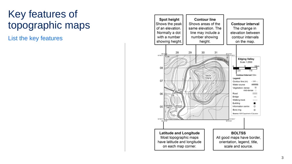
Key features of topographic maps List the key features 3<br>
04
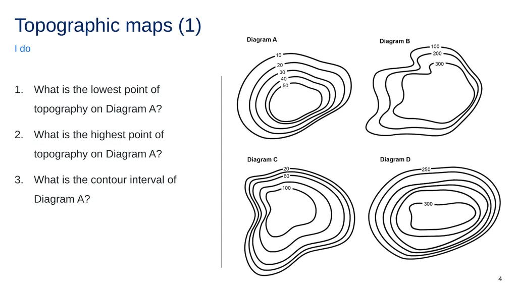
Topographic maps (1) I do What is the lowest point of topography on Diagram A?
What is the highest point of topography on Diagram A?
What is the contour interval of Diagram A? 4<br>
05
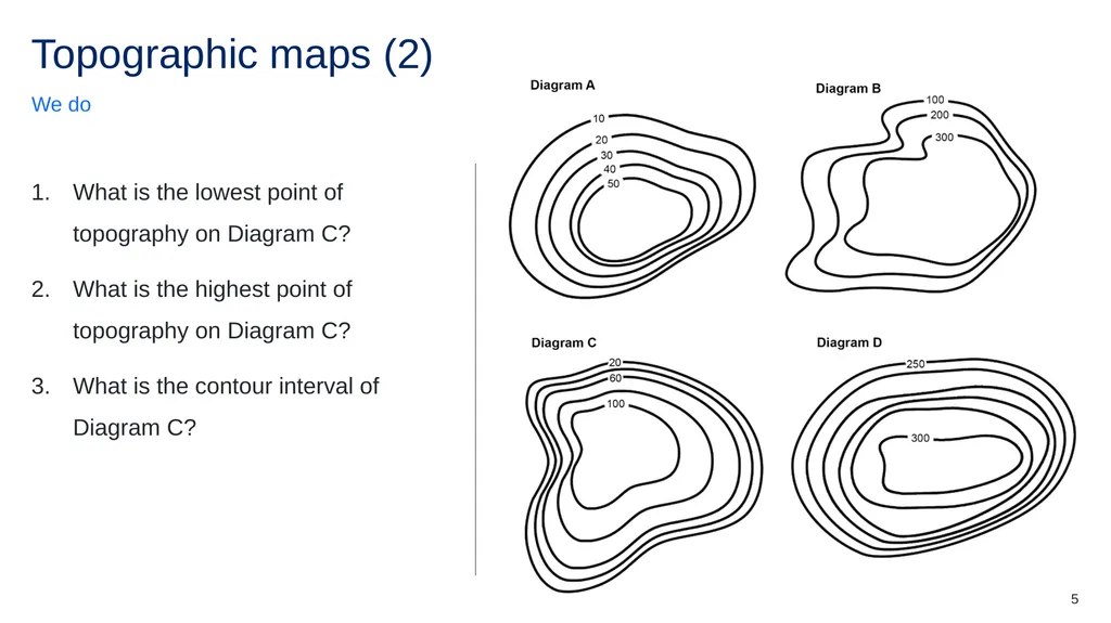
Topographic maps (2) We do What is the lowest point of topography on Diagram C?
What is the highest point of topography on Diagram C?
What is the contour interval of Diagram C? 5<br>
06
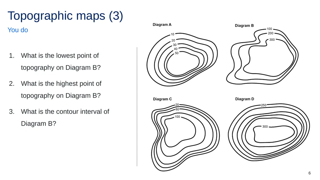
Topographic maps (3) You do What is the lowest point of topography on Diagram B?
What is the highest point of topography on Diagram B?
What is the contour interval of Diagram B? 6<br>
07
Think-Pair-Share (1) Topic – 7<br>
08
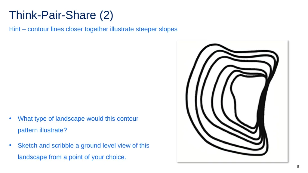
Think-Pair-Share (2) Hint – contour lines closer together illustrate steeper slopes What type of landscape would this contour pattern illustrate?
Sketch and scribble a ground level view of this landscape from a point of your choice. 8<br>
09
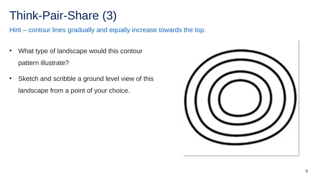
Think-Pair-Share (3) Hint – contour lines gradually and equally increase towards the top. What type of landscape would this contour pattern illustrate?
Sketch and scribble a ground level view of this landscape from a point of your choice. 9<br>
10
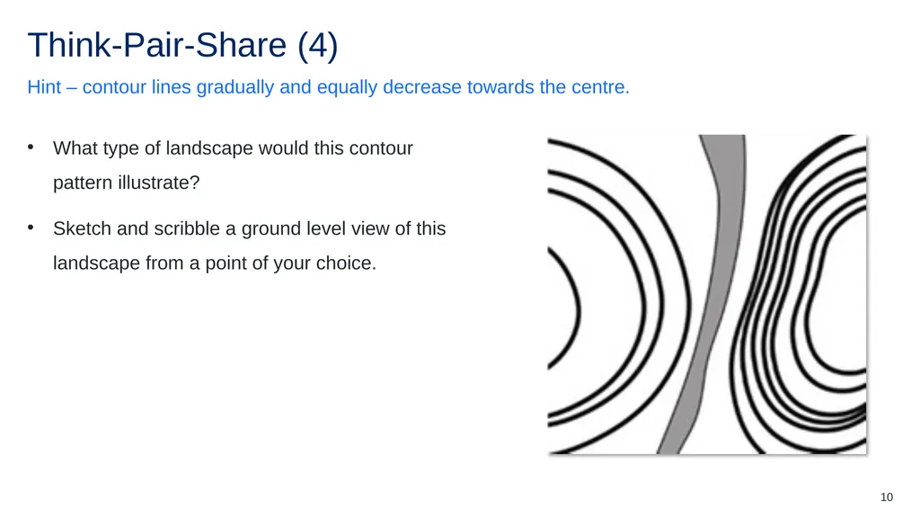
Think-Pair-Share (4) Hint – contour lines gradually and equally decrease towards the centre. What type of landscape would this contour pattern illustrate?
Sketch and scribble a ground level view of this landscape from a point of your choice. 10<br>
11
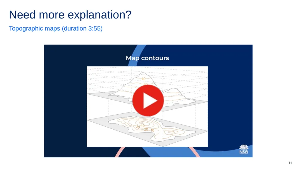
Need more explanation? Topographic maps (duration 3:55) 11<br>
12
3-2-1 things I learned today List 3 things you learned today: 1. 2. 3. List 2 questions you have about these things: 1. 2. Give 1 reason why it’s important to learn about these things: 1. 3 2 1 12<br>