PPT-Topography The Art of Reading &
Author : yoshiko-marsland | Published Date : 2018-03-18
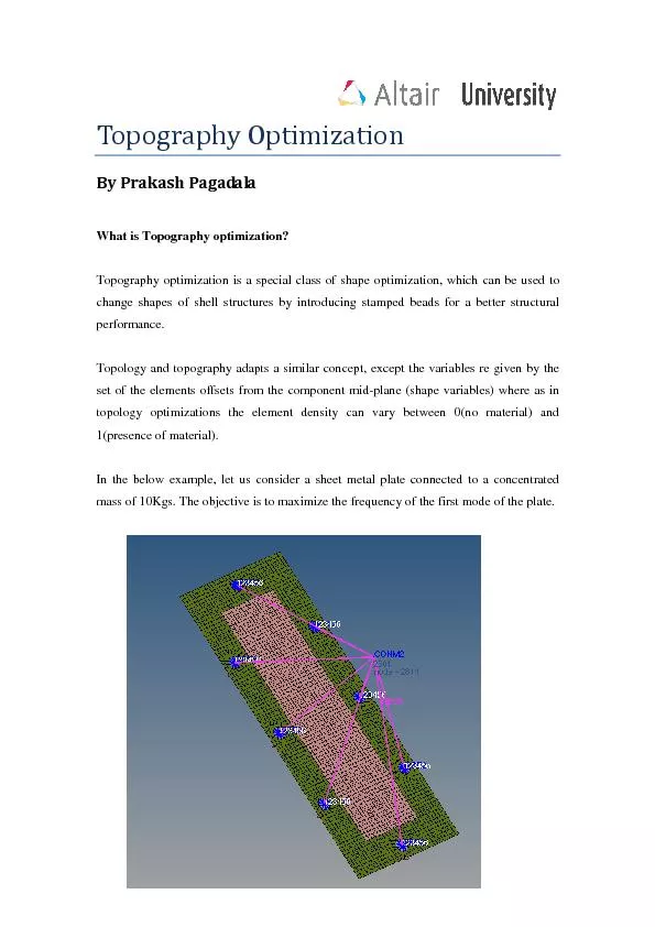
Using Contour Maps What is a Topographic Map Earths surface shape shown by contour lines Contour lines lines connecting points of equal elevation measure mountain
Presentation Embed Code
Download Presentation
Download Presentation The PPT/PDF document "Topography The Art of Reading &" is the property of its rightful owner. Permission is granted to download and print the materials on this website for personal, non-commercial use only, and to display it on your personal computer provided you do not modify the materials and that you retain all copyright notices contained in the materials. By downloading content from our website, you accept the terms of this agreement.
Topography The Art of Reading &: Transcript
Download Rules Of Document
"Topography The Art of Reading &"The content belongs to its owner. You may download and print it for personal use, without modification, and keep all copyright notices. By downloading, you agree to these terms.
Related Documents